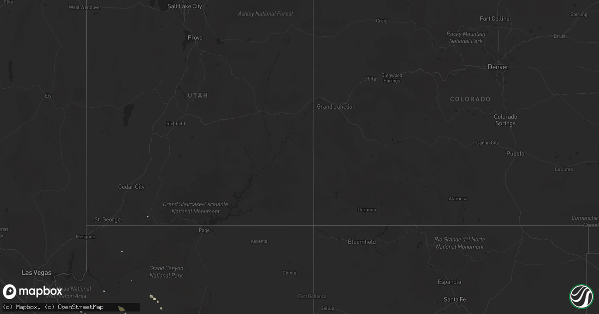
Hail Map on October 3, 2022
Get this storm
October 3 map
$229
one time, instant access
Download today. No call, no setup
Keep the $229
Bought the map and want the full workflow? Apply the entire $229 to a subscription within 7 days. None of it is wasted.
Every map, not just this one
This buys you this map. Subscription and you get every map we run, in the markets you choose from a few cities to whole states to nationwide. Plus real-time alerts the moment a storm fires.
Contact data
Name, contact info, occupancy, even credit band for addresses in the footprint. You go from where it hit to who to call.
Become the source they trust
Unlimited branding weather history reports on demand. You already have the documented answer ready for the property owner, and you are the one who showed up with it.
Property data and RoofTrace estimates
Pull up any address you have got, its value and the exact code rules for that jurisdiction, straight from One Click Code. Then RoofTrace estimates the squares, pitch, and roof value, priced the way you price.
States Impacted by Hail Map on October 3, 2022
Storm reports
Arizona
| Date | Description |
|---|---|
| 10/03/20226:39 PM CDT | Public reported a large shed blown from yard and damaged on social media. |
| 10/03/20226:09 PM CDT | ***delayed report*** restaurant sign fell over onto three parked vehicles at i-17 and thomas rd. Timing estimated from radar. |
| 10/03/20226:01 PM CDT | ***delayed report*** large tree uprooted near 7th ave and royal palm rd. Timing estimated from radar. |
| 10/03/20225:45 PM CDT | Dvt asos reported a 62 mph wind gust. |
| 10/03/20224:25 PM CDT | Two az cypress trees blew over. Heavy rain with 1.33 inches. |
| 10/03/20224:20 PM CDT | Spotters reported estimated wind gusts to 50-60 mph with several 2 inch diameter tree branches down. |
| 10/03/20224:15 PM CDT | Wind gusts of over 50 mph breaking branches. |
| 10/03/20224:05 PM CDT | Asos station kprc prescott airport. |
| 10/03/20222:42 PM CDT | Coconino county officials reported powerlines down and storm damage to homes... Including roofs missing in the junipine estates area north of williams. This is possible |
| 10/03/20227:41 AM CDT | At 1240 PM MST, a severe thunderstorm was located 9 miles north of Williams, or 35 miles west of Flagstaff, moving east at 15 mph. HAZARD...Quarter size hail. SOURCE...Radar indicated. IMPACT...Damage to vehicles is expected. This severe thunderstorm will remain over mainly rural areas of Coconino County.This includes State Route 64 between mile markers 190 and 202. |
| 10/03/20227:16 AM CDT | At 1216 PM MST, a severe thunderstorm was located over Kingman, moving southeast at 15 mph. HAZARD...60 mph wind gusts and quarter size hail. SOURCE...Radar indicated. IMPACT...Hail damage to vehicles is expected. Expect wind damage to roofs and trees. Locations impacted include... Kingman, Wild Cow Campground, Dw Ranch Road, New Kingman-Butler, Blake Ranch Road, Hualapai Mountain Park and Hualapai Peak.This includes Interstate 40 in Arizona between mile markers 43 and78. |
| 10/03/20226:15 AM CDT | At 1114 AM MST, a severe thunderstorm was located 14 miles northeast of Diamond M Ranch, or 46 miles northeast of Kingman, moving east at 20 mph. HAZARD...60 mph wind gusts and quarter size hail. SOURCE...Radar indicated. IMPACT...Hail damage to vehicles is expected. Expect wind damage to roofs, siding, and trees. This severe thunderstorm will remain over mainly rural areas of Coconino and Yavapai Counties.This includes the following highways... Route 66 between mile markers 111 and 132. Interstate 40 between mile markers 112 and 114. |
| 10/03/20222:27 AM CDT | At 726 AM MDT, a severe thunderstorm was located 8 miles northeast of Kanab, moving east at 20 mph. HAZARD...60 mph wind gusts and quarter size hail. SOURCE...Radar indicated. IMPACT...Hail damage to vehicles is expected. Expect wind damage to roofs, siding, and trees. This severe thunderstorm will remain over mainly rural areas of southwestern Kane County.This includes US Route 89 between mile markers 38 and 60. |
| 10/03/20221:54 AM CDT | At 653 AM MST, a severe thunderstorm was located 15 miles east of Kanab, moving east at 20 mph. HAZARD...60 mph wind gusts and quarter size hail. SOURCE...Radar indicated. IMPACT...Hail damage to vehicles is expected. Expect wind damage to roofs, siding, and trees. This severe thunderstorm will remain over mainly rural areas of Coconino County. |
| 10/03/20221:53 AM CDT | At 653 AM MDT, a severe thunderstorm was located 8 miles northwest of Kanab, moving east at 15 mph. HAZARD...60 mph wind gusts and half dollar size hail. SOURCE...Radar indicated. IMPACT...Hail damage to vehicles is expected. Expect wind damage to roofs, siding, and trees. Locations impacted include... Kanab.This includes US Route 89 between mile markers 51 and 77. |
| 10/03/20221:30 AM CDT | At 630 AM MDT, a severe thunderstorm was located 14 miles northwest of Kanab, moving southeast at 10 mph. HAZARD...60 mph wind gusts and quarter size hail. SOURCE...Radar indicated. IMPACT...Hail damage to vehicles is expected. Expect wind damage to roofs, siding, and trees. Locations impacted include... Kanab and Orderville. This includes US Route 89 between mile markers 66 and 81. |
| 10/02/202211:43 PM CDT | At 442 PM MST, severe outflow winds from thunderstorms was located along a line extending from Apache Junction to near Superstition Springs Mall to near Freestone Park, moving south at 40 mph. HAZARD...60 mph wind gusts. SOURCE...Radar indicated. IMPACT...Expect damage to roofs, siding, and trees. Dense blowing dust also anticipated. Locations impacted include... Mesa, Chandler, Gilbert, Casa Grande, Apache Junction, Florence, Coolidge, Gold Canyon, East Mesa, Sun Lakes, Queen Creek, Gold Camp, Falcon Field Airport, Lost Dutchman State Park and Goldfield.This includes the following highways...AZ Interstate 10 between mile markers 173 and 190.US Highway 60 between mile markers 179 and 212.AZ Route 87 between mile markers 131 and 176. |
| 10/02/202211:03 PM CDT | At 403 PM MST, a severe thunderstorm was located over Lake Pleasant, or 8 miles southwest of New River, moving east at 15 mph. HAZARD...60 mph wind gusts and penny size hail. SOURCE...Radar indicated. IMPACT...Expect damage to roofs, siding, and trees. Locations impacted include... New River, Lake Pleasant and Anthem. This includes the following highways...AZ Interstate 17 between mile markers 223 and 238.AZ Route 74 between mile markers 15 and 30.AZ Route 303 between mile markers 129 and 136. |
| 10/02/202210:32 PM CDT | At 332 PM MST, a severe thunderstorm was located 7 miles west of Gladden, or 27 miles south of Alamo Lake, moving southeast at 5 mph. HAZARD...60 mph wind gusts and nickel size hail. SOURCE...Radar indicated. IMPACT...Expect damage to roofs, siding, and trees. Locations impacted include... Gladden and Wenden. This includes US Highway 60 between mile markers 62 and 79. |
| 10/02/20229:45 PM CDT | At 244 PM MST, a severe thunderstorm was located over Bridgeport, or 12 miles northwest of Camp Verde, moving northeast at 10 mph. HAZARD...60 mph wind gusts and nickel size hail. SOURCE...Radar indicated. IMPACT...Expect damage to roofs, siding, and trees. Locations impacted include... Clarkdale, Verde Village, Bridgeport, Cottonwood, Page Springs, Cornville, Dead Horse Ranch State Park and Tuzigoot National Monument.This includes the following highways... State Route 260 between mile markers 207 and 211. State Route 89A between mile markers 350 and 367. |
| 10/02/20229:34 PM CDT | At 233 PM PDT/233 PM MST/, a severe thunderstorm was located near Desert Hills, or 7 miles northwest of Lake Havasu City, moving southeast at 20 mph. HAZARD...60 mph wind gusts and quarter size hail. SOURCE...Radar indicated. IMPACT...Hail damage to vehicles is expected. Expect wind damage to roofs and trees. Locations impacted include... Lake Havasu City, Parker Dam, Three Dunes Campground, Cattail Cove State Park, Desert Hills and Black Meadow Landing Campground. |
| 10/02/20229:10 PM CDT | At 210 PM MST, a severe thunderstorm was located near Sedona, moving northeast at 25 mph. HAZARD...60 mph wind gusts and quarter size hail. SOURCE...Radar indicated. IMPACT...Hail damage to vehicles is expected. Expect wind damage to roofs, siding, and trees. Locations impacted include... Sedona, Village At Oak Creek and Munds Park. This includes the following highways... Interstate 17 between mile markers 303 and 324. State Route 179 between mile markers 304 and 313. State Route 89A between mile markers 370 and 379. |
| 10/02/20229:07 PM CDT | At 207 PM MST, a severe thunderstorm was located near Perkinsville, or 14 miles east of Chino Valley, moving east at 20 mph. HAZARD...60 mph wind gusts and quarter size hail. SOURCE...Radar indicated. IMPACT...Hail damage to vehicles is expected. Expect wind damage to roofs, siding, and trees. Locations impacted include... Clarkdale, Perkinsville, Cottonwood, Jerome, Red Rock State Park, Tuzigoot National Monument and Dead Horse Ranch State Park.This includes State Route 89A between mile markers 341 and 350, andbetween mile markers 361 and 370. |
| 10/02/20229:02 PM CDT | At 202 PM MST, a severe thunderstorm was located over Prescott, moving east at 20 mph. HAZARD...60 mph wind gusts and quarter size hail. SOURCE...Radar indicated. IMPACT...Hail damage to vehicles is expected. Expect wind damage to roofs, siding, and trees. Locations impacted include... Prescott, Prescott Valley, Yavapai Campground, Downtown Prescott, Ponderosa Park, Prescott Airport, Indian Hill West Prescott, Oak Knoll Village, Prescott Gateway Mall, White Spar Campground and Lynx Lake Dam.This includes the following highways... State Route 89 between mile markers 303 and 320. State Route 89A between mile markers 318 and 321. State Route 69 between mile markers 289 and 296. |
| 10/02/20227:47 PM CDT | 60 mph wind gust measured at chandler municipal airport. |
| 10/02/20227:18 PM CDT | Report of tree down on van buren st and 15th ave on social media. |
| 10/02/20227:10 PM CDT | A 60 mph wind gust was measured near the intersection of elliot road and 181 st avenue near the estrella mountains in goodyear. |