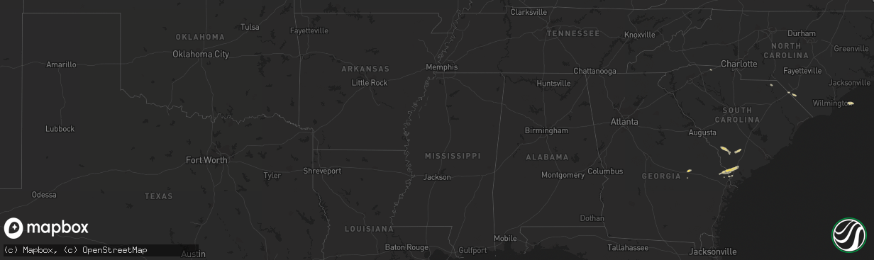
Hail Map on September 29, 2012
The weather event on September 29, 2012 includes Hail map. 5 states and 36 cities were impacted and suffered possible damage. The total estimated number of properties impacted is 0.
Want more than just the map?
Turn this storm into a full workflow.
- Owner + property data so you know who to knock
- OnDemand branded weather history reports to win the "did we even have hail?" argument
- RoofTrace estimate so reps stop guessing numbers at the door
Bought this map? Upgrade within 7 days and we'll credit the $230. (10-15 min setup call)
Hail
0
Estimated number of impacted properties by a 1.00" hail or larger0
Estimated number of impacted properties by a 1.75" hail or larger0
Estimated number of impacted properties by a 2.50" hail or largerStates Impacted by Hail Map on September 29, 2012
Storm reports
Texas
| Date | Description |
|---|---|
| 09/29/20125:45 PM CDT | Damage to railroad arm guard... Boat flipped off trailer... Several trees down... Carport and metal skirting around home damaged |
| 09/29/20125:16 PM CDT | Minor damage to a tractor supply business. Gutters blown off. Also power lines down in the area. |
| 09/29/20125:15 PM CDT | Report from county sherrif between fm 1090 and half league rd. |
| 09/29/20125:11 PM CDT | An nws storm survey concluded an ef-0 tornado briefly touched down just west of highway 35 at fm 3084. A tractor supply store experienced minor damage which included lo |
South Carolina
| Date | Description |
|---|---|
| 09/29/20126:55 PM CDT | Tree down on bees creek road blocking both lanes. |
| 09/29/20126:40 PM CDT | Tree down blocking both lanes of b and c landing road. |
| 09/29/20126:14 PM CDT | Highway patrol reported trees down on sc 200 at the catawba river dam |
| 09/29/20124:15 PM CDT | Several trees down on highway 18 reported by county ema |
| 09/29/20124:05 PM CDT | Tree down at smyly road off of mt carmel road. Time estimated from radar. |
Cities Impacted by Hail Map on September 29, 2012
- Islandton, SC
- Ruffin, SC
- Aberdeen, NC
- Raeford, NC
- Wallace, SC
- Hamer, SC
- Fairmont, NC
- Rowland, NC
- Fairfax, SC
- Allendale, SC
- Saluda, NC
- Tryon, NC
- Ridgeland, SC
- Orrum, NC
- Hampton, SC
- Brunson, SC
- Clyo, GA
- Tillman, SC
- Chester, SC
- Richburg, SC
- Springer, NM
- Soperton, GA
- Swainsboro, GA
- Springfield, GA
- Hardeeville, SC
- Sinton, TX
- Ulmer, SC
- Gaffney, SC
- Ingleside, TX
- Aransas Pass, TX
- Portland, TX
- Rincon, GA
- Guyton, GA
- Vidalia, GA
- Taft, TX
- Raton, NM