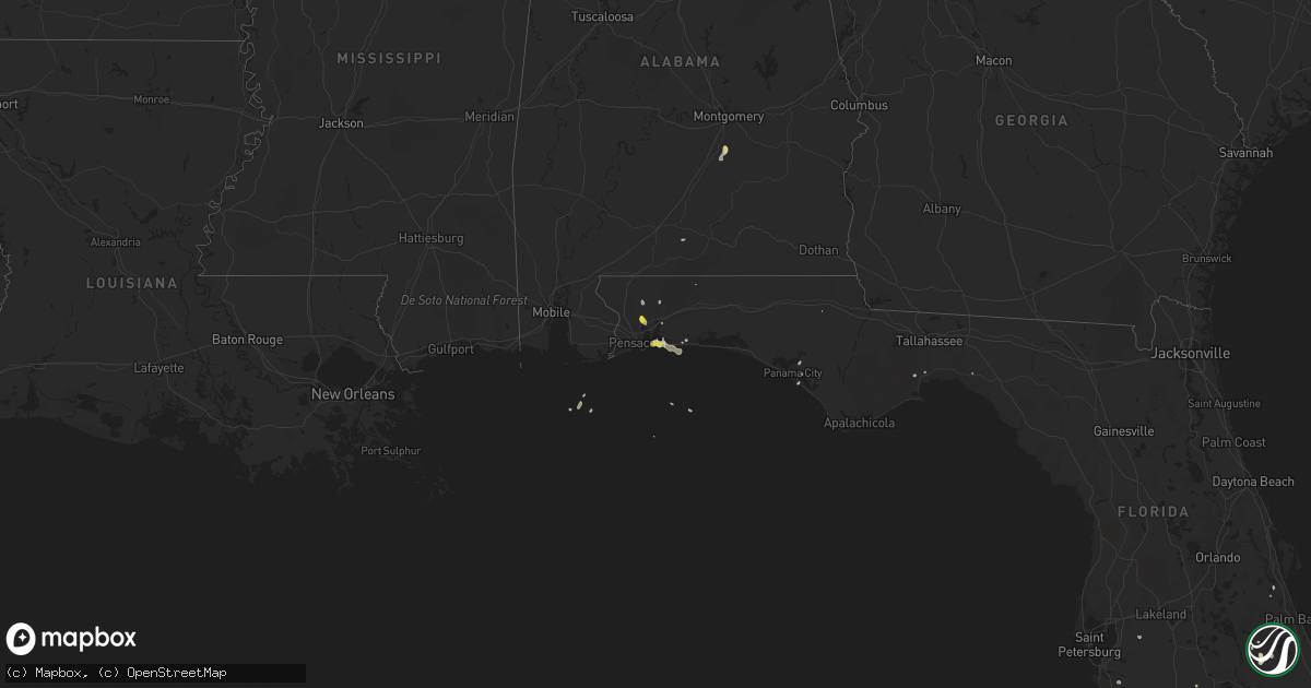
Hail Map on September 24, 2016
Get this storm
September 24 map
$229
one time, instant access
Download today. No call, no setup
Keep the $229
Bought the map and want the full workflow? Apply the entire $229 to a subscription within 7 days. None of it is wasted.
Every map, not just this one
This buys you this map. Subscription and you get every map we run, in the markets you choose from a few cities to whole states to nationwide. Plus real-time alerts the moment a storm fires.
Contact data
Name, contact info, occupancy, even credit band for addresses in the footprint. You go from where it hit to who to call.
Become the source they trust
Unlimited branding weather history reports on demand. You already have the documented answer ready for the property owner, and you are the one who showed up with it.
Property data and RoofTrace estimates
Pull up any address you have got, its value and the exact code rules for that jurisdiction, straight from One Click Code. Then RoofTrace estimates the squares, pitch, and roof value, priced the way you price.
States Impacted by Hail Map on September 24, 2016
Storm reports
Kansas
| Date | Description |
|---|---|
| 09/24/20164:10 PM CDT | A local report indicates 58 MPH wind near HUTCHINSON |
| 09/24/20161:56 PM CDT | 64 mph measured at 156 pm cdt |
Alabama
| Date | Description |
|---|---|
| 09/24/20164:44 PM CDT | One large tree was blown down into power lines. Hickory grove road lapine... Al. Wind estimated between 40 and 50 mph. |
Minnesota
| Date | Description |
|---|---|
| 09/24/20163:56 PM CDT | Wind gusts estimated at 70 mph due to huge waves splashing up on the docks of lake sarah. |
| 09/24/20163:35 PM CDT | Lots of tree branches up to 2 inches in diameter knocked down across town in edgerton. Also ponding water in the streets. |
Florida
| Date | Description |
|---|---|
| 09/24/20165:09 PM CDT | Quarter size hail reported at w. Spencer field rd. And norris rd. Traffic light and power lines down nearby. |
| 09/24/20164:20 PM CDT | Emergency management reported quarter size hail at burgren rd. At hwy.98. |
Cities Impacted by Hail Map on September 24, 2016
- Gulf Breeze, FL
- Council Bluffs, IA
- Snyder, TX
- Andale, KS
- Cheney, KS
- Garden Plain, KS
- Rock Rapids, IA
- Iona, MN
- Georgetown, TX
- Granger, TX
- Caldwell, TX
- Ruthton, MN
- Vici, OK
- Gause, TX
- Marietta, MN
- Ramer, AL
- Lapine, AL
- Venus, FL
- Lake Wilson, MN
- Slayton, MN
- Estherville, IA
- Punta Gorda, FL
- Mullinville, KS
- Arcadia, FL
- Morrill, KS
- Sabetha, KS
- Gail, TX
- Fluvanna, TX
- Navarre, FL
- Kingman, KS
- Childress, TX
- Milton, FL
- Laverne, OK
- Crawfordville, FL
- Mount Hope, KS
- Norwich, KS
- Goddard, KS
- Colwich, KS
- Du Bois, NE
- Wichita Falls, TX
- Kiron, IA
- Vail, IA
- Hardwick, MN
- Eldorado, OK
- Burlington, OK
- Alva, OK
- Sopchoppy, FL
- Girard, TX
- Waterville, KS
- Brewster, MN
- Rosebud, TX
- Gate, OK
- Crowell, TX
- Mountain View, OK
- Throckmorton, TX
- Ozona, TX
- Brackettville, TX
- Doole, TX
- Russell, MN
- Balaton, MN
- Lynd, MN
- Westbrook, TX
- Jarrell, TX
- Tipton, OK
- Elmer, OK
- Humboldt, NE
- Bern, KS
- Highland Home, AL
- Letohatchee, AL
- Currie, MN
- Tracy, MN
- Fort Stockton, TX
- Lithia, FL
- Tell, TX
- Paducah, TX
- Matador, TX
- Saint Helena, NE
- Roscoe, TX
- Maryneal, TX
- Thrall, TX
- Seneca, KS
- Waldron, KS
- Welcome, MN
- Steen, MN
- Kenansville, FL
- Okeechobee, FL
- Pond Creek, OK
- Barksdale, TX
- Canby, MN
- Seymour, TX
- Breda, IA
- Carroll, IA
- Arcadia, IA
- Minneota, MN
- Taunton, MN
- Bryan, TX
- Spur, TX
- Gary, SD
- San Angelo, TX
- Burlington, TX
- West Point, NE
- Sterling City, TX
- Larchwood, IA
- Evergreen, AL
- Andalusia, AL
- Dickens, TX
- Centralia, KS
- Mary Esther, FL
- Tyler, MN
- Emporia, KS
- Admire, KS
- Pretty Prairie, KS
- Camargo, OK
- Barnes, KS
- Hurlburt Field, FL
- Colorado City, TX
- Ira, TX
- Sweetwater, TX
- Lake Placid, FL
- Luverne, MN
- Cape Coral, FL
- Beaver Creek, MN
- Hills, MN
- Alta Vista, KS
- Corning, KS
- Riesel, TX
- Edgerton, MN
- Jay, FL
- Bradenton, FL
- Spivey, KS
- Dwight, KS
- Junction City, KS
- Reagan, TX
- Goree, TX
- Panama City, FL
- Walters, OK
- Cedar Point, KS
- Port Charlotte, FL
- Cunningham, KS
- Maple Hill, KS
- Loraine, TX
- Alvord, IA
- Albany, TX
- Dodge, NE
- Labelle, FL
- Loxahatchee, FL
- Green, KS
- Randolph, KS
- Immokalee, FL
- Henrietta, TX
- Vero Beach, FL
- Holland, MN
- Woodstock, MN
- Justiceburg, TX
- Haskell, TX
- Lakefield, MN