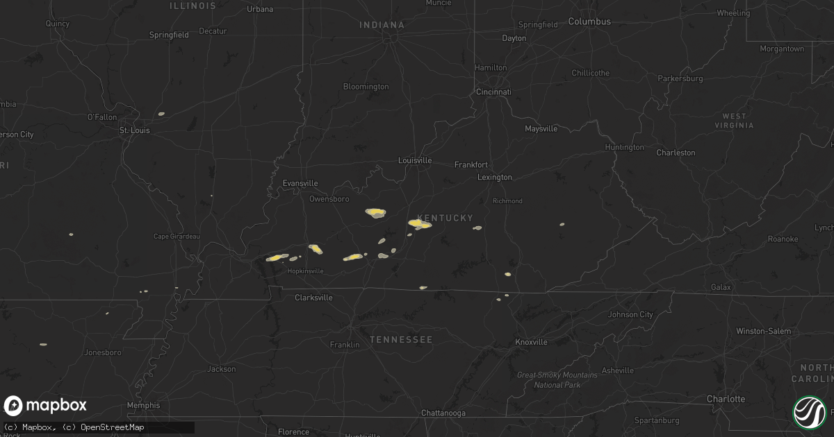
Hail Map on September 23, 2024
Get this storm
September 23 map
$229
one time, instant access
Download today. No call, no setup
Keep the $229
Bought the map and want the full workflow? Apply the entire $229 to a subscription within 7 days. None of it is wasted.
Every map, not just this one
This buys you this map. Subscription and you get every map we run, in the markets you choose from a few cities to whole states to nationwide. Plus real-time alerts the moment a storm fires.
Contact data
Name, contact info, occupancy, even credit band for addresses in the footprint. You go from where it hit to who to call.
Become the source they trust
Unlimited branding weather history reports on demand. You already have the documented answer ready for the property owner, and you are the one who showed up with it.
Property data and RoofTrace estimates
Pull up any address you have got, its value and the exact code rules for that jurisdiction, straight from One Click Code. Then RoofTrace estimates the squares, pitch, and roof value, priced the way you price.
Storm reports
Kentucky
| Date | Description |
|---|---|
| 09/23/20243:39 PM CDT | Flag pole damaged. |
| 09/23/20243:29 PM CDT | Scattered trees down in eastern larue county. |
| 09/23/20243:24 PM CDT | Scattered trees down in southeastern larue county. |
| 09/23/20243:16 PM CDT | Few trees down just north of magnolia near highway 31. |
North Carolina
| Date | Description |
|---|---|
| 09/23/20245:27 AM CDT | Tree down blocking both lanes on galax trail in mount airy north carolina. |
Cities Impacted by Hail Map on September 23, 2024
- Parkers Lake, KY
- Williamsburg, KY
- Falls Of Rough, KY
- Hardinsburg, KY
- McDaniels, KY
- Leitchfield, KY
- Westview, KY
- Corning, AR
- Knobel, AR
- Tompkinsville, KY
- Hestand, KY
- Hudson, KY
- Big Clifty, KY
- Eddyville, KY
- Kuttawa, KY
- Princeton, KY
- Campbell, MO
- Sonora, KY
- Upton, KY
- Malden, MO
- Lewisburg, KY
- Russellville, KY
- Nortonville, KY
- White Plains, KY
- Buffalo, KY
- Magnolia, KY
- Hodgenville, KY
- Mount Sherman, KY
- Oneida, TN
- Winfield, TN
- Campbellsville, KY
- Summersville, KY
- Park City, KY
- Greenville, KY
- Morgantown, KY
- Bowling Green, KY
- Hopkinsville, KY
- Crofton, KY
- Oakland, KY
- Rockfield, KY
- New Madrid, MO
- Cave City, AR
- Batesville, AR
- Smiths Grove, KY
- Middleburg, KY
- Jackson, KY
- Booneville, KY
- Kings Mountain, KY
- Waynesburg, KY
- Hustonville, KY
- Lost Creek, KY
- Alhambra, IL
- Marine, IL
- Peach Orchard, AR
- Johnston City, IL
- Cadiz, KY
- Cerulean, KY
- Brownsville, KY
- Rocky Hill, KY
- Sweeden, KY
- Bee Spring, KY
- Mammoth Cave, KY
- Munfordville, KY
- Bonnieville, KY