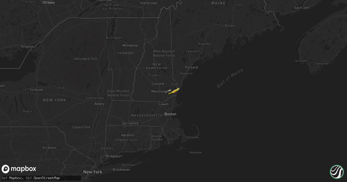
Hail Map on September 22, 2022
Get this storm
September 22 map
$229
one time, instant access
Download today. No call, no setup
Keep the $229
Bought the map and want the full workflow? Apply the entire $229 to a subscription within 7 days. None of it is wasted.
Every map, not just this one
This buys you this map. Subscription and you get every map we run, in the markets you choose from a few cities to whole states to nationwide. Plus real-time alerts the moment a storm fires.
Contact data
Name, contact info, occupancy, even credit band for addresses in the footprint. You go from where it hit to who to call.
Become the source they trust
Unlimited branding weather history reports on demand. You already have the documented answer ready for the property owner, and you are the one who showed up with it.
Property data and RoofTrace estimates
Pull up any address you have got, its value and the exact code rules for that jurisdiction, straight from One Click Code. Then RoofTrace estimates the squares, pitch, and roof value, priced the way you price.
States Impacted by Hail Map on September 22, 2022
Storm reports
Ohio
| Date | Description |
|---|---|
| 09/22/20228:49 AM CDT | Tree down on state route 209 |
| 09/22/20228:31 AM CDT | Tree down on route 666 just south of dresden |
| 09/22/20227:58 AM CDT | At 1258 AM EDT, a severe thunderstorm was located near Sharon, moving east at 50 mph. HAZARD...60 mph wind gusts and nickel size hail. SOURCE...Radar indicated. IMPACT...Expect damage to trees and power lines, resulting in some power outages. Locations impacted include... Hermitage, Sharon, Grove City, Franklin, Sharpsville, Greenville, Farrell, Slippery Rock, New Wilmington, Mercer, Pulaski, and Stoneboro. |
| 09/22/20227:29 AM CDT | At 1229 AM EDT, a severe thunderstorm was located near Ravenna, moving east at 35 mph. HAZARD...60 mph wind gusts and quarter size hail. SOURCE...Radar indicated. IMPACT...Minor damage to vehicles is possible. Expect damage to trees and power lines. Locations impacted include... Youngstown, Warren, Ravenna, Boardman, Niles, Campbell, Hubbard, Canfield, Newton Falls, Lordstown, Garrettsville, Vienna Center, Hilltop, Maplewood Park, Leavittsburg, Austintown, Struthers, Girard, Vienna and McDonald. |
| 09/21/20228:31 PM CDT | At 130 AM EDT, a severe thunderstorm was located near East Palestine, moving east at 45 mph. HAZARD...60 mph wind gusts and quarter size hail. SOURCE...Radar indicated. IMPACT...Minor hail damage to vehicles is possible. Expect wind damage to trees and power lines, resulting in some power outages. Locations impacted include... New Castle, Butler, Ellwood City, Homeacre-Lyndora, Shanor-Northvue, Meridian, Zelienople, Meadowood, Oak Hills, Oakwood, New Castle Northwest, and Big Beaver. |
| 09/21/20228:16 PM CDT | At 116 AM EDT, severe thunderstorms were located along a line extending from near Farrell to Canfield to near Leetonia, moving east at 40 mph. HAZARD...60 mph wind gusts and quarter size hail. SOURCE...Radar indicated. IMPACT...Minor damage to vehicles is possible. Expect damage to trees and power lines. Locations impacted include... Youngstown, Salem, Columbiana, Boardman, Campbell, Hubbard, Canfield, Maplewood Park, Austintown, Struthers, Poland, Ellsworth, New Middletown, Lowellville, West Hill, Greenford and Brookfield Center. |
Arizona
| Date | Description |
|---|---|
| 09/22/20222:33 AM CDT | At 732 PM MST, a severe thunderstorm was located 11 miles northwest of Sells, moving northwest at 10 mph. HAZARD...60 mph wind gusts and quarter size hail. SOURCE...Radar indicated. IMPACT...Hail damage to vehicles is expected. Expect wind damage to roofs, siding, and trees. Locations impacted include... Covered Wells, No:ligk, Cababi, Sil Nakya, San Luis - Sells District, Mountain Village and Rincon. |
| 09/22/20221:04 AM CDT | At 604 PM MST, a severe thunderstorm was located over Three Points, or 19 miles northwest of Sahuarita, moving north at 10 mph. HAZARD...60 mph wind gusts and penny size hail. SOURCE...Radar indicated. IMPACT...Expect damage to roofs, siding, and trees. Locations impacted include... Three Points and Tucson Estates. |
| 09/22/202212:52 AM CDT | At 552 PM MST, a severe thunderstorm was located near San Isidro, or 14 miles east of Sells, and is moving slowly northward. HAZARD...60 mph wind gusts and quarter size hail. SOURCE...Radar indicated. IMPACT...Hail damage to vehicles is expected. Expect wind damage to roofs, siding, and trees. Locations impacted include... San Isidro, Kitt Peak, Comobabi, South Comobabi, Santa Rosa Ranch and Pan Tak. |
| 09/21/20228:19 PM CDT | At 117 PM MST, a severe thunderstorm was located 12 miles west of Tolani Lake, or 37 miles northeast of Flagstaff, moving east at 15 to 20 mph. HAZARD...Quarter size hail and winds up to 50 mph possible. SOURCE...Radar indicated. IMPACT...Damage to vehicles is expected. Locations impacted include... Tolani Lake. |
New Hampshire
| Date | Description |
|---|---|
| 09/22/20227:15 AM CDT | A local report indicates 1.00 inch wind near 1 E STRATHAM |
| 09/22/20227:15 AM CDT | Social media photos. |
| 09/22/20227:13 AM CDT | A local report indicates 1.00 inch wind near 1 NE EXETER |
| 09/22/20227:10 AM CDT | Reported by amateur radio. |
Connecticut
| Date | Description |
|---|---|
| 09/22/20221:48 AM CDT | At 647 AM EDT, severe thunderstorms were located along a line extending from near Chester to near Tolland, moving east at 25 mph. HAZARD...60 mph wind gusts and quarter size hail. SOURCE...Radar indicated. IMPACT...Expect wind damage to trees and power lines. Minor hail damage to vehicles is possible. Severe thunderstorms will be near... Chester, Blandford and Middlefield around 655 AM EDT. Montgomery around 705 AM EDT. Huntington around 710 AM EDT. Granby, Westhampton, Granville and Chesterfield around 715 AM EDT. Southampton and Russell around 720 AM EDT. Easthampton and Southwick around 725 AM EDT. Northampton and Williamsburg around 730 AM EDT. Westfield and Agawam around 735 AM EDT. |
New Mexico
| Date | Description |
|---|---|
| 09/22/20222:03 PM CDT | Corrects time of previous tornado report from 10 n lake valley. Landspout tornado north of lake valley... Nm along state road 371. Location and time estimated. |
| 09/22/20221:15 PM CDT | Landspout tornado north of lake valley... Nm along state road 371. Location and time estimated. |
| 09/22/202212:44 AM CDT | At 543 PM MDT, a severe thunderstorm was located over Counselor, or 29 miles west of Cuba, moving east at 25 mph. HAZARD...60 mph wind gusts and quarter size hail. SOURCE...Radar indicated. IMPACT...Hail damage to vehicles is expected. Expect wind damage to roofs, siding, and trees. Locations impacted include... Counselor.This includes Highway 550 between Mile Markers 83 and 104. |
New York
| Date | Description |
|---|---|
| 09/22/20227:47 AM CDT | At 1247 AM EDT, a severe thunderstorm was located 13 miles northeast of Falconer, or 14 miles west of Salamanca, moving east at 50 mph. HAZARD...60 mph wind gusts and penny size hail. SOURCE...Radar indicated. IMPACT...Expect damage to trees and power lines. Locations impacted include... Salamanca, Allegany State Park, Ashford, Franklinville, Ashford Hollow, Weston Mills, Hinsdale, Great Valley, New Albion and Conewango.This includes Interstate 86 between exits 14 and 16, and betweenexits 20 and 21, and near exit 27. |
| 09/22/20227:35 AM CDT | At 1234 AM EDT, a severe thunderstorm was located near Arcade, or 18 miles south of East Aurora, moving east at 45 mph. HAZARD...60 mph wind gusts and quarter size hail. SOURCE...Radar indicated. IMPACT...Minor damage to vehicles is possible. Expect wind damage to trees and power lines. Locations impacted include... Dansville, Letchworth State Park, Springville, Alfred, Arcade, Belfast, Rushford, Houghton, Chaffee and Portageville.This includes the following highways... Interstate 390 between exits 4 and 5. Interstate 86 between exits 31 and 33. |
| 09/21/202210:43 PM CDT | At 343 AM EDT, a severe thunderstorm was located over Erin, or 9 miles northeast of Elmira, moving east at 40 mph. HAZARD...60 mph wind gusts and quarter size hail. SOURCE...Radar indicated. IMPACT...Hail damage to vehicles is expected. Expect wind damage to roofs, siding, and trees. Locations impacted include... Elmira, Big Flats, Horseheads, Elmira Heights, Owego, Erin, Candor, Spencer, Van Etten and Lockwood. |
| 09/21/202210:34 PM CDT | At 333 AM EDT, a severe thunderstorm was located near Chenango Forks, or 9 miles east of Greater Binghamton Airport, moving east at 40 mph. HAZARD...60 mph wind gusts and quarter size hail. SOURCE...Radar indicated. IMPACT...Hail damage to vehicles is expected. Expect wind damage to roofs, siding, and trees. Locations impacted include... Sidney, Guilford, Coventry, Greene, Bainbridge, Masonville, Unadilla, Whitney Point, Afton and Chenango Forks. |
| 09/21/20229:40 PM CDT | At 239 AM EDT, a severe thunderstorm was located Jericho and Beekmantown Point, moving east at 55 mph. HAZARD...60 mph wind gusts and quarter size hail. SOURCE...Radar indicated. IMPACT...Minor hail damage to vehicles is possible. Expect wind damage to trees and powerlines. Locations impacted include... Plattsburgh, Newport City, Beekmantown, Chazy, Enosburg Falls, Orleans, Franklin, Jay, Newport Town, Jay In Franklin County, Montgomery Center, Montgomery, St. Albans City, Troy, Sheldon, Enosburg, Swanton, Irasburg, Newport Center and Grand Isle. |
| 09/21/20229:09 PM CDT | At 208 AM EDT, severe thunderstorms were located along a line extending from 7 miles southwest of Oswegatchie to Herrings, moving east at 35 mph. HAZARD...60 mph wind gusts and quarter size hail. SOURCE...Radar indicated. IMPACT...Minor damage to vehicles is possible. Expect wind damage to trees and power lines. Locations impacted include... Fort Drum, Carthage, West Carthage, Herrings, Denmark, Black River, Harrisville, Castorland, Deferiet and Calcium. |
| 09/21/20229:04 PM CDT | At 204 AM EDT, a severe thunderstorm was located over Phelps, or 7 miles north of Geneva, moving east at 50 mph. HAZARD...60 mph wind gusts and quarter size hail. SOURCE...Radar indicated. IMPACT...Hail damage to vehicles is expected. Expect wind damage to roofs, siding, and trees. Locations impacted include... Auburn, Seneca Falls, Waterloo, Sennett, Fleming, Montezuma, Tyre, Cayuga, Melrose Park and Lehigh Vallley Junction. |
| 09/21/20228:59 PM CDT | At 158 AM EDT, a severe thunderstorm was located over Clifton Springs, or 10 miles northwest of Geneva, moving east at 45 mph. HAZARD...60 mph wind gusts and quarter size hail. SOURCE...Radar indicated. IMPACT...Minor damage to vehicles is possible. Expect wind damage to trees and power lines. Locations impacted include... Newark, Lyons, Clifton Springs, Clyde, Phelps, Weedsport, Savannah, Port Byron, Port Gibson and West Junius.This includes Interstate 90 between exits 40 and 42. |
| 09/21/20228:42 PM CDT | At 142 AM EDT, a severe thunderstorm was located near Carry Falls Reservoir, moving east at 60 mph. HAZARD...60 mph wind gusts and quarter size hail. SOURCE...Radar indicated. IMPACT...Minor hail damage to vehicles is possible. Expect wind damage to trees and powerlines. Locations impacted include... Adirondack Regional Airport, Saranac Lake, Lake Placid, Saranac, Wilmington, Au Sable Forks, Peasleeville, Clayburg, Carry Falls Reservoir, Jay In Essex County, Madawaska, Harrietstown, Black Brook, Upper Jay, Paul Smiths, Union Falls, Saranac Inn, Ray Brook, Moffittsville and Gabriels. |
| 09/21/20228:27 PM CDT | At 127 AM EDT, a severe thunderstorm was located 9 miles west of Arkport, or 11 miles southwest of Dansville, moving east at 40 mph. HAZARD...60 mph wind gusts and quarter size hail. SOURCE...Radar indicated. IMPACT...Minor damage to vehicles is possible. Expect wind damage to trees and power lines. Locations impacted include... Dansville, Belfast, Ossian, Canaseraga, Almond, West Almond, Birdsall, Short Tract, Dalton and Ossian Center.This includes the following highways... Interstate 390 between exits 4 and 5. Interstate 86 between exits 32 and 33. |
| 09/21/20228:22 PM CDT | At 122 AM EDT, a severe thunderstorm was located 10 miles west of Arkport, or 13 miles southwest of Dansville, moving east at 55 mph. HAZARD...60 mph wind gusts and quarter size hail. SOURCE...Radar indicated. IMPACT...Hail damage to vehicles is expected. Expect wind damage to roofs, siding, and trees. Locations impacted include... Hornell, Bath, Campbell, Urbana, Canisteo, Wayland, Howard, Thurston, Pulteney and Wheeler. |
Massachusetts
| Date | Description |
|---|---|
| 09/22/20223:12 AM CDT | At 812 AM EDT, a severe thunderstorm was located over Exeter, moving east at 40 mph. HAZARD...60 mph wind gusts and quarter size hail. SOURCE...Radar indicated. IMPACT...Hail damage to vehicles is expected. Expect wind damage to roofs, siding, and trees. Locations impacted include... Portsmouth, Hampton, Durham, Exeter, Kittery, Epping, Brentwood, Greenland, York, Newington, Stratham, Seabrook, Rye, Newmarket, Eliot, Kingston, East Kingston, Hampton Falls, Kensington and Newfields.This includes the following highways... Interstate 95 between mile markers 1 and 8. Interstate 95 in New Hampshire between mile markers 0 and 16. |
| 09/22/20221:02 AM CDT | At 602 AM EDT, a severe thunderstorm was located over Copake, or 9 miles southwest of Great Barrington, moving east at 50 mph. HAZARD...60 mph wind gusts and quarter size hail. SOURCE...Radar indicated. IMPACT...Hail damage to vehicles is expected. Expect wind damage to roofs, siding, and trees. Locations impacted include... Great Barrington, Copake, Sheffield, Otis, Ancram, Canaan, Sandisfield, Housatonic, Ashley Falls, Hillsdale, New Marlborough, Monterey, Alford, Tyringham, Sodom, Ancramdale, Hartsville, Konkapot, Wangum Village and Gomorrah. |
Montana
| Date | Description |
|---|---|
| 09/21/202210:51 PM CDT | At 350 PM MDT, severe thunderstorms were located along a line extending from 8 miles south of Colstrip to 8 miles south of Ashland to 33 miles northwest of Spotted Horse, moving northeast at 35 mph. HAZARD...60 mph wind gusts and quarter size hail. SOURCE...Radar indicated. IMPACT...Hail damage to vehicles is expected. Expect wind damage to roofs, siding, and trees. Locations impacted include... Colstrip, Ashland, Otter, Sonnette, Brandenberg, Moorhead and Northern Cheyenne Indian Reservation. |
Pennsylvania
| Date | Description |
|---|---|
| 09/21/20228:44 PM CDT | At 144 AM EDT, a severe thunderstorm was located near Franklin, moving east at 50 mph. HAZARD...60 mph wind gusts and quarter size hail. SOURCE...Radar indicated. IMPACT...Minor hail damage to vehicles is possible. Expect wind damage to trees and power lines, resulting in some power outages. Locations impacted include... Oil City, Franklin, Clarion, Knox, Sugarcreek, Hasson Heights, Seneca, Polk, Clintonville, Shippenville, Kennerdell, and Woodland Heights. |
Cities Impacted by Hail Map on September 22, 2022
- Sells, AZ
- Willcox, AZ
- San Simon, AZ
- Lame Deer, MT
- Ashland, MT
- Tucson, AZ
- Brusett, MT
- Leupp, AZ
- Hampton, NH
- Rye, NH
- Stratham, NH
- Exeter, NH
- North Hampton, NH
- Hampton Falls, NH
- New Castle, NH
- Portsmouth, NH
- Kittery, ME
- Greenland, NH
- Tubac, AZ
- Fremont, NH
- Epping, NH
- Cuba, NM
- Tumacacori, AZ
- Cochise, AZ
- Molt, MT
- Billings, MT
- Benson, AZ
- Ten Sleep, WY
- Chester, NH
- Sandown, NH
- Winnett, MT
- Otter, MT
- Birney, MT
- Sheridan, WY
- Kingston, NH
- Danville, NH
- East Kingston, NH