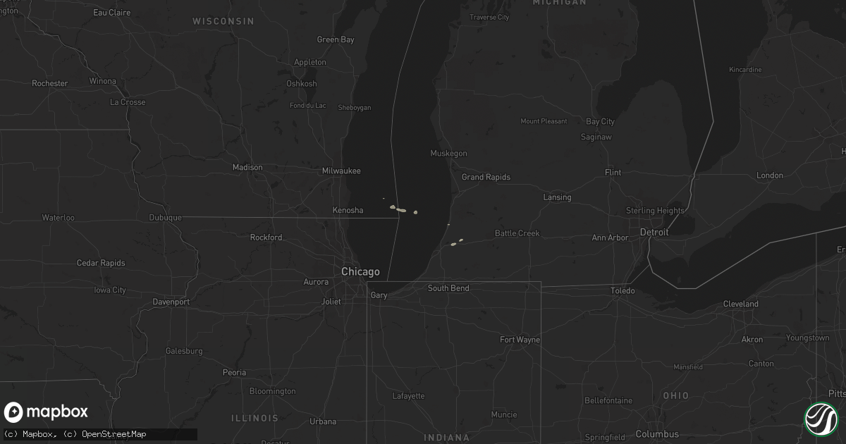
Hail Map on September 22, 2012
Get this storm
September 22 map
$229
one time, instant access
Download today. No call, no setup
Keep the $229
Bought the map and want the full workflow? Apply the entire $229 to a subscription within 7 days. None of it is wasted.
Every map, not just this one
This buys you this map. Subscription and you get every map we run, in the markets you choose from a few cities to whole states to nationwide. Plus real-time alerts the moment a storm fires.
Contact data
Name, contact info, occupancy, even credit band for addresses in the footprint. You go from where it hit to who to call.
Become the source they trust
Unlimited branding weather history reports on demand. You already have the documented answer ready for the property owner, and you are the one who showed up with it.
Property data and RoofTrace estimates
Pull up any address you have got, its value and the exact code rules for that jurisdiction, straight from One Click Code. Then RoofTrace estimates the squares, pitch, and roof value, priced the way you price.
States Impacted by Hail Map on September 22, 2012
Storm reports
New York
| Date | Description |
|---|---|
| 09/22/20128:06 AM CDT | Tree and wires down |
New Jersey
| Date | Description |
|---|---|
| 09/21/20127:30 PM CDT | Tree limbs and wires down on roseland avenue. Time estimated by radar. |
Pennsylvania
| Date | Description |
|---|---|
| 09/22/20126:59 PM CDT | Tree down |
| 09/22/20126:58 PM CDT | Power lines down |
| 09/22/20126:57 PM CDT | Trees and power lines down |
| 09/22/20126:56 PM CDT | Tree on house and power lines down |
| 09/22/20126:56 PM CDT | Tree and power lines down |
| 09/22/20126:55 PM CDT | Tree down |
| 09/22/20126:54 PM CDT | Tree and power lines down |
| 09/22/20126:51 PM CDT | Tree and power lines down |
| 09/22/20126:51 PM CDT | Tree down |
| 09/22/20126:50 PM CDT | Power lines down |
| 09/22/20126:38 PM CDT | Trees down |
| 09/22/20126:35 PM CDT | Trees down |
| 09/22/20126:31 PM CDT | Tree and power lines down |
| 09/22/20126:30 PM CDT | Power lines down |
| 09/22/20126:30 PM CDT | Power lines down |
| 09/22/20126:30 PM CDT | Tree down |
| 09/22/20126:30 PM CDT | Tree down |
| 09/22/20126:30 PM CDT | Trees and power lines down |
| 09/22/20126:30 PM CDT | Tree and power lines down |
| 09/22/20126:30 PM CDT | Tree and power lines down |
| 09/22/20126:30 PM CDT | Tree on house and power lines down |
| 09/22/20126:23 PM CDT | Trees down |
| 09/22/20126:17 PM CDT | Trees down |
| 09/22/20126:17 PM CDT | 10 trees down and powerlines down |
| 09/22/20126:16 PM CDT | Large branches down |
| 09/22/20126:11 PM CDT | Trees down |
| 09/22/20126:10 PM CDT | A couple of trees and tree limbs down power outages in the area. |
| 09/22/20126:08 PM CDT | Trees down |
| 09/22/20125:55 PM CDT | Multiple trees down |
| 09/22/20125:51 PM CDT | Trees down |
| 09/22/20125:51 PM CDT | Trees down |
| 09/22/20125:51 PM CDT | Trees down |
| 09/22/20125:51 PM CDT | Trees and wires down |
| 09/22/20125:51 PM CDT | Trees down |
| 09/22/20125:51 PM CDT | Trees down |
| 09/22/20125:51 PM CDT | Trees and wires down |
| 09/22/20125:46 PM CDT | Trees down |
| 09/22/20125:30 PM CDT | A local report indicates 1.00 inch wind near COOPERSTOWN |
| 09/22/20124:55 PM CDT | Tree down on north water ave |
| 09/22/20124:50 PM CDT | Tree down |
| 09/22/20124:47 PM CDT | Tree down on hickory road |
| 09/22/20124:40 PM CDT | Two trees down. |
| 09/22/20124:00 PM CDT | Hail lasted 5 minutes. |
| 09/21/20127:31 PM CDT | Event occurred between 816 pm 09/22/2012 and 831 pm 09/22/2012 |
| 09/21/20127:08 PM CDT | Power lines down |
| 09/21/20127:06 PM CDT | Tree down |
| 09/21/20127:06 PM CDT | Trees down on power lines |
| 09/21/20127:00 PM CDT | Tree down |
| 09/21/20127:00 PM CDT | Tree down |
Ohio
| Date | Description |
|---|---|
| 09/22/20125:40 PM CDT | Tree and power lines repoted down . |
| 09/22/20125:30 PM CDT | Tree down |
| 09/22/20125:26 PM CDT | Large branches broken |
| 09/22/20125:20 PM CDT | Tree down on route 644 |
| 09/22/20125:20 PM CDT | A tree and power lines reperted down. |
| 09/22/20125:03 PM CDT | Trees down |
| 09/22/20125:03 PM CDT | Trees down |
| 09/22/20125:00 PM CDT | Trees down |
| 09/22/20124:43 PM CDT | A few trees down. |
| 09/22/20124:35 PM CDT | Tree down in denmark township. |
| 09/22/20124:32 PM CDT | Tree down in jefferson township. |
| 09/22/20124:15 PM CDT | A barn destroyed. Four to five telepohone poles knocked down and two trees down around rte 193 and rte 87. |
| 09/22/20124:12 PM CDT | Tree down across the road in greene township. |
| 09/22/20123:30 PM CDT | A local report indicates 1.00 inch wind near JEFFERSON |
| 09/22/20123:27 PM CDT | A local report indicates 1.00 inch wind near JEFFERSON |
| 09/22/20123:27 PM CDT | A few large limbs down. |
| 09/22/20123:20 PM CDT | A local report indicates 1.00 inch wind near AUSTINBURG |
| 09/22/20123:20 PM CDT | Between russell and newbury...mainly on music street some large limbs down...wires down and debris in the road. Telephone pole leaning. A tree down on snow street in ne |
| 09/22/20123:05 PM CDT | A few trees down. |