Hail Map on September 19, 2020
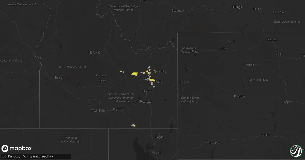
Get this storm
September 19 map
$229
one time, instant access
Download today. No call, no setup
Keep the $229
Bought the map and want the full workflow? Apply the entire $229 to a subscription within 7 days. None of it is wasted.
Every map, not just this one
This buys you this map. Subscription and you get every map we run, in the markets you choose from a few cities to whole states to nationwide. Plus real-time alerts the moment a storm fires.
Contact data
Name, contact info, occupancy, even credit band for addresses in the footprint. You go from where it hit to who to call.
Become the source they trust
Unlimited branding weather history reports on demand. You already have the documented answer ready for the property owner, and you are the one who showed up with it.
Property data and RoofTrace estimates
Pull up any address you have got, its value and the exact code rules for that jurisdiction, straight from One Click Code. Then RoofTrace estimates the squares, pitch, and roof value, priced the way you price.
States Impacted by Hail Map on September 19, 2020
Storm reports
Wyoming
| Date | Description |
|---|---|
| 09/19/20203:25 PM CDT | Lander airport. Weak showers coming off the wind river mountains caused strong gust. |
Idaho
| Date | Description |
|---|---|
| 09/19/20206:25 PM CDT | Downed trees and power lines. |
| 09/19/20206:14 PM CDT | Social media picture showing fence damage from thunderstorm winds |
| 09/19/20206:10 PM CDT | Hail damage to roof - hole size estimated a quarter or larger. Picture on social media. |
| 09/19/20205:30 PM CDT | Itd kettle butte station. |
| 09/19/20205:30 PM CDT | Highway 20. Kettle butte. |
| 09/19/20205:07 PM CDT | Photos from social media. Mix of quarter to ping pong size hail. |
| 09/19/20204:03 PM CDT | Moberg canyon raws |
| 09/19/202012:43 AM CDT | At 542 PM MDT, severe thunderstorms were located along a line extending from near Blackfoot to near Ririe Reservoir, moving southeast at 20 mph. HAZARD...60 mph wind gusts and quarter size hail. SOURCE...Radar indicated. IMPACT...Hail damage to vehicles is expected. Expect wind damage to roofs, siding, and trees. Locations impacted include... Blackfoot, Ririe Reservoir, Goshen, Chesterfield Reservoir, Inkom, Fort Hall Eagle Lodge, Fort Hall Lincoln Creek Lodge, Fort Hall Mount Putnam, Bone, Fort Hall Putnam Lodge, Fort Hall Townsite, Cutthroat Trout Campground, Trail Creek Campground and Wapello. |
| 09/19/202012:38 AM CDT | At 531 PM MDT, severe thunderstorms were located along a line extending from near Parker to Goshen, moving northeast at 20 mph. There have been reports of downed trees and powerline as a result of this line of thunderstorms. Frequent lightning is also occuring. Move indoors now! HAZARD...60 mph wind gusts and quarter size hail. SOURCE...Radar indicated. IMPACT...Hail damage to vehicles is expected. Expect wind damage to roofs, siding, and trees. Locations impacted include... Rexburg, Ashton, Ririe Reservoir, Marysville, Sugar City, Teton, Ririe, Parker, Drummond, Archer, St Anthony, Chester, Last Chance, Ashton Reservoir, Warm River, Tetonia Research Station, Green Canyon Hot Springs, Harriman State Park, Newdale and Ashton Hill. |
| 09/19/202012:34 AM CDT | At 531 PM MDT, severe thunderstorms were located along a line extending from near Parker to Goshen, moving northeast at 20 mph. There have been reports of downed trees and powerline as a result of this line of thunderstorms. Frequent lightning is also occuring. Move indoors now! HAZARD...60 mph wind gusts and quarter size hail. SOURCE...Radar indicated. IMPACT...Hail damage to vehicles is expected. Expect wind damage to roofs, siding, and trees. Locations impacted include... Rexburg, Ashton, Ririe Reservoir, Marysville, Sugar City, Teton, Ririe, Parker, Drummond, Archer, St Anthony, Chester, Last Chance, Ashton Reservoir, Warm River, Tetonia Research Station, Green Canyon Hot Springs, Harriman State Park, Newdale and Ashton Hill. |
| 09/19/202012:04 AM CDT | At 503 PM MDT, severe thunderstorms were located along a line extending from Hamer to near Rose, moving northeast at 20 mph. HAZARD...70 mph wind gusts and quarter size hail. SOURCE...Radar indicated. IMPACT...Hail damage to vehicles is expected. Expect considerable tree damage. Wind damage is also likely to mobile homes, roofs, and outbuildings. Locations impacted include... Idaho Falls, Rexburg, Rigby, Lorenzo, Goshen, Ririe Reservoir, Ammon, Shelley, Iona, Sugar City, Ucon, Menan, Ririe, Roberts, Lewisville, Parker, Archer, Egin, Bone and Plano. |
| 09/18/202011:29 PM CDT | At 429 PM MDT, severe thunderstorms were located along a line extending from near Mud Lake to 10 miles north of Rose, moving northeast at 30 mph. HAZARD...60 mph wind gusts and quarter size hail. SOURCE...Radar indicated. IMPACT...Hail damage to vehicles is expected. Expect wind damage to roofs, siding, and trees. Locations impacted include... Idaho Falls, Terreton, Ammon, Iona, Ucon, Menan, Roberts, Lewisville, Mud Lake, Hamer, Monteview, Sage Junction, Osgood and Kettle Butte. |
| 09/18/202011:08 PM CDT | At 407 PM MDT, a severe thunderstorm was located near Terreton, moving northeast at 15 mph. HAZARD...60 mph wind gusts and quarter size hail. SOURCE...Radar indicated. IMPACT...Hail damage to vehicles is expected. Expect wind damage to roofs, siding, and trees. Locations impacted include... Terreton, Hamer and Sage Junction. |
| 09/18/202010:44 PM CDT | At 343 PM MDT, a severe thunderstorm was located 7 miles southwest of Northwest Inl, or 20 miles west of Terreton, moving east at 20 mph. This storm has a history of rotation an would be capable of producing a funnel cloud or brief tornado. HAZARD...60 mph wind gusts and quarter size hail. SOURCE...Radar indicated. IMPACT...Hail damage to vehicles is expected. Expect wind damage to roofs, siding, and trees. Locations impacted include... Terreton, Mud Lake, Northwest Inl and Monteview. |
| 09/18/202010:22 PM CDT | At 322 PM MDT, a severe thunderstorm was located 14 miles southwest of Northwest Inl, or 17 miles northeast of Arco, moving east at 20 mph. HAZARD...60 mph wind gusts and quarter size hail. SOURCE...Radar indicated. IMPACT...Hail damage to vehicles is expected. Expect wind damage to roofs, siding, and trees. Locations impacted include... Northwest Inl and Howe. |
| 09/18/20209:09 PM CDT | At 209 PM MDT, a severe thunderstorm was located over Darlington, or 10 miles southeast of Mackay, moving east at 25 mph. HAZARD...Ping pong ball size hail and 60 mph wind gusts. SOURCE...Radar indicated. IMPACT...People and animals outdoors will be injured. Expect hail damage to roofs, siding, windows, and vehicles. Expect wind damage to roofs, siding, and trees. Locations impacted include... Darlington and Moore. |