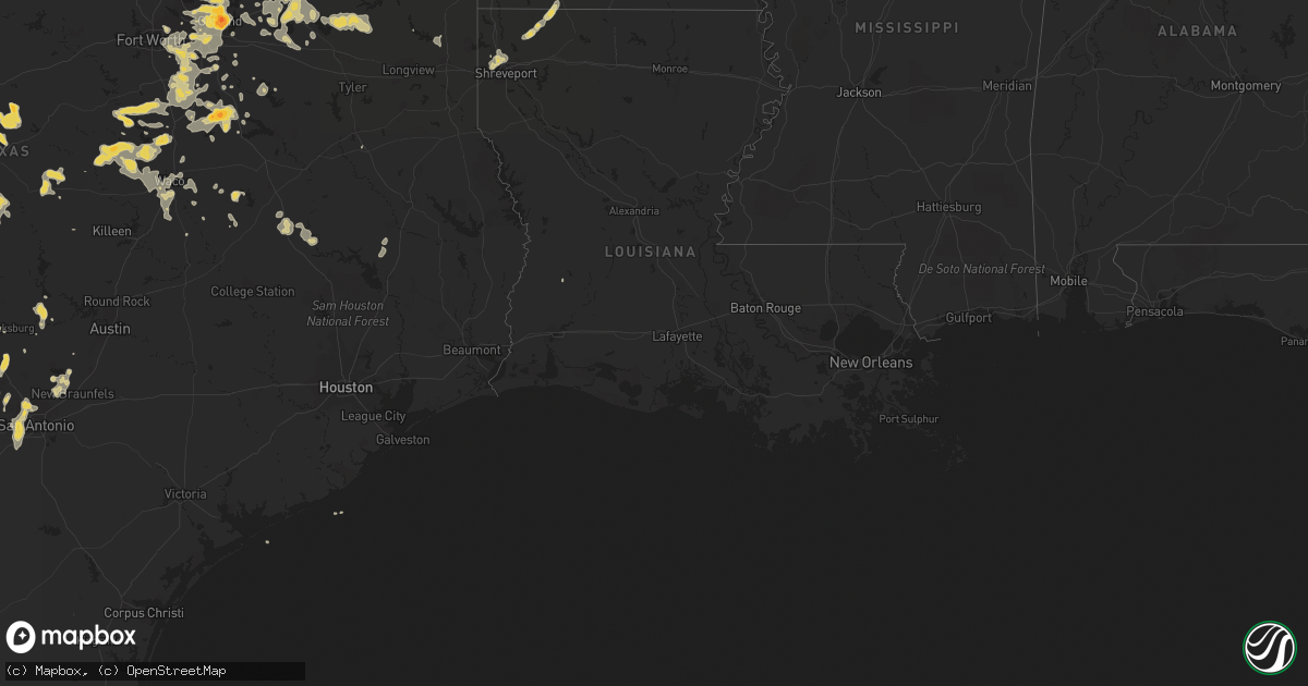
Hail Map on September 18, 2011
Get this storm
September 18 map
$229
one time, instant access
Download today. No call, no setup
Keep the $229
Bought the map and want the full workflow? Apply the entire $229 to a subscription within 7 days. None of it is wasted.
Every map, not just this one
This buys you this map. Subscription and you get every map we run, in the markets you choose from a few cities to whole states to nationwide. Plus real-time alerts the moment a storm fires.
Contact data
Name, contact info, occupancy, even credit band for addresses in the footprint. You go from where it hit to who to call.
Become the source they trust
Unlimited branding weather history reports on demand. You already have the documented answer ready for the property owner, and you are the one who showed up with it.
Property data and RoofTrace estimates
Pull up any address you have got, its value and the exact code rules for that jurisdiction, straight from One Click Code. Then RoofTrace estimates the squares, pitch, and roof value, priced the way you price.
States Impacted by Hail Map on September 18, 2011
Storm reports
Arkansas
| Date | Description |
|---|---|
| 09/18/20116:50 PM CDT | A few trees were downed near ione. |
| 09/18/20115:22 PM CDT | Golf ball hail reported at highway 371 and 26. |
| 09/17/20119:00 PM CDT | Trees down in arden. Power out in west central part of county. |
| 09/17/20118:45 PM CDT | Trees down and power out north of foreman on 41. |
| 09/17/20118:14 PM CDT | Hail storm inch to inch and half in horatio reported by office of emergency preparedness employee. |
Missouri
| Date | Description |
|---|---|
| 09/18/20115:32 PM CDT | Trees reported down on hwy 90 west of washburn. Location approximate. No trees blocking the road. No damage in town. A number of reports from rural fire and the highway |
| 09/18/20115:30 PM CDT | Local church reported quarter size hail |
Louisiana
| Date | Description |
|---|---|
| 09/17/201111:35 PM CDT | Tree down sandage road and pine cove street. |
| 09/17/201111:20 PM CDT | Large tree down bellview road at autumn wood circle. |
| 09/17/201110:44 PM CDT | Tree down hwy 2 near millers bluff in plain dealing. |
Texas
| Date | Description |
|---|---|
| 09/18/20116:50 PM CDT | A local report indicates 1.00 inch wind near VAN ALSTYNE |
| 09/18/20116:20 PM CDT | Spotter reports one inch hail |
| 09/18/20116:02 PM CDT | Trees down in ambrose. Knocked out power to town. |
| 09/18/20114:58 PM CDT | Quarter to golf ball size hail in oak ridge |
| 09/18/201112:30 AM CDT | A single tree was blown down just east of marlin |
| 09/17/201111:15 PM CDT | Hail up to the size of golfballs in barry |
| 09/17/201110:45 PM CDT | Trees and powerlines were downed at the intersections of englewood and dobbs and carlyle and franklin. |
| 09/17/201110:40 PM CDT | Tree downed cr 4247 south of itasca |
| 09/17/201110:40 PM CDT | Trees down county wide. Roof blown off west of gilmer. |
| 09/17/201110:30 PM CDT | Tree down cr 1450 wsw itasca |
| 09/17/201110:25 PM CDT | 4 inch tree branches blown down. There were also reports of poiwer lines down. |
| 09/17/201110:24 PM CDT | Tree down across sand country road near the intersection with hwy 49. |
| 09/17/201110:15 PM CDT | Large tree limbs down in residential areas. Also hail up to the size of pennies. |
| 09/17/201110:15 PM CDT | Large tree limbs down along county road 1114 near johnson county line |
| 09/17/201110:03 PM CDT | Power outages reported |
| 09/17/201110:00 PM CDT | Report of tree down near fm 1991 east of clifton |
| 09/17/20119:52 PM CDT | Tree down at the intersection of county roads 1619 and 1642. |
| 09/17/20119:50 PM CDT | Trees down at lake wright patman |
| 09/17/20119:40 PM CDT | Roof removed from a house under construction on county road 1416 on the south side of lake quitman. |
| 09/17/20119:35 PM CDT | Ten inch diameter tree split |
| 09/17/20119:35 PM CDT | Also wind gusts to 40 mph. |
| 09/17/20119:35 PM CDT | Power lines down in ovilla |
| 09/17/20119:30 PM CDT | Trees down county wide |
| 09/17/20119:25 PM CDT | Trees down in red water |
| 09/17/20119:22 PM CDT | A local report indicates 70 MPH wind near SEAGOVILLE |
| 09/17/20119:20 PM CDT | Reported near joe pool lake |
| 09/17/20119:15 PM CDT | Tree limbs down |
| 09/17/20119:09 PM CDT | Large trees down 4 sw of sulphur springs |
| 09/17/20118:55 PM CDT | Power lines down. Also reports of a large tree blocking highway 4 sw of sulphur springs. Time estimated. |
| 09/17/20118:55 PM CDT | Trees down all over franklin county and no power in mount vernon. |
| 09/17/20118:45 PM CDT | Golf ball size hail at 635 and royal |
| 09/17/20118:42 PM CDT | A local report indicates 2.00 inch wind near 1 SW GARLAND |
| 09/17/20118:40 PM CDT | Trees down greenhill road and tu bridge |
| 09/17/20118:38 PM CDT | Multiple trees blown down |
| 09/17/20118:37 PM CDT | Multiple power flashes at 635 and hwy 76. |
| 09/17/20118:37 PM CDT | Quarter size hail at 635 and hwy 76 |
| 09/17/20118:31 PM CDT | 2 sw garland |
| 09/17/20118:15 PM CDT | Wind gusts of 50 to 60 mph reported in emblem |
| 09/17/20118:01 PM CDT | Quarter size hail at hwy 75 and park blvd |
| 09/17/20117:45 PM CDT | Power lines down and outbuildings damaged in westminster. Time estimated |
| 09/17/20117:38 PM CDT | A local report indicates 1.25 inch wind near MCKINNEY |
| 09/17/20117:32 PM CDT | Quarter size hail 3 nw of point |
| 09/17/20117:25 PM CDT | Cocorahs spotter report |
| 09/17/20117:15 PM CDT | A local report indicates 1.00 inch wind near PROSPER |
| 09/17/20117:12 PM CDT | Power lines down in bonham |
Oklahoma
| Date | Description |
|---|---|
| 09/18/20116:51 PM CDT | Golf ball hail reported one mile north of broken bow. |
| 09/18/20115:35 PM CDT | Time estimated. |
| 09/18/20115:20 PM CDT | A local report indicates 1.00 inch wind near 7 SSW KINGSTON |
Cities Impacted by Hail Map on September 18, 2011
- Warner, OK
- Checotah, OK
- Webbers Falls, OK
- Braggs, OK
- Gore, OK
- Muskogee, OK
- Bunch, OK
- Sallisaw, OK
- Vian, OK
- Johnson City, TX
- Ferris, TX
- Cooper, TX
- Celina, TX
- Leonard, TX
- Melissa, TX
- Van Alstyne, TX
- Collinsville, TX
- Blue Ridge, TX
- Whitesboro, TX
- Frisco, TX
- Gunter, TX
- Prosper, TX
- Sherman, TX
- Anna, TX
- Tom Bean, TX
- Trenton, TX
- Howe, TX
- Mckinney, TX
- Whitewright, TX
- Dallas, TX
- Stella, MO
- Rocky Comfort, MO
- Hunt, TX
- Sonora, TX
- Ozona, TX
- Mabank, TX
- Eustace, TX
- Menard, TX
- Powell, TX
- Corsicana, TX
- Rocksprings, TX
- Tioga, TX
- Pilot Point, TX
- Midway, TX
- Crockett, TX
- Leona, TX
- Centerville, TX
- Deridder, LA
- Canyon Lake, TX
- New Braunfels, TX
- Okmulgee, OK
- Haskell, OK
- Porter, OK
- Oktaha, OK
- Coweta, OK
- Mounds, OK
- Bixby, OK
- Boynton, OK
- Taft, OK
- Pipe Creek, TX
- Mullin, TX
- De Kalb, TX
- Poteau, OK
- Shady Point, OK
- Bronte, TX
- Exeter, MO
- Kingston, OK
- Gordonville, TX
- Brady, TX
- Commerce, TX
- Campbell, TX
- Quinlan, TX
- Royse City, TX
- San Saba, TX
- Valley View, TX
- Alvarado, TX
- Waxahachie, TX
- Maypearl, TX
- Duncanville, TX
- Midlothian, TX
- Cedar Hill, TX
- Itasca, TX
- Venus, TX
- Desoto, TX
- Grandview, TX
- Italy, TX
- Grand Prairie, TX
- Arlington, TX
- Lockesburg, AR
- May, TX
- Pittsburg, OK
- Blanco, OK
- Blytheville, AR
- Fayetteville, AR
- Springdale, AR
- Muldrow, OK
- Denison, TX
- Savoy, TX
- Bells, TX
- Hendrix, OK
- Muenster, TX
- Tuskahoma, OK
- Whitefield, OK
- Mccurtain, OK
- Quinton, OK
- Stigler, OK
- Porum, OK
- Kinta, OK
- Keota, OK
- Eufaula, OK
- Rusk, TX
- Sadler, TX
- Sulphur Springs, AR
- Blanket, TX
- Covington, TX
- Elm Mott, TX
- West, TX
- Waldron, AR
- Siloam Springs, AR
- Watts, OK
- Colcord, OK
- Gentry, AR
- Normangee, TX
- Madisonville, TX
- Klondike, TX
- Hackett, AR
- Magazine, AR
- Mansfield, AR
- Greenwood, AR
- Hartford, AR
- Booneville, AR
- Midland, AR
- Huntington, AR
- Cameron, OK
- Ingram, TX
- Kerrville, TX
- Mason, TX
- Junction, TX
- London, TX
- Cartwright, OK
- Calera, OK
- Colbert, OK
- Broken Bow, OK
- Maud, TX
- Hooks, TX
- New Boston, TX
- Langley, AR
- Newhope, AR
- Kirby, AR
- Glenwood, AR
- Dierks, AR
- Mcalester, OK
- Winters, TX
- Hewitt, TX
- Lorena, TX
- Waco, TX
- Hartshorne, OK
- Kiowa, OK
- Lohn, TX
- Gorman, TX
- Hernando, MS
- Mountain Home, TX
- Round Mountain, TX
- Blum, TX
- Aquilla, TX
- Hillsboro, TX
- Abbott, TX
- Whitney, TX
- Kansas, OK
- Jay, OK
- Gainesville, TX
- Lindsay, TX
- Atoka, OK
- Comfort, TX
- Princeton, TX
- Ballinger, TX
- Greenville, TX
- Mineral Springs, AR
- Nashville, AR
- Rowlett, TX
- Garland, TX
- Woodway, TX
- Brashear, TX
- Sulphur Springs, TX
- Emory, TX
- Red Oak, OK
- Clifton, TX
- Hurst, TX
- North Richland Hills, TX
- Bedford, TX
- Madill, OK
- Durant, OK
- Kenefic, OK
- Eden, TX
- Rosebud, TX
- Cotton Valley, LA
- Shongaloo, LA
- Sarepta, LA
- Emerson, AR
- Benton, LA
- Boerne, TX
- Little Elm, TX
- Fredericksburg, TX
- Doss, TX
- Harper, TX
- Point, TX
- Lone Oak, TX
- Cumby, TX
- Valley Mills, TX
- Crawford, TX
- West Fork, AR
- Winslow, AR
- Barksdale, TX
- Clayton, OK
- Leakey, TX
- Ryan, OK
- Terral, OK
- Jonesboro, TX
- Lane, OK
- Stringtown, OK
- Blossom, TX
- Mertens, TX
- Lancaster, TX
- Fort Worth, TX
- Richardson, TX
- Purdon, TX
- Ennis, TX
- Cleburne, TX
- Morgan, TX
- Bynum, TX
- The Colony, TX
- Kopperl, TX
- Coppell, TX
- Malone, TX
- Milford, TX
- Rio Vista, TX
- Barry, TX
- Irving, TX
- Mesquite, TX
- Balch Springs, TX
- Wylie, TX
- Glen Rose, TX
- Sachse, TX
- Carrollton, TX
- Addison, TX
- Hutchins, TX
- Frost, TX
- Allen, TX
- Rockwall, TX
- Blooming Grove, TX
- Forreston, TX
- Lewisville, TX
- Red Oak, TX
- Palmer, TX
- Mansfield, TX
- Plano, TX
- San Antonio, TX
- Jbsa Lackland, TX
- Atascosa, TX
- Von Ormy, TX
- Danville, AR
- Caney, OK
- Caddo, OK
- Seagoville, TX
- De Queen, AR
- Haworth, OK
- Eagletown, OK
- Antlers, OK
- Rattan, OK
- Bogata, TX
- Hext, TX
- Rochelle, TX
- Dike, TX
- Cherokee, TX
- Farmersville, TX
- Celeste, TX
- Melvin, TX
- Crandall, TX
- China Spring, TX
- Pottsville, TX
- Hamilton, TX
- Evant, TX
- Cranfills Gap, TX
- Meridian, TX
- Magnolia, AR
- Coalgate, OK
- Centrahoma, OK
- Cross Plains, TX
- Pickton, TX
- Yantis, TX
- Winnsboro, TX
- Pittsburg, TX
- Como, TX
- Quitman, TX
- Gilmer, TX
- Goldthwaite, TX
- Stuart, OK
- Allen, OK
- Calvin, OK
- Detroit, TX
- Bagwell, TX
- Clarksville, TX
- Horatio, AR
- Thornton, TX
- Groesbeck, TX
- Wills Point, TX
- Winthrop, AR
- San Angelo, TX
- Wilburton, OK
- Clarksville, AR
- Wardville, OK
- Shreveport, LA
- Indianola, OK
- Comanche, TX
- De Leon, TX
- Idabel, OK
- Foreman, AR
- Sulphur Bluff, TX
- Lake Creek, TX
- Robinsonville, MS
- Lake Cormorant, MS
- Kemp, TX
- Reagan, TX
- Franklin, TX
- Bremond, TX
- Richland Springs, TX
- Finley, OK
- Snow, OK
- Decatur, AR
- Nesbit, MS
- Ashdown, AR
- Bella Vista, AR
- Henrietta, TX
- Euless, TX
- Colleyville, TX
- Roosevelt, TX
- Sidney, TX
- Broken Arrow, OK
- Thackerville, OK
- Mount Pleasant, TX
- Brownwood, TX
- Early, TX
- Boles, AR
- Hanna, OK
- Alba, TX
- Fort Smith, AR
- Charleston, AR
- Bokoshe, OK
- Ratcliff, AR
- Pocola, OK
- Heavener, OK
- Spiro, OK
- Gans, OK
- Ozark, AR
- Branch, AR
- Paris, AR
- Milburn, OK
- Pottsboro, TX
- Watson, OK
- Huntsville, AR
- Washburn, MO
- Rising Star, TX
- Sabinal, TX
- Elkins, AR
- Wesley, AR
- Hindsville, AR
- Corrigan, TX
- Groveton, TX
- Ector, TX
- Bonham, TX
- Dodd City, TX
- Carbon, TX
- Ogden, AR
- Eddy, TX
- Rose, OK
- Gravette, AR
- Noel, MO
- Texarkana, TX
- Annona, TX
- Kempner, TX
- Vienna, IL
- Horseshoe Bay, TX
- Mount Vernon, TX
- Honey Grove, TX
- Welling, OK
- Lavon, TX
- Nevada, TX
- Moscow, TX
- Livingston, TX
- Edgewood, TX
- Caddo Mills, TX
- Avery, TX
- Terrell, TX
- Paris, TX
- Pattonville, TX
- Deport, TX
- Talco, TX
- Fruitvale, TX
- Mead, OK
- Grand Saline, TX
- Scroggins, TX
- Leesburg, TX
- Ladonia, TX
- Windom, TX
- Bulverde, TX
- San Marcos, TX
- Spring Branch, TX
- Coleman, OK
- Mart, TX
- Riesel, TX
- Norton, TX
- Wimberley, TX
- Mico, TX
- Helotes, TX
- Okemah, OK
- Weleetka, OK
- Lott, TX
- Bruceville, TX
- Chilton, TX
- McGregor, TX
- Hico, TX
- Marlin, TX
- Medina, TX
- Theodosia, MO
- Somerset, TX
- Witter, AR
- Forney, TX
- Mena, AR
- Bossier City, LA
- Ravenna, TX
- Gillham, AR
- Lometa, TX
- Havana, AR
- Bentonville, AR
- Lincoln, AR
- Twin Oaks, OK
- Lowell, AR
- Westville, OK
- Summers, AR
- Farmington, AR
- Oden, AR
- Pencil Bluff, AR
- Bluffton, AR
- Gravelly, AR
- Stilwell, OK
- Prairie Grove, AR
- Canehill, AR
- Powell, MO
- Pineville, MO
- Wilmer, TX
- Jewett, TX
- Harvey, AR
- Parks, AR
- Plainview, AR
- Sims, AR
- Jefferson, TX
- Dawson, TX
- Prescott, AR
- Rogers, AR
- Chatfield, TX
- Star, TX