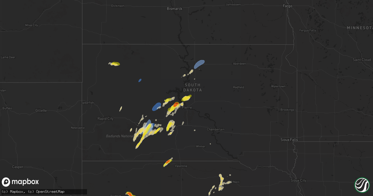
Hail Map on September 14, 2024
Get this storm
September 14 map
$229
one time, instant access
Download today. No call, no setup
Keep the $229
Bought the map and want the full workflow? Apply the entire $229 to a subscription within 7 days. None of it is wasted.
Every map, not just this one
This buys you this map. Subscription and you get every map we run, in the markets you choose from a few cities to whole states to nationwide. Plus real-time alerts the moment a storm fires.
Contact data
Name, contact info, occupancy, even credit band for addresses in the footprint. You go from where it hit to who to call.
Become the source they trust
Unlimited branding weather history reports on demand. You already have the documented answer ready for the property owner, and you are the one who showed up with it.
Property data and RoofTrace estimates
Pull up any address you have got, its value and the exact code rules for that jurisdiction, straight from One Click Code. Then RoofTrace estimates the squares, pitch, and roof value, priced the way you price.
States Impacted by Hail Map on September 14, 2024
Storm reports
Texas
| Date | Description |
|---|---|
| 09/14/20245:56 PM CDT | Weak echo return with a possible dry microburst. Not a strong thunderstorm... But a unique environmental interaction from a few090 cloud deck. |
| 09/14/20244:37 PM CDT | A local report indicates 59 MPH wind near 15 WSW Clarendon |
| 09/14/20243:36 PM CDT | [landspout] storm chaser submitted multiple videos of a landspout. No damage was reported. |
| 09/14/20242:54 PM CDT | [landspout] a photo of a landspout was submitted via social media. No damage was reported. |
| 09/13/202411:00 PM CDT | Tree fell. Blocking entire road. |
| 09/13/202410:00 PM CDT | Power outage/power lines down. |
| 09/13/202410:00 PM CDT | Power outage/power lines down. |
| 09/13/202410:00 PM CDT | Power outage/power lines down. |
| 09/13/202410:00 PM CDT | Power outage/power lines down. |
| 09/13/202410:00 PM CDT | Pizza hut sign fell on stalled vehicle unknown if the vehicle was occupied or not. |
Nebraska
| Date | Description |
|---|---|
| 09/14/202412:15 PM CDT | A local report indicates 1.25 inch wind near 13 SW Stapleton |
| 09/14/202412:13 PM CDT | Corrects previous hail report from 16 nne north platte. Covered the ground and stripped leaves from the trees. Damaged pasture. |
| 09/13/20248:00 PM CDT | The hail was about the size of an ice cube. |
| 09/13/20247:45 PM CDT | 1 to 1 1/2 inch hail. Very little rain. |
South Dakota
| Date | Description |
|---|---|
| 09/14/20244:53 PM CDT | Mesonet station 313 5se selby |
| 09/14/20242:45 PM CDT | A local report indicates 60 MPH wind near 1 NNE Faith |
| 09/14/20242:03 PM CDT | A local report indicates 60 MPH wind near 10 NNW Ottumwa |
| 09/14/20241:03 PM CDT | A local report indicates 61 MPH wind near 4 E Cactus Flat |
| 09/14/20241:00 PM CDT | Pea sized hail |
North Carolina
| Date | Description |
|---|---|
| 09/14/20246:18 PM CDT | 59 mph wind gust measured at johnnie mercers fishing pier. |
Cities Impacted by Hail Map on September 14, 2024
- Russell, KS
- Paradise, KS
- Ardmore, OK
- Madill, OK
- Kyle, SD
- North Platte, NE
- Stapleton, NE
- Scenic, SD
- Maxwell, NE
- Interior, SD
- Wanblee, SD
- Wall, SD
- Philip, SD
- New Underwood, SD
- Kadoka, SD
- Porcupine, SD
- Allen, SD
- Anselmo, NE
- Arnold, NE
- Merna, NE
- Midland, SD
- White River, SD
- Milesville, SD
- Fort Pierre, SD
- Hayes, SD
- Okaton, SD
- Belvidere, SD
- Long Valley, SD
- Faith, SD
- Dupree, SD
- Nenzel, NE
- Kilgore, NE
- Meadow, SD
- Murdo, SD
- Selby, SD
- Saint Francis, SD
- Pampa, TX
- Borger, TX
- Claude, TX
- Clarendon, TX
- Miami, TX
- Draper, SD
- Vivian, SD
- Java, SD
- Reva, SD
- Boise City, OK
- Prairie City, SD
- Bowdle, SD
- Perryton, TX
- Presho, SD
- Campo, CO
- Kennebec, SD
- Canadian, TX
- Pritchett, CO
- Ellsworth, NE
- Springfield, CO
- Lakeside, NE
- Wellington, TX
- Mobeetie, TX
- Briscoe, TX
- Richardton, ND
- Erick, OK
- Bingham, NE
- Bassett, NE
- Gettysburg, SD
- Gregory, SD
- Pierre, SD
- Butler, OK
- Canute, OK
- Dill City, OK
- Elk City, OK
- Onida, SD
- Stuart, NE
- Atkinson, NE
- Laredo, TX
- Sentinel, OK
- Eagle Butte, SD
- Wrightsville Beach, NC
- Emmet, NE
- Amelia, NE