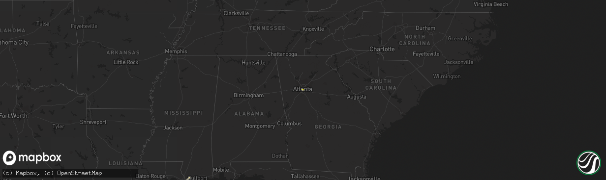
Hail Map on September 14, 2023
The weather event on September 14, 2023 includes Hail and Wind maps. 9 states and 110 cities were impacted and suffered possible damage. The total estimated number of properties impacted is 13,774.
Want more than just the map?
Turn this storm into a full workflow.
- Owner + property data so you know who to knock
- OnDemand branded weather history reports to win the "did we even have hail?" argument
- RoofTrace estimate so reps stop guessing numbers at the door
Bought this map? Upgrade within 7 days and we'll credit the $230. (10-15 min setup call)
Hail
Wind
13,774
Estimated number of impacted properties by a 1.00" hail or larger2,029
Estimated number of impacted properties by a 1.75" hail or larger0
Estimated number of impacted properties by a 2.50" hail or largerStates Impacted by Hail Map on September 14, 2023
Storm reports
Texas
| Date | Description |
|---|---|
| 09/14/20236:55 PM CDT | Mesonet station twb65 baker suave lomas. |
| 09/14/20236:10 PM CDT | A local report indicates 1.00 inch wind near 9 NW Columbus |
| 09/14/20235:40 PM CDT | Mesonet station ur247 11.9 e dryden |
| 09/14/20235:33 PM CDT | Photo and video relayed from the public by broadcast media of what appears to be a microburst causing tree and roof damage to a home in cedar creek. Time was taken from |
| 09/14/20233:55 PM CDT | Calhoun county airport awos measured a gust to 59 mph. |
| 09/14/20232:40 PM CDT | Trees down... San jacinto univ... Generation park campus. |
| 09/14/20232:35 PM CDT | Several small to medium sized trees and large branches down in fall creek subdivision. |
| 09/14/20233:36 AM CDT | Tree branch about one foot in diameter downed outside of nws office. Time estimated from radar. |
| 09/14/20233:14 AM CDT | A local report indicates 78 MPH wind near 2 NE Slaton |
| 09/14/20233:14 AM CDT | Slaton west texas mesonet site. Additional gusts ranging from 58 mph to 70 mph measured from 303 am to 316 am. |
| 09/14/20233:04 AM CDT | A local report indicates 70 MPH wind near 2 NE Slaton |
| 09/14/20232:47 AM CDT | Southeast lubbock west texas mesonet site. Additional gust to 64 mph measured at 243 am. |
| 09/14/20232:47 AM CDT | Southeast lubbock mesonet site |
| 09/14/20232:43 AM CDT | Southeast lubbock mesonet site |
| 09/14/20232:42 AM CDT | All saints episcopal school mesonet site |
| 09/14/20232:42 AM CDT | Corrected report. All saints episcopal school west texas mesonet site. Additional gusts to 59 mph measured at 241 am and 243 am. |
| 09/14/20232:38 AM CDT | Roofing material peeled off of low rise apartment building. Time estimated from radar. |
| 09/14/20232:37 AM CDT | Lubbock christian university west texas mesonet site. |
| 09/14/20232:37 AM CDT | Lubbock christian university mesonet site |
| 09/14/20232:36 AM CDT | Tree branch about one foot in diameter downed outside of nws office. Time estimated from radar. |
| 09/14/20232:35 AM CDT | Corrected time. Multiple large tree branches larger than one foot in diameter downed just south of the texas tech campus. Time estimated from radar and nearby observati |
| 09/14/20232:34 AM CDT | Tree down across road near 34th and university. Time estimated from radar. |
| 09/14/20232:33 AM CDT | Several tree branches larger than 1 foot in diameter downed and several large mature trees completely uprooted. Time estimated from radar. |
| 09/14/20232:32 AM CDT | Tree branches larger than one foot in diameter downed. Minor damage to homes also reported in the area of 19th and chicago. Time estimated from radar. |
| 09/14/20232:30 AM CDT | Multiple large tree branches larger than one foot in diameter downed just south of the texas tech campus. Time estimated from radar. |
| 09/14/20232:21 AM CDT | Reese center west texas mesonet site. Additional severe gusts ranging from 58 to 64 mph measured from 219 am through 227 am. |
| 09/14/20232:20 AM CDT | A local report indicates 60 MPH wind near Reese Center |
| 09/13/202310:25 PM CDT | Multiple power poles and lines downed. |
| 09/13/202310:17 PM CDT | Also gusted to 65 mph at 1018 pm. Measured by the northwest lubbock west texas mesonet site. |
| 09/13/202310:17 PM CDT | Also gusted to 65 mph at 1018 pm. Measured by the west texas mesonet. |
| 09/13/202310:15 PM CDT | Measured by the lubbock international airport asos. |
| 09/13/202310:15 PM CDT | Measured by the lubbock asos. |
| 09/13/20239:54 PM CDT | Measured by the west texas mesonet. |
| 09/13/20239:28 PM CDT | Roof blown off of outbuilding and into a nearby house. A fence supported by steel posts was also blown down and debris was found 200 yards away. Time estimated from rad |
| 09/13/20238:49 PM CDT | Measured by the west texas mesonet. |
| 09/13/20237:45 PM CDT | Media relayed public report of hail up to golf ball size. Mostly quarter to half-dollar size. Time estimated. |
| 09/13/20237:18 PM CDT | Fayette county sheriffs office reports damage to roofs in the city of flatonia. Time estimated from radar. |
Georgia
| Date | Description |
|---|---|
| 09/14/20235:30 PM CDT | Large tree in the road along fox glen dr. |
| 09/14/20234:10 PM CDT | Tree down on hwy 80 near the turkey creek bridge at. |
| 09/14/20233:43 PM CDT | Tree down on a powerline near the intersection of feagin mill rd and bent tree ave. |
| 09/14/20233:40 PM CDT | Tree down along hunters ridge rd. |
| 09/14/20231:25 PM CDT | A few powerlines down along turner rd se. |
| 09/14/20231:24 PM CDT | Tree down along henry thomas dr se. |
| 09/14/20231:20 PM CDT | A few powerlines down along albany dr sw. |
| 09/14/20231:20 PM CDT | Corrects previous tstm wnd dmg report from 1 se cascade heights. A few wires down along albany dr sw. |
| 09/14/20231:15 PM CDT | Corrects previous tstm wnd dmg report from 1 sse west end. A few wires down along christman st. Sw. |
| 09/14/20231:10 PM CDT | A few wires down near the intersection of lakewood way sw and macon dr sw. |
| 09/14/20231:04 PM CDT | A large oak tree was downed in the yard of a home in the area of bruce cir se and pontiac pl se. |
| 09/14/202312:50 PM CDT | Tree down along w lake dr nw. |
| 09/14/202312:43 PM CDT | Large tree uprooted at se corner of broyles st se and sydney st se. |
| 09/14/202312:40 PM CDT | Several wires down along beckwith st sw. |
| 09/14/202312:40 PM CDT | A few powerlines down along holly rd nw. |
Cities Impacted by Hail Map on September 14, 2023
- Atlanta, GA
- Humble, TX
- Houston, TX
- Austin, TX
- Sedgwick, CO
- Chappell, NE
- Cedar Creek, TX
- Johnson City, TX
- Dripping Springs, TX
- Dryden, TX
- Fayetteville, TX
- La Grange, TX
- Ellinger, TX
- Correll, MN
- Pontotoc, TX
- Willow City, TX
- Fredericksburg, TX
- Llano, TX
- Fredonia, TX
- San Saba, TX
- Arrey, NM
- Caballo, NM
- Victoria, TX
- Round Mountain, TX
- Valley Spring, TX
- Inez, TX
- Bloomington, TX
- Kaibeto, AZ
- Bay Saint Louis, MS
- Kiln, MS
- Diamondhead, MS
- Port Lavaca, TX
- Woonsocket, SD
- Letcher, SD
- Edna, TX
- Voca, TX
- Pep, NM
- Elida, NM
- Shallowater, TX
- Lubbock, TX
- Anton, TX
- Abernathy, TX
- Columbus, TX
- Earth, TX
- Littlefield, TX
- Muleshoe, TX
- Dimmitt, TX
- Amherst, TX
- Fieldton, TX
- Olton, TX
- Springlake, TX
- Farwell, TX
- Friona, TX
- Sudan, TX
- Slaton, TX
- Byers, CO
- Deer Trail, CO
- Schulenburg, TX
- Flatonia, TX
- Hallettsville, TX
- Moulton, TX
- Wilson, TX
- Del Rio, TX
- Brackettville, TX
- Portales, NM
- Appleton, MN
- Lewellen, NE
- Oshkosh, NE
- Socorro, NM
- Truth Or Consequences, NM
- Rush, CO
- Red Rock, TX
- Del Valle, TX
- Muldoon, TX
- Spring, TX
- Luling, TX
- Rosanky, TX
- Navasota, TX
- Milnesand, NM
- Bastrop, TX
- Holyoke, CO
- Manchaca, TX
- Buda, TX
- Harwood, TX
- Lockhart, TX
- Dale, TX
- Crosby, TX
- Smithville, TX
- Goldsmith, TX
- Maple, TX
- Morton, TX
- Utopia, TX
- Fort Sumner, NM
- Taiban, NM
- Rogers, NM
- Causey, NM
- Cuero, TX
- Yoakum, TX
- Jal, NM
- Clovis, NM
- Floyd, NM
- Shiner, TX
- Notrees, TX
- Gardendale, TX
- Ransom Canyon, TX
- Ozona, TX
- Post, TX
- Snyder, TX
- Justiceburg, TX
- Sonora, TX