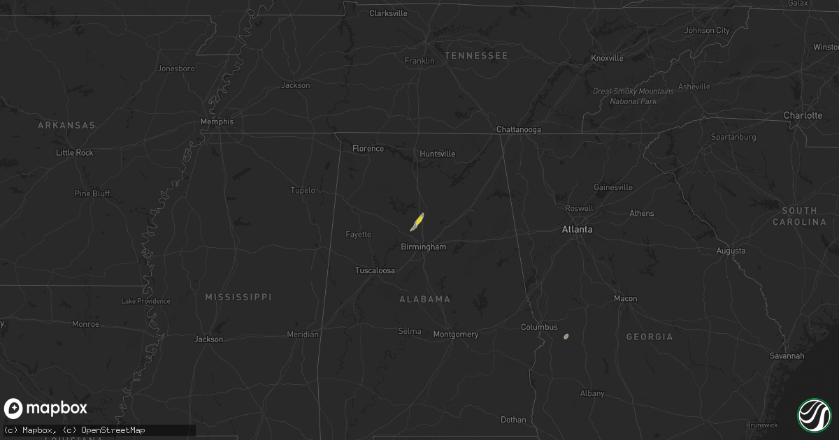
Hail Map on September 13, 2024
Get this storm
September 13 map
$229
one time, instant access
Download today. No call, no setup
Keep the $229
Bought the map and want the full workflow? Apply the entire $229 to a subscription within 7 days. None of it is wasted.
Every map, not just this one
This buys you this map. Subscription and you get every map we run, in the markets you choose from a few cities to whole states to nationwide. Plus real-time alerts the moment a storm fires.
Contact data
Name, contact info, occupancy, even credit band for addresses in the footprint. You go from where it hit to who to call.
Become the source they trust
Unlimited branding weather history reports on demand. You already have the documented answer ready for the property owner, and you are the one who showed up with it.
Property data and RoofTrace estimates
Pull up any address you have got, its value and the exact code rules for that jurisdiction, straight from One Click Code. Then RoofTrace estimates the squares, pitch, and roof value, priced the way you price.
Storm reports
Kentucky
| Date | Description |
|---|---|
| 09/13/20244:57 PM CDT | Carport blown by thunderstorm wind. |
Alabama
| Date | Description |
|---|---|
| 09/13/20246:53 PM CDT | A few trees down... Some involving power lines and road blockage. |
| 09/13/20246:42 PM CDT | Corrects previous tstm wnd dmg report from 1 ne locust fork for time. A few trees were blown down. One on tabernacle road... One on campbell road... And another one on |
| 09/13/20246:31 PM CDT | End point of damaging straight line wind swath that caused mostly damage to trees with some uprooted trees and small and large limbs down across this area. Some tree li |
| 09/13/20246:24 PM CDT | Start point of damaging straight line wind swath that caused mostly damage to trees with some uprooted trees and small and large limbs down across this area. Some tree |
| 09/13/20245:43 PM CDT | Tree reported down along county road 564 near hanceville. |
| 09/13/20245:43 PM CDT | Tree reported down along county road 565 near hanceville. |
| 09/13/20245:34 PM CDT | Tree reported down along county road 820 near good hope. |
| 09/13/20245:06 PM CDT | Tree reported down along highway 69 and county road 223 near good hope. |
| 09/13/202411:18 AM CDT | Corrects the event and time from the earlier report. Power pole reported down or leaning along highway 247 near tuscumbia. |
| 09/12/20248:49 PM CDT | Tree reported down along lentzville road and lakeside estates near rogersville. |
| 09/12/20247:07 PM CDT | A few trees were blown down. One on tabernacle road... One on campbell road... And another one on circle lane. |