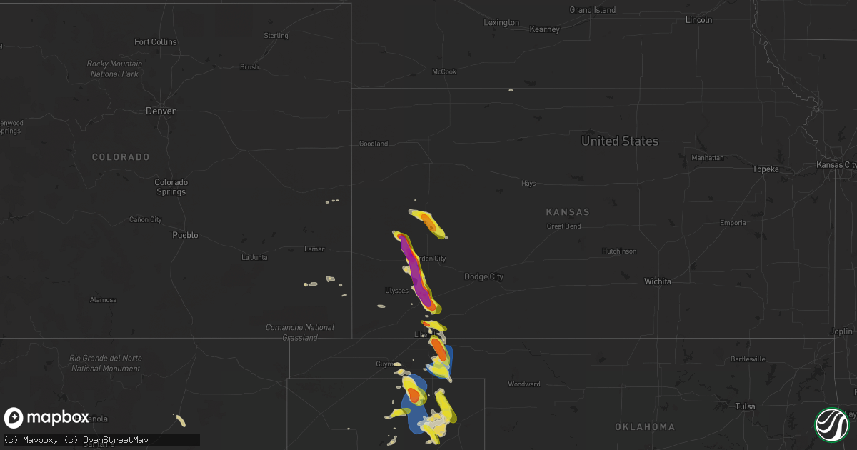
Hail Map on September 10, 2023
Get this storm
September 10 map
$229
one time, instant access
Download today. No call, no setup
Keep the $229
Bought the map and want the full workflow? Apply the entire $229 to a subscription within 7 days. None of it is wasted.
Every map, not just this one
This buys you this map. Subscription and you get every map we run, in the markets you choose from a few cities to whole states to nationwide. Plus real-time alerts the moment a storm fires.
Contact data
Name, contact info, occupancy, even credit band for addresses in the footprint. You go from where it hit to who to call.
Become the source they trust
Unlimited branding weather history reports on demand. You already have the documented answer ready for the property owner, and you are the one who showed up with it.
Property data and RoofTrace estimates
Pull up any address you have got, its value and the exact code rules for that jurisdiction, straight from One Click Code. Then RoofTrace estimates the squares, pitch, and roof value, priced the way you price.
States Impacted by Hail Map on September 10, 2023
Storm reports
Virginia
| Date | Description |
|---|---|
| 09/10/20236:49 PM CDT | Tree down on the 3000 block of caledon road |
Georgia
| Date | Description |
|---|---|
| 09/10/20235:45 PM CDT | Tree down 300 block of murry rd. |
| 09/10/20235:45 PM CDT | Tree down hwy 51 and bennett rd. |
| 09/10/20235:45 PM CDT | Tree down 400 block daily dr. |
Wyoming
| Date | Description |
|---|---|
| 09/10/20236:02 PM CDT | A local report indicates 1.00 inch wind near Pine Haven |
| 09/10/20236:02 PM CDT | 2 inch deep dime to nickel sized hail... With a few larger hailstones to quarter sized. |
| 09/10/20235:37 PM CDT | Hail near entrance to sinks canyon state park. Measured 1 1/3 inch hail... With hail about 2 inches deep. |
| 09/10/20235:06 PM CDT | Delayed report from earlier this afternoon. |
| 09/10/20234:12 PM CDT | Social media picture of quarter-sized hail. |
| 09/10/20234:00 PM CDT | Quarter sized hail reported from driver on hwy 259. |
| 09/10/20233:33 PM CDT | Traveler on i25 reported quarter to golf ball sized hail on road. |
| 09/10/20233:27 PM CDT | Storm chaser measured ping pong ball sized hail on arapahoe ranch rd. |
South Carolina
| Date | Description |
|---|---|
| 09/10/20236:20 PM CDT | Dorchester county em provided pictures of wind damage within the 100 block of mockingbird drive. The pictures indicated one downed trees with multiple large limbs down. |
Kansas
| Date | Description |
|---|---|
| 09/10/20236:38 PM CDT | A local report indicates 1.00 inch wind near 3 NE Hayne |
| 09/10/20236:10 PM CDT | A local report indicates 1.75 inch wind near 8 NW Sublette |
| 09/10/20235:27 PM CDT | A local report indicates 1.50 inch wind near Scott City |
| 09/10/20235:08 PM CDT | A local report indicates 2.00 inch wind near 1 SSE Deerfield |
| 09/10/20234:52 PM CDT | A local report indicates 2.50 inch wind near Deerfield |
| 09/10/20234:50 PM CDT | A local report indicates 1.50 inch wind near 1 N Deerfield |
| 09/10/20233:53 PM CDT | Trained spotter reports a few 1 inch hailstones. |
Oklahoma
| Date | Description |
|---|---|
| 09/09/20238:10 PM CDT | A local report indicates 70 MPH wind near 1 SSW Beaver |
| 09/09/20238:05 PM CDT | A local report indicates 61 MPH wind near 1 SSW Beaver |
Texas
| Date | Description |
|---|---|
| 09/10/20235:55 PM CDT | Photo submitted to the office email. |
| 09/10/202312:54 AM CDT | A local report indicates 59 MPH wind near 1 NE Post |
| 09/10/202312:30 AM CDT | Large tree limb downed. |
| 09/10/202312:30 AM CDT | Railroad crossing arm damaged from wind. |
| 09/10/202312:14 AM CDT | A local report indicates 83 MPH wind near 1 ENE Mclean |
| 09/10/202312:07 AM CDT | A local report indicates 58 MPH wind near 2 NNE Seminole |
| 09/10/202312:04 AM CDT | Porch damaged with resulting debris thrown 200 yards. Time estimated from radar. |
| 09/10/202312:02 AM CDT | Multiple trees uprooted and blown across highway 287. Time estimated from radar. |
| 09/09/202311:59 PM CDT | Well-built carport and cars within it destroyed. Part of home roof damaged. Time estimated from radar. |
| 09/09/202311:54 PM CDT | A local report indicates 58 MPH wind near 2 WSW Clarendon |
| 09/09/202311:36 PM CDT | A local report indicates 67 MPH wind near 15 WSW Clarendon |
| 09/09/202311:32 PM CDT | A local report indicates 77 MPH wind near Goodnight |
| 09/09/202311:19 PM CDT | Multiple large tree limbs downed and flag pole snapped in half. Report received via social media. Time of event estimated from radar. |
| 09/09/202310:43 PM CDT | A local report indicates 59 MPH wind near 4 WSW Pantex |
| 09/09/20239:57 PM CDT | A local report indicates 63 MPH wind near 10 ESE Valley de Oro |
| 09/09/20239:30 PM CDT | Measured by the west texas mesonet. |
| 09/09/20239:30 PM CDT | A local report indicates 62 MPH wind near 1 N Spearman |
| 09/09/20239:23 PM CDT | Measured by the west texas mesonet. |
| 09/09/20239:21 PM CDT | Three to four power poles were snapped and laying on the ground from thunderstorm winds. Time of occurrence based on radar. |
| 09/09/20237:40 PM CDT | Delayed report with picture of 1 inch hailstone. |
Cities Impacted by Hail Map on September 10, 2023
- Bridgeport, NE
- Jay Em, WY
- Hartville, WY
- Lusk, WY
- Minatare, NE
- Bayard, NE
- Melbeta, NE
- Gering, NE
- Early, TX
- Mullin, TX
- Long Island, KS
- Broadwater, NE
- Brownwood, TX
- Brookesmith, TX
- Harrisburg, NE
- Cisco, TX
- Rising Star, TX
- Scottsbluff, NE
- Kaycee, WY
- Thermopolis, WY
- Pavillion, WY
- Midwest, WY
- Casper, WY
- Leoti, KS
- Lakin, KS
- Deerfield, KS
- Holcomb, KS
- Lander, WY
- Marienthal, KS
- Scott City, KS
- Garden City, KS
- Canyon, TX
- Claude, TX
- Ulysses, KS
- Satanta, KS
- Sublette, KS
- Healy, KS
- Liberal, KS
- Moorcroft, WY
- Wayside, TX
- Miami, TX
- Happy, TX
- Kismet, KS
- Plains, KS
- Tulia, TX
- Jeffrey City, WY
- Uvalde, TX
- Broadus, MT
- Hondo, TX
- Rocksprings, TX
- Junction, TX
- Leakey, TX
- Vanderpool, TX
- Weston, WY
- Fitzgerald, GA
- Wray, GA
- Medina, TX
- Riverton, WY
- Barksdale, TX
- Turpin, OK
- Forgan, OK
- Hugoton, KS
- Silverton, TX
- Beaver, OK
- Balko, OK
- Booker, TX
- Hardesty, OK
- Spearman, TX
- Perryton, TX
- Gruver, TX
- Ozona, TX
- Eldorado, TX
- Stinnett, TX
- Canadian, TX
- Pampa, TX
- Amarillo, TX
- Panhandle, TX
- White Deer, TX
- Groom, TX
- Skellytown, TX
- Clarendon, TX
- Lakeview, TX
- Hedley, TX
- Memphis, TX
- Lelia Lake, TX
- Mclean, TX
- Shamrock, TX
- Quail, TX
- Wheeler, TX
- Wellington, TX
- Mountain Home, TX
- Ingram, TX
- Port Royal, VA
- Lance Creek, WY
- Labelle, FL
- Lamar, CO
- Springfield, CO
- Wagon Mound, NM
- Bowling Green, VA
- Evansville, WY
- Guymon, OK
- Bandera, TX
- Parrott, GA
- Barnhart, TX
- Rye, CO
- Granada, CO
- Rappahannock Academy, VA
- Ocate, NM
- Cheyenne Wells, CO
- Glenrock, WY
- Childress, TX
- Wilson, TX
- Tahoka, TX
- Post, TX
- Lorenzo, TX
- Slaton, TX
- Ralls, TX
- Tell, TX
- Dumas, TX
- Morse, TX
- Borger, TX
- Hooker, OK
- Turkey, TX
- Moran, TX