Hail Map on September 10, 2014
Get this storm
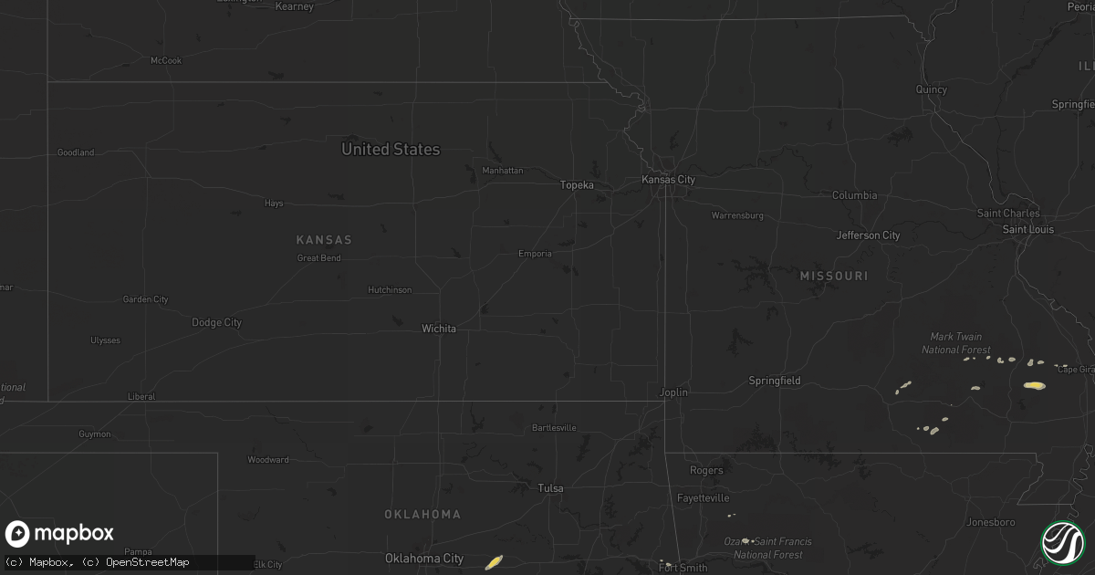
September 10 map
$229
one time, instant access
Download today. No call, no setup
Keep the $229
Bought the map and want the full workflow? Apply the entire $229 to a subscription within 7 days. None of it is wasted.
Every map, not just this one
This buys you this map. Subscription and you get every map we run, in the markets you choose from a few cities to whole states to nationwide. Plus real-time alerts the moment a storm fires.
Contact data
Name, contact info, occupancy, even credit band for addresses in the footprint. You go from where it hit to who to call.
Become the source they trust
Unlimited branding weather history reports on demand. You already have the documented answer ready for the property owner, and you are the one who showed up with it.
Property data and RoofTrace estimates
Pull up any address you have got, its value and the exact code rules for that jurisdiction, straight from One Click Code. Then RoofTrace estimates the squares, pitch, and roof value, priced the way you price.
States Impacted by Hail Map on September 10, 2014
Storm reports
Missouri
| Date | Description |
|---|---|
| 09/10/20148:55 AM CDT | Large silver maple tree damage - 35 foot by 3 foot diameter - mid rivers mall dr. |
Indiana
| Date | Description |
|---|---|
| 09/10/20145:36 PM CDT | Trees down onto street...corn field damage...time estimated based on radar...report relayed from amateur radio operator |
| 09/09/201411:38 PM CDT | A couple tree limbs were downed on antioch road. Time estimated from radar. |
| 09/09/20149:30 PM CDT | Tree downed. |
| 09/09/20149:15 PM CDT | Tree downed. Other trees downed on old sr37 5 miles south of bloomington and 13 miles southwest of bloomington along weaver road. |
| 09/09/20149:11 PM CDT | A couple trees were reported down on old haggard road...with power outages affecting the area as well. The time of this report was based on radar. Delayed report. |
| 09/09/20149:00 PM CDT | Measured with amatuer equipment |
| 09/09/20149:00 PM CDT | Numerous trees downed or snapped off above ground along drunkard lane near sr67 just north of gosport. |
| 09/09/20148:59 PM CDT | Relayed from family member |
| 09/09/20148:55 PM CDT | A large tree was downed on west 6th street. The time was estimated based on radar. Delayed report. |
| 09/09/20148:55 PM CDT | Several power poles snapped... Power lines down along the state route 39 bypass in martinsville. Numerous trees down on county roads between paragon and martinsville. |
| 09/09/20148:30 PM CDT | Tree downed in sullivan and 5 miles south of sullivan. |
| 09/09/20148:24 PM CDT | Wind damage to structures and trees...utility lines down...report received via social media |
Illinois
| Date | Description |
|---|---|
| 09/09/20147:55 PM CDT | Tree blown down onto a house causing roof and wall damage. |
| 09/09/20147:55 PM CDT | Grain delivery system blown over and damaged. |
| 09/09/20147:55 PM CDT | Numerous trees blown down...some onto houses and garages. Carport blown over. |
| 09/09/20147:54 PM CDT | Several trees and tree branches were blown down...including 2 that fell on structures...no injuries. |
| 09/09/20147:50 PM CDT | Large machine shed and machinery damaged |
| 09/09/20147:46 PM CDT | 12 inch diameter tree limbs down in ste. Marie |
| 09/09/20147:45 PM CDT | Large machine shed and machinery damaged. ...corrected report for time and location... |
| 09/09/20147:15 PM CDT | Telephone pole down in breese. |
Arkansas
| Date | Description |
|---|---|
| 09/09/20147:38 PM CDT | Scattered tree limbs down around town. Over 3000 lost power. Asos measured 49 kts at fort smith airport. |
Oklahoma
| Date | Description |
|---|---|
| 09/09/20147:25 PM CDT | A local report indicates 60 MPH wind near PANOLA |
Ohio
| Date | Description |
|---|---|
| 09/10/20145:08 PM CDT | State route 305 closed east of hiram due to debris on the road. |
| 09/10/20144:58 PM CDT | Torando on the ground near the center of hiram. |
| 09/10/20144:45 PM CDT | Debris observed by spotter nne of st rt 303. |
| 09/10/20144:28 PM CDT | A home damaged near graham and newcomer roads near stow and monroe high school. |
| 09/10/20144:15 PM CDT | Damage to crops in the area. Barn door blown off with roofing material partially removed. Small tree uprooted. |
| 09/10/20143:43 PM CDT | Reported on the ground southeast of route 57. |
Cities Impacted by Hail Map on September 10, 2014
- Tatum, NM
- Hartford, AR
- Heavener, OK
- Poteau, OK
- Wilburton, OK
- Prague, OK
- Saint Jo, TX
- Nocona, TX
- Alton, MO
- Birch Tree, MO
- Seminole, OK
- Earlsboro, OK
- Shawnee, OK
- Paden, OK
- Tecumseh, OK
- Ellington, MO
- Muldrow, OK
- Roland, OK
- Ardmore, OK
- Edwardsport, IN
- Oaktown, IN
- Marble Hill, MO
- Fremont, MO
- Combs, AR
- Huntsville, AR
- Trementina, NM
- Mountain View, MO
- Willow Springs, MO
- Annapolis, MO
- Clarksville, AR
- Patton, MO
- Wister, OK
- Zalma, MO
- Lowndes, MO
- Gipsy, MO
- Moweaqua, IL
- Willow Hill, IL
- Burfordville, MO
- Jackson, MO
- Whitewater, MO
- Centerville, MO
- Marquand, MO
- Lusk, WY
- Wichita Falls, TX
- Summersville, MO
- Fredericktown, MO
- Springer, OK
- Sulphur, OK
- Mill Creek, OK
- Wanette, OK
- Burneyville, OK
- Wilson, OK
- Harrison, NE
- Oark, AR
- Oblong, IL
- Howe, OK
- Greenville, MO
- Robinson, IL
- Flat Rock, IL