Hail Map on September 9, 2026
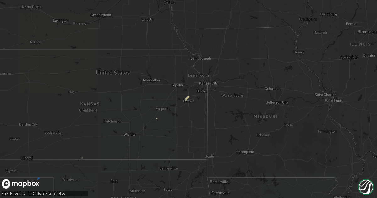
Get this storm
September 9 map
$229
one time, instant access
Download today. No call, no setup
Keep the $229
Bought the map and want the full workflow? Apply the entire $229 to a subscription within 7 days. None of it is wasted.
Every map, not just this one
This buys you this map. Subscription and you get every map we run, in the markets you choose from a few cities to whole states to nationwide. Plus real-time alerts the moment a storm fires.
Contact data
Name, contact info, occupancy, even credit band for addresses in the footprint. You go from where it hit to who to call.
Become the source they trust
Unlimited branding weather history reports on demand. You already have the documented answer ready for the property owner, and you are the one who showed up with it.
Property data and RoofTrace estimates
Pull up any address you have got, its value and the exact code rules for that jurisdiction, straight from One Click Code. Then RoofTrace estimates the squares, pitch, and roof value, priced the way you price.
States Impacted by Hail Map on September 9, 2026
Storm reports
Colorado
| Date | Description |
|---|---|
| 09/09/20261:00 AM CDT | A local report indicates 1.75 inch wind near 8 SE Colorado City |
| 09/09/20261:00 AM CDT | Quarter to golf ball sized hail. Shattered windows in multiple houses... With significant vehicle damage. Locations impacted were in the applewood drive area and around |
| 09/09/202612:30 AM CDT | Sky lights broken. |
Arizona
| Date | Description |
|---|---|
| 09/09/20266:44 PM CDT | Public personal weather station recorded wind gust of 73 mph. |
| 09/08/20269:04 PM CDT | Public weather station recorded wind gust of 78 mph. |
| 09/08/20268:14 PM CDT | Public weather station recorded 58 mph wind gust. |
Kentucky
| Date | Description |
|---|---|
| 09/09/20264:25 PM CDT | Power outages reported in this area. Time estimated from radar. |
Missouri
| Date | Description |
|---|---|
| 09/09/20266:57 PM CDT | Large tree downed into a fence at a residence. Time estimated from radar. |
| 09/09/20266:53 PM CDT | Large tree limb snapped in clinton. Time estimated from radar. |
| 09/09/20266:35 PM CDT | Downed tree reported in the creighton area. Time estimated from radar. |
| 09/09/20266:27 PM CDT | Downed wires reported north of chilhowee. Amateur radio reported very strong winds in chilhowee at the time. Time estimated from radar. |
| 09/09/20266:25 PM CDT | Several trees and limbs downed on route 58 and adjacent side roads. Time estimated from radar. |
| 09/09/20266:19 PM CDT | Personal weather station. |
| 09/09/20266:17 PM CDT | Personal weather station. |
| 09/09/20266:17 PM CDT | Multiple reports of tree limbs and wires down in the holden area. Time estimated from radar. |
| 09/09/20266:17 PM CDT | Downed tree limbs and wires near eagle drive. Time estimated from radar. |
| 09/09/20266:09 PM CDT | Downed tree limbs and wires reported between kingsville and holden. Time estimated from radar. |
| 09/09/20266:00 PM CDT | Wires down near waters road. Time estimated from radar. |
| 09/09/20265:59 PM CDT | Several reports of tree limbs and wires down northwest of kingsville. Time estimated from radar. |
| 09/09/20265:57 PM CDT | Reports of downed wires and power outages in the wingate area. Time estimated from radar. |
| 09/09/20265:57 PM CDT | Social media report of blown farm equipment and debris breaking a window at a residence. Several tree limbs were downed in the area as well. Time estimated from radar. |
| 09/09/20265:53 PM CDT | Downed tree limbs and wires near crawford creek road. Time estimated from radar. |
| 09/09/20265:46 PM CDT | Downed wires near lexington road. Time estimated from radar. |
| 09/09/20265:40 PM CDT | Social media report of a large tree snapped at a residence near country creek golf course. Time estimated from radar. |
| 09/09/20265:26 PM CDT | Multiple reports of tree limbs and wires down near lake winnebago. Time estimated from radar. |
| 09/08/20269:04 PM CDT | Gust measured by kcou asos. |
| 09/08/20268:01 PM CDT | Downed tree and wires reported east of smithton. Time estimated from radar. |
| 09/08/20267:38 PM CDT | Delayed report. A large outbuilding was destroyed... With an additional small outbuilding and gazebo damaged. Several wooden boards from the outbuilding blew onto the r |
| 09/08/20267:17 PM CDT | Reports of a few trees down near route c. Time estimated from radar. |
| 09/08/20267:00 PM CDT | Reports of trees and limbs down in clinton. Time estimated from radar. |
Pennsylvania
| Date | Description |
|---|---|
| 09/09/20266:20 PM CDT | Trees on power lines. Time est from radar. |
| 09/09/20266:19 PM CDT | An ef1 tornado with a maximum wind speed of 105mph occurred just east of bradford airport. Its path length was 1.23 miles and it had a peak width of around 200 yards. |
| 09/09/20264:10 PM CDT | 1 tree down in washington township. Time estimated from radar. |
New Mexico
| Date | Description |
|---|---|
| 09/09/20266:20 PM CDT | Mesonet station wsm39 shist |
Texas
| Date | Description |
|---|---|
| 09/09/20263:40 PM CDT | Xcel energy weather station 1 se of booker |
West Virginia
| Date | Description |
|---|---|
| 09/09/20266:22 PM CDT | Report of a power line down. Time estimated based on radar. |
| 09/09/20266:21 PM CDT | Report of a tree knocking down a power line in chester area. Time estimated based on radar. |
Kansas
| Date | Description |
|---|---|
| 09/09/20266:15 PM CDT | Multiple reports of tree limbs and wires down between la cygne and linn valley. Time estimated from radar. |
| 09/09/20266:15 PM CDT | Several reports of wires down and power outages in the pleasanton area. Time estimated from radar. |
| 09/09/20266:11 PM CDT | Multiple reports of wires down east of fontana. Time estimated from radar. |
| 09/09/20266:09 PM CDT | Several reports of wires down near prescott. Time estimated from radar. |
| 09/09/20266:03 PM CDT | Downed wires near spruce street. Time estimated from radar. |
| 09/09/20265:50 PM CDT | Multiple reports of wires down west of fontana. Time estimated from radar. |
| 09/09/20265:47 PM CDT | Small shed overturned and several tree limbs down at a residence in louisburg. Time estimated from radar. |
| 09/09/20265:47 PM CDT | Downed tree and wires near broadway street. Time estimated from radar. |
| 09/09/20265:21 PM CDT | Downed wires near labette terrace. Time estimated from radar. |
| 09/09/20264:47 PM CDT | A local report indicates 70 MPH wind near 8 SSE Mayfield |
| 09/09/20264:37 PM CDT | Multiple reports of power lines down in town. |
| 09/09/20264:15 PM CDT | Dgco em send several images of downed trees around the town of baldwin city. Consistent with very localized winds of 60-70 mph. Time estimated by radar. |
| 09/09/20262:41 PM CDT | Delayed report of tree damage in west wichita near 119th and pawnee. |
| 09/09/20263:37 AM CDT | Delayed report. Power poles broken near kalvesta via power companies social media post. Time estimated via radar. |
| 09/09/20263:23 AM CDT | Asos station kgck garden city. |
| 09/09/20263:11 AM CDT | Asos station kgck garden city. |
| 09/09/20263:04 AM CDT | Personal weather station measured. |
| 09/09/20263:02 AM CDT | Asos station kgck garden city. |
| 09/09/20262:59 AM CDT | Asos garden city regional airport. |
| 09/09/20262:53 AM CDT | Personal weather station recorded. |
Ohio
| Date | Description |
|---|---|
| 09/09/20265:16 PM CDT | Tree and utility wires down. Time estimated via radar. |
| 09/09/20265:15 PM CDT | Tree and utility lines down. Time estimated via radar. |
| 09/09/20264:57 PM CDT | Tree and utility wires down. Time estimated via radar. |
| 09/09/20264:57 PM CDT | Tree and utility lines down. Time estimated via radar. |
| 09/08/20269:48 PM CDT | Tree down across conrad road. |
| 09/08/20269:48 PM CDT | Tree down on thompson ridge road. |
| 09/08/20269:40 PM CDT | A few trees downed in the bourneville area. Time estimated from radar. |
| 09/08/20268:48 PM CDT | Report of power line down on car along spruce avenue. Time estimated based on radar. |
| 09/08/20268:39 PM CDT | There were trees reported snapped mid trunk. |
| 09/08/20268:36 PM CDT | There were several trees that had large branches broken off and a couple uprooted trees. There was also a trailer shifted off its foundation. |
| 09/08/20268:35 PM CDT | Fence blown down with a few downed trees twisted at their trunks. Time estimated via radar. |
| 09/08/20268:34 PM CDT | Over 60 customers without power due to tree damage. |
| 09/08/20268:34 PM CDT | A tornado touchdown was estimated from radar to be 9:34pm... Immediately knocking down a tree and impacting a couple residences at the intersection of mayfield lane and |
| 09/08/20268:30 PM CDT | Over 100 customers without power due to tree damage. |
| 09/08/20267:12 PM CDT | Tree down. Time estimated from radar. |
Cities Impacted by Hail Map on September 9, 2026
- Magdalena, NM
- Socorro, NM
- Matfield Green, KS
- Fort Myers, FL
- Pomona, KS
- Ottawa, KS
- Booker, TX
- Baldwin City, KS
- Wellsville, KS
- Texhoma, OK
- Mescalero, NM
- Stratford, TX
- Punta Gorda, FL
- Arcadia, FL
- Parker, KS
- Centerville, KS
- Wellington, KS
- Gruver, TX
- Uniontown, OH
- North Canton, OH
- Louisville, OH
- Middlebranch, OH
- Canton, OH
- Hartville, OH
- Alliance, OH
- Rio Rico, AZ
- Paris, OH
- Homeworth, OH
- Osawatomie, KS
- Sugar Land, TX
- Louisburg, KS
- Paola, KS
- Richmond, TX
- Nogales, AZ
- Blue Mound, KS
- Mound City, KS
- Salem, NM
- Campo, CO
- Kingsville, MO
- Holden, MO
- Garden City, MO
- Chilhowee, MO
- Blairstown, MO
- Centerview, MO
- Warrensburg, MO
- Brenham, TX
- Garfield, NM
- Willcox, AZ
- Somerville, TX
- Appleton City, MO
- Montrose, MO
- Amado, AZ
- Saint David, AZ
- Huachuca City, AZ
- Sierra Vista, AZ
- Benson, AZ
- Pima, AZ
- Elgin, AZ
- Vail, AZ
- Two Buttes, CO
- Walsh, CO
- Hugoton, KS
- La Junta, CO
- Florence, CO
- Model, CO
- Rocky Ford, CO
- Penrose, CO
- Arlington, CO
- Wetmore, CO
- Eads, CO
- Pueblo, CO
- Haswell, CO
- Bronson, KS
- Beulah, CO
- Kit Carson, CO
- Karval, CO
- Colorado City, CO
- Rye, CO
- Sheridan Lake, CO
- Sugar City, CO
- Walsenburg, CO
- Tribune, KS
- Marienthal, KS
- Leoti, KS
- Scott City, KS
- Holcomb, KS
- Garden City, KS
- Ingalls, KS
- Pierceville, KS
- Jetmore, KS
- Wild Horse, CO