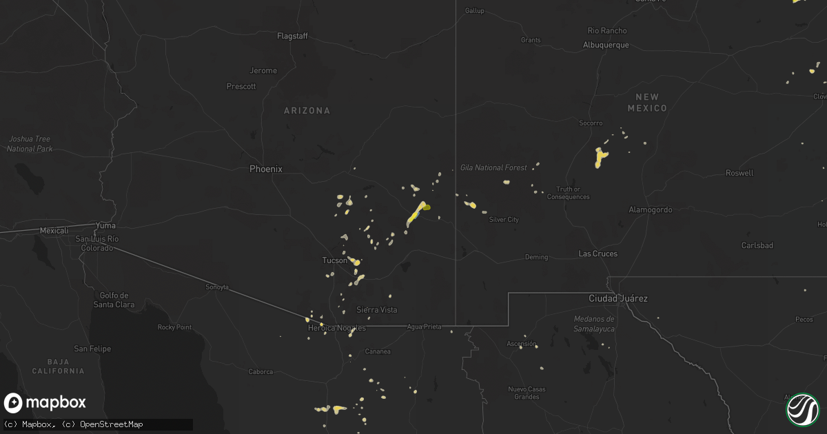
Hail Map on September 5, 2021
Get this storm
September 5 map
$229
one time, instant access
Download today. No call, no setup
Keep the $229
Bought the map and want the full workflow? Apply the entire $229 to a subscription within 7 days. None of it is wasted.
Every map, not just this one
This buys you this map. Subscription and you get every map we run, in the markets you choose from a few cities to whole states to nationwide. Plus real-time alerts the moment a storm fires.
Contact data
Name, contact info, occupancy, even credit band for addresses in the footprint. You go from where it hit to who to call.
Become the source they trust
Unlimited branding weather history reports on demand. You already have the documented answer ready for the property owner, and you are the one who showed up with it.
Property data and RoofTrace estimates
Pull up any address you have got, its value and the exact code rules for that jurisdiction, straight from One Click Code. Then RoofTrace estimates the squares, pitch, and roof value, priced the way you price.
Storm reports
New Mexico
| Date | Description |
|---|---|
| 09/05/20212:12 AM CDT | At 712 PM MDT, a severe thunderstorm was located 18 miles southeast of Mosquero, moving west at 15 mph. HAZARD...60 mph wind gusts and quarter size hail. SOURCE...Radar indicated. IMPACT...Hail damage to vehicles is expected. Expect wind damage to roofs, siding, and trees. This severe thunderstorm will remain over mainly rural areas of northeastern San Miguel and southeastern Harding Counties. |
| 09/05/20211:24 AM CDT | At 624 PM MDT, a severe thunderstorm was located 21 miles southwest of Hayden, or 22 miles west of Nara Visa, moving southwest at 10 mph. HAZARD...60 mph wind gusts and quarter size hail. SOURCE...Radar indicated. IMPACT...Hail damage to vehicles is expected. Expect wind damage to roofs, siding, and trees. This severe thunderstorm will remain over mainly rural areas of southeastern Harding and northeastern Quay Counties. |
| 09/04/202111:56 PM CDT | At 456 PM MDT, a severe thunderstorm was located 19 miles south of Bosque Del Apache Refuge, or 36 miles south of Socorro, moving southwest at 20 mph. HAZARD...60 mph wind gusts and half dollar size hail. SOURCE...Radar indicated. IMPACT...Hail damage to vehicles is expected. Expect wind damage to roofs, siding, and trees. This severe thunderstorm will remain over mainly rural areas of south central Socorro County. |
| 09/04/202111:42 PM CDT | At 442 PM MDT, a severe thunderstorm was located 24 miles northeast of Engle, moving southeast at 20 mph. HAZARD...60 mph wind gusts and half dollar size hail. SOURCE...Radar indicated. IMPACT...Hail damage to vehicles is expected. Expect wind damage to roofs, siding, and trees. This severe thunderstorm will remain over mainly rural areas of northeastern Sierra County. |
| 09/04/20219:39 PM CDT | At 239 PM MDT, a severe thunderstorm was located near Grady, or 23 miles north of Clovis, moving southwest at 10 mph. HAZARD...Quarter size hail. SOURCE...Radar indicated. IMPACT...Damage to vehicles is expected. This severe thunderstorm will remain over mainly rural areas of central Curry County. |
| 09/04/20219:04 PM CDT | At 204 PM MDT, a severe thunderstorm was located 6 miles south of Buckhorn, moving east at 10 mph. HAZARD...60 mph wind gusts and quarter size hail. SOURCE...Radar indicated. IMPACT...Hail damage to vehicles is expected. Expect wind damage to roofs, siding, and trees. Locations impacted include... Cliff, Riverside and Gila. |
Arizona
| Date | Description |
|---|---|
| 09/05/20216:46 PM CDT | Power outages... Likely due to severe thunderstorm. |
| 09/05/20216:26 PM CDT | Power outages... Likely due to severe thunderstorm. |
| 09/05/20216:16 PM CDT | Power outages... Likely due to severe thunderstorm. |
| 09/05/20216:15 PM CDT | Widespread damage across the safford area. Roof damage... Structure damage... Numerous trees snapped or uprooted... Numerous powerlines down... And other damage. Times |
| 09/05/20216:10 PM CDT | Roof peeled off shed or barn. Time estimated off reports. |
| 09/05/20216:10 PM CDT | Large rv close to 50 feet long flipped over from strong winds. Times estimated. |
| 09/05/20215:56 PM CDT | Ksad measured thunderstorm wind gusts to 68 mph. |
| 09/05/20215:45 PM CDT | Time estimated based on public report. Well built metal sign destroyed. |
| 09/05/20215:45 PM CDT | Building destroyed with significant roof failure. Metal beams appeared to be bent in pictures. Times estimated based on reports. |
| 09/05/20215:43 PM CDT | Mesonet station cw6532 tucson freeman/old spanish trl. |
| 09/05/20215:40 PM CDT | Public reported 1 inch hail in safford. |
| 09/05/20215:05 PM CDT | Spotter reported gusts to 60 mph. |
| 09/05/20217:24 AM CDT | At 1224 PM MST, a severe thunderstorm was located over Tombstone, or 18 miles northeast of Sierra Vista, moving west at 10 mph. HAZARD...60 mph wind gusts and penny size hail. SOURCE...Radar indicated. IMPACT...Expect damage to roofs, siding, and trees. Locations impacted include... Tombstone, Fairbank and Charleston. |
| 09/05/202112:58 AM CDT | At 558 PM MST, severe thunderstorms were located along a line extending from 6 miles southeast of Dudleyville to 10 miles north of Oracle to 17 miles north of Saddlebrooke to 18 miles southwest of Kearny, moving southwest at 25 mph. HAZARD...60 mph wind gusts. SOURCE...Radar indicated. IMPACT...Expect damage to roofs, siding, and trees. Locations impacted include... Catalina, Oro Valley, Marana, Oracle, Mammoth, Saddlebrooke, San Manuel, Tortolita, Dudleyville, Mount Lemmon/Summerhaven, Picacho Peak State Park, Catalina State Park, Red Rock, Campo Bonito, Dove Mountain, Oracle Junction and Biosphere 2. |
| 09/05/202112:18 AM CDT | At 518 PM MST, a severe thunderstorm was located 20 miles west of Willcox, moving southwest at 30 mph. HAZARD...60 mph wind gusts and penny size hail. SOURCE...Radar indicated. IMPACT...Expect damage to roofs, siding, and trees. Locations impacted include... Saguaro National Park East, Muleshoe Ranch Preserve, Texas Canyon and Cascabel. |
| 09/05/202112:04 AM CDT | At 504 PM MST, severe thunderstorms were located along a line extending from 9 miles southeast of Superior to near Christmas, moving south at 30 mph. HAZARD...60 mph wind gusts and penny size hail. SOURCE...Radar indicated. IMPACT...Expect damage to roofs, siding, and trees. Locations impacted include... Hayden and Christmas. This includes the following highways...AZ Route 77 between mile markers 135 and 141, near mile marker 143,and between mile markers 146 and 159.AZ Route 177 between mile markers 137 and 162. |
| 09/05/202112:01 AM CDT | At 501 PM MST, severe thunderstorms were located along a line extending from near Aravaipa Canyon Wilderness to near Dudleyville to near Kearny to 13 miles southeast of Superior, moving south at 20 mph. HAZARD...60 mph wind gusts and quarter size hail. SOURCE...Radar indicated. IMPACT...Hail damage to vehicles is expected. Expect wind damage to roofs, siding, and trees. Locations impacted include... Mammoth, Kearny, Dudleyville, Aravaipa Canyon Wilderness, Kelvin and San Carlos Reservoir. |
| 09/04/202111:47 PM CDT | At 446 PM MST, a severe thunderstorm was located near Mount Lemmon/Summerhaven, or near Catalina, moving south at 15 mph. HAZARD...60 mph wind gusts. SOURCE...Radar indicated. IMPACT...Expect damage to roofs, siding, and trees. Locations impacted include... Tucson, Catalina, Casas Adobes, Flowing Wells, Tanque Verde, Saddlebrooke, Mount Lemmon/Summerhaven, Sabino Canyon Recreation Area, Catalina Foothills, Catalina State Park, Saguaro National Park East and Seven Falls. |
| 09/04/202111:42 PM CDT | At 441 PM MST, a severe thunderstorm was located 21 miles southwest of Roper Lake State Park, or 23 miles northwest of Willcox, moving southwest at 15 mph. HAZARD...60 mph wind gusts and quarter size hail. SOURCE...Radar indicated. IMPACT...Hail damage to vehicles is expected. Expect wind damage to roofs, siding, and trees. Locations impacted include... Bonita. |
| 09/04/202111:30 PM CDT | At 429 PM MST, a severe thunderstorm was located near central and western Tucson, moving west at 10 mph. HAZARD...60 mph wind gusts. SOURCE...Radar indicated. IMPACT...Expect damage to roofs, siding, and trees. Locations impacted include... Tucson, Oro Valley, Marana, Casas Adobes, Drexel Heights, Flowing Wells, Tanque Verde, South Tucson, Tortolita, Sabino Canyon Recreation Area, Catalina Foothills, Tucson International Airport. |
| 09/04/202111:16 PM CDT | At 415 PM MST, a severe thunderstorm was located 7 miles southwest of Pascua Pueblo Yaqui Reservation, or 11 miles northwest of Sahuarita, moving west at 15 mph. HAZARD...70 mph wind gusts and penny size hail. SOURCE...Radar indicated. IMPACT...Expect considerable tree damage. Damage is likely to mobile homes, roofs, and outbuildings. Locations impacted include... Sahuarita, Three Points, Pascua Pueblo Yaqui Reservation, and Summit. |
| 09/04/202111:00 PM CDT | At 359 PM MST, a severe thunderstorm was located near Roper Lake State Park, or 7 miles southwest of Safford, moving southwest at 15 mph. This storm has a history of producing winds to 70 mph and wind driven hail. HAZARD...70 mph wind gusts and quarter size hail. SOURCE...Trained weather spotters. IMPACT...Hail damage to vehicles is expected. Expect considerable tree damage. Wind damage is also likely to mobile homes, roofs, and outbuildings. Locations impacted include... Swift Trail Junction, Mount Graham, Bonita, Fort Grant and Frye Mesa Dam. |
| 09/04/202110:52 PM CDT | At 351 PM MST, a severe thunderstorm was located near Tanque Verde, or 10 miles northeast of Davis-Monthan Air Force Base, moving west at 15 to 20 mph. HAZARD...60 mph wind gusts and penny size hail. SOURCE...Radar indicated. IMPACT...Expect damage to roofs, siding, and trees. Locations impacted include... Tucson, Catalina, Oro Valley, Marana, Davis-Monthan Air Force Base, Casas Adobes, Drexel Heights, Flowing Wells, Tanque Verde, South Tucson, Tortolita, Mount Lemmon/Summerhaven, Sabino Canyon Recreation Area, Catalina State Park, Catalina Foothills, Saguaro National Park West, Tucson Estates, and Picture Rocks. |
| 09/04/202110:40 PM CDT | At 340 PM MST, a severe thunderstorm was located over Saguaro National Park East, or 13 miles east of Davis-Monthan Air Force Base, moving southwest at 20 mph. HAZARD...70 mph wind gusts and penny size hail. SOURCE...Radar indicated. IMPACT...Expect considerable tree damage. Damage is likely to mobile homes, roofs, and outbuildings. Locations impacted include... East Tucson, Davis-Monthan Air Force Base, Tanque Verde, Vail, East Sahuarita, Corona De Tucson, Summit, Saguaro National Park East and Rita Ranch. |
| 09/04/202110:37 PM CDT | At 336 PM MST, a severe thunderstorm was located near East Sahuarita, or 7 miles east of Green Valley, moving west and southwest at 20 mph. HAZARD...60 mph wind gusts and penny size hail. SOURCE...Radar indicated. IMPACT...Expect damage to roofs, siding, and trees. Locations impacted include... Sahuarita, Green Valley, Tubac, Tumacacori, Amado, Madera Canyon and Arivaca Junction. |
| 09/04/202110:24 PM CDT | At 324 PM MST, a severe thunderstorm was located 8 miles northeast of Safford Regional Airport, or 11 miles northeast of Safford, moving south at 10 mph. HAZARD...60 mph wind gusts and quarter size hail. SOURCE...Radar indicated. IMPACT...Hail damage to vehicles is expected. Expect wind damage to roofs, siding, and trees. Locations impacted include... Safford, Thatcher, Solomon, Roper Lake State Park, Safford Regional Airport, Pima, Central and Swift Trail Junction. |
| 09/04/202110:08 PM CDT | At 307 PM MST, severe thunderstorms were located along a line extending from near Saguaro National Park East to 6 miles north of Sonoita, moving southwest at 15 to 20 mph. HAZARD...70 mph wind gusts and penny size hail. SOURCE...Radar indicated. IMPACT...Expect considerable tree damage. Damage is likely to mobile homes, roofs, and outbuildings. Locations impacted include... Southeast Tucson, Vail, Sonoita, Corona De Tucson, Saguaro National Park East and Rita Ranch. |
| 09/04/20219:31 PM CDT | At 231 PM MST, a severe thunderstorm was located 9 miles east of Vail, or 13 miles west of Benson, moving southwest at 15 mph. HAZARD...60 mph wind gusts and penny size hail. SOURCE...Radar indicated. IMPACT...Expect damage to roofs, siding, and trees. Locations impacted include... Vail and Corona De Tucson. |
| 09/04/20219:29 PM CDT | At 228 PM MST, severe thunderstorms were located along a line extending from 7 miles northwest of Morenci to 17 miles north of Safford Regional Airport to 19 miles north of Thatcher to 25 miles northwest of Safford, moving south at 10 mph. HAZARD...60 mph wind gusts and quarter size hail. SOURCE...Radar indicated. IMPACT...Hail damage to vehicles is expected. Expect wind damage to roofs, siding, and trees. Locations impacted include... Clifton, Morenci and Fort Thomas. |
| 09/04/20218:24 PM CDT | Power outages... Likely due to severe thunderstorm. |
| 09/04/20217:10 PM CDT | Power outage... Likely due to severe thunderstorms. |
Kansas
| Date | Description |
|---|---|
| 09/05/20216:59 PM CDT | Hail ranged from penny to quarter sized. |
| 09/05/20216:59 PM CDT | Corrects previous tstm wnd gst report from 7 ene angelus. |
| 09/05/20216:52 PM CDT | A local report indicates 60 MPH wind near 7 ENE ANGELUS |
| 09/05/20211:53 AM CDT | At 653 PM CDT, a severe thunderstorm was located 6 miles north of Grinnell, and is nearly stationary. HAZARD...60 mph wind gusts and quarter size hail. SOURCE...Radar indicated. IMPACT...Hail damage to vehicles is expected. Expect wind damage to roofs, siding, and trees. Locations impacted include... Grainfield and Grinnell.This includes Interstate 70 in Kansas between mile markers 84 and100. |
Nebraska
| Date | Description |
|---|---|
| 09/05/20217:45 AM CDT | Hail of at least golf ball size. Crop and tree damage. Time estimated from radar |
| 09/05/20212:36 AM CDT | At 736 AM CDT, a severe thunderstorm was located 10 miles northeast of O'Neill, moving southeast at 35 mph. HAZARD...Golf ball size hail. SOURCE...Radar indicated. IMPACT...People and animals outdoors will be injured. Expect damage to roofs, siding, windows, and vehicles. Locations impacted include... Page and Opportunity. |
| 09/04/202110:18 PM CDT | At 317 AM MDT, a severe thunderstorm was located near Arthur, moving southeast at 20 mph. HAZARD...Quarter size hail. SOURCE...Radar indicated. IMPACT...Damage to vehicles is expected. Locations impacted include... Arthur, Haythorn Lake, Bucktail and Bucktail Lake. This includes the following highways... Highway 61 between mile markers 115 and 129. Highway 92 between mile markers 165 and 172. |
| 09/04/20219:38 PM CDT | At 237 AM MDT, a severe thunderstorm was located 10 miles northwest of Lemoyne, or 13 miles southwest of Arthur, moving southeast at 20 mph. HAZARD...Quarter size hail. SOURCE...Radar indicated. IMPACT...Damage to vehicles is expected. Locations impacted include... Lemoyne and McKeag. This includes the following highways... Highway 61 between mile markers 99 and 113. Highway 92 mile marker 132 and near mile marker 138. |
Texas
| Date | Description |
|---|---|
| 09/05/202112:13 AM CDT | At 513 PM CDT, a severe thunderstorm was located 4 miles southeast of Black Mesa Park, or 17 miles west of Boise City, moving south at 5 mph. HAZARD...60 mph wind gusts and quarter size hail. SOURCE...Radar indicated. IMPACT...Minor damage to roofs, siding, and trees is possible. Hail damage to vehicles is expected. Locations impacted include... Black Mesa Park, Felt and Wheeless. |
Cities Impacted by Hail Map on September 5, 2021
- Evant, TX
- Lometa, TX
- Kearny, AZ
- Big Spring, TX
- Clovis, NM
- Safford, AZ
- Tombstone, AZ
- Felt, OK
- Kenton, OK
- Boise City, OK
- Vail, AZ
- Texico, NM
- Tucson, AZ
- Buckhorn, NM
- Page, NE
- Oneill, NE
- Hoxie, KS
- Winkelman, AZ
- Elida, NM
- Truth Or Consequences, NM
- Socorro, NM
- Maryneal, TX
- Colorado City, TX
- Richland Springs, TX
- Voss, TX
- Coleman, TX
- Santa Anna, TX
- Goldthwaite, TX
- Willcox, AZ
- Elgin, AZ
- Midland, TX
- Stanton, TX
- Grady, NM
- Broadview, NM
- Melrose, NM
- Gatesville, TX
- Coahoma, TX
- Clyde, TX
- Sahuarita, AZ
- Leoti, KS
- Westbrook, TX
- San Saba, TX
- Brookesmith, TX
- Butte, NE
- Oracle, AZ
- Hayden, AZ
- Winters, TX
- Novice, TX
- Bovina, TX
- Blackwell, TX
- Mount Lemmon, AZ
- Thatcher, AZ
- Lampasas, TX
- Lynch, NE
- Woodson, TX
- Mosquero, NM