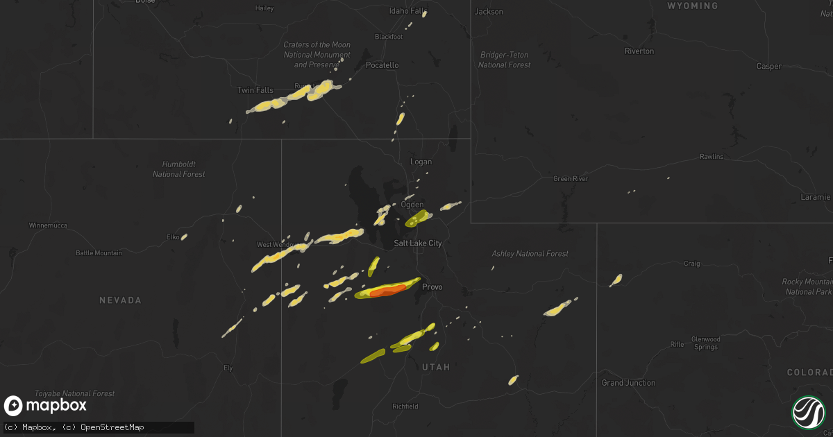
Hail Map on September 1, 2012
Get this storm
September 1 map
$229
one time, instant access
Download today. No call, no setup
Keep the $229
Bought the map and want the full workflow? Apply the entire $229 to a subscription within 7 days. None of it is wasted.
Every map, not just this one
This buys you this map. Subscription and you get every map we run, in the markets you choose from a few cities to whole states to nationwide. Plus real-time alerts the moment a storm fires.
Contact data
Name, contact info, occupancy, even credit band for addresses in the footprint. You go from where it hit to who to call.
Become the source they trust
Unlimited branding weather history reports on demand. You already have the documented answer ready for the property owner, and you are the one who showed up with it.
Property data and RoofTrace estimates
Pull up any address you have got, its value and the exact code rules for that jurisdiction, straight from One Click Code. Then RoofTrace estimates the squares, pitch, and roof value, priced the way you price.
States Impacted by Hail Map on September 1, 2012
Storm reports
Montana
| Date | Description |
|---|---|
| 09/01/20126:46 PM CDT | A local report indicates 61 MPH wind near 11 S LIVINGSTON |
| 09/01/20126:37 PM CDT | Power outages in livingston |
| 09/01/20126:15 PM CDT | A local report indicates 60 MPH wind near 11 E BOZEMAN |
| 09/01/20126:12 PM CDT | 60 mph wind gust at the dot sensor on bozeman pass...on interstate 15. |
| 09/01/20126:00 PM CDT | Power poles down from thunderstorm wind gusts...power outages also reported |
| 09/01/20125:06 PM CDT | 60 mph wind gust at the dot sensor just east of geyser. |
| 08/31/20129:44 PM CDT | A local report indicates 60 MPH wind near 11 E BOZEMAN |
Indiana
| Date | Description |
|---|---|
| 09/01/20125:41 PM CDT | Downtown tower media cam caught footage of a brief 38 second tornado near 16th street and white river. No damage reported or observed. |
South Dakota
| Date | Description |
|---|---|
| 09/01/20126:26 PM CDT | A local report indicates 62 MPH wind near RAPID CITY AIRPORT |
| 08/31/20127:40 PM CDT | Estimated gusts from 60 to 70 mph. |
| 08/31/20127:05 PM CDT | A local report indicates 60 MPH wind near 9 S ELM SPRINGS |
North Carolina
| Date | Description |
|---|---|
| 09/01/20124:00 PM CDT | Multiple trees down near iron station. |
| 09/01/20123:26 PM CDT | Multiple trees down in bakers mountain park area. |
| 09/01/20123:25 PM CDT | Multiple trees and powerlines down on strickland bridge road near bailey lake road |
| 09/01/20121:40 PM CDT | Park ranger reports that several trees were downed on a hiking trail in uwharrie national forest. |
Illinois
| Date | Description |
|---|---|
| 09/01/20121:24 PM CDT | Tornado on ground for 2 minutes...no damage |
| 09/01/20121:08 PM CDT | Tornado on ground for 3 minutes...no damage reported |
| 09/01/20121:07 PM CDT | Brief touchdown in field near 850n and 1700e |
| 09/01/201212:32 PM CDT | Tornado touchdown on illinois river |
| 09/01/201212:05 PM CDT | Brief touchdown...tin roof blown off a shed and minor damage to corn field. |
| 09/01/201212:03 PM CDT | Brief touchdown |
| 09/01/201211:48 AM CDT | Brief touchdown in a farm field |
| 08/31/20127:40 PM CDT | Scattered tree limbs down. Time estimated. |
| 08/31/20127:29 PM CDT | Power outages with half the city out. Large tree limbs down. Time estimated. |
| 08/31/20127:20 PM CDT | Large trees down...several trees down...tree tops blown out from 2 miles south of round knob and then scattered about metropolis. |
Colorado
| Date | Description |
|---|---|
| 08/31/20127:23 PM CDT | Measured at the pinto raws site |
Utah
| Date | Description |
|---|---|
| 09/01/20126:51 PM CDT | One inch hail reported in farmington |
| 09/01/20124:45 PM CDT | Interstate 80 at mp29. |
| 09/01/20124:35 PM CDT | Marble to quarter sized hail along interstate 80 near mile post 20. |
| 09/01/20123:15 PM CDT | Penny to quarter sized hail between mm230-235 on interstate 15. |
| 09/01/201212:15 PM CDT | A local report indicates 1.00 inch wind near GARRISON |
Maryland
| Date | Description |
|---|---|
| 09/01/20125:55 PM CDT | Tree blocking intersection of greenspring valley rd and greenspring ave |
Tennessee
| Date | Description |
|---|---|
| 08/31/20128:00 PM CDT | Large shop with 24 feet high doors was damaged by strong winds in the community of macedonia. |
| 08/31/20127:28 PM CDT | Tree down blocking road on route 19 |
Pennsylvania
| Date | Description |
|---|---|
| 09/01/20126:20 PM CDT | Tree damage and possible structural damage |
| 09/01/20126:15 PM CDT | Tree down on hanover pike |
| 09/01/20125:45 PM CDT | Damage to roof of barn |
Wyoming
| Date | Description |
|---|---|
| 09/01/20124:08 PM CDT | A local report indicates 72 MPH wind near RAWLINS |
| 08/31/20128:19 PM CDT | A local report indicates 60 MPH wind near 2 E RIVERTON |
West Virginia
| Date | Description |
|---|---|
| 09/01/20123:51 PM CDT | Tree down on quaint acres ln near cacapon rd. |
| 09/01/20123:34 PM CDT | Tree down on autumn acres rd near winchester grade rd. |
| 09/01/20123:02 PM CDT | Tree branches down |
Arkansas
| Date | Description |
|---|---|
| 09/01/20126:41 PM CDT | Trees are down in and around england. |
| 09/01/20126:37 PM CDT | Trees and powerlines down in the city of beebe. Some structural damage also reported in the city. |
| 09/01/20126:25 PM CDT | The austin hotel has structural damage that has blown into the street and is blocking traffic. The extent of damage is unknown at this time. |
| 09/01/20125:54 PM CDT | Roof damage in bryant. Several large trees have been snapped or fallen. |
| 09/01/20125:54 PM CDT | Shingles were blown off of a house in the community of salem just northwest of bryant. |
| 09/01/20125:42 PM CDT | Possible tornado 3 miles southeast of oak grove. |
| 09/01/20125:33 PM CDT | Terees are down in benton. |
| 09/01/20125:24 PM CDT | Several trees are down in georgetown. One tree fell on a vehicle that was unoccupied. |
| 09/01/20125:07 PM CDT | Large tress limbs were blown down in the newport area. A cable line was also blown down. |
| 09/01/20124:58 PM CDT | Multiple trees are down in and around the conway area. Several trees are down across southern portions of faulkner county including the area of hamlet. |
| 09/01/20124:45 PM CDT | Law enforcement reports roof damage in jusonia. |
| 09/01/20124:41 PM CDT | Trees down east of morrilton. |
| 09/01/20124:40 PM CDT | Trees down in judsonia. |
| 09/01/20124:35 PM CDT | Trees down on highway 16 north of searcy. |
| 09/01/20124:19 PM CDT | 2 miles west of corning on highway 67s. Possible tornado...extensive damage to airport property damaging 5 buildings...two hangars and a shed also at least 4 airplanes. |
| 09/01/20124:19 PM CDT | Possible tornado...extensive damage to airport property including airplanes. Nearby homes damaged. |
| 09/01/20124:11 PM CDT | Trees are down in the vilnoia area. Several power lines are also down. |
| 08/31/20127:15 PM CDT | Coop observer reported lots of large trees were down along with several down power lines. Observer also reported almost 2.5 inches of rain in two hours. |
Missouri
| Date | Description |
|---|---|
| 09/01/20126:30 PM CDT | Funnel cloud...possible tornado just southwest of hayti. |
| 09/01/20126:20 PM CDT | Funnel cloud and brief touch down on y highway cc south of kennet. |
| 09/01/20126:03 PM CDT | Storm chaser and trained spotters reported funnel cloud then tornado on ground with a debris field. Law enforcement confirmed tornado. Damage reported...a large farm sh |
| 09/01/20124:45 PM CDT | Tornado on the ground near qulin |
| 09/01/20124:40 PM CDT | Tornado on the ground between fisk and rombauer |
| 08/31/20127:02 PM CDT | Brief tornado touchdown highway 79 and great river road. |
Kentucky
| Date | Description |
|---|---|
| 09/01/20125:10 PM CDT | Power line down on county house road. |
| 09/01/20123:25 PM CDT | Several trees down on akin road near the county border. |
| 08/31/20128:00 PM CDT | Tree damage reported in northern mccracken county. |
| 08/31/20127:45 PM CDT | Large tree limb down on bruce street. |
| 08/31/20127:20 PM CDT | Tornado reported by em. |
| 08/31/20127:00 PM CDT | Scattered tree branch damage in northern ballard county. Time estimated. Power outages between wickliffe and barlow. |
Virginia
| Date | Description |
|---|---|
| 09/01/20125:40 PM CDT | Tree and power line down on poor mountain road. |
| 09/01/20125:15 PM CDT | Multiple trees down on sugar run road just northeast of the intersection to autumn drive |
| 09/01/20125:13 PM CDT | Large tree down on alleghany springs road near the floyd county border. |
Idaho
| Date | Description |
|---|---|
| 09/01/20126:50 PM CDT | Idaho power lost three 60+ foot towers near rast road in american falls due to thunderstorm wind gusts. |
| 09/01/20125:40 PM CDT | Kmvt channel 11 forwarded a picture of a tornado near albion. Able to confirm time and location after gather information from viewer. |
| 09/01/20125:20 PM CDT | Kmvt channel 11 forwarded a picture of a tornado in the area east of declo. Time is estimated from radar. |
| 09/01/20124:30 PM CDT | Photo received by kmvt indicates hail at least half-dollar size occurred at 330 pm in the rock creek area. |
Cities Impacted by Hail Map on September 1, 2012
- Evans City, PA
- Mars, PA
- Cranberry Township, PA
- Vernal, UT
- Benton, AR
- Lockesburg, AR
- Trappe, MD
- Burley, ID
- Heyburn, ID
- Nephi, UT
- Rush Valley, UT
- Cedar Valley, UT
- Stockton, UT
- Wendover, UT
- Croydon, UT
- Green River, UT
- Beebe, AR
- Dinosaur, CO
- Stanton, TN
- Shannon, NC
- Dugway, UT
- Leupp, AZ
- Tonalea, AZ
- Iona, ID
- Hansen, ID
- Murtaugh, ID
- Troy, NC
- Morgan, UT
- Fayetteville, NC
- Sheridan, AR
- Poyen, AR
- Malvern, AR
- Leola, AR
- Winthrop, AR
- Haworth, OK
- Malta, ID
- Rose Hill, NC
- Taneytown, MD
- Tooele, UT
- Malad City, ID
- Berkeley Springs, WV
- Hancock, MD
- Eagle Mountain, UT
- Blanding, UT
- Ogden, UT
- Saratoga Springs, UT
- Vernon, UT
- Bruceton Mills, WV
- Gibbon Glade, PA
- Farmington, PA
- Rupert, ID
- Moroni, UT
- Wales, UT
- Mount Pleasant, UT
- Hanover, PA
- Westminster, MD
- Littlestown, PA
- Declo, ID
- Harrells, NC
- Garland, NC
- Ringling, MT
- Hayti, MO
- Kaysville, UT
- Farmington, UT
- Twin Falls, ID
- Twin Bridges, MT
- American Falls, ID
- Cabot, AR
- Austin, AR
- Ward, AR
- Riverdale, MD
- College Park, MD
- Raeford, NC
- Beaver Falls, PA
- Wampum, PA
- New Castle, PA
- Laurel, DE
- Hot Springs National Park, AR
- Lake Lynn, PA
- Gettysburg, PA
- Carthage, AR
- Prattsville, AR
- Traskwood, AR
- Wells, NV
- Clinton, NC
- Vilonia, AR
- Saco, MT
- Cameron, MT
- Layton, UT
- Varney, KY
- Des Arc, AR
- Oakley, ID
- Williams, AZ
- Saint Pauls, NC
- Ely, NV
- Lonsdale, AR
- Burgaw, NC
- Rhodesdale, MD
- Centerville, UT
- Delta, UT
- Hinckley, UT