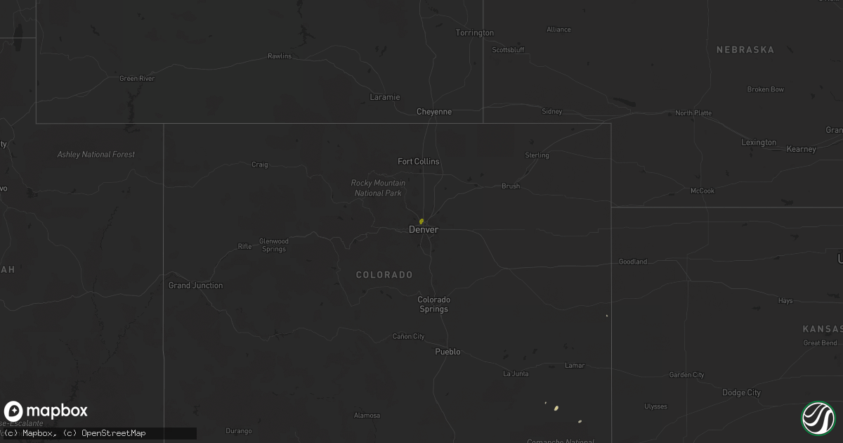
Hail Map on August 31, 2016
Get this storm
August 31 map
$229
one time, instant access
Download today. No call, no setup
Keep the $229
Bought the map and want the full workflow? Apply the entire $229 to a subscription within 7 days. None of it is wasted.
Every map, not just this one
This buys you this map. Subscription and you get every map we run, in the markets you choose from a few cities to whole states to nationwide. Plus real-time alerts the moment a storm fires.
Contact data
Name, contact info, occupancy, even credit band for addresses in the footprint. You go from where it hit to who to call.
Become the source they trust
Unlimited branding weather history reports on demand. You already have the documented answer ready for the property owner, and you are the one who showed up with it.
Property data and RoofTrace estimates
Pull up any address you have got, its value and the exact code rules for that jurisdiction, straight from One Click Code. Then RoofTrace estimates the squares, pitch, and roof value, priced the way you price.
States Impacted by Hail Map on August 31, 2016
Storm reports
Montana
| Date | Description |
|---|---|
| 08/31/20166:55 PM CDT | Fuel tanker blown over from thunderstorm wind gust. Time estimated from radar. |
Ohio
| Date | Description |
|---|---|
| 08/31/20166:45 PM CDT | Several large trees fell into power lines on oakes road near powellsville in green township causing power outage. Time estimated based on radar. |
Utah
| Date | Description |
|---|---|
| 08/30/20169:20 PM CDT | Gusty winds due to virga. North salt flats sensor... Dpg25. |
Arkansas
| Date | Description |
|---|---|
| 08/31/20166:10 PM CDT | A few trees reported down in and around perry. |
North Dakota
| Date | Description |
|---|---|
| 08/31/20168:57 AM CDT | Quarter to half dollar size hail. |
Virginia
| Date | Description |
|---|---|
| 08/31/20164:54 PM CDT | Public reported large tree limbs down. |
| 08/31/20164:32 PM CDT | Large tree down at 1459 howardsville turnpike |
| 08/31/20164:30 PM CDT | Large tree down near intersection of eastside hwy and patterson mill rd |
| 08/31/20164:29 PM CDT | Two trees down near lyndhurst post office |
| 08/31/20164:13 PM CDT | Ongoing at the time it was called in. |
| 08/30/20168:19 PM CDT | Large tree down near intersection of partlow road and pretty view drive |
Oklahoma
| Date | Description |
|---|---|
| 08/31/20165:01 PM CDT | Near memorial rd and western ave |
| 08/30/20167:40 PM CDT | A local report indicates 64 MPH wind near 3 SSW FREEDOM |
Cities Impacted by Hail Map on August 31, 2016
- Guthrie, OK
- Partlow, VA
- Steele, ND
- Braddock, ND
- Edmond, OK
- Tuttle, ND
- Wing, ND
- Herreid, SD
- El Reno, OK
- Yukon, OK
- Napoleon, ND
- Driscoll, ND
- Salem, VA
- Elliston, VA
- Kintyre, ND
- Eureka, SD
- Havre, MT
- Minco, OK
- Hinton, OK
- Linton, ND
- Bent Mountain, VA
- Stilwell, OK
- Waynesboro, VA
- Chinook, MT
- Drumright, OK
- Vernon, TX
- Strasburg, ND
- Rockham, SD
- Springfield, CO
- Miller, SD
- Carnegie, OK
- Shawsville, VA
- Chandler, OK
- Mannford, OK
- Bristow, OK
- Denver, CO
- Westminster, CO
- Sterling, ND
- Zeeland, ND
- Wishek, ND