Hail Map on August 30, 2015
Get this storm
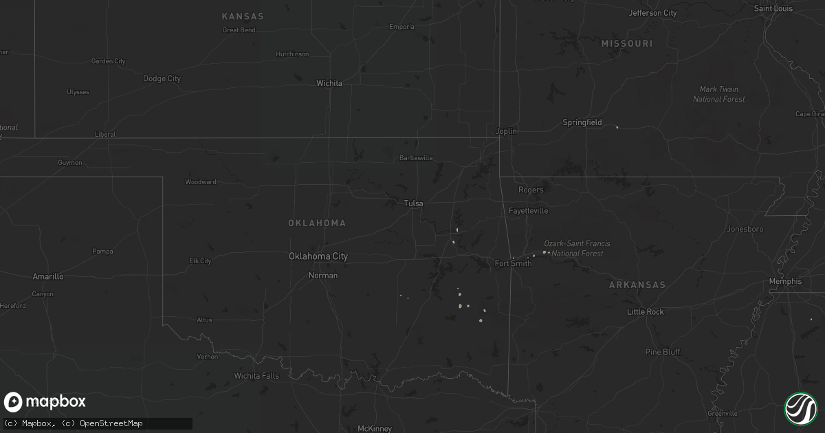
August 30 map
$229
one time, instant access
Download today. No call, no setup
Keep the $229
Bought the map and want the full workflow? Apply the entire $229 to a subscription within 7 days. None of it is wasted.
Every map, not just this one
This buys you this map. Subscription and you get every map we run, in the markets you choose from a few cities to whole states to nationwide. Plus real-time alerts the moment a storm fires.
Contact data
Name, contact info, occupancy, even credit band for addresses in the footprint. You go from where it hit to who to call.
Become the source they trust
Unlimited branding weather history reports on demand. You already have the documented answer ready for the property owner, and you are the one who showed up with it.
Property data and RoofTrace estimates
Pull up any address you have got, its value and the exact code rules for that jurisdiction, straight from One Click Code. Then RoofTrace estimates the squares, pitch, and roof value, priced the way you price.
States Impacted by Hail Map on August 30, 2015
Storm reports
Kentucky
| Date | Description |
|---|---|
| 08/30/20154:50 PM CDT | Delayed report...facebook report of tree limbs and power line damage in northeast frankfort. Nearby personal weather station had 51 mph gust. |
Georgia
| Date | Description |
|---|---|
| 08/30/20154:16 PM CDT | Sheriff dispatch reported trees in roadway on ray owens road. |
| 08/30/20153:54 PM CDT | Sheriff dispatch reported trees and powerlines down along hwy. 43. |
| 08/30/20153:46 PM CDT | Sheriff dispatch reported trees and powerlines down along stagecoach road. |
Arkansas
| Date | Description |
|---|---|
| 08/30/20153:00 PM CDT | Fence was damaged and one tree fell on a power line. There was also pea sized hail. |
Florida
| Date | Description |
|---|---|
| 08/30/20159:40 AM CDT | Flagler county emergency management reports 1629 customers currently without power along state road 100 and in downtown flagler beach. |
Arizona
| Date | Description |
|---|---|
| 08/30/201512:30 AM CDT | Strong winds caused mature cottonwood tree to fall down. |
| 08/29/201510:01 PM CDT | 6 in. Diameter tree snapped. |
| 08/29/20159:47 PM CDT | A local report indicates 59 MPH wind near 4 ESE CHANDLER |
| 08/29/20158:46 PM CDT | Power lines snapped and power outage. |
| 08/29/20158:30 PM CDT | 300 pound grill blown over and measured 1.75 in. Of rain. |
| 08/29/20158:30 PM CDT | Pharmacy wall blown down... 2 horse stables destroyed... Telephone pole snapped in laveen near 27th dr. And cheyenne. |
South Carolina
| Date | Description |
|---|---|
| 08/30/201512:15 AM CDT | Sc state highway patrol reported that a tree was blown down onto jefferies highway. Time was estimated from radar data. |
| 08/29/20159:00 PM CDT | Public relayed through local media that small utility shed was destroyed by wind. Shed was moved approximately 10 feet from cinderblock foundation and collapsed. |
Montana
| Date | Description |
|---|---|
| 08/29/20159:01 PM CDT | Estimated 60-70 mph wind gusts. |
| 08/29/20158:32 PM CDT | Metal grain building blown down and scattered about the prairie. Windows broken. |
| 08/29/20158:30 PM CDT | Very windy. Estimated wind gusting to 60 mph. |
Cities Impacted by Hail Map on August 30, 2015
- Nogales, AZ
- Belfield, ND
- Muskogee, OK
- Rocksprings, TX
- Two Dot, MT
- Brusett, MT
- Jordan, MT
- Kenton, TN
- Rutherford, TN
- Thomson, GA
- Brownsville, TN
- Butler, GA
- Reynolds, GA
- Roundup, MT
- Winnett, MT
- Winslow, AZ
- Brockton, MT
- Holly Springs, MS
- Ozark, AR
- Leupp, AZ
- Fort Smith, AR
- Red Oak, OK
- Seymour, MO
- Stuart, OK
- West Harrison, IN
- Lawrenceburg, IN
- Harrison, OH
- Fort Gibson, OK
- Grass Range, MT
- Talihina, OK
- Fort Valley, GA
- Murray, KY
- Corona, NM
- Forest Grove, MT
- Rentz, GA
- Dexter, GA
- Dublin, GA
- Judith Gap, MT
- Mescalero, NM
- Williams, AZ
- Lake Benton, MN
- Appling, GA
- Elkton, SD