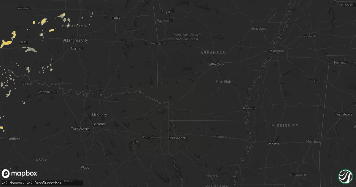
Hail Map on August 25, 2012
Get this storm
August 25 map
$229
one time, instant access
Download today. No call, no setup
Keep the $229
Bought the map and want the full workflow? Apply the entire $229 to a subscription within 7 days. None of it is wasted.
Every map, not just this one
This buys you this map. Subscription and you get every map we run, in the markets you choose from a few cities to whole states to nationwide. Plus real-time alerts the moment a storm fires.
Contact data
Name, contact info, occupancy, even credit band for addresses in the footprint. You go from where it hit to who to call.
Become the source they trust
Unlimited branding weather history reports on demand. You already have the documented answer ready for the property owner, and you are the one who showed up with it.
Property data and RoofTrace estimates
Pull up any address you have got, its value and the exact code rules for that jurisdiction, straight from One Click Code. Then RoofTrace estimates the squares, pitch, and roof value, priced the way you price.
States Impacted by Hail Map on August 25, 2012
Storm reports
Oklahoma
| Date | Description |
|---|---|
| 08/25/20126:40 PM CDT | A local report indicates 60 MPH wind near 5 WSW CRESCENT |
| 08/25/20125:45 PM CDT | A local report indicates 70 MPH wind near 4 ESE HENNESSEY |
| 08/25/20125:40 PM CDT | Numerous trees down and some structural damage. Power lines also down. |
| 08/25/20125:30 PM CDT | A local report indicates 60 MPH wind near 2 N DEMPSEY |
| 08/25/20125:30 PM CDT | Numerous trees down and some structural damage. Power lines also down. |
| 08/25/20125:10 PM CDT | Numerous 2 inch tree limbs downed. Estimated 50-60 mph. |
| 08/25/20124:25 PM CDT | A local report indicates 60 MPH wind near 3 W MEDICINE PARK |
| 08/24/20128:50 PM CDT | Downed trees |
| 08/24/20128:40 PM CDT | Downed power lines |
Virginia
| Date | Description |
|---|---|
| 08/25/201211:54 AM CDT | *** 1 inj *** trailer home damaged by straight-line winds...one minor injury...originally reported as a tornado |
Tennessee
| Date | Description |
|---|---|
| 08/25/20123:01 PM CDT | Public report of damage to docks at elm hill marina due to wind and rain. Dock employee also reported minor damage to few docked boats at marina. Estimated winds of 30- |
New York
| Date | Description |
|---|---|
| 08/25/20125:00 PM CDT | One tree down |
Texas
| Date | Description |
|---|---|
| 08/25/20126:30 PM CDT | West tx mesonet 10wsw guthrie |
| 08/25/20126:05 PM CDT | Report of 50 to 60 mph winds wnw of clarendon |
| 08/25/20125:10 PM CDT | A local report indicates 58 MPH wind near 3 NW SEYMOUR |
| 08/25/20125:07 PM CDT | Report of large tree across fm 1932 west of hedley near the fork. |
Cities Impacted by Hail Map on August 25, 2012
- Westbrook, TX
- Coahoma, TX
- South Haven, KS
- Wellington, KS
- Oxford, KS
- Geuda Springs, KS
- Shidler, OK
- Childress, TX
- Deer Creek, OK
- Dill City, OK
- Carter, OK
- Weatherford, OK
- Corn, OK
- Shamrock, TX
- Tahoka, TX
- Hedley, TX
- Quail, TX
- Roaring Springs, TX
- Midland, TX
- Odonnell, TX
- Clarendon, TX
- Altus, OK
- Canton, OK
- Fort Stockton, TX
- Erick, OK
- Wheeler, TX
- Sweetwater, OK
- Duncan, AZ
- Seiling, OK
- Longdale, OK
- Oakwood, OK
- Colorado City, TX
- Spur, TX
- Snyder, TX
- Thomas, OK
- Duke, OK
- Watonga, OK
- Greenfield, OK
- Medford, OK
- Young, AZ
- Newkirk, OK
- Arkansas City, KS
- Taloga, OK
- Berlin, MD
- Dickens, TX
- Apache, OK
- Girard, TX
- Crowell, TX
- Paducah, TX
- Caldwell, KS
- Old Glory, TX
- Melfa, VA
- Onancock, VA
- Accomac, VA
- Onley, VA
- Reydon, OK
- Hennessey, OK
- Kingfisher, OK
- Memphis, TX
- Quanah, TX
- Cheyenne, OK
- Greenbush, VA
- Matador, TX
- Braman, OK
- Nardin, OK
- Stillwater, OK
- Afton, TX
- Aspermont, TX
- McCaulley, TX
- Roby, TX
- Guthrie, OK
- Parksley, VA
- Headrick, OK
- Clifton, AZ
- Sentinel, OK
- Gotebo, OK
- Rocky, OK
- Cordell, OK
- Crawford, OK
- Seymour, TX
- Jayton, TX
- Jonesville, VA
- Payson, AZ
- Bison, OK
- Waukomis, OK
- Imperial, TX
- Bishopville, MD
- Showell, MD
- Lakeview, TX
- Winfield, KS
- Sylvester, TX
- Mereta, TX
- San Angelo, TX
- Miles, TX
- Orlando, OK
- Glencoe, OK
- Ira, TX
- Millsboro, DE
- Lewes, DE
- Harbeson, DE
- Lelia Lake, TX
- Floydada, TX
- Loraine, TX
- Wildwood, NJ
- Indiahoma, OK
- Birdsnest, VA
- Ocean View, DE
- Frankford, DE
- Bethany Beach, DE
- Gould, OK
- Perry, OK
- Machipongo, VA
- Cache, OK
- Perkins, OK
- Tryon, OK
- Geary, OK
- Chattanooga, OK
- Loveland, OK
- Lawton, OK
- Newark, MD
- Olpe, KS
- Bloxom, VA
- Elgin, OK
- Fort Sill, OK
- Pawnee, OK
- Ames, OK
- Drummond, OK
- Sayre, OK
- Briscoe, TX
- Leedey, OK
- Painter, VA
- Sanford, VA
- Marion Station, MD
- Girdletree, MD
- Snow Hill, MD
- Walsenburg, CO
- Quitaque, TX
- Mule Creek, NM
- Elmer, OK
- Ocean City, MD