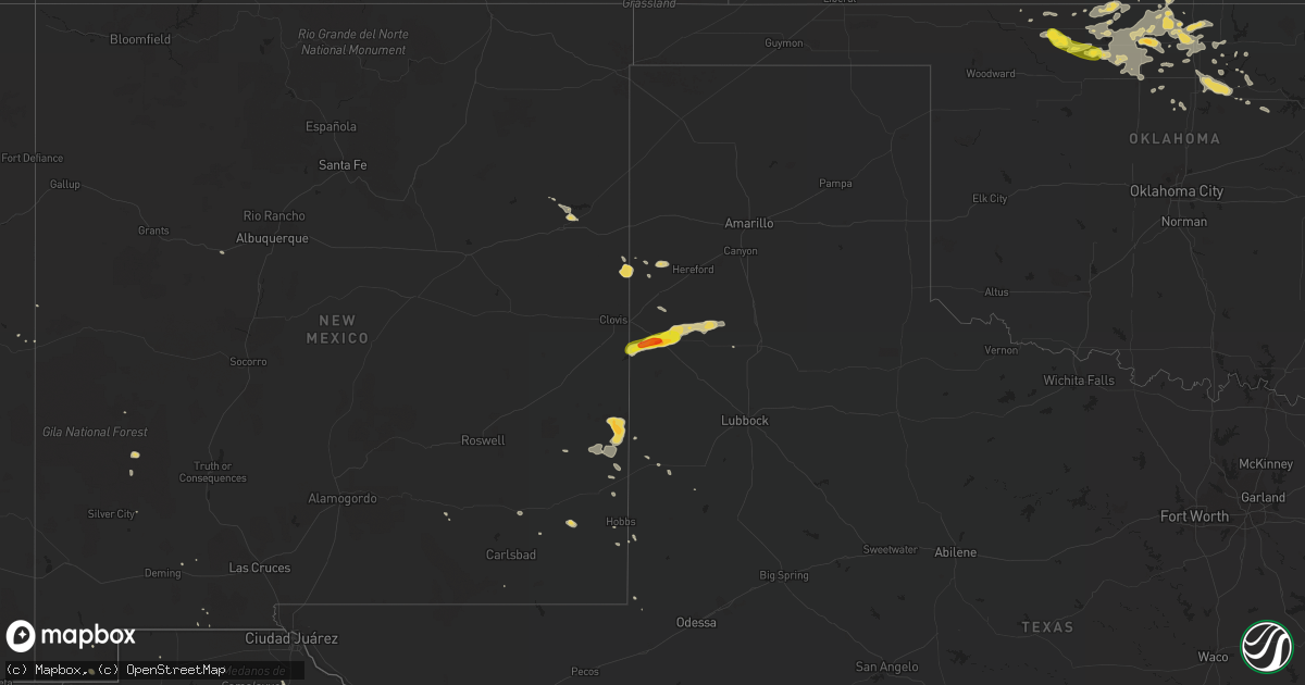
Hail Map on August 21, 2015
Get this storm
August 21 map
$229
one time, instant access
Download today. No call, no setup
Keep the $229
Bought the map and want the full workflow? Apply the entire $229 to a subscription within 7 days. None of it is wasted.
Every map, not just this one
This buys you this map. Subscription and you get every map we run, in the markets you choose from a few cities to whole states to nationwide. Plus real-time alerts the moment a storm fires.
Contact data
Name, contact info, occupancy, even credit band for addresses in the footprint. You go from where it hit to who to call.
Become the source they trust
Unlimited branding weather history reports on demand. You already have the documented answer ready for the property owner, and you are the one who showed up with it.
Property data and RoofTrace estimates
Pull up any address you have got, its value and the exact code rules for that jurisdiction, straight from One Click Code. Then RoofTrace estimates the squares, pitch, and roof value, priced the way you price.
States Impacted by Hail Map on August 21, 2015
Storm reports
Nebraska
| Date | Description |
|---|---|
| 08/21/20151:35 PM CDT | A local report indicates 1.00 inch wind near 2 W PARKS |
Kansas
| Date | Description |
|---|---|
| 08/21/20153:51 PM CDT | Picture sent over twitter location 4e of st francis. |
| 08/21/20153:43 PM CDT | A local report indicates 1.50 inch wind near 2 N ST. FRANCIS |
| 08/21/20153:13 PM CDT | A local report indicates 1.00 inch wind near 7 N ST. FRANCIS |
| 08/21/20156:33 AM CDT | Trained spotter reports dime to quarter sized hail which has lasted for past the few minutes. |
Texas
| Date | Description |
|---|---|
| 08/20/20159:09 PM CDT | Xcel energy had transmission structions go down south of us 380 and fm 1780. Lyntegar electric coop has one distribution pole down south of that intersection as well. |
| 08/20/20158:40 PM CDT | A local report indicates 60 MPH wind near 7 WNW DENVER CITY |
| 08/20/20157:25 PM CDT | A local report indicates 1.75 inch wind near MULESHOE |
New Mexico
| Date | Description |
|---|---|
| 08/21/20155:45 PM CDT | Half of mobile home overturned on hwy 285 |
| 08/20/201510:05 PM CDT | Spotter reported quarter size hail along hwy 82. |
| 08/20/20159:15 PM CDT | Several power poles down just west of nm 132 and nm 133. |
| 08/20/20157:35 PM CDT | A local report indicates 61 MPH wind near 2 SW TATUM |
Oklahoma
| Date | Description |
|---|---|
| 08/20/20159:35 PM CDT | Estimated at 60 to 70 mph |
| 08/20/20159:35 PM CDT | A local report indicates 1.00 inch wind near CARMEN |
| 08/20/20158:45 PM CDT | A local report indicates 78 MPH wind near 7 SSW ALVA |
| 08/20/20158:35 PM CDT | A local report indicates 61 MPH wind near 7 SSW ALVA |
| 08/20/20158:30 PM CDT | A local report indicates 78 MPH wind near 7 SSW ALVA |
Arizona
| Date | Description |
|---|---|
| 08/21/20155:32 PM CDT | Estimated quarter size hail in bisbee |
Colorado
| Date | Description |
|---|---|
| 08/21/20155:40 PM CDT | Report from public off co rd k about 2 to 3 miles east of 385. |
Alabama
| Date | Description |
|---|---|
| 08/21/20156:48 PM CDT | Estimated quarter size hail near the dale-houston county border...just into houston county. |
| 08/21/20156:40 PM CDT | Power lines down and small hail reported near the dothan airport. Updated location to be along highway 134. |
| 08/21/20156:40 PM CDT | Power lines down and small hail reported near the dothan airport. |
| 08/21/20155:39 PM CDT | Large tree limbs blown down between new brockton and enterprise with dime to nickel size hail also reported. |
Cities Impacted by Hail Map on August 21, 2015
- Hart, TX
- Carmen, OK
- Helena, OK
- Goltry, OK
- Earth, TX
- Sudan, TX
- Springlake, TX
- Muleshoe, TX
- Dimmitt, TX
- Benkelman, NE
- Parks, NE
- Bluff City, KS
- Franklin, GA
- Morrison, OK
- Perry, OK
- Claremore, OK
- Nash, OK
- Ponca City, OK
- Cherokee, OK
- Billings, OK
- Lamont, OK
- Burlington, OK
- Caldwell, KS
- Blackwell, OK
- Hunter, OK
- Carrier, OK
- Jet, OK
- Kremlin, OK
- Wakita, OK
- Nardin, OK
- Tonkawa, OK
- Pond Creek, OK
- Newkirk, OK
- Enid, OK
- Medford, OK
- Lahoma, OK
- South Haven, KS
- Deer Creek, OK
- Tatum, NM
- Opp, AL
- Viola, KS
- Burlington, CO
- Garber, OK
- Conway Springs, KS
- Broadview, NM
- Toxey, AL
- Goddard, KS
- Danville, KS
- Harper, KS
- Amorita, OK
- Waldron, KS
- Manchester, OK
- Argonia, KS
- Marshall, OK
- Pryor, OK
- Arapahoe, CO
- Clearwater, KS
- Cheney, KS
- Pawnee, OK
- Wellington, KS
- Marland, OK
- Freeport, KS
- Saint Francis, KS
- Hereford, AZ
- Tucumcari, NM
- Chelsea, OK
- Jayess, MS
- Monticello, MS
- Glencoe, OK
- Spavinaw, OK
- Adair, OK
- Strang, OK
- Salina, OK
- Baton Rouge, LA
- Crossroads, NM
- Picayune, MS
- New Brockton, AL
- Elba, AL
- Enterprise, AL
- Bowbells, ND
- Alva, OK
- Waynoka, OK
- Bolton, NC
- Ash, NC
- Fairfax, OK
- Red Rock, OK
- Dacoma, OK
- Orlando, OK
- Plains, TX
- Roanoke, AL
- Baker, LA
- Dothan, AL
- Midland City, AL
- Douglas, OK
- Fairmont, OK
- Bisbee, AZ
- Jennings, OK
- Yale, OK
- Plainview, TX
- Idalia, CO
- Goliad, TX
- Skiatook, OK
- Friona, TX
- Daufuskie Island, SC
- Lake Placid, FL
- Laguna, NM
- Darien, GA
- Quemado, NM
- Haigler, NE
- Sand Springs, OK
- Tulsa, OK
- Owasso, OK
- Inola, OK
- Headland, AL
- Talala, OK
- Kokomo, MS
- Foxworth, MS
- Carriere, MS
- Venus, FL
- Kinston, AL
- Conchas Dam, NM
- Pearl River, LA
- Labelle, FL
- Butler, AL
- Bird City, KS
- Collinsville, OK
- Jay, OK
- Lovington, NM
- Sperry, OK
- Punta Gorda, FL
- Fort Stockton, TX
- McNeal, AZ
- Georgetown, SC
- Townsend, GA
- Valley Center, KS
- Thornton, AR
- Walker, LA
- Portales, NM