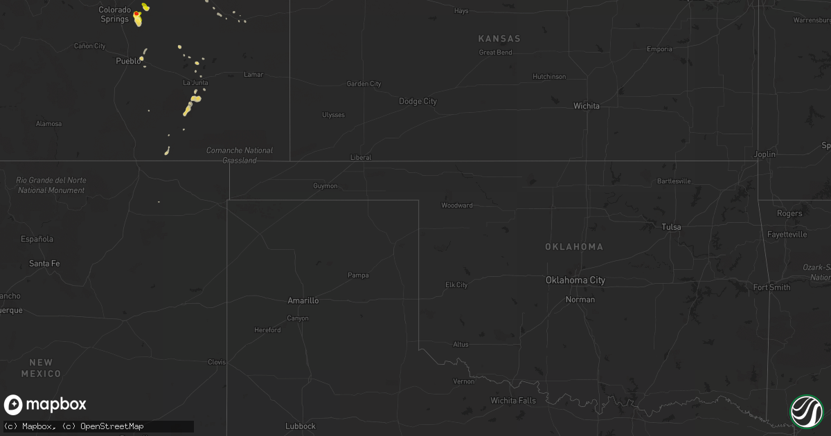
Hail Map on August 18, 2013
Get this storm
August 18 map
$229
one time, instant access
Download today. No call, no setup
Keep the $229
Bought the map and want the full workflow? Apply the entire $229 to a subscription within 7 days. None of it is wasted.
Every map, not just this one
This buys you this map. Subscription and you get every map we run, in the markets you choose from a few cities to whole states to nationwide. Plus real-time alerts the moment a storm fires.
Contact data
Name, contact info, occupancy, even credit band for addresses in the footprint. You go from where it hit to who to call.
Become the source they trust
Unlimited branding weather history reports on demand. You already have the documented answer ready for the property owner, and you are the one who showed up with it.
Property data and RoofTrace estimates
Pull up any address you have got, its value and the exact code rules for that jurisdiction, straight from One Click Code. Then RoofTrace estimates the squares, pitch, and roof value, priced the way you price.
States Impacted by Hail Map on August 18, 2013
Storm reports
Minnesota
| Date | Description |
|---|---|
| 08/17/20139:38 PM CDT | Quarter size hail 2 miles east of thief river falls airport |
| 08/17/20138:02 PM CDT | Very mushy hail |
Florida
| Date | Description |
|---|---|
| 08/18/20132:03 PM CDT | 62 mph wind gust measured by trained storm spoter near hwy 331 on southern portion of choctawhatchee bay. |
| 08/18/20132:03 PM CDT | 62 mph wind gust measured by trained storm spoter near hwy 331 on southern portion of choctawhatchee bay. Corrected reference location |
Colorado
| Date | Description |
|---|---|
| 08/18/20136:39 PM CDT | A local report indicates 1.00 inch wind near 1 NE BRUSH |
| 08/18/20136:29 PM CDT | A local report indicates 1.75 inch wind near 1 N BRUSH |
| 08/18/20134:45 PM CDT | A local report indicates 1.75 inch wind near ELLICOTT |
| 08/18/20134:40 PM CDT | A local report indicates 1.00 inch wind near 4 NE SCHRIEVER AFB |
| 08/18/20133:30 PM CDT | A local report indicates 1.00 inch wind near 7 S CALHAN |
| 08/17/20137:11 PM CDT | A local report indicates 59 MPH wind near AKRON |
Nevada
| Date | Description |
|---|---|
| 08/18/20136:28 PM CDT | A local report indicates 58 MPH wind near 4 NW LAS VEGAS |
Georgia
| Date | Description |
|---|---|
| 08/18/20136:41 PM CDT | National weather service survey team determined that an ef0 tornado touched down just inside the ga-al line in heard county. A mobile home sustained roof damage as the |
| 08/18/20136:40 PM CDT | National weather service survey team determined that an ef0 tornado touched down just inside the ga-al line in heard county. A mobile home sustained roof damage as the |
| 08/18/20134:15 PM CDT | 911 center reported one tree down along hwy 319 between wadley and bartow. |
| 08/18/20133:40 PM CDT | Several trees down along linton road. |
California
| Date | Description |
|---|---|
| 08/18/20134:20 PM CDT | Landspout looking tornado picture submited to our twitter account. The photo was taken on the west side of the storm near helendale. |
New Mexico
| Date | Description |
|---|---|
| 08/17/20138:25 PM CDT | A local report indicates 64 MPH wind near 2 E FORT SUMNER |
North Dakota
| Date | Description |
|---|---|
| 08/17/20137:35 PM CDT | Tops of a few cottonwood trees broken off |
Cities Impacted by Hail Map on August 18, 2013
- Hugo, CO
- Calhan, CO
- Colorado Springs, CO
- Torrington, WY
- Yoder, WY
- Lagrange, WY
- Sandersville, GA
- Morrill, NE
- Fort Stockton, TX
- Milledgeville, GA
- Warthen, GA
- Maida, ND
- Langdon, ND
- Driscoll, ND
- Sterling, ND
- Red Mountain, CA
- Ridgecrest, CA
- Pahrump, NV
- Strandquist, MN
- Newfolden, MN
- Lyman, NE
- Alliance, NE
- Wheatland, WY
- Fort Morgan, CO
- Viking, MN
- La Junta, CO
- Hawk Springs, WY
- Edwards, CA
- Boron, CA
- Akron, CO
- Kit Carson, CO
- Lingle, WY
- Waynesboro, GA
- Hillrose, CO
- Brush, CO
- Scottsbluff, NE
- Deer Trail, CO
- Lumber City, GA
- Alamo, GA
- Nunn, CO
- Tappen, ND
- Dawson, ND
- Medina, ND
- Pueblo, CO
- Lead, SD
- Boone, CO
- Thief River Falls, MN
- Trenton, FL
- Chiefland, FL
- Snyder, CO
- Avondale, CO
- Jean, NV
- Lancaster, CA
- Adelanto, CA
- Mitchell, NE
- Hazlehurst, GA
- Statesboro, GA
- Arriba, CO
- Bristol, FL
- Agate, CO
- Newberry Springs, CA
- Death Valley, CA
- Peyton, CO