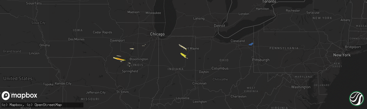
Hail Map on August 17, 2023
The weather event on August 17, 2023 includes Hail and Wind maps. 16 states and 203 cities were impacted and suffered possible damage. The total estimated number of properties impacted is 11,340.
Want more than just the map?
Turn this storm into a full workflow.
- Owner + property data so you know who to knock
- OnDemand branded weather history reports to win the "did we even have hail?" argument
- RoofTrace estimate so reps stop guessing numbers at the door
Bought this map? Upgrade within 7 days and we'll credit the $230. (10-15 min setup call)
Hail
Wind
11,340
Estimated number of impacted properties by a 1.00" hail or larger0
Estimated number of impacted properties by a 1.75" hail or larger0
Estimated number of impacted properties by a 2.50" hail or largerStates Impacted by Hail Map on August 17, 2023
Storm reports
Utah
| Date | Description |
|---|---|
| 08/17/20236:55 PM CDT | Mesonet station freut fremont island - miller hill. |
| 08/17/20234:30 PM CDT | Mesonet station utrky rocky ridge. |
| 08/17/20234:27 PM CDT | Asos station kslc salt lake city intl arpt. |
| 08/16/20238:45 PM CDT | Mesonet station ucc01 snowville |
Ohio
| Date | Description |
|---|---|
| 08/16/20238:36 PM CDT | Kyng asos measured 51 knots or 59 mph. |
| 08/16/20238:30 PM CDT | Corrects previous tstm wnd gst report from vienna. Kyng asos measured 51 knots or 59 mph. |
| 08/16/20238:24 PM CDT | 911 dispatch reports at least a dozen trees blown down across the county. A couple trees were blocking roadways. |
| 08/16/20238:24 PM CDT | Corrects previous tstm wnd gst report from vienna. Corrects previous tstm wnd gst report from vienna. Kyng asos measured 51 knots or 59 mph. |
Arizona
| Date | Description |
|---|---|
| 08/17/20235:35 PM CDT | Awos station kavq marana regional airport. |
| 08/17/20235:30 PM CDT | Tractor-trailer overturned avra valley rd. Near sandario rd. |
| 08/17/20235:15 PM CDT | Power poles down. |
| 08/17/20235:12 PM CDT | Trees down at marana high school. |
| 08/17/202312:08 AM CDT | Spotter in east bullhead city reported a peak wind gust to 59 with a passing thunderstorm. |
| 08/16/20239:10 PM CDT | Roof panels and trees limbs in the roadways. 7-8 inch diameter tree knocked over. Winds estimated at 45-50 mph based on nearby observations and radar estimates. |
| 08/16/20238:49 PM CDT | ***delayed report*** spotter reports tree limbs have been broken and are blocking the roadway on ellsworth rd 1/4 mile north of elliot rd. This burst of wind seemed to |
| 08/16/20238:35 PM CDT | Broadcast footage showed several large trees uprooted which caused property damage along skyline dr. Wind speeds estimated around 60 to 70 mph due to a downburst at the |
| 08/16/20238:30 PM CDT | Multiple video footages taken around the san tan valley area showed what was likely a microburst. A picture showed a power pole leaning at about a 30 degree angle. |
| 08/16/20237:05 PM CDT | A local report indicates 70 MPH wind near 4 S Gila Bend |
Maryland
| Date | Description |
|---|---|
| 08/16/202310:20 PM CDT | Several trees blew down along chapel point road. |
Virginia
| Date | Description |
|---|---|
| 08/16/202310:10 PM CDT | Downed power lines reported down near the 10 block of randolph rd. |
| 08/16/20237:22 PM CDT | Trees down near rocky hock rd. |
Wisconsin
| Date | Description |
|---|---|
| 08/17/20239:29 AM CDT | A branch from a tree was knocked down due to thunderstorm winds. Time is estimated by radar and the estimated time of about 10 pm from the observer. Report received via |
Illinois
| Date | Description |
|---|---|
| 08/17/20237:45 AM CDT | Relayed via social media. |
| 08/17/20237:31 AM CDT | Quarter to ping pong... Time estimated from radar. |
Pennsylvania
| Date | Description |
|---|---|
| 08/16/20239:02 PM CDT | Mping report of tree damage near lake latonaka. |
| 08/16/20238:45 PM CDT | Trees down in greenville. |
| 08/16/20238:43 PM CDT | Mping report of wind damage along birchwood drive. |
| 08/16/20238:36 PM CDT | A few trees down in west salem township. |
Florida
| Date | Description |
|---|---|
| 08/17/20233:20 PM CDT | Newspaper employee reports on social media of a large tree branch blocking south olive avenue north of avila road in west palm beach after a severe thunderstorm moved t |
| 08/17/20233:20 PM CDT | Trained spotter reported quarter-size hail for a duration of 5-10 minutes at the intersection of village blvd and palm beach lakes blvd at 4:20pm as a severe thundersto |
| 08/17/20233:16 PM CDT | Broadcast meteorologist reported several large trees uprooted/fallen over in howard park on social media. This occurred in association with a severe thunderstorm that m |
| 08/17/20233:15 PM CDT | Broadcast media reported that a tree fell on a school bus as a severe thunderstorm moved through the area. No injuries were reported at the time of the report. This occ |
| 08/17/20233:15 PM CDT | Earthnetworks mesonet wpbfo west palm beach fire station reported a wind gust of 74mph at 4:15pm as a severe thunderstorm moved through the area. |
| 08/17/20232:08 PM CDT | Asos station kopf miami opa locka reported a wind gust of 60mph at 3:08pm as a strong storm moved through the area. |
| 08/17/20231:33 PM CDT | Earthnetworks mesowest seminole tribe headquarters reported a wind gust of 59mph at 2:33pm as a strong thunderstorm moved through the area. |
| 08/17/202311:56 AM CDT | Mesonet station ar664 frostproof. |
Montana
| Date | Description |
|---|---|
| 08/17/20231:00 AM CDT | A local report indicates 58 MPH wind near 6 ENE Livingston |
| 08/16/202311:53 PM CDT | A local report indicates 59 MPH wind near 6 ENE Livingston |
Connecticut
| Date | Description |
|---|---|
| 08/17/20236:00 AM CDT | Power lines down partially blocking the road at mill st and main st. |
| 08/17/20235:54 AM CDT | Tree damage with branch on road... Blocking one lane. |
New York
| Date | Description |
|---|---|
| 08/17/202312:45 AM CDT | Trees and wires down on big hollow road. Time estimated from radar. |
Texas
| Date | Description |
|---|---|
| 08/17/20236:00 PM CDT | Former nws employee estimated winds around 70 mph. |
Indiana
| Date | Description |
|---|---|
| 08/17/20236:30 PM CDT | Tree and power lines down. Time estimated by radar. |
| 08/17/20235:45 PM CDT | A local report indicates 1.25 inch wind near 2 N Arcana |
| 08/17/20235:30 PM CDT | A local report indicates 1.25 inch wind near La Fontaine |
| 08/17/20235:03 PM CDT | Spotter also reported 50 mph wind gusts. |
Nevada
| Date | Description |
|---|---|
| 08/16/20238:00 PM CDT | A local report indicates 58 MPH wind near 4.5 E Sutcliffe |
Cities Impacted by Hail Map on August 17, 2023
- Macomb, IL
- Bushnell, IL
- Marietta, IL
- Smithfield, IL
- Table Grove, IL
- Adair, IL
- Steamboat Rock, IA
- Groton, SD
- Zahl, ND
- Wapello, IA
- Bristol, SD
- Marengo, IA
- Lehr, ND
- Columbia, SD
- Windom, MN
- Waubay, SD
- Eldora, IA
- Westbrook, MN
- Iowa Falls, IA
- Braddock, ND
- Williamsburg, IA
- Oakville, IA
- Latimer, IA
- Wilton, ND
- Oquawka, IL
- Dows, IA
- Rowan, IA
- Frederick, SD
- Gladbrook, IA
- Columbus Junction, IA
- Burlington, IA
- Florence, SD
- Roseville, IL
- Andover, SD
- Ivanhoe, MN
- Ashley, ND
- Fenton, IA
- Beaman, IA
- Wellman, IA
- Balaton, MN
- Corwith, IA
- Alden, IA
- Clarion, IA
- Goodwin, SD
- Hazen, ND
- Ainsworth, IA
- Forbes, ND
- Webster, SD
- Parnell, IA
- Riverside, IA
- Morning Sun, IA
- Napoleon, ND
- Clear Lake, SD
- Prairie City, IL
- Grundy Center, IA
- Garrison, ND
- Kalona, IA
- Jackson, MN
- Toledo, IA
- Center, ND
- Armstrong, IA
- Belmond, IA
- Stanton, ND
- Grenora, ND
- Lone Rock, IA
- New Town, ND
- Russell, MN
- Wishek, ND
- Dunnell, MN
- Hendricks, MN
- Alpha, MN
- Chelsea, IA
- Houghton, SD
- Biggsville, IL
- Avon, IL
- Burt, IA
- Ray, ND
- Sterling, ND
- Bancroft, IA
- Dolliver, IA
- Parshall, ND
- Sherburn, MN
- Conrad, IA
- Mediapolis, IA
- Currie, MN
- Slayton, MN
- Kanawha, IA
- Belle Plaine, IA
- Garvin, MN
- Wesley, IA
- Watertown, SD
- Smithshire, IL
- Tracy, MN
- Westby, MT
- Baldwin, ND
- Ridgedale, MO
- Seymour, MO
- Bruner, MO
- Lebanon, MO
- Saint Paul, AR
- Chamois, MO
- Freeburg, MO
- Chadwick, MO
- Meta, MO
- Linn, MO
- Richland, MO
- Rhineland, MO
- Crocker, MO
- Waynesville, MO
- Huntsville, AR
- Bowling Green, MO
- Montgomery City, MO
- Barry, IL
- Hollister, MO
- Versailles, IL
- Charleston, AR
- Chambersburg, IL
- Garrison, MO
- Middletown, MO
- New Salem, IL
- Mount Sterling, IL
- Dixon, MO
- Bellflower, MO
- Brinktown, MO
- Rockport, IL
- Louisiana, MO
- Laquey, MO
- Vermont, IL
- Hartville, MO
- Baylis, IL
- Forsyth, MO
- Green Forest, AR
- Grovespring, MO
- Berryville, AR
- Branson, MO
- Rushville, IL
- New Florence, MO
- Vienna, MO
- Ipava, IL
- Sparland, IL
- Lacon, IL
- Bardolph, IL
- Bradford, IL
- Ellisville, IL
- Lewistown, IL
- Mason City, IL
- San Jose, IL
- Sciota, IL
- Cuba, IL
- Blandinsville, IL
- Liverpool, IL
- Colchester, IL
- Good Hope, IL
- Greenview, IL
- Seneca, IL
- Verona, IL
- West Palm Beach, FL
- Palm Beach, FL
- Magna, UT
- Salt Lake City, UT
- Huntington, IN
- Roanoke, IN
- Wabash, IN
- La Fontaine, IN
- Warren, IN
- Andrews, IN
- Van Buren, IN
- Marion, IN
- Morris, IL
- Warsaw, IN
- Pierceton, IN
- Larwill, IN
- South Whitley, IN
- Ransom, IL
- Randolph, UT
- Laketown, UT
- Columbia City, IN
- Henry, IL
- Fort Lauderdale, FL
- Winona Lake, IN
- Claypool, IN
- Etna Green, IN
- Atwood, IN
- Maryneal, TX
- Sweetwater, TX
- Roscoe, TX
- Warren, OH
- Cortland, OH
- Fowler, OH
- Burghill, OH
- Kinsman, OH
- Farmdale, OH
- Vienna, OH
- Canton, IL
- Tooele, UT
- Bancroft, ID
- Willcox, AZ
- Breckenridge, TX
- Hartford City, IN
- San Tan Valley, AZ
- Idaho Springs, CO
- Georgetown, CO
- Grantsville, UT