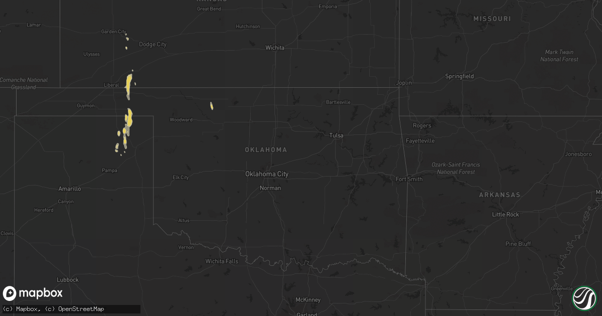
Hail Map on August 17, 2013
Get this storm
August 17 map
$229
one time, instant access
Download today. No call, no setup
Keep the $229
Bought the map and want the full workflow? Apply the entire $229 to a subscription within 7 days. None of it is wasted.
Every map, not just this one
This buys you this map. Subscription and you get every map we run, in the markets you choose from a few cities to whole states to nationwide. Plus real-time alerts the moment a storm fires.
Contact data
Name, contact info, occupancy, even credit band for addresses in the footprint. You go from where it hit to who to call.
Become the source they trust
Unlimited branding weather history reports on demand. You already have the documented answer ready for the property owner, and you are the one who showed up with it.
Property data and RoofTrace estimates
Pull up any address you have got, its value and the exact code rules for that jurisdiction, straight from One Click Code. Then RoofTrace estimates the squares, pitch, and roof value, priced the way you price.
States Impacted by Hail Map on August 17, 2013
Storm reports
Georgia
| Date | Description |
|---|---|
| 08/17/20136:50 PM CDT | A local report indicates 1.00 inch wind near HOBOKEN |
| 08/17/20136:28 PM CDT | A local report indicates 1.00 inch wind near N DOUGLAS |
| 08/17/20136:28 PM CDT | A roof of a home was blown back by thunderstorm winds. |
| 08/17/20136:28 PM CDT | A large pine tree was blown down onto a residence. Extensive damage was done to the home. No injuries were reported. |
| 08/17/20136:14 PM CDT | Correction...the roof damage was that of a barn. |
| 08/17/20136:13 PM CDT | A few trees were blown down at the intersection of j frank culpepper road and bethal church road. The time of damage was based on radar imagery. |
| 08/17/20132:15 PM CDT | Several trees down. |
| 08/16/20137:05 PM CDT | Dipatch reported a tree down near alma. |
Arizona
| Date | Description |
|---|---|
| 08/17/20136:29 PM CDT | A local report indicates 61 MPH wind near 2 SSE TUCSON |
| 08/16/20137:55 PM CDT | Additional storm damage report of torn up awnings and some broken windows on some of the properties around the roosevelt lakeview park mobile home rv park. |
| 08/16/20137:15 PM CDT | A local report indicates 60 MPH wind near ROOSEVELT |
Florida
| Date | Description |
|---|---|
| 08/17/20135:38 PM CDT | Trees down on a vehicle in dunnellon...and damage to a pole barn in homosassa...reported by law enforcement. |
| 08/17/20138:59 AM CDT | Tree blown down which blocked the road. |
| 08/16/20137:15 PM CDT | The ocala star banner banner reports that the marion county sheriffs office received multiple calls of downed trees and powerlines in the vicinity of ocala. A car struc |
Kansas
| Date | Description |
|---|---|
| 08/17/20137:25 AM CDT | A local report indicates 1.00 inch wind near 5 WNW MEADE STATE PARK |
Cities Impacted by Hail Map on August 17, 2013
- Silver Springs, FL
- Wagon Mound, NM
- Perryton, TX
- Booker, TX
- Balko, OK
- Ocala, FL
- Apopka, FL
- Brooksville, FL
- Inverness, FL
- Hernando, FL
- Meade, KS
- Valdosta, GA
- Lake Park, GA
- Pavo, GA
- Boston, GA
- Thomasville, GA
- Beverly Hills, FL
- Dunnellon, FL
- Lake Helen, FL
- Deltona, FL
- Hawthorne, FL
- Micanopy, FL
- Adel, GA
- Hahira, GA
- Barney, GA
- Umatilla, FL
- Mount Dora, FL
- Altoona, FL
- Sorrento, FL
- Eustis, FL
- Kingman, AZ
- Fort McCoy, FL
- Seligman, AZ
- Spring Hill, FL
- Hobson, MT
- Prescott, AZ
- Montezuma, KS
- Crown King, AZ
- Plains, KS
- Nicholls, GA
- Ambrose, GA
- West Green, GA
- Douglas, GA
- Willacoochee, GA
- Alapaha, GA
- Alma, GA
- Forgan, OK
- Tallahassee, FL
- Hoboken, GA
- Roosevelt, AZ
- Macclenny, FL
- Glen Saint Mary, FL
- Ocilla, GA
- Jesup, GA
- Morriston, FL
- Tucumcari, NM
- Conchas Dam, NM
- Flagstaff, AZ
- Starke, FL
- Littlefield, AZ
- Colorado City, AZ
- Lecanto, FL
- Crystal River, FL
- Miami, TX
- Richmond Hill, GA
- Blountstown, FL
- Wewahitchka, FL
- Alva, OK
- Waynoka, OK
- Darien, GA
- Townsend, GA
- Sarasota, FL
- Pearson, GA
- Jennings, FL
- Homosassa, FL
- Carrabelle, FL
- Webster, FL
- Lakeland, GA
- Moultrie, GA
- Lake City, FL
- Fort Myers, FL
- Gainesville, FL
- Reddick, FL
- Citra, FL
- Saint George, GA
- Bagdad, AZ
- Tampa, FL
- Brandon, FL
- Seffner, FL
- Hampton, FL
- Savannah, GA
- Hortense, GA
- Fargo, GA
- Norman Park, GA
- Waycross, GA
- Nahunta, GA
- Lenox, GA
- Sparks, GA
- Earleton, FL
- Sanderson, FL
- Palatka, FL
- Happy Jack, AZ
- Ingalls, KS
- Beaver, OK
- Kaibeto, AZ
- Enigma, GA
- Estero, FL
- North Fort Myers, FL
- Winter Garden, FL
- Roswell, NM
- Ocoee, FL
- Folkston, GA