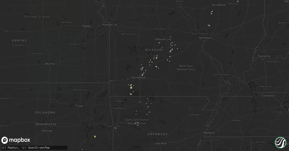
Hail Map on August 12, 2016
Get this storm
August 12 map
$229
one time, instant access
Download today. No call, no setup
Keep the $229
Bought the map and want the full workflow? Apply the entire $229 to a subscription within 7 days. None of it is wasted.
Every map, not just this one
This buys you this map. Subscription and you get every map we run, in the markets you choose from a few cities to whole states to nationwide. Plus real-time alerts the moment a storm fires.
Contact data
Name, contact info, occupancy, even credit band for addresses in the footprint. You go from where it hit to who to call.
Become the source they trust
Unlimited branding weather history reports on demand. You already have the documented answer ready for the property owner, and you are the one who showed up with it.
Property data and RoofTrace estimates
Pull up any address you have got, its value and the exact code rules for that jurisdiction, straight from One Click Code. Then RoofTrace estimates the squares, pitch, and roof value, priced the way you price.
States Impacted by Hail Map on August 12, 2016
Storm reports
Texas
| Date | Description |
|---|---|
| 08/12/20165:30 PM CDT | Estimated 60mph winds in sachse |
| 08/12/20164:07 PM CDT | Power poles snapped in irving |
| 08/12/20164:06 PM CDT | Significant roof damage at spanish trace apartments in irving near loop 12 and hwy 183 |
| 08/12/20163:03 PM CDT | Several power poles down west and north of tuscola |
| 08/11/20167:39 PM CDT | Measured 67mph wind gust at nws office. Minor roof damage. |
Massachusetts
| Date | Description |
|---|---|
| 08/12/20164:31 PM CDT | Tree down on west road |
| 08/12/20164:13 PM CDT | Tree and wires down |
| 08/12/20164:06 PM CDT | Wires down on pecks road |
| 08/12/20163:50 PM CDT | Multiple trees down on eagle street and point grove road |
| 08/12/20163:00 PM CDT | Boat dock blown over and large branches down...screen house damaged on lane 8 near south pond |
| 08/12/20162:15 PM CDT | Tree down on shaker road |
| 08/12/20162:15 PM CDT | Tree and wires down on worcester road /route 12/...wires down on old southbridge road |
| 08/12/20162:05 PM CDT | Tree down on wires at 21 old county road |
| 08/12/20161:59 PM CDT | Tree and wires down on main road...north road...and pitcher street. Wire on fire at main road and pitcher street. |
| 08/12/20161:58 PM CDT | Tree down on cottage street |
Missouri
| Date | Description |
|---|---|
| 08/12/20164:30 PM CDT | Numerous trees down in the viola area with some power lines down as well |
| 08/12/20164:30 PM CDT | Central crossing fire disctrict reports 4 trees down on loop street in shell knob |
| 08/12/20163:30 PM CDT | Delayed report... Tree down blocking roadway on roundhouse road nw of crane due to thunderstorm winds. Time estimated via radar |
| 08/11/20167:52 PM CDT | Rivers pointe fire district reports multiple large tree limbs and a few trees down with a few streets blocked |
Rhode Island
| Date | Description |
|---|---|
| 08/12/20165:45 PM CDT | Tree and wires down on lewis farm road |
| 08/12/20164:47 PM CDT | Tree down blocking route 101 |
| 08/12/20164:28 PM CDT | Tree down on wires on hill road...wires blocking road |
| 08/12/20164:27 PM CDT | Tree and wires down on clark street |
| 08/12/20164:16 PM CDT | Tree down on lake washington drive |
| 08/12/20164:13 PM CDT | Tree down on reynolds road per glocester police |
| 08/12/20164:07 PM CDT | Trees and wires down on foster road |
| 08/12/20164:05 PM CDT | Foster police reported many trees down on route 6 |
South Dakota
| Date | Description |
|---|---|
| 08/12/20163:52 PM CDT | 3 inch diameter tree branch down. |
New York
| Date | Description |
|---|---|
| 08/12/20166:46 PM CDT | Large tree limbs down around town. |
| 08/12/20166:45 PM CDT | Tree down on sound crest lane. |
| 08/12/20166:25 PM CDT | Large tree limb down at a home near the nassau country club. |
| 08/12/20163:18 PM CDT | Trees down at intersection of irwin road and route 49 |
| 08/12/20163:16 PM CDT | Trees down on willett street |
| 08/12/20163:06 PM CDT | Tree down at the intersection of route 40 and route 49 |
| 08/12/20163:03 PM CDT | Tree down on powerlines at the intersection of lindsey road and colebrook road |
| 08/12/20162:53 PM CDT | Wires down on ballard road in wilton |
| 08/12/20161:57 PM CDT | Tree down |
| 08/12/20161:55 PM CDT | Wires down. |
| 08/12/20161:53 PM CDT | Wires down on powerline rd. |
| 08/12/20161:41 PM CDT | Trees down. |
| 08/12/20161:00 PM CDT | Trees and wires down on oxford rd. |
Maine
| Date | Description |
|---|---|
| 08/12/20163:07 PM CDT | Tent blown over at freeport country club. Winds estimated 60 to 65 mph. |
| 08/12/20162:05 PM CDT | Berrys mill rd closed due to trees down on powerline |
| 08/12/20162:05 PM CDT | Numerous trees down over small area on south freeport rd near staples point rd. |
| 08/12/20162:00 PM CDT | Tree down in cumberland foreside |
| 08/12/20161:55 PM CDT | Trees down around town |
| 08/12/20161:50 PM CDT | Tent blown over at freeport country club. Winds estimated 60 to 65 mph. Time estimated from radar |
| 08/12/20161:47 PM CDT | Tree down on 295 |
| 08/12/20161:45 PM CDT | Large limb down blocking road on rt 231 near westcusgo rd |
| 08/12/20161:35 PM CDT | Trees and wires down |
| 08/12/20161:30 PM CDT | Multiple trees down on weymouth road... One on wires |
| 08/12/20161:30 PM CDT | Trees and wires down |
| 08/12/20161:20 PM CDT | Trees down on jordan shore rd |
| 08/12/20161:20 PM CDT | Lots of trees down in the poland area |
| 08/12/20161:20 PM CDT | Trees and wires down |
| 08/12/20161:20 PM CDT | Trees down around town |
| 08/12/20169:51 AM CDT | Trees downed on wires on 940 industry road |
New Jersey
| Date | Description |
|---|---|
| 08/12/20166:00 PM CDT | Numerous trees down. |
| 08/12/20164:28 PM CDT | Trees and wires reported down in the stockton and sergeantsville area. Time estimated from radar. |
Connecticut
| Date | Description |
|---|---|
| 08/12/20165:40 PM CDT | Tree down on truck between exits 91 and 92 on i-395s |
| 08/12/20165:00 PM CDT | Tree and wires down in a driveway at country manor off putnam road |
| 08/12/20164:48 PM CDT | Numerous trees and wires down across the eastern part of putnam |
| 08/12/20164:45 PM CDT | Trees and wires down on day road |
| 08/12/20163:40 PM CDT | Trees down and utility pole snapped on east quasset road |
| 08/12/20163:40 PM CDT | Trees and wires down on quasset road |
Louisiana
| Date | Description |
|---|---|
| 08/12/20166:10 PM CDT | Sheriffs dept reports tree down across road near lacamp grocery. |
| 08/12/20165:49 PM CDT | Sheriffs dept reports tree down. |
| 08/11/20167:55 PM CDT | Public reported several trees down and damage to a roof near maurice. Time estimated from radar. |
Pennsylvania
| Date | Description |
|---|---|
| 08/12/20164:15 PM CDT | Trees reported down on roads. Time estimated from radar. |
| 08/12/20164:15 PM CDT | Trees down near new hope. |
| 08/12/20163:54 PM CDT | Allentown road... Just south of coopersburg... Was closed due to downed trees. Time estimated from radar. |
| 08/12/20163:40 PM CDT | Multiple trees reported down in the emmaus area. |
Michigan
| Date | Description |
|---|---|
| 08/12/20163:30 PM CDT | Branches down across 32 mile rd causing road closure |
| 08/12/20161:11 PM CDT | An outbuilding was demolished on riverside road. A tree fell on a nearby house... Resulting in roof damage. Report relayed by wood tv. |
| 08/12/20161:10 PM CDT | Multiple trees/branches and power lines reported down in the saugatuck-douglas area. Time estimated from radar. |
Cities Impacted by Hail Map on August 12, 2016
- Pineville, LA
- Woodworth, LA
- Lecompte, LA
- Deville, LA
- Alexandria, LA
- Odessa, TX
- Glenmoore, PA
- Coatesville, PA
- Downingtown, PA
- Thorndale, PA
- Honey Brook, PA
- Belle, MO
- Kingman, AZ
- London, AR
- Lamar, AR
- Ideal, SD
- Harrison, AR
- Denver City, TX
- Greenview, IL
- Webster, MA
- Cisco, TX
- Eastland, TX
- Red Oak, OK
- Galena, MO
- Aurora, MO
- Pomfret Center, CT
- Ashford, CT
- Mansfield Center, CT
- Dayville, CT
- Eastford, CT
- Chaplin, CT
- Brooklyn, CT
- Hampton, CT
- Danielson, CT
- Woodstock Valley, CT
- Woodstock, CT
- Andrews, TX
- Roswell, NM
- Seminole, TX
- Valley View, TX
- Youngsville, LA
- Abbeville, LA
- Trent, TX
- Hugo, OK
- Plains, TX
- Lebanon, MO
- Falcon, MO
- Saint Francisville, LA
- Plano, TX
- Garland, TX
- Sachse, TX
- Richardson, TX
- Presho, SD
- Deer, AR
- Doylestown, PA
- Chalfont, PA
- Mount Vernon, MO
- Marshfield, MO
- Bushnell, FL
- Veguita, NM
- Dubberly, LA
- Sibley, LA
- Jacksboro, TX
- Delavan, IL
- Richland, MO
- Ocala, FL
- Minden, LA
- Marshall, AR
- Buffalo, MO
- Elkland, MO
- Conway, MO
- Alton, IL
- Clarksville, AR
- Douglas, MA
- Pascoag, RI
- Shipman, IL
- Brighton, IL
- Fort Polk, LA
- Leesville, LA
- Modesto, IL
- Chamois, MO
- Atoka, OK
- Capitan, NM
- Jal, NM
- Zionsville, PA
- Emmaus, PA
- Coopersburg, PA
- Sumner, TX
- Telephone, TX
- Breckenridge, TX
- Ranger, TX
- Rolla, MO
- Newburg, MO
- Iva, SC
- Lake Panasoffkee, FL
- Crane, MO
- Woodville, MS
- Foster, RI
- North Scituate, RI
- Everton, AR
- Saint Joe, AR
- Draper, SD
- Pima, AZ
- Thatcher, AZ
- Abilene, TX
- Clyde, TX
- Albany, TX
- Bennington, OK
- Kimball, SD
- Peridot, AZ
- Bokchito, OK
- Front Royal, VA
- Macungie, PA
- Payson, AZ
- Center Valley, PA
- Hereford, PA
- Alburtis, PA
- Barto, PA
- Fort Mcdowell, AZ
- Midland, TX
- Larkspur, CO
- Vivian, SD
- Sawyer, OK
- Spencerville, OK
- Fort Towson, OK
- Wylie, TX
- Allen, TX
- Whitehouse Station, NJ
- Somerville, NJ
- Bedminster, NJ
- Dudley, MA
- Oakland, MI
- Rochester, MI
- Lake Orion, MI
- Washington, MI
- Montreal, MO
- Naples, FL
- Bland, MO
- Hawthorne, FL
- Frost, TX
- Mertens, TX
- Milford, TX
- Durant, OK
- Waverly, OH
- Chillicothe, OH
- Benton, LA
- New Holland, IL
- Mason City, IL
- Vichy, MO
- Cloutierville, LA
- Russellville, MO
- Eugene, MO
- Jefferson City, MO
- Henley, MO
- Winner, SD
- Lane, OK
- Hagarville, AR
- Lynchburg, MO
- San Jose, IL
- Fair Grove, MO
- Ponca, AR
- Charlton, MA
- Eldridge, MO
- Sweetwater, TX
- Nevada, OH
- Shell Knob, MO
- Golden, MO
- Yellville, AR
- Saint Elizabeth, MO
- Meta, MO
- Eustis, FL
- Stoutland, MO
- Cerro Gordo, IL
- Argenta, IL
- Scottsdale, AZ
- Fort Smith, AR
- Barling, AR
- Verona, MO
- Linn, MO
- Elkhart, IL
- Athens, IL
- Bunker Hill, IL
- Stafford Springs, CT
- Saline, LA
- Monticello, IL
- Hineston, LA
- Owensville, MO
- Bisbee, AZ
- Elfrida, AZ
- Edgar Springs, MO
- Merkel, TX
- Stringtown, OK
- El Dorado, AR
- Gainesville, TX
- Clayville, RI
- Waverly, IL
- Chepachet, RI
- East Killingly, CT
- Putnam, CT
- Wassaic, NY
- Citra, FL
- Bordentown, NJ
- Mount Holly, NJ
- Alma, AR
- Van Buren, AR
- Kirby, AR
- Greenville, TX
- Crystal City, TX
- Strafford, MO
- Whitmore Lake, MI
- Dexter, MI
- Pinckney, MI