Hail Map on August 12, 2013
Get this storm
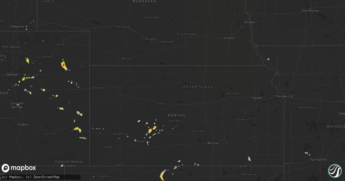
August 12 map
$229
one time, instant access
Download today. No call, no setup
Keep the $229
Bought the map and want the full workflow? Apply the entire $229 to a subscription within 7 days. None of it is wasted.
Every map, not just this one
This buys you this map. Subscription and you get every map we run, in the markets you choose from a few cities to whole states to nationwide. Plus real-time alerts the moment a storm fires.
Contact data
Name, contact info, occupancy, even credit band for addresses in the footprint. You go from where it hit to who to call.
Become the source they trust
Unlimited branding weather history reports on demand. You already have the documented answer ready for the property owner, and you are the one who showed up with it.
Property data and RoofTrace estimates
Pull up any address you have got, its value and the exact code rules for that jurisdiction, straight from One Click Code. Then RoofTrace estimates the squares, pitch, and roof value, priced the way you price.
States Impacted by Hail Map on August 12, 2013
Storm reports
Arkansas
| Date | Description |
|---|---|
| 08/12/20134:10 PM CDT | Tree limbs reported down. |
Delaware
| Date | Description |
|---|---|
| 08/12/20135:56 AM CDT | Trees down |
| 08/12/20135:56 AM CDT | Trees down |
| 08/12/20135:55 AM CDT | A local report indicates 60 MPH wind near NEWARK |
Virginia
| Date | Description |
|---|---|
| 08/12/20134:53 PM CDT | Tree down near richlands. Relayed by nws charleston wv from media. |
| 08/12/20134:30 PM CDT | Tree across the road on rt83 in haysi. |
| 08/12/20134:30 PM CDT | Tree across the road on rt83 in haysi. |
Mississippi
| Date | Description |
|---|---|
| 08/12/20136:45 PM CDT | Trees were downed on ms highway 528 east of bay springs and on cr 9 west of bay springs. |
| 08/12/20136:40 PM CDT | Trees downed on orange dr |
| 08/12/20136:40 PM CDT | Trees downed on orange dr at antioch dr |
| 08/12/20136:35 PM CDT | Tree downed at old highway 15 and tuckers crossing rd |
| 08/12/20136:35 PM CDT | Tree downed on euclid ave |
| 08/12/20136:35 PM CDT | Tree downed on elmo st |
| 08/12/20136:35 PM CDT | Tree downed at hogan rd and barlow rd |
| 08/12/20136:07 PM CDT | Powerlines down on highway 49. |
| 08/12/20136:02 PM CDT | Trees and powerlines down near sanford scarbrough rd. |
| 08/12/20135:53 PM CDT | Trees and powerlines down near william warren and earl stucky lane. |
| 08/12/20135:10 PM CDT | Large tree fell on ms highway 35 n near the intersection with ms highway 13...clipping a vehicle |
| 08/11/20138:23 PM CDT | Several trees down in the blackwater and oak grove communities. A tree was also repoted down along moscow rd northwest of blackwater. |
| 08/11/20137:00 PM CDT | Tree on a house |
Colorado
| Date | Description |
|---|---|
| 08/12/20136:23 PM CDT | Larger stones just to the north of observers house. Hail covered the ground to a depth of eight inches. 50 mph winds just before hail started |
| 08/12/20134:56 PM CDT | A local report indicates 1.00 inch wind near COLORADO SPRINGS |
| 08/12/20133:20 PM CDT | A local report indicates 1.00 inch wind near SE PARKER |
| 08/11/20137:52 PM CDT | A local report indicates 1.25 inch wind near 5 NE LAMAR |
Michigan
| Date | Description |
|---|---|
| 08/12/20136:06 PM CDT | 1 to 1.5 inch hail. Island lake rd and n territorial rd |
| 08/12/20136:06 PM CDT | Dan hoey rd and dexter ann arbor rd |
| 08/12/20135:30 PM CDT | Intersection of clinton and morton st |
| 08/12/20135:30 PM CDT | N territorial rd and stofer rd. Relayed via facebook. |
| 08/12/20135:20 PM CDT | Lasted 5 minutes. |
Tennessee
| Date | Description |
|---|---|
| 08/12/20136:05 PM CDT | A tree was downed near the intersection of rembert and harbert streets in midtown memphis. |
| 08/12/20139:36 AM CDT | Several trees were snapped or blown down at carr cemetery road and yates cave road. By apparent microburst. |
North Carolina
| Date | Description |
|---|---|
| 08/12/20135:35 PM CDT | A more detailed report. Trees down in the southern and eastern part of concord primarily along or near the intersection of warren c coleman blvd and north carolina high |
| 08/12/20135:35 PM CDT | An officer heard there were trees and limbs down with the storm but could not specify locations. Also heard another officer say hail fell but nobody knew a hail size. |
| 08/12/20135:32 PM CDT | 1 tree down 3 miles south of concord. |
| 08/12/20133:40 PM CDT | Trees down on 4th street lane nw and another tree down on 5th street nw. |
| 08/12/20132:42 PM CDT | Multiple trees down around mills river including on ray hill road as well as schoolhouse road and turnpike road. |
| 08/12/20131:25 PM CDT | Spotter just had quarter sized hail which started about 25 after and lasted about 10 minutes. A few stones may have been a bit larger. Also had strong wind gusts that b |
| 08/12/20131:03 AM CDT | Tree down on old glendon rd. |
| 08/11/201310:20 PM CDT | Tree down off rt 158 near rt 119 |
| 08/11/20139:55 PM CDT | One tree down along highway 158 west. |
Montana
| Date | Description |
|---|---|
| 08/12/20134:47 PM CDT | 59 mph wind gust at the brenner raws. |
| 08/11/201310:05 PM CDT | Hail up to ping pong ball size fell. |
| 08/11/201310:00 PM CDT | Report received of golfball-size hail on the gildford colony north of havre |
| 08/11/201310:00 PM CDT | Report received of golfball-size hail on the gildford colony north of havre |
| 08/11/20139:45 PM CDT | Hail from dime to quarter size fell. The hail fell on off for about 20 minutes. |
| 08/11/20139:39 PM CDT | A local report indicates 1.25 inch wind near 16 SSE RUDYARD |
| 08/11/20139:35 PM CDT | Hail up to golf ball size fell. Time of event is estimated. |
| 08/11/20139:30 PM CDT | Hail up to quarter size fell. The hail from pea to quarter size fell for about one half hour. The hail never covered the ground though. |
| 08/11/20138:15 PM CDT | Hail up to ping pong ball size fell. |
| 08/11/20138:06 PM CDT | Multiple trees and power lines down on whitetail dr and dolly varden dr |
South Carolina
| Date | Description |
|---|---|
| 08/12/20134:16 PM CDT | 1 small tree down and multiple large limbs down off anderson mill rd near roebuck. |
South Dakota
| Date | Description |
|---|---|
| 08/12/20133:33 PM CDT | A local report indicates 1.25 inch wind near 1 ENE DEERFIELD RESERVO |
| 08/11/20137:35 PM CDT | A local report indicates 2.00 inch wind near 13 WSW MUD BUTTE |
| 08/11/20137:35 PM CDT | A local report indicates 2.00 inch wind near 9 SW MUD BUTTE |
Kentucky
| Date | Description |
|---|---|
| 08/12/20135:24 PM CDT | Observer reported trees down. Dispatcher in the county confirms power lines down and homes struck by lightning. |
| 08/11/20139:15 PM CDT | A couple of tops blown out of trees on hwy 635. |
Indiana
| Date | Description |
|---|---|
| 08/12/20136:17 PM CDT | A few tree limbs down in wanatah. Diameter of tree limbs unknown. Relayed to nws by wsbt. |
| 08/12/20131:47 PM CDT | Tree down on old lanesville road in the georgetown area. Picture posted via facebook. |
Oklahoma
| Date | Description |
|---|---|
| 08/12/20136:48 PM CDT | Cr 1250 and whipperwill |
| 08/12/20135:33 PM CDT | Emergency management reports 4 inch tree limbs down...reports of power outages within city of sulphur. |
| 08/12/20134:15 PM CDT | Also sporadic 1 inch hail on hwy 33 between us 270 and sr 47. |
| 08/12/20134:15 PM CDT | A few shingles blown off a roof. Relayed report. |
| 08/11/201310:10 PM CDT | Fence damage and furniture blown over. Location...i-40 and morgan road. |
Idaho
| Date | Description |
|---|---|
| 08/12/20133:15 PM CDT | Numerous tree limbs around 1/2in diameter were all over the yard. Report based on local wind observations. |
| 08/12/20133:00 PM CDT | Shoshone-bannock tribal officials reported several trees down around town. Size unknown. |
Texas
| Date | Description |
|---|---|
| 08/12/20132:36 PM CDT | A local report indicates 58 MPH wind near 4 WNW AMARILLO |
Pennsylvania
| Date | Description |
|---|---|
| 08/12/20135:16 AM CDT | Downed trees and wires. |
| 08/12/20132:15 AM CDT | 1 tree down across road |
| 08/12/20131:25 AM CDT | Three trees down in the area. |
| 08/12/201312:10 AM CDT | A few large limbs and some power lines down. |
| 08/11/201311:57 PM CDT | Two trees down. |
| 08/11/201311:53 PM CDT | One tree down. |
Alabama
| Date | Description |
|---|---|
| 08/12/20134:58 PM CDT | One tree down along county road 99 near headland. |
| 08/12/20134:14 PM CDT | Coffee county emergency manager reported several trees down on the northern side of enterprise. |
Kansas
| Date | Description |
|---|---|
| 08/11/201310:40 PM CDT | A local report indicates 1.75 inch wind near BURDETT |
| 08/11/20139:28 PM CDT | A local report indicates 1.75 inch wind near 2 SSW HANSTON |
Georgia
| Date | Description |
|---|---|
| 08/12/20136:45 PM CDT | Trees down near thomas crossroads. Power also reported out. Powerlines were down in 4 areas. 500 block of shaw road...4000 and 4500 block of hwy 29 and 200 block of sam |
| 08/12/20134:25 PM CDT | Two trees were blown down at the entrance to the blythe island park. There was also damage to fencing. The time given was based on radar. |
Oregon
| Date | Description |
|---|---|
| 08/11/20139:30 PM CDT | A scanner picked up a report from osp of golfball size hail as well as inches of accumulating hail on the roadway at milepost 27 on highway 31. |
| 08/11/20139:20 PM CDT | Quarter size hail and locally hail has accumulated up to 3 inches deep. |
| 08/11/20137:05 PM CDT | Storm spotter reported via ham radio that quarter sized hail was falling from thunderstorm. |
Maryland
| Date | Description |
|---|---|
| 08/12/20135:50 AM CDT | 20 to 30 trees down 600 block knottingham road |
| 08/12/20135:18 AM CDT | Large tree down near intersection of rt 155 and rt 7a |
Ohio
| Date | Description |
|---|---|
| 08/12/20135:25 PM CDT | A couple of trees down. |
| 08/12/20135:20 PM CDT | An 8 inch diameter limb knocked down and a 12 to 16 inch diameter tree knocked over. |
Cities Impacted by Hail Map on August 12, 2013
- Seneca, NE
- Mobeetie, TX
- Lamar, CO
- Custer, MT
- Elkins, AR
- Winslow, AR
- Okemah, OK
- Okmulgee, OK
- Elkton, MD
- Newark, DE
- North East, MD
- Port Deposit, MD
- Charlestown, MD
- Perryville, MD
- Alva, OK
- Grand Valley, PA
- Spartansburg, PA
- Pittsfield, PA
- Spring Creek, PA
- Titusville, PA
- Arnett, OK
- Hingham, MT
- Finger, TN
- Henderson, TN
- Quail, TX
- Anadarko, OK
- Mayfield, KY
- Marion, KY
- Vona, CO
- Shirley, AR
- Edgemont, AR
- Mountain View, AR
- Ponchatoula, LA
- Steedman, MO
- Chamois, MO
- Mokane, MO
- Sedalia, CO
- Atkinson, NC
- Spearville, KS
- Pukwana, SD
- Hanston, KS
- Magdalena, NM
- St John, KS
- Limon, CO
- Colorado Springs, CO
- Stratton, CO
- Chelsea, MI
- Belleville, MI
- New Boston, MI
- Fox, AR
- Dunnellon, FL
- Parker, CO
- Hawthorne, FL
- Sulphur, OK
- Davis, OK
- Ledger, MT
- Concord, NC
- Cement, OK
- Chickasha, OK
- Bardstown, KY
- Gildford, MT
- Monroe, MI
- Akron, CO
- Detroit, MI
- Romulus, MI
- Taylor, MI
- White Sulphur Springs, MT
- Larned, KS
- Burdett, KS
- Elk City, KS
- Wellford, SC
- Duncan, SC
- Spartanburg, SC
- Moore, SC
- Roebuck, SC
- Roundup, MT
- Clarendon, TX
- Enville, TN
- Leedey, OK
- Lusk, WY
- Byers, CO
- Granada, CO
- Holly, CO
- Valentine, NE
- Jackson, TN
- Silver Lake, OR
- Fort Rock, OR
- Wright, KS
- Otis, CO
- Havre, MT
- Fort Benton, MT
- Chinook, MT
- Rudyard, MT
- Kremlin, MT
- Hobson, MT
- Lewistown, MT
- Yukon, OK
- Newell, SD
- Kinsley, KS
- Robinsonville, MS
- Hughes, AR
- Trumann, AR
- Rutledge, GA
- Madison, GA
- Elizabeth, CO
- Thomas, OK
- Taloga, OK
- Oakwood, OK
- Adrian, OR
- Havana, KS
- Mooreland, OK
- Bighorn, MT
- Morgantown, KY
- Sturkie, AR
- Moody, MO
- Viola, AR
- West Plains, MO
- Cimarron, KS
- Buffalo, OK
- Bennett, CO
- Brooklyn, MI
- Grass Lake, MI
- Wolf Lake, IL
- Milan, MI
- Bloomville, OH
- Sycamore, OH
- Gregory, MI
- Dexter, MI
- Stockbridge, MI
- Mullen, NE
- Ola, AR
- Royal, AR
- Geyser, MT
- Hammon, OK
- Sturgis, KY
- Williford, AR
- Chatsworth, GA
- Huntsville, AR
- Lavina, MT
- Aliceville, AL
- Calhan, CO
- Hedley, TX
- Fayetteville, AR
- Springdale, AR
- Conover, NC
- Roy, MT
- Lead, SD
- Hill City, SD
- Bethel Springs, TN
- Melbourne, AR
- Allen, OK
- Castle Rock, CO
- Owensville, MO
- Thedford, NE
- Custer City, OK
- Matheson, CO
- Freedom, OK
- Keenesburg, CO
- Roggen, CO
- Ford, KS
- Claude, TX
- Newport, MI
- Truth Or Consequences, NM
- Cascade, MT
- Klamath Falls, OR
- Keno, OR
- Gravelly, AR
- Bluffton, AR
- Versailles, KY
- Cedar Hill, MO
- Dittmer, MO
- McCutchenville, OH
- Carey, OH
- Cody, NE
- Lipscomb, TX
- Higgins, TX
- Ocala, FL
- Reddick, FL
- Cameron, OK
- Lelia Lake, TX
- Cheyenne Wells, CO
- Calvin, OK
- Ramah, CO
- New Bloomfield, MO
- Dayton, WA
- Republic, OH
- Morriston, FL
- Newark, AR
- Sulphur Rock, AR
- Carpenter, WY
- Burns, WY
- Mountainburg, AR
- Alma, AR
- Hendersonville, TN
- Gallatin, TN
- Mcalester, OK
- Conrad, MT
- Bluff City, KS
- Garfield, KS
- Surrency, GA
- Mound City, MO
- Newnan, GA
- Leslie, MI
- Munith, MI
- Fort Cobb, OK
- Oklahoma City, OK
- Forsyth, MT
- Fort Thompson, SD
- Ismay, MT
- Fort Smith, AR
- Charleston, AR
- Lavaca, AR
- Mount Judea, AR
- Hardtner, KS
- Medicine Lodge, KS
- Siloam Springs, AR
- Dresden, TN
- Palmersville, TN
- Jackson, MI
- Clay, KY
- Ness City, KS
- Maybee, MI
- Manchester, MI
- Saline, MI
- Britton, MI
- Clinton, MI
- Springfield, TN
- Anthony, KS
- Hickory, NC
- Newton, NC
- Benton, KY
- Fay, OK
- Franktown, CO
- Jetmore, KS
- Tuthill, SD
- Pawnee, OK
- Bloomfield, KY
- Portales, NM
- Greenfield, MO
- Everton, MO
- South Greenfield, MO
- Dodge City, KS
- Batesville, AR
- Kit Carson, CO
- Haswell, CO
- Porterville, MS
- Alexander, KS
- Molino, FL
- Lexington, TN
- Harriet, AR
- Cassopolis, MI
- Vandalia, MI
- Sheridan Lake, CO
- Hugo, CO
- Inverness, MT
- Moore, MT
- Union, MO
- Carleton, MI
- Brinkley, AR
- Aurora, CO
- Sedgewickville, MO
- Perryville, MO
- Friedheim, MO
- Imboden, AR
- Enterprise, MS
- Meridian, MS
- Milton, FL
- Jay, FL
- Salem, KY
- Burna, KY
- Lowell, AR
- Lowell, IN
- Hebron, IN
- Syracuse, KS
- Ada, OK
- Elizabethtown, IL
- Denmark, TN
- Wellington, TX
- Offerle, KS
- Witter, AR
- Agate, CO
- Gann Valley, SD
- Palestine, AR
- Chiloquin, OR
- Humboldt, TN
- Grass Range, MT
- Perry Point, MD
- Havre De Grace, MD
- Bear, DE
- Moccasin, MT
- Ash Grove, MO
- Vienna, IL
- Strasburg, CO
- Jackson, MO
- Havelock, NC
- Emelle, AL
- Gainesville, AL
- Boligee, AL
- Kiowa, CO
- Elbert, CO
- Dodson, TX
- Perry, OH
- Depew, OK
- Stroud, OK
- Dongola, IL
- Buncombe, IL
- Madisonville, KY
- Greer, SC
- Beeler, KS
- Tupelo, OK
- Friendship, TN
- Trenton, TN
- Fredonia, KY
- Centerville, PA
- Glenwood, AR
- Bernice, LA
- Homer, LA
- Seibert, CO
- Elk Mills, MD
- Rising Sun, MD
- Beech Bluff, TN
- Golconda, IL
- Hampton, KY
- Crown Point, IN
- Robertsville, MO
- Hillsboro, MO
- Providence, KY
- Dixon, KY
- Mena, AR
- Allen, SD
- Garden City, KS
- Masterson, TX
- Longmont, CO
- Kiowa, KS
- Ingalls, KS
- Newport, OH
- Marietta, OH
- Putnam, OK
- Vanlue, OH
- Findlay, OH
- Derby, IN
- Leopold, IN
- Cannelton, IN
- Gracemont, OK
- Pine Bluffs, WY
- Amarillo, TX
- Jordan Valley, OR
- Kannapolis, NC
- Salem, SC
- Danville, AR
- Pooler, GA
- Bloomingdale, GA
- Granite Falls, NC
- Springfield, KY
- Medon, TN
- Pinson, TN
- Independence, KS
- Dorris, CA
- Centreville, MI
- Perryville, AR
- Houston, AR
- Camp, AR
- Mammoth Spring, AR
- Brunswick, GA
- De Kalb, MS
- Wiggins, CO
- Hampstead, NC
- Holly Ridge, NC
- Ripley, TN
- Henning, TN
- Melrose, FL
- Keystone Heights, FL
- Cordell, OK
- Black Rock, AR
- Smithville, AR
- Claremont, NC
- Dahlonega, GA
- Norris, SD
- Clyde, OH
- Stonewall, OK
- Lakin, KS
- Adona, AR
- Casa, AR
- Ozark, AR
- Malta, MT
- Pleasant Lake, MI
- Cheyenne, WY
- Bethune, CO
- Verden, OK
- Canton, NC
- Clyde, NC
- Carnegie, OK