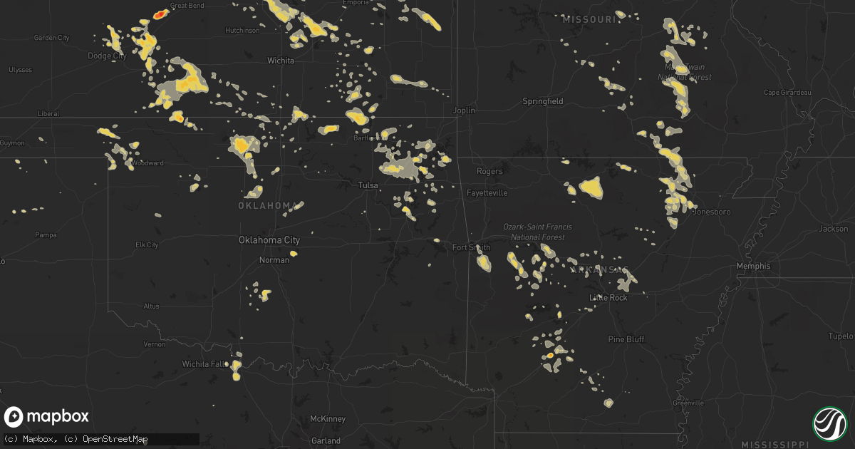
Hail Map on August 12, 2011
Get this storm
August 12 map
$229
one time, instant access
Download today. No call, no setup
Keep the $229
Bought the map and want the full workflow? Apply the entire $229 to a subscription within 7 days. None of it is wasted.
Every map, not just this one
This buys you this map. Subscription and you get every map we run, in the markets you choose from a few cities to whole states to nationwide. Plus real-time alerts the moment a storm fires.
Contact data
Name, contact info, occupancy, even credit band for addresses in the footprint. You go from where it hit to who to call.
Become the source they trust
Unlimited branding weather history reports on demand. You already have the documented answer ready for the property owner, and you are the one who showed up with it.
Property data and RoofTrace estimates
Pull up any address you have got, its value and the exact code rules for that jurisdiction, straight from One Click Code. Then RoofTrace estimates the squares, pitch, and roof value, priced the way you price.
States Impacted by Hail Map on August 12, 2011
Storm reports
Kansas
| Date | Description |
|---|---|
| 08/12/20116:39 PM CDT | A local report indicates 70 MPH wind near MEDICINE LODGE |
| 08/12/20116:27 PM CDT | 35 foot trailer was blown on top of a chevy suburban. |
| 08/12/20116:23 PM CDT | Tops of power poles snapped at 20th st sw of pratt |
| 08/12/20116:22 PM CDT | Numerous trees damaged in pratt with 3 to 6 inch limbs down. |
| 08/12/20116:16 PM CDT | A local report indicates 80 MPH wind near 5 S PRATT |
| 08/12/20116:15 PM CDT | Homeowner lost a few wood shingles on home from the strong thunderstorm winds. |
| 08/12/20116:11 PM CDT | A local report indicates 80 MPH wind near 1 W PRATT |
| 08/12/20116:07 PM CDT | A local report indicates 75 MPH wind near 5 W PRATT |
| 08/12/20116:01 PM CDT | A local report indicates 65 MPH wind near 3 ENE CULLISON |
| 08/12/20115:45 PM CDT | Three inch tree limbs were blown down. |
| 08/12/20115:39 PM CDT | A local report indicates 60 MPH wind near 2 W CULLISON |
| 08/12/20115:37 PM CDT | A local report indicates 60 MPH wind near TROUSDALE |
| 08/12/20115:34 PM CDT | A local report indicates 1.00 inch wind near 5 S COLDWATER |
| 08/12/20115:29 PM CDT | Quarter size hail as well mixed in with nickel size hail |
| 08/12/20115:29 PM CDT | A local report indicates 1.00 inch wind near 2 NNE CENTERVIEW |
| 08/12/20115:22 PM CDT | 1 inch live tree limbs down. |
| 08/12/20115:03 PM CDT | Large limbs down over 183 in kinsley |
| 08/12/20115:00 PM CDT | A local report indicates 1.50 inch wind near 1 S KINSLEY |
| 08/12/20115:00 PM CDT | A local report indicates 65 MPH wind near 1 S KINSLEY |
| 08/12/20114:50 PM CDT | A local report indicates 60 MPH wind near 6 NNE WRIGHT |
| 08/12/20114:50 PM CDT | Railroad crossing arm blown off |
| 08/12/20114:46 PM CDT | A local report indicates 2.50 inch wind near 1 SSE ASH VALLEY |
| 08/12/20114:17 PM CDT | A local report indicates 1.25 inch wind near 5 S JETMORE |
| 08/12/20114:17 PM CDT | A local report indicates 60 MPH wind near 5 S JETMORE |
| 08/12/20114:08 PM CDT | A local report indicates 1.00 inch wind near BURDETT |
| 08/11/20119:24 PM CDT | A local report indicates 60 MPH wind near PARSONS |
| 08/11/20119:16 PM CDT | 60-65 mph winds estimated |
| 08/11/20119:03 PM CDT | Power lines down. |
| 08/11/20118:53 PM CDT | A local report indicates 60 MPH wind near 6 N EL DORADO |
| 08/11/20118:50 PM CDT | Report of a railroad tie being picked up and damaging a fence. Also reported an alumminum flagpole being snapped in half and several tree limbs at least 3 inches in dia |
| 08/11/20118:50 PM CDT | A local report indicates 58 MPH wind near JABARA AIRPORT |
| 08/11/20118:49 PM CDT | A local report indicates 60 MPH wind near 8 N EL DORADO |
| 08/11/20118:48 PM CDT | A local report indicates 60 MPH wind near 5 SE WHITEWATER |
| 08/11/20118:35 PM CDT | Tree damage due to strong winds |
| 08/11/20118:30 PM CDT | A local report indicates 60 MPH wind near BURNS |
| 08/11/20118:30 PM CDT | Report of a railroad tie being picked up and damaging a fence. Also reported an alumminum flagpole being snapped in half and several tree limbs at least 3 inches in dia |
| 08/11/20118:30 PM CDT | Leaves stripped from trees and reported an antenna blown off roof. |
| 08/11/20118:29 PM CDT | A local report indicates 75 MPH wind near ELBING |
| 08/11/20118:18 PM CDT | A local report indicates 62 MPH wind near 1 NW NEWTON |
| 08/11/20118:17 PM CDT | A local report indicates 70 MPH wind near NEWTON |
| 08/11/20118:10 PM CDT | 12 inch diameter tree down |
| 08/11/20118:10 PM CDT | Numerous branches down |
| 08/11/20118:05 PM CDT | Trees described as damaged |
| 08/11/20118:05 PM CDT | Delayed report from a trained spotter of 60 to 70 mph winds and pea hail. |
| 08/11/20118:05 PM CDT | Delayed report from trained spotter of 6 to 8 inch tree limbs down as well as several powerlines. |
| 08/11/20118:00 PM CDT | A local report indicates 70 MPH wind near 1 N GOESSEL |
| 08/11/20117:53 PM CDT | A local report indicates 60 MPH wind near MOUNDRIDGE |
| 08/11/20117:50 PM CDT | A local report indicates 60 MPH wind near 5 E ARGONIA |
| 08/11/20117:45 PM CDT | A local report indicates 1.00 inch wind near 2 E GALVA |
| 08/11/20117:45 PM CDT | A local report indicates 60 MPH wind near 1 NE GALVA |
| 08/11/20117:41 PM CDT | A local report indicates 1.25 inch wind near 1 ENE GALVA |
| 08/11/20117:38 PM CDT | A local report indicates 65 MPH wind near 1 N GALVA |
| 08/11/20117:25 PM CDT | A local report indicates 60 MPH wind near DANVILLE |
| 08/11/20117:24 PM CDT | Observed limbs blown down in neighbors yard with estimated 70 mph gust. |
| 08/11/20117:11 PM CDT | Small limbs reported to be blown from trees. |
| 08/11/20117:09 PM CDT | A local report indicates 70 MPH wind near 2 N ANTHONY |
| 08/11/20117:08 PM CDT | Observer estimated at least 60 mph wind gust. Noted small limbs blown off of trees. |
| 08/11/20117:01 PM CDT | Some tree limbs were downed. |
| 08/11/20117:01 PM CDT | Some tree limbs were downed. |
| 08/11/20117:00 PM CDT | Spotter estimated 85 mph wind gust in attica. |
Alabama
| Date | Description |
|---|---|
| 08/12/20112:00 PM CDT | A tree was blown down onto powerlines. |
Illinois
| Date | Description |
|---|---|
| 08/12/20116:42 PM CDT | Several 3 to 6 inch diameter tree limbs down. Estimated time. Relayed by wifr. |
| 08/12/20116:32 PM CDT | Several 3 to 6 inch diameter tree limbs down. Estimated time. Relayed by wifr. |
| 08/12/20115:50 PM CDT | 4-5 inch diameter tree limbs down. |
| 08/12/20115:15 PM CDT | A local report indicates 61 MPH wind near FREEPORT ALBERTUS AIRPO |
Arizona
| Date | Description |
|---|---|
| 08/12/20116:50 PM CDT | Numerous power poles down in and around san carlos. |
| 08/11/20118:28 PM CDT | A local report indicates 68 MPH wind near 4 ENE SAFFORD |
Wisconsin
| Date | Description |
|---|---|
| 08/11/20117:40 PM CDT | At rock lake...boats on lifts moved...one 40 to 50 yards from its original spot. 2 foot tree snapped at base. Observed from intersection of lakeshore drive and college |
| 08/11/20117:20 PM CDT | Trees and power lines down near intersection of highway p and allen rd. Time estimated. |
North Dakota
| Date | Description |
|---|---|
| 08/12/20115:35 PM CDT | A few hail stones walnut size. Time approximate. |
| 08/12/20114:00 PM CDT | A local report indicates 1.00 inch wind near 7 ESE MARION |
| 08/12/20114:00 PM CDT | Quarter to nickel hail caused crop damage. |
| 08/12/20113:45 PM CDT | Minor street flooding reported. |
| 08/12/20113:38 PM CDT | A local report indicates 1.00 inch wind near 4 S BERLIN |
| 08/12/20113:25 PM CDT | Lasted around 5 minutes |
| 08/12/20113:13 PM CDT | 1.83 inches of rain in 20 minutes. |
| 08/12/20112:50 PM CDT | Also measued 3.30 inches of rain during the storm. |
| 08/12/20112:31 PM CDT | Lasted around 5 minutes. |
| 08/12/20112:25 PM CDT | Lasted a few minutes. Very heavy rain. 50 mph wind gusts. |
| 08/12/20111:30 PM CDT | Torrential rains with numerous nickel to walnut sized hail. Hail began smaller and increased in size from about 125 to 130 pm cdt. |
Oklahoma
| Date | Description |
|---|---|
| 08/12/20116:50 PM CDT | Moderate roof dmg woodward fire dept |
| 08/12/20116:45 PM CDT | Kwdg awos |
| 08/12/20116:45 PM CDT | Moderate roof damage apt cmplx west side of town |
| 08/12/20116:45 PM CDT | 80 x 120 ft pole barn destroyed |
| 08/12/20116:35 PM CDT | Major damage to the vo/ag building at fargo. /corrected time and location of fargo instead of woodward/ |
| 08/12/20116:30 PM CDT | East side... |
| 08/12/20116:27 PM CDT | Kwwr awos |
| 08/12/20115:50 PM CDT | Tree downed on mobile home. Multiple 8-12 inch diameter trees fallen around town. |
| 08/12/20115:45 PM CDT | A local report indicates 1.00 inch wind near 2 W TAHLEQUAH |
| 08/12/20115:30 PM CDT | Tree blown over onto mobile home on west side of city. Power line reported downed on east side. Time approximate. |
| 08/12/20115:10 PM CDT | Gusts to 60 and higher along outflow gust front ahead of thunderstorms. |
| 08/12/20115:00 PM CDT | Lindsay pd |
| 08/11/201110:23 PM CDT | Penn and edmond rd |
| 08/11/201110:19 PM CDT | Hefner and county line rd |
| 08/11/201110:08 PM CDT | Kclk awos |
| 08/11/201110:00 PM CDT | A local report indicates 62 MPH wind near 4 WNW BESSIE |
| 08/11/20119:30 PM CDT | A local report indicates 59 MPH wind near 5 SW BUTLER |
| 08/11/20119:20 PM CDT | A local report indicates 63 MPH wind near 4 SSE MARSHALL |
| 08/11/20119:15 PM CDT | A local report indicates 58 MPH wind near 4 SSE MARSHALL |
| 08/11/20118:43 PM CDT | Power lines down intersection of 15th and randolph |
| 08/11/20118:40 PM CDT | Power lines down intersection of washington and broadway |
| 08/11/20118:30 PM CDT | A local report indicates 61 MPH wind near 1 WSW LAHOMA |
| 08/11/20118:25 PM CDT | Hillsdale fd |
| 08/11/20118:06 PM CDT | Nash pd 55-60 mph gust |
| 08/11/20117:10 PM CDT | A local report indicates 60 MPH wind near 2 W BURLINGTON |
Georgia
| Date | Description |
|---|---|
| 08/12/20115:40 PM CDT | Trees and power lines down on lake gale dr and intersection of hwy 18 and hwy 84. |
| 08/12/20115:30 PM CDT | Law enforcement reported a tree and a powerline down in st. Marys. A retired nws employee estimated the winds at 50 to 55 mph in this area. |
| 08/12/20113:24 PM CDT | 6 pine tree snapped along palmetto drive southeast of rincon. |
| 08/11/20118:30 PM CDT | Reports of trees down across the county...especially on east side. |
| 08/11/20117:00 PM CDT | Tree limbs about 4 inches in diameter were blown down. A weighted canopy was blown down on base outside of a store front. There were some power outages along spurr 40 w |
South Carolina
| Date | Description |
|---|---|
| 08/12/20116:40 PM CDT | Reports of 50 to 60 trees blown down in vicinity of johnson road and zion church road. A few trees on houses. |
| 08/12/20116:40 PM CDT | Public report of trees down. |
| 08/12/20116:38 PM CDT | Hail estimated to be half dollar sized fell about 2 miles east of liberty. |
| 08/12/20116:32 PM CDT | Trees and large limbs down along smith grove road. Power is also reported to be out for parts of this area near easley. |
| 08/12/20116:20 PM CDT | Fire department cleared a tree from mush creek road that was a live green tree. Wind was quite strong in the area but does not know of any other trees or limbs down at |
| 08/12/20114:55 PM CDT | Dispatch center reported a tree down blocking both lanes of cypress creek rd. |
| 08/12/20114:15 PM CDT | Trees down at the intersection of highway 78 and cedar rd. |
| 08/12/20113:30 PM CDT | A fire department reported one 4 to 5 inch diameter branch fell onto the fire dept building. |
| 08/12/20113:30 PM CDT | Law enforcement reported one tree down near the intersection of augusta highway and patterson mill road. |
| 08/12/20113:25 PM CDT | *** 1 inj *** a fire dept reported one tree down and on a car near the intersection of hwy 46 and rose dhu creek plantation. 1 person was injured. Extent of injuries un |
| 08/12/20113:07 PM CDT | Trees down on honey lane. |
| 08/12/20113:05 PM CDT | Trees down on chickadee street. |
| 08/12/20113:03 PM CDT | Trees down on glover road. |
| 08/12/201111:16 AM CDT | Large limbs down near holmes bridge rd |
| 08/11/20118:00 PM CDT | *** 7 inj *** county reports camper overturned by wind with multiple injuries to persons inside. Numerous trees blown down along campers way...highway 29...and ginn roa |
| 08/11/20117:55 PM CDT | A few trees down in the fair play area. |
| 08/11/20117:50 PM CDT | Many trees down in this area...worst on west pine grove road...trees and powerlines down on river bend road...trees down on dairy farm road and trees down on shore driv |
| 08/11/20117:15 PM CDT | Large limbs and one tree down off of chantilly ln nr lake hartwell |
North Carolina
| Date | Description |
|---|---|
| 08/12/20113:10 PM CDT | Trees and power lines down along stag park road between i-40 and highway 53. |
| 08/12/20111:57 PM CDT | One tree down on willoughby road. |
| 08/12/201112:33 PM CDT | Tree down on rabbit hollow road. Time estimated from radar. |
| 08/12/201112:29 PM CDT | Spotter reported trees and powerlines down on sam miller road just south of warsaw. |
| 08/12/201112:25 PM CDT | Trees down on maysville school road. |
| 08/12/201112:25 PM CDT | Welding shop destroyed near the 200 block of hwy 403 by straight line winds. Winds estimated at 70 to 80 mph. |
| 08/12/201112:23 PM CDT | Trees down on beaman old creek road with marble size hail. |
| 08/12/201112:23 PM CDT | Powerlines and trees down on sandpit road. |
| 08/12/201112:19 PM CDT | Spotter reported trees down and heavy rain on beautancus road in beautancus. |
| 08/12/201112:15 PM CDT | Gas station awning blown down in mount olive |
| 08/12/201112:15 PM CDT | Several trees down on mount olive college campus |
| 08/12/201112:15 PM CDT | Building blown off of foundation |
| 08/12/201112:03 PM CDT | Dime sized hail and trees down on west college st |
| 08/12/201111:53 AM CDT | Trees down in stantonsburg |
| 08/12/201111:40 AM CDT | Trees and power poles and lines down on hwy 58. |
| 08/12/201111:35 AM CDT | Power poles down at wilson county water treatment plant - plant without power |
| 08/12/201111:35 AM CDT | Golfball size hail was reported. Two trees were also blown down. |
| 08/12/201111:32 AM CDT | Jones county sheriffs deputy reported golf ball size hail off davis field road near pollocksville. |
| 08/12/201111:30 AM CDT | Golf ball size hail damaged several mobile homes and crops |
| 08/12/201111:26 AM CDT | Tree down near pine street |
| 08/12/201111:25 AM CDT | Tree down on white oak road. Relayed from 911 center. |
| 08/12/201110:45 AM CDT | A local report indicates 1.00 inch wind near CARDINAL VILLAGE |
| 08/12/201110:42 AM CDT | A local report indicates 1.00 inch wind near DEERFIELD |
| 08/12/201110:18 AM CDT | Tree down on a power line |
Virginia
| Date | Description |
|---|---|
| 08/12/20115:25 PM CDT | A couple of trees and a power line down near cedar point lane. |
Michigan
| Date | Description |
|---|---|
| 08/12/20113:20 PM CDT | Nickel to quarter-sized hail observed at the far west end of big manistique lake near germfask. |
Arkansas
| Date | Description |
|---|---|
| 08/12/20116:40 PM CDT | Large tree fell on a house. Significant structural damage. |
| 08/12/20111:20 AM CDT | A local report indicates 1.75 inch wind near SHILOH |
| 08/11/201110:17 PM CDT | Trees were blown down on u.s. 270. |
| 08/11/201110:17 PM CDT | Trees were blown down. |
| 08/11/201110:05 PM CDT | A tree was blown down onto a vehicle on caney road. It is unknown if there were any injuries. |
| 08/11/20119:45 PM CDT | Numerous trees down in bryant. Winds estimated to be 60 to 70 mph. |
| 08/11/20119:36 PM CDT | Several large trees were blown down in augusta. |
| 08/11/20119:35 PM CDT | Wind gusts estimated at 60 to 65 mph in maumelle. |
| 08/11/20119:31 PM CDT | Trees and power lines were blown down. |
| 08/11/20119:31 PM CDT | Trees and power lines were blown down. |
| 08/11/20119:24 PM CDT | Trees were blown down blocking the road in the gulpha gorge area. |
| 08/11/20119:17 PM CDT | Trees were blown down across roads and power lines were blown down. |
| 08/11/20119:06 PM CDT | Tree fell on a business. Power poles down in town. |
| 08/11/20119:00 PM CDT | Trees and powerlines down |
| 08/11/20118:58 PM CDT | Numerous trees down on highway 9. |
| 08/11/20118:50 PM CDT | Trees and powerlines down. Street signs blown down. |
| 08/11/20118:50 PM CDT | Numerous tress and powerlines down in the city. Several street signs also blown over. |
| 08/11/20118:50 PM CDT | A local report indicates 1.00 inch wind near MORRILTON |
| 08/11/20118:40 PM CDT | Trees were blown down and small outbuildings were damaged at buckville. |
| 08/11/20118:20 PM CDT | Trees and powerlines down |
| 08/11/20118:11 PM CDT | Dime to quarter size hail and gusty winds in the town of black rock. |
| 08/11/20117:30 PM CDT | Trees down in booneville |
| 08/11/20117:22 PM CDT | Trees down in cauksville. |
| 08/11/20117:10 PM CDT | One tree blown down near whipporwill and ware road. Many broken tree limbs. House struck by lightning. All in greenwood area. |
New Mexico
| Date | Description |
|---|---|
| 08/11/20117:52 PM CDT | Schoolnet site. |
| 08/11/20117:49 PM CDT | Kvii schoolnet site. |
| 08/11/20117:45 PM CDT | Schoolnet site. |
Texas
| Date | Description |
|---|---|
| 08/12/20114:47 PM CDT | A local report indicates 1.00 inch wind near 4 E STRATFORD |
| 08/12/20115:20 AM CDT | Texas tech mesonet site |
Missouri
| Date | Description |
|---|---|
| 08/12/20116:38 PM CDT | A local report indicates 1.00 inch wind near MYRTLE |
| 08/12/20115:23 PM CDT | Several large trees blown down. |
| 08/12/20115:00 PM CDT | Estimated 65 to 70 mph winds at lake killarney...no damage so far. |
| 08/12/20115:00 PM CDT | Lots of two to three inch tree limbs blown down...one six inch tree limb blown down at lake killarney. |
| 08/12/20114:58 PM CDT | Numerous tree limbs blown down...so of which were six inches in diameter. |
| 08/12/20114:55 PM CDT | Several trees blown down. Minor roof damage to outbuilding. |
| 08/12/20114:45 PM CDT | Emergency manager estimated wind gusts up to 60 mph. Several trees and power lines blown down in the city of salem. One tree fell on house. |
| 08/12/20114:40 PM CDT | One to two inch tree limbs blown down around town. |
| 08/12/20114:33 PM CDT | Two to three inch tree limbs blown down. |
| 08/12/20114:29 PM CDT | Three inch diameter tree limbs blown down. |
| 08/12/20114:20 PM CDT | Power lines blown down. |
| 08/12/201111:42 AM CDT | A local report indicates 1.00 inch wind near 3 W PLEASANT HILL |
Florida
| Date | Description |
|---|---|
| 08/12/20116:35 PM CDT | The t and f eletric company reported several trees down along sw big tree road. |
| 08/12/20116:35 PM CDT | An employee at the t and f electric company reported several trees down along breezy point road. |
| 08/12/20116:25 PM CDT | Law enforcement reported a tree and power line down on mickler road in the ponte vedra area. Two tree fires caused by lightning were also reported in this area. |
| 08/12/20116:10 PM CDT | 2 trees were reported blown down at the bradford motel and campground in starke. One tree fell on a vehicle. Another tree was reported down on ne 28th ave near this are |
| 08/12/20116:00 PM CDT | Law enforcement reported a tree down on bishop estates road. |
| 08/12/20115:55 PM CDT | Law enforcement reported a tree down in the mandarin area. |
| 08/12/20115:53 PM CDT | Law enforcement reported a tree down on maxville middleburg road. |
| 08/12/20115:50 PM CDT | Law enforcement reported a small tree down on victoria drive. |
| 08/12/20115:35 PM CDT | Quarter size hail was reported along moody drive near doctors lake. |
| 08/12/20115:33 PM CDT | Golfball size hail was reported along u.s. Highway 17 on the northend of fleming island across from pace island. |
| 08/12/20115:20 PM CDT | Marion county dispatch reported widespread tree damage along highway 301 and county road 318 in the city limits of citra. An hour later numerous road crews were out sti |
| 08/12/20115:10 PM CDT | Tree was reported blown down at 1550 w newberry rd. |
| 08/12/20115:00 PM CDT | A home was damaged by a fallen tree. No injuries were reported. The time of the event was based on radar. |
| 08/12/20114:05 PM CDT | Numerous trees were blown down in the anthony cith limits. The time of damage was based on radar imagery. |
| 08/12/20113:50 PM CDT | Trees were blown down at sunset driev and hess road. |
| 08/12/20113:40 PM CDT | Three large trees were blown down across huninton road at the railroad tracks. The amtrack train had to be stopped an the tracks were still being cleared of debris abou |
| 08/12/20113:40 PM CDT | Trees were blown down at oleander street and lake margaret boulevard. |
| 08/12/20111:45 PM CDT | A few trees and powerlines down east of capps on us-27. Time estimated by radar. |
Cities Impacted by Hail Map on August 12, 2011
- Show Low, AZ
- Peru, KS
- Sedan, KS
- Pawhuska, OK
- Copan, OK
- Chautauqua, KS
- Crawfordville, FL
- Marion, KS
- Kanopolis, KS
- Ellsworth, KS
- Bourbon, MO
- Leasburg, MO
- Mcloud, OK
- Newalla, OK
- Tecumseh, OK
- Alva, OK
- Round O, SC
- Burrton, KS
- Buhler, KS
- Wilson, KS
- San Carlos, AZ
- Peridot, AZ
- Lamoure, ND
- Berlin, ND
- Harvey, ND
- Muskegon, MI
- Steele, ND
- Sawyer, KS
- Centerville, KS
- Yellville, AR
- Valley Springs, AR
- Flippin, AR
- Mountain Home, AR
- Big Flat, AR
- Harriet, AR
- Saint Joe, AR
- Bunker, MO
- Black, MO
- Boss, MO
- Bixby, MO
- Matfield Green, KS
- Glennville, GA
- Big Cabin, OK
- Lead Hill, AR
- Easley, SC
- Braman, OK
- Blackwell, OK
- Whitewater, KS
- Burdett, KS
- Larned, KS
- Tuttle, ND
- Florence, KS
- Burns, KS
- Cassoday, KS
- Birch Tree, MO
- Edgefield, SC
- Zolfo Springs, FL
- Perry, OK
- Atkins, AR
- Morrilton, AR
- Walton, KS
- Newton, KS
- Jetmore, KS
- Blue Mound, KS
- Garnett, KS
- Mapleton, KS
- Mound City, KS
- Mcpherson, KS
- Kremlin, OK
- Gepp, AR
- Pratt, KS
- Coats, KS
- Sun City, KS
- Lake City, KS
- Medicine Lodge, KS
- Odum, GA
- Sheyenne, ND
- Shidler, OK
- Salina, OK
- Spavinaw, OK
- Adair, OK
- Pryor, OK
- Yulee, FL
- Thayer, MO
- Couch, MO
- Saffell, AR
- Cord, AR
- Fleming Island, FL
- Middleburg, FL
- Jacksonville, FL
- Green Cove Springs, FL
- Orange Park, FL
- New Rockford, ND
- Morriston, FL
- Dunnellon, FL
- Fessenden, ND
- Pingree, ND
- Oakes, ND
- Milton, WI
- Hernando, FL
- Inverness, FL
- Hosford, FL
- Sopchoppy, FL
- Cathay, ND
- Pond Creek, OK
- Medford, OK
- Wright, KS
- Dodge City, KS
- Hennessey, OK
- Verndale, MN
- Havana, AR
- Blue Mountain, AR
- Magazine, AR
- Jay, OK
- Grove, OK
- Britton, SD
- Ward, AR
- Harveyville, KS
- Auburn, KS
- Arcadia, FL
- Clovis, NM
- Montpelier, ND
- Hardeeville, SC
- Gate, OK
- Rosston, OK
- Laverne, OK
- Havana, KS
- Caney, KS
- Wyndmere, ND
- Hot Springs National Park, AR
- Warthen, GA
- Sandersville, GA
- Bald Knob, AR
- Hecla, SD
- Starke, FL
- Kinsley, KS
- Spearville, KS
- Greensburg, KS
- Lewis, KS
- Offerle, KS
- Moorhead, MN
- Argusville, ND
- El Dorado, KS
- Lavonia, GA
- Hartwell, GA
- Everton, AR
- Harrison, AR
- Ponca City, OK
- Butler, OK
- Leedey, OK
- Ellington, MO
- Salem, MO
- Belview, MN
- Redwood Falls, MN
- Waldron, AR
- Danville, AR
- Stinnett, TX
- Shattuck, OK
- Huntington, AR
- Booneville, AR
- Mansfield, AR
- Greenwood, AR
- Buffalo, OK
- Coldwater, KS
- Monroe Center, IL
- Davis Junction, IL
- Lindenwood, IL
- Stillman Valley, IL
- Lindsay, OK
- Saint Paul, KS
- Parsons, KS
- Anthony, FL
- Fort McCoy, FL
- Citra, FL
- Balaton, MN
- Ruthton, MN
- Hope, ND
- Ridgeland, SC
- Aiken, SC
- Williamsburg, KS
- Mary Esther, FL
- Fort Walton Beach, FL
- Peace Valley, MO
- West Plains, MO
- Pomona, MO
- Adona, AR
- Perry, AR
- Macks Creek, MO
- Bellevue, TX
- Henrietta, TX
- Enid, OK
- Spearman, TX
- Llano, TX
- Haviland, KS
- Wadena, MN
- Glenfield, ND
- Sebring, FL
- Lake Placid, FL
- Howard, KS
- Elk Falls, KS
- Moline, KS
- Stover, MO
- Longdale, OK
- Okeene, OK
- Ridgeville, SC
- Ola, AR
- Plainview, AR
- Belleville, AR
- Maysville, NC
- Robinson, ND
- Eureka, KS
- Jamestown, ND
- Attica, KS
- Fargo, OK
- Twin Valley, MN
- Anthony, KS
- Ryan, OK
- Maddock, ND
- El Paso, AR
- Lebanon, MO
- Collinsville, OK
- Hawthorne, FL
- Micanopy, FL
- Madison, MN
- Mayo, FL
- Wrightsville, GA
- Falun, KS
- Springfield, AR
- Prospect Hill, NC
- Cedar Grove, NC
- Mebane, NC
- Portland, ND
- Muskogee, OK
- Marshall, OK
- Dardanelle, AR
- Ocala, FL
- Dixie, GA
- Alicia, AR
- Byron, IL
- Barnwell, SC
- Whitewater, WI
- Mullinville, KS
- Chokio, MN
- Morris, MN
- Hillsboro, ND
- Protection, KS
- Talala, OK
- Richland, MO
- Crocker, MO
- Meta, MO
- Topeka, KS
- Maple Hill, KS
- Bismarck, AR
- Donaldson, AR
- Malvern, AR
- Little River, KS
- Martin, SC
- Allendale, SC
- Danielsville, GA
- Longton, KS
- Nahunta, GA
- Patterson, GA
- Steelville, MO
- Dawson, ND
- Lenapah, OK
- Delaware, OK
- Colbert, GA
- Luray, SC
- Fredonia, KS
- Wilmore, KS
- McCune, KS
- Assaria, KS
- Gypsum, KS
- Paris, AR
- Reading, KS
- Woodworth, ND
- Brookville, KS
- Pawnee, OK
- Turkey, NC
- Warsaw, NC
- Tyler, MN
- Tuckerman, AR
- Pleasant Hill, MO
- Winona, MO
- Isabel, KS
- Newport, AR
- Gurdon, AR
- Okolona, AR
- Mitchell, GA
- Fort Myers, FL
- Rutledge, GA
- Mount Olive, NC
- Faison, NC
- Dudley, NC
- Kenansville, NC
- Trenton, NC
- Pollocksville, NC
- Brooklet, GA
- Stantonsburg, NC
- Walstonburg, NC
- Snow Hill, NC
- Greenwood, MO
- Peculiar, MO
- Raymore, MO
- Lees Summit, MO
- Monticello, FL
- Sparkman, AR
- Wilson, NC
- Hookerton, NC
- Smithville, AR
- Ravenden, AR
- Black Rock, AR
- Hardy, AR
- Williford, AR
- Poughkeepsie, AR
- Belton, MO
- Zenda, KS
- Savannah, GA
- Pinetta, FL
- Buchanan, ND
- Cedar Vale, KS
- Fort Smith, AR
- Vian, OK
- Bennet, NE
- Lincoln, NE
- Newberry, FL
- Lehigh Acres, FL
- Mims, FL
- Osteen, FL
- Fulda, MN
- Avoca, MN
- Jackson, MN
- Wagoner, OK
- Newington, GA
- Sylvania, GA
- Pocahontas, AR
- Ravenden Springs, AR
- Freeport, IL
- Baileyville, IL
- Van Buren, MO
- Fremont, MO
- Ringgold, TX
- Amity, AR
- Carlisle, AR
- Carlton, GA
- Cuba, MO
- Tryon, NC
- Saluda, NC
- Potosi, MO
- Hampton, AR
- Harrell, AR
- McMillan, MI
- Arden, NC
- Asheville, NC
- Fall River, KS
- Harper, KS
- Bucyrus, MO
- Plato, MO
- Arkadelphia, AR
- Burlington, NC
- Haw River, NC
- Hurdle Mills, NC
- Efland, NC
- Graham, NC
- Pettibone, ND
- Litchville, ND
- Valley City, ND
- London, AR
- Russellville, AR
- Strawberry, AR
- Gardner, ND
- Austin, AR
- Meridian, OK
- Wellston, OK
- Macclenny, FL
- Porter, OK
- Goodwin, SD
- Helena, OK
- Buckhorn, NM
- Piedmont, KS
- Aneta, ND
- Pomona, KS
- Melvern, KS
- Quenemo, KS
- Tahlequah, OK
- Hulbert, OK
- Silver Springs, FL
- Coahoma, TX
- Carnesville, GA
- Claremore, OK
- Georgetown, MN
- Fair Play, SC
- Seneca, SC
- Westminster, SC
- Bowersville, GA
- Dumont, MN
- Graceville, MN
- Commerce, GA
- Gulf Shores, AL
- Yates Center, KS
- Vinita, OK
- Elberton, GA
- Newark, AR
- Amherst, SD
- Nowata, OK
- Orr, MN
- Cliff, NM
- Benton, KS
- Bunnell, FL
- Valdosta, GA
- Carrabelle, FL
- Lanark Village, FL
- De Leon Springs, FL
- Windsor, SC
- Stratford, TX
- Punta Gorda, FL
- Milan, KS
- Argonia, KS
- Mayfield, KS
- Waukomis, OK
- Douglas, OK
- Nash, OK
- Thayer, KS
- Altoona, KS
- Neodesha, KS
- Kindred, ND
- Leonard, ND
- Sheldon, ND
- Marquette, KS
- Graff, MO
- Mountain Grove, MO
- Johns Island, SC
- New Blaine, AR
- Fairbank, IA
- Sumner, IA
- Oelwein, IA
- Westgate, IA
- Leaf River, IL
- Edgeley, ND
- Conway, AR
- Goessel, KS
- Canton, KS
- Peabody, KS
- Hillsboro, KS
- Moundridge, KS
- Germfask, MI
- Curtis, MI
- Titusville, FL
- Fordyce, AR
- Thornton, AR
- Emporia, KS
- Alton, MO
- Myrtle, MO
- Afton, OK
- Galva, KS
- Lindsborg, KS
- Lamont, FL
- Bristol, FL
- Jersey, AR
- Brandt, SD
- Imboden, AR
- Plainfield, IA
- Nashua, IA
- Waverly, IA
- Gary, SD
- Clear Lake, SD
- Okatie, SC
- Bluffton, SC
- Westphalia, KS
- Kulm, ND
- Claxton, GA
- Potwin, KS
- Lamont, OK
- Cherryville, MO
- Paragould, AR
- Newkirk, OK
- Arkansas City, KS
- Morris, OK
- Fountain, FL
- Milroy, MN
- Dewey, OK
- Bartlesville, OK
- Kingsland, GA
- Saint Marys, GA
- Fort Supply, OK
- Towanda, KS
- Valley Center, KS
- Downsville, LA
- West Monroe, LA
- Marble Rock, IA
- Greene, IA
- Raiford, FL
- Lawtey, FL
- Gulfport, MS
- Biloxi, MS
- Borger, TX
- Ridge Spring, SC
- Orange City, FL
- Deltona, FL
- Marietta, MN
- Perry, FL
- Perryton, TX
- Eskridge, KS
- Holloway, MN
- Rose, OK
- Jacksonville, NC
- Pooler, GA
- Walnut Ridge, AR
- Alpha, MN
- Quitman, GA
- Walcott, ND
- Coden, AL
- Groveland, FL
- Lakota, ND
- Wing, ND
- Lucan, MN
- Vesta, MN
- Lake Benton, MN
- Christmas, FL
- Lucedale, MS
- Gravelly, AR
- Bluffton, AR
- Waverly, KS
- Lebo, KS
- Chouteau, OK
- Jacksboro, TX
- Marion, ND
- Coweta, OK
- O'Brien, FL
- Sullivan, MO
- Panacea, FL
- Lakeland, FL
- Pottsville, AR
- Toronto, KS
- Virgil, KS
- Folkston, GA
- Summerville, SC
- Ladson, SC
- North Charleston, SC
- Charleston, SC
- Locust Grove, OK
- Oologah, OK
- Chelsea, OK
- Owasso, OK
- Inola, OK
- Ramona, OK
- Central, SC
- Pendleton, SC
- Oxford, KS
- Grandin, ND
- Lynn, AR
- Warm Springs, AR
- Koshkonong, MO
- Swifton, AR
- Cave City, AR
- Hoxie, AR
- Cash, AR
- Powhatan, AR
- Portia, AR
- Sulphur Rock, AR
- Summerdale, AL
- Little Rock, AR
- Piedmont, SC
- Liberty, SC
- Beaufort, SC
- Saint Helena Island, SC
- Lyons, KS
- Peggs, OK
- Williamston, SC
- Riceboro, GA
- Welch, OK
- Ulen, MN
- Fort Davis, TX
- Scammon, KS
- Ellabell, GA
- Lidgerwood, ND
- Janesville, WI
- Windom, KS
- Fairfax, SC
- Sallisaw, OK
- Salem, AR
- Mcville, ND
- Judsonia, AR
- Pangburn, AR
- Pindall, AR
- Delaware, AR
- Welda, KS
- Vienna, MO
- Berryton, KS
- Cottageville, SC
- Perkins, OK
- Carney, OK
- Dawson, MN
- Cogswell, ND
- Saucier, MS
- Walterboro, SC
- Cleveland, ND
- Medina, ND
- Moncks Corner, SC
- Cambridge, KS
- Gresham, SC
- Marion, SC
- Van Buren, AR
- Bearden, AR
- Grenola, KS
- Wimbledon, ND
- Bigelow, AR
- Houston, AR
- Starr, SC
- Anderson, SC
- Iva, SC
- Lueders, TX
- Brinktown, MO
- Elizabeth, AR
- Viola, AR
- Fort Stewart, GA
- Spivey, KS
- Cunningham, KS
- Nashville, KS
- Eldridge, MO
- Marshall, AR
- Campbell, MN
- Tryon, OK
- Marietta, SC
- Pickens, SC
- Huggins, MO
- Danvers, MN
- Wellington, KS
- Mccurtain, OK
- Dover, AR
- Wakita, OK
- Waurika, OK
- Mount Ida, AR
- Norman, AR
- Lincolnville, KS
- Licking, MO
- Fairview, OK
- Lynchburg, MO
- Tripoli, IA
- Elk Creek, MO
- Fairmont, OK
- Hot Springs Village, AR
- Fort Stockton, TX
- Scranton, KS
- Carbondale, KS
- Marlow, OK
- Waldron, KS
- Glen Saint Mary, FL
- Sharon, ND
- Finley, ND
- Maysville, OK
- Amorita, OK
- Crescent City, FL
- Sharon, KS
- Sherwood, AR
- Trent, TX
- Sweetwater, TX
- Cabool, MO
- Falcon, MO
- Banks, AR
- Hermitage, AR
- Bluff City, KS
- Page, ND
- Silver City, NM
- Severy, KS
- Burlington, KS
- Freeport, FL
- German Valley, IL
- Eucha, OK
- Hooker, OK
- Midway, GA
- Shannon, IL
- Grandview, MO
- Kansas City, MO
- Tunas, MO
- Porter, MN
- Theodore, AL
- Travelers Rest, SC
- Floral, AR
- Tonkawa, OK
- Pleasant Plains, AR
- Wakarusa, KS
- Geneseo, KS
- Prescott, AR
- Shawnee, OK
- Centerville, MO
- Plant City, FL
- Cape Coral, FL
- Bartow, FL
- Hunter, OK
- Clear Lake, IA
- Carrington, ND
- Alma, KS
- Odessa, MN
- Bellingham, MN
- Danville, KS
- Clifford, ND
- Mason City, IA
- Guyton, GA
- Caldwell, KS
- Tampa, KS
- Montevideo, MN
- Granite Falls, MN
- Overbrook, KS
- Clinton, MN
- Broken Arrow, OK
- Evening Shade, AR
- Junction City, KS
- Hull, GA
- Nicholson, GA
- Seiling, OK
- Jesup, GA
- Briggsville, AR
- Toccoa, GA
- Clarksville, IA
- Benton, AR
- Appleton, MN
- Correll, MN
- Mount Vernon, AR
- Norwood, MO
- Manhattan, KS
- Drasco, AR
- Hilliard, FL
- Saint George, GA
- Belle, MO
- Reddick, FL
- Heron Lake, MN
- Bradley, OK
- Alex, OK
- Ocklawaha, FL
- Meeker, OK
- Rush Springs, OK
- Galesburg, ND
- Saint Simons Island, GA
- Sea Island, GA
- Landrum, SC
- Solgohachia, AR
- Burbank, OK
- Gravois Mills, MO
- Harwood, ND
- Hunter, ND
- Niotaze, KS
- Independence, KS
- Winter Garden, FL
- Orlando, FL
- North Fort Myers, FL
- Solo, MO
- Houston, MO
- Watertown, SD
- Boston, GA
- Lonsdale, AR
- Vilonia, AR
- Americus, KS
- Allen, KS
- Royalton, MN
- Martin, GA
- Minneota, MN
- Ponce De Leon, FL
- Park Hill, OK
- Inman, KS
- Terral, OK
- Kincaid, KS
- Abilene, TX
- Sanderson, FL
- Benson, NC
- Newton Grove, NC
- Woodward, OK
- Callahan, FL
- Galesburg, KS
- Florence, SD
- Bryant, AR
- Alexander, AR
- Bayou La Batre, AL
- Pecos, TX
- Kinder, LA
- Mittie, LA
- Greenbrier, AR
- Cedar Point, KS
- Lincoln, MO
- Edwards, MO
- Dover, OK
- Crescent, OK
- Richmond Hill, GA
- Ninnekah, OK
- Lyndon, KS
- Council Grove, KS
- Hamilton, KS
- Wood Lake, MN
- Cottonwood, MN
- White, SD
- Elk City, KS
- Springfield, GA
- Lucien, OK
- Covington, OK
- Davisville, MO
- Cook Sta, MO
- Wesco, MO
- Hermleigh, TX
- Snyder, TX
- Auburndale, FL
- Clermont, FL
- Cabot, AR
- Jacksonville, AR
- Lonoke, AR
- Little Rock Air Force Base, AR
- Beebe, AR
- Williston, SC
- Cook, NE
- Jacksonboro, SC
- Green Pond, SC
- Gainesville, FL
- Adams Run, SC
- Verona, ND
- Lavaca, AR
- Jacksonville Beach, FL
- Pearl City, IL
- May, OK
- Pawnee Rock, KS
- Donnelly, MN
- Eagle Pass, TX
- Barling, AR
- Wadmalaw Island, SC
- Enola, AR
- Slayton, MN
- Deland, FL
- Beggs, OK
- Mounds, OK
- Argyle, MO
- Irondale, MO
- Clarkfield, MN
- Madison, FL
- Greenville, FL
- Charleston Afb, SC
- Hanahan, SC
- Goose Creek, SC
- Burlingame, KS
- Geuda Springs, KS
- Wolford, ND
- York, ND
- Pomona Park, FL
- South Haven, KS
- Harrison, GA
- Cadet, MO
- Roxbury, KS
- Dorrance, KS
- Durham, KS
- Lehigh, KS
- Lorraine, KS
- Holyrood, KS
- Northwood, ND
- Tennille, GA
- Richwoods, MO
- Anamoose, ND
- North Port, FL
- Goltry, OK
- Carrier, OK
- Jet, OK
- Lake Park, GA
- Saint Johns, FL
- Saint Augustine, FL
- Manning, SC
- Bryceville, FL
- Alberta, MN
- Cross City, FL
- Guthrie, OK
- Pembroke, GA
- Burgaw, NC
- Marland, OK
- Rincon, GA
- Johnson, NE
- Auburn, NE
- Texico, NM
- Damascus, AR
- Clyo, GA
- Strandburg, SD