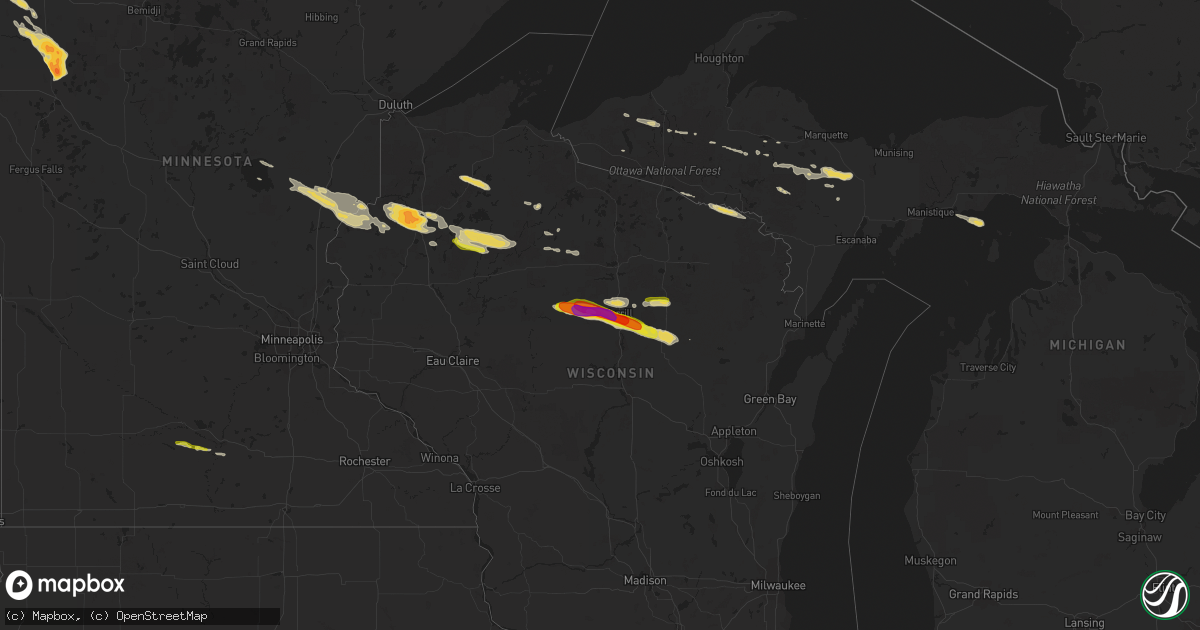
Hail Map on August 1, 2015
Get this storm
August 1 map
$229
one time, instant access
Download today. No call, no setup
Keep the $229
Bought the map and want the full workflow? Apply the entire $229 to a subscription within 7 days. None of it is wasted.
Every map, not just this one
This buys you this map. Subscription and you get every map we run, in the markets you choose from a few cities to whole states to nationwide. Plus real-time alerts the moment a storm fires.
Contact data
Name, contact info, occupancy, even credit band for addresses in the footprint. You go from where it hit to who to call.
Become the source they trust
Unlimited branding weather history reports on demand. You already have the documented answer ready for the property owner, and you are the one who showed up with it.
Property data and RoofTrace estimates
Pull up any address you have got, its value and the exact code rules for that jurisdiction, straight from One Click Code. Then RoofTrace estimates the squares, pitch, and roof value, priced the way you price.
States Impacted by Hail Map on August 1, 2015
Storm reports
South Dakota
| Date | Description |
|---|---|
| 08/01/20156:30 PM CDT | A local report indicates 1.00 inch wind near PINE RIDGE |
| 08/01/20156:03 PM CDT | Mostly nickel size and some to quarter size. |
| 08/01/20155:38 PM CDT | A local report indicates 1.00 inch wind near 7 SW ROCKHAM |
| 07/31/20157:18 PM CDT | A local report indicates 1.25 inch wind near 7 SSW BATESLAND |
Arizona
| Date | Description |
|---|---|
| 08/01/20156:15 PM CDT | Twitter photos of broken palo verde tree limbs. Time is estimated. |
| 08/01/20156:11 PM CDT | Tree down 12th and irvington |
| 08/01/20152:16 PM CDT | Kalk recorded 58 kt thunderstorm wind gust. |
| 08/01/20152:13 PM CDT | Kalk asos recorded 53 kt thunderstorm wind gust. |
Wisconsin
| Date | Description |
|---|---|
| 08/01/20156:43 AM CDT | 10 minute duration |
| 08/01/20156:43 AM CDT | A local report indicates 1.75 inch wind near 6 W TREGO |
| 08/01/20155:05 AM CDT | Tree fell on power line east of webster. Location and time estimated. |
| 08/01/20151:40 AM CDT | Intersection of highway 64 and highway 51. |
| 08/01/20151:28 AM CDT | A local report indicates 1.00 inch wind near W MERRILL |
| 08/01/20151:25 AM CDT | A local report indicates 1.25 inch wind near 1 W MERRILL |
| 08/01/20151:17 AM CDT | A local report indicates 1.50 inch wind near 8 W MERRILL |
| 08/01/20151:05 AM CDT | Updated hail size per pictures via social media. |
| 08/01/201512:40 AM CDT | Picture and report received via social media |
Minnesota
| Date | Description |
|---|---|
| 08/01/20156:55 AM CDT | Picture from social media |
| 08/01/20156:40 AM CDT | Via social media |
| 08/01/20156:35 AM CDT | Picture from social media |
| 08/01/20156:30 AM CDT | Via social media |
| 08/01/20156:10 AM CDT | Via social media |
| 08/01/20156:00 AM CDT | Via social media |
| 08/01/20154:36 AM CDT | Time estimated by radar. |
| 08/01/20152:23 AM CDT | Spotter reports a live 6 inch diameter tree downed in yard. Time radar estimated. |
| 08/01/201512:25 AM CDT | A few large 3 to 5 inch diameter tree branches were blown down. Heavy rains and brief periods of dime sized hail also occurred. |
| 08/01/201512:15 AM CDT | Heavy rains and small hail were accompanied with driving winds. A few large 2 to 4 inch diameter tree branches were broken down and garden furniture was scattered. Init |
| 08/01/201512:10 AM CDT | Trees knocked over by wind. Report relayed via social media. Time estimated from radar. |
| 07/31/201511:54 PM CDT | Peak wind to 58 kts measured at the roseau airport. |
| 07/31/201511:54 PM CDT | Large tree blown down |
| 07/31/201511:54 PM CDT | Peak wind to 58 kts measured at the roseau airport. |
| 07/31/201511:54 PM CDT | Trees knocked over by wind. Report relayed via social media. |
| 07/31/201511:36 PM CDT | Occasional large hail along with heavy rains and smaller broken branches. |
Michigan
| Date | Description |
|---|---|
| 08/01/20156:11 AM CDT | Fell for about one minute. |
Iowa
| Date | Description |
|---|---|
| 08/01/20155:00 AM CDT | Delayed report |
| 08/01/20154:30 AM CDT | Delayed report. |
| 08/01/20154:20 AM CDT | Delayed report. |
Colorado
| Date | Description |
|---|---|
| 07/31/20158:28 PM CDT | A local report indicates 62 MPH wind near AKRON |
| 07/31/20157:40 PM CDT | A local report indicates 1.00 inch wind near 11 NNE AKRON |
Nebraska
| Date | Description |
|---|---|
| 08/01/20156:30 PM CDT | Sustained winds measured at 46 mph. 0.26 of rainfall between 525 to 547 pm. 18 inch hardwood tree uprooted. Branches 4 to 6 inches in diameter broke. |
| 08/01/20156:25 PM CDT | Wind gusts estimated at 70-80 mph along with pea-sized hail. |
| 08/01/20156:10 PM CDT | 70-80 mph gusts estimated. Wind driven marble sized hail broke winds on north side of home. |
| 08/01/20156:00 PM CDT | A local report indicates 1.00 inch wind near 11 SSE BROADWATER |
| 08/01/20154:55 PM CDT | A local report indicates 1.50 inch wind near 7 NE BRIDGEPORT |
| 07/31/20158:00 PM CDT | Power poles cracked due to high winds. |
Maine
| Date | Description |
|---|---|
| 08/01/20154:27 PM CDT | Quarter and nickel size hail caused tents to collapse at lamoine state park. |
| 08/01/20154:02 PM CDT | A local report indicates 59 MPH wind near 4 ENE ISLEBORO |
| 08/01/20154:00 PM CDT | Trees donw hill ridge rd |
| 08/01/20153:55 PM CDT | Trees down shore rd |
| 08/01/20153:50 PM CDT | Trees donw hill ridge rd |
| 08/01/20153:45 PM CDT | Trees down |
| 08/01/20153:45 PM CDT | Trees down shore rd |
| 08/01/20153:33 PM CDT | Tree down |
| 08/01/20153:33 PM CDT | Tree down |
| 08/01/20153:33 PM CDT | Tree down |
| 08/01/20153:30 PM CDT | Branches down all over searsmont |
| 08/01/20153:20 PM CDT | Trees and wires down |
| 08/01/20153:05 PM CDT | Tree down knocking power out to east side of town. |
| 08/01/20152:40 PM CDT | Tree down on route 6 |
| 08/01/20152:30 PM CDT | Augusta country club |
| 08/01/20152:30 PM CDT | Augusta country club had trees down and tables blown over |
| 08/01/20152:27 PM CDT | Pole broken and trees down on morton street old lewiston road and tallyran road |
| 08/01/20152:00 PM CDT | A local report indicates 1.75 inch wind near WINN |
| 08/01/20152:00 PM CDT | A local report indicates 1.75 inch wind near CHESTER |
| 08/01/20152:00 PM CDT | A local report indicates 1.00 inch wind near MATTAWAMKEAG |
| 08/01/20152:00 PM CDT | A local report indicates 1.00 inch wind near KINGMAN |
| 08/01/20151:50 PM CDT | A local report indicates 1.75 inch wind near MATTAWAMKEAG |
| 08/01/20151:45 PM CDT | A local report indicates 1.75 inch wind near WINN |
| 08/01/20151:45 PM CDT | Time estimated from radar |
| 08/01/20151:35 PM CDT | A local report indicates 1.75 inch wind near CHESTER |
| 08/01/20151:05 PM CDT | Pea to quarter sized hail in lakeview plantation on schoodic lake |
| 08/01/20151:00 PM CDT | Trees down in presque isle. Power outages reported by media and public. |
| 08/01/20151:00 PM CDT | A local report indicates 1.00 inch wind near GREENVILLE |
| 08/01/201512:45 PM CDT | A local report indicates 1.00 inch wind near SEBEC |
Missouri
| Date | Description |
|---|---|
| 08/01/20152:10 PM CDT | Tin ripped off two barn roofs with an approximate 15ft gap in each roof. |
| 08/01/201512:51 PM CDT | Power line down in miami. Windspeed unknown. |
| 07/31/20158:00 PM CDT | Tree snapped in half in addition to power pole and line damage. Confined to 3 to 5 block radius. |
Georgia
| Date | Description |
|---|---|
| 07/31/20157:36 PM CDT | A tree was blown down in douglas. Time of event based on radar data. Douglas awos measured a gust to 32 mph. |
| 07/31/20157:12 PM CDT | A couple trees were blown down sw of broxton. Douglas awos measured gusts to 32 mph. |
California
| Date | Description |
|---|---|
| 08/01/20155:20 PM CDT | A local report indicates 1.00 inch wind near DARDANELLE |
Texas
| Date | Description |
|---|---|
| 08/01/20151:16 AM CDT | Thunderstorm wind gusts estimated between 55 and 60 mph on the east side of lefors. |
New Mexico
| Date | Description |
|---|---|
| 07/31/20157:20 PM CDT | A local report indicates 60 MPH wind near SANTA ROSA |
| 07/31/20157:20 PM CDT | A local report indicates 1.00 inch wind near 2 N SANTA ROSA |
Cities Impacted by Hail Map on August 1, 2015
- Dawn, MO
- Trego, WI
- Springbrook, WI
- Chillicothe, MO
- Burlington, ME
- Waubun, MN
- Butternut, WI
- Rock, MI
- Skandia, MI
- Gwinn, MI
- Winter, WI
- Couderay, WI
- Radisson, WI
- Stone Lake, WI
- Exeland, WI
- Ojibwa, WI
- Murray, IA
- Grand River, IA
- Portola, CA
- Carrollton, MO
- Jamaica, IA
- Hale, MO
- Lake Crystal, MN
- Humboldt, MN
- Hallock, MN
- Lancaster, MN
- Saint Vincent, MN
- Pembina, ND
- Gruver, TX
- Bingham, ME
- Tahoka, TX
- Wilson, TX
- Lubbock, TX
- Merrill, WI
- Rib Lake, WI
- Bosworth, MO
- Bogard, MO
- Danbury, WI
- Spooner, WI
- Webster, WI
- Medford, WI
- Athens, WI
- Gulliver, MI
- Pampa, TX
- Sarona, WI
- Deerbrook, WI
- Kiron, IA
- Covington, MI
- Islesboro, ME
- Brooksville, ME
- Castine, ME
- Lincolnville, ME
- Nevada, IA
- Hinckley, MN
- Sandstone, MN
- Grantsburg, WI
- Mora, MN
- Gleason, WI
- Battle Creek, IA
- Ida Grove, IA
- Flagstaff, AZ
- Sedona, AZ
- Ainsworth, NE
- Johnstown, NE
- Milo, ME
- Winn, ME
- Mattawamkeag, ME
- Lincoln, ME
- Howland, ME
- Fertile, MN
- Akron, CO
- Otis, CO
- Portsmouth, IA
- Audubon, IA
- Earling, IA
- Panama, IA
- Woodbine, IA
- Harlan, IA
- Kimballton, IA
- Kirkman, IA
- Westphalia, IA
- Irwin, IA
- Sedalia, MO
- Hughesville, MO
- Houstonia, MO
- La Monte, MO
- Knob Noster, MO
- Bruce Crossing, MI
- Channing, MI
- Ontonagon, MI
- Brownville, ME
- Shiprock, NM
- Tohatchi, NM
- Carroll, IA
- Gilliam, MO
- Georgetown, DE
- Roseau, MN
- Childress, TX
- Wausau, WI
- Harborside, ME
- Morrill, ME
- Searsmont, ME
- Tina, MO
- Tulare, SD
- Hamlin, IA
- Exira, IA
- Aniwa, WI
- Birnamwood, WI
- Guymon, OK
- White Earth, MN
- Ogema, MN
- Detroit Lakes, MN
- Callaway, MN
- Mahnomen, MN
- Twin Valley, MN
- Rochert, MN
- Gary, MN
- Lineville, IA
- Phillips, WI
- Fifield, WI
- Sedgwick, CO
- Anthon, IA
- Moville, IA
- Correctionville, IA
- Brantwood, WI
- Salol, MN
- Warroad, MN
- Hillsboro, ND
- Grandin, ND
- Blanchard, ND
- Guthrie Center, IA
- Benson, AZ
- Canyon, TX
- Hayward, WI
- Cable, WI
- Roosevelt, MN
- Vega, TX
- Hereford, TX
- Avoca, IA
- Neola, IA
- Persia, IA
- Logan, IA
- Shelby, IA
- Elk Horn, IA
- De Witt, MO
- Triplett, MO
- Shallowater, TX
- Abernathy, TX
- Antigo, WI
- Mattoon, WI
- Wood Lake, NE
- Birchwood, WI
- Haswell, CO
- Union, ME
- Iron River, MI
- Florence, WI
- Versailles, MO
- Fortuna, MO
- Santa Rosa, NM
- Ludlow, MO
- Seaford, DE
- Batesland, SD
- Concordia, MO
- Warrensburg, MO
- Tekamah, NE
- Herman, NE
- Susanville, CA
- Groom, TX
- Leeton, MO
- Isle, MN
- Meadow, TX
- Post, TX
- Claude, TX
- Ropesville, TX
- Levelland, TX
- Las Animas, CO
- Champion, MI
- Madelia, MN
- Hanska, MN
- Beltrami, MN
- Powersville, MO
- Farmington, NM
- Dodge, NE
- Howells, NE
- Clarkson, NE
- Dalton, MO
- Janesville, CA
- Gilman City, MO
- Missouri Valley, IA
- Brownfield, TX
- Irma, WI
- Danbury, IA
- Bejou, MN
- Crystal Falls, MI
- Brunswick, MO
- Jefferson, IA
- Dana, IA
- Gowrie, IA
- Reno, NV
- Goodwell, OK
- Sumner, MO
- Meadville, MO
- Slaton, TX
- Crookston, MN
- McGrath, MN
- Finlayson, MN
- Good Thunder, MN
- Mankato, MN
- Unionville, MO
- Lucerne, MO
- Denison, IA
- Ewen, MI
- Florence, MO
- Oto, IA
- Ogden, IA
- Allerton, IA
- Long Lake, WI
- Wildorado, TX
- Scribner, NE
- West Enfield, ME
- Foster City, MI
- Tipton, MO
- Clarksburg, MO
- Bunceton, MO
- Sebec, ME
- Dover Foxcroft, ME
- Republic, MI
- Lawton, IA
- Schleswig, IA
- Clio, IA
- Osceola, IA
- Van Wert, IA
- Ishpeming, MI
- Anton, TX
- Goodridge, MN
- Kingman, ME
- Long Barn, CA
- Pinecrest, CA
- Readfield, ME
- Augusta, ME
- Manchester, ME
- Winthrop, ME
- Gordon, NE
- Rushville, NE
- Pine Ridge, SD
- Garita, NM
- Newkirk, NM
- Conchas Dam, NM
- Cuervo, NM
- Tucumcari, NM
- Greenville Junction, ME
- Angora, NE
- Dalton, NE
- Bridgeport, NE
- Broadwater, NE
- Lodgepole, NE
- Redfield, SD
- Orient, SD
- Rockham, SD
- Plains, TX