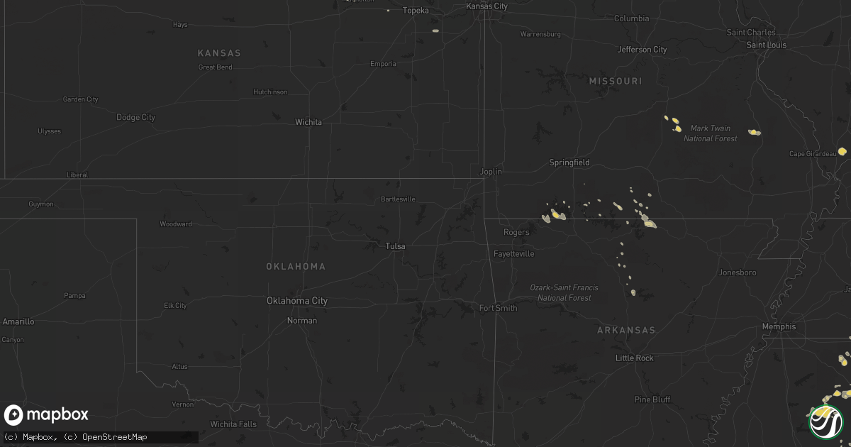
Hail Map on August 1, 2012
Get this storm
August 1 map
$229
one time, instant access
Download today. No call, no setup
Keep the $229
Bought the map and want the full workflow? Apply the entire $229 to a subscription within 7 days. None of it is wasted.
Every map, not just this one
This buys you this map. Subscription and you get every map we run, in the markets you choose from a few cities to whole states to nationwide. Plus real-time alerts the moment a storm fires.
Contact data
Name, contact info, occupancy, even credit band for addresses in the footprint. You go from where it hit to who to call.
Become the source they trust
Unlimited branding weather history reports on demand. You already have the documented answer ready for the property owner, and you are the one who showed up with it.
Property data and RoofTrace estimates
Pull up any address you have got, its value and the exact code rules for that jurisdiction, straight from One Click Code. Then RoofTrace estimates the squares, pitch, and roof value, priced the way you price.
States Impacted by Hail Map on August 1, 2012
Storm reports
Virginia
| Date | Description |
|---|---|
| 08/01/20126:25 PM CDT | A local report indicates 1.00 inch wind near 3 WSW JONESVILLE |
| 08/01/20126:15 PM CDT | Power lines down on indian grave road near rt 220 |
| 08/01/20126:06 PM CDT | Quarter size hail in boones mill |
| 08/01/20125:56 PM CDT | Quarter size hail on 3rd street sw across from the city court house |
| 08/01/20125:48 PM CDT | Quarter size hail on pine court road |
| 08/01/20125:45 PM CDT | Golf ball size hail on livingston road |
| 08/01/20125:38 PM CDT | Golf ball size hail on virginia ave |
| 08/01/20125:38 PM CDT | Golf ball size hail in east salem near the medical center |
| 08/01/20125:36 PM CDT | Nickel to quarter sized hail |
| 08/01/20125:35 PM CDT | Golf ball size hail on peters creek road |
| 08/01/20125:32 PM CDT | Quarter size hail reported at the wdbj studio. |
| 08/01/20125:30 PM CDT | Tree down in wise. |
| 08/01/20125:28 PM CDT | Quarter size hail on electric road |
| 08/01/20125:25 PM CDT | Hail ranged from dime size to quarter size on green ridge road |
| 08/01/20125:25 PM CDT | Golf ball size hail reported |
| 08/01/20125:20 PM CDT | A local report indicates 1.00 inch wind near 1 NNE RUBERMONT |
| 08/01/20125:20 PM CDT | Hail ranging from dime to quarter size near glen cove elementary school. |
| 08/01/20124:44 PM CDT | Branches down |
| 08/01/20124:20 PM CDT | Hail fell for about 5 minutes near us 11. Hail ranged from pea to quarter size. |
| 08/01/20123:25 PM CDT | A local report indicates 1.25 inch wind near CLOVER CREEK |
| 08/01/20123:25 PM CDT | Ping pong size hail in millboro |
| 08/01/20123:25 PM CDT | Hail ranged from nickel to quarter size |
| 08/01/20122:59 PM CDT | State route 633 |
| 08/01/201210:38 AM CDT | Water spout came onshore and became a tornado briefly before dissipating |
| 08/01/201210:38 AM CDT | Several reports of tornado in vicinity of chamber...mason and taylor roads |
| 07/31/20127:15 PM CDT | Quarter size hail on woodburn lane |
Minnesota
| Date | Description |
|---|---|
| 08/01/20126:51 PM CDT | Rwf airport asos. |
| 08/01/20126:45 PM CDT | Rwf airport asos. |
| 08/01/20126:40 PM CDT | Rwf airport asos. |
| 08/01/20126:39 PM CDT | A local report indicates 67 MPH wind near 2 W REDWOOD FALLS |
| 08/01/20126:25 PM CDT | A couple of trees had damage and corn laying over |
| 08/01/20126:21 PM CDT | Also receiving up to 1/2 inch hail |
| 08/01/20126:17 PM CDT | Siding torn off sides of trailer homes |
| 08/01/20125:47 PM CDT | A local report indicates 62 MPH wind near 2 W MARSHALL |
| 08/01/20125:35 PM CDT | A local report indicates 1.75 inch wind near MINNEOTA |
| 08/01/20125:30 PM CDT | Limbs down and corn flattened |
| 08/01/20125:29 PM CDT | A local report indicates 1.75 inch wind near 3 NE TAUNTON |
| 08/01/20125:17 PM CDT | A local report indicates 1.75 inch wind near 4 NE PORTER |
| 08/01/20125:00 PM CDT | Very flat hail - some with a diameter to one inch. |
| 08/01/20129:45 AM CDT | Trees down over road near intersection hwy 22 171 st. |
| 08/01/20129:45 AM CDT | Several large trees down and on power lines. |
| 08/01/20129:30 AM CDT | Boats and pontoons flipped on east lake...estimated gust 50 mph. |
| 08/01/20123:40 AM CDT | 4 to 5 foot long tree branches down. |
| 07/31/20129:34 PM CDT | Large tree down. |
| 07/31/20129:30 PM CDT | Time estimated |
| 07/31/20129:24 PM CDT | 50 ft long large tree limb down and other debris. |
| 07/31/20127:20 PM CDT | A local report indicates 1.25 inch wind near 4 N CURRIE |
West Virginia
| Date | Description |
|---|---|
| 08/01/20125:30 PM CDT | Tree down on elk river rd. |
| 08/01/20125:15 PM CDT | Reports of several trees down in clendenin along elk river road and valley view drive |
| 08/01/20124:25 PM CDT | Hail ranged from pea to quarter size during a ten minute period |
| 07/31/20127:52 PM CDT | Large branches down |
Tennessee
| Date | Description |
|---|---|
| 08/01/20126:47 PM CDT | Hail reported in bon aqua in hickman county |
| 08/01/20126:00 PM CDT | A local report indicates 1.00 inch wind near ETOWAH |
| 08/01/20125:55 PM CDT | In crieve hall...a couple of houses with fallen trees on them...no injuries. Downed power lines in the road. |
| 08/01/20125:50 PM CDT | Numerous tree reported down in crieve hall along blackman road |
| 08/01/20125:47 PM CDT | Sizeable branch ripped off tree near music row. |
| 08/01/20125:40 PM CDT | A local report indicates 1.00 inch wind near ETOWAH |
| 08/01/20125:39 PM CDT | Multiple trees and power lines down in bordeaux. |
| 08/01/20125:32 PM CDT | Multiple trees and power lines down in bordeaux. |
| 08/01/20125:28 PM CDT | Several trees donw in maynardville. |
| 08/01/20125:25 PM CDT | A local report indicates 1.00 inch wind near ENGLEWOOD |
| 08/01/20125:15 PM CDT | Near the indian mound community...highway 46 blocked in several locations by fallen trees and powerlines. |
| 08/01/20125:08 PM CDT | Trees down around the indian mound community in stewart county. |
| 08/01/20125:05 PM CDT | Reports of several trees downed across southwestern portions of the county. |
| 08/01/20125:04 PM CDT | Also estimated winds at 65mph. |
| 08/01/20125:00 PM CDT | Several limbs and small trees down. |
| 08/01/20125:00 PM CDT | A local report indicates 1.00 inch wind near 6 WSW BEAN STATION |
| 08/01/20124:40 PM CDT | Trees down in the town of lutts. |
| 08/01/20124:10 PM CDT | A local report indicates 1.50 inch wind near MASCOT |
| 08/01/20123:45 PM CDT | A local report indicates 1.00 inch wind near 7 NW LIVINGSTON |
| 08/01/20123:30 PM CDT | A local report indicates 1.00 inch wind near HARROGATE-SHAWANEE |
| 08/01/20122:50 PM CDT | A local report indicates 1.00 inch wind near 5 SE OAK RIDGE |
| 08/01/20122:50 PM CDT | Few trees down. |
| 08/01/20122:45 PM CDT | Few trees down. |
| 08/01/20122:45 PM CDT | A local report indicates 1.00 inch wind near OAK RIDGE |
| 08/01/20122:40 PM CDT | Large tree down. |
| 07/31/20129:35 PM CDT | Several trees down |
| 07/31/20129:10 PM CDT | Several trees and powerlines down across the county. |
| 07/31/20128:35 PM CDT | Several trees down in normandy. |
| 07/31/20128:30 PM CDT | Numerous trees were blown down all around tullahoma. |
| 07/31/20127:53 PM CDT | A local report indicates 1.25 inch wind near CLEVELAND |
South Dakota
| Date | Description |
|---|---|
| 08/01/20124:35 PM CDT | A few golfball hail but mostly nickel. Covers the ground. |
| 08/01/20124:10 PM CDT | Winds estimated at least 60 mph with pea sized hail. |
| 08/01/20124:05 PM CDT | A local report indicates 60 MPH wind near 6 WSW LONG VALLEY |
| 08/01/20124:00 PM CDT | Pea to nickel hail at residence and 40 to 50 mph winds. 1 mile south - major crop damage to sunflower fields on several sections of land. |
| 08/01/20123:55 PM CDT | Peak wind gust from the fort pierre raws. |
| 08/01/20123:40 PM CDT | A local report indicates 60 MPH wind near 1 E SWETT |
| 08/01/20122:55 PM CDT | A local report indicates 1.00 inch wind near 4 NNW COTTONWOOD |
| 08/01/20122:45 PM CDT | A local report indicates 60 MPH wind near 3 SSE CREIGHTON |
| 07/31/20127:30 PM CDT | A few small branches down |
Montana
| Date | Description |
|---|---|
| 08/01/20125:35 PM CDT | A local report indicates 60 MPH wind near FROID |
| 08/01/20124:45 PM CDT | Accompanied by 60 mph winds. |
| 08/01/20124:45 PM CDT | A local report indicates 1.50 inch wind near 25 SW PLENTYWOOD |
| 08/01/20124:45 PM CDT | A local report indicates 1.50 inch wind near 20 SW PLENTYWOOD |
| 08/01/20123:55 PM CDT | Hail the size of dimes and quarters. |
Michigan
| Date | Description |
|---|---|
| 08/01/20124:40 AM CDT | The ludington daily news is reporting numerous trees are down in ludington state park...causing damage to camper trailers...vehicles...and possibly a park building as w |
New York
| Date | Description |
|---|---|
| 08/01/20121:50 PM CDT | Localized trees down on eastern parkway and mcclellan and bradley streets |
Florida
| Date | Description |
|---|---|
| 08/01/20125:20 PM CDT | Strong winds downed a large tree onto an automobile. |
Wisconsin
| Date | Description |
|---|---|
| 08/01/20125:35 PM CDT | Dime to golf ball size hail. Report relayed by mjfw. |
| 08/01/201211:49 AM CDT | A local report indicates 1.00 inch wind near ODANAH |
| 08/01/201211:45 AM CDT | A local report indicates 1.75 inch wind near ODANAH |
| 08/01/20124:30 AM CDT | Tree down on west smith road. |
| 08/01/20124:28 AM CDT | Tree blown down in sidie hollow park. |
| 08/01/20122:05 AM CDT | Measured in grand chute. |
| 08/01/20121:05 AM CDT | Tree down. Time estimated. |
| 08/01/20121:00 AM CDT | Several reports of wind damage across southern part of the county. |
| 08/01/201212:44 AM CDT | A local report indicates 1.00 inch wind near 1 NE VEEFKIND |
| 08/01/201212:28 AM CDT | Tree down on roadway. |
| 08/01/201212:28 AM CDT | Tree blown down onto shed. Time estimated using radar. |
| 08/01/201212:25 AM CDT | One tree uprooted in the city. Several branches down throughout the city. A few phone and power lines down. |
| 08/01/201212:03 AM CDT | A couple of trees down along hwy 12 southeast of black river falls near castle mound. Time estimated by radar. |
Illinois
| Date | Description |
|---|---|
| 08/01/20125:30 PM CDT | Trees...power lines...and a couple homes damaged. Time estimated based on radar. |
Kansas
| Date | Description |
|---|---|
| 08/01/20123:20 AM CDT | 12 inch diameter tree blown down. Time estimated. |
| 08/01/20123:00 AM CDT | 3 inch tree branches down and power outages through out marshall county |
| 08/01/20122:30 AM CDT | Tree branches and power lines down in town |
| 08/01/20122:30 AM CDT | 2 inch tree branches down through out northern riley county. |
| 08/01/20122:30 AM CDT | Tree limbs down and 2.15 inches of rain. |
| 08/01/20121:05 AM CDT | There were several small branches down. Largest branch was 5 inches in diameter. |
| 08/01/20121:05 AM CDT | Est 60 mph wind gust. 8 inch tree branch knock down plus several other branches. |
| 08/01/20121:05 AM CDT | Est 60 mph wind gust. 8 inch tree branch knocked down plus several other branches. |
Colorado
| Date | Description |
|---|---|
| 08/01/20126:56 PM CDT | A local report indicates 60 MPH wind near 4 SE YUMA |
Kentucky
| Date | Description |
|---|---|
| 08/01/20125:36 PM CDT | Hail lasted for about a half hour near cardinal chevrolet. |
| 08/01/20124:55 PM CDT | A local report indicates 1.00 inch wind near 1 SSE ULVAH |
| 08/01/20124:25 PM CDT | Several trees and large limbs blown down around the big laurel community. |
| 08/01/20124:25 PM CDT | A local report indicates 1.25 inch wind near BIG LAUREL |
| 08/01/20124:00 PM CDT | Trees down along meathouse creek. |
| 08/01/20123:35 PM CDT | Tree fell on a car on hwy 522. Numerous other trees downed in the area. |
| 08/01/20123:25 PM CDT | One tree down on route 40. |
| 08/01/20122:50 PM CDT | A local report indicates 1.00 inch wind near LITTCARR |
| 07/31/20127:25 PM CDT | One tree down on route 40. |
Missouri
| Date | Description |
|---|---|
| 08/01/20126:40 PM CDT | Several large trees blown down and power lines down across the branson area. |
| 08/01/20126:27 PM CDT | A pontoon boat was overturned from strong winds and rough water over table rock lake. This event happened between point 10 and point 11 on the lake. No injuries reporte |
| 08/01/20124:27 PM CDT | Branson asos reported 56 knots or 64 mph wind gust |
| 08/01/20124:14 PM CDT | Large tree completely blocking exit to dogwood canyon nature park. |
South Carolina
| Date | Description |
|---|---|
| 07/31/20127:17 PM CDT | A funnel cloud appeared over kiawah island then moved into the waterway east of the kiawah island parkway. Photographs and video footage showed the funnel touched down |
Georgia
| Date | Description |
|---|---|
| 08/01/20126:40 PM CDT | Walker county 911 relayed a report of 5 trees down in the southern part of the county. Time is based on radar. |
| 08/01/20126:35 PM CDT | A local report indicates 1.00 inch wind near 5 NNW TRION |
| 08/01/20126:34 PM CDT | Chattooga county em relayed a report of numerous trees down in teloga. Time is based on radar. |
| 08/01/20126:27 PM CDT | Noaa research group relayed a report of quarter sized hail. |
| 08/01/20126:21 PM CDT | Nssl research team has relayed a report of snapped trees in this area. A pecan tree was snapped at the base and landed on the roof of a barn. Time is based on radar. |
| 08/01/20123:37 PM CDT | Forsyth ema relayed a report of trees down on houses...powerlines down...street lights and stoplights downed by thunderstorm wind across the county. Also 4 mobile homes |
| 08/01/20123:14 PM CDT | Chattoga county em relayed a report of three trees down in the county. Time is based on radar. |
| 07/31/201210:15 PM CDT | Law enforcement reported several trees down in the wildwood area. |
| 07/31/20128:15 PM CDT | 911 call center relayed a report of a tree down in northern whitfield county. |
Nebraska
| Date | Description |
|---|---|
| 08/01/20126:15 PM CDT | Small branches down. Dime size hail also reported. |
| 08/01/20126:05 PM CDT | A local report indicates 66 MPH wind near VALENTINE |
| 08/01/20125:58 PM CDT | A local report indicates 63 MPH wind near VALENTINE |
| 08/01/20123:55 PM CDT | 50 to 60 mph winds with dime hail. |
| 07/31/201211:00 PM CDT | 6 inch diameter limbs broken |
| 07/31/201210:59 PM CDT | A few tree limbs down. |
| 07/31/201210:55 PM CDT | A local report indicates 58 MPH wind near WAYNE |
| 07/31/201210:29 PM CDT | Delayed wind damage report from wednesday evening. A three-story barn destroyed...along with other nearby outbuilding damage. Time estimated from radar. |
| 07/31/20128:17 PM CDT | Quarter to ping pong ball sized hail reported at lake maloney. |
| 07/31/20128:17 PM CDT | A local report indicates 60 MPH wind near 7 S AMELIA |
| 07/31/20127:20 PM CDT | Branches down. Power out at location. |
| 07/31/20127:15 PM CDT | Thunderstorm wind gust estimated as high as 60 mph from 715 pm cdt through 720 pm cdt. Lightning caused hay fires in fields nearby around 730 pm cdt. Delayed reports fr |
| 07/31/20127:02 PM CDT | A local report indicates 58 MPH wind near 7 W AINSWORTH |
Mississippi
| Date | Description |
|---|---|
| 08/01/20125:41 PM CDT | Off duty air force officer from keesler afb reported several trees down along lorraine road near highway 67...some small hail and flooding rainfall. Apparent downburst. |
| 08/01/20125:20 PM CDT | Several trees down in and around ackerman with one large tree on a house in town. |
| 08/01/20125:20 PM CDT | Dime to quarter sized hail in ackerman...via social media. Also had a picture of a half a tree snapped. |
| 08/01/20125:19 PM CDT | Tin shed blown down on south union road. Report relayed through twitter. |
| 08/01/20125:00 PM CDT | Trees down along hwy 12. |
| 08/01/20124:20 PM CDT | A local report indicates 1.00 inch wind near 5 NW WEST POINT |
| 08/01/20124:00 PM CDT | Tree on powerline around highway 50 and berry road. This has resulted in numerous power outages around the area. |
| 08/01/20123:45 PM CDT | Quarter sized hail and several limbs down...occurred along billy white rd. |
| 08/01/20123:38 PM CDT | Several trees and power lines down just west of saltillo. |
| 08/01/20122:19 PM CDT | Tin shed blown down on south union road. Report relayed through twitter. |
Arkansas
| Date | Description |
|---|---|
| 08/01/20126:47 PM CDT | Several power lines and power poles were blown down. Tin roofing was removed from several structures on the west side of salem. |
| 08/01/20126:43 PM CDT | Many people are without power. |
| 08/01/20126:36 PM CDT | Power lines were down at highway 223 north and browns chapel road in mount calm. Winds caused damage to two homes and two barns. A semi truck and a horse trailer were b |
| 08/01/20126:34 PM CDT | Tress and power lines are down. Some power poles were snapped. Tin roofing was removed from several houses...mtress and power lines are down. |
| 08/01/20126:09 PM CDT | Several large trees were blown down in yellville. One tree was reported to have fallen on a house. |
| 08/01/20125:48 PM CDT | Atleast two boat docks were overturned and a power line was down in bull shoals. |
| 08/01/20125:10 PM CDT | Update from previous lsr. Trees were blown down and several blocked roads. A business sign was blown down onto a vehicle. The vehicle was not occupied. Power lines were |
| 07/31/20127:17 PM CDT | Multiple trees are down with trees reported on houses and vehicles. No injuries are being reported at this time. Power lines and power poles were blown down. |
North Carolina
| Date | Description |
|---|---|
| 08/01/20125:29 PM CDT | Several trees down in murphy. |
| 08/01/20125:09 PM CDT | Wake co 911 received report of power lines down on durham rd. |
| 08/01/20124:39 PM CDT | Wake co 911 received report of 2 trees down on fowler rd in zebulon. |
| 08/01/20124:23 PM CDT | Rolesville fd received report of tree down on quarry road. |
| 08/01/20124:12 PM CDT | Rolesville fd received report of tree down on zebulon rd. |
| 08/01/20121:29 AM CDT | Trees and branches down around the rock barn golf course. |
| 08/01/20121:10 AM CDT | Dispatch reports a tree on a home near conover. |
| 08/01/20121:10 AM CDT | Media reports trees down across eastover dr. |
| 08/01/20121:05 AM CDT | A local report indicates 1.00 inch wind near 2 SW HIDDENITE |
| 08/01/201212:52 AM CDT | Quarter size hail lasted for about 15 minutes |
| 08/01/201212:45 AM CDT | One tree blown down in downtown taylorsville. |
| 08/01/201212:14 AM CDT | Trees and powerlines down along state route 16 just south of moravian falls. |
| 07/31/201211:48 PM CDT | Trees and powerlines reported down around north wilkesboro with power out across much of the area. |
| 07/31/201211:40 PM CDT | Trees down on johnson road near hays. |
| 07/31/201211:08 PM CDT | Hail of various sizes occurred for nearly one hour ending around 1245 am edt...and accumulated to a depth of one to two inches in some areas. |
| 07/31/201211:00 PM CDT | Public reported quarter-sized hail in jefferson. |
| 07/31/201210:52 PM CDT | Public reported quarter-sized hail just southeast of jefferson near wagoner. |
| 07/31/201210:48 PM CDT | Trees down on bamboo road near boone. |
| 07/31/201210:42 PM CDT | Tree down on house on blue ridge avenue in boone. |
Cities Impacted by Hail Map on August 1, 2012
- Park Falls, WI
- Chickamauga, GA
- Ogallala, NE
- Maxwell, NE
- Wanblee, SD
- McDowell, VA
- Monroe, TN
- Byrdstown, TN
- Indianola, NE
- Cambridge, NE
- Danbury, NE
- Lebanon, NE
- Wilsonville, NE
- Bartley, NE
- Lafayette, TN
- Pleasant Shade, TN
- Wauneta, NE
- Mitchell, SD
- Fulton, SD
- Green Bay, VA
- Victoria, VA
- Englewood, TN
- Athens, TN
- Westfield, NC
- Pilot Mountain, NC
- Iuka, MS
- Waterloo, AL
- Renville, MN
- Allen, SD
- Boulder Junction, WI
- Clarksville, TN
- Ullin, IL
- Cypress, IL
- Dongola, IL
- Lismore, MN
- Old Fort, TN
- Cleveland, TN
- Clear Lake, SD
- Estelline, SD
- Castlewood, SD
- Princeton, KY
- Cadiz, KY
- Crossville, TN
- Martin, SD
- Hazard, KY
- Jeff, KY
- Happy, KY
- Viper, KY
- Minneota, MN
- Taunton, MN
- Porter, MN
- Tracy, MN
- Gainesville, GA
- Belvidere, SD
- Prentice, WI
- Merrill, WI
- Tripoli, WI
- Tomahawk, WI
- Ogema, WI
- Brantwood, WI
- Three Lakes, WI
- Kimball, MN
- Cold Spring, MN
- Selden, KS
- Atwood, KS
- Altamont, TN
- Johnstown, NE
- Gainesville, MO
- Thornfield, MO
- Branson, MO
- Lac Du Flambeau, WI
- Whitwell, TN
- Harlan, KY
- Wallins Creek, KY
- Coldiron, KY
- Hopkinsville, KY
- Crofton, KY
- Louisa, KY
- Inez, KY
- High Bridge, WI
- North Platte, NE
- Slayton, MN
- Garvin, MN
- Bumpus Mills, TN
- Indian Mound, TN
- Tennessee Ridge, TN
- Dover, TN
- Cumberland City, TN
- Big Rock, TN
- Jonesville, VA
- Burwell, NE
- Broken Bow, NE
- Keysville, VA
- Floodwood, MN
- Wright, MN
- New Castle, VA
- Rhinelander, WI
- Kissee Mills, MO
- Faribault, MN
- Dundas, MN
- Nerstrand, MN
- Dennison, MN
- Northfield, MN
- Debord, KY
- Pilgrim, KY
- Tomahawk, KY
- Pikeville, KY
- Murphy, NC
- Ludington, MI
- Manistee, MI
- Free Soil, MI
- Elkview, WV
- Charleston, WV
- Clendenin, WV
- Dickens, NE
- Ripley, MS
- Ashland, MS
- Blue Mountain, MS
- Clinton, TN
- Oliver Springs, TN
- Briceville, TN
- Oak Ridge, TN
- Deerbrook, WI
- Hayes Center, NE
- Froid, MT
- Pontotoc, MS
- Thaxton, MS
- Celina, TN
- Irma, WI
- Gleason, WI
- Hendricks, MN
- Brandt, SD
- Canby, MN
- Lick Creek, KY
- Kimper, KY
- Phyllis, KY
- Decatur, TN
- Riceville, TN
- Elmira, MI
- Vanderbilt, MI
- Melrose, WI
- Black River Falls, WI
- Wabasso, MN
- Clements, MN
- Springfield, MN
- Sanborn, MN
- Lamberton, MN
- Sleepy Eye, MN
- Culbertson, NE
- Ellijay, GA
- Highmore, SD
- Ree Heights, SD
- Savannah, TN
- West Plains, MO
- Manchester, TN
- Eagle Rock, VA
- Jamestown, TN
- Manhattan, KS
- Norton, KS
- Midland, SD
- Hallie, KY
- Slemp, KY
- Cornettsville, KY
- Delphia, KY
- Butternut, WI
- Gruetli Laager, TN
- Coalmont, TN
- Tracy City, TN
- Pelham, TN
- Iron City, TN
- Lutts, TN
- Cypress Inn, TN
- Florence, AL
- Nunnelly, TN
- McEwen, TN
- Bon Aqua, TN
- Dickson, TN
- Keystone, NE
- Arthur, NE
- Lemoyne, NE
- Monteagle, TN
- Morrison, TN
- Litchfield, NE
- Hazard, NE
- Mason City, NE
- Ravenna, NE
- Lynd, MN
- Marshall, MN
- Roanoke, VA
- Fairfield Bay, AR
- Higden, AR
- Shirley, AR
- Boyceville, WI
- La Fayette, GA
- Bomont, WV
- Glen, WV
- Orchard, NE
- Reserve, MT
- Dunlap, TN
- Palmer, TN
- Beersheba Springs, TN
- Mcminnville, TN
- Chapmanville, WV
- Ranger, WV
- Kiahsville, WV
- Spurlockville, WV
- Danville, WV
- Harts, WV
- Big Creek, WV
- Julian, WV
- Ravenswood, WV
- Reedsville, OH
- Long Bottom, OH
- Pheba, MS
- Starkville, MS
- Maben, MS
- Rockwood, TN
- Corryton, TN
- Charleston, TN
- Valentine, NE
- Whitman, NE
- Clover, VA
- Nathalie, VA
- Flaxville, MT
- Scobey, MT
- Clearwater, MN
- South Haven, MN
- Leslie, AR
- Marshall, AR
- Boone, NC
- Logan, WV
- Hay Springs, NE
- Ellsworth, NE
- McCool, MS
- Clarkfield, MN
- Menomonie, WI
- Knapp, WI
- Hillsboro, TN
- Mascot, TN
- Dresden, KS
- Ashland, WI
- Peerless, MT
- Hernshaw, WV
- Cabin Creek, WV
- Belle, WV
- East Bank, WV
- Drybranch, WV
- Winifrede, WV
- Eskdale, WV
- Bruce, MS
- Randolph, MS
- Lenore, WV
- Dingess, WV
- Stollings, WV
- Holden, WV
- Sawyer, MN
- Salem, VA
- Troutville, VA
- Mercersburg, PA
- McConnellsburg, PA
- Big Cove Tannery, PA
- Tiplersville, MS
- Pocahontas, TN
- Middleton, TN
- Hornsby, TN
- Walnut, MS
- Corinth, MS
- Friendsville, TN
- Greenback, TN
- Lenoir City, TN
- West Jefferson, NC
- Glendale Springs, NC
- Jefferson, NC
- Normandy, TN
- Glidden, WI
- Whitehall, WI
- Banner, MS
- Minocqua, WI
- Woodruff, WI
- Saint Germain, WI
- Manitowish Waters, WI
- Brookneal, VA
- Phenix, VA
- Leoma, TN
- Lawrenceburg, TN
- Mantachie, MS
- Marietta, MS
- Rolla, MO
- Edgar Springs, MO
- Bonesteel, SD
- Fairfax, SD
- Fredericktown, MO
- New Smyrna Beach, FL
- Millboro, VA
- Harrison, TN
- Ironwood, MI
- Arco, MN
- Cottonwood, MN
- Hanley Falls, MN
- Ghent, MN
- Ivanhoe, MN
- Harriman, TN
- Wartburg, TN
- Jennings, KS
- Oberlin, KS
- Etowah, TN
- Delano, TN
- Niota, TN
- Benton, TN
- Brule, NE
- Point Pleasant, WV
- Letart, WV
- Lithonia, GA
- Conyers, GA
- Kadoka, SD
- McCook, NE
- Whitetail, MT
- Thorn Hill, TN
- Tazewell, TN
- Cuba, KS
- Agenda, KS
- Eleva, WI
- Hindman, KY
- Vicco, KY
- Littcarr, KY
- Elsmere, NE
- Salem, MO
- Clarkrange, TN
- Deer Lodge, TN
- Atlanta, NE
- Belleville, KS
- Eitzen, MN
- New Site, MS
- Dennis, MS
- Golden, MS
- Fulton, MS
- Esbon, KS
- Branchland, WV
- Midkiff, WV
- Hager City, WI
- Swoope, VA
- Harrisonville, PA
- Crystal Spring, PA
- Breezewood, PA
- Needmore, PA
- Everett, PA
- Warfordsburg, PA
- Caulfield, MO
- Wall, SD
- Wise, VA
- Ooltewah, TN
- Lenora, KS
- Clayton, KS
- Wake Forest, NC
- Zebulon, NC
- Youngsville, NC
- Rolesville, NC
- Wendell, NC
- Louisburg, NC
- Spring Grove, MN
- Wausau, WI
- Fort Pierre, SD
- Biloxi, MS
- Saucier, MS
- Crumpler, NC
- Laurel Springs, NC
- Alma Center, WI
- Waupaca, WI
- Evarts, KY
- Closplint, KY
- Brockton, MT
- Redstone, MT
- Strawberry Plains, TN
- Maynardville, TN
- Luttrell, TN
- Knoxville, TN
- Summerville, GA
- Varney, KY
- Rising Fawn, GA
- Trenton, NE
- Maywood, NE
- Prestonsburg, KY
- Menlo, GA
- Stoney Fork, KY
- Arjay, KY
- Kettle Island, KY
- Palestine, WV
- Reedy, WV
- Mondovi, WI
- Lowmansville, KY
- Tunnel Hill, GA
- Dalton, GA
- Sacred Heart, MN
- Granite Falls, MN
- Falkner, MS
- Wisconsin Rapids, WI
- Cerulean, KY
- Gracey, KY
- Center, CO
- Gordon, KY
- Homestead, MT
- Thompsons Station, TN
- Spring Hill, TN
- Ten Mile, TN
- Stantonville, TN
- Selmer, TN
- Comfrey, MN
- Wellfleet, NE
- Gann Valley, SD
- Wood Lake, MN
- Comstock, NE
- Westerville, NE
- Mellen, WI
- Auburndale, WI
- Milladore, WI
- Hedgesville, WV
- Gerrardstown, WV
- Martinsburg, WV
- Inwood, WV
- Lonsdale, MN
- Baldwin City, KS
- Jewell, KS
- Tullahoma, TN
- Bledsoe, KY
- Helton, KY
- New Albin, IA
- Caledonia, MN
- Tellico Plains, TN
- Saint Charles, VA
- Keokee, VA
- Callaway, VA
- Walnut Grove, MN
- Greenwood, WI
- Toronto, SD
- Chappell, KY
- Big Laurel, KY
- Blackwater, VA
- Hilham, TN
- Gainesboro, TN
- Palisade, NE
- East Lynn, WV
- Gordon, NE
- West Point, MS
- Richmond, MN
- Cohutta, GA
- Holdrege, NE
- Pittsville, WI
- Winchester, VA
- Glengary, WV
- Bethpage, TN
- Virgilina, VA
- Pine River, WI
- Bear Lake, MI
- Arcadia, MI
- Shiloh, TN
- Bethel Springs, TN
- Michie, TN
- Belmont, MS
- Baldwyn, MS
- Lexington, VA
- Clifton Forge, VA
- Balaton, MN
- Howard, SD
- Nisswa, MN
- Brainerd, MN
- Only, TN
- Page, NE
- Lampe, MO
- Shell Knob, MO
- Halifax, VA
- Scottsburg, VA
- Alpine, TN
- Livingston, TN
- Allons, TN
- Tompkinsville, KY
- Burkesville, KY
- Farragut, TN
- Hillsboro, WI
- Philip, SD
- Killen, AL
- Counce, TN
- Cordele, GA
- Vilas, NC
- West Union, WV
- Matoaka, WV
- Rock, WV
- Hays, NC
- North Wilkesboro, NC
- Wilkesboro, NC
- Weir, MS
- Ackerman, MS
- Warwick, GA
- Mathias, WV
- Lost City, WV
- Revere, MN
- Georgetown, TN
- McDonald, TN
- Raleigh, NC
- Kosciusko, MS
- Louisville, MS
- Webster, MN
- Westmoreland, TN
- Weyauwega, WI
- Lovely, KY
- Beauty, KY
- Etta, MS
- New Albany, MS
- Tigerton, WI
- Hurricane, WV
- Hamlin, WV
- Watkins, MN
- Saint Cloud, MN
- Onida, SD
- Pierre, SD
- Crab Orchard, TN
- Kingston, TN
- Belview, MN
- Grethel, KY
- Printer, KY
- Rienzi, MS
- Boomer, NC
- Moravian Falls, NC
- Millers Creek, NC
- Scottville, NC
- Purlear, NC
- Saxon, WI
- Oxford, MS
- Eustis, NE
- Calhoun, TN
- Artesian, SD
- Almond, WI
- Plainfield, WI
- Pulaski, VA
- Cumming, GA
- Ages Brookside, KY
- Remer, MN
- Bainville, MT
- Presho, SD
- Quinn, SD
- Carthage, MS
- Trion, GA
- Water Valley, MS
- Franklinton, NC
- Knightdale, NC
- Ball Ground, GA
- Teaberry, KY
- Harold, KY
- McDowell, KY
- Ettrick, WI
- Carrie, KY
- Emmalena, KY
- Redfox, KY
- Premium, KY
- Blackey, KY
- Letcher, KY
- Roxana, KY
- Jeremiah, KY
- Belden, MS
- Currie, MN
- Flat Lick, KY
- Viola, AR
- Gepp, AR
- Wallace, NE
- Cumberland Furnace, TN
- Charlotte, TN
- Bertrand, NE
- Cookeville, TN
- Franklin, MN
- Fairfax, MN
- Blue Springs, MS
- Upson, WI
- Elcho, WI
- Pelican Lake, WI
- Morgan, MN
- De Soto, WI
- Williamsport, TN
- Duck River, TN
- Hampshire, TN
- Harrogate, TN
- Cumberland Gap, TN
- Middlesboro, KY
- Ewing, VA
- Hackensack, MN
- Boones Mill, VA
- Pineville, KY
- Rossville, GA
- Glasgow, VA
- Natural Bridge, VA
- Long Pine, NE
- Chattanooga, TN
- Lookout Mountain, GA
- Trenton, GA
- Wildwood, GA
- Morton, MN
- Redwood Falls, MN
- Wasta, SD
- Hixton, WI
- Argonne, WI
- Willard, WI
- Fairchild, WI
- Humbird, WI
- Bancroft, WI
- Lead Hill, AR
- Petersburg, WV
- Independence, WI
- Strum, WI
- Farnam, NE
- Moorefield, NE
- Okaton, SD
- Warm Springs, VA
- Monterey, VA
- Loyal, WI
- Alum Creek, WV
- Chatsworth, GA
- Burr Oak, KS
- Rocky Mount, VA
- Franklin, KY
- Scuddy, KY
- Blue Ridge, GA
- Willow Lake, SD
- Golconda, IL
- Plentywood, MT
- Wilcox, NE
- Glencoe, MN
- Eupora, MS
- Pound, VA
- Eolia, KY
- Bakersfield, MO
- Hixson, TN
- Soddy Daisy, TN
- Birchwood, TN
- Ringgold, GA
- Pittsboro, MS
- Batesland, SD
- Pearson, WI
- Colfax, WI
- Galena, MO
- Oshkosh, WI
- Creedmoor, NC
- Vanleer, TN
- Berryville, AR
- Eureka Springs, AR
- Golden, MO
- Eagle Rock, MO
- Sweetwater, TN
- Philadelphia, TN
- Parker, CO
- Wallace, WV
- Totz, KY
- Baxter, KY
- Putney, KY
- Mozelle, KY
- Hamilton, MS
- Aberdeen, MS
- Woodlawn, TN
- Turtletown, TN
- Granton, WI
- Leon, WV
- Edinburg, VA
- Harriet, AR
- Verndale, MN
- Staples, MN
- Ainsworth, NE
- Neenah, WI
- Oak Vale, MS
- Signal Mountain, TN
- Loomis, NE
- Tupelo, MS
- Ecru, MS
- Rib Lake, WI
- Resaca, GA
- Jim Falls, WI
- Ord, NE
- Bell, FL
- Paxico, KS
- Tyler, MN
- Glen, MS
- Berlin, WI
- Coolville, OH
- Mahnomen, MN
- Grimsley, TN
- Grand Rapids, MN
- Monte Vista, CO
- Grand Bay, AL
- Randolph, MN
- Cannon Falls, MN
- Salem, WV
- Mabel, MN
- Washburn, TN
- Rutledge, TN
- New Tazewell, TN
- Collinwood, TN
- Culloden, WV
- Oak Grove, AR
- Blue Eye, MO
- Arcadia, WI
- Stockbridge, GA
- Herndon, KS
- Rushville, NE
- Max Meadows, VA
- Fulda, MN
- Vardaman, MS
- Paris, MS
- Houlka, MS
- Coffeeville, MS
- Bowler, WI
- Bryant, WI
- Phillipsburg, KS
- Peytona, WV
- Pinetops, NC
- Elm City, NC
- Rocky Mount, NC
- Chili, WI
- Marshfield, WI
- Curtis, NE
- Appalachia, VA
- Ewing, NE
- Lisco, NE
- Oshkosh, NE
- Sturgis, MS
- Monterey, TN
- Courtland, KS
- Claremont, NC
- Stony Point, NC
- Taylorsville, NC
- Conover, NC
- Buckhannon, WV
- Volga, WV
- Downing, WI
- Farner, TN
- Sevierville, TN
- Kodak, TN
- Seymour, TN
- Medicine Lake, MT
- Bulan, KY
- Ary, KY
- Leburn, KY
- Mallie, KY
- Long Beach, MS
- Pass Christian, MS
- Sayner, WI
- Copperhill, TN
- Reliance, TN
- Ocoee, TN
- Madisonville, TN
- Protem, MO
- White Lake, WI
- Townsend, WI
- Wanamingo, MN
- Kenyon, MN
- Drury, MO
- Dawson, MN
- Yuma, CO
- Taylor, NE
- Aniwa, WI
- Antigo, WI
- Clyde, KS
- Mobile, AL
- Whitleyville, TN
- Arabi, GA
- Raccoon, KY
- Warrens, WI
- Westbrook, MN
- Madison, MN
- Ellamore, WV
- Alma, WI
- Wytheville, VA
- Dupree, SD
- Fort Gay, WV
- Dunlow, WV
- Genoa, WV
- French Camp, MS
- Blaine, TN
- Ranger, GA
- Kyles Ford, TN
- Sneedville, TN
- La Follette, TN
- Lanett, AL
- Milroy, MN
- Reeds Spring, MO
- Paintsville, KY
- River, KY
- Newton, NC
- Maiden, NC
- Hickory, NC
- Tecumseh, MO
- Columbia, TN
- Bay City, WI
- Overbrook, KS
- Astoria, SD
- Funk, NE
- Rome, GA
- Elk Mound, WI
- Wheeler, WI
- Sidney, KY
- Mercer, WI
- Thedford, NE
- Zumbrota, MN
- Gettysburg, PA
- Yeaddiss, KY
- Andersonville, TN
- Sharps Chapel, TN
- Boynton Beach, FL
- Rupert, WV
- Stopover, KY
- Majestic, KY
- Freeburn, KY
- Montgomery, MN
- New Prague, MN
- Kittrell, NC
- White Bluff, TN
- Sturgeon Bay, WI
- Lebanon, KS
- Branford, FL
- Iroquois, SD
- Centre, AL
- Cave Spring, GA
- Wooton, KY
- Busy, KY
- Sassafras, KY
- Partridge, KY
- Cumberland, KY
- Combs, KY
- Linefork, KY
- Whitesburg, KY
- Wild Rose, WI
- Scandia, KS
- Augusta, WV
- Flintstone, GA
- Ramer, TN
- Cochrane, WI
- Genoa, WI
- Cedarbluff, MS
- Mantee, MS
- Prentiss, MS
- Wewahitchka, FL
- Loyall, KY
- Dryden, VA
- Pennington Gap, VA
- Champion, NE
- Ansley, NE
- Kensington, KS
- Agra, KS
- Port Edwards, WI
- Nekoosa, WI
- Spanishburg, WV
- Beechgrove, TN
- Wartrace, TN
- Mayo, FL
- Lafayette, AL
- Five Points, AL
- Mathiston, MS
- Roaring River, NC
- Nashville, TN
- Pegram, TN
- Kingston Springs, TN
- Stockville, NE
- Birnamwood, WI
- Marengo, WI
- Russell, MN
- Callaway, NE
- Vienna, IL
- Belknap, IL
- White Pine, TN
- Lucan, MN
- Powell, TN
- Heiskell, TN
- Clinton, AR
- Spencer, WI
- Mountain Home, AR
- Goodhue, MN
- Lake City, MN
- Gamaliel, AR
- Kermit, WV
- Switzer, WV
- Williamson, WV
- Delbarton, WV
- Madison, WV
- Foster, WV
- South Boston, VA
- Zanoni, MO
- Dora, MO
- Madrid, NE
- Eagle River, WI
- Flippin, AR
- Palmyra, TN
- Cunningham, TN
- Cloquet, MN
- Henderson, NC