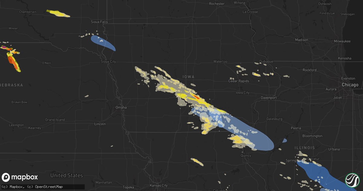
Hail Map on July 30, 2024
Get this storm
July 30 map
$229
one time, instant access
Download today. No call, no setup
Keep the $229
Bought the map and want the full workflow? Apply the entire $229 to a subscription within 7 days. None of it is wasted.
Every map, not just this one
This buys you this map. Subscription and you get every map we run, in the markets you choose from a few cities to whole states to nationwide. Plus real-time alerts the moment a storm fires.
Contact data
Name, contact info, occupancy, even credit band for addresses in the footprint. You go from where it hit to who to call.
Become the source they trust
Unlimited branding weather history reports on demand. You already have the documented answer ready for the property owner, and you are the one who showed up with it.
Property data and RoofTrace estimates
Pull up any address you have got, its value and the exact code rules for that jurisdiction, straight from One Click Code. Then RoofTrace estimates the squares, pitch, and roof value, priced the way you price.
States Impacted by Hail Map on July 30, 2024
Storm reports
Vermont
| Date | Description |
|---|---|
| 07/30/20243:14 PM CDT | Trees down and pea sized hail. |
| 07/30/20243:08 PM CDT | Tree down on mobile home |
| 07/30/20243:05 PM CDT | Trees down on route 7. Debris in road. |
| 07/30/20243:00 PM CDT | Trees down along no |
| 07/30/20243:00 PM CDT | Trees down along north avenue |
Kansas
| Date | Description |
|---|---|
| 07/29/202410:30 PM CDT | Awos station keha elkhart awos site. |
Alabama
| Date | Description |
|---|---|
| 07/29/20249:00 PM CDT | A couple trees and limbs were blown down by sub-severe winds along whitten cir... Louina rd... And strozier st in roanoke. Time estimated by radar. |
North Dakota
| Date | Description |
|---|---|
| 07/30/20246:15 PM CDT | Trees down in hazen. Accompanied by heavy rain. |
| 07/29/20247:54 PM CDT | Trained spotter reported estimated 60 mph gusts. Time estimated from radar. |
| 07/29/20247:35 PM CDT | Measured hail at edison school in minot. Reported by ham radio operator. |
| 07/29/20247:33 PM CDT | Trained spotter estimated 70 mph winds. Time estimated from radar. |
| 07/29/20247:27 PM CDT | Report from mping: quarter size hail. |
| 07/29/20247:24 PM CDT | Estimated 60 mph winds with heavy rain and no hail. Strong winds lasted about 5 minutes. |
| 07/29/20247:03 PM CDT | Social media report of crop damage from nickel and quarter size hail. |
New York
| Date | Description |
|---|---|
| 07/30/20242:57 PM CDT | Tree down on moriah road |
| 07/30/20242:18 PM CDT | Multiple reports of trees and wires down in geneva. |
Virginia
| Date | Description |
|---|---|
| 07/30/20244:34 PM CDT | Tree down on millner rd |
| 07/30/20243:34 PM CDT | Vdot reports tree down onto roadway near intersection of foggy bottom rd and walsh farm lane. Time estimated from radar. |
| 07/30/20242:54 PM CDT | Tree down on millner rd |
| 07/30/202412:52 PM CDT | Tree downed by thunderstorm winds on richmond highway... And caused a vehicle accident. |
| 07/30/202412:52 PM CDT | One tree downed across richmond hwy near piedmont rd |
| 07/30/202412:52 PM CDT | Tree downed by thunderstorm winds on spring grove road. |
| 07/30/202412:42 PM CDT | Tree downed by thunderstorm winds on us 29 expressway south near the james street exit. |
Minnesota
| Date | Description |
|---|---|
| 07/30/20245:25 AM CDT | Report from social media with photo. Large pine tree snapped approximately 5 feet up from ground. Other trees in nearby still standing. Time estimated from radar. |
South Dakota
| Date | Description |
|---|---|
| 07/30/20246:45 PM CDT | A local report indicates 60 MPH wind near 11 W Milesville |
| 07/30/20245:49 PM CDT | Hail covered the ground. About an inch and half of rain as well. |
| 07/30/20245:49 PM CDT | Hail covered the ground. Winds estimated at 50 mph. Hail and wind stripped leaves off trees. About an inch and half of rain as well. |
| 07/30/20245:33 PM CDT | A local report indicates 1.25 inch wind near 7 SE Saint Francis |
| 07/30/20245:30 PM CDT | A local report indicates 1.75 inch wind near 8 ESE Saint Francis |
| 07/30/20248:00 AM CDT | Tree downed in alcester. |
| 07/30/20247:55 AM CDT | Mesonet station 16 sd rwis beresford. |
| 07/30/20247:46 AM CDT | A local report indicates 1.25 inch wind near 1 SE Mitchell |
| 07/30/20247:39 AM CDT | Hail up to the size of quarters. Small hail would break up when hitting the ground or deck... But larger stones would not. |
| 07/30/20247:12 AM CDT | Hail started out like ice cubes... But then got smaller as the rain got heavier. Rainfall up to 710 am was 0.14 inch... But it was still raining. |
| 07/29/20247:56 PM CDT | A local report indicates 63 MPH wind near 3 E Philip |
| 07/29/20247:32 PM CDT | A local report indicates 65 MPH wind near 10 WNW Philip |
| 07/29/20247:32 PM CDT | A local report indicates 1.50 inch wind near 10 WNW Philip |
Tennessee
| Date | Description |
|---|---|
| 07/30/20246:52 PM CDT | Tspotter report of trees down on bear hollow road. Also small hail. |
| 07/30/20245:25 PM CDT | Trees down near intersection of river road and toccoa ave in mccaysville. |
| 07/30/20245:23 PM CDT | Reported by trained spotter. Trees down in farner tennessee. |
| 07/30/20245:16 PM CDT | Asos at chattanooga airport measured a 62 mph gust. |
| 07/30/20245:15 PM CDT | Multiple trees and power lines down in cleveland and across the county. Reported by ham radio operator. Time estimated by radar. |
| 07/30/20245:05 PM CDT | A large tree was felled near chickamauga dam. |
| 07/30/20245:02 PM CDT | Tree down. Some home damage. |
| 07/30/20244:50 PM CDT | Multiple trees and power lines down from athens to the northern portions of the county. |
| 07/30/20244:40 PM CDT | Facebook posts show much of the altamont city hall sheet metal roof was blown off. Time estimated based on radar. |
| 07/30/20244:40 PM CDT | Multiple trees down. 15 roads in the county with downed trees. Large section of talbott kansas rd is closed. |
| 07/30/20244:40 PM CDT | Trees down. |
| 07/30/20244:34 PM CDT | A local report indicates 60 MPH wind near 6 NNW Dunlap |
| 07/30/20244:33 PM CDT | Trees down and power outages. |
| 07/30/20244:30 PM CDT | Several trees down. |
| 07/30/20244:30 PM CDT | Multiple trees down in the northern portions of the county. |
| 07/30/20244:25 PM CDT | Multiple trees down across driveway. |
| 07/30/20244:23 PM CDT | Sky warn reports of standing water and impassable traffic through central knoxville and knox county. This included i-75 between exit 108 merchants drive and exit 110 ca |
| 07/30/20244:22 PM CDT | Water over the road in sparta. |
| 07/30/20244:15 PM CDT | Several trees down east of sweetwater. |
| 07/30/20244:11 PM CDT | Winds... Likely associated with thunderstorm outflow... Brought down a large chunk of a tree just north of spring city. |
| 07/30/20244:05 PM CDT | Several large diameter trees snapped at the trunk along tazewell pike... Along with a large branch broken on beverly road. |
| 07/30/20244:00 PM CDT | Several trees down. |
| 07/30/20244:00 PM CDT | Parking lot and surrounding streets flooded in cookeville. |
| 07/30/20244:00 PM CDT | Trees down in big ridge state park. |
| 07/30/20244:00 PM CDT | Brief hail shower lasted around 10 minutes with the largest hailstones estimated around quarter sized. |
| 07/30/20243:57 PM CDT | Report from mping: 1-inch tree limbs broken; shingles blown off. |
| 07/30/20243:55 PM CDT | Numerous trees and power lines down across white county. Roads with trees down included lancaster rd... Golden mtn rd... Mcminnville hwy... Power house rd... Quebeck rd |
| 07/30/20243:54 PM CDT | Tree down at the intersection of n spring st and wright rd. |
| 07/30/20243:52 PM CDT | Report from mping: trees uprooted or snapped; roof blown off. |
| 07/30/20243:50 PM CDT | Trees down on dairy pond rd. |
| 07/30/20243:47 PM CDT | Multiple trees down in this area. |
| 07/30/20243:47 PM CDT | Corrects previous tstm wnd dmg report from 5 sse pleasant hill. Multiple trees down in this area including on taylors chapel rd... Pow camp rd... Old hwy 70... And earl |
| 07/30/20243:40 PM CDT | Several large trees down along with multiple powerlines in la follette tn from multiple social media relayed reports. |
| 07/30/20243:38 PM CDT | Large tree branch on home. Minor roof damage. |
| 07/30/20243:38 PM CDT | Strong winds and hail at cove lake state park... Hail was generally dime to nickel sized but the largest were quarter sized. |
| 07/30/20243:33 PM CDT | Facebook photo of small tree down on house in temperance hall area. |
| 07/30/20243:30 PM CDT | Trees down. |
| 07/30/20243:30 PM CDT | Multiple trees down in and around greenback. |
| 07/30/20243:29 PM CDT | Tree on home. Occupant trapped. |
| 07/30/20243:28 PM CDT | Traffic signals blown down at golden bear pkwy and i-40. |
| 07/30/20243:25 PM CDT | Trees down. |
| 07/30/20243:25 PM CDT | Powerlines were down across east lamar alexander parkway between buchanan road and john helton road. |
| 07/30/20243:20 PM CDT | Several large trees were broken or down along north chucky road in jefferson city. |
| 07/30/20243:16 PM CDT | Tree on hwy 70 in rome. |
| 07/30/20243:15 PM CDT | Facebook report and photo of 12 trees uprooted in yard of home in hanging limb. |
| 07/30/20243:15 PM CDT | Multiple trees down in and around loudon. |
| 07/30/20243:11 PM CDT | Large tree limb down. |
| 07/30/20243:11 PM CDT | Trees and power lines down on several roads across putnam county per putnam county sheriff... Including on gainesboro rd at foster circle... Bunker hill at tanasi trail |
| 07/30/20243:10 PM CDT | Trees down near and across little salt lick creek rd. |
| 07/30/20243:01 PM CDT | Multiple trees down between new market and strawberry plains. |
| 07/30/20243:00 PM CDT | Large tree down. |
| 07/30/20242:25 PM CDT | Multiple trees split and large branches down in the neighborhood. |
| 07/30/20242:22 PM CDT | Several large trees were uprooted and blocking the road. |
| 07/30/20242:20 PM CDT | Several trees down across the county. |
| 07/30/20242:15 PM CDT | Tree down on hwy 164 at pierce ln. |
| 07/30/20242:11 PM CDT | Tree down on panther dr. |
| 07/30/20242:00 PM CDT | Couple trees down. |
| 07/30/20242:00 PM CDT | A large tree fell onto powerlines along garrison drive in karns. |
| 07/30/20241:58 PM CDT | Tree down... Street flooding. |
| 07/30/20241:54 PM CDT | Report from mping: 1-inch tree limbs broken; shingles blown off. |
| 07/29/202410:52 PM CDT | Tree and power lines down on barnes rd. |
| 07/29/202410:30 PM CDT | Power lines down with 1300+ customers without power. |
| 07/29/202410:07 PM CDT | Two trees down on highway 70 about 3 miles east of hwy 96. |
| 07/29/202410:05 PM CDT | Trees and power lines down around ashland city. 1900 customers without power. |
| 07/29/202410:00 PM CDT | Twitter report of trees down all over chapmansboro. |
| 07/29/20249:15 PM CDT | Facebook reports indicate a few trees down across clarksville with some falling onto mobile homes in new providence. |
| 07/29/20248:35 PM CDT | Brick storage building collapsed at hwy 41 |
| 07/29/20248:35 PM CDT | Brick storage building collapsed at hwy 41 and e colle |
| 07/29/20248:35 PM CDT | Corrects previous tstm wnd dmg report from 1 nne inglewood. Significant microburst struck the inglewood area roughly from gallatin pike to kennedy drive. Numerous large |
| 07/29/20248:35 PM CDT | Tree down by inglewood kroger. |
| 07/29/20248:35 PM CDT | Brick storage building collapsed at hwy 41 and e college st. Apparent microburst based on radar. |
| 07/29/20248:35 PM CDT | Tree fell onto house causing heavy damage at mcalpine and gallatin pike. |
| 07/29/20248:35 PM CDT | Several trees down in inglewood including at riverwood and brush hill rd. |
| 07/29/20248:28 PM CDT | A few trees down near readyville. |
| 07/29/20247:28 PM CDT | Report from mping: 1-inch tree limbs broken; shingles blown off. |
| 07/29/20247:00 PM CDT | Trees down at clay lick rd and i-24. |
Georgia
| Date | Description |
|---|---|
| 07/30/20246:58 PM CDT | Tree down at wiseman road and mcclain road. |
| 07/30/20246:58 PM CDT | Tree down at old cornelia highway and joe chandler road. |
| 07/30/20246:58 PM CDT | Tree down at poplar springs church road and poplar springs road. |
| 07/30/20246:55 PM CDT | Trees and power lines down near intersection of old old alabama rd se and red top circle se. |
| 07/30/20246:52 PM CDT | Tree down at chamblee road and w white road. |
| 07/30/20246:52 PM CDT | A tree was downed onto a structure in the 100 block of hideaway village rd. |
| 07/30/20246:52 PM CDT | *** 1 fatal *** tree down on vehicle along vaughn road... 0.2 miles south of millstone way. |
| 07/30/20246:52 PM CDT | Tree down along gaines loop road ne. |
| 07/30/20246:51 PM CDT | Tree down at riverbend road and henton road. |
| 07/30/20246:51 PM CDT | At least 13 trees reported down across dalton. |
| 07/30/20246:50 PM CDT | A tree was downed onto a structure in the 1400 block of towne harbor passage. |
| 07/30/20246:47 PM CDT | Tree down at gilmer ferry and gazaway lane. |
| 07/30/20246:47 PM CDT | Tree down at reavus mountain road and cherokee gold trail. |
| 07/30/20246:47 PM CDT | Multiple trees down along kellie bridge road between cowart road and love lady road. |
| 07/30/20246:47 PM CDT | Multiple trees down in the canton area. |
| 07/30/20246:47 PM CDT | A tree was downed onto a home in the 3000 block of cherokee overlook drive. |
| 07/30/20246:46 PM CDT | Quarter inch hail reported at woodridge lane and bethany drive. |
| 07/30/20246:45 PM CDT | Tree partially down on a home along roberts street. Power lines also down in the area. |
| 07/30/20246:45 PM CDT | Tree down on power lines along rudy york road nw. |
| 07/30/20246:41 PM CDT | Multiple trees down in the ball ground area. |
| 07/30/20246:40 PM CDT | Trees and power lines down near intersection of hwy 411 and reynolds bridge road. |
| 07/30/20246:35 PM CDT | Trees down along pony lake road. |
| 07/30/20246:35 PM CDT | Tree down on roadway on grady street near old r.m. Moore school. |
| 07/30/20246:30 PM CDT | Trees down across long hollow road blocking all lanes of traffic. |
| 07/30/20246:30 PM CDT | Trees down near intersection of ridgeway drive and chattooga line road. |
| 07/30/20246:29 PM CDT | Tree down at hwy 53 and arrowhead way. |
| 07/30/20246:25 PM CDT | Trees down along little mountain road. Additional trees down along wesley chapel road. |
| 07/30/20246:20 PM CDT | Trees down along oak grove road sw. |
| 07/30/20246:15 PM CDT | Multiple reports of trees down along linda lane. |
| 07/30/20246:00 PM CDT | Tree down at hwy 52 alt and sitton road. |
| 07/30/20246:00 PM CDT | Trees down along roud top road. |
| 07/30/20245:55 PM CDT | Trees down along boardtown road. |
| 07/30/20245:55 PM CDT | A tree fell and partially blocked gainesville hwy at cindy cove rd. |
| 07/30/20245:51 PM CDT | Large tree on home at miller drive and morning dove way. |
| 07/30/20245:50 PM CDT | A tree was downed on rich gap rd between owl creek rd and lower owltown rd. |
| 07/30/20245:41 PM CDT | Tree on roadway at old ccc camp road and crandall ellijay road. |
| 07/30/20245:40 PM CDT | A tree was downed on lake cove lodge rd at dixie dr. |
| 07/30/20245:40 PM CDT | A tree was downed on ivylog drive near hideaway hills road. |
| 07/30/20245:35 PM CDT | A power pole was snapped on jonica gap rd at loving rd. |
| 07/30/20245:32 PM CDT | Trees down along tennis court road. |
| 07/30/20245:30 PM CDT | Trees down along salem road near humphrey mill road. |
| 07/30/20245:22 PM CDT | Tree down at apison road and parrott road. |
| 07/30/20243:46 PM CDT | Tree on home on 600 block of hannah court. |
| 07/29/202410:35 PM CDT | Large tree downed on the north side of waverly hall around ga 208. |
| 07/29/202410:23 PM CDT | Tree downed just north of oak mountain rd. |
| 07/29/20248:30 PM CDT | A tree fell across the roadway in the 900 block of w. Quilly street. |
| 07/29/20248:30 PM CDT | A tree was reported down in the 1100 block of old sapelo road. |
| 07/29/20248:25 PM CDT | Power lines were downed on edwards road. |
| 07/29/20248:20 PM CDT | A tree fell onto a home in the 1700 block of north mcdonough road. |
| 07/29/20248:20 PM CDT | A tree fell onto a vehicle and a structure in the 100 block of w. Mcintosh road. |
| 07/29/20248:20 PM CDT | Power lines were reported down on hall road. |
| 07/29/20248:20 PM CDT | A tree was downed on bent creek drive. |
| 07/29/20248:15 PM CDT | A tree fell across mud bridge road. |
| 07/29/20248:15 PM CDT | A tree was downed in the 2000 block of birdie road. |
| 07/29/20248:15 PM CDT | A tree fell onto a home on w. Teamon circle. |
| 07/29/20248:00 PM CDT | Wires were downed in the 100 block of chappell road. |
| 07/29/20248:00 PM CDT | A tree fell and blocked williamsburg way. |
| 07/29/20247:59 PM CDT | Several trees down on powerlines at brogdon and new hope road. |
| 07/29/20247:55 PM CDT | Wires were downed near the intersection of lincoln rd and palmetto rd. |
| 07/29/20247:55 PM CDT | Wires were downed on magmar lane. |
| 07/29/20247:50 PM CDT | Utility wires were downed on westbridge rd near old jonesboro rd. |
| 07/29/20247:50 PM CDT | Utility lines were downed in the 200 block of rivers road. |
| 07/29/20247:40 PM CDT | A tree was downed near the intersection of hwy 166 at tuscany drive. |
| 07/29/20247:40 PM CDT | Utility lines were downed at john calvin avenue at hemphill street. |
| 07/29/20247:40 PM CDT | A tree and power lines were downed in the 5000 block of w. Chapel hill road. |
| 07/29/20247:40 PM CDT | A tree was downed on big a road at fouts mill road. |
| 07/29/20247:39 PM CDT | Tree down at willivee place and willivee drive. |
| 07/29/20247:38 PM CDT | A tree was downed on west lake way near the intersection of gray road. |
| 07/29/20247:35 PM CDT | A tree was reported down in the 3600 block of rainbow drive. |
| 07/29/20247:35 PM CDT | A tree was downed in the 3000 block of pope road. |
| 07/29/20247:35 PM CDT | A tree was downed near the intersection of fairburn rd and anneewakee rd. |
| 07/29/20247:32 PM CDT | A tree was downed on clearview drive. |
| 07/29/20247:32 PM CDT | Utility lines were reported down in the 6300 block of douglas blvd. |
| 07/29/20247:32 PM CDT | A tree was downed along brannen rd se. |
| 07/29/20247:30 PM CDT | A tree was downed in the 4900 block of central drive. |
| 07/29/20247:25 PM CDT | A tree was reported down on reynolds road at mansfield lane. |
| 07/29/20247:25 PM CDT | A tree was downed near the intersection of spring creek road and creekwood drive. |
| 07/29/20247:25 PM CDT | A tree and power lines were downed in the 4100 block of anneewakee road. |
| 07/29/20247:25 PM CDT | A tree was downed on longshore cove. |
| 07/29/20247:22 PM CDT | Tree down at vernon ridge court and vernon ridge drive. |
| 07/29/20247:20 PM CDT | A tree was reported down on childerlee ln ne. |
| 07/29/20247:20 PM CDT | A tree was downed in the 2000 block of galahad drive. |
| 07/29/20247:16 PM CDT | A tree was reported down in the 3000 block of ashford dunwoody road. |
| 07/29/20247:15 PM CDT | A tree was downed in the 4000 block of n. Shallowford road. |
| 07/29/20247:15 PM CDT | A tree fell across gray drive at the intersection of nebo road. |
| 07/29/20247:10 PM CDT | A tree fell onto power lines on mill gate drive. |
| 07/29/20247:10 PM CDT | A tree was reported down in the 1000 block of redfield terrace. |
| 07/29/20247:00 PM CDT | Trees and power lines were downed on s d hicks road. |
| 07/29/20247:00 PM CDT | A tree fell into the roadway on highway 101 northbound at buchanan hwy. |
| 07/29/20247:00 PM CDT | A tree fell onto a house in the 200 block of oak leaf road. |
Nebraska
| Date | Description |
|---|---|
| 07/30/20245:55 PM CDT | A local report indicates 1.50 inch wind near 6 SW Springview |
| 07/30/20244:30 PM CDT | A local report indicates 2.00 inch wind near 6 SE Sparks |
| 07/29/20249:04 PM CDT | A local report indicates 1.75 inch wind near 4 W Ainsworth |
| 07/29/20248:57 PM CDT | Chief reported that they spotted a tornado on the ground 8 miles west of ainsworth moving to the southeast. |
| 07/29/20248:45 PM CDT | A local report indicates 1.50 inch wind near 1 ESE Johnstown |
Indiana
| Date | Description |
|---|---|
| 07/30/20246:56 PM CDT | A few trees down in rockport. |
| 07/30/20246:39 PM CDT | Trees down near nolia ln and county rd 850w. |
| 07/30/20246:36 PM CDT | Large tree down... Smashing a fence. |
| 07/30/20246:35 PM CDT | Several large tree limbs down on fuquay rd. |
| 07/30/20246:33 PM CDT | A local report indicates 70 MPH wind near 1 N Evansville |
| 07/30/20246:32 PM CDT | Several trees down near heck rd and n green river rd. |
| 07/30/20246:30 PM CDT | Tree and power line down on oak hill rd by oak hill elementary. |
| 07/30/20246:30 PM CDT | Ef-1 tornado began just east of evansville regional airport. Moving east-southeast... The tornado crossed interstate 69 into warrick county... Lifting just northeast of |
| 07/30/20246:27 PM CDT | Wires down on the 3700 block of stringtown rd. |
| 07/30/20246:26 PM CDT | Wires down. |
| 07/30/20246:25 PM CDT | Wires down and power poles down on n st joseph ave. |
| 07/30/20246:10 PM CDT | Wind gusts at least between 50-55 mph has caused a transformer to blow. |
| 07/30/20246:00 PM CDT | Late report. Trees and power lines down in and around princeton. |
| 07/30/20245:57 PM CDT | Large tree limbs down. |
| 07/30/20245:55 PM CDT | Small trees and limbs down in princeton and northern portions of the county. Corn fields nearly flattened. |
| 07/30/20245:50 PM CDT | Late report. Trees and power lines down in and around patoka. |
| 07/30/202412:32 PM CDT | Tree down and several power lines down ne of i-64 and pinewood trail. |
| 07/30/202411:55 AM CDT | Several trees down. |
| 07/30/202411:50 AM CDT | Trees down reported by dispatch. |
| 07/30/202411:31 AM CDT | Late report. Tree down along route 62 east of dale. |
| 07/30/202411:24 AM CDT | Dispatch reports tree across roadway highway 231 just north of huntingburg airport. |
| 07/30/202411:09 AM CDT | Tree over road near sr 257. Time estimated from radar. |
| 07/30/202411:05 AM CDT | Late report. Tree down on state route 364 near winslow. |
| 07/30/202410:57 AM CDT | Late report. Tree down on north street in petersburg. Also one down near intersection of hwy 57 and county road 150 west to the south of petersburg. |
| 07/30/202410:39 AM CDT | A local report indicates 65 MPH wind near Bicknell |
| 07/30/202410:31 AM CDT | Metal roof damage... Two sections of sheeting peeled back. |
| 07/30/202410:28 AM CDT | Tree down on house. |
| 07/30/20241:48 AM CDT | Trees down on double or nothing rd nr rt 356. |
| 07/29/20247:00 PM CDT | A few trees down near the rockport area... Including along county road 500. |
North Carolina
| Date | Description |
|---|---|
| 07/30/20246:58 PM CDT | Power outage in vicinity of royal dr attributed to fallen trees or lines. Time estimated from radar. |
| 07/30/20246:58 PM CDT | Pictures of a tree down on a house along royal dr. |
| 07/30/20246:54 PM CDT | Fire dept reported a tree blown down on a vehicle on highway 16 near the catawba county line. |
| 07/30/20246:54 PM CDT | Fire dept reported a tree down on and blocking cheatham ford rd. |
| 07/30/20246:54 PM CDT | Tree down on springs rd near lee cline rd. |
| 07/30/20246:50 PM CDT | Fire dept reported multiple trees blown down in lincolnton and vicinity. |
| 07/30/20246:35 PM CDT | Carport roof blown off and a few trees knocked down. Time estimated from radar velocity. |
| 07/30/20246:30 PM CDT | Picture of multiple trees down across deal mill rd. |
| 07/30/20246:15 PM CDT | Several trees and power lines down. |
| 07/30/20246:13 PM CDT | Picture of trees down in the belwood area. |
| 07/30/20246:05 PM CDT | Many trees and powerlines down across the casar area. |
| 07/30/20245:35 PM CDT | Multiple trees down in the area. |
| 07/30/20245:30 PM CDT | Multiple trees down around the mineral bluff area in northern fannin county. This was along mount pleasant road. |
| 07/30/20245:20 PM CDT | Multiple powerlines down across the county. |
| 07/30/20244:21 PM CDT | Several trees and powerlines blown down across the flat rock area. |
| 07/29/20248:25 PM CDT | Power outage attributed to fallen trees or limbs. |
| 07/29/20248:15 PM CDT | Power outage attributed to fallen trees or limbs near monroe rd crossing of mcmullen creek. |
| 07/29/20248:05 PM CDT | Char-meck emergency management reported a tree down on a vehicle at pineville-matthews rd and baybrook ln. |
| 07/29/20247:52 PM CDT | Power outage attributed to fallen trees or limbs. |
| 07/29/20247:46 PM CDT | Two trees down along gilead rd. Time estimated from radar. |
| 07/29/20247:40 PM CDT | Pictures of a tree that went into a house causing extensive damage via social media. |
| 07/29/20247:37 PM CDT | Tree on a vehicle. |
| 07/29/20247:25 PM CDT | Tree down inside a house and causing a structure fire. Time estimated from radar velocity. |
| 07/29/20247:24 PM CDT | Emergency manager reported a tree down and blocking old willis school rd. |
| 07/29/20247:24 PM CDT | Trees down on buffalo shoals rd and old airport rd. Time estimated by radar velocity. |
| 07/29/20247:23 PM CDT | Powerlines and possible transformer down. Time estimated from radar velocity. |
| 07/29/20247:20 PM CDT | Power outage on blackburn dr attributed to fallen trees or limbs. Time estimated from radar. |
| 07/29/20247:15 PM CDT | Spotter relayed scanner report of a tree on a house with significant damage on wilmington ave. |
| 07/29/20247:04 PM CDT | Tree down along i-40. |
| 07/29/20247:03 PM CDT | Picture of gas station canopy destroyed by wind. |
| 07/29/20247:03 PM CDT | Picture of a tree down across river bend rd. |
Florida
| Date | Description |
|---|---|
| 07/30/20243:55 PM CDT | A tree was reported to have fallen on a home in bradenton... Damaging the home and displacing the residents. No injuries were reported. |
| 07/30/202412:45 PM CDT | Warning coordination meteorologist reported a large tree down on a power line covering half the road. Dispatch confirmed that the location was across the wakulla public |
Wisconsin
| Date | Description |
|---|---|
| 07/30/20244:46 PM CDT | T |
| 07/30/20244:46 PM CDT | Time estimated by radar. |
| 07/30/20244:15 PM CDT | Report from mping: quarter |
| 07/30/202411:39 AM CDT | A local report indicates 1.00 inch wind near 3 W Reeve |
| 07/30/202411:15 AM CDT | Photos of roughly 2 inch hail. Time estimated from radar. |
| 07/30/202410:57 AM CDT | Hail estimated at 1.5 inches in diameter along with crop damage. Time estimated from radar. |
| 07/30/202410:28 AM CDT | A tree branch 8-12 inches in diameter was snapped off about 15-20 feet up and was down across highway 27 near county road k. |
| 07/29/20247:08 PM CDT | Time estimated by radar. Public report courtesy of wsaw-tv. |
Illinois
| Date | Description |
|---|---|
| 07/30/20245:39 PM CDT | A tree fell through a garage heavily damaging a car... On the northeast side of mt carmel. |
| 07/30/20245:30 PM CDT | Tree down across the road at e il 250 and w north ave. |
| 07/30/20245:30 PM CDT | Tree down across the road at e il 250 and w north ave. (il |
| 07/30/20245:20 PM CDT | Powerlines down across 600n and 725e. |
| 07/30/20245:20 PM CDT | A local report indicates 1.00 inch wind near Olney |
| 07/30/20245:15 PM CDT | Tree down on power lines. Multiple trees down on state routes. Utility pole blown down. |
| 07/30/20245:07 PM CDT | A local report indicates 60 MPH wind near Harrisburg |
| 07/30/20244:55 PM CDT | A local report indicates 60 MPH wind near Sesser |
| 07/30/20244:50 PM CDT | Trees and power lines down. Time approximate. Location approximate. |
| 07/30/20244:49 PM CDT | A local report indicates 1.00 inch wind near Olney |
| 07/30/20244:46 PM CDT | Large tree limbs down. |
| 07/30/20244:30 PM CDT | Tree down across road on the block between 25th and 26th streets on western ave. |
| 07/30/20244:30 PM CDT | Large tree down on two cars near the intersection of marshall ave and 36th st. |
| 07/30/20244:04 PM CDT | Powerline down on robinson st between dixie st and hale st. |
| 07/30/20243:35 PM CDT | Tree down on powerline. Power out on east side of town. Multiple limbs down across town. Time estimated by radar. |
| 07/30/20243:25 PM CDT | Powerlines were blown down along 169th street. |
| 07/30/202410:50 AM CDT | Delayed report. Asos station klwv lawrenceville ap. |
| 07/30/202410:22 AM CDT | Corrects previous tstm wnd gst report from lawrenceville airport. Delayed report. Asos station klwv lawrenceville ap. |
| 07/30/202410:17 AM CDT | Corrects previous non-tstm wnd dmg report from 2 ese lawrenceville. Large tree limbs down. |
| 07/30/202410:17 AM CDT | Large tree limbs down. |
| 07/30/20249:44 AM CDT | Six inch tree limbs down east of newton. |
| 07/30/20249:38 AM CDT | Large tree limb down on power line. |
| 07/30/20249:38 AM CDT | Corrects previous non-tstm wnd dmg report from 4 sse jewett. Large tree limb down on power line. |
| 07/30/20249:32 AM CDT | Report of a power line down. |
| 07/30/20249:10 AM CDT | Report of a power line down in the lake sara area. |
| 07/30/20249:08 AM CDT | Report of 6 inch diameter tree limbs down... With additional reports of tree damage. |
| 07/30/20249:08 AM CDT | Corrects previous tstm wnd dmg report from sullivan. Report of 6 inch diameter tree limbs down...with additional reports of tree damage. |
| 07/30/20247:49 AM CDT | Report of power lines down in several spots across springfield with additional reports of tree damage. |
| 07/30/20247:46 AM CDT | Multiple 2 diameter tree branches down at intersection of piper rd and vincent st. One 4-6 diameter branch down on west st...just south of vincent st. |
South Carolina
| Date | Description |
|---|---|
| 07/30/20246:30 PM CDT | Trained spotter called in a report of quarter sized hail covering his yard. He mentioned hail began as pea sized around 7pm and increased to quarter sized around 7:30pm |
| 07/30/20246:25 PM CDT | Scdps website reported a tree in roadway at the intersection of green pond road... Desoto drive... And dragstrip road. Time estimated by radar. |
| 07/30/20246:20 PM CDT | Received an email with a picture of roughly quarter sized hail at this location at 7:20pm. |
| 07/30/20246:19 PM CDT | Scdps website reported a tree in roadway at the intersection of storm branch road and silver bluff road |
| 07/30/20249:36 AM CDT | Newberry dispatch reported a tree fell on a house in newberry. No injuries reported. Time estimated by radar. |
| 07/29/20249:36 PM CDT | Corrects previous tstm wnd dmg report from 1 se newberry for the proper time. Newberry dispatch reported a tree fell on a house in newberry. No injuries reported. Time |
| 07/29/20248:52 PM CDT | Approximately 4 trees blown down between the city of chester and lockhart. |
| 07/29/20248:50 PM CDT | Saluda county emergency management reported several damaged large chicken sheds with partially torn off tin rooves. Numerous trees also down on the property. Time estim |
| 07/29/20248:30 PM CDT | 911 communications reported a tree blocking roadway on greenpond road... Near baynes creek road. Reports of a few trees down across laurens county. |
| 07/29/20248:22 PM CDT | Orangeburg county em reported numerous buildings damaged along a path beginning at the intersection of russell st and broughton st to whaley st and crystal st and endin |
| 07/29/20248:22 PM CDT | Updates to previous tstm wnd dmg report from orangeburg. Orangeburg county em reported numerous buildings damaged along a path beginning at the intersection of russell |
| 07/29/20248:12 PM CDT | Power outage attributed to fallen trees or limbs. Time estimated. |
| 07/29/20247:57 PM CDT | 911 communications reported tree blocking roadway on evergreen road. |
| 07/29/20247:55 PM CDT | Firefighter and trained spotter with orangeburg county reported a tree down at the intersection of cannon bridge road and dry swamp road. Time estimated by radar. |
| 07/29/20247:50 PM CDT | Scdps reported a tree blocking the roadway on cannon bridge rd. Time estimated by radar. |
| 07/29/20247:17 PM CDT | 911 communications reported trees down in the city of blacksburg. |
| 07/29/20247:12 PM CDT | 911 communications reported numerous trees and powerlines down across the city of gaffney. |
| 07/29/20247:10 PM CDT | Power outage attributed to fallen trees or limbs. Time estimated from radar. |
| 07/29/20247:04 PM CDT | Utility company reported fallen trees down leading to power outages near coal pit road. |
| 07/29/20247:04 PM CDT | Jackson police reported multiple trees and powerlines down in the town of jackson along with hail of unknown size. Time estimated. |
Iowa
| Date | Description |
|---|---|
| 07/30/20244:16 PM CDT | Report from mping: half dollar |
| 07/30/20243:51 PM CDT | Large tree snapped near bos landen golf course. Time estimated from radar. |
| 07/30/20243:35 PM CDT | Peak gust at the ottumwa airport. |
| 07/30/20243:25 PM CDT | Reported by trained spotter. |
| 07/30/20243:16 PM CDT | Numerous 5 inch tree limbs down at property. Time estimated from radar... Delayed report. |
| 07/30/20242:47 PM CDT | Downed limbs and powerlines. |
| 07/30/20242:20 PM CDT | Hail to golfball sized. |
| 07/30/20242:15 PM CDT | A local report indicates 1.00 inch wind near Monroe |
| 07/30/20242:09 PM CDT | A local report indicates 1.00 inch wind near 2 W Pella |
| 07/30/20242:03 PM CDT | A local report indicates 1.00 inch wind near Prairie City |
| 07/30/20242:00 PM CDT | Time estimated from radar. |
| 07/30/20241:43 PM CDT | Report from mping: quarter |
| 07/30/20241:40 PM CDT | Relayed from social media. |
| 07/30/20241:07 PM CDT | A local report indicates 1.00 inch wind near 1 NE Des Moines |
| 07/30/20241:00 PM CDT | Reported by trained spotter. |
| 07/30/202410:36 AM CDT | Delayed report. Large tree limb down in image submitted via social media. Time estimated from radar. |
| 07/30/20249:43 AM CDT | Pine tree branch fell and damage side of a house roof. Time estimated from radar. |
| 07/30/20249:30 AM CDT | Several reports of tree damage in town. |
| 07/30/20249:17 AM CDT | Delayed report. |
| 07/30/20249:15 AM CDT | Large limb down in east waukee. Wind gust estimate of 50+ mph. |
| 07/30/20245:39 AM CDT | No wind damage noted. |
| 07/30/20245:37 AM CDT | Davis weather station. |
| 07/30/20245:14 AM CDT | Personal weather station just northwest of houghton. |
| 07/30/20244:54 AM CDT | Personal weather station. |
| 07/30/20244:15 AM CDT | Delayed report of several large trees split with numerous large branches downed. |
| 07/30/20243:56 AM CDT | A local report indicates 63 MPH wind near 4 SE Kirkville |
| 07/30/20243:33 AM CDT | Tree limbs down and trees uprooted. |
| 07/30/20243:20 AM CDT | Personal weather station. |
| 07/30/20242:37 AM CDT | A local report indicates 1.00 inch wind near 3 NE Des Moines |
| 07/30/20242:34 AM CDT | A local report indicates 1.00 inch wind near 1 NE Windsor Heights |
| 07/30/20242:14 AM CDT | Mostly penny to quarter sized hail... A few up to half dollar sized. |
| 07/30/20241:53 AM CDT | Torrential rain... Est s winds at 45-50mph and qtr size hail right now... 2 mi. Se of waukee. |
| 07/30/20241:40 AM CDT | Quarter sized hail and winds estimated 30 to 40 mph. |
Kentucky
| Date | Description |
|---|---|
| 07/30/20245:50 PM CDT | Multiple trees down along state route 947 west of morganfield. Also... Multiple trees down in the city of morganfield. |
| 07/30/20245:50 PM CDT | Numerous trees down throughout the county. |
| 07/30/20245:50 PM CDT | Numerous trees down throughout |
| 07/30/20244:24 PM CDT | Corrects previous tstm wnd dmg report from 1 sse ice cliff. Clay county 911 center relayed a report of trees down 1 mile south of the intersection of ky-2467 and ky-152 |
| 07/30/20244:24 PM CDT | Clay county 911 center relayed a report of trees down 1 mile south of the intersection of ky-2467 and ky-1524 on ky-2467 but north of the intersection with hurricane br |
| 07/30/20244:16 PM CDT | Clay county 911 center relayed an report of trees and powerlines blown down near 69 work camp dr near redbird... Kentucky. Time estimated from radar. |
| 07/30/20244:05 PM CDT | Clay county 911 center relayed a report of trees down at the intersection of us-421 and billys branch rd. |
| 07/30/20243:55 PM CDT | Clay county 911 center relayed a report of trees down on town branch rd about a half mile from downtown. |
| 07/30/20243:49 PM CDT | Clay county 911 center relayed a report trees and powerlines down at the intersection of greasy branch rd and highway 80. |
| 07/30/20243:24 PM CDT | Tree downed 4.2 miles s of london. |
| 07/30/20243:18 PM CDT | Tree reported down on big cave road by rockcastle county 911. |
| 07/30/20243:12 PM CDT | Tree down near the intersection of east level green rd and wabd jones rd. |
| 07/30/20242:58 PM CDT | Trees reported down just n of whitley city. Public reports power flashes as well. |
| 07/30/20242:46 PM CDT | Trees down on roadway at sulfur creek resort. |
| 07/30/20242:38 PM CDT | Multiple reports of trees and power lines down in albany. |
| 07/30/20242:30 PM CDT | *** 1 inj *** county em reports 1 person injured by a falling tree. |
| 07/30/20242:30 PM CDT | 3 trees down. |
| 07/30/20241:58 PM CDT | Large garage destroyed. |
| 07/30/20241:53 PM CDT | Trees and power lines down on hurt street. |
| 07/30/20241:50 PM CDT | Trees down on henry st. |
| 07/30/20241:43 PM CDT | Trees down throughout the county especially along ky 55 south of campbellsville. |
| 07/30/20241:41 PM CDT | Facebook report of estimated 60 mph from bloomfield. |
| 07/30/20241:40 PM CDT | Tree down in greenville. |
| 07/30/20241:40 PM CDT | Tree tree limbs down in the greenville area. |
| 07/30/20241:34 PM CDT | Crop damage was reported near alum springs in southern butler county. |
| 07/30/20241:32 PM CDT | Trees down. |
| 07/30/20241:30 PM CDT | Downed tree on barn. |
| 07/30/20241:30 PM CDT | Trees down throughout the county especially from old mac road to saloma. |
| 07/30/20241:25 PM CDT | Large tree down on a structure. |
| 07/30/20241:25 PM CDT | Roof damage to a house on shawnee dr. |
| 07/30/20241:25 PM CDT | Trees down on cox ln. |
| 07/30/20241:10 PM CDT | Trees down and power outages throughout the city of leitchfield. |
| 07/30/20241:04 PM CDT | Trees down in the 3000 block of s long grove. |
| 07/30/20241:00 PM CDT | Tr |
| 07/30/20241:00 PM CDT | Trees down on the 6000 block of s wilson. |
| 07/30/202412:57 PM CDT | Multiple trees down near panther. |
| 07/30/202412:50 PM CDT | 2 trees down. |
| 07/30/202412:50 PM CDT | 2 trees down. |
| 07/30/202412:48 PM CDT | 2 trees down. |
| 07/30/202412:40 PM CDT | Trees and power lines down in irvington. |
| 07/30/202412:40 PM CDT | Trees down on rt 261 heading into hardinsburg. |
| 07/30/202412:40 PM CDT | Trees and power lines down in hardinsburg. |
| 07/30/202412:40 PM CDT | Trees and power lines down on rt 401 near hudson. |
| 07/30/202412:30 PM CDT | Large tree branch down. |
| 07/30/202412:22 PM CDT | Multiple trees down on power lines and roadways along ky 79. |
| 07/30/202412:20 PM CDT | Garage roof partially collapsed along green river road. |
| 07/29/20249:18 PM CDT | Trees down along turner landing road near highway 60. |
| 07/29/20248:40 PM CDT | Large healthy tree limb |
| 07/29/20248:38 PM CDT | Retired nws employee observed lots of twigs and leaves on u.s. 62 near suwanee and a tree limb in a yard. |
| 07/29/20248:37 PM CDT | A local report indicates 60 MPH wind near 2 NNW Hopkinsville |
| 07/29/20247:49 PM CDT | Trees down. |
| 07/29/20247:48 PM CDT | Barn destroyed... Trees down and powerlines down. Time estimated via radar. |
| 07/29/20247:47 PM CDT | Trees down. |
| 07/29/20247:23 PM CDT | Tree down over indian lake drive. |
| 07/29/20247:07 PM CDT | Power line down on morton ln near the railroad. |
Missouri
| Date | Description |
|---|---|
| 07/30/20244:40 PM CDT | Time estimate from radar. |
| 07/30/20244:10 PM CDT | Two large tree limbs down. Time estimated. |
| 07/30/20241:37 PM CDT | Downed power lines near glade road. Time estimated from radar. |
| 07/30/20244:35 AM CDT | Tree reported down in memphis. Time estimated by radar. |
Cities Impacted by Hail Map on July 30, 2024
- Fort Yates, ND
- Strasburg, ND
- Selfridge, ND
- Solen, ND
- Linton, ND
- McLaughlin, SD
- Mulberry Grove, IL
- Vandalia, IL
- Ramsey, IL
- Fillmore, IL
- Shobonier, IL
- Patoka, IL
- Vernon, IL
- Alma, IL
- Salem, IL
- Odin, IL
- Sandoval, IL
- Iuka, IL
- Kell, IL
- Texico, IL
- Dix, IL
- Bluford, IL
- Mount Vernon, IL
- Mayslick, KY
- Ewing, KY
- Maysville, KY
- Flemingsburg, KY
- Wallingford, KY
- Tollesboro, KY
- Henning, MN
- Deer Creek, MN
- Ottertail, MN
- Wessington Springs, SD
- White Lake, SD
- Plankinton, SD
- Topeka, IL
- Havana, IL
- Liverpool, IL
- Lewistown, IL
- Mount Vernon, SD
- Mitchell, SD
- Springfield, IL
- Rochester, IL
- Dawson, IL
- Mechanicsburg, IL
- Mount Auburn, IL
- Buffalo, IL
- Blue Mound, IL
- Edinburg, IL
- Taylorville, IL
- Stonington, IL
- Pawnee, IL
- Macon, IL
- Moweaqua, IL
- Assumption, IL
- Pana, IL
- Owaneco, IL
- Oconee, IL
- Rosamond, IL
- Viborg, SD
- Centerville, SD
- Lennox, SD
- Beresford, SD
- Alcester, SD
- Wakonda, SD
- Irene, SD
- Hudson, SD
- Hawarden, IA
- Le Mars, IA
- Ireton, IA
- Akron, IA
- Elk Point, SD
- Chatsworth, IA
- Brunsville, IA
- Shelbyville, IL
- Bethany, IL
- Dalton City, IL
- Tower Hill, IL
- Herrick, IL
- Findlay, IL
- Lakewood, IL
- Cowden, IL
- Beecher City, IL
- Sullivan, IL
- Windsor, IL
- Strasburg, IL
- Stewardson, IL
- Mode, IL
- Shumway, IL
- Gays, IL
- Neoga, IL
- Effingham, IL
- Sigel, IL
- Mattoon, IL
- Webster, WI
- Strandburg, SD
- Clear Lake, SD
- Bagley, IA
- Jefferson, IA
- Paton, IA
- Dana, IA
- Grand Junction, IA
- Boone, IA
- Ogden, IA
- Perry, IA
- Springbrook, WI
- Trego, WI
- Radisson, WI
- Couderay, WI
- Lohrville, IA
- Rockwell City, IA
- Knoxville, IA
- Beardsley, MN
- Sisseton, SD
- Browns Valley, MN
- Menno, SD
- Lake City, IA
- Glidden, IA
- Lanesboro, IA
- Clarissa, MN
- Long Prairie, MN
- Eagle Bend, MN
- Browerville, MN
- Madrid, IA
- Woodward, IA
- Audubon, IA
- Marietta, MN
- Manning, IA
- Templeton, IA
- Carroll, IA
- Arthur, IA
- Kiron, IA
- Danbury, WI
- Revillo, SD
- Labolt, SD
- Milbank, SD
- Dawson, IA
- Jamaica, IA
- Yale, IA
- Hurley, SD
- Scranton, IA
- Ralston, IA
- Arcadia, IA
- Breda, IA
- Odebolt, IA
- Westside, IA
- Vail, IA
- Ida Grove, IA
- Bath, IL
- Farnhamville, IA
- Amery, WI
- Clear Lake, WI
- Deer Park, WI
- Rippey, IA
- Boyd, MN
- Minneota, MN
- Polk City, IA
- Davis, SD
- Auburn, IA
- Otley, IA
- Canby, MN
- Clarkfield, MN
- Dawson, MN
- Prairie City, IA
- Hayward, WI
- Owensboro, KY
- Claremont, IL
- Oblong, IL
- Sumner, IL
- Monroe, IA
- Osceola, WI
- Gowrie, IA
- Runnells, IA
- Spooner, WI
- Alexander, IL
- Andale, KS
- Mount Hope, KS
- Osceola, IA
- Cumming, IA
- Willow Hill, IL
- Fulton, SD
- Oakland City, IN
- Francisco, IN
- Hamilton, IA
- Waukee, IA
- Urbandale, IA
- Clive, IA
- West Des Moines, IA
- Minburn, IA
- Adel, IA
- Dallas Center, IA
- Madison, MN
- Chandlerville, IL
- Otwell, IN
- Winslow, IN
- Beaver, IA
- Wall Lake, IA
- Halbur, IA
- Pella, IA
- Pleasantville, IA
- Mitchellville, IA
- Swan, IA
- Mosheim, TN
- Peever, SD
- Jacksonville, IL
- Franklin, IL
- New Berlin, IL
- Lidderdale, IA
- Alexandria, SD
- Cheney, KS
- Kingman, KS
- Murdock, KS
- Twin Brooks, SD
- Mooresburg, TN
- Rogersville, TN
- Carlisle, IA
- Churdan, IA
- Bulls Gap, TN
- Whitesburg, TN
- Olney, IL
- Dundas, IL
- Lynnville, IN
- Newton, IL
- Lawrenceville, IL
- Sainte Marie, IL
- Bridgeport, IL
- West Liberty, IL
- Des Moines, IA
- Norwalk, IA
- Grimes, IA
- Granger, IA
- Evansville, IN
- Chandler, IN
- Philpot, KY
- Utica, KY
- Cloverport, KY
- Reynolds Station, KY
- Maceo, KY
- Wadesville, IN
- Lewisport, KY
- Falls Of Rough, KY
- Trilla, IL
- Lerna, IL
- Greenup, IL
- Montrose, IL
- Casey, IL
- Toledo, IL
- Jewett, IL
- Palestine, IL
- Teutopolis, IL
- Robinson, IL
- Hutsonville, IL
- Yale, IL
- Hidalgo, IL
- West York, IL
- Annapolis, IL
- Wheeler, IL
- Flat Rock, IL
- Stoy, IL
- Saint Francisville, IL
- Dieterich, IL
- Ingraham, IL
- Watson, IL
- Altamont, IL
- Hardinsburg, KY
- Westphalia, IN
- Bicknell, IN
- Sandborn, IN
- Vincennes, IN
- Edwardsport, IN
- Freelandville, IN
- Carlisle, IN
- Oaktown, IN
- Bruceville, IN
- Merom, IN
- Sullivan, IN
- Ragsdale, IN
- Monroe City, IN
- Wheatland, IN
- Decker, IN
- Petersburg, IN
- Washington, IN
- Montgomery, IN
- Plainville, IN
- Odon, IN
- Tell City, IN
- Cannelton, IN
- Rome, IN
- Boonville, IN
- Newburgh, IN
- Henderson, KY
- Rockport, IN
- Hawesville, KY
- Richland, IN
- Fordsville, KY
- Whitesville, KY
- Clayton, WI
- Hartford, KY
- Harned, KY
- Westview, KY
- Sopchoppy, FL
- Strong City, KS
- Spottsville, KY
- Beaver Dam, KY
- McDaniels, KY
- Caneyville, KY
- Leitchfield, KY
- Millwood, KY
- Custer, KY
- Irvington, KY
- Garfield, KY
- Muldraugh, KY
- Brandenburg, KY
- Laconia, IN
- Hudson, KY
- Altoona, IA
- Bondurant, IA
- Amherst, VA
- Windsor Heights, IA
- Gladstone, VA
- West Point, KY
- Pleasant Hill, IA
- Elizabethtown, KY
- Horse Branch, KY
- Cromwell, KY
- Island, KY
- Central City, KY
- Fort Knox, KY
- Calhoun, KY
- Cub Run, KY
- Munfordville, KY
- Clarkson, KY
- Wheeling, MO
- Meadville, MO
- Greensburg, KY
- Hartford, IA
- Taylorsville, KY
- Mount Washington, KY
- Drakesboro, KY
- Livingston, TN
- Centertown, KY
- Magnolia, KY
- Summersville, KY
- Morgantown, KY
- Monterey, TN
- Rumsey, KY
- Johnston, IA
- Campbellsville, KY
- Horse Cave, KY
- Sparta, TN
- Brookfield, MO
- Ackworth, IA
- Laclede, MO
- Browder, KY
- Belton, KY
- Powderly, KY
- Beech Creek, KY
- Beechmont, KY
- Greenville, KY
- Oak Ridge, TN
- Edmonton, KY
- Harriman, TN
- Ankeny, IA
- Harvey, IA
- Berwick, IA
- Columbia, KY
- Rickman, TN
- Lewisburg, KY
- Leighton, IA
- Elkhart, IA
- Alleman, IA
- Prole, IA
- Winterset, IA
- Knob Lick, KY
- Glasgow, KY
- Cave City, KY
- Center, KY
- Clinton, TN
- Knoxville, TN
- Russell Springs, KY
- Van Meter, IA
- Auburn, KY
- Leesburg, GA
- Crawford, TN
- Bowling Green, KY
- Marceline, MO
- Oskaloosa, IA
- University Park, IA
- Summer Shade, KY
- Rockfield, KY
- Kingston, TN
- Powell, TN
- Glens Fork, KY
- Jamestown, KY
- Seneca, SC
- Chariton, IA
- Oakfield, GA
- Monticello, KY
- Rothville, MO
- Bussey, IA
- Scottsville, KY
- Cedar, IA
- Tompkinsville, KY
- Burkesville, KY
- Woodburn, KY
- Franklin, KY
- Fremont, IA
- Hedrick, IA
- Madison, MO
- Hilham, TN
- Celina, TN
- Allons, TN
- Russellville, KY
- Gainesboro, TN
- Ottumwa, IA
- Austin, KY
- Lucas, KY
- Star Prairie, WI
- Cookeville, TN
- Strawberry Plains, TN
- Byrdstown, TN
- Monroe, TN
- Okeechobee, FL
- Lovilia, IA
- Albany, KY
- Batavia, IA
- Lebanon, TN
- Ollie, IA
- Loudon, TN
- Packwood, IA
- Illiopolis, IL
- Eddyville, IA
- Whitleyville, TN
- Mount Pulaski, IL
- Sherman, IL
- Riverton, IL
- Williamsville, IL
- Elkhart, IL
- Pioneer, TN
- Huntsville, TN
- Latham, IL
- Columbia, MO
- Kirkville, IA
- Chillicothe, IA
- Blakesburg, IA
- Albia, IA
- Baxter, TN
- Silver Point, TN
- Decatur, IL
- Promise City, IA
- Plano, IA
- Lineville, IA
- Allerton, IA
- Russell, IA
- Moravia, IA
- Corydon, IA
- Melrose, IA
- Woodburn, IA
- Lucas, IA
- Creston, IA
- Murray, IA
- Afton, IA
- Lorimor, IA
- New Virginia, IA
- Agency, IA
- Bloomfield, IA
- Drakesville, IA
- Fairfield, IA
- Niantic, IL
- Smithville, TN
- Eldon, IA
- Floris, IA
- Pulaski, IA
- Tomahawk, WI
- Irma, WI
- Gleason, WI
- Robbins, TN
- Valentine, NE
- Sparks, NE
- Springview, NE
- Noble, IL
- Saint Francis, SD
- Boody, IL
- Morrisonville, IL
- Harvel, IL
- Mascot, TN
- Irving, IL
- Nokomis, IL
- Witt, IL
- Thompsonville, IL
- Macedonia, IL
- Pittsburg, IL
- Johnston City, IL
- Ewing, IL
- Logan, IL
- Marion, IL
- Benton, IL
- West Frankfort, IL
- Creal Springs, IL
- Stonefort, IL
- Harrisburg, IL
- Galatia, IL
- Raleigh, IL
- Carrier Mills, IL
- Broughton, IL
- McLeansboro, IL
- Eldorado, IL
- Parkersburg, IL
- West Salem, IL
- Calhoun, IL
- Farina, IL
- Edgewood, IL
- Mason, IL
- Louisville, IL
- Bingham, IL
- Cedar Key, FL
- Pall Mall, TN
- Pleasant Hill, TN
- Chestnut Mound, TN
- Brush Creek, TN
- Gordonsville, TN
- Watertown, TN
- Buffalo Valley, TN
- Alexandria, TN
- Lascassas, TN
- Hickman, TN
- Crossville, TN
- Elmwood, TN
- Murfreesboro, TN
- Dowelltown, TN
- Auburntown, TN
- Liberty, TN
- Lancaster, TN
- Milton, TN
- Woodbury, TN
- Readyville, TN
- Walling, TN
- Quebeck, TN
- Mcminnville, TN
- Rock Island, TN
- Beechgrove, TN
- Doyle, TN
- Christiana, TN
- Morrison, TN
- Manchester, TN
- Bradyville, TN
- Spencer, TN
- Hillsboro, TN
- Pelham, TN
- Pikeville, TN
- Altamont, TN
- Decherd, TN
- Beersheba Springs, TN
- Wartrace, TN
- Gruetli Laager, TN
- Tracy City, TN
- Coalmont, TN
- South Pittsburg, TN
- Palmer, TN
- Monteagle, TN
- Dunlap, TN
- Whitwell, TN
- Sequatchie, TN
- Rockwood, TN
- Dayton, TN
- Spring City, TN
- Graysville, TN
- Evensville, TN
- Grandview, TN
- Crab Orchard, TN
- Lancing, TN
- Heiskell, TN
- Soddy Daisy, TN
- Oliver Springs, TN
- Louisville, TN
- Philadelphia, TN
- Lenoir City, TN
- Oakdale, TN
- Decatur, TN
- Farragut, TN
- Sale Creek, TN
- Ten Mile, TN
- Niota, TN
- Briceville, TN
- Wartburg, TN
- Sweetwater, TN
- Rockford, TN
- Walland, TN
- Alcoa, TN
- Friendsville, TN
- Birchwood, TN
- Greenback, TN
- Athens, TN
- Maryville, TN
- Vonore, TN
- Madisonville, TN
- Seymour, TN
- Kodak, TN
- Sewanee, TN
- Signal Mountain, TN
- Estill Springs, TN
- Guild, TN
- Hixson, TN
- Chattanooga, TN
- Cleveland, TN
- Riceville, TN
- Englewood, TN
- Lupton City, TN
- Ooltewah, TN
- Trenton, GA
- Jasper, TN
- Whiteside, TN
- Harrison, TN
- Bridgeport, AL
- Calhoun, TN
- Bryant, AL
- Georgetown, TN
- Charleston, TN
- Stevenson, AL
- Flat Rock, AL
- Wildwood, GA
- McDonald, TN
- Apison, TN
- Delano, TN
- Reliance, TN
- Lookout Mountain, TN
- Tellico Plains, TN
- Flintstone, GA
- Benton, TN
- Ocoee, TN
- Tallassee, TN
- Rossville, GA
- Lookout Mountain, GA
- Etowah, TN
- Regent, ND
- Bradenton, FL
- Goodwell, OK
- Mount Carmel, IL
- New Russia, NY
- Elizabethtown, NY
- Cohutta, GA
- Ringgold, GA
- Cisco, GA
- Chickamauga, GA
- Turtletown, TN
- Mineral Bluff, GA
- Murphy, NC
- Copperhill, TN
- Chatsworth, GA
- Rising Fawn, GA
- Dalton, GA
- Epworth, GA
- Fort Oglethorpe, GA
- Higdon, AL
- Crandall, GA
- McCaysville, GA
- Farner, TN
- Old Fort, TN
- Blue Ridge, GA
- Tunnel Hill, GA
- Young Harris, GA
- Blairsville, GA
- Morganton, GA
- Rock Spring, GA
- Dale, IL
- Ridgway, IL
- Omaha, IL
- Norris City, IL
- Equality, IL
- Patoka, IN
- Owensville, IN
- Allendale, IL
- Princeton, IN
- Sailor Springs, IL
- Clay City, IL
- Faith, SD
- Dupree, SD
- Mission, SD
- Avon Park, FL
- Dickinson, ND
- Belfield, ND
- Labelle, FL
- Dixon, KY
- Morganfield, KY
- Clay, KY
- Hendersonville, NC
- East Flat Rock, NC
- Flat Rock, NC
- Ainsworth, NE
- Long Pine, NE
- Mexico, MO
- Girard, IL
- Carlinville, IL
- Drakes Branch, VA
- Reddick, FL
- Williston, FL
- Harrisburg, MO
- Sturgeon, MO
- Hettick, IL
- Fulton, MO
- Carmi, IL
- Gerald, MO
- Leslie, MO
- Mount Vernon, IN
- Guymon, OK
- Bellmont, IL
- Zolfo Springs, FL
- Sturgis, KY
- Cody, NE
- Palmetto, FL
- Elberfeld, IN
- Manning, ND
- Griffin, IN
- Coffeen, IL
- Johnsonville, IL
- Cherry Creek, SD
- Bassett, NE
- Trion, GA
- Menlo, GA
- Rocky Face, GA
- Sugar Valley, GA
- Summerville, GA
- Ider, AL
- Ranger, GA
- Calhoun, GA
- La Fayette, GA
- Armuchee, GA
- Cherry Log, GA
- Suches, GA
- Resaca, GA
- Ellijay, GA
- Washington, MO
- Morriston, FL
- Ocala, FL
- Fifield, WI
- Phillips, WI
- Slaughters, KY
- Providence, KY
- Kismet, KS
- New Bloomfield, MO
- Poseyville, IN
- Murphysboro, IL
- Browns, IL
- Haubstadt, IN
- Brownstown, IL
- Pearson, GA
- Saint Elmo, IL
- Gainesville, FL
- Adairsville, GA
- Rome, GA
- Rydal, GA
- Fairmount, GA
- Kingston, GA
- Plainville, GA
- Talking Rock, GA
- White, GA
- Cleveland, GA
- Waleska, GA
- Dawsonville, GA
- Dahlonega, GA
- Jasper, GA
- Cartersville, GA
- Marble Hill, GA
- Hazleton, IN
- Fort Branch, IN
- Mount Erie, IL
- Albion, IL
- Bone Gap, IL
- Ellery, IL
- Cynthiana, IN
- Grayville, IL
- New Harmony, IN
- Crossville, IL
- Uniontown, KY
- Reed, KY
- Shawneetown, IL
- Junction, IL
- New Haven, IL
- Corydon, KY
- Waverly, KY
- Enfield, IL
- Tennyson, IN
- Spurgeon, IN
- Stendal, IN
- Velpen, IN
- Huntingburg, IN
- Ferdinand, IN
- Dale, IN
- Gentryville, IN
- Holland, IN
- Chrisney, IN
- Grandview, IN
- Labadie, MO
- Mount Juliet, TN
- Auxvasse, MO
- Nilwood, IL
- Herod, IL
- Nebo, KY
- Riverview, FL
- Rinard, IL
- Etowah, NC
- Horse Shoe, NC
- Alachua, FL
- Cisne, IL
- Xenia, IL
- Caryville, TN
- Riddleton, TN
- Clermont, FL
- Groveland, FL
- Milesville, SD
- Richardton, ND
- Dunn Center, ND
- Percy, IL
- Cutler, IL
- Hillsboro, IL
- Butler, IL
- Taylor, ND
- Mokane, MO
- Crookston, NE
- Mills River, NC
- Beacon, IA
- Sims, IL
- Taylorsville, GA
- Canton, GA
- Tate, GA
- Ball Ground, GA
- Acworth, GA
- Rockmart, GA
- Emerson, GA
- Dallas, GA
- Kennesaw, GA
- Woodstock, GA
- Clermont, GA
- Helen, GA
- Alpharetta, GA
- Lula, GA
- Demorest, GA
- Gainesville, GA
- Marietta, GA
- Sautee Nacoochee, GA
- Murrayville, GA
- Cumming, GA
- Cornelia, GA
- Powder Springs, GA
- Roswell, GA
- Alto, GA
- Baldwin, GA
- Lincoln City, IN
- Santa Claus, IN
- Saint Meinrad, IN
- Evanston, IN
- Bristow, IN
- Saint Anthony, IN
- Eckerty, IN
- Birdseye, IN
- English, IN
- Saint Croix, IN
- Derby, IN
- Branchville, IN
- Union Star, KY
- Leopold, IN
- Leavenworth, IN
- Battletown, KY
- Sulphur, IN
- Tampa, FL
- Eddyville, IL
- Glen Flora, WI
- Chester, IL
- Brandon, FL
- Marthasville, MO
- Rockwood, IL
- Arcadia, FL
- Sullivan, MO
- Du Quoin, IL
- Halliday, ND
- Beulah, ND
- Walsh, IL
- Sparta, IL
- Pinckneyville, IL
- Tamaroa, IL
- Steedman, MO
- Chamois, MO
- Portland, MO
- Saint Albans, MO
- Pacific, MO
- Oakwood, GA
- Flowery Branch, GA
- Suwanee, GA
- Buford, GA
- Gillsville, GA
- Braselton, GA
- Pendergrass, GA
- Talmo, GA
- Maysville, GA
- Turpin, OK
- Beaufort, MO
- Simpson, IL
- Golconda, IL
- Coulterville, IL
- Hawkins, WI
- Ladysmith, WI
- Geff, IL
- Winner, SD
- Tony, WI
- Myakka City, FL
- Windermere, FL
- Joelton, TN
- Whites Creek, TN
- Ava, IL
- Philip, SD
- Minot, ND
- Makoti, ND
- Burlington, ND
- Ryder, ND
- Des Lacs, ND
- Douglas, ND
- Surrey, ND
- Conrath, WI
- Jonesboro, IL
- Wolf Lake, IL
- Hampton, KY
- Smithland, KY
- Hardesty, OK
- Livermore, KY
- Parrish, FL
- Wasta, SD
- Hermitage, TN
- Nashville, TN
- Ashland City, TN
- Gibsonton, FL
- Plains, KS
- Newton, AL
- Ona, FL
- Hendersonville, TN
- Old Hickory, TN
- Pomona, IL
- Hartsville, TN
- Gallatin, TN
- Rhodelia, KY
- Payneville, KY
- Stephensport, KY
- Webster, KY
- Guston, KY
- Vine Grove, KY
- Killdeer, ND
- Cuba, MO
- Bourbon, MO
- Owensville, MO
- Gladstone, ND
- Casar, NC
- Lawndale, NC
- Scheller, IL
- Anna, IL
- Dongola, IL
- Salem, KY
- Burna, KY
- Midland City, AL
- Potosi, MO
- Six Mile, SC
- Union City, GA
- Chase City, VA
- Beech Island, SC
- Jackson, SC
- Cerulean, KY
- Princeton, KY
- Tiline, KY
- Temple, GA
- Lodge, SC
- Saxe, VA
- Carlyle, IL
- Atlanta, GA
- Midland, SD
- Zap, ND
- Cadiz, KY
- Gracey, KY
- Roseglen, ND
- Hazen, ND
- Glendale, KY
- Johnstown, NE
- White Mills, KY
- Big Clifty, KY
- Eastview, KY
- Cecilia, KY
- Madison, TN
- Forest Park, GA
- Alberta, VA
- Morrow, GA
- Aiken, SC
- Steelville, MO
- Keysville, VA
- Gorham, IL
- Wall, SD
- Carthage, TN
- Campbell Hill, IL
- Alto Pass, IL
- Cobden, IL
- Hopkinsville, KY
- Travelers Rest, SC
- Taylors, SC
- Smoaks, SC
- Rawlings, VA
- Bismarck, MO
- Boydton, VA
- Hooker, OK
- Douglasville, GA
- Fairburn, GA
- Ullin, IL
- Tamms, IL
- Pulaski, IL
- Newborn, GA
- Lithia Springs, GA
- Grand Rivers, KY
- Brookport, IL
- Herndon, KY
- Monticello, GA
- Tignall, GA
- Olmsted, IL
- Grand Chain, IL
- Villa Ridge, IL
- Tripoli, WI
- La Center, KY
- Kevil, KY
- Mounds, IL
- Barlow, KY
- Eagleville, TN
- College Grove, TN
- Maryland Heights, MO
- Bridgeton, MO
- Deerbrook, WI
- Bamberg, SC
- Pelican Lake, WI
- Marietta, SC
- Saint Charles, MO
- Saint Louis, MO
- Gradyville, KY
- Brantwood, WI
- Castalian Springs, TN
- Keyes, OK
- Mound City, IL
- Arrington, TN
- Westboro, WI
- Stony Point, NC
- Wickliffe, KY
- Cope, SC
- Beaver, OK
- Junction City, WI
- Fountain Run, KY
- Mosinee, WI
- Lancaster, SC
- Marathon, WI
- Johnston, SC
- Saluda, SC
- Byron, GA
- Milladore, WI
- Washington, GA
- Rembert, SC
- Merrill, WI
- Rudolph, WI
- Stevens Point, WI
- Wausau, WI
- Pleasant Shade, TN
- Birnamwood, WI
- Antigo, WI
- Aniwa, WI
- Heath Springs, SC
- Kershaw, SC
- Hamilton, GA
- Pageland, SC
- Bowler, WI
- Wittenberg, WI
- Black Creek, WI
- Shiocton, WI
- Nichols, WI
- Bonduel, WI
- Seymour, WI
- Westville, SC
- Columbia, TN
- Denmark, WI
- Kewaunee, WI
- Columbus, NE
- Schuyler, NE
- Guthrie Center, IA
- Panora, IA
- Coon Rapids, IA
- Bayard, IA
- Indianola, IA
- Denison, IA
- Manilla, IA
- Linden, IA
- Redfield, IA
- Bouton, IA
- Booneville, IA
- Melcher Dallas, IA
- Saint Charles, IA
- Lacona, IA
- Steinauer, NE
- Milo, IA
- Slater, IA
- Bevington, IA
- Patterson, IA
- Martensdale, IA
- Tracy, IA
- Columbia, IA
- Saint Marys, IA
- Unionville, IA
- Sheldahl, IA
- Moulton, IA
- Udell, IA
- Centerville, IA
- Mystic, IA
- Union Center, SD
- Mud Butte, SD
- Huxley, IA
- Ina, IL
- Belle Rive, IL
- Opdyke, IL
- Kinmundy, IL
- Keenes, IL
- Dahlgren, IL
- Wayne City, IL
- Flora, IL
- Springerton, IL
- Fairfield, IL
- Barnhill, IL
- Golden Gate, IL
- Mill Shoals, IL
- Burnt Prairie, IL
- Troy, IN
- Lamar, IN
- Bonnie, IL
- Prairie City, SD
- Selma, IA
- Whitewater, KS
- Garden Grove, IA
- Humeston, IA
- Valley Center, KS
- Victoria, VA
- Baskerville, VA
- Cincinnati, IA
- Libertyville, IA
- Douds, IA
- Birmingham, IA
- Benton, KS
- Bison, SD
- Exline, IA
- Milton, IA
- Meadow, SD
- Seymour, IA
- Keosauqua, IA
- Mount Sterling, IA
- Unionville, MO
- Colfax, IA
- Cantril, IA
- Arbela, MO
- Bonaparte, IA
- Farmington, IA
- Gorin, MO
- Newhall, IA
- Vinton, IA
- Luray, MO
- Memphis, MO
- Kelley, IA
- Kahoka, MO
- Winthrop, IA
- Rowley, IA
- Center Point, IA
- Atkins, IA
- Shellsburg, IA
- Wyaconda, MO
- Walker, IA
- Maxwell, IA
- Williamson, IA
- Marion, IA
- Central City, IA
- Argyle, IA
- Donnellson, IA
- Montrose, IA
- Coggon, IA
- Masonville, IA
- Saint Patrick, MO
- Palo, IA
- Ryan, IA
- Alburnett, IA
- Wayland, MO
- Collins, IA
- New Sharon, IA
- Stockport, IA
- Lockridge, IA
- Mount Pleasant, IA
- Brighton, IA
- Salem, IA
- Hillsboro, IA
- Denmark, IA
- Saint Paul, IA
- West Point, IA
- Danville, IA
- Wever, IA
- Fort Madison, IA
- New London, IA
- West Burlington, IA
- Burlington, IA
- Niota, IL
- Nauvoo, IL
- Hamilton, IL
- Carthage, IL
- Dallas City, IL
- Keokuk, IA
- Middletown, IA
- Revere, MO
- Alexandria, MO
- Warsaw, IL
- Lomax, IL
- West Point, IL
- Elvaston, IL
- Basco, IL
- Sutter, IL
- Dyersville, IA
- Baxter, IA
- Rhodes, IA
- Mingo, IA
- Anamosa, IA
- Monticello, IA
- Lost Nation, IA
- Williamstown, MO
- Springville, IA
- Lewistown, MO
- La Belle, MO
- Loraine, IL
- Mendon, IL
- La Harpe, IL
- Blandinsville, IL
- Bowen, IL
- Tennessee, IL
- Colchester, IL
- Rochester, KY
- Monticello, MO
- Farley, IA
- Epworth, IA
- Onslow, IA
- Center Junction, IA
- Wyoming, IA
- Canton, MO
- Truro, IA
- Oxford Junction, IA
- Zwingle, IA
- Maquoketa, IA
- Peosta, IA
- Penn, ND
- Monmouth, IA
- Dubuque, IA
- Devils Lake, ND
- Oberon, ND
- Andrew, IA
- Spragueville, IA
- Golden, IL
- Bellevue, IA
- La Grange, MO
- Cascade, IA
- La Prairie, IL
- Industry, IL
- Plymouth, IL
- Vermont, IL
- Table Grove, IL
- Macomb, IL
- Augusta, IL
- Littleton, IL
- Sciota, IL
- Adair, IL
- Camden, IL
- Timewell, IL
- Camp Point, IL
- Clayton, IL
- Mount Sterling, IL
- Rushville, IL
- Huntsville, IL
- Crary, ND
- Cannon Ball, ND
- Buffalo, KY
- Mount Carroll, IL
- Browning, IL
- Astoria, IL
- Frederick, IL
- Galena, IL
- Lanark, IL
- Colchester, VT
- Winooski, VT
- Ellis Grove, IL
- Tyrone, PA
- Bethpage, TN
- Greenfield, IL
- East Bernstadt, KY
- Helenwood, TN
- Colquitt, GA
- Moriah Center, NY
- Mineville, NY
- Witherbee, NY
- Philipsburg, PA
- Granville, TN
- Bloomington Springs, TN
- Maddock, ND
- Clark, MO
- O'Fallon, MO
- Deland, FL
- Perryville, MO