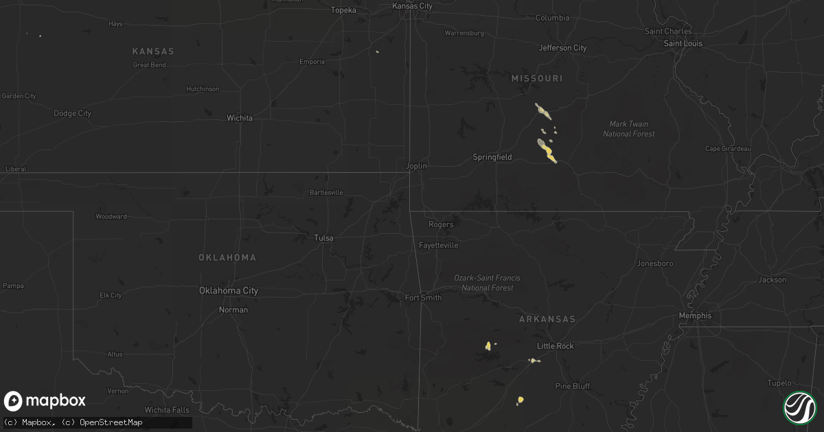
Hail Map on July 29, 2012
Get this storm
July 29 map
$229
one time, instant access
Download today. No call, no setup
Keep the $229
Bought the map and want the full workflow? Apply the entire $229 to a subscription within 7 days. None of it is wasted.
Every map, not just this one
This buys you this map. Subscription and you get every map we run, in the markets you choose from a few cities to whole states to nationwide. Plus real-time alerts the moment a storm fires.
Contact data
Name, contact info, occupancy, even credit band for addresses in the footprint. You go from where it hit to who to call.
Become the source they trust
Unlimited branding weather history reports on demand. You already have the documented answer ready for the property owner, and you are the one who showed up with it.
Property data and RoofTrace estimates
Pull up any address you have got, its value and the exact code rules for that jurisdiction, straight from One Click Code. Then RoofTrace estimates the squares, pitch, and roof value, priced the way you price.
States Impacted by Hail Map on July 29, 2012
Storm reports
South Carolina
| Date | Description |
|---|---|
| 07/29/20123:02 PM CDT | Tree down on a car at the lebanon quick stop. Time estimated based on radar. |
| 07/29/20122:50 PM CDT | Tree down on sc hwy 46 in hardeeville. |
| 07/29/20122:46 PM CDT | One tree was reported down near the intersection of old baileys road and rawstrom drive. |
| 07/29/20122:46 PM CDT | Tree down on hwy 78. |
| 07/29/20122:45 PM CDT | Tree down on delee road. Time estimated based on radar. |
| 07/29/20122:38 PM CDT | Tree down on state highway 174 near cypress bottom road. Time estimated based on radar. |
| 07/29/20122:31 PM CDT | Tree blown down on a mobile home on orvin street. |
| 07/29/20122:30 PM CDT | Tree blown down on fassitt rd in north charleston. |
| 07/29/20122:27 PM CDT | Tree down on jehossee road near highway 174. |
| 07/29/20122:27 PM CDT | Tree down on sc hwy 174 near dahoo bridge. |
| 07/29/20122:23 PM CDT | Tree down on cypress gardens rd near old depot rd. |
| 07/29/20122:23 PM CDT | Powerlines down on 2nd texas road. Time estimated based on radar. |
| 07/29/20122:13 PM CDT | Tree down on deer ridge lane. |
| 07/29/20121:50 PM CDT | Tree down on log hall rd at sc hwy 462. |
| 07/29/20121:27 PM CDT | Tree down at intersection of sc hwy 3 and pine level church rd. |
| 07/29/20121:16 PM CDT | One tree down along the intersection of patriot blvd and rocking porch lane and one large branch down in residential yard. Time estimated by radar. |
| 07/29/201212:41 PM CDT | The hampton county 911 call center relayed a report of a power line down near cummings south carolina. A tree was also reported down near the intersection of savannah h |
Missouri
| Date | Description |
|---|---|
| 07/29/20124:58 PM CDT | Several trees reported down across route 38 between route 95 and state highway e. |
| 07/29/20124:57 PM CDT | Tree down on state hwy 38. |
| 07/29/20124:08 PM CDT | Large tree reported down along route 95. |
| 07/29/20123:45 PM CDT | Thunderstorm wind gust blew wooden shed over on its side. Porch roof damaged. Several three inch tree branches broken off. |
| 07/29/20123:35 PM CDT | Several large trees reported uprooted in the vicinity of smittle cave road. Several buildings were damaged and pieces of buildings were blown into the road. |
| 07/28/20127:45 PM CDT | A barn was heavily damaged and power lines down near highway a and highway f |
| 07/28/20127:10 PM CDT | Damage occurred along the pulaski and laclede county line starting one mile west of mile marker 145 on i-44. On heartwood road multiple powerlines were down. Just to th |
| 07/28/20127:10 PM CDT | 20 to 25 large trees downed along starling drive. An outbuilding was destroyed and a barn lost a portion of its roof. Time of event estimated. |
Minnesota
| Date | Description |
|---|---|
| 07/28/20129:58 PM CDT | Winds gusting estimated to 45 mph. |
| 07/28/20129:55 PM CDT | One camper was flipped and a shed under construction was blown over. Numerous trees downed. |
| 07/28/20129:50 PM CDT | A local report indicates 1.00 inch wind near 3 E GREENBUSH |
| 07/28/20127:30 PM CDT | A local report indicates 1.00 inch wind near 6 S ELY |
North Dakota
| Date | Description |
|---|---|
| 07/28/20128:30 PM CDT | Public report received via facebook. |
Michigan
| Date | Description |
|---|---|
| 07/28/20127:50 PM CDT | Microburst winds snapped off or uprooted numerous large trees. |
Georgia
| Date | Description |
|---|---|
| 07/29/20126:10 PM CDT | The parkers gas station/general store reported scattered trees were blown down along the jesup highway between jesup and brunswick. |
| 07/29/20126:00 PM CDT | The 911 call center reported power lines were blown down along the new jesup highway in the brunswick city limits. |
| 07/29/20125:30 PM CDT | Thunderstorm winds blew down power lines along brunel street in southern waycross. |
| 07/29/20124:55 PM CDT | Trees were blown down along highway 1 in the waycross city limits. Time was estimated based on radar. |
| 07/29/20123:55 PM CDT | Tree down and another tree down on a powerline near whitaker st and w jones st. |
| 07/29/20123:38 PM CDT | The long county 911 call center relayed a report of a power line down near the intersection of highway 301 and bradwell durham road. |
| 07/29/20123:09 PM CDT | Tree down on mud road. Time estimated based on radar. |
| 07/29/20123:00 PM CDT | Tree down on rye patch rd near lanier rd. |
| 07/29/20122:25 PM CDT | Small tree down on old state route 50 west of sylvester. |
| 07/29/20121:55 PM CDT | Power line blown down near rosemary church rd and spell rd. |
| 07/29/20121:25 PM CDT | Trees down on ashbranch road...sims road and strickland street. Time based on radar. |
Arkansas
| Date | Description |
|---|---|
| 07/29/20126:56 PM CDT | Downed trees reported in benton. |
| 07/29/20126:50 PM CDT | A local report indicates 1.00 inch wind near HASKELL |
Arizona
| Date | Description |
|---|---|
| 07/29/20125:55 PM CDT | Trees down. Time estimated. |
| 07/29/20124:30 PM CDT | Delayed report media relayed viewer reports of tstm wind damage in fountain hills. Trees uprooted and roof tile damage reported. Time estimated. |
Kansas
| Date | Description |
|---|---|
| 07/29/20126:30 PM CDT | 4 inch tree limbs down...shingles blown off roof. |
| 07/29/20125:30 PM CDT | A local report indicates 60 MPH wind near 3 E OLPE |
| 07/29/20124:45 PM CDT | Tree limbs down blocking roadways in town |
| 07/29/20127:45 AM CDT | Trees blown down |
| 07/28/20127:39 PM CDT | A local report indicates 60 MPH wind near 3 SE OTTAWA |
Nebraska
| Date | Description |
|---|---|
| 07/29/20125:15 PM CDT | Portions of a metal roof were blown off an outbuilding near the intersection of hwy 385 and cr 105 due to straightline winds. Metal and wood pieces were thrown approxim |
Mississippi
| Date | Description |
|---|---|
| 07/29/20124:23 PM CDT | Power line down along hwy 511. |
South Dakota
| Date | Description |
|---|---|
| 07/29/20124:57 PM CDT | Trained spotter measured 70 mph gust |
| 07/29/20124:50 PM CDT | Trained spotter measured 70 mph winds which snapped a tree |
| 07/29/20124:23 PM CDT | Peak wind from grand river raws...corrected for mdt |
| 07/28/20128:50 PM CDT | A local report indicates 58 MPH wind near DOWNTOWN SPEARFISH |
| 07/28/20127:15 PM CDT | Weather station at the landfill west of abr reported 60 mph wind gust |
| 07/28/20127:15 PM CDT | Weather station at the landfill west of abr reported 60 mph wind gust |
Colorado
| Date | Description |
|---|---|
| 07/29/20126:17 PM CDT | A local report indicates 1.00 inch wind near NNW ILIFF |
| 07/29/20126:12 PM CDT | County road 38 and 43.5. No damage reported |
Alabama
| Date | Description |
|---|---|
| 07/29/20124:09 PM CDT | Two small trees down near weedon field airport. |
| 07/29/20124:04 PM CDT | Tree down through the windshield of a car on highway 165 north of lakepoint resort. |
Cities Impacted by Hail Map on July 29, 2012
- Charleston, SC
- Hertford, NC
- Tyner, NC
- Belvidere, NC
- Saint Helena Island, SC
- Gatzke, MN
- Warroad, MN
- Salol, MN
- Metter, GA
- Woodland Park, CO
- Darien, GA
- Townsend, GA
- Abbeville, GA
- Pansey, AL
- Ashford, AL
- Donalsonville, GA
- Blakely, GA
- Jakin, GA
- Colquitt, GA
- Lebanon, MO
- Varnville, SC
- Estill, SC
- Georgetown, SC
- Eckley, CO
- Yuma, CO
- Blanding, UT
- Cope, SC
- Climax, MN
- Reynolds, ND
- Fisher, MN
- Big Sur, CA
- Big Falls, MN
- Dothan, AL
- Ponsford, MN
- Coolidge, AZ
- Fleming, CO
- Sterling, CO
- Iliff, CO
- Blackshear, GA
- Ely, MN
- Redvale, CO
- Roseau, MN
- Baxley, GA
- Lyons, GA
- Uvalda, GA
- Badger, MN
- Galivants Ferry, SC
- Rhine, GA
- Saint George, SC
- Tillman, SC
- Quincy, FL
- Portal, GA
- Statesboro, GA
- Thomasville, GA
- Sunbury, NC
- Manning, SC
- Buchanan, ND
- Jamestown, ND
- Columbia, SC
- Jacksonville, GA
- Milan, GA
- Quitman, MS
- Shubuta, MS
- Heidelberg, MS
- Millen, GA
- Ochlocknee, GA
- Littlefork, MN
- International Falls, MN
- Queen Creek, AZ
- Wannaska, MN
- Lake City, SC
- Olanta, SC
- Turbeville, SC
- Midway, GA
- Richmond Hill, GA
- Hatton, ND
- Hardeeville, SC
- Sparkman, AR
- Mountain Grove, MO
- Goose Creek, SC
- Bigfork, MN
- Bovey, MN
- Marcell, MN
- Nashwauk, MN
- Lockwood, CA
- Norwood, MO
- Fort Davis, AL
- Tuskegee, AL
- Union Springs, AL
- Register, GA
- Tallahassee, FL
- Starke, FL
- Crookston, MN
- Gable, SC
- Gresham, SC
- Monticello, FL
- Akron, CO
- Effie, MN
- Bapchule, AZ
- Chandler, AZ
- Midland City, AL
- Hephzibah, GA
- Augusta, GA
- Brunswick, GA
- Cope, CO
- Waynesboro, GA
- Keysville, GA
- Wakpala, SD
- Adel, GA
- Sparks, GA
- Lewistown, MT
- Moore, MT
- Thompson, ND
- Tuba City, AZ
- Kelliher, MN
- Fort Gaines, GA
- Winnabow, NC
- Hawkinsville, GA
- Orangeburg, SC
- Neeses, SC
- Newton, GA
- Valley City, ND
- Kathryn, ND
- Walterboro, SC
- Smoaks, SC
- Effingham, SC
- Timmonsville, SC
- Pinewood, SC
- Sumter, SC
- Greenbush, MN
- Ivanhoe, NC
- Bonifay, FL
- Coolidge, GA
- San Tan Valley, AZ
- Gove, KS
- Leary, GA
- Skandia, MI
- East Grand Forks, MN
- Grand Forks, ND
- Divide, CO
- Babbitt, MN
- Crane Lake, MN
- Tower, MN
- Midway, AL
- Sanborn, ND
- Litchville, ND
- Fingal, ND
- Jessieville, AR
- Andrews, SC
- Conway, SC
- Spiritwood, ND
- Florissant, CO
- Sedalia, CO
- Middle River, MN
- Trenary, MI
- Carthage, AR
- Euclid, MN
- Warren, MN
- Thief River Falls, MN
- Hartville, MO
- Stoutland, MO
- Richland, MO
- Ridgeville, SC
- Dorchester, SC
- Leland, NC
- Waycross, GA
- Savannah, GA
- Buckeye, AZ
- Northome, MN
- Twin City, GA
- Kimball, NE
- Clarkdale, AZ
- Aynor, SC
- Claxton, GA
- Glennville, GA
- Swainsboro, GA
- Forbes, MN
- Banks, AL
- Early Branch, SC
- Pineland, SC
- Vossburg, MS
- Benton, AR
- Ridgeland, SC
- Surrency, GA
- Saxon, WI
- Reidsville, GA
- Langdon, ND
- Lumber City, GA
- Ashland, WI
- Eutawville, SC
- Strathcona, MN
- Fountain Hills, AZ
- Cook, MN
- Sylvester, GA
- Albany, GA
- Doerun, GA
- Cornville, AZ
- Pittsview, AL
- Eufaula, AL
- Nome, ND
- Waynesboro, MS
- Emerado, ND
- Pembroke, GA
- North, SC
- Sundance, WY
- Beulah, WY
- Greenville, FL
- Grovespring, MO
- Boston, GA
- Otis, CO
- Ozark, AL
- Glenwood, GA
- Joes, CO
- Iron, MN
- Eveleth, MN
- Pine River, MN
- Backus, MN
- Hackensack, MN
- Longville, MN
- Bauxite, AR
- Luverne, AL
- Brantley, AL
- Westville, FL
- Spearfish, SD
- Clyo, GA
- Springfield, GA
- Flagler, CO
- Blythe, GA
- Vienna, GA
- Newton, AL
- Cameron, SC
- Falcon, MO
- Roosevelt, MN
- Nashville, GA
- Grand Rapids, MN
- Rantoul, KS
- Hortense, GA
- Sorrento, FL
- Wrightsville, GA
- McRae Helena, GA
- Alamo, GA
- Hobbsville, NC
- Ashburn, GA
- Crawfordville, FL
- Collins, GA
- Hilton Head Island, SC
- Okatie, SC
- Moncks Corner, SC
- Williams, MN
- Lynchburg, SC
- Scranton, SC
- Alma, GA
- Mershon, GA
- Axson, GA
- Bristol, GA
- Kite, GA
- Millwood, GA
- Coosawhatchie, SC
- Cottonwood, AZ
- Tyler, AL
- Huger, SC
- North Charleston, SC
- Tucson, AZ
- Odum, GA
- Waskish, MN
- Northwood, ND
- New Raymer, CO
- Lynchburg, MO
- Swansea, SC
- Upson, WI
- Arvilla, ND
- Mount Vernon, GA
- Skipperville, AL
- Clio, AL
- Sellers, SC
- Wagener, SC
- Gaston, SC
- Pelion, SC
- Leesville, SC
- Sylvania, GA
- Marion Junction, AL
- Cordele, GA
- Bamberg, SC
- Denmark, SC
- Soperton, GA
- Nesmith, SC
- Blackville, SC
- Haxtun, CO