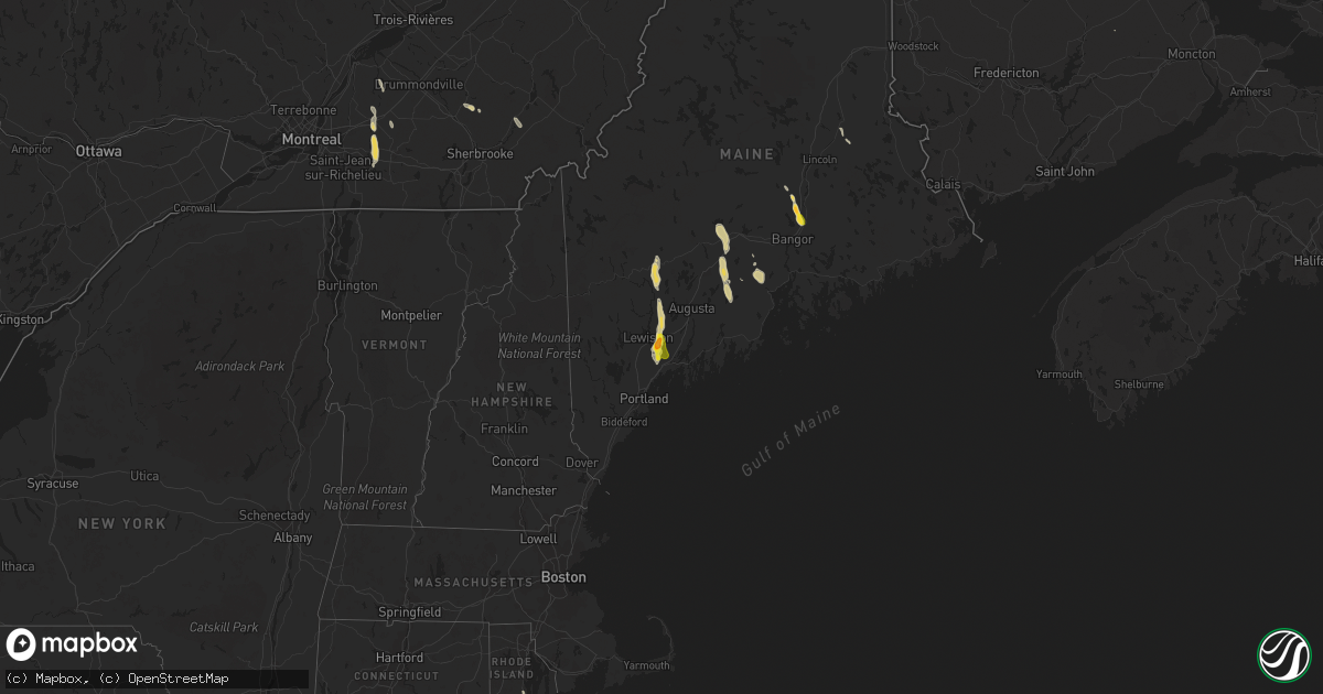
Hail Map on July 28, 2015
Get this storm
July 28 map
$229
one time, instant access
Download today. No call, no setup
Keep the $229
Bought the map and want the full workflow? Apply the entire $229 to a subscription within 7 days. None of it is wasted.
Every map, not just this one
This buys you this map. Subscription and you get every map we run, in the markets you choose from a few cities to whole states to nationwide. Plus real-time alerts the moment a storm fires.
Contact data
Name, contact info, occupancy, even credit band for addresses in the footprint. You go from where it hit to who to call.
Become the source they trust
Unlimited branding weather history reports on demand. You already have the documented answer ready for the property owner, and you are the one who showed up with it.
Property data and RoofTrace estimates
Pull up any address you have got, its value and the exact code rules for that jurisdiction, straight from One Click Code. Then RoofTrace estimates the squares, pitch, and roof value, priced the way you price.
States Impacted by Hail Map on July 28, 2015
Storm reports
Rhode Island
| Date | Description |
|---|---|
| 07/28/20155:35 PM CDT | Large limb down 8 to 14 inches in diameter in the boston neck road and juliet road area |
| 07/28/20155:35 PM CDT | Straight line wind damage estimated to be around 60 mph occurred across old boston neck and boston neck road. Most of the damage was large tree limbs that were southerl |
| 07/28/20155:33 PM CDT | Branch and wires down on middlebridge road |
| 07/28/20155:31 PM CDT | Large limbs blocking ocean road |
| 07/28/20155:07 PM CDT | Multiple trees down across road on old boston neck road |
| 07/28/20154:57 PM CDT | One half to 1 inch diameter hail and power outage due to lightning |
| 07/28/20154:05 PM CDT | Large branch down on wires on linden street |
| 07/28/20154:02 PM CDT | Large limb down on lindbergh avenue |
| 07/28/20153:55 PM CDT | Three to 4 inch limbs down on water street at columbus avenue |
Maine
| Date | Description |
|---|---|
| 07/28/20156:00 PM CDT | Trees down |
| 07/28/20155:35 PM CDT | Hail varied from 1/2 to 1 inch |
| 07/28/20155:35 PM CDT | Trees down on albion rd |
| 07/28/20154:52 PM CDT | Trees down |
| 07/28/20154:50 PM CDT | Trees and wires down - corrected - in pittsfied me |
| 07/28/20154:30 PM CDT | Trees and wires down |
| 07/28/20153:00 PM CDT | Large branches and wires down |
| 07/28/20152:55 PM CDT | From photo |
| 07/28/20152:54 PM CDT | Based on photo |
| 07/28/20152:46 PM CDT | A local report indicates 1.00 inch wind near LISBON |
| 07/28/20152:41 PM CDT | Trees down across highway 139... Power outages |
| 07/28/20152:15 PM CDT | Trees down on north rd near fayette town line |
| 07/28/20152:01 PM CDT | Marrs point rd and rt 132 |
| 07/28/20152:00 PM CDT | Dime to quarter size hail |
| 07/28/20151:50 PM CDT | General public posted a picture of large hailstones via facebook. Hail size is oddly shaped but estimated to be ping pong size on minor axis. However... Hail had signific (ca |
| 07/28/20151:43 PM CDT | Trees down |
| 07/28/20151:41 PM CDT | Trees down |
| 07/28/20151:34 PM CDT | Trees down |
| 07/28/201512:56 PM CDT | Trees down in jay hyde rd... Chesterville rd... East jay rd. |
| 07/28/201512:44 PM CDT | Trees on car on knoleton corner rd |
| 07/28/201512:25 PM CDT | Trees down old corner rd... Whitter rd. |
New Hampshire
| Date | Description |
|---|---|
| 07/28/20154:50 PM CDT | Trees and wires down |
Tennessee
| Date | Description |
|---|---|
| 07/28/20154:35 PM CDT | Tree down at carters creek and horton lane with roadway not passable |
| 07/28/20154:30 PM CDT | Tree down across clovercroft road at burke hollow road. |
| 07/28/20154:30 PM CDT | Tree snapped in antioch |
| 07/28/20154:30 PM CDT | Tree snapped at stones river road and rocky ridge circle |
| 07/28/20154:27 PM CDT | Tree down on turning wheel lane between mcewen and liberty pike |
| 07/28/20154:25 PM CDT | Trees and power lines down at glendale lane at lealand lane |
| 07/28/20154:20 PM CDT | Tree branches blown down near nashville zoo |
| 07/28/20154:20 PM CDT | Two trees and power lines blown down on granny white pike near jt moore middle school |
| 07/28/20154:18 PM CDT | 70 mph wind gusts currently near the hamilton church area of murfreesboro road in southeast davidson county. |
| 07/28/20154:15 PM CDT | Trees and power lines down in woodland pointe area off bell road |
| 07/28/20154:15 PM CDT | Large tree limb blown down in donelson |
| 07/28/20154:10 PM CDT | Large tree blown down at stewarts ferry pike and lebanon pike in donelson |
| 07/28/20154:07 PM CDT | Power line down blocking elm hill pike near i-40. Report via tspotter |
| 07/28/20154:05 PM CDT | Trees blown down in old hickory |
| 07/28/20154:00 PM CDT | Tree down at claudia drive and old hickory blvd. |
| 07/28/20154:00 PM CDT | Numerous trees down along forest retreat road. |
| 07/28/20154:00 PM CDT | Large tree snapped on anderson lane at myatt drive |
| 07/28/20154:00 PM CDT | Large tree down in backyard of home at 915 broadmorr drive in inglewood |
| 07/28/20154:00 PM CDT | Power lines down on riviera drive |
| 07/28/20153:55 PM CDT | A few trees were downed by thunderstorm winds. |
| 07/28/20153:55 PM CDT | Goodlettsville city employee reported trees down across hitt lane. Relayed by nws employee. |
| 07/28/20153:53 PM CDT | Roof damage to one business and structural damage to another business on midtown court |
| 07/28/20153:50 PM CDT | A few trees were downed by thunderstorm winds. |
| 07/28/20153:28 PM CDT | Tree blown down on highway 31... Along the ridge leading up to white house... Blocking one lane of traffic. |
| 07/28/20153:19 PM CDT | Tree down at the hope center in white house at 1115 highway 76. |
Montana
| Date | Description |
|---|---|
| 07/28/20152:40 PM CDT | A local report indicates 58 MPH wind near 13 NE BAKER |
Iowa
| Date | Description |
|---|---|
| 07/28/20156:54 PM CDT | Iowa dot rwis observation |
| 07/28/20156:34 PM CDT | Large tree limb down 10 to 12 inches in diameter. |
| 07/28/20155:50 PM CDT | Tree down across highway 92. Relayed by em. Time estimated. |
| 07/28/20155:31 PM CDT | Large tree snapped in half diameter around 10 to 12 inches. |
| 07/28/20155:30 PM CDT | Tree down across highway 92. Relayed by em. Time estimated. |
| 07/28/20154:20 PM CDT | Trees and power lines down. Tree on house. Report relayed by em. |
| 07/27/201510:00 PM CDT | A local report indicates 65 MPH wind near CENTERVILLE |
| 07/27/20159:44 PM CDT | Large tree limbs down. |
| 07/27/20159:31 PM CDT | Large tree down 20 inches in diameter and crops blown down. |
| 07/27/20159:30 PM CDT | Large tree limbs down. |
| 07/27/20159:17 PM CDT | Three to four inch tree limbs down and buckets blown. |
| 07/27/20158:30 PM CDT | Tree blown over by the thunderstorm winds...2.5 ft in diameter. Time estimated by radar. Delayed report. |
| 07/27/20157:42 PM CDT | Several small trees and branches down in streets. Unknown diameter. Estimated wind 60 mph. Delayed report. Time based on radar. |
| 07/27/20157:20 PM CDT | Delayed report. 20 to 25 inch diameter trees uprooted. Roof damage. 10 inch diameter tree branches down. Approximately 720 to 740 pm. |
| 07/27/20157:05 PM CDT | Numerous tree limbs down on houses and powerlines. Time estimated from radar. Report relayed from trained spotter. |
| 07/27/20157:00 PM CDT | Telephone pole knock over at intersection of clay and gateway. Wind gusts estimated at 60-65 mph. |
| 07/27/20157:00 PM CDT | A local report indicates 63 MPH wind near 5 SSE FREMONT |
Massachusetts
| Date | Description |
|---|---|
| 07/28/20152:10 PM CDT | Trees and wires down on main and hollis streets. |
| 07/28/20151:26 PM CDT | Tree hanging in road on keets road. Road partially blocked. |
| 07/28/20151:12 PM CDT | Tree and wires down on lower road. |
| 07/28/20151:10 PM CDT | Route 91 southbound at greenfield town line...tree down across road. |
Texas
| Date | Description |
|---|---|
| 07/27/20159:15 PM CDT | A local report indicates 59 MPH wind near 26 NW MIAMI |
Virginia
| Date | Description |
|---|---|
| 07/28/20152:15 PM CDT | Tree down on rt 360 |
Alabama
| Date | Description |
|---|---|
| 07/28/20155:21 PM CDT | Tree down near alice st and spring st in oxford. Reported via social media. |
| 07/28/20155:17 PM CDT | Trees and powerlines down on cooper ave in anniston between 18th and 19th streets. Also trees down at 15th st and christine ave. |
| 07/28/20153:10 PM CDT | Several trees and phone lines down near coosa river rd and foreman rd. Winds estimated 40-50 mph. Time estimated from radar. |
| 07/28/20151:02 AM CDT | Tree uprooted in the northport area. Winds etimated 40-45 mph. |
Arizona
| Date | Description |
|---|---|
| 07/27/20157:25 PM CDT | Downed power pole on valencia rd between 6th and nogales hwy |
| 07/27/20157:21 PM CDT | A local report indicates 64 MPH wind near 2 SSE TUCSON |
North Dakota
| Date | Description |
|---|---|
| 07/28/20155:00 PM CDT | Late report from july 28. A few trees snapped and others had large branches broken off. |
Kentucky
| Date | Description |
|---|---|
| 07/27/20158:05 PM CDT | A few trees down blocking highway 280 between hwy 94e and hwy 121s. |
Cities Impacted by Hail Map on July 28, 2015
- Wilton, ME
- Jay, ME
- Livermore Falls, ME
- Kents Hill, ME
- Farmington, ME
- Pittsfield, ME
- Elliott, IA
- Griswold, IA
- Waverly, KY
- Corydon, KY
- Erin, TN
- Lisbon, ME
- Pownal, ME
- Sabattus, ME
- Auburn, ME
- Leeds, ME
- Greene, ME
- North Monmouth, ME
- Durham, ME
- Lisbon Falls, ME
- Wayne, ME
- Freeport, ME
- Monmouth, ME
- Lewiston, ME
- Eskridge, KS
- Alma, KS
- Paxico, KS
- Guthrie Center, IA
- Stuart, IA
- Linden, IA
- Panora, IA
- Villisca, IA
- Stanton, IA
- Skellytown, TX
- Knoxville, IA
- Milo, IA
- Pleasantville, IA
- Melcher Dallas, IA
- Lacona, IA
- Burchard, NE
- Burnham, ME
- Palmyra, ME
- Hartland, ME
- Canaan, ME
- Belle Rive, IL
- Dahlgren, IL
- Conchas Dam, NM
- Old Town, ME
- Laurel, DE
- Amarillo, TX
- Sublette, IL
- Floyd, NM
- Beattie, KS
- Home, KS
- Pella, IA
- Harvey, IA
- Albertville, AL
- Albion, ME
- Waterville, ME
- Clinton, ME
- Tucumcari, NM
- San Jon, NM
- Bard, NM
- Douglas, AZ
- Corning, IA
- Nodaway, IA
- Palermo, ME
- Lorimor, IA
- Macksburg, IA
- Stevenson, AL
- Martensdale, IA
- Bevington, IA
- Saint Charles, IA
- Norwalk, IA
- Prole, IA
- Peru, IA
- Murray, IA
- Patterson, IA
- Winterset, IA
- Grady, NM
- Liberty, ME
- Canadian, TX
- Hereford, TX
- Princeton, KY
- Dover, TN
- Haviland, KS
- Auburn, NE
- Dixmont, ME
- Greensburg, KS
- Watson, IL
- Effingham, IL
- Dieterich, IL
- Indianola, IA
- Red Oak, IA
- Freedom, ME
- Moville, IA
- Brooks, ME
- Manitou, KY
- Wedowee, AL
- Leighton, IA
- Prairie City, IA
- Ackworth, IA
- Swan, IA
- Otley, IA
- Monroe, IA
- Tracy, IA
- New Market, IA
- Drakes Branch, VA
- Graham, MO
- Barnard, MO
- McEwen, TN
- Palmer, KS
- Linn, KS
- Greenleaf, KS
- Maryville, MO
- Only, TN
- Perry, IA
- Dawson, IA
- Lorraine, KS
- Runnells, IA
- East Saint Louis, IL
- Afton, IA
- Creston, IA
- Tarkio, MO
- Wadley, AL
- Simpson, IL
- Clive, IA
- Granger, IA
- Urbandale, IA
- Grimes, IA
- West Des Moines, IA
- Des Moines, IA
- Johnston, IA
- Woodward, IA
- Waukee, IA
- Dallas Center, IA
- Scottsville, KY
- Dalzell, IL
- La Salle, IL
- Spring Valley, IL
- Granville, IL
- Peru, IL
- Hennepin, IL
- Peru, NE
- Brownville, NE
- Rock Port, MO
- Watson, MO
- Carmi, IL
- Olin, NC
- Galva, KS
- Statesville, NC
- Liberty, KY
- Buhler, KS
- Oskaloosa, IA
- McNabb, IL
- Monroe, ME
- Belfast, ME
- Mosquero, NM
- Goodwell, OK
- Truro, IA
- Ottumwa, IA
- Ten Mile, TN
- Fairfax, MO
- Waynesboro, TN
- Lawrenceburg, TN
- Orient, IA
- Greenfield, IA
- Lebanon, IL
- Orono, ME
- Ocala, FL
- Summerfield, FL
- Eldorado, IL
- Adair, IA
- Exira, IA
- Macksville, KS
- Cutler, IL
- Pinckneyville, IL
- Claflin, KS
- Cumming, IA
- Van Meter, IA
- Cedar, IA
- Fremont, IA
- Lebanon, TN
- Hartsville, TN
- Lane, IL
- Clinton, IL
- Neponset, IL
- Bedford, IA
- Hurricane Mills, TN
- Wymore, NE
- Barneston, NE
- Farragut, IA
- Russellville, KY
- Osceola, IA
- Saint Marys, IA
- New Virginia, IA
- Fritch, TX
- Mcpherson, KS
- Nogales, AZ
- Prescott, IA
- Skidmore, MO
- Clarinda, IA
- Clearmont, MO
- Shambaugh, IA
- Hopkins, MO
- Braddyville, IA
- McLeansboro, IL
- Broughton, IL
- Shenandoah, IA
- Hamburg, IA
- Pollock, MO
- Lucerne, MO
- Clovis, NM
- Carbondale, IL
- Victoria, IL
- Marion, IL
- Lineville, AL
- Nashville, TN
- Earlham, IA
- Dunnellon, FL
- Equality, IL
- Elizabethtown, IL
- Golconda, IL
- Carlisle, IA
- Melrose, NM
- Bolckow, MO
- Macedonia, IL
- Goodlettsville, TN
- Hendersonville, TN
- Greenbrier, TN
- Springfield, TN
- White House, TN
- Walhalla, SC
- Liberty, NE
- Gravity, IA
- Lenox, IA
- Eddyville, IL
- Borger, TX
- Mound City, MO
- Portales, NM
- Cromwell, IA
- Bouton, IA
- Higgins, TX
- Creal Springs, IL
- Otis, KS
- Sheridan, MO
- Adel, IA
- Gowrie, IA
- Neoga, IL
- Trilla, IL
- Westmoreland, TN
- Fort Sumner, NM
- Mullinville, KS
- Hamilton, IA
- Geneseo, KS
- Centerville, TN
- Nunnelly, TN
- Lehigh, KS
- Green, KS
- Chester, IL
- West Brooklyn, IL
- Bushton, KS
- Thompsonville, IL
- Tennessee Ridge, TN
- Patagonia, AZ
- Dexter, IA
- Redfield, IA
- Steinauer, NE
- Mount Carmel, IL
- Allendale, IL
- Saunderstown, RI
- Wakefield, RI
- Narragansett, RI
- Lagrange, ME
- Lancaster, TN
- Hickman, TN
- Madrid, IA
- Slater, IA
- Kelley, IA
- Dawson Springs, KY
- Montezuma, IA
- Essex, IA
- Morganfield, KY
- Eddyville, KY
- Cadiz, KY
- Westboro, MO
- Blanchard, IA
- Coin, IA
- Durham, KS
- Adrian, TX
- Yale, IA
- Sparland, IL
- Lacon, IL
- Herod, IL
- Rio Rico, AZ
- Maitland, MO
- Oketo, KS
- Joelton, TN
- Streator, IL
- Elmo, MO
- College Springs, IA
- Coldwater, KS
- Wiota, IA
- Old Hickory, TN
- Madison, TN
- Robards, KY
- Brunswick, ME
- Topsham, ME
- Bowdoin, ME