Hail Map on July 27, 2024
Get this storm
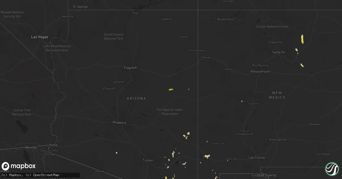
July 27 map
$229
one time, instant access
Download today. No call, no setup
Keep the $229
Bought the map and want the full workflow? Apply the entire $229 to a subscription within 7 days. None of it is wasted.
Every map, not just this one
This buys you this map. Subscription and you get every map we run, in the markets you choose from a few cities to whole states to nationwide. Plus real-time alerts the moment a storm fires.
Contact data
Name, contact info, occupancy, even credit band for addresses in the footprint. You go from where it hit to who to call.
Become the source they trust
Unlimited branding weather history reports on demand. You already have the documented answer ready for the property owner, and you are the one who showed up with it.
Property data and RoofTrace estimates
Pull up any address you have got, its value and the exact code rules for that jurisdiction, straight from One Click Code. Then RoofTrace estimates the squares, pitch, and roof value, priced the way you price.
States Impacted by Hail Map on July 27, 2024
Storm reports
North Dakota
| Date | Description |
|---|---|
| 07/26/20249:28 PM CDT | Delayed report. Hail ranged from pea to quarter size and lasted for about 10 minutes. Winds estimated 40 to 50 mph. Time estimated from radar. |
| 07/26/20249:10 PM CDT | Public report to media relayed to nws. This is the roughrider development area on the far west side of mandan and along i-94. |
| 07/26/20249:10 PM CDT | Delayed report. Additional reports from roughrider development area. Multiple large branches down with some minor structural damage. Relayed via pictures from broadcast |
| 07/26/20249:10 PM CDT | Public report to the media... Relayed to nws. This is along old red trail in northwest mandan. |
| 07/26/20249:06 PM CDT | This is the ndawn station 9 ene carson... Nd. 10 meter peak gust. |
| 07/26/20248:15 PM CDT | Also had 1 inch diameter hail... And a lot of hail between a half inch and one inch diameter. Had about a half inch of rain. Event lasted about 5 minutes until 820 pm. |
Nebraska
| Date | Description |
|---|---|
| 07/27/20246:55 PM CDT | 60 mph winds caused small branches to fall out of tree. |
| 07/27/20246:28 PM CDT | Mesonet station fw8225 sidney. |
| 07/27/20246:18 PM CDT | Mesonet station fw8225 sidney. |
| 07/27/20246:17 PM CDT | Spotter reported power line down. |
| 07/27/20245:11 PM CDT | Delayed report from emergency manager of quarter sized hail in minatare. |
| 07/27/202412:39 AM CDT | Corrects previous tstm wnd gst report from 2 ene trenton. Ambient weather station my_weather_station_ |
| 07/27/202412:35 AM CDT | Ambient weather station my_weather_station_ |
| 07/26/202411:48 PM CDT | Asos station klbf north platte airport. |
| 07/26/20248:24 PM CDT | Raws site montrose. |
| 07/26/20248:21 PM CDT | Chadron asos |
| 07/26/20247:43 PM CDT | A local report indicates 1.00 inch wind near 6 SSE Sidney |
Utah
| Date | Description |
|---|---|
| 07/27/20246:50 PM CDT | Mesonet station pc492 radar. |
| 07/27/20246:50 PM CDT | A pacificorp mesonet site called radar measured a gust of 67 mph. |
| 07/27/20246:40 PM CDT | A pacificorp mesonet site called radar measured a gust of 62 mph. |
| 07/27/20246:00 PM CDT | Pc358 hansel valley... A pacificorp a mesonet site on a ridge... Measured 66 mph gust as a line of thunderstorms collapsed overhead. |
| 07/26/20249:10 PM CDT | Mesonet station snd arrowhead summit. |
| 07/26/20248:40 PM CDT | Mesonet station uts16 sr-16 at mp 1. |
| 07/26/20248:00 PM CDT | Multiple trees down at sourdough wilderness ranch due to thunderstorm winds. |
| 07/26/20247:50 PM CDT | Mesonet station pc298 the head. |
| 07/26/20247:50 PM CDT | Mesonet station utnod north ogden divide. |
| 07/26/20247:40 PM CDT | Mesonet station tpr trappers loop road. |
| 07/26/20247:40 PM CDT | Mesonet station pc102 shepard creek. |
| 07/26/20247:40 PM CDT | Mesonet station pc211 weber canyon. |
| 07/26/20247:10 PM CDT | Mesonet station pc124 crow mountain. |
Arizona
| Date | Description |
|---|---|
| 07/27/20243:00 PM CDT | A local report indicates 1.00 inch wind near Snowflake |
New Mexico
| Date | Description |
|---|---|
| 07/26/20247:59 PM CDT | Lordsburg municipal airport reported a wind gust of 63 mph. |
Wyoming
| Date | Description |
|---|---|
| 07/27/20246:59 PM CDT | Asos station ktor torrington airport - tor. |
| 07/27/20246:56 PM CDT | Corrects previous non-tstm wnd gst report from 8 nnw glendo. Mesonet station wy56 i25 us26 us87 - platte converse. |
| 07/27/20246:53 PM CDT | Asos station kdgw douglas airport - dgw. |
| 07/27/20246:53 PM CDT | Corrects previous non-tstm wnd gst report from 2 e torrington. Asos station ktor torrington airport - tor. |
| 07/27/20246:42 PM CDT | A local report indicates 60 MPH wind near 5 S Lingle |
| 07/27/20246:40 PM CDT | Mesonet station dw7426 douglas. |
| 07/27/20246:36 PM CDT | Mesonet station wy1 8.4 s sibley peak |
| 07/27/20246:22 PM CDT | Mesonet station kbrx 1.4 s bordeaux |
| 07/27/20246:12 PM CDT | Mesonet station kbrx 1.4 s bordeaux |
| 07/27/20246:06 PM CDT | Mesonet station wy40 7.5 s chugwater |
| 07/27/20245:16 PM CDT | Mesonet station wy18 halleck ridge |
| 07/27/20244:19 PM CDT | Asos station krwl 1 ene rawlins. |
| 07/26/20249:31 PM CDT | Mesonet station up146 7.8 ne carter. |
| 07/26/20249:26 PM CDT | Mesonet station up146 7.8 ne carter. |
| 07/26/20248:52 PM CDT | Asos station kevw evanston-uinta cnty airport. |
| 07/26/20248:43 PM CDT | Mesonet station av868 medicine butte mountain. |
| 07/26/20248:20 PM CDT | Halleck ridge wydot site. |
| 07/26/20248:08 PM CDT | Camp guernsey wydot site. |
| 07/26/20247:22 PM CDT | Mesonet station wy60 3.4 w van tassell |
Colorado
| Date | Description |
|---|---|
| 07/27/20246:23 PM CDT | Mesonet station pirc2 pinto... Massadona 18se. |
| 07/26/20249:45 PM CDT | Mesonet station co034 i-76 julesburg. |
| 07/26/20249:04 PM CDT | A local report indicates 63 MPH wind near 3 N Fairfield |
| 07/26/20248:48 PM CDT | Delayed report. Time estimated by radar. |
| 07/26/20248:06 PM CDT | A local report indicates 1.00 inch wind near 1 WSW Crook |
| 07/26/20247:30 PM CDT | Broken window and damage to cars. |
| 07/26/20247:30 PM CDT | A local report indicates 1.00 inch wind near Peetz |
| 07/26/20247:28 PM CDT | A local report indicates 1.75 inch wind near Peetz |
| 07/26/20247:21 PM CDT | Awos station k1ow 2 nw pawnee buttes. |
Florida
| Date | Description |
|---|---|
| 07/27/20246:10 PM CDT | A tree was reported down at the intersection of beach blvd and kernan blvd s. Time was estimated by radar. |
| 07/27/20244:00 PM CDT | A tree was reported down along key haven dr. Time was estimated by radar. |
| 07/27/20243:40 PM CDT | A powerline was reported down and caused a tree to catch fire along mulhall dr. Time was estimated by radar. |
Idaho
| Date | Description |
|---|---|
| 07/27/20244:10 PM CDT | Mesonet station san sand dunes. |
| 07/27/20244:02 PM CDT | Mesonet station crii1 cotton ridge. |
| 07/26/20248:10 PM CDT | Mesonet station pc506 sheep creek hills. |
| 07/26/20248:00 PM CDT | Mesonet station pc215 bartlett lake. |
| 07/26/20247:10 PM CDT | Mesonet station pc130 cub river. |
South Dakota
| Date | Description |
|---|---|
| 07/26/20249:04 PM CDT | A local report indicates 59 MPH wind near 3 ESE Pine Ridge |
| 07/26/20248:53 PM CDT | A local report indicates 62 MPH wind near 12 E Oelrichs |
| 07/26/20248:47 PM CDT | Estimated 60 mph winds and dime size hail. |
| 07/26/20247:25 PM CDT | Camper blown over. |
Cities Impacted by Hail Map on July 27, 2024
- Snowflake, AZ
- Newton, GA
- Albany, GA
- Taylor, AZ
- Freeman, MO
- Cleveland, MO
- Pine Bluffs, WY
- Louisburg, KS
- Nogales, AZ
- Sierra Vista, AZ
- Harrisburg, NE
- Ocate, NM
- Lenexa, KS
- Olathe, KS
- Bushnell, NE
- Guadalupita, NM
- Albin, WY
- Hereford, AZ
- Huachuca City, AZ
- Declo, ID
- Cheyenne, WY
- International Falls, MN
- Grouse Creek, UT
- Hemingford, NE
- Carey, ID
- Malta, ID
- Shawnee, KS
- Bayard, NE
- Bridgeport, NE
- La Jara, CO
- Antonito, CO
- Manassa, CO
- Sanford, CO
- Dubois, ID
- Laramie, WY
- Buford, WY
- Baldwin City, KS
- Colorado Springs, CO
- Usaf Academy, CO
- Kimball, NE
- Dix, NE
- Pearce, AZ
- Melbeta, NE
- Minatare, NE
- Gering, NE
- Ellsworth, NE
- Kiowa, CO
- Ramah, CO
- Broadwater, NE
- Gordon, NE
- Valdosta, GA
- Paducah, TX
- Willcox, AZ
- Agate, CO
- Benson, AZ
- Alliance, NE
- Laporte, CO
- Wheatland, WY
- Las Vegas, NM
- Sapello, NM
- Oshkosh, NE
- La Cygne, KS
- Merriman, NE
- Fort Collins, CO
- Sidney, NE
- Martin, SD
- Wellington, CO
- Bingham, NE
- Rushville, NE
- Long Valley, SD
- Bellvue, CO
- White River, SD
- Carpenter, WY
- Burns, WY
- Grantsville, UT
- Norris, SD
- Chugwater, WY
- Lagrange, WY
- Hawk Springs, WY
- Meriden, WY
- Glendo, WY
- Guernsey, WY
- Yoder, WY
- Hartville, WY
- Shawnee, WY
- Veteran, WY
- Fort Laramie, WY
- Jay Em, WY
- Harrison, NE
- Mitchell, NE
- Lyman, NE
- Torrington, WY
- Morrill, NE
- Lingle, WY
- Lusk, WY
- Manville, WY
- Peetz, CO
- Lordsburg, NM
- Padroni, CO
- Douglas, WY
- Lost Springs, WY
- Parmelee, SD
- Lodgepole, NE
- Scottsbluff, NE
- Marsland, NE
- Van Tassell, WY
- Quanah, TX
- Fort Pierre, SD
- Carson, ND
- Iliff, CO
- Crook, CO
- Safford, AZ
- Syracuse, UT
- Clearfield, UT
- Montpelier, ID
- Flasher, ND
- Buckhorn, NM
- Logan, UT
- Hurley, NM
- Pierre, SD
- Elgin, ND
- Almont, ND
- Clifton, AZ
- Whitman, NE
- Cokeville, WY
- Chadron, NE
- Mission, SD
- New Salem, ND
- Onida, SD
- Sedgwick, CO
- Morenci, AZ
- Mandan, ND
- Lance Creek, WY
- Edgemont, SD
- Oelrichs, SD
- Whitney, NE
- Hot Springs, SD
- Crawford, NE
- Smithwick, SD
- Oral, SD
- Hay Springs, NE
- Pine Ridge, SD
- Oglala, SD
- Casa Grande, AZ
- Raleigh, ND
- Bismarck, ND
- Baldwin, ND
- Holabird, SD
- Batesland, SD
- Milliken, CO
- Eagle Butte, SD
- Ovid, CO
- Wounded Knee, SD
- Potter, NE
- Wilton, ND
- Saint Johns, AZ
- Gettysburg, SD
- Agar, SD
- Newell, SD
- Union Center, SD
- Mud Butte, SD
- Bosler, WY
- Hoven, SD
- Peyton, CO
- North Platte, NE
- Tolstoy, SD
- Onaka, SD
- Adams, ND
- Park River, ND
- Grafton, ND
- Glasston, ND
- Saint Thomas, ND
- Hensel, ND
- Pembina, ND
- Hamilton, ND
- Stephen, MN
- Karlstad, MN
- Donaldson, MN
- Hallock, MN
- Lancaster, MN
- Glade, KS
- Edinburg, ND
- Greenbush, MN
- Badger, MN
- Roseau, MN
- Solomon, KS
- Halma, MN
- Salina, KS
- Clifton, KS
- Haddam, KS
- Beltrami, MN
- Fertile, MN