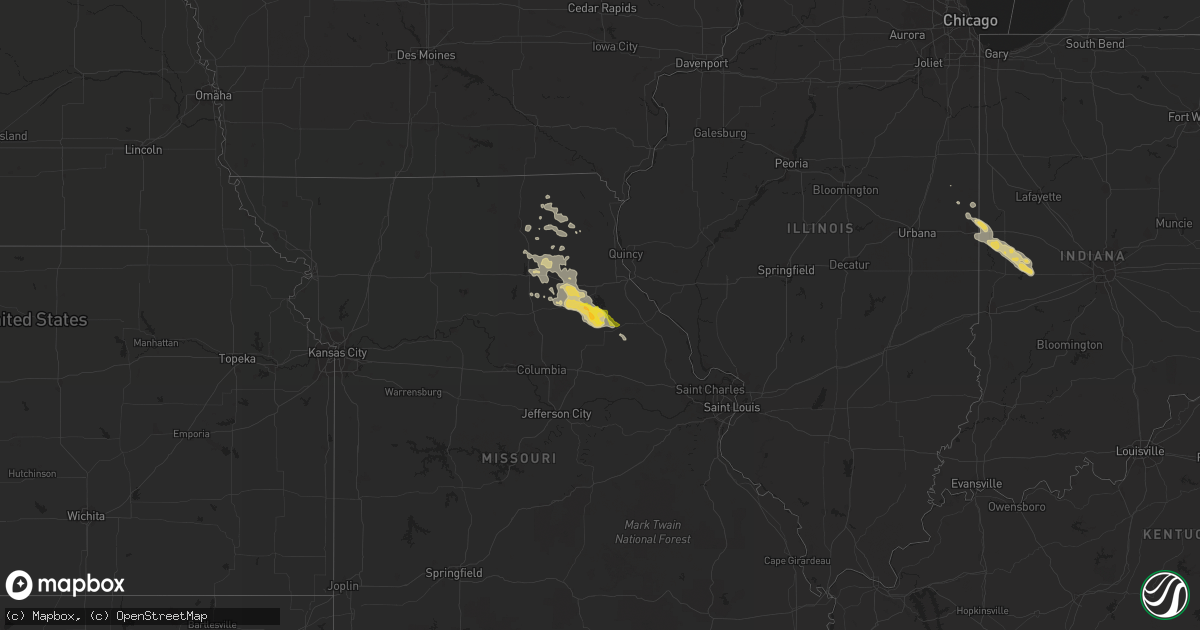
Hail Map on July 25, 2014
Get this storm
July 25 map
$229
one time, instant access
Download today. No call, no setup
Keep the $229
Bought the map and want the full workflow? Apply the entire $229 to a subscription within 7 days. None of it is wasted.
Every map, not just this one
This buys you this map. Subscription and you get every map we run, in the markets you choose from a few cities to whole states to nationwide. Plus real-time alerts the moment a storm fires.
Contact data
Name, contact info, occupancy, even credit band for addresses in the footprint. You go from where it hit to who to call.
Become the source they trust
Unlimited branding weather history reports on demand. You already have the documented answer ready for the property owner, and you are the one who showed up with it.
Property data and RoofTrace estimates
Pull up any address you have got, its value and the exact code rules for that jurisdiction, straight from One Click Code. Then RoofTrace estimates the squares, pitch, and roof value, priced the way you price.
States Impacted by Hail Map on July 25, 2014
Storm reports
Missouri
| Date | Description |
|---|---|
| 07/25/20142:05 PM CDT | Tree limbs reported downing powerlines both north and south of warrenton. |
California
| Date | Description |
|---|---|
| 07/25/20144:40 PM CDT | Thunderstorm winds knocked down a metal flagpole. A 53 mph peak wind gust was measured. |
Indiana
| Date | Description |
|---|---|
| 07/25/20146:05 AM CDT | Largest hailstones were quarter size. |
Texas
| Date | Description |
|---|---|
| 07/25/20144:18 PM CDT | A local report indicates 58 MPH wind near LAREDO |
Wyoming
| Date | Description |
|---|---|
| 07/25/20146:13 PM CDT | Out building destroyed by straight line winds where highway 158 turns east towards nebraska. |
South Carolina
| Date | Description |
|---|---|
| 07/25/20146:12 PM CDT | Sc hwy patrol reported a tree down on old house rd and bees creek rd. |
| 07/25/20145:11 PM CDT | Tree down on perry rd at orange grove rd. |
| 07/25/20145:01 PM CDT | Sc hwy patrol reports a tree down on glover rd on st helena island. |
| 07/25/20144:51 PM CDT | Tree down on sea island pkwy on ladys island. |
| 07/25/20144:50 PM CDT | Tree down on vehicle on ladys island drive. No injuries reported. |
| 07/25/20144:19 PM CDT | Tree and powerlines down on highway 17 near william a campbell rd. |
| 07/25/20142:40 PM CDT | Highway patrol reported a tree down on bears bluff rd at truckfarm rd. |
| 07/25/20142:10 PM CDT | Multiple trees down on sc hwy 45 near intersection with us hwy 17. |
| 07/25/20141:58 PM CDT | Golfball size hail was reported. |
| 07/25/20141:57 PM CDT | Intersection of bay road with hwy 707 |
| 07/24/20148:12 PM CDT | Sc highway patrol reports a tree down and in the roadway on jericho road between augusta stage coach road and collie road. Time estimated from radar. |
Florida
| Date | Description |
|---|---|
| 07/25/20144:20 PM CDT | Power lines were damaged by thunderstorm wind in east palatka per the satsuma fire dept. |
| 07/25/20143:30 PM CDT | Minor roof damage to apartment building on south atlantic ave. In new smyrna beach. Time estimated by radar. |
| 07/25/20143:26 PM CDT | Skywarn spotter reported three ft diameter 50 foot tall pine tree down near intersection of pine tree drive and 30th st. Time estimated from radar. |
Kansas
| Date | Description |
|---|---|
| 07/24/201411:53 PM CDT | Public reported 12 inch diameter live tree limbs blown down with numerous other branches down... Relayed by emergency manager. Time estimated from radar. |
| 07/24/201411:53 PM CDT | Shingles blown off of house numerous tree braches down. Time estimated from radar. Reported received via social media. |
| 07/24/201411:50 PM CDT | Grain bin moved 3 feet off foundation. Roof damage to outbuildings. Multiple trees and tree limbs down...including an approx 1.5 foot diameter dead tree which was blown |
| 07/24/20148:30 PM CDT | The thunderstorm winds were estimated at 60 mph or greater. |
| 07/24/20148:26 PM CDT | Trees were uprooted and windows were blown from a residence. |
| 07/24/20148:20 PM CDT | Four power poles were blown down by high winds. |
| 07/24/20148:15 PM CDT | Seven power poles were blown down by high winds. |
| 07/24/20147:50 PM CDT | One injury was reported in a mobile home rolled by the wind. |
Colorado
| Date | Description |
|---|---|
| 07/25/20146:27 PM CDT | Large tree down at 8th and hudson. |
| 07/25/20146:15 PM CDT | Large tree down at 8th and hudson. |
Cities Impacted by Hail Map on July 25, 2014
- Atwood, KS
- Novelty, MO
- Congress, AZ
- Danville, IL
- Bismarck, IL
- Williamsport, IN
- State Line, IN
- Covington, IN
- Bapchule, AZ
- McClellanville, SC
- Titusville, FL
- Sells, AZ
- Port Orange, FL
- Perry, MO
- Stoutsville, MO
- Cairo, MO
- Jacksonville, MO
- Madison, MO
- Clarence, MO
- Brashear, MO
- Kingman, AZ
- Nogales, AZ
- Myrtle Beach, SC
- Murrells Inlet, SC
- La Belle, MO
- Edgewater, FL
- New Smyrna Beach, FL
- Daytona Beach, FL
- Holliday, MO
- Shelbina, MO
- Macon, MO
- Anabel, MO
- Wadmalaw Island, SC
- Hollywood, SC
- Russellville, IN
- Rockville, IN
- Greencastle, IN
- Tucson, AZ
- Arivaca, AZ
- Globe, AZ
- Rossville, IL
- Paris, MO
- Estes Park, CO
- Palatka, FL
- Blunt, SD
- Pierre, SD
- Harrold, SD
- Kingman, IN
- Bloomingdale, IN
- Marshall, IN
- Oak Hill, FL
- Osteen, FL
- Laddonia, MO
- Santa Fe, MO
- Mexico, MO
- Waveland, IN
- Veedersburg, IN
- Orlando, FL
- Maricopa, AZ
- Loveland, CO
- Rutledge, MO
- Baring, MO
- Memphis, MO
- Edina, MO
- Knox City, MO
- Satsuma, FL
- Laredo, TX
- Kingsley, MI
- Atlanta, MO
- Leonard, MO
- Tribune, KS
- Gibbs, MO
- La Plata, MO
- Santee, SC
- Vance, SC
- Aiken, SC
- Miller, SD
- Highmore, SD
- Avon Park, FL
- Springfield, GA
- Syracuse, KS
- Georgetown, SC
- Guyton, GA
- Bushnell, NE
- North, SC
- Neeses, SC
- Port Royal, SC
- Okatie, SC
- Ridgeland, SC
- Beaufort, SC
- Hardeeville, SC
- Roachdale, IN
- Bainbridge, IN
- Alvin, IL
- Crawfordsville, IN
- Perrysville, IN
- Hillsboro, IN
- Ladoga, IN
- Johns Island, SC
- Lentner, MO
- Vandalia, MO
- Pawleys Island, SC
- Bouse, AZ
- Salome, AZ
- Hackberry, AZ
- Deltona, FL
- Winkelman, AZ
- Winona, KS
- Shelbyville, MO
- Pahokee, FL
- Jennings, KS
- Coolidge, AZ
- Bullhead City, AZ
- Edisto Island, SC
- Green Pond, SC
- Port Saint Lucie, FL
- Honor, MI
- Selden, KS
- Flagler Beach, FL
- Lake Ann, MI
- Sanford, FL
- Winter Springs, FL
- Oviedo, FL
- Monroe City, MO
- Bethel, MO
- Cocoa, FL
- Loxahatchee, FL
- Mims, FL
- Martin, SC
- Interlochen, MI
- Lane, SC
- Rio Rico, AZ
- Hurdland, MO
- Charleston, SC
- North Charleston, SC
- Colby, KS
- Casa Grande, AZ
- Robstown, TX
- Grawn, MI
- Dresden, KS
- Hastings, FL
- Kirksville, MO
- Center, MO