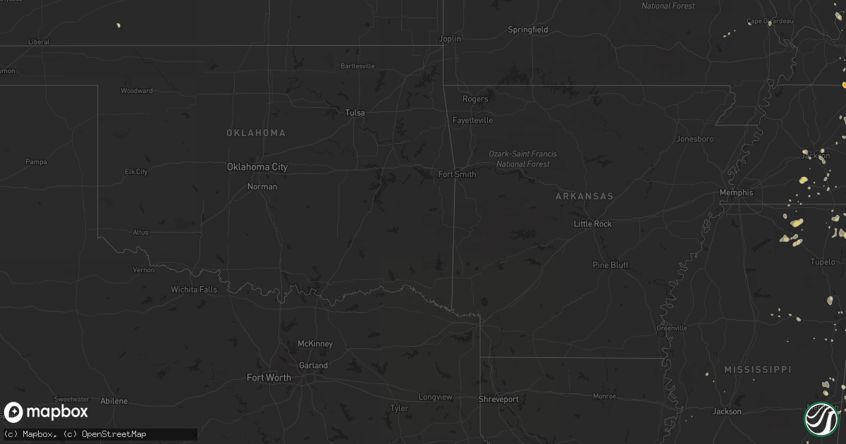
Hail Map on July 18, 2012
Get this storm
July 18 map
$229
one time, instant access
Download today. No call, no setup
Keep the $229
Bought the map and want the full workflow? Apply the entire $229 to a subscription within 7 days. None of it is wasted.
Every map, not just this one
This buys you this map. Subscription and you get every map we run, in the markets you choose from a few cities to whole states to nationwide. Plus real-time alerts the moment a storm fires.
Contact data
Name, contact info, occupancy, even credit band for addresses in the footprint. You go from where it hit to who to call.
Become the source they trust
Unlimited branding weather history reports on demand. You already have the documented answer ready for the property owner, and you are the one who showed up with it.
Property data and RoofTrace estimates
Pull up any address you have got, its value and the exact code rules for that jurisdiction, straight from One Click Code. Then RoofTrace estimates the squares, pitch, and roof value, priced the way you price.
States Impacted by Hail Map on July 18, 2012
Storm reports
West Virginia
| Date | Description |
|---|---|
| 07/18/20126:20 PM CDT | *** 1 inj *** 2 rides collapsed at fair. |
| 07/18/20125:40 PM CDT | Limbs down on multiple trees near us 33 west of franklin wv |
| 07/18/20125:30 PM CDT | Limbs down on multiple trees near us 33 west of franklin wv |
| 07/18/20125:28 PM CDT | Multiple trees down on power lines... Power outages throughout the city of buckhannon. |
| 07/18/20125:20 PM CDT | A few trees across hinkle mountain road near intersection of county rt 7. |
| 07/18/20124:45 PM CDT | Trees down on phillips ridge rd. In brave |
| 07/18/20124:42 PM CDT | Trees down |
| 07/18/20124:35 PM CDT | Trees down |
| 07/18/20124:30 PM CDT | Numerous trees and power lines down in and around follansbee |
| 07/18/20124:30 PM CDT | Structural damage to a house in mannington older construction |
| 07/18/20124:21 PM CDT | Trees down |
| 07/18/20124:20 PM CDT | Numerous trees down in the big grave area of moundsville |
| 07/18/20123:50 PM CDT | A local report indicates 1.00 inch wind near LITTLETON |
| 07/18/20123:47 PM CDT | Event occurred between 432 pm 07/18/2012 and 447 pm 07/18/2012 |
| 07/18/20123:40 PM CDT | A local report indicates 1.00 inch wind near LITTLETON |
| 07/18/20122:32 PM CDT | Structural damage |
| 07/18/20122:19 PM CDT | Roof blown off of home |
| 07/18/20121:55 PM CDT | Penny to quarter size hail for about 10 minutes. |
| 07/18/20121:52 PM CDT | Large tree downed on south queen street. |
| 07/18/20121:26 PM CDT | A tree was down near rio. |
| 07/18/20121:05 PM CDT | Several trees down |
| 07/18/20121:00 PM CDT | Several trees down just east of old fields. |
| 07/18/201212:52 PM CDT | Several trees down |
| 07/18/201212:20 PM CDT | Trees reported down along shadys run road. |
| 07/18/201212:08 PM CDT | Trees down. 1255pm |
Minnesota
| Date | Description |
|---|---|
| 07/18/20122:50 PM CDT | Six three foot diameter trees down. Park pavilion and apartment building damaged. |
| 07/18/20122:45 PM CDT | Tree branches up to 8 inches in diameter down. Localized street flooding. |
| 07/18/201212:58 PM CDT | A local report indicates 1.50 inch wind near HAYFIELD |
District of Columbia
| Date | Description |
|---|---|
| 07/18/20124:10 PM CDT | Tree blown down onto car in 4900 block of jay st ne |
| 07/18/20123:22 PM CDT | Large tree down across two houses. |
Oregon
| Date | Description |
|---|---|
| 07/18/20126:50 PM CDT | 1.38 in |
| 07/18/20126:30 PM CDT | A lot of dime to golf ball size hail for 10-15 minutes |
| 07/18/20126:25 PM CDT | Quarter to less than golf ball size |
| 07/17/20128:40 PM CDT | Hail larger than golf ball size. Hail started at 640 pm and was still going at 655 pm. |
| 07/17/20128:08 PM CDT | A local report indicates 1.00 inch wind near IMBLER |
| 07/17/20127:57 PM CDT | A local report indicates 1.00 inch wind near 4 S IMBLER |
Pennsylvania
| Date | Description |
|---|---|
| 07/18/20123:40 PM CDT | Trees down |
| 07/18/20123:30 PM CDT | Large branches off of trees. |
| 07/18/20123:09 PM CDT | Tree branches down on wires |
| 07/18/20122:57 PM CDT | Tree down on route 36 and edge hill road |
| 07/18/20122:55 PM CDT | Trees and wires down |
| 07/18/20122:55 PM CDT | Trees and wires down on rte 271 in upper yoder township |
| 07/18/20122:50 PM CDT | Trees down. Relayed by local media. |
| 07/18/20122:50 PM CDT | Trees down. |
| 07/18/20122:40 PM CDT | Trees down |
| 07/18/20122:40 PM CDT | Branches down... 1 tree uprooted. Time est. |
| 07/18/20122:39 PM CDT | Trees down. |
| 07/18/20122:36 PM CDT | Wires down in york township |
| 07/18/20122:30 PM CDT | Large branches off of trees. |
| 07/18/20122:30 PM CDT | Trees down |
| 07/18/20122:30 PM CDT | Trees down. |
| 07/18/20122:27 PM CDT | Event occurred between 312 pm 07/18/2012 and 327 pm 07/18/2012 |
| 07/18/20122:27 PM CDT | 1 tree down |
| 07/18/20122:22 PM CDT | Numerous large tree branches down with some power outages. Union blvd and pennsylvania ave |
| 07/18/20122:19 PM CDT | Numerous trees down |
| 07/18/20122:15 PM CDT | Heavy rain and strong wind gusts |
| 07/18/20122:05 PM CDT | Several 10 to 12 inch diameter trees snapped |
| 07/18/20122:01 PM CDT | Numerous trees down county wide |
| 07/18/20122:01 PM CDT | Numerous trees down county wide |
| 07/18/20122:00 PM CDT | Large trees and powerlines down |
| 07/18/20121:45 PM CDT | A local report indicates 1.75 inch wind near DOVER |
| 07/18/20121:40 PM CDT | A local report indicates 1.00 inch wind near SAXONBURG |
| 07/18/20121:35 PM CDT | Numerous trees down |
| 07/18/20121:35 PM CDT | Trees down |
| 07/18/20121:35 PM CDT | Trees down |
| 07/18/20121:34 PM CDT | Trees down. Estimated 90 mph wind. |
| 07/18/20121:30 PM CDT | Trees down across route 30...trees on homes |
| 07/18/20121:30 PM CDT | Trees down. |
| 07/18/20121:27 PM CDT | Trees down |
| 07/18/20121:20 PM CDT | Golfball sized hail reported. |
| 07/18/20121:20 PM CDT | Tree limb downs in jefferson memorial cemetary |
| 07/18/20121:18 PM CDT | Trees down. |
| 07/18/20121:15 PM CDT | Trees down in carroll township |
| 07/18/20121:10 PM CDT | Large trees down. |
| 07/18/20121:10 PM CDT | Trees down in north park |
| 07/18/20121:10 PM CDT | Quarter sized hail reported. |
| 07/18/20121:05 PM CDT | Large branches down. |
| 07/18/20121:00 PM CDT | Quarter inch hail reported. |
| 07/18/20121:00 PM CDT | Half dollar sized hail reported. |
| 07/18/201212:31 PM CDT | Quarter size hail reported. |
| 07/18/201212:30 PM CDT | Numerous trees reported down across greene... Independence townships. |
| 07/18/201212:30 PM CDT | Half dollar size hail reported. |
| 07/18/201212:14 PM CDT | A local report indicates 1.00 inch wind near HARSHAVILLE |
| 07/18/201212:14 PM CDT | Numerous trees down along state route 151 in hanover township. |
| 07/18/201211:50 AM CDT | Trees down. |
South Carolina
| Date | Description |
|---|---|
| 07/18/20124:55 PM CDT | Tree down at the intersection of highways 55 and 161 |
| 07/18/20124:50 PM CDT | Tree down on highway 55 and henry knob rd |
| 07/18/20124:40 PM CDT | Several large limbs down on sauer farm rd. |
| 07/18/20124:40 PM CDT | Tree down on highway 20 near county line |
| 07/18/20124:35 PM CDT | Trees and large branches down along whitney rd. |
| 07/18/20124:35 PM CDT | Trees and large branches down along beattys bridge rd. |
| 07/18/20124:35 PM CDT | Tree down at 600 block of berry farm rd |
| 07/18/20123:30 PM CDT | 2 large trees down near the 8000 block of highlands highway/sc 28 |
| 07/18/20123:22 PM CDT | Tree brought down power line on lake becky rd |
| 07/18/20123:15 PM CDT | Tree down at falling leaf rd |
| 07/18/20122:35 PM CDT | Trees and power lines down on fernwood dr at dupre dr and bellwood ln. Fernwood dr is impassable. |
| 07/18/20122:30 PM CDT | *** 2 inj *** tree fell on vehicle at briarwood rd trapping 2 persons inside. |
| 07/18/20122:25 PM CDT | Quarter to nickel size hail at mile marker 22 on i-26 |
| 07/18/20122:20 PM CDT | Quarter to nickel size hail at mile marker 22 on i-26 |
Ohio
| Date | Description |
|---|---|
| 07/18/20125:35 PM CDT | A total of three trees were knocked down. They were on ridge avenue and willowdale avenue. |
| 07/18/20125:30 PM CDT | Trees down on state route 332 |
| 07/18/20125:13 PM CDT | Trees down |
| 07/18/20125:07 PM CDT | Trees down |
| 07/18/20125:00 PM CDT | Trees down |
| 07/18/20124:55 PM CDT | Trees down |
| 07/18/20124:45 PM CDT | Trees down |
| 07/18/20124:40 PM CDT | Trees down |
| 07/18/20124:30 PM CDT | Several trees down in and around caldwell |
| 07/18/20123:54 PM CDT | Several large trees down into buildings in whitewater township in hamilton county along kilby road. |
| 07/18/20123:46 PM CDT | Numerous trees down |
| 07/18/20123:45 PM CDT | Numerous trees and power lines down in the southern portion of the county |
| 07/18/20123:37 PM CDT | Siding damage to a house in bridgetown. Time estimated from radar. |
| 07/18/20123:35 PM CDT | A local report indicates 63 MPH wind near DENT |
| 07/18/20123:35 PM CDT | Trees and limbs down. Estimated gusts up to 60mph at times. |
| 07/18/20123:35 PM CDT | Trees down near sayler park |
| 07/18/20123:27 PM CDT | Numerous trees and power lines down in south eastern portion of the county |
| 07/18/20123:23 PM CDT | *** 2 inj *** a tree fell on a pickup truck on pleasant valley road ne...about 8 miles east of utica. Two people in the car were injured. |
| 07/18/20123:22 PM CDT | Trees down |
| 07/18/20123:21 PM CDT | A large section of a tree snapped off on glen este withamsville road. |
| 07/18/20123:15 PM CDT | Hail lasted 15 minutes. |
| 07/18/20123:15 PM CDT | Larger than quarter size |
| 07/18/20122:56 PM CDT | One large tree down near fort hamilton hospital. Time estimated. |
| 07/18/20122:50 PM CDT | A few trees down and dime hail. |
| 07/18/20122:30 PM CDT | Top portion of a power pole snapped. |
| 07/18/20122:23 PM CDT | Multiple trees down. Large tree fell on two cars. |
| 07/18/20122:21 PM CDT | Multiple trees and power lines down. |
| 07/18/20122:15 PM CDT | Belden and waynesburg dr. |
| 07/18/20122:00 PM CDT | Some limbs down. |
| 07/18/20121:41 PM CDT | Some 3 to 5 inch diameter limbs down. |
| 07/18/20121:31 PM CDT | Trees down |
| 07/18/20121:24 PM CDT | Quarter size hail covering ground. |
| 07/18/20121:14 PM CDT | Trees down |
| 07/18/20121:08 PM CDT | A few 6 inch diameter limbs down north of new bremen. |
| 07/18/201212:53 PM CDT | Several large branches down near becks mills |
| 07/18/201212:30 PM CDT | Gutter and shingles ripped off of house. Large tree branches down. |
| 07/18/201212:09 PM CDT | Tree down on rangeline rd near sr 66. Time estimated from radar. |
Kentucky
| Date | Description |
|---|---|
| 07/18/20126:53 PM CDT | Trees downed near bryantsville |
| 07/18/20126:47 PM CDT | Golf ball size hail reported in the community. Hail the size of quarters reported north of town. Wind gusts 40 to 50 mph occurring with this storm. |
| 07/18/20126:45 PM CDT | Trees down on danville road hwy. 52... Pollys bend road... And kennedy bridge road. |
| 07/18/20126:20 PM CDT | Trees down in southern nicholasville. |
| 07/18/20126:12 PM CDT | Trees down near alexandria drive. |
| 07/18/20125:55 PM CDT | Large tree down in peaks mill area. |
| 07/18/20125:17 PM CDT | Trees were blown down |
| 07/18/20125:07 PM CDT | Widespread trees down in custer |
| 07/18/20125:05 PM CDT | Large branch down in town. |
| 07/18/20125:00 PM CDT | Trees down and a tree blocking the road for a short while on ky-36 coming in from paris. There was also a report of trees down on upper jaxtown road in carlisle. Half o |
| 07/18/20124:54 PM CDT | Trees down on high plains road |
| 07/18/20124:44 PM CDT | Trees down |
| 07/18/20124:42 PM CDT | Trees down along county road 625. |
| 07/18/20124:30 PM CDT | Several reports of trees down around pendleton county |
| 07/18/20124:20 PM CDT | Several trees down near kentucky route 8. |
| 07/18/20124:09 PM CDT | Tree down on antioch road north of hopkinsville. A powerline down on butler road |
| 07/18/20124:08 PM CDT | Numerous trees down through southern campbell county. |
| 07/18/20124:00 PM CDT | Numerous small branches and larger branches down along river road. Tree down at river road and zorn avenue. |
| 07/18/20123:54 PM CDT | Quarter sized hail reported in crescent hill |
| 07/18/20123:53 PM CDT | A large tree was downed near highway 16 in independence. |
| 07/18/20123:40 PM CDT | Downed trees throughout covington. Some trees fell on cars. |
| 07/18/20123:40 PM CDT | Late report. Tree and multiple 5 inch limbs down along long pond road. Corn flattened. |
| 07/18/20123:30 PM CDT | Wkyt relayed viewer report of quarer sized hail north of richmond kentucky. |
| 07/18/20122:20 PM CDT | Trees down on rocky bottom road. |
| 07/18/20121:45 PM CDT | Numerous trees down in burton subdivision off richardson road. |
| 07/18/20121:15 PM CDT | Large tree limb down blocking the road on foister heights street. |
| 07/18/20129:45 AM CDT | A few trees blown down. |
| 07/17/20128:32 PM CDT | Trees down on balltown road. |
| 07/17/20128:05 PM CDT | Severe damage to two mobile homes and a barn. Trees also down. |
| 07/17/20128:00 PM CDT | Half the roof of a large barn was blown off. Mobile home badly damaged. Several large trees down. |
| 07/17/20127:33 PM CDT | Tree down near truck stop on old dixie hwy. |
Indiana
| Date | Description |
|---|---|
| 07/18/20126:45 PM CDT | Trees down on danville road hwy 52 |
| 07/18/20126:17 PM CDT | Tree down on long avenue. |
| 07/18/20125:30 PM CDT | Trees down on north copeland road and hwy. 337 in depauw. |
| 07/18/20124:55 PM CDT | Powerlines down at 10835 west county road 600 north. Relayed by amateur radio. Time estimated. |
| 07/18/20124:31 PM CDT | Winds of 50 to 60 mph at 300 west and state route 28. Relayed report for tipton county ema. |
| 07/18/20123:00 PM CDT | Time estimated |
| 07/18/20122:12 PM CDT | A three foot diameter tree was downed on peacock road. |
| 07/18/20121:16 PM CDT | Large healthy tree down on high school road |
| 07/18/201212:53 PM CDT | Observer reported hail over the last half hour. Increase from pea to quarter size. |
| 07/18/201212:00 AM CDT | Report of a tree down across road in new carlisle. Time estimated from radar. |
| 07/18/201212:00 AM CDT | Numerous reports of trees down |
| 07/17/201211:55 PM CDT | Numerous trees down |
| 07/17/201211:54 PM CDT | Associated with outflow boundary. Relayed by wsbt |
| 07/17/201211:35 PM CDT | Numerous trees and power lines down |
| 07/17/201211:21 PM CDT | 60mph gusts over 3-4 min |
| 07/17/201211:15 PM CDT | Trees and powerlines down countywide |
| 07/17/201210:52 PM CDT | Lake front - port of indiana - blowing garbage cans around and tree limbs down. Power out. |
| 07/17/201210:43 PM CDT | Spotter estimates 60-70 mph winds with heavy rain reducing visibility to less than one quarter mile at the intersection of i-94 and i-65. |
| 07/17/201210:40 PM CDT | Two 10 inch diameter trees down. |
| 07/17/201210:33 PM CDT | Tree limbs down. At cline avenue and us-6. |
| 07/17/20128:13 PM CDT | Tree down on atlanta road north of tell city. |
| 07/17/20127:00 PM CDT | Several tree limbs down. |
Mississippi
| Date | Description |
|---|---|
| 07/18/20124:40 PM CDT | Several trees down in ne tishimingo county near jp coleman state park |
| 07/18/20124:35 PM CDT | Trees down along county rd 177 south of burnville |
| 07/18/20124:20 PM CDT | Harrison county sheriff office reported trees down and damage to an out building at a residence on cuevas delisle road. Survey will be conducted thursday for possible t |
| 07/18/20124:00 PM CDT | Nws storm survey indicates straight line thunderstorm winds toppled a weakened tree...snapped several large and small tree limbs..and caused damage to a out building. D |
Georgia
| Date | Description |
|---|---|
| 07/18/20125:47 PM CDT | 911 dispatcher reported 12-16 trees down around chatsworth. |
| 07/18/20125:44 PM CDT | 911 center reported several trees and powerlines down along post and liberty church roads. |
| 07/18/20124:59 PM CDT | Powerlines down on ridge rd. |
| 07/18/20124:50 PM CDT | Multiple trees down on prather bridge rd |
| 07/18/20124:46 PM CDT | Trees down on ray owens rd at tom bartles rd. |
| 07/18/20124:00 PM CDT | 7 trees down across the county including a few at thrusher park and academy road. |
| 07/18/20123:20 PM CDT | Multiple trees down in town along with small hail and minor street flooding due to poor drainage |
| 07/18/20122:55 PM CDT | The jekyll island authority reported a few trees and power lines down near the campground on the island. |
| 07/18/20122:42 PM CDT | A tornado continued near the intracoastal waterway in the vicinity of the sidney lanier bridge. The tornado was becoming rainwrapped and was over marsh areas. |
| 07/18/20121:45 PM CDT | Emergency manager reported 7-10 trees down in the old keiths bridge road...perry road and truman mountain road area. |
North Carolina
| Date | Description |
|---|---|
| 07/18/20126:34 PM CDT | Trees down on palmerville road... Time estimated by radar |
| 07/18/20125:14 PM CDT | Tree down along mallard creek church rd just north of odell school rd. |
| 07/18/20125:04 PM CDT | Tree down at baltimore lane |
| 07/18/20124:55 PM CDT | Tree down along old highway 27 and tree on power line along lane road and hickory nut lane. |
| 07/18/20124:55 PM CDT | Tree down on riverview rd. At linwood southmont rd. |
| 07/18/20124:50 PM CDT | Fallen tree blocking henderson grove church rd. |
| 07/18/20124:50 PM CDT | Tree down on cramerton rd near lowell-bethesda rd |
| 07/18/20124:50 PM CDT | Tree down on queens rd at york highway |
| 07/18/20124:45 PM CDT | Large branches broken. |
| 07/18/20123:35 PM CDT | 1 tree down |
| 07/18/20123:35 PM CDT | 1 tree down near sugar hill |
| 07/18/20123:20 PM CDT | Quarter size hail near mile marker 60 on i-26 |
| 07/18/20123:10 PM CDT | *** 1 inj *** trees on vehicle on rhodhiss rd and multiple trees and power lines down on icard rhodhiss rd |
| 07/18/20123:07 PM CDT | Multiple trees down on tomlinson loop at israel chapel rd |
| 07/18/20122:35 PM CDT | 1 tree down |
| 07/18/20122:35 PM CDT | 1 tree down near sugar hill |
| 07/18/20121:30 PM CDT | 1 tree down at 110 north hyde park avenue |
Virginia
| Date | Description |
|---|---|
| 07/18/20126:35 PM CDT | Numerous trees down |
| 07/18/20125:56 PM CDT | Portion of a roof blown off a barn on readus road near readus va. |
| 07/18/20125:40 PM CDT | Several trees down in vicinity of gristmill court |
| 07/18/20124:53 PM CDT | A local report indicates 1.75 inch wind near 5 E BENT CREEK |
| 07/18/20124:52 PM CDT | Three trees blown down near highway 60. |
| 07/18/20124:48 PM CDT | Numerous trees...powerlines and flag pole down. Lots of pea-size hail. |
| 07/18/20124:42 PM CDT | Several trees down onto state route 613 between the 14000 and 18000 block |
| 07/18/20124:01 PM CDT | Powerlines down near intersection of alpine rd and nover ave. |
| 07/18/20123:53 PM CDT | Trees down near dixie hill road. |
| 07/18/20123:36 PM CDT | Large tree down near the intersection of austinville rd and rickey rd. |
| 07/18/20123:34 PM CDT | One tree down near retreat and dugwell road. |
| 07/18/20123:30 PM CDT | One tree blown down near rockland road. |
| 07/18/20123:25 PM CDT | One tree blown down near bethlehem road. |
| 07/18/20123:05 PM CDT | Tree down on betts road |
| 07/18/20121:28 PM CDT | Tree down on back creek rd and wardensville pike |
| 07/18/201212:46 PM CDT | Multiple trees down on 400 block of woods mill rd |
| 07/18/201212:43 PM CDT | Tree down on route 55 near back road. |
| 07/18/201212:33 PM CDT | A local report indicates 1.00 inch wind near 3 SSE HIGH VIEW MANOR |
| 07/18/201212:20 PM CDT | Tree down near intersection of round hill rd and limestone ln |
| 07/18/201212:07 PM CDT | A tree fell onto the road in broadway. |
| 07/18/201211:30 AM CDT | Branches down blocking half of route 250. |
| 07/17/20127:43 PM CDT | One tree down near buckshoal road. |
Massachusetts
| Date | Description |
|---|---|
| 07/18/20125:05 PM CDT | Tree down on chandler road |
| 07/18/20125:00 PM CDT | Probable microburst. Approximately 100 trees down. Some streets involved include marathon street...waldo road....chandler street...mass ave and broadway. Brick garage c |
| 07/18/20123:49 PM CDT | Tree down across driveway on crystal springs road |
| 07/18/20123:44 PM CDT | Large tree down on delano road and prospect streets |
| 07/18/20123:40 PM CDT | 6 to 7 trees down |
| 07/18/20123:37 PM CDT | Trees down on main street |
| 07/18/20123:20 PM CDT | Tree down on car on carrol street. Tree down on rochambeau street. Tree down on hatch street. |
| 07/18/20123:15 PM CDT | One foot diameter tree down on reagan road |
| 07/18/20123:15 PM CDT | Trees and wires down on main avenue |
| 07/18/20123:10 PM CDT | A local report indicates 1.00 inch wind near TAUNTON |
| 07/18/20123:10 PM CDT | Trees down on franklin street and union street |
| 07/18/20123:01 PM CDT | Tree down on front st |
| 07/18/20123:01 PM CDT | Tree down on front street |
| 07/18/20123:00 PM CDT | Two trees down on elm street |
| 07/18/20122:58 PM CDT | Tree and power line down on first parish rd |
| 07/18/20122:58 PM CDT | A local report indicates 1.00 inch wind near SEEKONK |
| 07/18/20122:58 PM CDT | Tree and powerline down on first parish road |
| 07/18/20122:58 PM CDT | Wires down on williams street |
| 07/18/20122:58 PM CDT | Wires down on pine street |
| 07/18/20122:57 PM CDT | A local report indicates 1.75 inch wind near DIGHTON |
| 07/18/20122:57 PM CDT | Golfball size hail near fire dept |
| 07/18/20122:48 PM CDT | Hail ranged from 1.5 to 2.0 inches in diameter |
| 07/18/20122:13 PM CDT | A local report indicates 1.75 inch wind near UXBRIDGE |
| 07/18/20121:44 PM CDT | A local report indicates 1.75 inch wind near FRAMINGHAM |
| 07/18/20121:26 PM CDT | A local report indicates 1.50 inch wind near SOUTHBRIDGE |
| 07/18/20121:15 PM CDT | A local report indicates 1.25 inch wind near SAUGUS |
| 07/18/20121:15 PM CDT | A local report indicates 1.25 inch wind near SAUGUS |
| 07/18/20121:14 PM CDT | A local report indicates 1.00 inch wind near SWAMPSCOTT |
| 07/18/20121:14 PM CDT | Tree down tower court |
| 07/18/20121:14 PM CDT | Tree down at tower ct |
| 07/18/20121:12 PM CDT | A local report indicates 1.25 inch wind near REVERE |
| 07/18/20121:12 PM CDT | A local report indicates 1.25 inch wind near REVERE |
| 07/18/20121:10 PM CDT | A local report indicates 1.00 inch wind near SAUGUS |
| 07/18/20121:05 PM CDT | A local report indicates 1.75 inch wind near MALDEN |
| 07/18/20121:05 PM CDT | A local report indicates 1.75 inch wind near MALDEN |
| 07/18/20121:04 PM CDT | A local report indicates 1.75 inch wind near STONEHAM |
| 07/18/20121:03 PM CDT | A local report indicates 1.25 inch wind near PEABODY |
| 07/18/201212:23 PM CDT | A local report indicates 1.00 inch wind near DRACUT |
| 07/17/20127:20 PM CDT | Tree down on car on carrol street. Tree down on rochambeau street. Tree down on hatch street. |
Tennessee
| Date | Description |
|---|---|
| 07/18/20126:21 PM CDT | *** 1 inj *** humphreys s. O. Reports a tree blown down on a trailer with one injury on cuba landing road. |
| 07/18/20125:55 PM CDT | Humphreys s. O. Reports trees blown down in several locations around waverly and mcewen. |
| 07/18/20125:43 PM CDT | Dickson s. O. Reports a large tree blown down on rock springs road in north dickson county. |
| 07/18/20125:15 PM CDT | Trees down along mount herman road and hwy 48. A tree fell on a house on vernon creek road in southside. |
| 07/18/20124:40 PM CDT | Trees down on lewis atkins road in the indian mound community. |
| 07/18/20124:35 PM CDT | Trees down on oak glen lane in east clarksville. |
| 07/18/20124:20 PM CDT | Dispatch reported a tree down off clover lane in graysville. |
| 07/18/20124:15 PM CDT | Couple of trees down on mowbray mountain. |
| 07/18/20124:05 PM CDT | Dispatch reported a tree down in the mount crest area. |
| 07/18/20121:47 PM CDT | Several trees down across city. |
| 07/17/201210:42 PM CDT | Pole down on tyne blvd |
| 07/17/201210:12 PM CDT | Tree down in the bellevue/riverwalk area |
| 07/17/201210:03 PM CDT | Power line down on curd road in mount juliet |
| 07/17/20129:45 PM CDT | Tree down on weeping elm road and lightning caused damage to a home on woods run road. |
Alabama
| Date | Description |
|---|---|
| 07/18/20125:11 PM CDT | A large tree was blown down on riverton rose trail. |
| 07/18/20124:40 PM CDT | A tree was blown down on highway 68. |
| 07/18/20124:08 PM CDT | A sign was blown down in the parking lot of a radio station. |
| 07/18/20124:05 PM CDT | Two trees were blown down onto power poles. |
| 07/18/20124:04 PM CDT | Trees were blown down on cr 15 north of oakland. |
| 07/18/20124:01 PM CDT | Multiple trees were reported down in the owens community. |
| 07/18/20124:00 PM CDT | Multiple trees were reported down in the athens area. |
| 07/18/20124:00 PM CDT | A tree and powerlines were blown down at carters trailer court. |
| 07/18/20123:57 PM CDT | Winds were estimated at 60 mph. |
| 07/18/20123:57 PM CDT | Trees were blown down onto power poles on highway 99. |
| 07/18/20123:55 PM CDT | Multiple trees blown down in the east limestone area. |
| 07/18/20123:55 PM CDT | Portions of the roof at athens bible school were blown off. |
| 07/18/20122:15 PM CDT | A tree/powerline was knocked down. |
Connecticut
| Date | Description |
|---|---|
| 07/18/20123:15 PM CDT | Numerous trees down along keeny road. |
| 07/18/20122:23 PM CDT | Wires down at rte 2 and middletown rd |
| 07/18/20122:00 PM CDT | A local report indicates 1.75 inch wind near PUTNAM |
| 07/18/20122:00 PM CDT | A local report indicates 1.75 inch wind near THOMPSON |
| 07/18/20122:00 PM CDT | Wires down at merritt pkwy and round hill rd |
| 07/18/20121:53 PM CDT | Large tree down across west chippens hill road |
| 07/18/20121:50 PM CDT | Hail ranged from dime to golfball size |
| 07/18/20121:45 PM CDT | Tree uprooted in rogers park |
| 07/18/20121:45 PM CDT | 2 ton air conditioning unit on top of roger park middle school torn loose and thrown through top floor into building. Town engineer est wind 100 mph many large trees up |
| 07/18/20121:40 PM CDT | A local report indicates 1.00 inch wind near UNION |
| 07/18/20121:40 PM CDT | Skywarn spotter |
| 07/18/20121:35 PM CDT | A local report indicates 63 MPH wind near 1 WNW WINDSOR LOCKS |
| 07/18/20121:27 PM CDT | Tree down on route 17 |
| 07/18/20121:25 PM CDT | Large branches down and part of screen ripped off screen door |
| 07/18/20121:24 PM CDT | Tree down across new britain road |
| 07/18/20121:15 PM CDT | A local report indicates 1.00 inch wind near CORNWALL |
| 07/18/20121:15 PM CDT | A local report indicates 1.00 inch wind near 1 NE EAST CORNWALL |
| 07/18/20121:15 PM CDT | Multiple trees and wires down |
| 07/18/20121:10 PM CDT | Tree down |
| 07/18/201212:35 PM CDT | A local report indicates 63 MPH wind near 1 WNW WINDSOR LOCKS |
New Jersey
| Date | Description |
|---|---|
| 07/18/20124:26 PM CDT | A local report indicates 1.00 inch wind near RED BANK |
| 07/18/20124:01 PM CDT | A local report indicates 60 MPH wind near PERTH AMBOY |
| 07/18/20123:35 PM CDT | Large branches broken |
| 07/18/20122:48 PM CDT | Trees and wires reported down on route 46. |
| 07/18/20122:35 PM CDT | Trees and wires down |
| 07/18/20122:15 PM CDT | Tree down on car and house on catherine ct |
| 07/18/20121:46 PM CDT | Numerous trees and wires down in sayreville. |
| 07/18/20121:29 PM CDT | Wires down across route 17 |
Maryland
| Date | Description |
|---|---|
| 07/18/20125:28 PM CDT | Trees reported down in goldsboro. |
| 07/18/20125:20 PM CDT | Wires down in ridgely. |
| 07/18/20125:09 PM CDT | Scattered trees down across the county extending from kent island to crumpton. |
| 07/18/20124:30 PM CDT | Two snapped trees and large branch down at a residence |
| 07/18/20124:30 PM CDT | A local report indicates 60 MPH wind near KENT ISLAND ESTATES |
| 07/18/20123:45 PM CDT | Several trees down. |
| 07/18/20122:41 PM CDT | Tree down on kellys store rd |
| 07/18/20122:30 PM CDT | Trees down on old frederick road and old mill rd |
| 07/18/20122:30 PM CDT | Large limbs down in meadowbrook development. |
| 07/18/20122:30 PM CDT | Large limbs down along md 140. |
| 07/18/20122:20 PM CDT | Large limbs down along md 140. |
| 07/18/20122:13 PM CDT | A tree fell across the intersection of boonsboro mountain road and keadle road. |
New York
| Date | Description |
|---|---|
| 07/18/20124:00 PM CDT | Multiple trees down at northern blvd and whitney ln |
| 07/18/20123:50 PM CDT | Estimated quarter size hail just west of jamaica station |
| 07/18/20123:25 PM CDT | Hail covering the ground at w broadway and spring |
| 07/18/20122:40 PM CDT | Numerous tress down along cedar swamp rd north of 25a |
| 07/18/20122:15 PM CDT | Trees and wires down along with nickel size hail |
| 07/18/20121:15 PM CDT | A local report indicates 65 MPH wind near HARMON |
| 07/18/20121:14 PM CDT | Trees and wires down |
| 07/18/20121:08 PM CDT | A local report indicates 1.00 inch wind near WASSAIC |
| 07/18/201212:25 PM CDT | Trees down on route 210 near greenwood lake |
| 07/18/201211:35 AM CDT | Time estimated from radar. |
Illinois
| Date | Description |
|---|---|
| 07/17/201210:25 PM CDT | 50 to 60 mph wind gusts with heavy rain at 159th and harlem ave. |
| 07/17/201210:23 PM CDT | Tree branches 6 to 8 inches in diameter down at galena blvd and fordham. |
| 07/17/20129:32 PM CDT | At barrington and schaumburg roads. Heavy rainfall. |
| 07/17/20129:30 PM CDT | 1.5 inch diameter tree limbs down on olmstead drive in northern hoffman estates. Winds estimated around 55 mph. Time estimated. |
| 07/17/20129:25 PM CDT | Multiple wind gusts at 50 to 60 mph downing small tree branches. |
| 07/17/20129:25 PM CDT | Also torrential rainfall. |
| 07/17/20129:15 PM CDT | A local report indicates 60 MPH wind near ELGIN |
| 07/17/20129:12 PM CDT | 6 inch diameter tree limbs down and 8 inch tree down. |
| 07/17/20128:40 PM CDT | 50-60 mph winds on interstate 88 near university road exit. |
| 07/17/20128:34 PM CDT | 4 to 6 inch diameter tree down on rt 173 just east of herbon. |
| 07/17/20128:20 PM CDT | 20 to 30 foot long / 6 inch diameter limb feel through roof of house on mildred road. |
| 07/17/20128:06 PM CDT | Estimated 65 mph winds brought large branches down. |
| 07/17/20127:58 PM CDT | Large tree limb down. West bound on hwy 75 4 miles east of durand. |
| 07/17/20127:58 PM CDT | 8 inch tree limb down on 7800 block of forest hills road. Time estimated. |
| 07/17/20127:57 PM CDT | Winds estimated 60 to 70 mph. Small branches down. |
| 07/17/20127:47 PM CDT | 3 inch diameter limbs down and cornfields flattened |
| 07/17/20127:10 PM CDT | Large tree blown down across road at 1750e and 2000n |
Kansas
| Date | Description |
|---|---|
| 07/18/20126:30 PM CDT | 2 foot diameter tree broken at base...tree height 30 ft tall |
| 07/18/20126:22 PM CDT | Brief downburst of wind...measured 73 mph wind gust at the ft riley asos...damage reported to some equipment on base |
| 07/18/20126:22 PM CDT | Delayed report...pole barn damaged...4 miles south of interstate 70 |
| 07/18/20125:40 PM CDT | One inch diameter tree limbs down...patio chairs blown over |
| 07/18/20125:40 PM CDT | Mainly nickel size hail with some quarter size. |
| 07/17/20129:00 PM CDT | Also pea size hail reported with the wind gust. |
| 07/17/20128:32 PM CDT | Power poles down near k106 and 170th road |
| 07/17/20128:32 PM CDT | Power poles down near us81 and ivy road |
| 07/17/20128:00 PM CDT | Damage around lake goodwin...roof of home blown off...multiple trees blocking goodwin drive |
| 07/17/20127:43 PM CDT | A local report indicates 58 MPH wind near 6 NW HERNDON |
| 07/17/20127:39 PM CDT | Localized downburst blew over 4 trees...several power lines down...south side of minneapolis |
| 07/17/20127:30 PM CDT | Delayed report...several barns destroyed including the historic round barn landmark |
Delaware
| Date | Description |
|---|---|
| 07/18/20125:37 PM CDT | A local report indicates 62 MPH wind near DOVER AFB |
| 07/18/20125:07 PM CDT | Pole reported down in townsend. |
| 07/18/20125:07 PM CDT | Trees and wires down |
Wisconsin
| Date | Description |
|---|---|
| 07/18/20126:35 PM CDT | *** 1 inj *** one person with minor head injury due to falling tree. Trees and power lines down in mount horeb...town of springfield...and town of vermont. Time estimat |
| 07/18/20126:15 PM CDT | Two and a half foot diameter tree uprooted. |
| 07/18/20126:12 PM CDT | Side of ace hardware store blown in. Trees also reported down. Time estimated from radar. |
| 07/18/20125:54 PM CDT | Multiple power poles and lines down. |
| 07/18/20125:54 PM CDT | Multiple power poles and lines down. |
| 07/18/20125:51 PM CDT | A few trees blown down and some power lines down. Time estimated based on radar. |
| 07/18/20125:50 PM CDT | Multiple healthy branches downed...six inches in diameter...at a location along highway 213. Time based on radar. |
| 07/18/20125:50 PM CDT | Significant hail damage to a farm house...large holes punched in roof. Time and hail size estimated based on radar. |
| 07/18/20125:43 PM CDT | A local report indicates 1.00 inch wind near EVANSVILLE |
| 07/18/20125:42 PM CDT | Hay wagon blown over |
| 07/18/20125:41 PM CDT | A local report indicates 60 MPH wind near LONE ROCK AIRPORT |
| 07/18/20125:33 PM CDT | Trees down in the city. Also other trees down in the county. Time estimated via radar. |
| 07/18/20125:30 PM CDT | Large trees 3 feet in diameter snapped off 8 to 12 feet above the ground. |
| 07/18/20125:12 PM CDT | Mature trees down in parts of town. |
| 07/18/20125:03 PM CDT | Numerous branches down and a few trees down on residence and neighbors residence. |
| 07/18/20125:01 PM CDT | Trees and powerlines down. |
| 07/18/20124:50 PM CDT | Reports of trees power lines down across crawford county. Location estimated from radar. |
| 07/18/20124:45 PM CDT | Trees and power lines down around ferryville. |
| 07/18/20124:45 PM CDT | 5 inch diameter branches down at 4th and cedar. |
| 07/17/20128:11 PM CDT | A local report indicates 65 MPH wind near 7 NW RACINE |
| 07/17/20127:30 PM CDT | A local report indicates 60 MPH wind near JOHNSON CREEK |
| 07/17/20127:25 PM CDT | A local report indicates 60 MPH wind near 5 SW WATERTOWN |
| 07/17/20127:15 PM CDT | 2 1/2 foot diameter tree down and across a road. |
| 07/17/20127:12 PM CDT | Actual location 3.3 miles sw of monroe |
Iowa
| Date | Description |
|---|---|
| 07/18/20124:15 PM CDT | A few trees down and power lines down |
| 07/18/20124:06 PM CDT | Barn destoryed. Time estimated from radar. |
| 07/18/20124:06 PM CDT | Corn flattened. Time estimated from radar. |
| 07/18/20124:01 PM CDT | A local report indicates 62 MPH wind near 1 N CALMAR |
| 07/18/20124:01 PM CDT | A local report indicates 65 MPH wind near 4 N CALMAR |
| 07/18/20123:50 PM CDT | Large tree uprooted. |
| 07/18/20123:45 PM CDT | Corn bent over and several trees uprooted. |
| 07/18/20123:40 PM CDT | Trees down in town. |
| 07/18/20123:28 PM CDT | A local report indicates 1.75 inch wind near RIDGEWAY |
| 07/18/20123:24 PM CDT | A local report indicates 1.50 inch wind near 3 W FREDERICKSBURG |
| 07/18/20122:29 PM CDT | 2 1/2 foot diamter fell on home on broadstreet. Numerous branches down around town. Tree blocking road on bridge and main street. Wind speed unknown. Time estimated. |
Rhode Island
| Date | Description |
|---|---|
| 07/18/20123:16 PM CDT | A local report indicates 1.00 inch wind near NASONVILLE |
| 07/18/20122:58 PM CDT | Wires down on pine st |
| 07/18/20122:58 PM CDT | A local report indicates 1.00 inch wind near SEEKONK |
| 07/18/20122:18 PM CDT | A local report indicates 2.00 inch wind near CUMBERLAND |
| 07/18/20122:18 PM CDT | A local report indicates 2.00 inch wind near PROVIDENCE |
| 07/18/20122:15 PM CDT | Trees down at route 7 and route 5 |
| 07/18/20122:15 PM CDT | A local report indicates 1.75 inch wind near SMITHFIELD |
| 07/18/20122:03 PM CDT | A local report indicates 1.00 inch wind near BURRILLVILLE |
| 07/18/20122:02 PM CDT | A local report indicates 1.75 inch wind near BURRILLVILLE |
Missouri
| Date | Description |
|---|---|
| 07/18/20125:15 PM CDT | Boards torn off outbuilding and boat lift thrown into a lake on maxene court. Time estimated. |
| 07/17/20128:50 PM CDT | Delayed report...branches down and a 7 ton feed bin was blown down...winds estimated at 65 mph |
Nebraska
| Date | Description |
|---|---|
| 07/18/20123:22 PM CDT | A local report indicates 58 MPH wind near 4 W BIG SPRINGS |
| 07/18/20123:00 PM CDT | Brief touchdown over open rangeland. |
| 07/17/20128:03 PM CDT | Media reports extensive soy and corn crop damage and ongoing golf ball hail received from trained spotter. |
| 07/17/20127:57 PM CDT | Ongoing golf ball sized hail with the ground covered. |
| 07/17/20127:48 PM CDT | Numerous quarter sized hail pieces on ground. Corn field adjacent to road completely stripped to the stalk from hail. |
| 07/17/20127:39 PM CDT | Quarter hail mixed with heavy rain ongoing. |
| 07/17/20127:37 PM CDT | Quarter hail mixed with wind driven rain in cozad. |
| 07/17/20127:33 PM CDT | Heavy rain mixed with quarter hail. 60 mph wind gust reported ahead of storm by chaser. |
| 07/17/20127:30 PM CDT | Heavy rain mixed with quarter hail. 60 mph wind gust reported ahead of storm by chaser. |
Texas
| Date | Description |
|---|---|
| 07/18/20125:50 PM CDT | A local report indicates 1.75 inch wind near UVALDE |
| 07/18/20125:50 PM CDT | Trees blown down along with power outages in uvalde |
| 07/18/20125:43 PM CDT | Golf ball sized hail broke windows at uvalde memorial hospital |
| 07/18/20125:34 PM CDT | A local report indicates 1.50 inch wind near UVALDE |
| 07/17/20127:00 PM CDT | 3-4 inch diameter tree branches broken from high winds |
Cities Impacted by Hail Map on July 18, 2012
- Buchanan, TN
- Richland Center, WI
- Cazenovia, WI
- Appling, GA
- Afton, WI
- Janesville, WI
- Beloit, WI
- Orfordville, WI
- La Grande, OR
- Hueysville, KY
- Holdingford, MN
- Rice, MN
- New Haven, IN
- Woodburn, IN
- Monroeville, IN
- Sidney, OH
- Fort Loramie, OH
- Westport, IN
- Hustonville, KY
- Brooksville, KY
- Falmouth, KY
- Crownsville, MD
- Odenton, MD
- Gambrills, MD
- Fort George G Meade, MD
- Millersville, MD
- Richmond, KY
- Monticello, KY
- Nancy, KY
- Franklin, WV
- Circleville, WV
- Davis, IL
- Rock City, IL
- Mccordsville, IN
- Webbville, KY
- Louisa, KY
- Bland, VA
- Cambridge, MA
- Medford, MA
- Charlestown, MA
- Boston, MA
- Somerville, MA
- Dover, OH
- Bolivar, OH
- Carmichaels, PA
- Valentine, NE
- Blue Mounds, WI
- Mount Horeb, WI
- Hatfield, PA
- Hilltown, PA
- Line Lexington, PA
- Souderton, PA
- Chalfont, PA
- Blue Mountain, MS
- Hickory Flat, MS
- Ripley, MS
- Ashland, MS
- Shady Dale, GA
- Newborn, GA
- Mehoopany, PA
- Lopez, PA
- Stoystown, PA
- Central City, PA
- Spencer, WV
- Arnoldsburg, WV
- Glenville, MN
- Switz City, IN
- Worthington, IN
- Bloomfield, IN
- Stoddard, WI
- Clay Center, KS
- Dayton, OH
- Saluda, NC
- Travelers Rest, SC
- Dayton, VA
- Hinton, VA
- Dickson, TN
- Burns, TN
- West Jefferson, OH
- London, OH
- Hayes Center, NE
- Palisade, NE
- Culbertson, NE
- Warwick, RI
- Cranston, RI
- Toano, VA
- Lanexa, VA
- Patriot, OH
- Crown City, OH
- Glenwood, WV
- Gallipolis Ferry, WV
- Gallipolis, OH
- Lesage, WV
- Tompkinsville, KY
- Burkesville, KY
- Charleston, WV
- Poca, WV
- Alexandria, IN
- Middlebury, CT
- Watertown, CT
- Prospect, CT
- Cheshire, CT
- Naugatuck, CT
- Waterbury, CT
- Huntingdon, TN
- McKenzie, TN
- Booneville, MS
- Long Bottom, OH
- Portland, OH
- Craigsville, WV
- Summersville, WV
- North Attleboro, MA
- Cumberland, RI
- Custer, KY
- Vine Grove, KY
- Irvington, KY
- Garfield, KY
- Hudson, KY
- Harned, KY
- Iuka, MS
- Freeport, IL
- Monroe, WI
- Orangeville, IL
- Pecatonica, IL
- Dakota, IL
- Athens, AL
- Fredericksburg, PA
- Jonestown, PA
- Lebanon, PA
- Mauston, WI
- New Lisbon, WI
- Ashland City, TN
- Nashville, TN
- Cynthiana, KY
- Paris, KY
- Florence, IN
- Vevay, IN
- Rising Sun, IN
- McKee, KY
- Ewing, KY
- Flemingsburg, KY
- Wallingford, KY
- Coxs Creek, KY
- Shepherdsville, KY
- Mount Vernon, OH
- Utica, OH
- Centerburg, OH
- Swampscott, MA
- Broken Bow, NE
- Lewisburg, OH
- Grant, NE
- Mountain Rest, SC
- Virgilina, VA
- Jersey City, NJ
- Hoboken, NJ
- New York, NY
- Great Meadows, NJ
- Stanhope, NJ
- Andover, NJ
- Newton, NJ
- Hackettstown, NJ
- Laceys Spring, AL
- Toone, TN
- Bolivar, TN
- Cedar, MN
- Isanti, MN
- Bethel, MN
- Andover, MN
- Anoka, MN
- Saint Francis, MN
- East Hampton, CT
- Marlborough, CT
- Carlisle, PA
- Shippensburg, PA
- Newville, PA
- Gardners, PA
- Walnut Bottom, PA
- Cove, OR
- Elizabeth, WV
- Hartford City, IN
- Montpelier, IN
- Unionville, IN
- Nashville, IN
- Bloomington, IN
- Citronelle, AL
- McIntosh, AL
- Deer Park, AL
- Ashley, OH
- Cardington, OH
- Gastonia, NC
- Lowell, NC
- Bethel, OH
- Felicity, OH
- Hamersville, OH
- Georgetown, OH
- Trafalgar, IN
- Uvalde, TX
- Fannettsburg, PA
- Willow Hill, PA
- Glouster, OH
- Chesterhill, OH
- New Oxford, PA
- La Crosse, VA
- South Hill, VA
- Alberta, VA
- Brodnax, VA
- Kenbridge, VA
- Darlington, WI
- Rock Hall, MD
- Spring Valley, MN
- Wykoff, MN
- Rutland, OH
- Langsville, OH
- Bedford, IN
- Morral, OH
- Forreston, IL
- Shannon, IL
- Lanark, IL
- Diana, WV
- Cowen, WV
- Webster Springs, WV
- Lauderdale, MS
- Meridian, MS
- Daleville, MS
- Charles City, IA
- Floyd, IA
- Orchard, IA
- Dover, PA
- Monsey, NY
- Spring Valley, NY
- Mahwah, NJ
- Saddle River, NJ
- Davin, WV
- Man, WV
- Danville, IL
- Irondale, OH
- Hammondsville, OH
- Cameron, WV
- Glen Easton, WV
- Moundsville, WV
- Versailles, KY
- Frankfort, KY
- Gentryville, IN
- Dale, IN
- Chappell, NE
- White Sulphur Springs, WV
- Boston, KY
- New Haven, KY
- Clermont, KY
- Hodgenville, KY
- Lebanon Junction, KY
- Bardstown, KY
- Salem, NH
- Pelham, NH
- Saint Paul, IN
- Greensburg, IN
- New Castle, VA
- Troutville, VA
- Catawba, VA
- Winnebago, MN
- Delavan, MN
- Cumming, GA
- Mason City, NE
- Jackson, TN
- Butler, PA
- Cabot, PA
- Saxonburg, PA
- Plain, WI
- Sauk City, WI
- Brookville, IN
- West Harrison, IN
- Harrison, OH
- Cincinnati, OH
- Sunman, IN
- Cedar Grove, IN
- Guilford, IN
- Aurora, IN
- Hamilton, OH
- New Trenton, IN
- Metamora, IN
- Miamitown, OH
- Oxford, OH
- Okeana, OH
- Lawrenceburg, IN
- Cleves, OH
- Batesville, IN
- Danville, PA
- Portland, TN
- Orlinda, TN
- Callaway, NE
- Bon Secour, AL
- Gulf Shores, AL
- Foley, AL
- McDowell, VA
- Head Waters, VA
- Williamsville, VA
- Germantown, KY
- Mount Olivet, KY
- Berry, KY
- Patton, MO
- Perryville, MO
- Hamburg, PA
- East Sparta, OH
- Canton, OH
- Waynesburg, OH
- Erbacon, WV
- Upperglade, WV
- Hacker Valley, WV
- Pickens, WV
- Lowell, MA
- Dracut, MA
- Reading, MA
- North Reading, MA
- Tyngsboro, MA
- Andover, MA
- Wilmington, MA
- Tewksbury, MA
- Mascot, TN
- Strawberry Plains, TN
- Union Star, KY
- Derby, IN
- Cannelton, IN
- Albany, OH
- Athens, OH
- New Marshfield, OH
- Nelsonville, OH
- Berlin, CT
- Monroe, GA
- Social Circle, GA
- Carlisle, KY
- Millersburg, KY
- Fall River, MA
- Assonet, MA
- Somerset, MA
- Swansea, MA
- Westport, MA
- Lakeville, MA
- Boonsboro, MD
- Kenton, OH
- Winchester, VA
- Stephenson, VA
- Berryville, VA
- Greenwood, IN
- Indianapolis, IN
- La Rue, OH
- Harpster, OH
- Chana, IL
- Utica, KY
- Philpot, KY
- Elwood, IN
- Windfall, IN
- Tipton, IN
- Annville, KY
- Ft Mitchell, KY
- Newport, KY
- Bellevue, KY
- Latonia, KY
- Fort Thomas, KY
- Covington, KY
- Dayton, KY
- Sadieville, KY
- Corinth, KY
- Florence, AL
- Aleppo, PA
- Littleton, WV
- New Freeport, PA
- Wind Ridge, PA
- Ivanhoe, VA
- Wytheville, VA
- Dowagiac, MI
- Belvidere, TN
- Clarksville, VA
- Porterville, MS
- Livingston, AL
- Macy, IN
- Silver Lake, IN
- Akron, IN
- Roann, IN
- Lexington, KY
- Pleasant Hill, OH
- Piqua, OH
- Covington, OH
- Laurel, IN
- Covington, VA
- Preston, MN
- Harmony, MN
- Canton, MN
- Mapleton, MN
- New Liberty, KY
- Worthville, KY
- Sanders, KY
- Owenton, KY
- Turners Station, KY
- Carrollton, KY
- Sparta, KY
- Ferdinand, IN
- Churchville, VA
- Mount Solon, VA
- Caledonia, IL
- Bellefontaine, OH
- Sauk Centre, MN
- Rocky Top, TN
- Fulks Run, VA
- New Lexington, OH
- Shawnee, OH
- Corning, OH
- Wellfleet, NE
- Maywood, NE
- Nahant, MA
- Stoneham, MA
- Revere, MA
- East Boston, MA
- Lynn, MA
- Saugus, MA
- Wakefield, MA
- Allston, MA
- Woburn, MA
- Melrose, MA
- Winthrop, MA
- Chelsea, MA
- Malden, MA
- Peabody, MA
- Everett, MA
- Burlington, MA
- Winchester, MA
- Watertown, MA
- Washington, IN
- Wheatland, IN
- Horse Cave, KY
- Leon, WV
- Buffalo, WV
- Fraziers Bottom, WV
- Browntown, WI
- Springfield, KY
- Johnstown, OH
- Alexandria, OH
- Sugar Grove, WV
- Brandywine, WV
- Portsmouth, OH
- Buffalo, MN
- Belle Center, OH
- Rushsylvania, OH
- Marion, KY
- Herndon, KY
- Guysville, OH
- Coolville, OH
- Union City, OH
- Ansonia, OH
- Decorah, IA
- Dallastown, PA
- York, PA
- Le Roy, MN
- Augusta, KY
- New Hampton, IA
- Ionia, IA
- Fredericksburg, IA
- Sumner, IA
- Barbourville, KY
- Orland Park, IL
- Washington, DC
- Lexington, NE
- Paris, OH
- Minerva, OH
- Springfield, OH
- Yellow Springs, OH
- Cedarville, OH
- Hingham, MA
- Holbrook, MA
- Avon, MA
- Hanover, MA
- Abington, MA
- Quincy, MA
- Milton, MA
- Braintree, MA
- South Weymouth, MA
- Weymouth, MA
- Whitman, MA
- Canton, MA
- Randolph, MA
- Rockland, MA
- Sharon, MA
- Stoughton, MA
- Brockton, MA
- East Weymouth, MA
- Sandyville, WV
- Elkton, KY
- Trenton, KY
- Pembroke, KY
- Hopkinsville, KY
- Herminie, PA
- Irwin, PA
- Tell City, IN
- Hawesville, KY
- Lewisport, KY
- Elliottsburg, PA
- Paoli, IN
- Orleans, IN
- Richland, IN
- Cresco, IA
- Ridgeway, IA
- Fyffe, AL
- Millbrook, NY
- Wassaic, NY
- Staatsburg, NY
- Clinton Corners, NY
- Stanfordville, NY
- Rhinebeck, NY
- Dover Plains, NY
- Salt Point, NY
- Hyde Park, NY
- Walkersville, WV
- Napier, WV
- Crawford, WV
- Ireland, WV
- Orlando, WV
- Russia, OH
- Houston, OH
- Norfolk, CT
- Irvine, KY
- Harrisville, WV
- Bluffton, OH
- Trout Run, PA
- Batesville, TX
- Frederick, MD
- Myersville, MD
- Loveland, OH
- Liberty, WV
- Given, WV
- Evansville, WI
- Brodhead, WI
- Louisville, KY
- Sonora, KY
- Russell Springs, KY
- Bronston, KY
- Jamestown, KY
- Whitley City, KY
- Pineville, WV
- Brenton, WV
- Matheny, WV
- Glen Fork, WV
- Jesse, WV
- Reynoldsburg, OH
- Pataskala, OH
- New Albany, OH
- Davisville, WV
- Le Roy, WV
- Macfarlan, WV
- Palestine, WV
- Mineral Wells, WV
- Ravenswood, WV
- Walker, WV
- Doylestown, PA
- Summerville, OR
- Imbler, OR
- West Van Lear, KY
- Van Lear, KY
- Paintsville, KY
- Hagerhill, KY
- Staffordsville, KY
- Clarksville, TN
- Rockford, IL
- Arena, WI
- Barneveld, WI
- Ridgeway, WI
- Fort Wayne, IN
- Cornwall Bridge, CT
- Amenia, NY
- Sharon, CT
- West Cornwall, CT
- Kent, CT
- Beeville, TX
- Catawissa, PA
- Bridgeport, WV
- Buckhannon, WV
- Mount Clare, WV
- Philippi, WV
- Volga, WV
- Old Westbury, NY
- Glen Head, NY
- Roslyn, NY
- Greenvale, NY
- Roslyn Heights, NY
- Augusta, NJ
- Lafayette, NJ
- Branchville, NJ
- Stockholm, NJ
- Sussex, NJ
- Hamburg, NJ
- Franklin, NJ
- Sparta, NJ
- Plantsville, CT
- Meriden, CT
- Southington, CT
- Mathiston, MS
- Maben, MS
- Croton, OH
- Monterey, VA
- Blue Grass, VA
- Estancia, NM
- Mansfield, OH
- Galion, OH
- New Market, TN
- Glen Cove, NY
- Newark, OH
- Saint Louisville, OH
- Ripley, WV
- Dunning, NE
- Anselmo, NE
- Edgerton, WI
- Springfield, TN
- Cedar Hill, TN
- Crabtree, PA
- New Alexandria, PA
- Latrobe, PA
- Greensburg, PA
- Luxor, PA
- Hannastown, PA
- North Platte, NE
- Cambridge, WI
- Stoughton, WI
- Monroe, TN
- Alpine, TN
- Gainesboro, TN
- Whitleyville, TN
- Bidwell, OH
- Lime Springs, IA
- Jetersville, VA
- Burkeville, VA
- Crewe, VA
- Evanston, IN
- Troy, IN
- Saint Meinrad, IN
- Bristow, IN
- Crown Point, IN
- Cedar Lake, IN
- Pandora, OH
- Brentwood, MD
- Mount Rainier, MD
- Melbourne, KY
- California, KY
- Alexandria, KY
- Cumberland City, TN
- Erin, TN
- Belleville, PA
- Fort Gay, WV
- Canfield, OH
- Hawkeye, IA
- Nashua, IA
- North Vernon, IN
- Elizabethtown, IN
- Scipio, IN
- Woodstock, CT
- Woodstock Valley, CT
- Galveston, IN
- Flora, IN
- Camden, IN
- Lawrenceburg, TN
- Leoma, TN
- Clay, KY
- Southborough, MA
- Hopkinton, MA
- Ashland, MA
- Ottawa, OH
- Columbus Grove, OH
- Gothenburg, NE
- Litchfield, NE
- Sumner, NE
- Oconto, NE
- Eddyville, NE
- Cozad, NE
- Ansley, NE
- Willow Island, NE
- Loganville, WI
- North Freedom, WI
- Potts Camp, MS
- Myrtle, MS
- Taylor, NE
- Brewster, NE
- Herndon, KS
- Millerton, NY
- Litchfield, CT
- Cornwall, CT
- Angola, IN
- Holmdel, NJ
- Lincroft, NJ
- Hazlet, NJ
- Middletown, NJ
- Wilkes Barre, PA
- Pittston, PA
- Duryea, PA
- Wyoming, PA
- Kingston, PA
- Old Forge, PA
- Foster, KY
- Elkins, WV
- Campbellsburg, IN
- Hardinsburg, IN
- Albany, MN
- Sweet Valley, PA
- Benton, PA
- Muncy Valley, PA
- Verona, KY
- Hillsdale, MI
- Reading, MI
- Osseo, MI
- Saint Michael, MN
- Hanover, MN
- Northborough, MA
- Harpers Ferry, WV
- Graysville, TN
- Dunlap, TN
- Soddy Daisy, TN
- Glenford, OH
- Somerset, OH
- Mineral Point, WI
- Belmont, WI
- Argyle, WI
- Dodgeville, WI
- Blanchardville, WI
- Fortville, IN
- Pendleton, IN
- Nicholasville, KY
- Postville, IA
- Waukon, IA
- Wrightstown, NJ
- Chesterfield, NJ
- Columbus, NJ
- Allentown, NJ
- Culver, IN
- Westport, TN
- Sugar Tree, TN
- New Johnsonville, TN
- Waverly, TN
- Holladay, TN
- Camden, TN
- Parsons, TN
- London, KY
- Lily, KY
- Garner, IA
- Britt, IA
- Smithville, TN
- Biglerville, PA
- Gettysburg, PA
- Bendersville, PA
- Aspers, PA
- Albany, WI
- Henderson, WV
- Southside, WV
- Apple Grove, WV
- Morning View, KY
- Walton, KY
- Crittenden, KY
- Cherokee, AL
- New Philadelphia, OH
- Martinsburg, WV
- Shepherdstown, WV
- Pleasant City, OH
- Thedford, NE
- Burlington, NJ
- Beverly, NJ
- Willingboro, NJ
- Barnesville, OH
- Bethesda, OH
- Belmont, OH
- Beallsville, OH
- Powhatan Point, OH
- Jerusalem, OH
- Jacobsburg, OH
- Alledonia, OH
- Strasburg, OH
- Lobelville, TN
- Puryear, TN
- Hazel, KY
- Sunbury, PA
- Selinsgrove, PA
- Noblesville, IN
- Lapel, IN
- Goshen, OH
- Maineville, OH
- Morrow, OH
- Winchester, TN
- Laketon, IN
- Denver, IN
- North Manchester, IN
- Birdsboro, PA
- Douglassville, PA
- Oley, PA
- Lewisburg, KY
- Sharon Grove, KY
- Vincennes, IN
- New Milford, CT
- Convoy, OH
- Decatur, IN
- Newburg, PA
- Stafford Springs, CT
- Camden, MS
- Dennis, MS
- Tishomingo, MS
- New Site, MS
- Marietta, PA
- Mount Wolf, PA
- Bainbridge, PA
- Toronto, OH
- Noxen, PA
- Dushore, PA
- Banner Elk, NC
- Sugar Grove, NC
- Albany, KY
- Point Pleasant, WV
- Cheshire, OH
- Saint Marys, OH
- Alger, OH
- McGuffey, OH
- Acme, PA
- Stahlstown, PA
- Donegal, PA
- Freeport, OH
- Piedmont, OH
- Port Washington, OH
- Tippecanoe, OH
- Allons, TN
- Celina, TN
- Byrdstown, TN
- Blue Rock, OH
- Fayette, AL
- Vernon, AL
- Manville, RI
- North Smithfield, RI
- Chepachet, RI
- Forestdale, RI
- Oakland, RI
- Slatersville, RI
- Douglas, MA
- Thompson, CT
- Albion, RI
- Harrisville, RI
- Woonsocket, RI
- Smithfield, RI
- Uxbridge, MA
- Glendale, RI
- Mapleville, RI
- Pascoag, RI
- Lincoln, RI
- Darien, WI
- Delavan, WI
- Roanoke, IN
- Huntington, IN
- Continental, OH
- Cloverdale, OH
- Wapakoneta, OH
- Holliston, MA
- Sherborn, MA
- Manchester, PA
- York Haven, PA
- Somerset, WI
- Centerville, IN
- Richmond, IN
- Greens Fork, IN
- Bucyrus, OH
- Bellville, OH
- Mount Gilead, OH
- Baltic, OH
- Millersburg, OH
- Mount Joy, PA
- Manheim, PA
- Parksville, KY
- Perryville, KY
- Danville, KY
- Gravel Switch, KY
- Wilmerding, PA
- Pittsburgh, PA
- East Pittsburgh, PA
- Braddock, PA
- Mckeesport, PA
- North Versailles, PA
- Monroeville, PA
- Turtle Creek, PA
- East McKeesport, PA
- Emmons, MN
- Lake Mills, IA
- Andreas, PA
- Lehighton, PA
- West Alexandria, OH
- Brookville, OH
- Arcanum, OH
- Eaton, OH
- West Manchester, OH
- New Lebanon, OH
- Quakertown, PA
- Perkasie, PA
- Waltham, MN
- Stroudsburg, PA
- Sciota, PA
- Saylorsburg, PA
- Belle Vernon, PA
- Carver, MA
- Middleboro, MA
- Guntersville, AL
- Grant, AL
- Tescott, KS
- Minneapolis, KS
- Caneyville, KY
- Dover, MA
- Dedham, MA
- Sudbury, MA
- Weston, MA
- Wayland, MA
- Natick, MA
- Framingham, MA
- Needham, MA
- Wellesley, MA
- Wellesley Hills, MA
- Chester, IA
- Elma, IA
- Ostrander, MN
- Riceville, IA
- Calmar, IA
- McIntire, IA
- Cave City, KY
- Park City, KY
- Bartow, WV
- Brimfield, MA
- Southbridge, MA
- Webster, MA
- Dudley, MA
- Charlton, MA
- Holland, MA
- Sturbridge, MA
- Fiskdale, MA
- Reynolds, IN
- Freehold, NJ
- Murray, KY
- Cambridge, OH
- New Concord, OH
- Dexter, MN
- Sargeant, MN
- Hayfield, MN
- Waterloo, OH
- Woodbury, TN
- Brazil, IN
- Frederika, IA
- Dover, DE
- Brooklyn, NY
- Secaucus, NJ
- Kearny, NJ
- Union City, NJ
- North Bergen, NJ
- Dayville, CT
- Putnam, CT
- Saucier, MS
- Cody, NE
- Lodgepole, NE
- Decaturville, TN
- Bangor, PA
- Williamsport, PA
- Manchester, TN
- Greenfield, IN
- New Cumberland, WV
- Chester, WV
- Georgetown, PA
- Pilgrim, KY
- Maplewood, OH
- Fredericksburg, IN
- Depauw, IN
- Stewart, OH
- Cutler, OH
- Moss, TN
- South Charleston, OH
- Oldtown, MD
- Camp Dennison, OH
- Terrace Park, OH
- Miamiville, OH
- Milford, OH
- Martinsburg, PA
- Saxton, PA
- Woodbury, PA
- Crum, WV
- Inez, KY
- Holbrook, PA
- Warsaw, OH
- Walhonding, OH
- Dresden, OH
- Frazeysburg, OH
- Gambier, OH
- Howard, OH
- Reynolds Station, KY
- Lamar, IN
- Santa Claus, IN
- Whitesville, KY
- Maceo, KY
- Grandview, IN
- Leopold, IN
- Fordsville, KY
- New Britain, CT
- Wethersfield, CT
- Farmington, CT
- Rocky Hill, CT
- Newington, CT
- McEwen, TN
- Marion, OH
- La Pryor, TX
- Uniontown, PA
- Smock, PA
- Durand, IL
- Lititz, PA
- Luana, IA
- Racine, MN
- Grand Meadow, MN
- Proctor, WV
- Reading, PA
- Johnstown, PA
- Siler, KY
- Zanesville, OH
- Hollow Rock, TN
- Bruceton, TN
- Buena Vista, TN
- Cromwell, CT
- Easton, MD
- Queenstown, MD
- Irvington, NJ
- Newark, NJ
- Tryon, NE
- Indian Mound, TN
- Woodlawn, TN
- Wheeling, WV
- Rochelle, IL
- Sharpsville, IN
- Quincy, OH
- Monona, IA
- McGregor, IA
- Harpers Ferry, IA
- Saint Joseph, MN
- Avon, MN
- Gladstone, VA
- Appomattox, VA
- Buckingham, VA
- Wingina, VA
- Paxinos, PA
- Landisburg, PA
- Agness, OR
- Viper, KY
- Zimmerman, MN
- Princeton, MN
- Columbus, MS
- Burwell, NE
- Sturgis, KY
- Morganfield, KY
- Dixon, KY
- Warfield, KY
- Troy, AL
- Trenton, OH
- Seymour, IN
- Elgin, OR
- Martinsville, IN
- Morgantown, IN
- Fayville, MA
- Needham Heights, MA
- Westwood, MA
- Waltham, MA
- Red Lion, PA
- Felton, PA
- Lebanon, CT
- Windham, CT
- South Windham, CT
- Scotland, CT
- McArthur, OH
- Harrisburg, PA
- Dauphin, PA
- Centreville, MD
- Almo, KY
- Kirksey, KY
- Warfordsburg, PA
- Needmore, PA
- Big Cove Tannery, PA
- Prairie Du Sac, WI
- Wellsville, PA
- East Berlin, PA
- Francesville, IN
- Rensselaer, IN
- Medaryville, IN
- Poplar Grove, IL
- Dornsife, PA
- Hamlet, IN
- Chloe, WV
- Swoope, VA
- Carol Stream, IL
- Winfield, IL
- Glendale Heights, IL
- McCook, NE
- Curtis, NE
- Lebanon, OH
- Waynesville, OH
- Springboro, OH
- Bath Springs, TN
- Livingston, KY
- Mount Vernon, KY
- Charlotte, NC
- Mount Sterling, OH
- Comstock, NE
- Pipersville, PA
- Hickory Valley, TN
- Eastview, KY
- Weir, MS
- La Porte, IN
- Walkerton, IN
- Norris City, IL
- Omaha, IL
- East Brady, PA
- Waldron, MI
- Pittsford, MI
- Jackson, OH
- Thurman, OH
- Beverly, MA
- Prides Crossing, MA
- McVeytown, PA
- Huntingdon, PA
- Allensville, PA
- Flemington, NJ
- Whitehouse Station, NJ
- Somerville, NJ
- Poughquag, NY
- Sunbury, OH
- Capron, IL
- Sharon, WI
- Rockton, IL
- South Beloit, IL
- Footville, WI
- Clinton, WI
- Centerville, TN
- Linden, TN
- Everett, PA
- New Enterprise, PA
- Hopewell, PA
- Bedford, PA
- Renick, WV
- Chase City, VA
- Howell, NJ
- Jackson, NJ
- Blue Earth, MN
- Wardensville, WV
- Taswell, IN
- Madisonburg, PA
- Rebersburg, PA
- Loganton, PA
- Howard, PA
- Spring Mills, PA
- Ruffs Dale, PA
- Clinton, PA
- Aliquippa, PA
- Hookstown, PA
- Chicago, IL
- Burbank, IL
- Hometown, IL
- Evergreen Park, IL
- New Market, AL
- Grover Hill, OH
- Oakwood, OH
- Paulding, OH
- Willington, CT
- Tolland, CT
- Storrs Mansfield, CT
- Coventry, CT
- Ashford, CT
- Beaver Falls, PA
- Darlington, PA
- Batavia, OH
- New Richmond, OH
- South Lebanon, OH
- Amelia, OH
- Buffalo Junction, VA
- Savannah, GA
- Pennsboro, WV
- Alma, WV
- West Union, WV
- Pleasureville, KY
- Lockport, KY
- Salisbury, NC
- Cumberland Furnace, TN
- Cunningham, TN
- Palmyra, TN
- Hartford, WV
- Racine, OH
- Pomeroy, OH
- West Columbia, WV
- Syracuse, OH
- New Haven, WV
- Letart, WV
- Mason, WV
- Blacklick, OH
- Oak Hill, OH
- South Webster, OH
- Brooten, MN
- Gilbert, WV
- Garrett, KY
- Oxford, NJ
- Belvidere, NJ
- Smyrna, DE
- Lorida, FL
- Okeechobee, FL
- Rushville, IN
- Wise, VA
- Mount Bethel, PA
- Phillipsburg, NJ
- Easton, PA
- Columbia, NJ
- Nazareth, PA
- Heiskell, TN
- Rio Grande City, TX
- Providence, KY
- Viola, WI
- La Farge, WI
- Waucoma, IA
- West Union, IA
- Goodlettsville, TN
- Milltown, IN
- Narrows, VA
- Wilbraham, MA
- Lake Mills, WI
- Johnson Creek, WI
- Rienzi, MS
- Corinth, MS
- Glen, MS
- Prestonsburg, KY
- Ashland, OH
- Sapelo Island, GA
- Coden, AL
- Lakeville, OH
- Loudonville, OH
- Shreve, OH
- Dingmans Ferry, PA
- Cold Spring, MN
- Northwood, IA
- Velpen, IN
- Winslow, IN
- Cadiz, OH
- Jewett, OH
- Marblehead, MA
- Chesapeake, OH
- Proctorville, OH
- Scottown, OH
- Eupora, MS
- Boone, NC
- Blowing Rock, NC
- Ingalls, IN
- Loretto, MN
- Galena, MD
- Clayton, DE
- Townsend, DE
- Massey, MD
- Chandlersville, OH
- Boyertown, PA
- Pomfret Center, CT
- Eastford, CT
- Wales, MA
- North Grosvenordale, CT
- Wagarville, AL
- Jourdanton, TX
- Pawling, NY
- Hopewell Junction, NY
- Lagrangeville, NY
- Muncie, IN
- Upland, IN
- Fairmount, IN
- Gaston, IN
- Summitville, IN
- Matthews, IN
- Laurel, MD
- Annapolis, MD
- Crofton, MD
- Arnold, MD
- Severna Park, MD
- Burtonsville, MD
- Salem, IN
- Bolton, CT
- Andover, CT
- Blaine, TN
- Tamaqua, PA
- Hollsopple, PA
- Boswell, PA
- Warsaw, KY
- Dillsboro, IN
- Patriot, IN
- Union, KY
- Cobalt, CT
- Portland, CT
- Oxford, CT
- Southbury, CT
- Rockwood, PA
- Markleton, PA
- Fort Hill, PA
- Nicollet, MN
- Mankato, MN
- Beaver, PA
- Aberdeen, MS
- Delbarton, WV
- Freeport, MN
- Sauk Rapids, MN
- Yoder, IN
- Riverton, WV
- Lisman, AL
- Boonville, IN
- Munfordville, KY
- Saint Cloud, MN
- Hebron, KY
- Marion, NC
- Highland, NY
- Pineville, KY
- Calvin, KY
- Ada, OH
- Dola, OH
- Lower Peach Tree, AL
- Golconda, IL
- Eddyville, IL
- Cadiz, KY
- North Windham, CT
- Mansfield Center, CT
- French Lick, IN
- Crisfield, MD
- Tennyson, IN
- Le Sueur, MN
- Bent, NM
- Mannington, WV
- South Glastonbury, CT
- Amston, CT
- Colchester, CT
- Gordo, AL
- Granville, OH
- Muncy, PA
- Montoursville, PA
- Newtown, CT
- Sandy Hook, CT
- Mechanicsburg, PA
- Wellsville, OH
- New Manchester, WV
- Bloomingdale, OH
- Salineville, OH
- Newell, WV
- Stratton, OH
- Empire, OH
- Bergholz, OH
- Richmond, OH
- Huntland, TN
- Bridgewater, VA
- Dillwyn, VA
- Chippewa Falls, WI
- Meally, KY
- East Point, KY
- Oil Springs, KY
- Auxier, KY
- Fort Loudon, PA
- McConnellsburg, PA
- Saint Thomas, PA
- Crystal Spring, PA
- Breezewood, PA
- Upperstrasburg, PA
- Pleasant Hall, PA
- Chambersburg, PA
- Mercersburg, PA
- Gouldsboro, PA
- Mitchell, IN
- Spartanburg, SC
- Moore, SC
- Venango, NE
- Lewisberry, PA
- Middletown, PA
- Olivehill, TN
- Wallowa, OR
- Hurricane Mills, TN
- Greentown, IN
- Southside, TN
- Wexford, PA
- Gibsonia, PA
- Allison Park, PA
- Charlotte, TN
- Machesney Park, IL
- Boydton, VA
- Montague, NJ
- Grantville, PA
- Mason City, IA
- Manly, IA
- Middleport, OH
- Vinton, OH
- Quantico, MD
- Hebron, MD
- Yellow Spring, WV
- Eutaw, AL
- Pleasanton, TX
- Annandale, NJ
- Ringoes, NJ
- Flagtown, NJ
- Hopewell, NJ
- Three Bridges, NJ
- Neshanic Station, NJ
- Lebanon, NJ
- Hillsborough, NJ
- Clinton, IA
- Tippecanoe, IN
- Argos, IN
- Bourbon, IN
- Fort Littleton, PA
- Neelyton, PA
- Burnt Cabins, PA
- Orbisonia, PA
- Shade Gap, PA
- Asbury, NJ
- Washington, NJ
- Parkers Lake, KY
- Wilkesville, OH
- Liberty Mills, IN
- Claypool, IN
- Wakefield, KS
- Edmonton, KY
- Sutherland, NE
- Connellsville, PA
- Collinwood, TN
- Lutts, TN
- Waynesboro, TN
- Savannah, TN
- Somerset, PA
- Laughlintown, PA
- Grafton, MA
- Deer Park, WI
- New Richmond, WI
- Star Prairie, WI
- Amery, WI
- Quaker City, OH
- Linn, WV
- Glenville, WV
- Reedsville, OH
- Abbottstown, PA
- Hanover, PA
- Cumberland, OH
- Fruitdale, AL
- Saint Peter, MN
- Scottdale, PA
- Dawson, PA
- Normalville, PA
- Mount Pleasant, PA
- White, PA
- Plain City, OH
- Fincastle, VA
- Alverton, PA
- Crump, TN
- Adamsville, TN
- Westerville, NE
- Columbus, IN
- Parkersburg, WV
- Rockport, WV
- Atlantic Highlands, NJ
- Sayreville, NJ
- South River, NJ
- Cliffwood, NJ
- Keyport, NJ
- Matawan, NJ
- East Brunswick, NJ
- Keasbey, NJ
- Rumson, NJ
- South Amboy, NJ
- Fair Haven, NJ
- Red Bank, NJ
- Old Bridge, NJ
- Port Monmouth, NJ
- Perth Amboy, NJ
- Parlin, NJ
- Staten Island, NY
- Morganville, NJ
- Keansburg, NJ
- Edison, NJ
- Creston, WV
- McGrady, NC
- Laurel Springs, NC
- Summertown, TN
- Corbin, KY
- Keavy, KY
- Chester, NJ
- Harrison, TN
- Wheelersburg, OH
- Pedro, OH
- West Chester, OH
- Mason, OH
- Goose Lake, IA
- Bryant, IA
- Lawrenceville, VA
- Magnolia, KY
- Upton, KY
- Bonnieville, KY
- Woodford, WI
- South Wayne, WI
- Winslow, IL
- Gratiot, WI
- Melrose, MN
- Whitewater, MO
- Vanderbilt, PA
- Perryopolis, PA
- Sherman, CT
- Bridgewater, CT
- Wingdale, NY
- Dry Ridge, KY
- Jobstown, NJ
- Bordentown, NJ
- Helenwood, TN
- White Plains, NY
- Five Points, TN
- Loretto, TN
- Nauvoo, AL
- Eldridge, AL
- Chaseburg, WI
- Viroqua, WI
- Williamsport, MD
- Harvard, IL
- Adamsburg, PA
- Rillton, PA
- West Newton, PA
- Darragh, PA
- Madison, PA
- New Stanton, PA
- Arona, PA
- Jeannette, PA
- Palmyra, IN
- Sacramento, KY
- Fayetteville, TN
- Galena, OH
- Walnutport, PA
- Cherryville, PA
- Northampton, PA
- Slatington, PA
- Laurys Station, PA
- Coplay, PA
- Gracey, KY
- La Fayette, KY
- Owensboro, KY
- Green, KS
- Thurmont, MD
- Mazomanie, WI
- Black Earth, WI
- Counce, TN
- Powell, OH
- Dublin, OH
- Delaware, OH
- Coxs Mills, WV
- Leakesville, MS
- Wadsworth, IL
- Zion, IL
- Pleasant Prairie, WI
- Waukegan, IL
- New Knoxville, OH
- Seanor, PA
- Hooversville, PA
- Windber, PA
- New Bloomington, OH
- West Unity, OH
- Alvordton, OH
- Holly Springs, MS
- Marshall, WI
- Jefferson, WI
- Waterloo, WI
- Watertown, WI
- Juda, WI
- Red Hook, NY
- Platteville, WI
- Ickesburg, PA
- Honey Grove, PA
- Port Royal, PA
- Loysville, PA
- Canadensis, PA
- Cresco, PA
- Chatom, AL
- Dorchester, IA
- Henderson, TN
- Barrington, IL
- Mount Cory, OH
- Jenera, OH
- Rawson, OH
- Shelbyville, TN
- River, KY
- Kalida, OH
- Tarrytown, NY
- New Albany, MS
- Dover Afb, DE
- Cuba, AL
- Ottsville, PA
- Kintnersville, PA
- Richlandtown, PA
- Kunkletown, PA
- Wind Gap, PA
- Bath, PA
- Millington, MD
- Kennedyville, MD
- Warwick, MD
- Harrison, NY
- New Rochelle, NY
- Scarsdale, NY
- Xenia, OH
- Brooksville, MS
- Capon Bridge, WV
- Star Tannery, VA
- Delray, WV
- Rio, WV
- Strasburg, VA
- Saltsburg, PA
- Export, PA
- Slickville, PA
- Donalds, SC
- Zoar, OH
- Belgrade, MN
- Elrosa, MN
- Amboy, MN
- Carrollton, AL
- White Bluff, TN
- Elizabethport, NJ
- Elizabeth, NJ
- Vicksburg, MS
- Villa Park, IL
- Lombard, IL
- Butlerville, IN
- Purvis, MS
- Lumberton, MS
- Mount Sherman, KY
- Buffalo, KY
- Ridgefield, CT
- North Salem, NY
- Goldens Bridge, NY
- Waccabuc, NY
- Hunker, PA
- Gibson, GA
- Harrod, OH
- Frost, MN
- Bricelyn, MN
- Glady, WV
- Connelly Springs, NC
- Chisago City, MN
- Lindstrom, MN
- Kokomo, IN
- Layton, NJ
- Mill Hall, PA
- Millheim, PA
- Lamar, PA
- Aaronsburg, PA
- Kimbolton, OH
- Linden, NJ
- Bloomer, WI
- Livingston, TN
- Union Grove, AL
- Bethel Springs, TN
- Pottsville, PA
- Palmer, TN
- Manns Choice, PA
- Hayward, MN
- Henrico, VA
- Mathis, TX
- Kiln, MS
- Pass Christian, MS
- Adams, TN
- Gurley, NE
- Bradford, OH
- Rochester, MA
- Port Murray, NJ
- Honea Path, SC
- Hainesport, NJ
- Petroleum, WV
- Frankfort, IN
- Maytown, PA
- Henderson, MD
- East Orange, NJ
- Harrison, NJ
- Stockport, OH
- Prairie Du Chien, WI
- Chevy Chase, MD
- Bethesda, MD
- Clifton, TN
- Hardinsburg, KY
- Cloverport, KY
- Gays Mills, WI
- Hagerstown, MD
- Keedysville, MD
- Fairplay, MD
- Sharpsburg, MD
- Old Fort, NC
- Fulton, IL
- Westborough, MA
- Upton, MA
- North Grafton, MA
- Holton, IN
- New Bremen, OH
- Midway, KY
- Polo, IL
- Medfield, MA
- Lexington, MA
- Lynnfield, MA
- Marlborough, MA
- Newtonville, MA
- Belmont, MA
- Newton Lower Falls, MA
- Millis, MA
- Dunstable, MA
- Danvers, MA
- North Billerica, MA
- Bedford, MA
- Newton Center, MA
- Salem, MA
- Chelmsford, MA
- Arlington, MA
- Brookline, MA
- North Andover, MA
- West Roxbury, MA
- Hyde Park, MA
- West Newton, MA
- Newton, MA
- Brighton, MA
- Auburndale, MA
- North Chelmsford, MA
- Chestnut Hill, MA
- Roslindale, MA
- Middleton, MA
- Topsfield, MA
- Billerica, MA
- Oregon, WI
- Amesville, OH
- Newcomb, TN
- Cassopolis, MI
- Reedsburg, WI
- La Valle, WI
- Ashton, WV
- Marengo, IN
- Smithland, KY
- Vinegar Bend, AL
- Cookeville, TN
- Milroy, PA
- Chauncey, OH
- Minford, OH
- Trimble, OH
- Milton, WV
- New Straitsville, OH
- Willow Wood, OH
- The Plains, OH
- Franklin Furnace, OH
- Evans, WV
- Mount Alto, WV
- Red House, WV
- Millfield, OH
- Cottageville, WV
- Jacksonville, OH
- Rio Grande, OH
- Goochland, VA
- Milroy, IN
- New Hope, KY
- Glendale, KY
- Campbellsville, KY
- Mount Washington, KY
- Taylorsville, KY
- Elizabethtown, KY
- Cogan Station, PA
- Upper Tract, WV
- Fairborn, OH
- Homeworth, OH
- East Rochester, OH
- Beloit, OH
- Central Falls, RI
- Oxford, MA
- Ellington, CT
- Somers, CT
- Attleboro, MA
- Monson, MA
- Saltillo, TN
- Sardis, TN
- Morris Chapel, TN
- Nettie, WV
- Canvas, WV
- Schellsburg, PA
- New Paris, PA
- Cairnbrook, PA
- Denmark, TN
- Auburn, WV
- Williamsburg, KY
- Waynesburg, PA
- Spraggs, PA
- Winfield, WV
- Waterman, IL
- Big Rock, IL
- Elburn, IL
- Hinckley, IL
- Dekalb, IL
- Fountaintown, IN
- Fairland, IN
- Camden Wyoming, DE
- Forest, OH
- Carmi, IL
- Dubois, IN
- Ridott, IL
- Shullsburg, WI
- Loves Park, IL
- Warren, IL
- Winnebago, IL
- Fort Campbell, KY
- Big Rock, TN
- Canton, CT
- Levels, WV
- Green Spring, WV
- Belleville, WI
- Verona, WI
- Hollandale, WI
- New Glarus, WI
- Marydel, MD
- Marydel, DE
- Diamond, OH
- Berlin Center, OH
- Lake Milton, OH
- Ohiopyle, PA
- Dunbar, PA
- Tibbie, AL
- Livingston, WI
- Stitzer, WI
- Lancaster, WI
- Crofton, KY
- Shermans Dale, PA
- Beatrice, AL
- Villard, MN
- Adams, MN
- Rose Creek, MN
- West Baden Springs, IN
- Franklin, KY
- Hoffman Estates, IL
- Schaumburg, IL
- Tarrs, PA
- Albert Lea, MN
- Industry, PA
- Coopersburg, PA
- Allentown, PA
- Emmaus, PA
- Bethlehem, PA
- Center Valley, PA
- Smithton, PA
- Prospect, KY
- Tennessee Ridge, TN
- New Florence, PA
- Carrollton, OH
- Bowerston, OH
- Princeton, KY
- Selmer, TN
- Atlanta, IN
- Sheridan, IN
- Kempton, IN
- Jack, AL
- Brooklyn, WI
- Highland, WI
- Zalma, MO
- Antwerp, OH
- Grabill, IN
- Harlan, IN
- Hicksville, OH
- Upper Sandusky, OH
- Nevada, OH
- Leaf River, IL
- Byron, IL
- Glenwood, MN
- Cassville, PA
- East Greenville, PA
- Palm, PA
- Livingston, NJ
- Corona, NY
- East Elmhurst, NY
- Jackson Heights, NY
- West Orange, NJ
- Maplewood, NJ
- Forest Hills, NY
- Fresh Meadows, NY
- Hollis, NY
- Orange, NJ
- Flushing, NY
- Jamaica, NY
- Long Island City, NY
- Weehawken, NJ
- Florham Park, NJ
- Short Hills, NJ
- Elmhurst, NY
- Astoria, NY
- Woodside, NY
- Middle Village, NY
- Sunnyside, NY
- Madison, NJ
- South Orange, NJ
- Rego Park, NY
- Millburn, NJ
- Ridgewood, NY
- Maspeth, NY
- Hedgesville, WV
- Thornville, OH
- Farmersville, OH
- Avoca, WI
- Schuylkill Haven, PA
- New Ringgold, PA
- Orwigsburg, PA
- Minster, OH
- Botkins, OH
- Anna, OH
- Arbovale, WV
- Pepperell, MA
- Waterloo, SC
- Hohenwald, TN
- Glen Dale, WV
- Mcmechen, WV
- Benwood, WV
- Shadyside, OH
- Bellaire, OH
- Diberville, MS
- Greensboro, PA
- Nemacolin, PA
- Madison, WI
- Yazoo City, MS
- Middlebourne, WV
- Colfax, WI
- Berne, IN
- Elizabeth, IN
- Woodstock, IL
- Crystal City, TX
- Redkey, IN
- Omar, WV
- Sloatsburg, NY
- Hillburn, NY
- Ringwood, NJ
- Suffern, NY
- Montvale, NJ
- Ramsey, NJ
- Freer, TX
- Rebuck, PA
- Pitman, PA
- Leck Kill, PA
- Klingerstown, PA
- Flintstone, MD
- Cumberland, MD
- Reader, WV
- Pine Grove, WV
- Jacksonburg, WV
- Forest Lake, MN
- Bargersville, IN
- Glendale Springs, NC
- West Jefferson, NC
- Jefferson, NC
- Arcadia, NE
- Stamping Ground, KY
- Poteet, TX
- Reform, AL
- Charles City, VA
- Linton, IN
- Lyons, IN
- New Lenox, IL
- Delmar, IA
- Steubenville, OH
- Weirton, WV
- Oceana, WV
- Cyclone, WV
- Good Thunder, MN
- Rockville, MD
- Potomac, MD
- Buhl, AL
- Gibson Island, MD
- Hillsboro, WI
- Dodge Center, MN
- Blooming Prairie, MN
- Montfort, WI
- Monticello, GA
- Lost Creek, WV
- Fishers, IN
- Milledgeville, IL
- Norwich, OH
- Coshocton, OH
- Duncan Falls, OH
- Adamsville, OH
- Martinsburg, OH
- Philo, OH
- Trinway, OH
- Crab Orchard, KY
- Stanford, KY
- Stillman Valley, IL
- Scottsburg, VA
- Dahlonega, GA
- Fairfield, NJ
- Duncannon, PA
- Enola, PA
- Summerdale, PA
- Marysville, PA
- Halifax, PA
- Mentone, IN
- Queen Anne, MD
- Ridgely, MD
- Lenoir, NC
- Ferguson, NC
- Greencastle, IN
- Appalachia, VA
- Pittstown, NJ
- Frenchtown, NJ
- Vanleer, TN
- McKees Rocks, PA
- Coraopolis, PA
- Dunkirk, OH
- Waynesfield, OH
- Lima, OH
- Vallonia, IN
- Brownstown, IN
- Dellroy, OH
- Dudley, PA
- Six Mile Run, PA
- Broad Top, PA
- Trosper, KY
- Port Chester, NY
- Floral Park, NY
- Syosset, NY
- Jericho, NY
- Williston Park, NY
- Bronx, NY
- Manhasset, NY
- West Harrison, NY
- Purchase, NY
- Glen Oaks, NY
- Old Greenwich, CT
- New Hyde Park, NY
- Larchmont, NY
- Queens Village, NY
- Tuckahoe, NY
- Great Neck, NY
- Little Neck, NY
- Riverside, CT
- Oakland Gardens, NY
- Port Washington, NY
- Yonkers, NY
- Eastchester, NY
- Locust Valley, NY
- Glenwood Landing, NY
- Greenwich, CT
- Bayville, NY
- Sea Cliff, NY
- Bayside, NY
- Albertson, NY
- Rye, NY
- Bellerose, NY
- Mamaroneck, NY
- Hustontown, PA
- Grand Junction, TN
- Burnsville, MS
- Calvin, WV
- Tioga, WV
- Etna, OH
- Marengo, OH
- Sparta, OH
- Fredericktown, OH
- Spring Grove, PA
- Clinton, SC
- Kinsley, KS
- Offerle, KS
- Perkinston, MS
- Kempton, PA
- De Kalb, MS
- Mifflintown, PA
- Morristown, NJ
- Powell, TN
- Knoxville, TN
- Wartrace, TN
- Fort Atkinson, IA
- Jackson Center, OH
- Cedar Grove, TN
- Lexington, TN
- Kannapolis, NC
- Crystal Lake, IL
- Huntley, IL
- Fremont, IN
- Hornsby, TN
- West Lafayette, OH
- Newcomerstown, OH
- Dawsonville, GA
- Baraboo, WI
- Spring Green, WI
- Merrimac, WI
- Saint Stephen, MN
- Sartell, MN
- Bowlus, MN
- Winchester, KY
- Millbury, MA
- South Grafton, MA
- Sutton, MA
- Atchison, KS
- Flemington, WV
- Nunnelly, TN
- Jamestown, TN
- Charlotte, IA
- Milton, KY
- Van Wert, OH
- Dolton, IL
- Battletown, KY
- Payneville, KY
- King William, VA
- Robbinsville, NJ
- New Kent, VA
- West Point, VA
- Somerset, KY
- Lamar, MS
- Gray, KY
- Williamston, SC
- Anderson, SC
- Victoria, VA
- Austin, MN
- Lyle, MN
- Huntsville, OH
- Vossburg, MS
- Heidelberg, MS
- Scandia, MN
- Marine On Saint Croix, MN
- Osceola, WI
- Shelbyville, IN
- Waldron, IN
- Barrington, RI
- Michigan City, IN
- New Buffalo, MI
- Salem, WI
- Bristol, WI
- Trevor, WI
- Hampton, KY
- Herod, IL
- Equality, IL
- Saint Ansgar, IA
- Long Branch, NJ
- Oceanport, NJ
- Monmouth Beach, NJ
- Easton, MN
- Elk Creek, VA
- Fries, VA
- Wallingford, CT
- Rockfall, CT
- Harwinton, CT
- Milldale, CT
- Bethany, CT
- Woodbury, CT
- Plainville, CT
- Beacon Falls, CT
- Middlefield, CT
- Burlington, CT
- Unionville, CT
- West Hartford, CT
- Marion, CT
- Bristol, CT
- Middletown, CT
- Wolcott, CT
- Eagle Pass, TX
- Barhamsville, VA
- Providence Forge, VA
- Williamsburg, VA
- Lahmansville, WV
- Old Fields, WV
- Smithville, WV
- Munday, WV
- Brohard, WV
- Hardeeville, SC
- Plymouth, IA
- Clear Lake, IA
- Dawson Springs, KY
- Lock Haven, PA
- Scio, OH
- Wonder Lake, IL
- Temperanceville, VA
- Sanford, VA
- Hallwood, VA
- Fountain, MN
- Claremont, MN
- Ramsey, IN
- Pekin, IN
- Monroe City, IN
- Hodges, SC
- Hoagland, IN
- Ossian, IN
- Pocahontas, TN
- Yuma, TN
- Jeromesville, OH
- Wooster, OH
- Schnecksville, PA
- Whitehall, PA
- Benton, KY
- Waltonville, IL
- Uhrichsville, OH
- Gnadenhutten, OH
- Reeseville, WI
- Quitman, MS
- Kingston Springs, TN
- Laura, OH
- Buckland, OH
- Versailles, OH
- Celina, OH
- Lenhartsville, PA
- Port Trevorton, PA
- Blairstown, NJ
- Ezel, KY
- Wellington, KY
- Freeburn, KY
- Matewan, WV
- McCarr, KY
- Majestic, KY
- Mill Creek, IN
- Rolling Prairie, IN
- Medon, TN
- Seven Valleys, PA
- Urbana, IN
- Servia, IN
- Moorefield, WV
- Harrisburg, IL
- Rices Landing, PA
- Jefferson, PA
- Parsons, WV
- Kerens, WV
- Lake Placid, FL
- Deerfield, WI
- Cottage Grove, WI
- Waunakee, WI
- Sun Prairie, WI
- Boyceville, WI
- New Haven, IL
- Bennington, KS
- Craigville, IN
- Stewart, MS
- Solsberry, IN
- Round Lake, IL
- Grayslake, IL
- Pioneer, OH
- Fayette, OH
- Wappingers Falls, NY
- Nineveh, IN
- Norcross, GA
- Fresno, OH
- Plainfield, OH
- Princeton, AL
- Stendal, IN
- Huntingburg, IN
- Robertsdale, PA
- Cherry Valley, IL
- Steens, MS
- Port Ewen, NY
- Goshen, CT
- Kingston, NY
- Ulster Park, NY
- Pine Plains, NY
- Delmont, PA
- Richwood, WV
- Plymouth, MA
- Atwood, KS
- Ludell, KS
- Madison, GA
- Charlestown, IN
- Marysville, IN
- New Market, VA
- Timberville, VA
- Hudson, MI
- Rochester, IN
- San Antonio, TX
- Littlestown, PA
- Taneytown, MD
- Mcminnville, TN
- Union Bridge, MD
- New Concord, KY
- Dover, TN
- Burnsville, WV
- Elberton, GA
- Lakewood, NJ
- Gipsy, MO
- Waite Park, MN
- Berkley, MA
- Riley, KS
- North Jackson, OH
- Newton Falls, OH
- South Solon, OH
- Monterey, IN
- Versailles, IN
- Pinson, TN
- Beech Bluff, TN
- Flatgap, KY
- Eckerty, IN
- Mather, PA
- Amelia Court House, VA
- Ashland, KS
- Burton, WV
- New Martinsville, WV
- Clarington, OH
- Smithfield, WV
- Ligonier, PA
- Becker, MN
- Chicora, PA
- Fenelton, PA
- Worthington, PA
- Palos Heights, IL
- Alsip, IL
- Midlothian, IL
- Crestwood, IL
- Crab Orchard, TN
- Rockwood, TN
- Denton, KY
- Grayson, KY
- Marietta, MS
- Gassaway, WV
- Warren, RI
- Bristol, RI
- Greenville, OH
- Thomasville, AL
- Campbellsburg, KY
- Morgantown, KY
- Russiaville, IN
- Jonesboro, IN
- Fowlerton, IN
- Shinnston, WV
- Staunton, VA
- Verona, VA
- Middletown, OH
- Beckley, WV
- Moorestown, NJ
- Mount Laurel, NJ
- Lumberton, NJ
- Victor, WV
- Hico, WV
- Ashland, PA
- Hewitt, NJ
- Glenview, KY
- Jeffersonville, IN
- Goshen, KY
- Lore City, OH
- Massillon, OH
- Scotts Hill, TN
- Normandy, TN
- Wyoming, MN
- Shafer, MN
- Fairfield, PA
- Saint Amant, LA
- Waterloo, AL
- Columbia, KY
- Wheeler, WI
- Murrysville, PA
- Halifax, MA
- Plympton, MA
- Wilsey, KS
- Heath, OH
- Salina, KS
- Brookville, KS
- Senecaville, OH
- Byesville, OH
- Camby, IN
- Keymar, MD
- Arvonia, VA
- Albion, IN
- Babylon, NY
- Waldo, OH
- Grovertown, IN
- Knox, IN
- Camden On Gauley, WV
- Williamson, WV
- Gay, WV
- Reedy, WV
- Flat Rock, IL
- Palestine, IL
- Shoemakersville, PA
- Pleasant Unity, PA
- Stonewall, MS
- Enterprise, MS
- Sabinal, TX
- Knippa, TX
- Herington, KS
- High View, WV
- Rockholds, KY
- Wood, PA
- West Mansfield, OH
- Bentonia, MS
- Carbon, IN
- Pegram, TN
- Mount Morris, PA
- Fairfield, OH
- Finger, TN
- Clarksville, IN
- New Albany, IN
- English, IN
- Birdseye, IN
- Malvern, OH
- East Canton, OH
- Hitchins, KY
- McClure, IL
- Saint Croix Falls, WI
- Centuria, WI
- Kensett, IA
- Malta, IL
- Oak Grove, KY
- Walkersville, MD
- Millerstown, PA
- Waynesboro, MS
- Valdese, NC
- Mountville, SC
- Paw Paw, WV
- Great Cacapon, WV
- Medora, IN
- Millers Creek, NC
- Millstone, WV
- Downing, WI
- Glenwood City, WI
- Clear Lake, WI
- Eva, TN
- Bon Aqua, TN
- York, AL
- Callaway, VA
- Rock Cave, WV
- Kanawha Head, WV
- Eau Claire, MI
- Pennville, IN
- Portland, IN
- Caldwell, OH
- Garden Prairie, IL
- Phelps, KY
- Wharncliffe, WV
- Verner, WV
- Moorefield, KY
- Sharpsburg, KY
- Council Grove, KS
- Potosi, WI
- Scott City, MO
- Cape Girardeau, MO
- Addison, IL
- Rogersville, PA
- Rogers, MN
- Rockford, MN
- Montrose, MN
- Waverly, MN
- Delano, MN
- Bernville, PA
- Oregon, IL
- Dover, KY
- Moscow, OH
- Ripley, OH
- Pikeville, KY
- Belfry, KY
- Debord, KY
- Tomahawk, KY
- Arlington, OH
- Muscoda, WI
- Sarahsville, OH
- Crooksville, OH
- Roseville, OH
- Fayetteville, PA
- Northfield, CT
- Leipsic, OH
- Fort Jennings, OH
- Vicco, KY
- Littcarr, KY
- Redfox, KY
- Highlands, NJ
- Malta, OH
- Hillsboro, TN
- Genoa, WI
- Decker, IN
- Bulan, KY
- Leburn, KY
- Vest, KY
- Ellettsville, IN
- Gosport, IN
- Brogue, PA
- Lewistown, OH
- Zanesfield, OH
- De Graff, OH
- Dallas, WV
- Independence, KY
- Oregonia, OH
- De Mossville, KY
- Jonesville, KY
- Silver Grove, KY
- Erlanger, KY
- Milan, IN
- Glencoe, KY
- Burlington, KY
- Florence, KY
- Morrison, IL
- Floyd, VA
- Hazard, KY
- Johnson City, TN
- Union, SC
- Osage, IA
- Darlington, MD
- Conowingo, MD
- Bells, TN
- South Whitley, IN
- Belvidere, IL
- Eastern, KY
- Colliers, WV
- Follansbee, WV
- Middleton, TN
- Concord, NC
- Spring Run, PA
- Three Springs, PA
- Mount Morris, IL