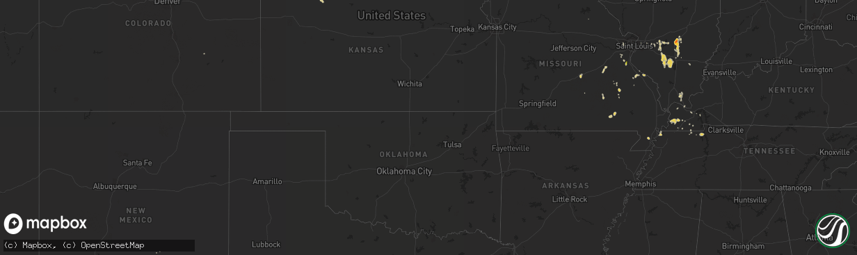
Hail Map on July 6, 2013
The weather event on July 6, 2013 includes Hail map. 17 states and 182 cities were impacted and suffered possible damage. The total estimated number of properties impacted is 456.
Want more than just the map?
Turn this storm into a full workflow.
- Owner + property data so you know who to knock
- OnDemand branded weather history reports to win the "did we even have hail?" argument
- RoofTrace estimate so reps stop guessing numbers at the door
Bought this map? Upgrade within 7 days and we'll credit the $230. (10-15 min setup call)
Hail
456
Estimated number of impacted properties by a 1.00" hail or larger273
Estimated number of impacted properties by a 1.75" hail or larger0
Estimated number of impacted properties by a 2.50" hail or largerStates Impacted by Hail Map on July 6, 2013
Storm reports
Minnesota
| Date | Description |
|---|---|
| 07/06/20135:42 PM CDT | Mostly pea size hail with a few stones the size of nickels and quarters. |
| 07/06/20135:37 PM CDT | A local report indicates 1.00 inch wind near 1 N EUCLID |
West Virginia
| Date | Description |
|---|---|
| 07/06/20135:37 PM CDT | Tree down on rte 47. |
Montana
| Date | Description |
|---|---|
| 07/06/20135:00 AM CDT | A local report indicates 1.00 inch wind near GERALDINE |
North Dakota
| Date | Description |
|---|---|
| 07/05/201311:55 PM CDT | Intermittent large hail and very heavy rain. |
| 07/05/20138:01 PM CDT | Winds estimated to 60 mph as well. |
| 07/05/20137:58 PM CDT | A local report indicates 1.75 inch wind near 11 SW HURDSFIELD |
| 07/05/20137:20 PM CDT | 40 to 60 mph winds also reported with storm. |
Illinois
| Date | Description |
|---|---|
| 07/06/20136:14 PM CDT | A local report indicates 1.75 inch wind near ALMA |
Kentucky
| Date | Description |
|---|---|
| 07/06/20136:10 PM CDT | 1 farm building overturned and the sidewalls of an equipment shed were blown in approximately a foot. Several large tree limbs were blown down. |
Pennsylvania
| Date | Description |
|---|---|
| 07/05/20139:10 PM CDT | Trees and wires down. |
| 07/05/20139:05 PM CDT | Several trees down. |
Utah
| Date | Description |
|---|---|
| 07/06/20136:25 PM CDT | Portable rwis 4 - 9805 ft |
| 07/06/20135:50 PM CDT | Target s dpg04 4349 ft |
| 07/06/20135:40 PM CDT | Juliet road dpg12 4324 ft |
| 07/05/20137:45 PM CDT | Ogden peak - 9570 ft |
| 07/05/20137:35 PM CDT | West of wildcat mtn - 4259 ft |
Arizona
| Date | Description |
|---|---|
| 07/05/201311:55 PM CDT | Several trees down...sheet metal blown off a few buildings. Time estimated based on radar. |
| 07/05/201311:21 PM CDT | Power poles reported down near thorton rd and w hanna st. Time estimated based on radar |
| 07/05/201310:08 PM CDT | Spotter report of 78mph wind gust |
| 07/05/201310:00 PM CDT | Sheriffs office reported power lines down on fort grant road north of willcox. |
Nevada
| Date | Description |
|---|---|
| 07/06/20136:42 PM CDT | Spruce mountain raws-6100 ft amsl |
| 07/06/20136:12 PM CDT | Baker raws-5613 ft amsl |
Nebraska
| Date | Description |
|---|---|
| 07/06/20136:20 PM CDT | A local report indicates 60 MPH wind near 8 N CHADRON |
South Dakota
| Date | Description |
|---|---|
| 07/06/20136:45 PM CDT | Public reported at least 60 mph winds with tree damage at residence along with quarter sized hail. |
| 07/05/20139:00 PM CDT | A local report indicates 87 MPH wind near 10 W EDGEMONT |
Missouri
| Date | Description |
|---|---|
| 07/06/20134:48 PM CDT | Hail size varied from nickel to quarter. |
Idaho
| Date | Description |
|---|---|
| 07/06/20134:30 PM CDT | Public reported at least golf ball sized hail between kasota and ridgeway road. |
Wyoming
| Date | Description |
|---|---|
| 07/06/20136:35 PM CDT | Hail 4 to 6 inches deep. Damage to siding and to a camper. |
| 07/06/20132:30 PM CDT | A local report indicates 72 MPH wind near 3 NW JACKSON |
| 07/05/20138:35 PM CDT | Nickel to quarter and strong wind |
| 07/05/20137:32 PM CDT | A local report indicates 1.25 inch wind near 7 NNE ROCKYPOINT |
| 07/05/20137:32 PM CDT | A local report indicates 60 MPH wind near 7 NNE ROCKYPOINT |
North Carolina
| Date | Description |
|---|---|
| 07/06/20135:45 PM CDT | Large tree split in half. |
| 07/06/20135:34 PM CDT | A couple trees blown down on hwy 64. |
| 07/06/20135:32 PM CDT | At least one tree blown down on justice dr and hwy 64. Fire dept is still investigating. |
| 07/06/20135:30 PM CDT | Tree down on miller road. |
Cities Impacted by Hail Map on July 6, 2013
- Lakota, ND
- Springville, TN
- Pinckneyville, IL
- Du Bois, IL
- Nashville, IL
- Tamaroa, IL
- Dubois, ID
- Harrison, NE
- Torrington, WY
- Mylo, ND
- Cody, WY
- Powell, WY
- Salem, MO
- Ravenswood, WV
- Rockport, WV
- Elizabeth, WV
- Sandyville, WV
- Wilsall, MT
- Livingston, MT
- Bourbon, MO
- Weston, WY
- Moorcroft, WY
- Tuttle, ND
- Goodrich, ND
- Van Buren, MO
- Spencer, ID
- Mcclusky, ND
- Denhoff, ND
- Hamer, ID
- Terreton, ID
- Bluford, IL
- Iuka, IL
- Dix, IL
- Texico, IL
- Mount Vernon, IL
- Salem, IL
- Kinmundy, IL
- Kell, IL
- Alma, IL
- Melville, MT
- Annapolis, MO
- Ironton, MO
- Clinton, KY
- Saint Anthony, ID
- Waltonville, IL
- Ashley, IL
- Sesser, IL
- Scheller, IL
- Fort Pierre, SD
- Ririe, ID
- Hillsboro, MO
- Dugway, UT
- Euclid, MN
- Chadron, NE
- Paulden, AZ
- Belvidere, SD
- Midland, SD
- Okaton, SD
- Chesterfield, MO
- White River, SD
- Hazelton, ID
- Murtaugh, ID
- Mayo, FL
- Ashton, ID
- Farmington, MO
- Panguitch, UT
- Hayti, MO
- Bragg City, MO
- Chino Valley, AZ
- Farina, IL
- Saint Peter, IL
- Marion Center, PA
- Smicksburg, PA
- Newburg, MO
- Sainte Genevieve, MO
- Licking, MO
- Carlyle, IL
- Sandoval, IL
- Belt, MT
- Fancy Farm, KY
- Hoyleton, IL
- Richview, IL
- Cando, ND
- Beckemeyer, IL
- Bartelso, IL
- Heyburn, ID
- Paul, ID
- Wardell, MO
- Vienna, IL
- Grantsburg, IL
- De Soto, MO
- Festus, MO
- Dawson, ND
- Pettibone, ND
- Woodlawn, IL
- Du Quoin, IL
- Whitney, NE
- Aviston, IL
- Highland, IL
- Trenton, IL
- Devils Lake, ND
- Pacific, MO
- Grandin, MO
- Ellsinore, MO
- Buchanan, TN
- Big Sandy, TN
- Belknap, IL
- Metropolis, IL
- Gillette, WY
- Murray, KY
- Jackson, WY
- Arlington, KY
- Mayfield, KY
- Columbus, KY
- Cedar Hill, MO
- Clayton, KS
- Norton, KS
- Willcox, AZ
- Saint Charles, MO
- Pocatello, ID
- Syracuse, UT
- Saint Mary, MO
- Steelville, MO
- House Springs, MO
- Belleview, MO
- Rushville, NE
- McLeansboro, IL
- Springerton, IL
- Hornbeak, TN
- Tiptonville, TN
- Breese, IL
- Punxsutawney, PA
- Reynoldsville, PA
- Fulton, KY
- Crawford, NE
- Pocahontas, IL
- Caledonia, MO
- Rozet, WY
- Saint Jacob, IL
- Troy, IL
- Fredericktown, MO
- Oakley, ID
- Hansen, ID
- Twin Falls, ID
- Palestine, WV
- Walker, WV
- Clearmont, WY
- Bisbee, ND
- Water Valley, KY
- Wingo, KY
- Fillmore, UT
- Kevil, KY
- Greenville, IL
- Rapid City, SD
- Cottage Grove, TN
- Puryear, TN
- Soda Springs, ID
- Starkweather, ND
- Centralia, IL
- Thayne, WY
- Chester, ID
- Rolette, ND
- Swan Valley, ID
- Hazel, KY
- Bottineau, ND
- Eloy, AZ
- Gilbertsville, KY
- Farmington, KY
- Sheridan, WY
- Wayan, ID
- Ballwin, MO
- Simpson, IL
- Churchs Ferry, ND
- Benton, KY
- Calvert City, KY
- Brookport, IL
- Paducah, KY
- Leasburg, MO
- Coolidge, AZ
- Hurdsfield, ND
- Warren, MN
- Robinson, ND