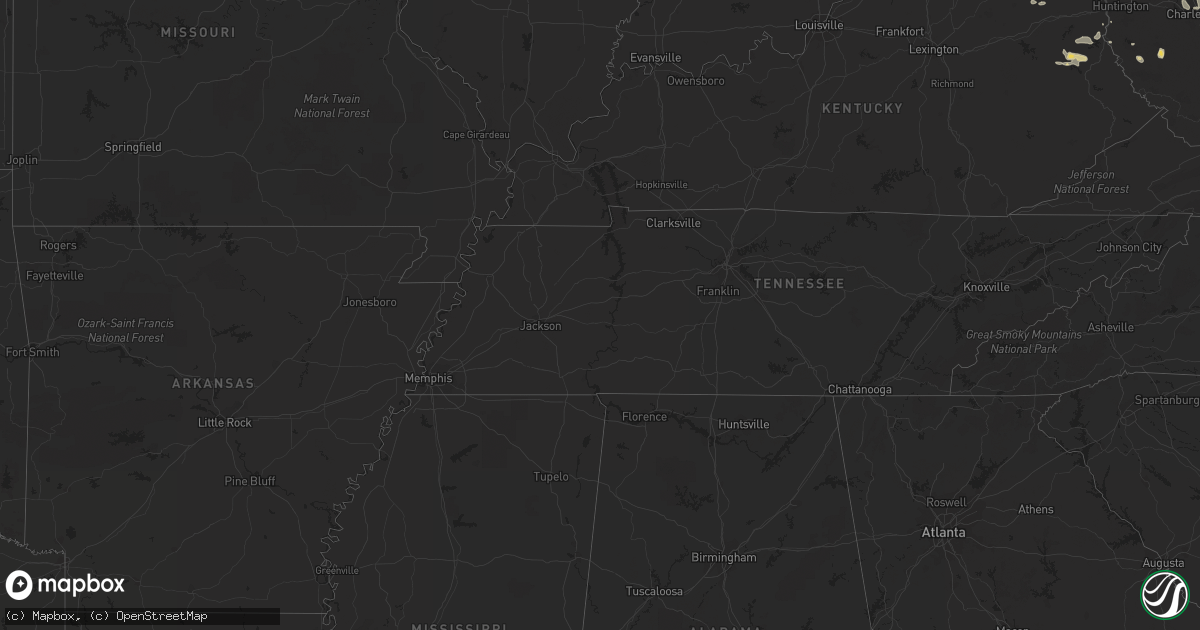
Hail Map on June 29, 2012
Get this storm
June 29 map
$229
one time, instant access
Download today. No call, no setup
Keep the $229
Bought the map and want the full workflow? Apply the entire $229 to a subscription within 7 days. None of it is wasted.
Every map, not just this one
This buys you this map. Subscription and you get every map we run, in the markets you choose from a few cities to whole states to nationwide. Plus real-time alerts the moment a storm fires.
Contact data
Name, contact info, occupancy, even credit band for addresses in the footprint. You go from where it hit to who to call.
Become the source they trust
Unlimited branding weather history reports on demand. You already have the documented answer ready for the property owner, and you are the one who showed up with it.
Property data and RoofTrace estimates
Pull up any address you have got, its value and the exact code rules for that jurisdiction, straight from One Click Code. Then RoofTrace estimates the squares, pitch, and roof value, priced the way you price.
States Impacted by Hail Map on June 29, 2012
Storm reports
South Dakota
| Date | Description |
|---|---|
| 06/29/20125:47 PM CDT | A local report indicates 1.00 inch wind near 4 NE TRENT |
| 06/29/201210:40 AM CDT | 60 mph gusts reported near miranda |
| 06/29/201210:30 AM CDT | Report from orient fire chief relayed by faulk county sherrif of 60 mph gusts...also no power in orient |
| 06/29/201210:18 AM CDT | Strong wind gusts to 60 mph with heavy rain |
Maine
| Date | Description |
|---|---|
| 06/29/20126:45 PM CDT | Trees down on the grimes road between caribou and fort fairfield. Time is estimated. |
| 06/29/20126:45 PM CDT | Tree and power lines down. |
| 06/29/20126:45 PM CDT | Trees down on the grimes road between caribou and fort fairfield. Time is estimated. |
| 06/29/20126:22 PM CDT | Quarter size hail and trees down. |
| 06/29/20126:20 PM CDT | Report of trees down on powerlines |
| 06/29/20126:10 PM CDT | Quarter size hail on the east-presque isle road with a few large trees down. Time is estimated. |
| 06/29/20126:10 PM CDT | A local report indicates 1.00 inch wind near 3 ENE CORNVILLE |
| 06/29/20125:36 PM CDT | A local report indicates 1.75 inch wind near WASHBURN |
| 06/29/20125:15 PM CDT | Scattered tree damage throughout caribou. |
| 06/29/20125:15 PM CDT | 1 1/2 hail |
| 06/29/20125:06 PM CDT | A local report indicates 1.25 inch wind near LIMESTONE |
| 06/29/20125:06 PM CDT | Golf ball sized hail in connor |
| 06/29/20125:05 PM CDT | A local report indicates 1.50 inch wind near LIMESTONE |
| 06/28/20127:10 PM CDT | 1 inch... Quarter size hail |
Indiana
| Date | Description |
|---|---|
| 06/29/20124:16 PM CDT | A local report indicates 60 MPH wind near 4 N NEW HAVEN |
| 06/29/20124:00 PM CDT | Trees down |
| 06/29/20123:42 PM CDT | Tree down... 1 1 2 to 2 feet in diameter |
| 06/29/20123:32 PM CDT | Tree down on road near 37 |
| 06/29/20123:28 PM CDT | Numerous trees and power lines down. |
| 06/29/20123:19 PM CDT | Trees and power lines down from dublin to cambridge city. |
| 06/29/20123:19 PM CDT | Numerous trees downed in whitewater memorial state park. |
| 06/29/20123:18 PM CDT | A large tree was downed on main street in liberty. |
| 06/29/20123:17 PM CDT | Power lines down resutling in traffic light outage at 38th and central ave. Reported via twitter. |
| 06/29/20123:15 PM CDT | Widespread tree damage. Powerlines down. Roof off a school and house roof damage in richmond. |
| 06/29/20123:10 PM CDT | Tree limbs and tents blown down on butler campus |
| 06/29/20123:06 PM CDT | Minor tree limbs down |
| 06/29/20123:05 PM CDT | One tree down about 1 foot in diameter |
| 06/29/20123:05 PM CDT | Several buildings heavily damaged near state road 1 and state road 28 |
| 06/29/20123:02 PM CDT | A local report indicates 60 MPH wind near GREENFIELD |
| 06/29/20123:02 PM CDT | Trees...tree limbs and power lines near 28 and hwy 3 |
| 06/29/20122:48 PM CDT | Barn blown over. Event time estimated from radar. |
| 06/29/20122:47 PM CDT | Roof of building blown down near 9th and new york |
| 06/29/20122:46 PM CDT | Minor tree limbs down |
| 06/29/20122:45 PM CDT | Measured 60 mph gust with gust front. Two large trees downed on butler university campus across 49th street. Several tents also blown over. Time estimated from radar. |
| 06/29/20122:45 PM CDT | Shingles blown off garage roof. Estimated 65-70 mph winds. |
| 06/29/20122:41 PM CDT | Very heavy rain. |
| 06/29/20122:41 PM CDT | 2 separate trees down on 2 separate |
| 06/29/20122:39 PM CDT | A local report indicates 60 MPH wind near 1 S ALEXANDRIA |
| 06/29/20122:35 PM CDT | Trees down in hillsdale. Time estimated by radar. |
| 06/29/20122:31 PM CDT | Large tree across 205. Road closed. |
| 06/29/20122:30 PM CDT | Power out from outflow winds at sr37 and 146th st. |
| 06/29/20122:30 PM CDT | Trees downed at washington and dicks street with gust front. Time approximated to be 330 pm by spotter. |
| 06/29/20122:30 PM CDT | Power line down. Time estimated via radar. |
| 06/29/20122:24 PM CDT | A local report indicates 1.00 inch wind near PLEASANT MILLS |
| 06/29/20122:20 PM CDT | Empty 500 gallon capacity water tank blown approx 1000 feet. Nickel size hail also reported. |
| 06/29/20122:20 PM CDT | *** 1 inj *** tree fell on trruck at 300 west and 700 north causing injury to occupants. Time estimated. Report via espotter. Unknown number of injuries...but report im |
| 06/29/20122:17 PM CDT | A local report indicates 1.00 inch wind near PLEASANT MILLS |
| 06/29/20122:15 PM CDT | Estimated 50 mph wind gusts. |
| 06/29/20122:15 PM CDT | A local report indicates 63 MPH wind near 3 E SAINT JOHNS |
| 06/29/20122:15 PM CDT | A local report indicates 65 MPH wind near 2 E DECATUR |
| 06/29/20122:13 PM CDT | Trees and power lines down |
| 06/29/20122:08 PM CDT | Widespread tree damage. No power in town. |
| 06/29/20122:08 PM CDT | Trees down |
| 06/29/20122:08 PM CDT | Windows blown in throughout county. Roofs blown off of barns. Tent down at the fairgrounds. 3 to 5 foot trees down. Shingles blown off roofs. Siding off buildings. Welc |
| 06/29/20122:07 PM CDT | A local report indicates 58 MPH wind near GAS CITY |
| 06/29/20122:05 PM CDT | Power out at tri-central high school |
| 06/29/20122:05 PM CDT | 8-10 inch tree limbs down. 30 feet of wooden fence blown down. 8 foot by 12 foot shed turned over. |
| 06/29/20122:05 PM CDT | Massive damage through the entire north part of adams county with intermittent damage throughout. Small fires...trucks blown over...trees down...and roofs blown off in |
| 06/29/20122:05 PM CDT | A local report indicates 72 MPH wind near 1 SW NEW HAVEN |
| 06/29/20122:02 PM CDT | Trees down. |
| 06/29/20122:00 PM CDT | Siding blown off houses...large oak tree limbs down...pea sized hail as well |
| 06/29/20122:00 PM CDT | Widespread damage across the fort wayne area...including tree limbs...downed trees and power lines down. |
| 06/29/20122:00 PM CDT | At corner of sr18 and 325w. Also flagpoles down in marion. |
| 06/29/20121:58 PM CDT | Trees and power lines down |
| 06/29/20121:54 PM CDT | Measured 91 mph gust at fort wayne international airport |
| 06/29/20121:50 PM CDT | Large tree across 205. Road closed. |
| 06/29/20121:50 PM CDT | Golf ball...or slightly larger...hail se of pine village. |
| 06/29/20121:50 PM CDT | Report of trees uprooted and limbs down in ashley. Time estimated from radar. |
| 06/29/20121:50 PM CDT | 30 trees down in one park many close to 2 feet in diameter. 3 of the trees fell on cars. |
| 06/29/20121:45 PM CDT | Tree branches down blocking secondary roads in the town of amboy |
| 06/29/20121:45 PM CDT | Mostly pea size hail but some larger. |
| 06/29/20121:43 PM CDT | Large uprooted tree with 64 mph wind gust |
| 06/29/20121:42 PM CDT | Tree down on division road and on 300w near 1100 n |
| 06/29/20121:41 PM CDT | Several large branches down and one tree down near mentone on state road 19 |
| 06/29/20121:40 PM CDT | Multiple trees down along 205 in whitley county. Healthy trees up to 5 feet in diameter snapped at base in collins |
| 06/29/20121:40 PM CDT | Measured at wabash county central dispatch |
| 06/29/20121:40 PM CDT | Trees and power lines reported down at several spots across the county. Time estimated from radar data. |
| 06/29/20121:40 PM CDT | Estimated 70 mph wind gust near grissom afb. Shingles blow off of a roof. |
| 06/29/20121:38 PM CDT | A local report indicates 65 MPH wind near 5 SSW LEO-CEDARVILLE |
| 06/29/20121:36 PM CDT | Roof blown off fire station and radio tower blown down in same location. Thunderstorm wind damage widespread throughout the county. |
| 06/29/20121:34 PM CDT | Multiple trees down throughout the county. Pea sized hail. Power lines down. 2 house fires as a result. |
| 06/29/20121:32 PM CDT | Partially cracked tree was blown over onto house at 935 n and warsaw trail n |
| 06/29/20121:31 PM CDT | Top 40 feet of 100 foot radio tower blown down. Also separate report of top 2 sections of 160 foot tower down. |
| 06/29/20121:30 PM CDT | A local report indicates 60 MPH wind near 4 SE PERU |
| 06/29/20121:21 PM CDT | Top 40 feet of 100 foot radio tower blown down. Also separate report of top 2 sections of 160 foot tower down. |
| 06/29/20121:20 PM CDT | 2 large healthy trees down |
| 06/29/20121:20 PM CDT | Estimated 60 mph wind gust with multiple small tree limbs down |
| 06/29/20121:20 PM CDT | 2ft diameter oak tree down on house on n. Ogden pt road |
| 06/29/20121:19 PM CDT | For approximately 7 minutes wind blew an estimated 65 to 70 mph....multiple trees down and multiple tree limbs are down. |
| 06/29/20121:16 PM CDT | A local report indicates 61 MPH wind near 4 SE GOSHEN |
| 06/29/20121:12 PM CDT | A local report indicates 1.00 inch wind near BREMEN |
| 06/29/20121:08 PM CDT | State police reports trees down and widespread power outages in rochester. Time estimated from radar. |
| 06/29/20121:06 PM CDT | Many trees and tree limbs down in the county. |
| 06/29/20121:05 PM CDT | Large tree down across the road. Power lines down. |
| 06/29/20121:04 PM CDT | Multiple reports of 4 inch diameter tree limbs down. Power outages at sr15 and us20. |
| 06/29/20121:01 PM CDT | Large tree on top of a car blocking the street |
| 06/29/201212:57 PM CDT | Small to medium sized branches down. Wooden golf course sign blown down. |
| 06/29/201212:42 PM CDT | A local report indicates 62 MPH wind near 4 NW SOUTH BEND |
| 06/29/201212:20 PM CDT | News media reports trees down throughout michigan city. Time estimated from radar. |
North Carolina
| Date | Description |
|---|---|
| 06/28/201211:10 PM CDT | A local report indicates 60 MPH wind near GATES |
| 06/28/201211:05 PM CDT | Willow springs golf club reported 38 trees blown down. |
| 06/28/201210:55 PM CDT | Tree down on neal dr. At us-42. |
| 06/28/201210:46 PM CDT | Tree down on harnett central rd. |
| 06/28/201210:44 PM CDT | Power lines down in angier. |
| 06/28/201210:40 PM CDT | Tree down seven paths road and arthur wilder road |
| 06/28/201210:38 PM CDT | Power lines down near fuquay varina. |
| 06/28/201210:35 PM CDT | Tree down at ackerman rd. And coalyard dr. |
| 06/28/201210:35 PM CDT | Multiple trees down along james slaughter rd...at old powell rd...bass lake rd...and white meadows dr. |
| 06/28/201210:35 PM CDT | Tree down at 3012 optimist farm rd. |
| 06/28/201210:35 PM CDT | Tree down at timber dr. And white oak rd. |
| 06/28/201210:35 PM CDT | Tree down at old stage rd. And vandora springs rd. |
| 06/28/201210:35 PM CDT | Tree down at lake wheeler rd. And ten-ten rd. |
| 06/28/201210:32 PM CDT | Tree down at 102 donagher ct. |
| 06/28/201210:32 PM CDT | Tree down at broad st. And wade-nash rd. |
| 06/28/201210:32 PM CDT | Tree down on piney grove-wilbon rd. |
| 06/28/201210:30 PM CDT | Trees down at haven rd and donald ross rd. |
| 06/28/201210:30 PM CDT | Tree on power line at 2801 gladstone dr. |
| 06/28/201210:30 PM CDT | Tree down on mitchel mill rd. |
| 06/28/201210:28 PM CDT | Tree on power lines at oxford rd. And reaves dr. |
| 06/28/201210:22 PM CDT | Tree down at falls of neuse and litchford rd. |
| 06/28/201210:22 PM CDT | Tree down at t k allen road and highway 561 |
| 06/28/201210:20 PM CDT | Power lines down |
| 06/28/201210:08 PM CDT | Trees down at creedmoor rd. And sandy plains rd. |
| 06/28/201210:08 PM CDT | Trees on power lines...which started a one acre brush fire on macon-embro rd. |
| 06/28/201210:06 PM CDT | Trees down at duke st. And university dr. |
| 06/28/201210:05 PM CDT | Tree down at kittrell rd. And long creek circle. |
| 06/28/201210:05 PM CDT | Glass door blown out of service station at 943 us-158 business west. |
| 06/28/201210:04 PM CDT | Trees down at stadium dr. And duke st. |
| 06/28/201210:04 PM CDT | Aluminum siding peeled off of doctors office on us-158 business west. |
| 06/28/201210:04 PM CDT | Rubber roof peeled off warr am radio station on us-158 business west. |
| 06/28/201210:03 PM CDT | Trees and power lines down at duke st. And cameron blvd. |
| 06/28/201210:02 PM CDT | Trees down at duke st. And i-85. |
| 06/28/201210:02 PM CDT | Large tree down on a van at erwin rd. And mt sinai rd. |
| 06/28/201210:00 PM CDT | Tree down on hwy 96 n near joe toler-oak hill school. |
| 06/28/20129:55 PM CDT | Roof blown off a carport at 5654 swepsonville-saxapahaw rd. |
| 06/28/20129:55 PM CDT | Tree down on orange st in oxford. Numerous other trees down throughout the county. |
| 06/28/20129:55 PM CDT | Large tree snapped in half about 40 ft off the ground. Numerous large limbs also down. |
| 06/28/20129:50 PM CDT | Numerous trees down near lawsonville avenue |
| 06/28/20129:45 PM CDT | 2 trees uprooted and winds estimated over 50 mph. Trees were approx 25 ft tall. |
| 06/28/20129:25 PM CDT | Trees reported down from at least 10 locations in eastern wilkes county from near elkin toward traphill. |
| 06/28/20129:25 PM CDT | Numerous trees down all around the county. |
| 06/28/20129:20 PM CDT | Caswell emergency manager reports dozens of trees down throughout the county. Damage started at 1020 pm edt in the northwest part of the county and continued until 1050 |
| 06/28/20129:20 PM CDT | Several limbs broken out of trees and light pole blown over. |
| 06/28/20129:19 PM CDT | Trees down on snatchburg road. |
| 06/28/20129:15 PM CDT | 20 reports of downed trees on roads and 2 reports of trees on vehicles per thunderstorm gust front which entered the county at 1015 pm and exited the county at 1045 pm. |
| 06/28/20129:10 PM CDT | A few trees and several large tree limbs were blown down along walters mill road near the intersection highway 86 |
| 06/28/20129:08 PM CDT | Several trees blown down. |
| 06/28/20129:04 PM CDT | Large tree uprooted on rierson road at spring drive |
| 06/28/20129:00 PM CDT | 151 reports of trees and powerlines down across the county from thunderstorm gust front which entered the county at 1000 pm and exited county at 1030 pm. 1 tree fell on |
| 06/28/20129:00 PM CDT | 43 reports of trees and powerlines down across the county from thunderstorm gust front which crossed the county between 1000 and 1030 pm. Heaviest damage was in the nor |
| 06/28/20128:52 PM CDT | Tree down on glade creek school rd |
| 06/28/20128:50 PM CDT | Two trees down on kings creek rd |
| 06/28/20128:43 PM CDT | At least 200 trees blown down across surry county between 943 pm and 1005 pm. Five residents experienced trees down on roofs...eight trees fell on vehicles. |
Kansas
| Date | Description |
|---|---|
| 06/28/201211:33 PM CDT | A local report indicates 60 MPH wind near SYRACUSE |
Illinois
| Date | Description |
|---|---|
| 06/29/20122:38 PM CDT | A local report indicates 2.00 inch wind near VERMILION COUNTY AIRPOR |
| 06/29/20122:25 PM CDT | A local report indicates 3.00 inch wind near 8 NNW DANVILLE |
| 06/29/20122:25 PM CDT | A local report indicates 2.75 inch wind near 4 W BISMARCK |
| 06/29/201211:55 AM CDT | I-80 and i-394 |
| 06/29/201211:54 AM CDT | A local report indicates 1.00 inch wind near CRETE |
| 06/29/201211:30 AM CDT | Power lines down. Estimated wind speeds 60 mph. |
| 06/29/201210:54 AM CDT | Several trees down on vehicles and power lines |
| 06/29/201210:45 AM CDT | I-88 and keslinger rd |
| 06/29/201210:25 AM CDT | At i-88 and i39 |
| 06/28/201211:45 PM CDT | A local report indicates 1.00 inch wind near BOURBONNAIS |
| 06/28/201211:37 PM CDT | A local report indicates 1.00 inch wind near BOURBONNAIS |
| 06/28/201211:33 PM CDT | A local report indicates 62 MPH wind near PEOTONE |
| 06/28/201211:14 PM CDT | Downed power lines north of frances road and just east of cedar road. Time estimated. |
| 06/28/201211:11 PM CDT | A local report indicates 72 MPH wind near 1 W CARBON HILL |
| 06/28/201210:56 PM CDT | Estimated 60 to 70 mph winds |
| 06/28/20129:53 PM CDT | Large limbs tree down |
| 06/28/20129:52 PM CDT | Measured at nws office in romeoville. Pine tree 10 inches in diameter snapped at its base. |
| 06/28/20129:50 PM CDT | Widespread large branches down along with power outages. Winds estimated between 60 and 70 mph. |
| 06/28/20129:50 PM CDT | Large trees raining down onto cars on route 53 with 3 out of 4 lanes blocked by 2 very large uprooted trees. One tree fell onto a car. Hail also was falling but employe |
| 06/28/20129:50 PM CDT | Large tree down blocking road and widespread tree damage across the neighborhood. |
| 06/28/20129:45 PM CDT | At renwick road and old renwick trail...large oak limbs snapped and power out. |
| 06/28/20129:45 PM CDT | Several tree branches blown down. One tree with 5 to 6 inch diameter trunk snapped in half. Second tree with 4 to 5 inch diameter trunk broken at base. Winds estimated |
| 06/28/20129:41 PM CDT | Wind gusts with very heavy rain 1.02 inches in 15 minutes. Quarter inch hail for 10 minutes. Power went out at 942 pm and returned 1038 pm. |
| 06/28/20129:41 PM CDT | Severe wind gusts furniture blown against fence. Small limbs torn from parkway trees. |
| 06/28/20129:40 PM CDT | Small tree 4-5 inches in diameter snapped a few feet above ground. Part of a fence blown down. |
| 06/28/20129:31 PM CDT | Trees and limbs down. |
| 06/28/20129:14 PM CDT | Two 70 foot sections of wooden fencing blown down. Delayed report |
| 06/28/20129:05 PM CDT | Flagpole bent over and tree limbs blown down. Winds estimated at 70 mph. Relayed by nws lincoln. |
| 06/28/20128:15 PM CDT | Power lines down in town. Relayed by broadcast media. Time estimated. |
| 06/28/20128:05 PM CDT | Several large trees and power lines down on lowell park road just north of dixon. Relayed by broadcast media. Time estimated. |
| 06/28/20128:02 PM CDT | Also 5 inch diameter tree down. |
| 06/28/20128:00 PM CDT | 74 mph wind gust with dime size hail and wind rotation. Multiple trees down in area. Rainfall was 1.39 inches in 20 minutes. Delayed report |
| 06/28/20127:50 PM CDT | A local report indicates 1.50 inch wind near 5 ENE HOOPPOLE |
| 06/28/20127:49 PM CDT | Most stones .5 to 1.o inch in diameter. |
| 06/28/20127:49 PM CDT | Several trees and limbs down. |
| 06/28/20127:45 PM CDT | Heavy rain reported as well. |
| 06/28/20127:27 PM CDT | A local report indicates 60 MPH wind near 5 SE GARDEN PLAIN |
Iowa
| Date | Description |
|---|---|
| 06/29/20126:10 PM CDT | Numerous trees down in anamosa. |
| 06/29/20126:00 PM CDT | Large maple tree broken off. |
| 06/29/20126:00 PM CDT | Rwis site |
| 06/29/20126:00 PM CDT | Numerous limbs down...10 inch tree down on pasture fence...5 inch limb down in front yard. |
| 06/29/20125:55 PM CDT | Report from the linn county fairgrounds of widespread tents blown over with some damage to carnival equipment. |
| 06/29/20125:54 PM CDT | Off duty nws employee reported widespread 6 to 7 inch tree limbs down in town. |
| 06/29/20125:52 PM CDT | Relayed by linn county emergency management. |
| 06/29/20125:51 PM CDT | Large 16 inch diameter tree snapped on the ground near 4th street and mill ave in town...time estimated from radar. |
| 06/29/20125:48 PM CDT | Winds estimated at 60 mph began 1730 and were continuing through 1748 pm cdt. |
| 06/29/20125:46 PM CDT | Winds of 60 to 65 mph winds. Report relayed by jones county emergency manager. |
| 06/29/20125:45 PM CDT | Large tree limbs down. |
| 06/29/20125:43 PM CDT | At least 70 mph. |
| 06/29/20125:43 PM CDT | Large trees down. Mini van blown over. |
| 06/29/20125:41 PM CDT | Large tree down on 10th ave near 17th and 18th street in town...several smaller branches down...numerous power outages...time estimated from radar. |
| 06/29/20125:40 PM CDT | Branches and trees down. |
| 06/29/20125:40 PM CDT | Estimated wind gust of 70 mph on linn benton rd. Relayed by linn county emergency management. |
| 06/29/20125:40 PM CDT | 10 inch tree branch snapped near residence...numerous power outages also reported...time estimated from radar. |
| 06/29/20125:39 PM CDT | Large tree snapped and covering an entire street in town...near the corner of 13th street and 4th avenue. |
| 06/29/20125:36 PM CDT | Report of 7 inch diameter tree limbs down. |
| 06/29/20125:35 PM CDT | Wind gusts estimated 60-70 mph. |
| 06/29/20125:34 PM CDT | Power is out in northeast cedar rapids. |
| 06/29/20125:27 PM CDT | Power outages in southwest cedar rapids. Damage to kirkwood community college outdoor stage. |
| 06/29/20125:27 PM CDT | A local report indicates 60 MPH wind near SE ATKINS |
| 06/29/20125:27 PM CDT | Estimated in excess of 60 mph. Relayed by benton county emergency management. |
| 06/29/20125:26 PM CDT | A local report indicates 58 MPH wind near CEDAR RAPIDS MUNICIPAL |
| 06/29/20125:23 PM CDT | A local report indicates 70 MPH wind near NEWHALL |
| 06/29/20125:20 PM CDT | 3 light poles down in town...near 1304 15th street. |
| 06/29/20125:19 PM CDT | Estimated 65 to 75 mph. Winds over 60 mph now for over 5 minutes. |
| 06/29/20125:18 PM CDT | Relayed by benton county emergency management. |
| 06/29/20125:17 PM CDT | Power pole down in town. Electricity out. Winds over 40 mph for over 10 minutes now. |
| 06/29/20125:16 PM CDT | From iowa county sheriff office |
| 06/29/20125:14 PM CDT | A local report indicates 60 MPH wind near 1 SSW BELLE PLAINE |
| 06/29/20125:12 PM CDT | Trees breaking...unknown size at this time. |
| 06/29/20125:10 PM CDT | Luzerne fire department estimated winds 65 to 70 mph. Relayed by benton county em. |
| 06/29/20125:07 PM CDT | A local report indicates 60 MPH wind near 4 W WILLIAMSBURG |
| 06/29/20125:06 PM CDT | Widespread tree limbs and power lines down across the southern third of benton county |
| 06/29/20125:00 PM CDT | Wind still gusting 50 to 60 mph at 505 pm. |
| 06/29/20125:00 PM CDT | Power pole snapped in half along country road m |
| 06/29/20124:59 PM CDT | Spotter ia-4 |
| 06/29/20124:55 PM CDT | Highest gust measured thus far by kcci schoolnet site. |
| 06/29/20124:47 PM CDT | 3 to 4 large tree limbs...generally 3 to 5 inches in diameter down. One branch was 20 foot long. |
| 06/29/20124:45 PM CDT | From kcci schoolnet sbri4 |
| 06/29/20124:45 PM CDT | Many trees and tree limbs down across the city with some trees on roofs. Time estimated from radar. |
| 06/29/20124:40 PM CDT | Peak wind gust measured by weather station at the water treatment plant. Time estimated from radar. |
| 06/29/20124:39 PM CDT | A local report indicates 60 MPH wind near 1 NE GRINNELL |
| 06/29/20124:35 PM CDT | Measured by an iowa dot rwis site on interstate 80. Reports of a semi jack knifed in the area as well. |
| 06/29/20124:33 PM CDT | Several large road signs and large tree limbs down near interstate 80 south of grinnell. Quarter size hail reported as well. |
| 06/29/20124:30 PM CDT | Barn destroyed. Relayed from social media website. Time estimated by radar. |
| 06/29/20124:25 PM CDT | A local report indicates 1.25 inch wind near 4 ENE NEWTON AIRPORT |
| 06/29/20124:23 PM CDT | A local report indicates 2.50 inch wind near NEWTON |
| 06/29/20124:19 PM CDT | A local report indicates 59 MPH wind near 2 E PELLA AIRPORT |
| 06/29/20124:13 PM CDT | Very strong winds knocked down several large limbs just north of lake red rock. Spotter estimated winds in excess of 60 mph. |
| 06/29/20124:08 PM CDT | 3 miles ese of metz |
| 06/29/20123:34 PM CDT | 5 inch diameter tree limb down at the intersection of 5th ave and watson powell. Time estimated by radar. |
| 06/29/20123:06 PM CDT | Estimated quarter size hail and estimated 50 mph wind at de soto exit on i-80. |
| 06/28/201210:33 PM CDT | Mostly nickel size with some quarter size hail. |
| 06/28/20129:07 PM CDT | On route g36 near the riverside exit. Nickel to quarter sized hail. |
| 06/28/20129:05 PM CDT | Flagpole bent over and tree limbs blown down. Winds estimated at 70 mph. |
| 06/28/20128:22 PM CDT | Machine shed doors blown in. Numerous tree limbs down. |
| 06/28/20128:22 PM CDT | Winds in excess of 60 mph. |
| 06/28/20128:16 PM CDT | Nickel to quarter size hail. |
Delaware
| Date | Description |
|---|---|
| 06/28/201211:25 PM CDT | Poles snapped. Wind gusts estimated in excess of 70 mph. |
| 06/28/201211:21 PM CDT | Trees down. |
| 06/28/201211:20 PM CDT | Limbs down. |
| 06/28/201211:20 PM CDT | Large limbs down |
| 06/28/201211:16 PM CDT | Large limbs down. |
| 06/28/201211:15 PM CDT | A local report indicates 1.75 inch wind near NEWARK |
| 06/28/201211:15 PM CDT | Multiple trees reported down in middletown. |
| 06/28/201211:15 PM CDT | Large limbs broken. |
| 06/28/201211:10 PM CDT | Trees down |
| 06/28/201211:00 PM CDT | Large limbs down. |
| 06/28/201211:00 PM CDT | Large limbs down |
| 06/28/201211:00 PM CDT | Trees down. |
| 06/28/201210:45 PM CDT | A local report indicates 70 MPH wind near BRIDGEVILLE |
Ohio
| Date | Description |
|---|---|
| 06/29/20126:20 PM CDT | Numerous large trees blown down. |
| 06/29/20126:20 PM CDT | Numerous large trees blown down. |
| 06/29/20126:20 PM CDT | Numerous large trees blown down. |
| 06/29/20126:03 PM CDT | Trees down. Event occurred between 650 |
| 06/29/20126:00 PM CDT | Large branches broken |
| 06/29/20125:58 PM CDT | Trees down. Roof damage |
| 06/29/20125:30 PM CDT | Large trees...up to 2 feet in diameter...down |
| 06/29/20125:30 PM CDT | Numerous structural damage. Numerous trees down |
| 06/29/20125:30 PM CDT | A local report indicates 1.00 inch wind near WOODSFIELD |
| 06/29/20125:30 PM CDT | Numerous structural damage. Numerous trees down |
| 06/29/20125:30 PM CDT | Large trees down |
| 06/29/20125:29 PM CDT | Trees down |
| 06/29/20125:27 PM CDT | Structural damage. |
| 06/29/20125:27 PM CDT | Roof of structure damaged and tree down on camper with one minor injury. Event occurred at fairgrounds. |
| 06/29/20125:26 PM CDT | Multiple trees down |
| 06/29/20125:25 PM CDT | Asos at albany airport measured 51kt gust |
| 06/29/20125:25 PM CDT | Tree ripped across road in half |
| 06/29/20125:23 PM CDT | Large tree down in nelsonville ohio. Power is out. |
| 06/29/20125:20 PM CDT | Large branches down |
| 06/29/20125:20 PM CDT | Tornado on ground unconfirmed |
| 06/29/20125:19 PM CDT | A local report indicates 1.75 inch wind near SMITHFIELD |
| 06/29/20125:15 PM CDT | Numerous trees down |
| 06/29/20125:15 PM CDT | Trees down |
| 06/29/20125:15 PM CDT | Two foot diamerter trees down in jackson |
| 06/29/20125:15 PM CDT | Numerous 80 foot pine trees snapped off at around 35-40 feet |
| 06/29/20125:15 PM CDT | A local report indicates 59 MPH wind near 2 SW ALBANY |
| 06/29/20125:15 PM CDT | Roof blown off house. |
| 06/29/20125:12 PM CDT | A local report indicates 64 MPH wind near ATHENS |
| 06/29/20125:10 PM CDT | Numerous trees down |
| 06/29/20125:10 PM CDT | Clock tower damaged on courthouse... Church collapsed... And several other structures damaged in cambridge. |
| 06/29/20125:10 PM CDT | Tree down on a house |
| 06/29/20125:10 PM CDT | Tornado on ground unconfirmed |
| 06/29/20125:10 PM CDT | Numerous trees down...power out |
| 06/29/20125:08 PM CDT | Over 200 trees down throughout the county. Over a dozen homes in the county sustained damage due to tree impacts. |
| 06/29/20125:07 PM CDT | Barn destroyed and trees down along luther rd. Time estimated from radar. |
| 06/29/20125:06 PM CDT | Trees down. Structural damage including roof damage. |
| 06/29/20125:06 PM CDT | A local report indicates 1.00 inch wind near CAMBRIDGE |
| 06/29/20125:05 PM CDT | Large tree down on trailer. |
| 06/29/20125:04 PM CDT | Significant tree damage around the city |
| 06/29/20125:03 PM CDT | Mesonet site |
| 06/29/20125:00 PM CDT | Trees down. |
| 06/29/20125:00 PM CDT | Trees down |
| 06/29/20125:00 PM CDT | Peak wind gust at kzzv asos. |
| 06/29/20125:00 PM CDT | Multiple trees down |
| 06/29/20125:00 PM CDT | Lots of trees down. Power outages. Structural damage |
| 06/29/20125:00 PM CDT | Large trees blown down. |
| 06/29/20124:57 PM CDT | Multiple trees down |
| 06/29/20124:57 PM CDT | Ohio route 335 closed near beaver due to downed power lines. |
| 06/29/20124:53 PM CDT | A local report indicates 63 MPH wind near 2 WSW BRIDGEVILLE |
| 06/29/20124:52 PM CDT | Several trees down. Sporadic power outages. |
| 06/29/20124:50 PM CDT | Structural damage |
| 06/29/20124:50 PM CDT | A local report indicates 62 MPH wind near NEW LEXINGTON |
| 06/29/20124:50 PM CDT | Multiple trees down. Roof blown off. Garage destroyed. |
| 06/29/20124:50 PM CDT | Lots of trees down in and around town. Time estimated by radar. |
| 06/29/20124:49 PM CDT | Numerous roads closed across the area due to snapped trees. |
| 06/29/20124:47 PM CDT | Several trees and limbs down in clark. |
| 06/29/20124:47 PM CDT | Multiple trees down in mohican state park. |
| 06/29/20124:45 PM CDT | Trees down...some on power lines. Multiple large branches down. |
| 06/29/20124:45 PM CDT | Multiple trees down. Report from iln |
| 06/29/20124:45 PM CDT | Large tree snapped midway up. Numerous large tree branches down. |
| 06/29/20124:45 PM CDT | Numerous trees downed in hocking hills state park. |
| 06/29/20124:44 PM CDT | Ohio route 220 closed west of waverly due to downed power lines. |
| 06/29/20124:44 PM CDT | Ohio route 551 closed near lake white due to downed power lines. |
| 06/29/20124:42 PM CDT | Trees down and power out. Corrected time from 455 pm to 542 pm. |
| 06/29/20124:42 PM CDT | Numerous trees down |
| 06/29/20124:41 PM CDT | Tree on a mobile home. |
| 06/29/20124:40 PM CDT | Multiple trees were reported down due to thunderstorm winds. |
| 06/29/20124:40 PM CDT | Power out. |
| 06/29/20124:40 PM CDT | Numerous trees downed in tar hollow state forest. |
| 06/29/20124:40 PM CDT | One tree down |
| 06/29/20124:38 PM CDT | Numerous trees and power lines down in massieville and elsewhere around ross county |
| 06/29/20124:37 PM CDT | Horns mill road was closed due to numerous trees downed. |
| 06/29/20124:36 PM CDT | 4-6 mile stretch north of felicity with numerous trees down along highway |
| 06/29/20124:35 PM CDT | Large trees down. |
| 06/29/20124:34 PM CDT | A local report indicates 81 MPH wind near LANCASTER |
| 06/29/20124:33 PM CDT | A metal roof was removed from a building on race street. |
| 06/29/20124:31 PM CDT | A large tree was downed on a pickup truck. Siding damage reported at a house. |
| 06/29/20124:30 PM CDT | Tree uprooted. Time estimated |
| 06/29/20124:30 PM CDT | Trees down |
| 06/29/20124:30 PM CDT | Multiple large tree limbs downed. Siding damage to buildings. |
| 06/29/20124:27 PM CDT | Tree branches down |
| 06/29/20124:27 PM CDT | Large tree limbs down. |
| 06/29/20124:26 PM CDT | A local report indicates 70 MPH wind near NEWARK |
| 06/29/20124:26 PM CDT | Several trees down along route 22 between amanda and lancaster. |
| 06/29/20124:25 PM CDT | Large branches down in anderson township |
| 06/29/20124:25 PM CDT | A local report indicates 69 MPH wind near KLHQ LANCASTER APT |
| 06/29/20124:25 PM CDT | Numerous large limbs and small trees down. One fell on a vehicle. |
| 06/29/20124:25 PM CDT | A garage was destroyed...numerous trees were downed...and a roof was taken off a barn. One horse was killed. |
| 06/29/20124:23 PM CDT | Trees down. |
| 06/29/20124:22 PM CDT | Trees down |
| 06/29/20124:21 PM CDT | 2 large branches down. |
| 06/29/20124:20 PM CDT | 10-12 inch diameter tree limbs down. |
| 06/29/20124:20 PM CDT | Trees down on main street and a utility pole down. |
| 06/29/20124:19 PM CDT | A large tree was downed on a house on half avenue. |
| 06/29/20124:18 PM CDT | Large branches down. |
| 06/29/20124:17 PM CDT | A local report indicates 65 MPH wind near LEXINGTON |
| 06/29/20124:17 PM CDT | At lunken field. |
| 06/29/20124:17 PM CDT | A tree fell on a mobile home near the intersection of mad river and riber roads. |
| 06/29/20124:15 PM CDT | Trees down...shingles off the roof. No power. |
| 06/29/20124:15 PM CDT | Trees down. |
| 06/29/20124:15 PM CDT | Large tree branches down |
| 06/29/20124:15 PM CDT | A local report indicates 66 MPH wind near 2 SE JOHNSTOWN |
| 06/29/20124:15 PM CDT | Large trees and limbs down. |
| 06/29/20124:15 PM CDT | A local report indicates 66 MPH wind near NEWARK |
| 06/29/20124:14 PM CDT | A tree fell on a mobile home near the intersection of mad river and riber roads. Time estimated from radar. |
| 06/29/20124:13 PM CDT | Several trees uprooted along sr 135 near allensburg. |
| 06/29/20124:12 PM CDT | Small trees down. No electric power in the town. |
| 06/29/20124:11 PM CDT | At rickenbacker afb. |
| 06/29/20124:10 PM CDT | Golf ball hail at mid ohio race track. |
| 06/29/20124:10 PM CDT | Widespread tree damage here and in clintonville...and worthington. Most of franklin county. |
| 06/29/20124:10 PM CDT | At mid ohio race track. |
| 06/29/20124:10 PM CDT | Poles snapped and wires down |
| 06/29/20124:10 PM CDT | Several trees down along dade road. Time estimated from radar. |
| 06/29/20124:08 PM CDT | Numerous trees downed in johnstown. Two rooves were removed from houses. |
| 06/29/20124:08 PM CDT | *** 1 inj *** at least a dozen power poles snapped along hamilton rd. At least one injury from pole falling on car. |
| 06/29/20124:07 PM CDT | Numerous trees downed near duncan plains road. |
| 06/29/20124:07 PM CDT | A local report indicates 72 MPH wind near 2 NNE GAHANNA |
| 06/29/20124:06 PM CDT | At port columbus international airport |
| 06/29/20124:06 PM CDT | Siding ripped from a home. Time estimated. |
| 06/29/20124:05 PM CDT | Large trees down. |
| 06/29/20124:05 PM CDT | Siding off of two homes. |
| 06/29/20124:05 PM CDT | Large trees down. Time estimated |
| 06/29/20124:05 PM CDT | Trees down on the ohio state university campus. |
| 06/29/20124:05 PM CDT | A local report indicates 70 MPH wind near 1 E WESTERVILLE |
| 06/29/20124:05 PM CDT | Shutter off house. Power lines down. |
| 06/29/20124:03 PM CDT | Tree uprooted. Time corrected from 530 pm to 503 pm. |
| 06/29/20124:03 PM CDT | Large trees down. |
| 06/29/20124:03 PM CDT | Large 100 year old tree uprooted. Numerous trees and branches down around fayette county. Three semi trucks overturned on i-71. |
| 06/29/20124:02 PM CDT | At nws wilmington. |
| 06/29/20124:02 PM CDT | Wall of attached garage blown out/damaged. |
| 06/29/20124:02 PM CDT | Utility poles down. |
| 06/29/20124:02 PM CDT | A local report indicates 71 MPH wind near 3 E HUBER RIDGE |
| 06/29/20124:01 PM CDT | One foot diameter tree snapped |
| 06/29/20124:01 PM CDT | A local report indicates 58 MPH wind near KILN WILMINGTON APT |
| 06/29/20124:00 PM CDT | 4 inch branch broken. |
| 06/29/20124:00 PM CDT | Large tree limbs down. |
| 06/29/20124:00 PM CDT | 70-80 mph estimated gust in edison. |
| 06/29/20124:00 PM CDT | Large trees down along us 22 in deerfield township |
| 06/29/20124:00 PM CDT | 2 trees down |
| 06/29/20124:00 PM CDT | A local report indicates 67 MPH wind near KILN WILMINGTON APT |
| 06/29/20124:00 PM CDT | Several trees down near liberty keuter road and oregonia road. |
| 06/29/20124:00 PM CDT | Trees down on osu campus |
| 06/29/20123:59 PM CDT | Numerous large limbs down and shingles ripped off homes near i-270 and cleveland ave. Time estimated from radar. |
| 06/29/20123:59 PM CDT | Trees down. Via broadcast media |
| 06/29/20123:59 PM CDT | A local report indicates 63 MPH wind near 2 WSW BRIDGEVILLE |
| 06/29/20123:59 PM CDT | Brick structure in downtown area with a roof off |
| 06/29/20123:57 PM CDT | Numerous trees downed on stafford and clearview streets. |
| 06/29/20123:57 PM CDT | Numerous trees downed on northland and proprietors roads. |
| 06/29/20123:57 PM CDT | Near interstate 74 |
| 06/29/20123:56 PM CDT | A local report indicates 70 MPH wind near MOUNT GILEAD |
| 06/29/20123:55 PM CDT | Large tree down |
| 06/29/20123:55 PM CDT | Trees down and power out. |
| 06/29/20123:54 PM CDT | Trees down. 56 mph measured gust. |
| 06/29/20123:54 PM CDT | Odot garage sensor. |
| 06/29/20123:54 PM CDT | Several trees down |
| 06/29/20123:54 PM CDT | A tractor trailer was blown over on interstate 71. |
| 06/29/20123:54 PM CDT | Trees down. |
| 06/29/20123:53 PM CDT | A local report indicates 82 MPH wind near KOSU OSU AIRPORT |
| 06/29/20123:52 PM CDT | Trees down. |
| 06/29/20123:50 PM CDT | Trees down and power lines down |
| 06/29/20123:50 PM CDT | Trees down along curve rd. |
| 06/29/20123:50 PM CDT | 2 large trees down. |
| 06/29/20123:50 PM CDT | Tree snapped off. |
| 06/29/20123:50 PM CDT | Numerous trees uprooted and several others partially downed on cranston drive in dublin. |
| 06/29/20123:47 PM CDT | 2 large trees down. |
| 06/29/20123:47 PM CDT | A local report indicates 1.75 inch wind near 1 E MARION |
| 06/29/20123:47 PM CDT | A local report indicates 64 MPH wind near KDLZ DELAWARE APT |
| 06/29/20123:46 PM CDT | A local report indicates 63 MPH wind near KMWO MIDDLETOWN APT |
| 06/29/20123:45 PM CDT | A brick chimney was blown off a house in hamilton. |
| 06/29/20123:45 PM CDT | A local report indicates 1.00 inch wind near 3 ESE MARION |
| 06/29/20123:45 PM CDT | Large tree down on lebanon street |
| 06/29/20123:44 PM CDT | A local report indicates 1.50 inch wind near MARYSVILLE |
| 06/29/20123:44 PM CDT | Large tree limbs down |
| 06/29/20123:43 PM CDT | A local report indicates 2.00 inch wind near MARYSVILLE |
| 06/29/20123:42 PM CDT | Damage to outbuildings with a few large tree limbs downed. |
| 06/29/20123:42 PM CDT | Trees downed. Sheet metal stripped off barns and barn roof. |
| 06/29/20123:41 PM CDT | Numerous trees and power lines down |
| 06/29/20123:40 PM CDT | Semi truck rolled over. |
| 06/29/20123:40 PM CDT | Large tree branches down. |
| 06/29/20123:40 PM CDT | Numerous large trees down with siding damage to several homes. |
| 06/29/20123:40 PM CDT | A 60 x 108 foot pole barn was destroyed. Numerous trees were downed. |
| 06/29/20123:39 PM CDT | Trees downed on randall road near franklin ohio. |
| 06/29/20123:39 PM CDT | Numerous trees downed near downtown franklin. Some roof and car damage due to the winds and falling trees. |
| 06/29/20123:37 PM CDT | Numerous large trees and limbs are down throughout the county. Power lines down. 2 house fires. |
| 06/29/20123:37 PM CDT | Trees down. |
| 06/29/20123:37 PM CDT | Large tree down on a side of a house |
| 06/29/20123:37 PM CDT | A local report indicates 60 MPH wind near 1 NE XENIA |
| 06/29/20123:37 PM CDT | A local report indicates 60 MPH wind near CENTERVILLE |
| 06/29/20123:36 PM CDT | Two trees down |
| 06/29/20123:35 PM CDT | Several trees and limbs down. |
| 06/29/20123:32 PM CDT | Tree down |
| 06/29/20123:32 PM CDT | Several big trees down in the area around rahn rd and mad river rd. Time estimated from radar. |
| 06/29/20123:31 PM CDT | A local report indicates 60 MPH wind near EATON |
| 06/29/20123:30 PM CDT | Tree snapped in osborn park |
| 06/29/20123:30 PM CDT | Trees down and quarter sized hail. |
| 06/29/20123:30 PM CDT | Structural damage at dayton mall. |
| 06/29/20123:30 PM CDT | Many limbs less than 3 inches in diameter blown off trees. |
| 06/29/20123:28 PM CDT | Large trees down. Power poles snapped. Tree on a house. Multiple roads blocked. From spotternetwork.org |
| 06/29/20123:27 PM CDT | Large branches down |
| 06/29/20123:27 PM CDT | Numerous 4 inch plus limbs down. Damage to small shed. |
| 06/29/20123:25 PM CDT | A local report indicates 75 MPH wind near DAYTON |
| 06/29/20123:25 PM CDT | Trees down. Time corrected from am to pm. |
| 06/29/20123:25 PM CDT | A local report indicates 84 MPH wind near FINDLAY |
| 06/29/20123:25 PM CDT | Damage occurred across much of jackson township in southwest wyandot county. The roof was blown off of a couple of barns. Roof shingles and sheet metal was blown off se |
| 06/29/20123:24 PM CDT | Ohio dot sensor. |
| 06/29/20123:24 PM CDT | Structural damage. Time corrected from am to pm. |
| 06/29/20123:23 PM CDT | Numerous trees and power lines down in german township |
| 06/29/20123:23 PM CDT | Multiple large tree limbs downed in the walnut hills neighborhood of dayton. |
| 06/29/20123:21 PM CDT | Large trees down |
| 06/29/20123:20 PM CDT | A local report indicates 63 MPH wind near HUBER HEIGHTS |
| 06/29/20123:20 PM CDT | 4 or 5 semi trucks blown over on i-75 between findlay and bluffton. Trees down. |
| 06/29/20123:20 PM CDT | Tree down on a car and large branches down. Power out |
| 06/29/20123:20 PM CDT | Numerous trees down and roof damage to several buildings. |
| 06/29/20123:19 PM CDT | Power pole and line down on sr 122 west due to a tree on it. Numerous tree limbs down in town. Time of damage estimated from radar. |
| 06/29/20123:18 PM CDT | A local report indicates 82 MPH wind near KDAY DAYTON COX APT |
| 06/29/20123:16 PM CDT | A local report indicates 70 MPH wind near KDAY DAYTON COX APT |
| 06/29/20123:15 PM CDT | Trees down. Barn blown over. |
| 06/29/20123:15 PM CDT | Penny hail. |
| 06/29/20123:15 PM CDT | Sturctures damaged in findlay with roofs blown off. |
| 06/29/20123:15 PM CDT | Siding off homes...numerous tress down |
| 06/29/20123:15 PM CDT | Trees down. |
| 06/29/20123:15 PM CDT | Large branch blocking us 33/68 exit ramp. Also water ponded here. Other large limbs down in area. |
| 06/29/20123:15 PM CDT | Large branches broken. Time estimated from radar. |
| 06/29/20123:14 PM CDT | Numerous trees down...some on cars. |
| 06/29/20123:14 PM CDT | A large tree was downed in spring grove cemetery. |
| 06/29/20123:14 PM CDT | Several large tree branches down. |
| 06/29/20123:13 PM CDT | Roof damage throughout the city. |
| 06/29/20123:10 PM CDT | A local report indicates 64 MPH wind near 3 SE NEW BAVARIA |
| 06/29/20123:10 PM CDT | 8-10 inch tree down. |
| 06/29/20123:08 PM CDT | Report of tree fell through house near pandora. Time estimated from radar. |
| 06/29/20123:05 PM CDT | Numerous large trees and large branches down. |
| 06/29/20123:04 PM CDT | Numerous trees and large limbs down |
| 06/29/20123:03 PM CDT | A local report indicates 63 MPH wind near 1 S KENTON |
| 06/29/20123:02 PM CDT | A local report indicates 61 MPH wind near 1 W SIDNEY |
| 06/29/20123:00 PM CDT | 1 foot diameter tree snapped. |
| 06/29/20123:00 PM CDT | Large tree branches down. |
| 06/29/20123:00 PM CDT | A local report indicates 70 MPH wind near ADA |
| 06/29/20123:00 PM CDT | Power lines and small limbs down throughout town |
| 06/29/20122:59 PM CDT | *** 1 inj *** a tree was downed on a pickup truck. One person in the truck was injured. |
| 06/29/20122:59 PM CDT | Several rvs were blown over at a dealership. A roof of a show room was significantly damaged. |
| 06/29/20122:58 PM CDT | 4.5-6 inch limbs down. Also pea size hail. |
| 06/29/20122:55 PM CDT | Tree limbs down and pea sized hail |
| 06/29/20122:55 PM CDT | Roof blown off factory. Trees uprooted. |
| 06/29/20122:55 PM CDT | Swing set destroyed |
| 06/29/20122:54 PM CDT | Large limbs down. Estimated 70-75 mph winds. |
| 06/29/20122:52 PM CDT | A local report indicates 74 MPH wind near KAXV WAPAKONETA APT |
| 06/29/20122:52 PM CDT | *** 1 inj *** glass windows blown in at an automotive dealership. One person was injured by the glass. |
| 06/29/20122:51 PM CDT | *** 1 inj *** a woman was struck by a falling tree limb near the auglaize county public library. |
| 06/29/20122:50 PM CDT | Report of a second story collapse of a home and a blown down barn in the extreme southeast portion of defiance county. Time estimated from radar. |
| 06/29/20122:50 PM CDT | 11 trees downed at the auglaize county fairgrounds. |
| 06/29/20122:50 PM CDT | Very large limbs broken. Time estimated. |
| 06/29/20122:50 PM CDT | Trees down. Time estimated from radar. |
| 06/29/20122:50 PM CDT | Ohio 109 closed from ottawa to ohio 613 due to wind damage. |
| 06/29/20122:50 PM CDT | Trees down |
| 06/29/20122:49 PM CDT | A local report indicates 63 MPH wind near KAXV WAPAKONETA APT |
| 06/29/20122:49 PM CDT | Boat driven into rocks. Boat was taking on water. Man was rescued by the fire department. On bresler lake. |
| 06/29/20122:45 PM CDT | Large branches broken. Time estimated from radar. |
| 06/29/20122:45 PM CDT | A local report indicates 64 MPH wind near 3 NNW CONVOY |
| 06/29/20122:45 PM CDT | Multiple trees down along kemp rd. Shingles blown off many roofs in the area. |
| 06/29/20122:45 PM CDT | Trees down. Time estimated from radar. |
| 06/29/20122:44 PM CDT | Measured on us24 at the indiana state line. |
| 06/29/20122:42 PM CDT | Tractor trailer rolled over along route 33 near kettlersville road. |
| 06/29/20122:42 PM CDT | A local report indicates 82 MPH wind near 1 W WAPAKONETA |
| 06/29/20122:42 PM CDT | Roof of structure damaged and tree down on camper with one minor injury. Event occurred at fairgrounds. Corrected time. |
| 06/29/20122:40 PM CDT | *** 1 inj *** damage to a stage at a festival in downtown celina. One stage crew member injured. |
| 06/29/20122:40 PM CDT | Wind damage throughout western auglaize county...from st. Marys to new knoxville to new bremen. Several large trees down and roof damage to some buildings. |
| 06/29/20122:37 PM CDT | 18 foot boat docked on east end of lake st. Marys lifted and blown onto roadway. |
| 06/29/20122:37 PM CDT | Measured along guadalupe rd. |
| 06/29/20122:37 PM CDT | Hundreds of trees down countywide...widespread power outages with roofs off of many homes. Cars and trucks flipped across portions of the county. |
| 06/29/20122:37 PM CDT | Several power and phone poles down. Roof torn off a mobile home. |
| 06/29/20122:36 PM CDT | 80 foot pine tree snapped 20 feet up. Corner of 7th street and main street. |
| 06/29/20122:36 PM CDT | 80 foot pine tree snapped 20 feet up. Corner of 7th street and main street. |
| 06/29/20122:35 PM CDT | A local report indicates 64 MPH wind near 3 NNW CONVOY |
| 06/29/20122:32 PM CDT | A local report indicates 80 MPH wind near VERSAILLES |
| 06/29/20122:30 PM CDT | Church steeple knocked over. Power lines also down. |
| 06/29/20122:25 PM CDT | A local report indicates 76 MPH wind near 2 WSW ANTWERP |
| 06/29/20122:22 PM CDT | Measured in the town of paulding |
| 06/29/20122:20 PM CDT | A local report indicates 59 MPH wind near 2 WNW CONVOY |
| 06/29/20122:17 PM CDT | Widespread large trees down. Possible structural damage in town. |
Kentucky
| Date | Description |
|---|---|
| 06/29/20126:58 PM CDT | A local report indicates 1.00 inch wind near 5 NNW PAINTSVILLE |
| 06/29/20126:58 PM CDT | Trees and power lines down and on fire on maynard drive. |
| 06/29/20126:58 PM CDT | Trees down on pond creek road. |
| 06/29/20126:45 PM CDT | Trees down with one tree holding three others back about to fall on road and homes. |
| 06/29/20126:45 PM CDT | Tree fell on house causing minor damage. |
| 06/29/20126:43 PM CDT | Trees downed on hwy 52. |
| 06/29/20126:42 PM CDT | Wind gust measured by home weather station with anemometer 18 feet above the ground. Several large trees up to 36 inches in diameter blown down. |
| 06/29/20126:36 PM CDT | Numerous calls of trees and powerlines down. |
| 06/29/20126:30 PM CDT | Several trees down and power outages. |
| 06/29/20126:29 PM CDT | Trees down. Event occurred between 714 pm |
| 06/29/20126:25 PM CDT | Trees down in downtown paintsville. |
| 06/29/20126:25 PM CDT | Trees down in town and throughout the county. |
| 06/29/20126:23 PM CDT | Wind rolled and demolished shed. |
| 06/29/20126:19 PM CDT | Tree down at the junction of hiram branch road and highway 746. |
| 06/29/20126:18 PM CDT | One tree down. |
| 06/29/20126:17 PM CDT | Tree down on miller ridge road. |
| 06/29/20126:10 PM CDT | Trees down countywide. |
| 06/29/20126:10 PM CDT | Several trees down on highways 172 and 3214 with the initial gust front. |
| 06/29/20126:10 PM CDT | Trees down in and around town. |
| 06/29/20126:10 PM CDT | Trees and power lines down across the county. |
| 06/29/20126:10 PM CDT | Numerous trees down in and around ezel. |
| 06/29/20126:10 PM CDT | Observed at the clark county mesonet station 3 miles northwest of winchester. |
| 06/29/20126:08 PM CDT | Roof damage on house in stanton. Trees and power lines down countywide. |
| 06/29/20126:04 PM CDT | Deputy director reports trees and power lines down throughout menifee county. First reports came in shortly after 7 pm from around the wellington and big woods area. |
| 06/29/20126:00 PM CDT | Numerous trees down in and around ezel. |
| 06/29/20125:55 PM CDT | Trees down and power outages countywide. |
| 06/29/20125:55 PM CDT | Several trees down across the county with some blocking roads. The trees were as large as 14 inches in diameter. |
| 06/29/20125:50 PM CDT | Wind gust measured on home weather station. Numerous trees down at the residence. |
| 06/29/20125:50 PM CDT | Trees and power lines down on us 460. |
| 06/29/20125:50 PM CDT | *** 1 fatal *** tree fell on a man who was trying to clear the road of some limbs that had fallen after a gust front initially moved through the area. |
| 06/29/20125:49 PM CDT | Numerous trees down. |
| 06/29/20125:49 PM CDT | Power lines down. |
| 06/29/20125:45 PM CDT | A couple trees blown down. |
| 06/29/20125:45 PM CDT | Us 23 currently closed in both direction due to downed utility poles. |
| 06/29/20125:43 PM CDT | Large trees down... Some on cars |
| 06/29/20125:41 PM CDT | Trees down. |
| 06/29/20125:35 PM CDT | Numerous trees down on rock fork road and highway 377. |
| 06/29/20125:30 PM CDT | Several trees down across the county with some blocking roads. |
| 06/29/20125:20 PM CDT | Trees down countywide. |
| 06/29/20125:18 PM CDT | Trees and power lines down countywide. |
| 06/29/20125:15 PM CDT | Trees down. |
| 06/29/20125:15 PM CDT | Numerous trees down near mckinneysburg and morgan |
| 06/29/20125:15 PM CDT | Large trees down |
| 06/29/20125:05 PM CDT | Kentucky mesonet |
| 06/29/20125:03 PM CDT | Roof damage to pizza hut. Numerous trees down in area. |
| 06/29/20125:01 PM CDT | Roof completely ripped off barn on route 165 near bracken county line. Numerous other reports of barns damaged and trees downed across robertson county. Time estimated |
| 06/29/20124:49 PM CDT | Staging set collapsed at kentucky speedway. Canopies blown over. Time estimated |
| 06/29/20124:44 PM CDT | Large limbs down. |
| 06/29/20124:42 PM CDT | Winds estimated 50-60 mph. Trees uprooted. Awnings damaged. From kentucky speedway. |
| 06/29/20124:41 PM CDT | A local report indicates 60 MPH wind near CRITTENDEN |
| 06/29/20124:25 PM CDT | Numerous trees down |
| 06/29/20124:14 PM CDT | Trees downed in newport. |
| 06/28/20127:10 PM CDT | Several trees blown down. |
| 06/28/20127:07 PM CDT | Tree down. Spotter estimated winds sustained at 50 mph with gusts to 70 mph. |
| 06/28/20127:03 PM CDT | Wind measured at 68 mph using a home weather station. Several trees downed. |
| 06/28/20127:03 PM CDT | A local report indicates 1.00 inch wind near 1 W PAINTSVILLE |
| 06/28/20127:00 PM CDT | The roof was partially torn from the house. |
| 06/28/20127:00 PM CDT | Power line down and on fire on chloe road. |
North Dakota
| Date | Description |
|---|---|
| 06/29/20123:48 AM CDT | Quarter sized hail occurring at time of call. |
| 06/29/20122:01 AM CDT | Lasted 5 minutes |
| 06/29/20121:57 AM CDT | A local report indicates 1.00 inch wind near WILLISTON |
| 06/29/20121:35 AM CDT | A local report indicates 1.75 inch wind near 1 E WILLISTON |
Pennsylvania
| Date | Description |
|---|---|
| 06/29/20126:57 PM CDT | Trees reproted down across road in tell township. |
| 06/29/20126:51 PM CDT | Trees down |
| 06/29/20126:50 PM CDT | Large trees blown down. |
| 06/29/20126:50 PM CDT | Trees down |
| 06/29/20126:45 PM CDT | A local report indicates 1.00 inch wind near 4 SE CLEARVILLE |
| 06/29/20126:38 PM CDT | Large branches broken |
| 06/28/201210:34 PM CDT | Large tree...approximately 30-inch diameter....blown down. |
| 06/28/20129:56 PM CDT | Trees reported down in columbia. |
| 06/28/20129:05 PM CDT | Trees and wires reported down in dickinson twp. |
| 06/28/20128:25 PM CDT | Wires reported down in mercersburg. |
| 06/28/20127:50 PM CDT | Scattered reports of wires down across somerset county. |
| 06/28/20127:35 PM CDT | Quarter-sized hail reported just north of rainsburg. |
| 06/28/20127:34 PM CDT | Numerous trees down |
| 06/28/20127:25 PM CDT | Trees down on mt. View intersection off of rt 3 |
| 06/28/20127:21 PM CDT | Numerous trees down county wide |
| 06/28/20127:17 PM CDT | Power lines down. Numerous trees down |
| 06/28/20127:05 PM CDT | A local report indicates 1.00 inch wind near 1 ESE LOCUST GROVE |
| 06/28/20127:05 PM CDT | Trees down on route 20 |
| 06/28/20127:02 PM CDT | Trees and wires reported down near needmore. |
| 06/28/20127:00 PM CDT | A local report indicates 1.75 inch wind near 1 SW FLICKERVILLE |
| 06/28/20127:00 PM CDT | Multiple reports of trees down across the far southern portions of the county. |
New Jersey
| Date | Description |
|---|---|
| 06/29/201212:40 AM CDT | A local report indicates 81 MPH wind near TUCKERTON |
| 06/29/201212:30 AM CDT | Widespread number of trees and wires down |
| 06/29/201212:30 AM CDT | A local report indicates 60 MPH wind near TUCKERTON |
| 06/29/201212:28 AM CDT | Poles and wires down in lower township. Also trees down at mrytle and pine streets. |
| 06/29/201212:20 AM CDT | Limbs down. |
| 06/29/201212:18 AM CDT | Downed wires. |
| 06/29/201212:17 AM CDT | Trees down on glade road. |
| 06/29/201212:15 AM CDT | A local report indicates 64 MPH wind near MULLICA TWP |
| 06/29/201212:15 AM CDT | Trees down |
| 06/29/201212:15 AM CDT | Trees down . |
| 06/29/201212:15 AM CDT | Trees and wires down... Shingles off homes. |
| 06/29/201212:15 AM CDT | Trees down. |
| 06/29/201212:13 AM CDT | A local report indicates 58 MPH wind near ATLANTIC CITY AIRPORT |
| 06/29/201212:10 AM CDT | Measured wind gust |
| 06/29/201212:10 AM CDT | Numerous trees down. |
| 06/29/201212:10 AM CDT | Numerous reports of wires down thrut cape may county. |
| 06/29/201212:10 AM CDT | Large limbs down. |
| 06/29/201212:08 AM CDT | Trees down including one across u.s. Route 9 |
| 06/29/201212:05 AM CDT | 80 foot tree knocked down. |
| 06/29/201212:05 AM CDT | A local report indicates 1.25 inch wind near EGG HARBOR CITY |
| 06/29/201212:05 AM CDT | Trees down. |
| 06/29/201212:05 AM CDT | Numerous trees and wires down. At least one tree through a home. |
| 06/29/201212:05 AM CDT | A local report indicates 74 MPH wind near ABSECON |
| 06/29/201212:05 AM CDT | Trees down. |
| 06/29/201212:00 AM CDT | 64 mph gust recorded in vineland. |
| 06/29/201212:00 AM CDT | Trees down. |
| 06/29/201212:00 AM CDT | Tree onto house... Wind gusts estimated over 60 mph. |
| 06/29/201212:00 AM CDT | Large limbs down |
| 06/29/201212:00 AM CDT | Numerous trees down. |
| 06/29/201212:00 AM CDT | Trees and wires down. |
| 06/29/201212:00 AM CDT | Trees down. Gusts estimated at greater than 60 mph. |
| 06/29/201212:00 AM CDT | Large limbs down. |
| 06/29/201212:00 AM CDT | Numerous trees down... Roadways blocked. |
| 06/29/201212:00 AM CDT | Numerous trees knocked down. |
| 06/28/201211:57 PM CDT | Millville municipal airport |
| 06/28/201211:55 PM CDT | Many trees down. |
| 06/28/201211:52 PM CDT | Millville municipal airport |
| 06/28/201211:50 PM CDT | Estimated gust greater than 60 mph. |
| 06/28/201211:50 PM CDT | A local report indicates 67 MPH wind near BIVALVE |
| 06/28/201211:50 PM CDT | 10 minute duration. |
| 06/28/201211:50 PM CDT | *** 2 fatal *** pine tree fell on tent causing two fatalities in parvin state park. |
| 06/28/201211:45 PM CDT | Large limbs down |
| 06/28/201211:45 PM CDT | Described as structural damage. |
| 06/28/201211:45 PM CDT | Tree limbs down |
| 06/28/201211:45 PM CDT | A local report indicates 62 MPH wind near UPPER DEERFIELD TWP |
| 06/28/201211:45 PM CDT | Large limbs down |
| 06/28/201211:40 PM CDT | A local report indicates 59 MPH wind near NEWPORT |
| 06/28/201211:30 PM CDT | Second report of large hail from absecon. |
| 06/28/201211:23 PM CDT | A local report indicates 1.00 inch wind near ABSECON |
Maryland
| Date | Description |
|---|---|
| 06/28/201211:50 PM CDT | Large tree on home in ocean pines with several additional trees down. |
| 06/28/201211:30 PM CDT | Numerous trees down |
| 06/28/201211:15 PM CDT | *** 1 inj *** numerous trees and power lines down countywide. About thirty-five roadways with trees down across them. Chesapeake city multiple large trees into homes wi |
| 06/28/201211:08 PM CDT | Numerous trees down in salisbury |
| 06/28/201211:06 PM CDT | Trees and wires reported down in the warwick area. Also... Damage to buildings reported. |
| 06/28/201211:02 PM CDT | Numerous trees down...awning blown off residence in cambridge creek |
| 06/28/201210:57 PM CDT | Tree down blocking road |
| 06/28/201210:55 PM CDT | Time is approximate and based on radar estimate. Numerous trees down...awning blown off residence in cambridge creek |
| 06/28/201210:55 PM CDT | Tree down on maryland 715 |
| 06/28/201210:49 PM CDT | Tree down onto townhouse along pearson place |
| 06/28/201210:48 PM CDT | Tree down on laburnum road |
| 06/28/201210:45 PM CDT | Trees down |
| 06/28/201210:45 PM CDT | Large limbs down |
| 06/28/201210:40 PM CDT | Tree debris in road |
| 06/28/201210:40 PM CDT | Tree down onto townhouse along plaza circle |
| 06/28/201210:39 PM CDT | Tree down on james run rd |
| 06/28/201210:38 PM CDT | Trees down across st. James church rd |
| 06/28/201210:36 PM CDT | A local report indicates 58 MPH wind near 1 N BALTIMORE MARTIN ST |
| 06/28/201210:35 PM CDT | Large trees down along bel air bypass |
| 06/28/201210:35 PM CDT | Tree across ipswich dr |
| 06/28/201210:34 PM CDT | A local report indicates 62 MPH wind near 2 ENE PATUXENT RIVER NA |
| 06/28/201210:30 PM CDT | Large tree limbs down. Large chimney and exterior wall damage to house. |
| 06/28/201210:30 PM CDT | A local report indicates 61 MPH wind near 2 W SAINT INIGOES |
| 06/28/201210:27 PM CDT | Several 8 to 10 inch diameter trees knocked down near intersection of kenwood ave and coco rd. |
| 06/28/201210:25 PM CDT | Trees and wires down countywide... Starting at around 1125 pm on tilgman island. |
| 06/28/201210:25 PM CDT | A local report indicates 60 MPH wind near 2 N HUNTINGTOWN |
| 06/28/201210:25 PM CDT | Several 8 to 10 inch diameter trees knocked down near intersection of kenwood ave and coco rd. |
| 06/28/201210:25 PM CDT | A local report indicates 67 MPH wind near 1 W BALTIMORE INNER HAR |
| 06/28/201210:25 PM CDT | Trees down |
| 06/28/201210:23 PM CDT | Trees down |
| 06/28/201210:23 PM CDT | Trees down along shuresville road near conowingo road |
| 06/28/201210:22 PM CDT | Initial wind gust 40 to 50 mph locally... Wires down elsewhere. |
| 06/28/201210:22 PM CDT | Trees and limbs down |
| 06/28/201210:22 PM CDT | Several branches and some trees down. |
| 06/28/201210:22 PM CDT | Several branches and some trees down. |
| 06/28/201210:22 PM CDT | Large oak tree approximately 3 feet in diameter knocked down. |
| 06/28/201210:20 PM CDT | Tree down at md-543 and smithson rd |
| 06/28/201210:18 PM CDT | Tree branch 8 inches in diameter thrown through a windshield of a car along south fulton st. |
| 06/28/201210:18 PM CDT | Trees and wires down on greene road. |
| 06/28/201210:18 PM CDT | Several trees down. |
| 06/28/201210:18 PM CDT | Large trees down in neighborhood. |
| 06/28/201210:16 PM CDT | A local report indicates 71 MPH wind near 1 WSW WALDORF |
| 06/28/201210:16 PM CDT | A local report indicates 58 MPH wind near 1 NNW EASTPORT |
| 06/28/201210:15 PM CDT | A local report indicates 61 MPH wind near EDGEWATER BEACH |
| 06/28/201210:15 PM CDT | One foot diameter tree onto powerlines along warren dr. |
| 06/28/201210:15 PM CDT | 12 inch diameter down onto powerlines between north frederick rd and stonehedge st |
| 06/28/201210:15 PM CDT | Two foot diameter tree down off newfield road. |
| 06/28/201210:15 PM CDT | 2 inch tree branches broken off. |
| 06/28/201210:13 PM CDT | Tree of 12 to 18 inch diameter blown down along mount harmony road |
| 06/28/201210:10 PM CDT | Few 2 foot diameter trees knocked over. Couple of 1 foot diameter trees uprooted. |
| 06/28/201210:09 PM CDT | A local report indicates 60 MPH wind near 1 W GLEN BURNIE |
| 06/28/201210:08 PM CDT | One foot diameter branch with length of 20 to 25 feet was downed on dolfield road between ritters lane and millpaint lane. |
| 06/28/201210:05 PM CDT | Tree branches of 6 inches in diameter were broken off near the intersection of routes 100 and 170. |
| 06/28/201210:05 PM CDT | A local report indicates 66 MPH wind near 1 N BALT-WASH INTL ARPT |
| 06/28/201210:05 PM CDT | Numerous trees down along banks odee road. |
| 06/28/201210:05 PM CDT | Chimney broken off of home on sandy ridge court. |
| 06/28/201210:05 PM CDT | A local report indicates 60 MPH wind near 1 WSW GLEN BURNIE |
| 06/28/201210:05 PM CDT | Down tree limbs...at least 6 inches in diameter...throughout neighborhood. Intersections impacted include route 424 at reidel and at duke of kent...and crofton parkway |
| 06/28/201210:03 PM CDT | Large tree down. Large 6 to 8 inch diameter branches down. Road sign snapped by wind. |
| 06/28/201210:02 PM CDT | A local report indicates 66 MPH wind near 1 N BALT-WASH INTL ARPT |
| 06/28/201210:00 PM CDT | Plane flipped at tipton airport. |
| 06/28/201210:00 PM CDT | Outbuilding suffered complete loss of roofing material at a horseracing track. |
| 06/28/201210:00 PM CDT | Tree down on rolling road near intersection with edmondson avenue. |
| 06/28/201210:00 PM CDT | Tree fell into house on grooms lane. |
| 06/28/201210:00 PM CDT | Several power poles snapped...homes lost shingles...blown out upper windows...widespread tree damage. |
| 06/28/201210:00 PM CDT | Numerous trees down...with some on cars. Roads were impassable. |
| 06/28/20129:59 PM CDT | A local report indicates 71 MPH wind near 1 WSW WALDORF |
| 06/28/20129:58 PM CDT | Tree down at intersection of green street and perth drive. |
| 06/28/20129:58 PM CDT | A local report indicates 77 MPH wind near 1 NE SWAN POINT |
| 06/28/20129:56 PM CDT | Tree down into house on baja way. |
| 06/28/20129:56 PM CDT | Tree fell into house on meadowfield court. |
| 06/28/20129:55 PM CDT | A local report indicates 68 MPH wind near 1 E MORNINGSIDE |
| 06/28/20129:55 PM CDT | A local report indicates 65 MPH wind near 2 ENE BELTSVILLE |
| 06/28/20129:55 PM CDT | Tree down into house on mission road. |
| 06/28/20129:55 PM CDT | A local report indicates 61 MPH wind near 1 E LAUREL |
| 06/28/20129:55 PM CDT | A local report indicates 61 MPH wind near 3 NE GLENN DALE |
| 06/28/20129:55 PM CDT | Tree down into house on nottingham way. |
| 06/28/20129:54 PM CDT | A local report indicates 76 MPH wind near 1 NE SEAT PLEASANT |
| 06/28/20129:53 PM CDT | Several large trees and large branches knocked down near intersection of rt 108 and rt 175 |
| 06/28/20129:51 PM CDT | Tree down into house on font hill drive. |
| 06/28/20129:50 PM CDT | A local report indicates 68 MPH wind near 1 SSE CALVERTON |
| 06/28/20129:50 PM CDT | Tree down into house on eden brook drive. |
| 06/28/20129:50 PM CDT | Several trees down. |
| 06/28/20129:50 PM CDT | Two large branches down. |
| 06/28/20129:50 PM CDT | Tree fell into house on carlinda avenue. |
| 06/28/20129:50 PM CDT | Tree fell into house on faulkner ridge circle. |
| 06/28/20129:48 PM CDT | Tree down into house on homewood. |
| 06/28/20129:48 PM CDT | Trees into two houses on hallmark road. |
| 06/28/20129:48 PM CDT | Tree down into house on woodenhawk circle. |
| 06/28/20129:48 PM CDT | Tree fell into house on reservoir road. |
| 06/28/20129:45 PM CDT | Several trees down. |
| 06/28/20129:45 PM CDT | Tree down into house on river clyde drive. |
| 06/28/20129:44 PM CDT | Roof partially torn off seven story apartment building |
| 06/28/20129:44 PM CDT | Tree down into house on garratt court. |
| 06/28/20129:43 PM CDT | Two trees down into houses on burntwoods road. |
| 06/28/20129:43 PM CDT | Numerous trees down and on houses. |
| 06/28/20129:43 PM CDT | Tree down into house on browns bridge road. |
| 06/28/20129:42 PM CDT | Two trees fell into houses on celbridge drive. |
| 06/28/20129:41 PM CDT | Tree fell into house on brantly court. |
| 06/28/20129:39 PM CDT | Trees down. |
| 06/28/20129:39 PM CDT | Trees down. |
| 06/28/20129:39 PM CDT | Limbs of varying sizes on roads. |
| 06/28/20129:36 PM CDT | Tree across road... Large limbs down |
| 06/28/20129:36 PM CDT | *** 1 inj *** tree fell onto george washington parkway...striking vehicle. |
| 06/28/20129:35 PM CDT | Multiple trees down. |
| 06/28/20129:35 PM CDT | Large tree uprooted on quince orchard road near dosh drive. |
| 06/28/20129:35 PM CDT | A local report indicates 65 MPH wind near ROCKVILLE |
| 06/28/20129:32 PM CDT | A local report indicates 1.25 inch wind near GREEN VALLEY |
| 06/28/20129:30 PM CDT | A local report indicates 70 MPH wind near 3 SSW DAMASCUS |
| 06/28/20129:30 PM CDT | Some uprooted trees and large limbs down. |
| 06/28/20129:26 PM CDT | 12 inch diameter down onto powerlines between north frederick rd and stonehedge st |
| 06/28/20129:25 PM CDT | Numerous trees down near intersection of holster teen and barn road. |
| 06/28/20129:24 PM CDT | A local report indicates 58 MPH wind near 3 SW IJAMSVILLE |
| 06/28/20129:23 PM CDT | Telephone pole and several tree branches a few inches in diameter down near and east of comus... Md and rt 109 |
| 06/28/20129:22 PM CDT | Trees downed. |
| 06/28/20129:20 PM CDT | Mostly smaller hail...but at least 1 minute period of golfball sized hail. Damage to vehicles. |
| 06/28/20129:10 PM CDT | Widespread trees down and roads blocked. |
| 06/28/20129:09 PM CDT | Trees down countywide. Transformers blown. High water on roads. |
| 06/28/20129:08 PM CDT | Numerous trees down and a few power lines down. 1 home was struck by lightning... Minor damage |
| 06/28/20128:50 PM CDT | Tree limbs broken |
| 06/28/20128:49 PM CDT | A local report indicates 59 MPH wind near 1 SSW WALKERSVILLE |
| 06/28/20128:35 PM CDT | Nickels to quarter |
| 06/28/20128:15 PM CDT | Roof blown off house along york place. |
| 06/28/20128:14 PM CDT | Large trees down |
| 06/28/20128:14 PM CDT | Spotter reports power out throughout cumberland city |
| 06/28/20128:14 PM CDT | Trees down |
| 06/28/20128:09 PM CDT | Trees down near rocky gap |
| 06/28/20128:07 PM CDT | Tree down over car on hilltop street. |
| 06/28/20128:07 PM CDT | Numerous trees uprooted. Damage extends into cumberland...where downtown windows were blown out...and several roofs were torn off. |
| 06/28/20128:05 PM CDT | Numerous trees down. |
| 06/28/20128:02 PM CDT | Three inch diamater branches down. |
| 06/28/20128:02 PM CDT | Multiple trees knocked down or uprooted |
| 06/28/20127:50 PM CDT | Numerous trees down county wide |
| 06/28/20127:49 PM CDT | Several trees down and one tree into a house. |
| 06/28/20127:48 PM CDT | Numerous trees down in western allegany county. |
| 06/28/20127:39 PM CDT | Electrical wires down on rockinghorse road between broiling brook parkway and randolph road. |
| 06/28/20127:30 PM CDT | Numerous trees down county wide |
Virginia
| Date | Description |
|---|---|
| 06/29/201210:56 AM CDT | A local report indicates 63 MPH wind near FORT EUSTIS |
| 06/29/201210:55 AM CDT | A local report indicates 74 MPH wind near FRANKLIN/J_B_ROSE |
| 06/29/20129:10 AM CDT | Several large trees...power poles...power lines and branches down county wide in louisa county. Trees reported down on homes and cars in mineral. |
| 06/28/201211:43 PM CDT | A local report indicates 61 MPH wind near OCEANA NAS |
| 06/28/201211:35 PM CDT | Large oak trees down on hwy. At rt 1 and layhill ave... Blocking 3 lanes |
| 06/28/201211:30 PM CDT | Multiple trees down. |
| 06/28/201211:30 PM CDT | A local report indicates 58 MPH wind near KIPTOPEKE |
| 06/28/201211:27 PM CDT | A local report indicates 64 MPH wind near HAMPTON |
| 06/28/201211:24 PM CDT | 61 mph gust measured at portsmouth eoc |
| 06/28/201211:17 PM CDT | Large oak tree down with several additional large branches down in grafton. |
| 06/28/201211:10 PM CDT | Trees down...estimated wind gust 60 mph |
| 06/28/201211:00 PM CDT | A local report indicates 62 MPH wind near WINDSOR |
| 06/28/201210:56 PM CDT | A local report indicates 63 MPH wind near FORT EUSTIS |
| 06/28/201210:55 PM CDT | Large tree downed blocking road near intersection of green springs and tyler in jamestown |
| 06/28/201210:55 PM CDT | A local report indicates 74 MPH wind near FRANKLIN/J_B_ROSE |
| 06/28/201210:53 PM CDT | A local report indicates 71 MPH wind near FRANKLIN |
| 06/28/201210:45 PM CDT | Numerous trees downed along highway 14...ne of gloucester |
| 06/28/201210:40 PM CDT | Large tree branches partially blocking us 460 |
| 06/28/201210:25 PM CDT | Numerous trees down |
| 06/28/201210:25 PM CDT | Trees falling on cars along interstate 95 near exit 86. Several downed trees west of ashland. |
| 06/28/201210:22 PM CDT | One and a half to two feet diameter tree blocking roadway of rt 617 |
| 06/28/201210:18 PM CDT | Numerous trees down throughout the county |
| 06/28/201210:16 PM CDT | 2 foot diameter tree into a house with 1 entrapment along indian hollow rd |
| 06/28/201210:15 PM CDT | Trees down on powerlines and on house vicinity of garys church rd and college rd |
| 06/28/201210:05 PM CDT | Numerous trees down at whippernock marina and campground |
| 06/28/201210:05 PM CDT | Multiple trees down near fall hill ave and normandy ave. Some 1-2 inches in diameter. Some 7-8 inches in diameter. A few trees onto vehicles. |
| 06/28/20129:56 PM CDT | 58 mph gust at kenbridge |
| 06/28/20129:52 PM CDT | Several trees down. Power lines down. |
| 06/28/20129:52 PM CDT | A local report indicates 71 MPH wind near 1 NNE DULLES INTERNATIO |
| 06/28/20129:50 PM CDT | Multiple 1 to 2 inch tree branches down along fall hill ave and near hughey ct and near heritage pl |
| 06/28/20129:50 PM CDT | Several large trees down along penola rd |
| 06/28/20129:48 PM CDT | One foot diameter limb down on powerlines. |
| 06/28/20129:48 PM CDT | Large tree limbs down. |
| 06/28/20129:45 PM CDT | Trees down and blocking va 723 in lunenburg |
| 06/28/20129:45 PM CDT | A local report indicates 82 MPH wind near 2 SE DAHLGREN |
| 06/28/20129:44 PM CDT | Large tree down near intersection of route 50 and manchester street. |
| 06/28/20129:44 PM CDT | A local report indicates 66 MPH wind near 1 SW QUANTICO |
| 06/28/20129:41 PM CDT | A local report indicates 60 MPH wind near 1 E CHERRYDALE |
| 06/28/20129:40 PM CDT | Wind gusts on parham and pemberton roads |
| 06/28/20129:40 PM CDT | Time is approximate and based on radar estimate. Multiple trees down at intersection of va 522 and va 711. |
| 06/28/20129:40 PM CDT | Large trees down on coatesville rd near beaverdam |
| 06/28/20129:39 PM CDT | Medium to large trees down on lorton road. |
| 06/28/20129:39 PM CDT | Multiple trees down near intersection of north mclinkley street and 25th road. |
| 06/28/20129:39 PM CDT | Small limbs were down. |
| 06/28/20129:38 PM CDT | *** 1 fatal *** motorist struck by falling tree |
| 06/28/20129:36 PM CDT | Several trees down |
| 06/28/20129:35 PM CDT | Three large branches blocked two lanes of prosperity avenue. |
| 06/28/20129:35 PM CDT | A local report indicates 79 MPH wind near RESTON |
| 06/28/20129:35 PM CDT | Tree limbs of 2 to 3 inch diameter snapped along a 0.1 mile stretch of fairfax county parkway |
| 06/28/20129:35 PM CDT | Large tree downed and blocking roadway on sleepy hollow rd in richmond |
| 06/28/20129:35 PM CDT | Three inch diameter tree down at intersection of lee highway and nutley street. |
| 06/28/20129:35 PM CDT | Multiple trees and power lines down. |
| 06/28/20129:31 PM CDT | Quarter sized hail on shelton shop road. |
| 06/28/20129:30 PM CDT | At least ten trees sheared off 20 to 40 feet above ground. Large branches spread many yards in all directions. |
| 06/28/20129:30 PM CDT | Trees down in sandy hook and hadensville |
| 06/28/20129:30 PM CDT | Tree down on post forest drive at black ironwood drive |
| 06/28/20129:30 PM CDT | Numerous trees fallen across roads in and around partlow. |
| 06/28/20129:30 PM CDT | Numerous trees down in and around brokenburg. |
| 06/28/20129:30 PM CDT | Branches of at least 4 inches in diameter blocking valewood drive. |
| 06/28/20129:30 PM CDT | Tree with diameter of over a foot and height of 50-60 feet was downed. Several smaller trees also fell. |
| 06/28/20129:28 PM CDT | Multiple trees down approx 4.5 to 5 inches in diameter. |
| 06/28/20129:28 PM CDT | Multiple branches... Some 4 inches in diameter... Down as well as a residents gutter torn off side of house. |
| 06/28/20129:28 PM CDT | Two limbs of at least 12 inches in diameter were snapped. |
| 06/28/20129:28 PM CDT | A local report indicates 80 MPH wind near 1 W FREDERICKSBURG |
| 06/28/20129:27 PM CDT | Powerlines down. |
| 06/28/20129:27 PM CDT | Large tree down blocking intersection of elden street and ferndale avenue. |
| 06/28/20129:26 PM CDT | Multiple 1 to 2 inch tree branches down along fall hill ave and near hughey ct and near heritage pl |
| 06/28/20129:26 PM CDT | Numerous trees fallen across roads in spotsylvania county. |
| 06/28/20129:26 PM CDT | Multiple trees down near fall hill ave and normandy ave. Some 1-2 inches in diameter. Some 7-8 inches in diameter. A few trees onto vehicles. |
| 06/28/20129:26 PM CDT | Trunk of large pine tree snapped in half. |
| 06/28/20129:25 PM CDT | Large oak trees down on hwy. At rt 1 and layhill ave... Blocking 3 lanes |
| 06/28/20129:25 PM CDT | Trees down on grit road. |
| 06/28/20129:25 PM CDT | 40 gusting to 60 mph |
| 06/28/20129:25 PM CDT | A local report indicates 62 MPH wind near 2 E COUNTRYSIDE |
| 06/28/20129:25 PM CDT | Numerous trees down on winding creek road. |
| 06/28/20129:25 PM CDT | Numerous trees down throughout county. Widespread power outages. |
| 06/28/20129:23 PM CDT | Large tree down onto house. |
| 06/28/20129:23 PM CDT | Large tree down over powerlines. Power pole broken off and wrapped into tree. Cedar drive was blocked. |
| 06/28/20129:23 PM CDT | Medium sized tree down across roadway. |
| 06/28/20129:23 PM CDT | A local report indicates 71 MPH wind near 1 NNE DULLES INTERNATIO |
| 06/28/20129:23 PM CDT | Large tree limb down over 20 to 30 feet high powerlines on holly avenue. |
| 06/28/20129:23 PM CDT | Large tree into townhouse on sugarland square...causing structural damage. |
| 06/28/20129:23 PM CDT | Medium sized tree blocking southbound algonkian pkwy near hardwood forest drive. |
| 06/28/20129:23 PM CDT | One foot diameter tree down across roadway and on top of occupied vehicle near intersection of lowes island blvd and saulty drive. |
| 06/28/20129:22 PM CDT | Measured near intersection of route 17 and poplar road. |
| 06/28/20129:22 PM CDT | Numerous trees fallen across roads in spotsylvania county. |
| 06/28/20129:22 PM CDT | Tree blocking the roadway near the intersection of mount view and joshua road. |
| 06/28/20129:22 PM CDT | Numerous trees down on arrowhead drive. |
| 06/28/20129:22 PM CDT | A local report indicates 70 MPH wind near 1 NE ASHBURN |
| 06/28/20129:22 PM CDT | Large limbs snapped on loudoun county parkway just south of washington and old dominion trail. |
| 06/28/20129:22 PM CDT | A local report indicates 67 MPH wind near 1 SE ASHBURN |
| 06/28/20129:22 PM CDT | Small limbs snapped on broderick south of waxpool. |
| 06/28/20129:22 PM CDT | Tree snapped near intersection of broderick and moran. |
| 06/28/20129:22 PM CDT | Small tree fell onto unoccupied car in a driveway on clear spring terrace. |
| 06/28/20129:21 PM CDT | A local report indicates 66 MPH wind near 2 E HOLLY CORNER |
| 06/28/20129:21 PM CDT | Large limbs on route 606. |
| 06/28/20129:20 PM CDT | A local report indicates 63 MPH wind near 2 NNE BELMONT |
| 06/28/20129:20 PM CDT | A local report indicates 61 MPH wind near 1 SE GAINESVILLE |
| 06/28/20129:19 PM CDT | Deck partially removed from townhouse on huron terrace. |
| 06/28/20129:19 PM CDT | A local report indicates 68 MPH wind near 3 NE NOKESVILLE |
| 06/28/20129:18 PM CDT | Maple tree tops were snapped off...shingles were blown off roofs. |
| 06/28/20129:18 PM CDT | Numerous trees down throughout the county |
| 06/28/20129:15 PM CDT | Warrenton airport awos |
| 06/28/20129:15 PM CDT | A local report indicates 60 MPH wind near 2 SSW LEESBURG |
| 06/28/20129:15 PM CDT | Numerous trees down. |
| 06/28/20129:15 PM CDT | A local report indicates 60 MPH wind near 2 WNW GROTTOES |
| 06/28/20129:14 PM CDT | Two foot diameter tree down near intersection of route 15 and gap road. |
| 06/28/20129:10 PM CDT | Several large trees down in mineral. |
| 06/28/20129:10 PM CDT | Damage to roof of home. Many trees two and a half to three feet in diameter snapped in half along thicket ct. |
| 06/28/20129:10 PM CDT | Several large trees...power poles...power lines and branches down county wide in louisa county. Trees reported down on homes and cars in mineral. |
| 06/28/20129:09 PM CDT | Large tree uprooted on golf course just west of purcellville |
| 06/28/20129:09 PM CDT | Numerous trees down along roadways...some onto houses and cars in a stretch from 5 miles west of marshall through marshall to warrenton. |
| 06/28/20129:09 PM CDT | Multiple large trees down on furnace mountain road...making it impassible between route 15 and taylorstown road. |
| 06/28/20129:09 PM CDT | Two large trees down on main street in purcellville. |
| 06/28/20129:08 PM CDT | A local report indicates 60 MPH wind near 2 ENE LOVETTSVILLE |
| 06/28/20129:06 PM CDT | Trees and large branches down on timberlake drive. |
| 06/28/20129:05 PM CDT | One and a half to two feet diameter tree blocking roadway of rt 617 |
| 06/28/20129:05 PM CDT | Tree was downed on a house along the 400 block of west main street. |
| 06/28/20129:05 PM CDT | Large tree downed...damaging fence on pickwick street. |
| 06/28/20129:05 PM CDT | Large tree uprooted. |
| 06/28/20129:03 PM CDT | *** 1 inj *** multiple reports of large trees down along west main street and windsor heights subdivision. Person injured by falling tree limb...fell on persons arm. |
| 06/28/20129:02 PM CDT | Numerous trees and power lines around blairs. |
| 06/28/20129:01 PM CDT | Numerous trees down blocking road. |
| 06/28/20129:00 PM CDT | Trees down on route 20 and route 522. |
| 06/28/20129:00 PM CDT | 50-75 reports of downed trees and powerlines across the county between 1000 pm and 1050 pm. Hardest hit area was aspen...in the western part of the county. Couple repor |
| 06/28/20129:00 PM CDT | Large trees blocking the intersection of route 601 and mount weather. |
| 06/28/20129:00 PM CDT | Numerous trees down. |
| 06/28/20129:00 PM CDT | Numerous 4 to 6 in limbs down. Power out. Route 620. |
| 06/28/20129:00 PM CDT | Appox. 100 reports of trees and powerlines down between 1000 pm and 1050 pm. |
| 06/28/20128:56 PM CDT | Trees down countywide. Trees on houses. |
| 06/28/20128:56 PM CDT | Tree limbs down on electrical wires. |
| 06/28/20128:55 PM CDT | A local report indicates 61 MPH wind near 2 SE WINCHESTER |
| 06/28/20128:55 PM CDT | More than 50 reports of trees and power lines blown down across buckingham county. First report of damage was trees down on howardsville road around 955 pm. Storms exit |
| 06/28/20128:51 PM CDT | Several trees fell on houses |
| 06/28/20128:49 PM CDT | A local report indicates 69 MPH wind near 1 NNE HARRISONBURG |
| 06/28/20128:48 PM CDT | Numerous trees and power lines down throughout madison county. |
| 06/28/20128:48 PM CDT | Five trees down near intersection of wolfe and washington. |
| 06/28/20128:48 PM CDT | Widespread trees down |
| 06/28/20128:46 PM CDT | Several trees fell on houses |
| 06/28/20128:45 PM CDT | Tree knocked over onto tractor trailer along us 50. |
| 06/28/20128:45 PM CDT | Several trees and branches down. Largest tree about 15 inches in diameter. |
| 06/28/20128:45 PM CDT | Trees down blocking rt 58 |
| 06/28/20128:45 PM CDT | 150 to 175 calls of trees and powerlines down across the county from a thunderstorm gust front which moved across the county between 930 and 1000 pm. Tree fell on house |
| 06/28/20128:45 PM CDT | Multiple trees down |
| 06/28/20128:45 PM CDT | Trees and power lines down along indian hills road. |
| 06/28/20128:44 PM CDT | Tree down on house on washington street. |
| 06/28/20128:44 PM CDT | Few trees knocked down onto trailer homes near rt 37 and us 522. |
| 06/28/20128:44 PM CDT | Trees down countywide |
| 06/28/20128:43 PM CDT | Numerous trees down throughout the county with one house damaged. Strongest winds entered the county around 945 pm and exited around 1035 pm. |
| 06/28/20128:43 PM CDT | *** 1 fatal *** tree struck man on his porch |
| 06/28/20128:42 PM CDT | Trees down |
| 06/28/20128:42 PM CDT | Multiple trees down with telephone poles on fire at 1590 bassett heights road. |
| 06/28/20128:40 PM CDT | 2 foot diameter tree into a house with 1 entrapment along indian hollow rd |
| 06/28/20128:40 PM CDT | Large...mature oak tree was blown into house on plank road. Extensive roof and significant structural damage. |
| 06/28/20128:40 PM CDT | A local report indicates 68 MPH wind near 2 E HARRISONBURG |
| 06/28/20128:40 PM CDT | 400 reports of trees and powerlines down across henry county and the city of martinesville. Some vehicles and personal property damaged...overall scope of damage unknow |
| 06/28/20128:40 PM CDT | Numerous trees down throughout warren county |
| 06/28/20128:40 PM CDT | Tree on house |
| 06/28/20128:39 PM CDT | Four large trees down and minor siding damage. |
| 06/28/20128:39 PM CDT | A local report indicates 63 MPH wind near 2 E WINCHESTER |
| 06/28/20128:39 PM CDT | Tree over tasker road |
| 06/28/20128:37 PM CDT | Over 25 reports of trees and power lines down across appomattoax county. Based on radar...damage began around 937 pm and continued through 1015 pm. |
| 06/28/20128:35 PM CDT | Several trees were blown down along the blue ridge parkway. |
| 06/28/20128:35 PM CDT | Trees and limbs blown down..winds estimated bear 80 mph. |
| 06/28/20128:35 PM CDT | Trees and power lines down. |
| 06/28/20128:35 PM CDT | Several pine trees toppled over near lawsons farm rd and lawsons farm circle. |
| 06/28/20128:34 PM CDT | Multiple trees down. |
| 06/28/20128:32 PM CDT | In campbell county hundreds of trees were blown down. The greatest concentration of damage was in the northern portion of the county. No significant structural damage w |
| 06/28/20128:32 PM CDT | Multiple trees down. |
| 06/28/20128:30 PM CDT | Tree limbs down |
| 06/28/20128:30 PM CDT | Several trees down...both snapped off and uprooted. Roads are impassable due to downed trees |
| 06/28/20128:30 PM CDT | Numerous large trees down in and around earlysville. |
| 06/28/20128:30 PM CDT | Numerous trees down on wagon trail road. |
| 06/28/20128:30 PM CDT | Tree down on lakeside drive across from lynchburg college. |
| 06/28/20128:30 PM CDT | A few trees were blown down along mckinney avenue. |
| 06/28/20128:30 PM CDT | Two trees reported down in clifford. Several large limbs also blown down in the town of amherst. |
| 06/28/20128:30 PM CDT | Multiple trees down. |
| 06/28/20128:30 PM CDT | Several trees down at mile marker 192 on the blue ridge parkway. |
| 06/28/20128:30 PM CDT | A few trees down on elm street. |
| 06/28/20128:30 PM CDT | Large tree fell into power lines. |
| 06/28/20128:28 PM CDT | Four trees blown down on woodway drive. |
| 06/28/20128:28 PM CDT | Tree blown down and numerous large limbs down on ginger lane. |
| 06/28/20128:28 PM CDT | Trees down. |
| 06/28/20128:26 PM CDT | Five trees down. One structure damaged by one of the trees. |
| 06/28/20128:26 PM CDT | Two large trees down on 1615 windsor ave |
| 06/28/20128:26 PM CDT | Tree limbs down. |
| 06/28/20128:26 PM CDT | Fireworks stand demolished downtown |
| 06/28/20128:25 PM CDT | Numerous trees and power lines down. Over 60 homes damaged by the winds and falling trees. Some homes are uninhabitable. Radar estimates strongest winds exited lynchbur |
| 06/28/20128:25 PM CDT | Trees and power lines down. |
| 06/28/20128:25 PM CDT | Three trees were blown down along cardinal drive. One tree fell on powerlines. |
| 06/28/20128:25 PM CDT | Tree down and power lines down on wayne drive. |
| 06/28/20128:24 PM CDT | At least a dozen trees down..widths up to 16 inches |
| 06/28/20128:24 PM CDT | Trees down |
| 06/28/20128:22 PM CDT | Multiple 3 ft dia trees down. Roof damage. |
| 06/28/20128:22 PM CDT | Trees down. Possible roof blown off structure |
| 06/28/20128:22 PM CDT | Roof damage at highland ave and 9th street. |
| 06/28/20128:22 PM CDT | Numerous trees down |
| 06/28/20128:22 PM CDT | Trees on houses..roads..cars. Power lines down throughout the county |
| 06/28/20128:22 PM CDT | Large tree down |
| 06/28/20128:22 PM CDT | Fallen trees damaged 10 apartments in 800 block of lyndhurst road in waynesboro |
| 06/28/20128:20 PM CDT | A local report indicates 87 MPH wind near 4 NW WINTERGREEN |
| 06/28/20128:20 PM CDT | Large tree split. Another tree uprooted |
| 06/28/20128:18 PM CDT | Trees and power lines down on rt 24 and beagle club road. |
| 06/28/20128:18 PM CDT | Trees power lines down throughout the city |
| 06/28/20128:16 PM CDT | *** 1 inj *** fallen trees damaged 10 apartments in 800 block of lyndhurst road in waynesboro |
| 06/28/20128:15 PM CDT | 3 trailers destroyed on pandapas pond road. |
| 06/28/20128:15 PM CDT | Trees down on carroll road. |
| 06/28/20128:15 PM CDT | A large tree and powerlines were blown down along wisteria drive. |
| 06/28/20128:15 PM CDT | Multiple trees down on vermillion st. |
| 06/28/20128:15 PM CDT | *** 1 fatal *** tree fell on vfd firefighter in line of duty responding to a call and crushed him in his vehicle...age 54. Critically inj...passed away july 2. |
| 06/28/20128:15 PM CDT | Tree down on kane street. |
| 06/28/20128:10 PM CDT | Numerous trees down. |
| 06/28/20128:10 PM CDT | Large limbs down in the north side of town. |
| 06/28/20128:10 PM CDT | Three 1-2 ft diameter trees snapped 2-3 feet above the ground. |
| 06/28/20128:10 PM CDT | Trees power lines down throughout the city |
| 06/28/20128:08 PM CDT | Trees down on crestview drive. |
| 06/28/20128:08 PM CDT | Wind gust measured at the roanoke regional airport |
| 06/28/20128:07 PM CDT | Some damage to roofs..several trees down. |
| 06/28/20128:07 PM CDT | Trees down |
| 06/28/20128:05 PM CDT | In bedford county...hundreds of trees were blown down. Power lines were also knocked down. Some trees were blown down on homes. The strongest winds exited the county ar |
| 06/28/20128:05 PM CDT | Tree down on cherry branch road |
| 06/28/20128:05 PM CDT | Two trees down..winds estimated up to 60 mph along george edward via road. |
| 06/28/20128:05 PM CDT | Large trees down on echo hills road. |
| 06/28/20128:05 PM CDT | A couple trees were blown down near the intersection of electric road and interstate 81. |
| 06/28/20128:05 PM CDT | Trees down |
| 06/28/20128:05 PM CDT | Several trees were blown down along north lake drive. |
| 06/28/20128:05 PM CDT | The wind gust was measured on home weather equipment. |
| 06/28/20128:04 PM CDT | Tree down on power line and numerous large branches down along poor valley road. |
| 06/28/20128:04 PM CDT | Tree down on power line and numerous large branches down along poor valley road. |
| 06/28/20128:04 PM CDT | Trees down. |
| 06/28/20128:02 PM CDT | Numerous trees downed on collierstown road. |
| 06/28/20128:01 PM CDT | Tree down and several large limbs down on gobblers spur. |
| 06/28/20128:01 PM CDT | Trees blown down near elliston near big spring drive. |
| 06/28/20128:00 PM CDT | Several trees were blown down near the daleville high school. |
| 06/28/20128:00 PM CDT | Winds estimated over 50 mph and signifcant tree damage. |
| 06/28/20128:00 PM CDT | Several trees snapped off 20-30 feet above the ground. |
| 06/28/20128:00 PM CDT | Several trees down...campers flipped at new river junction and a tree down on a house. |
| 06/28/20128:00 PM CDT | A large tree and powerlines were blown down along lyons road. |
| 06/28/20128:00 PM CDT | Several trees and large tree limbs were blown down near the intersection of timber ridge road and hwy 11. |
| 06/28/20128:00 PM CDT | A local report indicates 66 MPH wind near 3 WSW MOSCOW |
| 06/28/20128:00 PM CDT | A local report indicates 76 MPH wind near 6 ESE PILOT |
| 06/28/20128:00 PM CDT | Large limbs down in the community of new river. |
| 06/28/20128:00 PM CDT | Three trees down on 1600-1800 block of patterson ave. In roanoke. |
| 06/28/20128:00 PM CDT | Campers at claytor lake state park reported numerous trees blown down across the park. |
| 06/28/20128:00 PM CDT | Several trees were blown down along peppers ferry road. |
| 06/28/20128:00 PM CDT | 20 inch diameter tree uprooted |
| 06/28/20128:00 PM CDT | Tree blown on house on jackson drive. |
| 06/28/20127:59 PM CDT | Several trees down...some blocking streets. |
| 06/28/20127:59 PM CDT | A local report indicates 69 MPH wind near 1 NNE HARRISONBURG |
| 06/28/20127:58 PM CDT | Trees down on flat woods road |
| 06/28/20127:58 PM CDT | Rees were snapped and blown down at the dogwood lodge. |
| 06/28/20127:58 PM CDT | Tree down on reesedale road |
| 06/28/20127:58 PM CDT | Barn blown down on north fork road |
| 06/28/20127:57 PM CDT | A local report indicates 63 MPH wind near 10 N LEXINGTON CITY |
| 06/28/20127:57 PM CDT | Tree down on house on valley pike. |
| 06/28/20127:57 PM CDT | Trees blown down. |
| 06/28/20127:56 PM CDT | Trees down and tree down on car along wrights valley road. |
| 06/28/20127:56 PM CDT | Hundreds of trees were blown down across roanoke county as well as numerous power lines down. In the southeast portion of roanoke county an uprooted tree flipped a mobi |
| 06/28/20127:56 PM CDT | Trees down in raven. |
| 06/28/20127:55 PM CDT | Across the county there were hundreds of reports of trees down...as well as power lines and numerous power outages. This occurred between 855 pm and 915 pm. In dublin.. |
| 06/28/20127:55 PM CDT | Tree down on cambridge road. |
| 06/28/20127:55 PM CDT | Numerous trees and powerlines down in north tazewell along fairground road...east riverside drive...cochran hollow road...east fincastle street...hill street...whitley |
| 06/28/20127:55 PM CDT | A large tree was blown down onto a house on broce drive. |
| 06/28/20127:55 PM CDT | Several trees down |
| 06/28/20127:55 PM CDT | Two trees blown down on eakin street southeast. |
| 06/28/20127:54 PM CDT | Six or seven trees blown down blocking mt. Tabor road. |
| 06/28/20127:54 PM CDT | Trees and several large limbs blown down. |
| 06/28/20127:53 PM CDT | Several trees down on high meadow drive. One tree fell on...and damaged...a vehicle. |
| 06/28/20127:52 PM CDT | Large apple tree down |
| 06/28/20127:52 PM CDT | A tree was blown down onto a car. |
| 06/28/20127:52 PM CDT | Numerous trees and powerlines down along hubble hill rd...maplewood drive...gratton road...pounding mill branch...cherry hills drive...fincastle road...hill street...po |
| 06/28/20127:52 PM CDT | Several trees down along tip top road and hurt road. |
| 06/28/20127:51 PM CDT | Several large limbs down on mcdaniel drive. |
| 06/28/20127:50 PM CDT | Hundreds of reports of tree and power line damage across montgomery county were called in to the 911 center friday night from the extreme windstorm that entered the cou |
| 06/28/20127:50 PM CDT | *** 2 inj *** hundreds of reports of trees and power lines down. Two or three people were injured at an outdoor show at natural bridge. Cars were crushed by falling tre |
| 06/28/20127:50 PM CDT | At least a dozen large trees and hundreds of medium to large size limbs down along pearman road in preston forest...especially at elevations above 2200 ft. |
| 06/28/20127:47 PM CDT | Numerous large trees down and fencing blown down. |
| 06/28/20127:45 PM CDT | Trees down on jumps road |
| 06/28/20127:45 PM CDT | Tree fell on house. |
| 06/28/20127:45 PM CDT | Numerous trees down and power outages across the county...starting at 845 pm and lasting until about 915 pm. Roof damage to one barn...otherwise no known significant st |
| 06/28/20127:45 PM CDT | Trees down on burton hollow road |
| 06/28/20127:45 PM CDT | 2 trees were reported blown down off of river road. |
| 06/28/20127:44 PM CDT | A tree was blown down onto a trailer on liberty lane. |
| 06/28/20127:44 PM CDT | Trees down on panther branch road |
| 06/28/20127:43 PM CDT | The roof of a home was badly damaged by strong winds on muaney road. |
| 06/28/20127:42 PM CDT | *** 12 inj *** hundreds of trees blown down countywide. Power lines also blown down. Less than 20 structures were damaged...mainly from winds blowing off roofing. Trees |
| 06/28/20127:42 PM CDT | A large tree was blown down along curve road. |
| 06/28/20127:42 PM CDT | Multiple large trees were blown down partially blocking hwy 460. |
| 06/28/20127:42 PM CDT | Trees down on dry fork road |
| 06/28/20127:41 PM CDT | Trees down on stoney ridge road at horsepen road |
| 06/28/20127:40 PM CDT | Several trees were reported down. |
| 06/28/20127:39 PM CDT | Trees down countywide |
| 06/28/20127:38 PM CDT | Trees down on loop road |
| 06/28/20127:37 PM CDT | In craig county hundreds of trees were blown down...power lines down. A few barns were damaged...a porch was destroyed by thunderstorm winds on route 42. Several vehicl |
| 06/28/20127:35 PM CDT | Large apple tree down |
| 06/28/20127:35 PM CDT | Numerous trees were reported blown down across the city. Some trees were blown down into homes and over cars. A church was badly damaged. |
| 06/28/20127:35 PM CDT | Multiple reports of trees and powerl lines down across the county |
| 06/28/20127:35 PM CDT | Several trees down around the county |
| 06/28/20127:34 PM CDT | Trees down on boissevain road |
| 06/28/20127:30 PM CDT | Many trees down throughout buchanan county with power outages reported |
| 06/28/20127:25 PM CDT | Numerous trees and power lines were blown down. A church roof was severely damaged by thunderstorm winds. A portion of the high school roof and a roof at a local hotel |
| 06/28/20127:22 PM CDT | Hundreds of trees and power lines blown down across bath county. One tree fell on a home and a few trees fell on cars causing damage. One person had debris blown in the |
West Virginia
| Date | Description |
|---|---|
| 06/29/20126:59 PM CDT | Numerous trees down |
| 06/29/20126:59 PM CDT | 56 trees down across the county. |
| 06/29/20126:58 PM CDT | Large branches broken. Event occurred 758 pm on 6/29/2012 |
| 06/29/20126:55 PM CDT | This wind gust was measured with home weather equipment. |
| 06/29/20126:55 PM CDT | *** 1 inj *** mobile home slid off its foundation. |
| 06/29/20126:55 PM CDT | A few large trees were blown down along hwy 219. |
| 06/29/20126:49 PM CDT | Large trees down |
| 06/29/20126:48 PM CDT | Event occurred 724 pm 06/29/2012 |
| 06/29/20126:47 PM CDT | Trees down |
| 06/29/20126:47 PM CDT | Trees down |
| 06/29/20126:47 PM CDT | Tree down |
| 06/29/20126:45 PM CDT | 3 trees down...marion road...warm hallow road...stone mine road |
| 06/29/20126:36 PM CDT | Event occurred 721 pm 06/29/2012 |
| 06/29/20126:34 PM CDT | Trees down |
| 06/29/20126:30 PM CDT | Trees are all down in a straight line on big fork rd. |
| 06/29/20126:30 PM CDT | Measured wind at 73mph... Large trees... 2ft in diameter... Down |
| 06/29/20126:28 PM CDT | Event occurred between 715pm 06/29/2012 |
| 06/29/20126:25 PM CDT | *** 1 inj *** trees down throughout the county. |
| 06/29/20126:24 PM CDT | Large trees down... Roof damage on homes |
| 06/29/20126:21 PM CDT | Numerous trees and powerlines down across the county. |
| 06/29/20126:21 PM CDT | Numerous trees down |
| 06/29/20126:18 PM CDT | Large branches broken. Event occurred 713 pm 06/29/2012 |
| 06/29/20126:16 PM CDT | 36 inch trees broken and down... Trees on hillside all appear to be down |
| 06/29/20126:15 PM CDT | Metal roof blown off detached garage. Several trees down as well |
| 06/29/20126:13 PM CDT | Reported at nws office. |
| 06/29/20126:12 PM CDT | Damage to a hangar at yeager airport |
| 06/29/20126:10 PM CDT | A local report indicates 70 MPH wind near CHARLESTON |
| 06/29/20126:10 PM CDT | Numerous trees and power lines down |
| 06/29/20126:10 PM CDT | 18 inch diameter walnut tree uprooted |
| 06/29/20126:08 PM CDT | Debris and trees down on railroad tracks in reader... Numerous trees down across the county. |
| 06/29/20126:05 PM CDT | Jamie bielinski reports healthy tree... 1 foot in diameter down. |
| 06/29/20126:05 PM CDT | Large trees down... Damage to home |
| 06/29/20126:05 PM CDT | Power out at airport... Airplane flipped over by wind. |
| 06/29/20126:00 PM CDT | Front porch ripped off of a house. Several large trees uprooted. Power pole in road on route 14. |
| 06/29/20125:59 PM CDT | Numerous trees down |
| 06/29/20125:59 PM CDT | Numerous trees down |
| 06/29/20125:55 PM CDT | Numerous trees down |
| 06/29/20125:51 PM CDT | West huntington... Multiple large trees down. Est winds 40 plus mph |
| 06/29/20125:47 PM CDT | Bridge in ravenswood... Wv will remain closed until further notice due to wind damage |
| 06/29/20125:45 PM CDT | A sternwheeler named the gwendylen sank on the ohio river near point pleasant. No injuries occured. |
| 06/29/20125:45 PM CDT | *** 1 inj *** tree fell on person getting into vehicle at onset of storm. Person has been hospitalized. |
| 06/29/20125:41 PM CDT | Spotter lowell rogers... Roof damage... Large branches down... Power out |
| 06/29/20125:32 PM CDT | Multiple trees down... Entrapments... Power outage through0ut county |
| 06/29/20125:32 PM CDT | Trees 2 feet in diameter down... Blocked roads... Power outage |
| 06/29/20125:32 PM CDT | Trees down. |
| 06/29/20125:30 PM CDT | Siding... Shigles peeled off of houses. |
| 06/28/20129:34 PM CDT | Gust time at 2049l |
| 06/28/20129:03 PM CDT | Large tree down across roadway at md 17 at md79. |
| 06/28/20128:56 PM CDT | Trees down on flowing springs road between daniel road and job corp road. |
| 06/28/20128:54 PM CDT | Several large trees and powerlines down along flowing springs road. |
| 06/28/20128:52 PM CDT | Large tree down on deck. Siding torn off house. Power out. |
| 06/28/20128:50 PM CDT | A local report indicates 60 MPH wind near BUNKER HILL |
| 06/28/20128:50 PM CDT | Branches and powerlines down near intersection of janice and cearfoss streets. |
| 06/28/20128:50 PM CDT | A local report indicates 60 MPH wind near 1 ENE CHARLES TOWN |
| 06/28/20128:48 PM CDT | Multiple trees down. |
| 06/28/20128:48 PM CDT | Trees down. Large tree snapped in half. Portion of house trim peeled away from house. |
| 06/28/20128:48 PM CDT | Two large trees of several feet in diameter and height of 20 feet uprooted. Several other smaller trees and limbs down...all in vicinity of rosedale cemetery. |
| 06/28/20128:48 PM CDT | Multiple large trees down |
| 06/28/20128:44 PM CDT | Multiple large trees down |
| 06/28/20128:39 PM CDT | Multiple 20 in trees down. |
| 06/28/20128:35 PM CDT | Multiple trees and power lines down throughout the county. |
| 06/28/20128:33 PM CDT | Large branches broken. Event occurred between 918 pm |
| 06/28/20128:26 PM CDT | Tree fell on a house in capon bridge... Wv |
| 06/28/20128:25 PM CDT | Several trees down on organ cave and childers road |
| 06/28/20128:22 PM CDT | Tree fell on a car on dillons run road |
| 06/28/20128:09 PM CDT | Couple of trees about 10 inches in diameter were snapped off |
| 06/28/20128:09 PM CDT | Several tree branches about 3 inches in diameter knocked down. |
| 06/28/20128:05 PM CDT | Large tree down |
| 06/28/20128:00 PM CDT | Structural damage. Event occurred between 830 pm 06/29/2012 and 900 pm 06/29/2012 |
| 06/28/20127:55 PM CDT | Numerous trees down in and around franklin. |
| 06/28/20127:52 PM CDT | Trees down county wide |
| 06/28/20127:49 PM CDT | A local report indicates 60 MPH wind near 2 SSW KEYSER |
| 06/28/20127:48 PM CDT | Trees down county wide |
| 06/28/20127:46 PM CDT | A local report indicates 60 MPH wind near PETERSBURG |
| 06/28/20127:44 PM CDT | Numerous trees down across the county |
| 06/28/20127:40 PM CDT | Numerous trees down in and around franklin. |
| 06/28/20127:39 PM CDT | Electrical wires down on rockinghorse road between broiling brook parkway and randolph road. |
| 06/28/20127:39 PM CDT | Trees down throughout pendleton county |
| 06/28/20127:36 PM CDT | A local report indicates 60 MPH wind near FRANKLIN |
| 06/28/20127:36 PM CDT | Four trees down. |
| 06/28/20127:35 PM CDT | Large elm tree down on union drive. |
| 06/28/20127:35 PM CDT | Several large trees and power lines down. Rt 18 is blocked. |
| 06/28/20127:35 PM CDT | Wind gust measured at the greenbrier valley airport |
| 06/28/20127:27 PM CDT | Trees down on eads mill road and old athens road. |
| 06/28/20127:26 PM CDT | Trees down at mercer springs road and old springs road. |
| 06/28/20127:26 PM CDT | Trees down on west broadway street and east broadway street. |
| 06/28/20127:26 PM CDT | Trees down at eads mill road at mercer springs road. |
| 06/28/20127:25 PM CDT | Tree down on power line on w. Vermillion street |
| 06/28/20127:25 PM CDT | Tree down on house at blazer place and south state street. |
| 06/28/20127:25 PM CDT | Numerous trees down county wide |
| 06/28/20127:25 PM CDT | 3 trees were blown down crossing gardner road. |
| 06/28/20127:20 PM CDT | Multiple trees down. |
| 06/28/20127:18 PM CDT | In monroe conty...hundreds of trees blown down...power lines blown down. Worst damage occurred north and west of union. Several vehicles were damaged by falling trees. |
| 06/28/20127:16 PM CDT | Structural damage to spotters house...and multiple 85-foot high white birch trees down |
| 06/28/20127:16 PM CDT | Trees down. Event occurred between 800 pm |
| 06/28/20127:15 PM CDT | Trees and powerlines down across the county...structural damage to houses. |
| 06/28/20127:15 PM CDT | Trees down with some falling on structures across areas in the county south of kingwood. |
| 06/28/20127:12 PM CDT | Multiple trees down on houses in rainelle...local fire department on the scene |
| 06/28/20127:11 PM CDT | Numerous trees down in the county. Power out county wide. |
| 06/28/20127:10 PM CDT | Numerous trees down across the county. Most county roads experieced trees blown across them. One church in hinton had a portion of its roof peeled off from thunderstorm |
| 06/28/20127:10 PM CDT | Trees down. |
| 06/28/20127:10 PM CDT | Strong winds caused minor damage to a home...with roof shingles blown down and porch screens blown in. A large limb was blown out of a nearby tree. |
| 06/28/20127:10 PM CDT | Randolph county emergency mgt called to report reports of about 250 trees down...numerous power lines down with at least 14000 people without power. Several people stra |
| 06/28/20127:08 PM CDT | 2 foot diameter tree down in beckley |
| 06/28/20127:08 PM CDT | Numerous trees down |
| 06/28/20127:07 PM CDT | Large branches broken. Event occurred between 752 pm |
| 06/28/20127:06 PM CDT | Numerous trees down county wide |
| 06/28/20127:05 PM CDT | Trees down and a garage destroyed. |
| 06/28/20127:05 PM CDT | Trees and powerlines down in nw part of county. |
| 06/28/20127:04 PM CDT | Numerous trees down |
| 06/28/20127:01 PM CDT | Several trees blown down on anjean road...u.s. Highway 60...and route 20. |
| 06/28/20127:00 PM CDT | Trees down on rt 20 |
District of Columbia
| Date | Description |
|---|---|
| 06/28/20129:51 PM CDT | Several trees down. |
| 06/28/20129:50 PM CDT | A local report indicates 62 MPH wind near 1 NNW NATIONAL ARBORETU |
| 06/28/20129:48 PM CDT | A local report indicates 70 MPH wind near 1 S REAGAN NATIONAL AIR |
| 06/28/20129:45 PM CDT | A local report indicates 64 MPH wind near 1 E WASHINGTON |
Minnesota
| Date | Description |
|---|---|
| 06/28/20127:11 PM CDT | A local report indicates 1.50 inch wind near 5 NNW HOLLAND |
Cities Impacted by Hail Map on June 29, 2012
- Washington, WV
- Belpre, OH
- Parkersburg, WV
- Little Hocking, OH
- Todd, PA
- James Creek, PA
- Parshall, ND
- Roseglen, ND
- New Carlisle, OH
- Bluffton, OH
- Lima, OH
- Harrod, OH
- Columbus Grove, OH
- Beaverdam, OH
- Forest, IN
- Frankfort, IN
- Windfall, IN
- Swayzee, IN
- Kempton, IN
- Kokomo, IN
- Elwood, IN
- Fairmount, IN
- Greentown, IN
- Russiaville, IN
- Michigantown, IN
- Sharpsville, IN
- Tipton, IN
- Richwood, OH
- Lawton, IA
- Sioux City, IA
- Hinton, IA
- Earlville, IL
- Southwest Harbor, ME
- Mount Desert, ME
- Chapmanville, WV
- Westerville, OH
- Tippecanoe, OH
- Breezewood, PA
- Clearville, PA
- Warfordsburg, PA
- Needmore, PA
- Dupree, SD
- Redkey, IN
- Dunkirk, IN
- Hartford City, IN
- Leon, WV
- Fairmont, WV
- Shinnston, WV
- Bridgeport, WV
- Grafton, WV
- Le Claire, IA
- Frenchville, ME
- Madawaska, ME
- Gordonsville, VA
- Louisa, VA
- Williston, ND
- Colton, SD
- Chester, SD
- Dell Rapids, SD
- Walnut, IL
- Holland, MN
- Ruthton, MN
- Tyler, MN
- Pipestone, MN
- Indianapolis, IN
- Brownsburg, IN
- Newark, DE
- Wilmington, DE
- New Castle, DE
- Elkton, MD
- Steward, IL
- Ashton, IL
- West Brooklyn, IL
- Franklin Grove, IL
- Perham, ME
- New Sweden, ME
- Stockholm, ME
- Caribou, ME
- Washburn, ME
- Fort Fairfield, ME
- Limestone, ME
- Calvin, PA
- Colman, SD
- Malta, OH
- Mcconnelsville, OH
- Crooksville, OH
- Chana, IL
- Walton, KY
- Morning View, KY
- Independence, KY
- Hebron, IN
- Valparaiso, IN
- Boone Grove, IN
- McComb, OH
- Groveport, OH
- Moville, IA
- Galva, IA
- Storm Lake, IA
- Pierson, IA
- Cleghorn, IA
- Holstein, IA
- Alta, IA
- Kingsley, IA
- Aurelia, IA
- Quimby, IA
- Washta, IA
- Cherokee, IA
- Correctionville, IA
- Marcus, IA
- Newton, WV
- Left Hand, WV
- Looneyville, WV
- Wallback, WV
- Clendenin, WV
- Procious, WV
- Amma, WV
- Jamestown, OH
- Mount Vernon, OH
- Fredericktown, OH
- Butler, OH
- New Plymouth, OH
- Nelsonville, OH
- New Marshfield, OH
- Shade, OH
- Gallipolis, OH
- Albany, OH
- Rutland, OH
- Thurman, OH
- The Plains, OH
- Langsville, OH
- Patriot, OH
- Wilkesville, OH
- Wellston, OH
- Athens, OH
- Jackson, OH
- Rio Grande, OH
- Pomeroy, OH
- McArthur, OH
- Oak Hill, OH
- Bidwell, OH
- Vinton, OH
- Delaware City, DE
- Prophetstown, IL
- Leipsic, OH
- Findlay, OH
- Luray, VA
- Coolville, OH
- Steuben, ME
- Charlottesville, IN
- Knightstown, IN
- Greenfield, IN
- Wilkinson, IN
- Trenton, OH
- Oxford, OH
- Hamilton, OH
- Somerville, OH
- Middletown, OH
- Mansfield, OH
- Fowler, IN
- Patten, ME
- Independence, IA
- Jesup, IA
- Brandon, IA
- Woodstock, MN
- Marysville, OH
- Morris, IL
- Keswick, VA
- Troy, VA
- Flandreau, SD
- Wood Lake, NE
- Valentine, NE
- New London, IA
- Glenford, OH
- Heath, OH
- Streator, IL
- Franklinville, NJ
- Brigantine, NJ
- Landisville, NJ
- Port Republic, NJ
- Vineland, NJ
- Absecon, NJ
- Vincentown, NJ
- Chatsworth, NJ
- Buena, NJ
- Newtonville, NJ
- Hammonton, NJ
- Tuckerton, NJ
- New Gretna, NJ
- Pleasantville, NJ
- Minotola, NJ
- Egg Harbor City, NJ
- Mays Landing, NJ
- Newfield, NJ
- Atlantic City, NJ
- Malaga, NJ
- Ventnor City, NJ
- Williamstown, NJ
- Egg Harbor Township, NJ
- Pembroke Township, IL
- Saint Anne, IL
- Plainfield, IL
- Sheridan, IL
- Yorkville, IL
- Newark, IL
- Sandwich, IL
- Plano, IL
- Oswego, IL
- Millbrook, IL
- Millington, IL
- Yarmouth, IA
- Mount Union, IA
- Canaan, ME
- Skowhegan, ME
- Pittsfield, ME
- Milledgeville, IL
- Polo, IL
- Woosung, IL
- Oregon, IL
- Chadwick, IL
- Dixon, IL
- Compton, IL
- Sterling, IL
- Laotto, IN
- Avilla, IN
- Gaithersburg, MD
- Aledo, IL
- Sublette, IL
- Fair Oaks, IN
- Wheatfield, IN
- Rensselaer, IN
- Salisbury, PA
- West Salisbury, PA
- Springs, PA
- Fort Hill, PA
- Newton, IA
- Louisa, KY
- West Liberty, IA
- Nichols, IA
- Rockwood, PA
- Ohio City, OH
- Willshire, OH
- Rockford, OH
- Decatur, IN
- Monroe, IN
- Wren, OH
- Van Wert, OH
- Vienna, WV
- Vincent, OH
- Amesville, OH
- Waterford, OH
- Cutler, OH
- Orient, SD
- Beallsville, MD
- Dickerson, MD
- Clarksburg, MD
- Sterling, VA
- Hamilton, VA
- Ashburn, VA
- Tuscarora, MD
- Boyds, MD
- Point Of Rocks, MD
- Montgomery Village, MD
- Potomac, MD
- Rockville, MD
- Paeonian Springs, VA
- Waterford, VA
- Poolesville, MD
- Barnesville, MD
- Purcellville, VA
- Leesburg, VA
- Germantown, MD
- Stafford, VA
- Bucyrus, OH
- Summitville, IN
- Alexandria, IN
- Winner, SD
- Cedar Rapids, IA
- Marion, IA
- Plainview, NE
- Neligh, NE
- Wayland, IA
- Mount Pleasant, IA
- Lockridge, IA
- Brighton, IA
- Hague, VA
- Montross, VA
- Waterloo, IN
- Butler, IN
- Augusta, KY
- Iowa City, IA
- Lone Tree, IA
- Atalissa, IA
- Muscatine, IA
- Freeport, OH
- Hudson, IN
- Ashley, IN
- Clarksburg, OH
- Washington Court House, OH
- Frankfort, OH
- Millinocket, ME
- Lewiston, ME
- Kanorado, KS
- Gaston, IN
- East Millsboro, PA
- Bedford, PA
- Lebanon, IN
- Whitestown, IN
- Arcadia, IN
- Atlanta, IN
- Sheridan, IN
- Noblesville, IN
- Cicero, IN
- Westfield, IN
- Kirklin, IN
- Kellogg, IA
- Keene, ND
- New Town, ND
- West Des Moines, IA
- Shirley, IN
- Lebanon, SD
- Tolstoy, SD
- McHenry, MD
- Accident, MD
- Friendsville, MD
- Bloomfield, NE
- Wyanet, IL
- Fenton, IL
- New Bedford, IL
- Tampico, IL
- Princeton, IL
- Annawan, IL
- Erie, IL
- Sheffield, IL
- Manlius, IL
- Sidney, OH
- Quincy, OH
- De Graff, OH
- Aberdeen, MD
- Abingdon, MD
- Belcamp, MD
- Bellevue, IA
- Milford Center, OH
- North Lewisburg, OH
- Anamosa, IA
- Wyoming, IA
- Center Junction, IA
- Rossville, IL
- Hoopeston, IL
- Ambia, IN
- Seneca, IL
- Marseilles, IL
- Galion, OH
- Waterman, IL
- Hicksville, OH
- Martha, KY
- Sitka, KY
- Keaton, KY
- West Liberty, KY
- Flatgap, KY
- Defiance, OH
- Ney, OH
- Harlan, IN
- Grabill, IN
- Stoutsville, OH
- Amanda, OH
- Alexis, IL
- Little York, IL
- Dana, IN
- Farmland, IN
- Winchester, IN
- Logan, OH
- New Straitsville, OH
- Wapello, IA
- Frederick, MD
- Adamstown, MD
- Osmond, NE
- Friendly, WV
- Middlebourne, WV
- Amboy, IL
- Potomac, IL
- Modoc, IN
- Arcanum, OH
- Losantville, IN
- Eldorado, OH
- New Castle, IN
- Springport, IN
- Lynn, IN
- Richmond, IN
- Middletown, IN
- New Madison, OH
- Hagerstown, IN
- Hollansburg, OH
- Economy, IN
- Fountain City, IN
- Greens Fork, IN
- Lewisburg, OH
- Williamsburg, IN
- New Paris, OH
- Mooreland, IN
- Greenville, OH
- West Manchester, OH
- Carmel, IN
- Fishers, IN
- Boswell, IN
- Oxford, IN
- West Chester, OH
- Swedesboro, NJ
- Mickleton, NJ
- Sewell, NJ
- Pitman, NJ
- Mullica Hill, NJ
- Clarksboro, NJ
- Mantua, NJ
- Glassboro, NJ
- Dola, OH
- Dunkirk, OH
- Ada, OH
- Vanceburg, KY
- Garrison, KY
- Garrison, ND
- Dover, PA
- Thomasville, PA
- Princeton, IA
- Crown Point, IN
- Griffith, IN
- Dyer, IN
- Schererville, IN
- Saint John, IN
- Merrillville, IN
- Bremen, IN
- Albion, IN
- Cromwell, IN
- North Webster, IN
- Churubusco, IN
- Milford, IN
- Kimmell, IN
- Leesburg, IN
- Nappanee, IN
- Larwill, IN
- Columbia City, IN
- Warsaw, IN
- Syracuse, IN
- Pierceton, IN
- Big Creek, WV
- Harts, WV
- Manchester, OH
- Aberdeen, OH
- Maysville, KY
- Dover, KY
- Sunbury, OH
- Galena, OH
- Centerburg, OH
- La Moille, IL
- Eldridge, IA
- Ligonier, PA
- Monrovia, MD
- Damascus, MD
- Ijamsville, MD
- Burnham, ME
- Waterville, ME
- Troy, ME
- Clinton, ME
- Brooks, ME
- Unity, ME
- Thorndike, ME
- Albion, ME
- Buffalo, WV
- Pennsboro, WV
- Sabattus, ME
- Kingwood, WV
- Brookeville, MD
- Dayton, MD
- Glenelg, MD
- Hillsboro, OH
- South Salem, OH
- Greenfield, OH
- Bainbridge, OH
- Manhattan, IL
- Peotone, IL
- Monee, IL
- Mount Zion, WV
- Grantsville, WV
- Hamler, OH
- Ottawa, OH
- Presque Isle, ME
- Mapleton, ME
- Pemberton, OH
- Maplewood, OH
- Henning, IL
- Williamsport, IN
- Collison, IL
- West Lebanon, IN
- Danville, IL
- Alvin, IL
- Bismarck, IL
- Danforth, ME
- Brookton, ME
- Ripley, OH
- Mount Perry, OH
- Hopewell, OH
- Thornville, OH
- Huntsville, OH
- Bellefontaine, OH
- Newark, OH
- Frazeysburg, OH
- Croton, OH
- Utica, OH
- Saint Louisville, OH
- Johnstown, OH
- North English, IA
- Alexandria, OH
- Dresden, OH
- Warsaw, OH
- Trinway, OH
- Coshocton, OH
- Conesville, OH
- Granville, OH
- Homer, NE
- East Liberty, OH
- Raymond, OH
- Woodstock, OH
- Zanesfield, OH
- McConnellsburg, PA
- Fort Loudon, PA
- Mercersburg, PA
- Chambersburg, PA
- Canal Winchester, OH
- Masonville, IA
- Fort Gay, WV
- Windber, PA
- Middletown, DE
- Fort Wayne, IN
- Argos, IN
- Culver, IN
- North Judson, IN
- Hanna, IN
- La Crosse, IN
- Knox, IN
- Wanatah, IN
- Kouts, IN
- Plymouth, IN
- Chillicothe, OH
- New Portland, ME
- North Anson, ME
- Harrisville, WV
- Dwight, IL
- Cornell, IL
- Ransom, IL
- Blackstone, IL
- Mount Gilead, OH
- Bellville, OH
- Epping, ND
- Ripley, WV
- Given, WV
- Walkersville, MD
- Fairmount, IL
- Salesville, OH
- Old Washington, OH
- Cambridge, OH
- Lore City, OH
- Lewisville, OH
- Lottsburg, VA
- Francesville, IN
- Seneca, SD
- Markleton, PA
- Frankfort, IL
- Wilmington, IL
- Aroda, VA
- Timber Lake, SD
- Isabel, SD
- Flora, IN
- Racine, OH
- Portland, OH
- Max, ND
- Coleharbor, ND
- Burlington, KY
- Florence, KY
- Harrington, ME
- Addison, ME
- Beals, ME
- Ellenboro, WV
- Melbourne, IA
- Haverhill, IA
- Swanton, MD
- Schellsburg, PA
- Manns Choice, PA
- Smithfield, OH
- Mingo Junction, OH
- Dillonvale, OH
- Rayland, OH
- Pataskala, OH
- Columbus, OH
- New Albany, OH
- Hebron, OH
- Marengo, IA
- Blairstown, IA
- Newhall, IA
- Fairfax, IA
- Norway, IA
- Atkins, IA
- Watkins, IA
- Marengo, OH
- Eaton, IN
- Portland, IN
- Stahlstown, PA
- Northfield, NJ
- London, OH
- West Jefferson, OH
- Pierce, NE
- Adena, OH
- Watford City, ND
- Vinton, IA
- Meadow Grove, NE
- Tilden, NE
- Marion, OH
- Gloucester, VA
- Dutton, VA
- Blue Grass, IA
- Walcott, IA
- Davenport, IA
- New Bloomington, OH
- Piqua, OH
- Covington, OH
- Miller, SD
- La Fayette, IL
- Magnolia, IL
- Hennepin, IL
- Henry, IL
- Granville, IL
- Putnam, IL
- McNabb, IL
- Southside, WV
- Williamsport, OH
- Crawfordsville, IA
- Goose Lake, IA
- Clinton, IA
- Bryant, IA
- Charlotte, IA
- Oakwood, OH
- Cecil, OH
- Paulding, OH
- Rowley, IA
- Great Cacapon, WV
- Little Orleans, MD
- Lucas, OH
- Petroleum, WV
- Elizabeth, WV
- Davisville, WV
- Walker, WV
- Martinsburg, PA
- Saxton, PA
- Carey, OH
- Wharton, OH
- Elburn, IL
- Mooseheart, IL
- North Aurora, IL
- Sugar Grove, IL
- Batavia, IL
- Aurora, IL
- Palo, IA
- Robins, IA
- Center Point, IA
- Toddville, IA
- Shellsburg, IA
- North East, MD
- Kenton, OH
- Thomson, IL
- Fleming, OH
- Marietta, OH
- Salix, IA
- Bryan, OH
- Mediapolis, IA
- Morning Sun, IA
- Cloverdale, OH
- Grover Hill, OH
- Haviland, OH
- Antwerp, OH
- Latty, OH
- Fort Jennings, OH
- Miles, IA
- Saint Georges, DE
- Bear, DE
- Madison, MD
- Church Creek, MD
- Taylors Island, MD
- Walkerton, IN
- Battle Ground, IN
- West Lafayette, IN
- Beach Haven, NJ
- Shenandoah, VA
- Stanley, VA
- Felicity, OH
- Foster, KY
- California, KY
- Neville, OH
- Bethel, OH
- Butler, KY
- Moscow, OH
- Georgetown, OH
- Gouldsboro, ME
- Milbridge, ME
- Cadiz, OH
- Bloomingdale, OH
- Winfield, IA
- Nevada, IA
- Radiant, VA
- Madison, VA
- Rochelle, VA
- Orange, VA
- Pratts, VA
- Belfast, ME
- Hartland, ME
- Fairfield, ME
- Freedom, ME
- Mount Airy, MD
- Aurora, IN
- Petersburg, KY
- Attica, IN
- De Mossville, KY
- Alexandria, KY
- Keswick, IA
- Keota, IA
- Webster, IA
- Wellman, IA
- South English, IA
- Deep River, IA
- Owings, MD
- Huntingtown, MD
- Sunderland, MD
- Garrett, IN
- Leo, IN
- Huntertown, IN
- Spencerville, IN
- Saint Joe, IN
- Auburn, IN
- South Whitley, IN
- Ryan, IA
- Manchester, IA
- New Palestine, IN
- New Carlisle, IN
- Ottawa, IL
- Tioga, ND
- Ray, ND
- Crete, IL
- Cedar Lake, IN
- Wausa, NE
- Creighton, NE
- Mendota, IL
- Rock Falls, IL
- Eldena, IL
- Harmon, IL
- Anthon, IA
- Selby, SD
- Glenham, SD
- Oakville, IA
- Forest, OH
- Oakland, MD
- Clarksville, MD
- West Friendship, MD
- Olney, MD
- Cooksville, MD
- Sykesville, MD
- Woodbine, MD
- Derwood, MD
- Marriottsville, MD
- Brinklow, MD
- Highland, MD
- Glenwood, MD
- Caledonia, OH
- Ruso, ND
- Lafayette, IN
- Brunswick, NE
- Harmony, ME
- Adamsville, OH
- Joppa, MD
- Baltimore, MD
- Nottingham, MD
- Lutherville Timonium, MD
- Perry Hall, MD
- Gunpowder, MD
- Essex, MD
- Pikesville, MD
- White Marsh, MD
- Rosedale, MD
- Middle River, MD
- Parkville, MD
- Towson, MD
- Kewanee, IL
- Londonderry, OH
- Ainsworth, IA
- Washington, IA
- Mineral, IL
- Leland, IL
- New Boston, IL
- Bealeton, VA
- Sumerduck, VA
- Goldvein, VA
- Fraziers Bottom, WV
- Dekalb, IL
- Port Republic, MD
- Steger, IL
- Park Forest, IL
- Chicago Heights, IL
- Harpster, OH
- La Rue, OH
- Upper Sandusky, OH
- Jenera, OH
- Pandora, OH
- Silver Spring, MD
- Greenbelt, MD
- College Park, MD
- Chevy Chase, MD
- Laurel, MD
- Hyattsville, MD
- Washington, DC
- Glenn Dale, MD
- Takoma Park, MD
- Kensington, MD
- Bethesda, MD
- Beltsville, MD
- Botkins, OH
- Plain City, OH
- West Mansfield, OH
- Jackson Center, OH
- Lewistown, OH
- Rushsylvania, OH
- Russells Point, OH
- Powell, OH
- Lakeview, OH
- Belle Center, OH
- Ostrander, OH
- Wapakoneta, OH
- Anna, OH
- Delaware, OH
- West Liberty, OH
- Stockton, IA
- Harpers Ferry, WV
- Sharpsburg, MD
- Keedysville, MD
- Knoxville, MD
- Shepherdstown, WV
- Townsend, DE
- Millersburg, OH
- Killbuck, OH
- Neillsville, WI
- Inwood, WV
- Martinsburg, WV
- Red House, WV
- Apple Grove, WV
- Gallipolis Ferry, WV
- Sherwood, OH
- Solon, ME
- Kingfield, ME
- Gordonville, PA
- Fort Loramie, OH
- Minster, OH
- Monroeville, IN
- New Haven, IN
- Jeffersonville, OH
- West Union, WV
- Ashland, ME
- Woodburn, IN
- Howard, OH
- Ligonier, IN
- Mitchellville, IA
- Reasnor, IA
- Colfax, IA
- Monroe, IA
- Sully, IA
- Rochelle, IL
- Etlan, VA
- Corunna, IN
- Midland, VA
- Fredericksburg, VA
- Brandy Station, VA
- Richardsville, VA
- Culpeper, VA
- Stevensburg, VA
- Remington, VA
- Elkwood, VA
- Urbana, OH
- Odessa, DE
- Washington Grove, MD
- Central City, IA
- Mechanicsburg, OH
- Dudley, PA
- Broad Top, PA
- Robertsdale, PA
- Milford, IL
- Muncie, IN
- Yorktown, IN
- Waite, ME
- Morral, OH
- Waldo, OH
- Ashley, OH
- Cardington, OH
- Poca, WV
- Le Roy, WV
- Reedy, WV
- Evans, WV
- Kenna, WV
- Sandyville, WV
- Gay, WV
- Spencer, WV
- Charleston, WV
- Liberty, WV
- Gandeeville, WV
- Hoven, SD
- Houston, OH
- Maria Stein, OH
- Chickasaw, OH
- Celina, OH
- Saint Henry, OH
- Yorkshire, OH
- New Bremen, OH
- Versailles, OH
- Russia, OH
- Greensburg, PA
- Meyersdale, PA
- Garrett, PA
- Berlin, PA
- Braddock Heights, MD
- Middletown, MD
- Dexter City, OH
- Caldwell, OH
- Lower Salem, OH
- Mazon, IL
- Lincoln, ME
- Fletcher, OH
- Saint Paris, OH
- Conover, OH
- Batesville, IN
- Greensburg, IN
- Osgood, IN
- Delmar, IA
- Pennsville, NJ
- Mineral Wells, WV
- Clarksburg, WV
- Lumberport, WV
- Encino, TX
- Trent, SD
- Egan, SD
- Wessington Springs, SD
- Guysville, OH
- Wilton, IA
- Moscow, IA
- Everett, PA
- Big Cove Tannery, PA
- Crystal Spring, PA
- Galesburg, IL
- Abingdon, IL
- Low Moor, IA
- Cordova, IL
- Camanche, IA
- De Witt, IA
- Port Byron, IL
- Savanna, IL
- Mount Carroll, IL
- Mandaree, ND
- South Webster, OH
- Brownsville, TX
- Crown City, OH
- Orient, OH
- Westville, IN
- Eaton, OH
- Hillsboro, IN
- Waynetown, IN
- Kingman, IN
- Lagro, IN
- Springfield, ME
- Hood, VA
- Ray, OH
- Arlington, IL
- Otway, OH
- Liberty, IN
- Brownsville, IN
- Blue Rock, OH
- Roseville, OH
- Stanardsville, VA
- Elkton, VA
- Webbville, KY
- Sandy Hook, KY
- Blaine, KY
- Burlington, IA
- Parnell, IA
- What Cheer, IA
- Olds, IA
- Riverside, IA
- Conesville, IA
- Seaton, IL
- Oquawka, IL
- Columbus Junction, IA
- Keithsburg, IL
- Fruitland, IA
- Joy, IL
- Gibson, IA
- Fairfield, IA
- Letts, IA
- Kalona, IA
- Harper, IA
- Sigourney, IA
- Columbus City, IA
- West Portsmouth, OH
- Chatsworth, IL
- Delray, WV
- Vaughnsville, OH
- Payne, OH
- Quaker City, OH
- Arcola, IN
- Homer Glen, IL
- Medaryville, IN
- Freeman, SD
- Emery, SD
- Cascade, IA
- Farley, IA
- Hornick, IA
- West Branch, IA
- Hooversville, PA
- Colfax, IN
- Clarks Hill, IN
- Pine Village, IN
- Templeton, IN
- Otterbein, IN
- Ryder, ND
- Darlington, IN
- Crawfordsville, IN
- Lockport, IL
- Union Mills, IN
- Hobart, IN
- Tippecanoe, IN
- Glenwood, IL
- Reynolds, IL
- Hallettsville, TX
- Bingham, ME
- Lynnville, IA
- Prairie City, IA
- Grinnell, IA
- Searsboro, IA
- Malcom, IA
- Montezuma, IA
- Benedict, ND
- Plaza, ND
- Douglas, ND
- Makoti, ND
- Pendleton, IN
- Mathias, WV
- Verona, OH
- Webster, IN
- Brookville, OH
- Osgood, OH
- New Weston, OH
- Rossburg, OH
- Bernard, IA
- Cable, OH
- Eagle Butte, SD
- Lancaster, OH
- Mccordsville, IN
- Sergeant Bluff, IA
- West Point, VA
- Summerfield, OH
- Jerusalem, OH
- Sarahsville, OH
- Woodsfield, OH
- West Alexandria, OH
- New Lebanon, OH
- Cincinnati, OH
- Watseka, IL
- Pontiac, IL
- Fulton, IL
- Morrison, IL
- Catlett, VA
- Latonia, KY
- Newport, KY
- Maple Park, IL
- Monson, ME
- Abbot, ME
- Guilford, ME
- Walton, WV
- Elmer, NJ
- Monroeville, NJ
- Woodstown, NJ
- Genoa, IL
- Kankakee, IL
- Aroma Park, IL
- Pleasant Hill, OH
- Laura, OH
- Aberdeen Proving Ground, MD
- Brooklyn, IA
- Hartwick, IA
- Tollesboro, KY
- La Porte City, IA
- Byron, IL
- Cambridge City, IN
- New Holland, OH
- Bentonville, VA
- Front Royal, VA
- Taylor Ridge, IL
- Cumberland, MD
- Akron, IN
- Centerville, IN
- Milton, IN
- Martelle, IA
- Franklin, OH
- Lebanon, OH
- Monroe, OH
- Belle Valley, OH
- Sedgwick, ME
- Thurmont, MD
- Rocky Ridge, MD
- Woodsboro, MD
- Keymar, MD
- Northeast Harbor, ME
- Bar Harbor, ME
- Cranberry Isles, ME
- Three Oaks, MI
- La Porte, IN
- Rolling Prairie, IN
- Country Club Hills, IL
- Chelsea, IA
- New Windsor, IL
- Viola, IL
- Myersville, MD
- Adel, IA
- Clive, IA
- Van Meter, IA
- Windsor Heights, IA
- Cumming, IA
- Urbandale, IA
- Waukee, IA
- Des Moines, IA
- Victor, IA
- Onarga, IL
- Gilman, IL
- Crescent City, IL
- Rhoadesville, VA
- Prospect, OH
- Mokena, IL
- Bourbon, IN
- Pella, IA
- Plankinton, SD
- Hiawatha, IA
- Alburnett, IA
- Colo, IA
- Anderson, IN
- Lapel, IN
- Seaboard, NC
- New Concord, OH
- Kimbolton, OH
- Edgerton, OH
- Chesapeake City, MD
- Fayetteville, OH
- Blanchester, OH
- Delphi, IN
- Rossville, IN
- Castine, ME
- Monmouth, IA
- Brandywine, MD
- Henderson, WV
- Cottageville, WV
- Elkview, WV
- Ravenswood, WV
- Springville, IA
- Long Grove, IA
- Catlettsburg, KY
- Mercedes, TX
- Indianola, IL
- Homer, IL
- Piketon, OH
- Lucasville, OH
- Rarden, OH
- Montezuma, IN
- Rockville, IN
- Momence, IL
- Manassas, VA
- Bristow, VA
- Keyser, WV
- Somonauk, IL
- Romeoville, IL
- Joliet, IL
- Minooka, IL
- Crest Hill, IL
- Sicklerville, NJ
- Berlin, NJ
- Blount, WV
- Oneida, IL
- Woodhull, IL
- Altona, IL
- King And Queen Court House, VA
- Wilmington, OH
- Hamersville, OH
- Russellville, OH
- Boswell, PA
- Wardensville, WV
- Guernsey, IA
- Bridgeton, NJ
- Brookston, IN
- Newtown, IN
- Romney, IN
- Covington, IN
- Mulberry, IN
- Earl Park, IN
- Westpoint, IN
- Dayton, IN
- State Line, IN
- Buck Creek, IN
- Linden, IN
- New Richmond, IN
- Stockland, IL
- Wingate, IN
- Veedersburg, IN
- Waldorf, MD
- Hancock, MD
- Six Mile Run, PA
- Cassville, PA
- Goshen, IN
- Millersburg, IN
- New Paris, IN
- Macy, IN
- Rochester, IN
- Bennett, IA
- New Liberty, IA
- Troy, OH
- Casstown, OH
- Senecaville, OH
- Barnesville, OH
- Granger, IN
- Osceola, IN
- Newcomerstown, OH
- Earleville, MD
- Warwick, MD
- Havre De Grace, MD
- Chesapeake Beach, MD
- Luzerne, IA
- Salem, NJ
- Bowdle, SD
- Java, SD
- Easton, ME
- Mobridge, SD
- Sabina, OH
- Ashkum, IL
- Eagle Lake, ME
- Harrison, OH
- Hooven, OH
- Cleves, OH
- West Harrison, IN
- North Bend, OH
- Amity, PA
- Washington, PA
- Arlington, IN
- Peebles, OH
- Strasburg, VA
- Waverly, OH
- Dysart, IA
- Pollock, SD
- Pedricktown, NJ
- Berkeley Springs, WV
- Casey, IA
- Keystone, IA
- Van Horne, IA
- Galva, IL
- Port Republic, VA
- Harrisonburg, VA
- Prosperity, PA
- Illinois City, IL
- Tipton, IA
- Marshalltown, IA
- Central City, PA
- Ladora, IA
- Belle Plaine, IA
- Moores Hill, IN
- Morgantown, WV
- Braidwood, IL
- Triadelphia, WV
- Wheeling, WV
- Piedmont, OH
- Flushing, OH
- Rising Sun, IN
- Maquoketa, IA
- Pleasant Hill, NC
- Tama, IA
- Valley Grove, WV
- Hamilton, IN
- Port Washington, OH
- Olmito, TX
- Kingston, OH
- Circleville, OH
- Reva, VA
- New Creek, WV
- King George, VA
- Ohio, IL
- Hagerstown, MD
- Smithsburg, MD
- Rockham, SD
- Stambaugh, KY
- Vanlue, OH
- Mount Blanchard, OH
- Grant Park, IL
- Catlin, IL
- Edison, OH
- Stewart, OH
- Centerville, SD
- Rockbridge, OH
- Deer Grove, IL
- Faith, SD
- Thorntown, IN
- Zionsville, IN
- Cayuga, IN
- Perrysville, IN
- Georgetown, IL
- Independence, WV
- Connersville, IN
- Fairfield, OH
- Dingess, WV
- Breeden, WV
- Walton, IN
- Glenmont, OH
- Sullivan, ME
- Arlington, OH
- Jamestown, IN
- Cherry Creek, SD
- Bettendorf, IA
- Preston, IA
- Crum Lynne, PA
- Essington, PA
- Gibbstown, NJ
- Ridley Park, PA
- Donovan, IL
- Esmond, IL
- Kirkland, IL
- Bloomingburg, OH
- Springboro, OH
- Channahon, IL
- Albany, IL
- Shabbona, IL
- Hazel Crest, IL
- Gary, IN
- Lyndon, IL
- Bourbonnais, IL
- Calamus, IA
- Shorewood, IL
- Homewood, IL
- Elwood, IL
- Markham, IL
- Manteno, IL
- Bonfield, IL
- Thornton, IL
- Bolingbrook, IL
- Orland Park, IL
- Dixon, IA
- Hillsdale, IL
- San Pierre, IN
- Lost Nation, IA
- Lee, IL
- New Lenox, IL
- Malden, IL
- Essex, IL
- Hooppole, IL
- Bradley, IL
- Gardner, IL
- Grovertown, IN
- Matteson, IL
- Munster, IN
- Richton Park, IL
- Etna Green, IN
- Paw Paw, IL
- Coal City, IL
- Highland, IN
- Hampton, IL
- Grand Mound, IA
- Donahue, IA
- Braceville, IL
- Hamlet, IN
- Rapids City, IL
- Van Orin, IL
- Olympia Fields, IL
- Beecher, IL
- Lansing, IL
- Mentone, IN
- Tinley Park, IL
- Flossmoor, IL
- East Moline, IL
- Dover, IL
- Oak Forest, IL
- Hinckley, IL
- University Park, IL
- Pleasant Valley, IA
- Geneseo, IL
- Bradford, IL
- Tiskilwa, IL
- York, PA
- Woodstock, MD
- Danville, OH
- Chesterville, OH
- Alma, WV
- Union City, IN
- Fort Recovery, OH
- Union City, OH
- Wolcottville, IN
- Rome City, IN
- Topeka, IN
- Danville, IA
- West Burlington, IA
- Hopkinton, IA
- Gerlaw, IL
- Monmouth, IL
- Collins, IA
- Rhodes, IA
- Covington, KY
- Mount Sterling, OH
- Blacklick, OH
- Ansonia, OH
- Ridgeway, OH
- Roundhead, OH
- Magnetic Springs, OH
- Mount Victory, OH
- New Buffalo, MI
- Westville, IL
- Sistersville, WV
- New Matamoras, OH
- Corning, OH
- Lonaconing, MD
- Barton, MD
- Westernport, MD
- Piper City, IL
- Petersburg, VA
- Tipp City, OH
- Vandalia, OH
- Long Bottom, OH
- Reedsville, OH
- Altoona, IA
- Runnells, IA
- Ely, IA
- Bondurant, IA
- Baxter, IA
- Walford, IA
- Killduff, IA
- Winthrop, IA
- Verona, KY
- Warsaw, KY
- North Manchester, IN
- Servia, IN
- South Portsmouth, KY
- Quincy, KY
- Shippensburg, PA
- Corpus Christi, TX
- Wynot, NE
- Seven Mile, OH
- Wayne, IL
- Syria, VA
- Gettysburg, SD
- Leesburg, OH
- Isonville, KY
- Greenville, ME
- Worthington, IA
- Logansport, IN
- Milmay, NJ
- Saluda, VA
- La Motte, IA
- Rapidan, VA
- Locust Dale, VA
- Continental, OH
- Miller City, OH
- New Bavaria, OH
- Camden, OH
- Jeffersonton, VA
- Rixeyville, VA
- Hyndman, PA
- Bowdoinham, ME
- Lowell, IN
- Bringhurst, IN
- Cutler, IN
- Cairnbrook, PA
- Napoleon, OH
- Malinta, OH
- Fort Valley, VA
- Mount Auburn, IA
- Coralville, IA
- North Liberty, IA
- Flintstone, MD
- Artemas, PA
- Nevada, OH
- Cairo, WV
- Verona, IL
- North Liberty, IN
- Gerrardstown, WV
- Lostant, IL
- Laurelville, OH
- Adelphi, OH
- South Bloomingville, OH
- Upland, IN
- Portage, ME
- Oldtown, MD
- Garrison, IA
- Free Union, VA
- Dyke, VA
- Rawson, OH
- Delphos, OH
- Williamstown, OH
- Byesville, OH
- Mount Cory, OH
- Mark Center, OH
- Kipling, OH
- Deshler, OH
- Melrose, OH
- Benton Ridge, OH
- Norwich, OH
- Walhonding, OH
- Gomer, OH
- Cairo, OH
- Holgate, OH
- Beverly, OH
- Brightwood, VA
- Elkhart, IN
- Kiahsville, WV
- Star Tannery, VA
- Arnoldsburg, WV
- Reisterstown, MD
- Cockeysville, MD
- Big Rock, IL
- Dayton, OH
- Shelbyville, IN
- Manilla, IN
- Daleville, IN
- Grand Ridge, IL
- Roanoke, IN
- Prichard, WV
- Rohrersville, MD
- Bremen, OH
- Pleasantville, OH
- Rushville, OH
- Junction City, OH
- Callao, VA
- Farnham, VA
- Bruceton Mills, WV
- Portsmouth, OH
- McDermott, OH
- Faulkton, SD
- French Creek, WV
- Tallmansville, WV
- Oxford Junction, IA
- Seal Cove, ME
- Cheshire, OH
- Point Pleasant, WV
- Hampshire, IL
- Charles Town, WV
- Shenandoah Junction, WV
- Lovettsville, VA
- Ranson, WV
- Millville, WV
- Brunswick, MD
- Boonsboro, MD
- Dallas, WV
- West Finley, PA
- Weston, WV
- Jane Lew, WV
- Battle Creek, NE
- Bel Air, MD
- Lindenwood, IL
- Penns Grove, NJ
- Blackwood, NJ
- Winn, ME
- Searsport, ME
- Traer, IA
- Demotte, IN
- Allen, NE
- Mount Orab, OH
- Masontown, WV
- Albright, WV
- Petersburg, WV
- Lahmansville, WV
- Neponset, IL
- Sinclair, ME
- Laughlintown, PA
- Lucerne, IN
- Nokesville, VA
- Claysville, PA
- Selma, IN
- Parker City, IN
- Albany, IN
- Carroll, OH
- Stillman Valley, IL
- Davis Junction, IL
- Springview, NE
- Crestline, OH
- Hills, IA
- Oxford, IA
- Great Falls, VA
- McLean, VA
- Fairfax, VA
- Herndon, VA
- Falls Church, VA
- Dunn Loring, VA
- Oakton, VA
- Vienna, VA
- Reston, VA
- Annandale, VA
- Randallstown, MD
- Windsor Mill, MD
- Owings Mills, MD
- Silver Lake, IN
- Saint Marys, WV
- West Alexander, PA