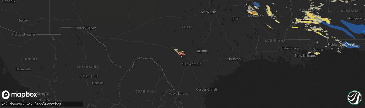
Hail Map on June 18, 2023
The weather event on June 18, 2023 includes Wind, Hail, and Tornado maps. 12 states and 401 cities were impacted and suffered possible damage. The total estimated number of properties impacted is 32,225.
Want more than just the map?
Turn this storm into a full workflow.
- Owner + property data so you know who to knock
- OnDemand branded weather history reports to win the "did we even have hail?" argument
- RoofTrace estimate so reps stop guessing numbers at the door
Bought this map? Upgrade within 7 days and we'll credit the $230. (10-15 min setup call)
Wind
Hail
Tornado
32,225
Estimated number of impacted properties by a 1.00" hail or larger22,384
Estimated number of impacted properties by a 1.75" hail or larger1,197
Estimated number of impacted properties by a 2.50" hail or largerStates Impacted by Hail Map on June 18, 2023
Storm reports
Missouri
| Date | Description |
|---|---|
| 06/18/20232:56 PM CDT | Tree limbs down into power lines... Blew transformer. City police reports multiple tree limbs down throughout carthage. |
| 06/18/20232:30 PM CDT | Photo posted to facebook of the top of a healthy tree being stripped. |
Florida
| Date | Description |
|---|---|
| 06/18/20233:22 PM CDT | Trees reported down between greenwood and malone. |
| 06/18/20232:37 PM CDT | Tree down on flowing well road just south of monroe paul road. |
| 06/18/20231:16 PM CDT | Ham radio operator reported a large tree down near e 11th st and school avenue. |
| 06/18/20231:11 PM CDT | A pine tree at least 10 inches in diameter snapped near the walmart. |
| 06/18/20231:11 PM CDT | Oak tree uprooted near the corner of 14th street and east avenue. |
| 06/18/20231:09 PM CDT | 10-inch tree snapped and blown into power line on west side of jenks avenue near 34th. |
| 06/18/202312:40 PM CDT | Peacocks point dr. Wind recording from tempest equipment. |
| 06/18/202312:05 PM CDT | Peacocks point dr. Wind recording from tempest equipment. |
| 06/18/202311:19 AM CDT | A local report indicates 59 MPH wind near 1 SSW Milton Near Whiti |
| 06/18/202311:11 AM CDT | Numerous reports of downed trees in milton fl. |
| 06/18/202310:09 AM CDT | Very brief touchdown that damaged a large metal free-standing freezer. Time estimated from radar. |
| 06/18/20236:49 AM CDT | Trees down on highway 81 at magnolia. |
| 06/18/20236:35 AM CDT | Trees and two power lines down at county highway 183 south and george montgomery road. |
Illinois
| Date | Description |
|---|---|
| 06/18/20232:25 PM CDT | Delayed report. A small microburst uprooted a large tree and snapped a few other trees and large tree limbs... Some landing on structures. Photos also show numerous sma |
Mississippi
| Date | Description |
|---|---|
| 06/18/20231:48 PM CDT | Several posts via facebook show golf ball size hail on harmony rd and crews lanes south of crystal springs. Several vehicles were damaged. |
| 06/18/202310:54 AM CDT | Widespread tree and power line damage across much of the county. |
| 06/18/202310:50 AM CDT | Trees down on cr 110. |
| 06/18/202310:47 AM CDT | Penny to quarter sized hail fell. |
| 06/18/202310:43 AM CDT | Trees were reported down in the city of stonewall. |
| 06/18/202310:37 AM CDT | Tree across the exit ramp of i-59. |
| 06/18/202310:31 AM CDT | Trees down along hwy 513. |
| 06/18/202310:30 AM CDT | Trees down on cr 1824 in the rose hill community. |
| 06/18/202310:28 AM CDT | Trees down along cr 24. |
| 06/18/20239:55 AM CDT | Scattered trees down in the s part of the county. |
| 06/18/20239:00 AM CDT | Emergency management reported a tree down near farr rd. |
| 06/18/20238:46 AM CDT | Penny to quarter sized hail in the ovett area. |
| 06/18/20238:31 AM CDT | Several posts via facebook show golf ball size hail on harmony road and crews lanes south of crystal springs. Several vehicles were damaged. |
| 06/18/20238:15 AM CDT | Numerous trees and power lines are down in the laurel area... Including report of a tree on a house and vehicles... And trees blocking a roadway. |
| 06/18/20237:42 AM CDT | Several trees down reported throughout holly springs. |
| 06/18/20237:30 AM CDT | Report of lots of trees downed on lower myrick rd. |
| 06/18/20237:15 AM CDT | Tree down across hwy 42. |
| 06/17/202311:44 PM CDT | Storm chaser reported major structural damage on cr 16. |
| 06/17/202311:30 PM CDT | Trees were reported down along hwy 15. |
| 06/17/20239:28 PM CDT | Report of a tornado on the ground just south of pelahatchie. |
| 06/17/20239:21 PM CDT | Golf ball size hail reported on cato road northeast of braxton ms via twitter. |
| 06/17/20239:13 PM CDT | Damage along hwy 49... Tds noted on radar as well. |
| 06/17/20238:40 PM CDT | Trees were reported down across leake county. |
| 06/17/20238:40 PM CDT | Trees downed along mississippi highway 404. |
| 06/17/20238:34 PM CDT | Tds just near baker ln and junction with andrew chapel rd. |
| 06/17/20238:04 PM CDT | Corrects previous tornado report from 2 ese forkville. Tds noted on radar near hwy 13 and davis rd. |
Arkansas
| Date | Description |
|---|---|
| 06/18/20236:07 PM CDT | Public reports half dollar hail. Time is radar estimated. |
| 06/18/20235:44 PM CDT | Public reports image of hail in beech grove. Time is radar estimated. |
| 06/18/20235:44 PM CDT | Corrects previous hail report from beech grove. Public reports image of hail in beech grove. Time is radar estimated. |
| 06/18/20235:21 PM CDT | Trees down in okean. |
| 06/18/20235:05 PM CDT | A few trees were uprooted a couple miles south of pocahontas. |
| 06/18/20234:55 PM CDT | Trees down near the intersection of hwy 62 and squirrel rd. |
| 06/18/20238:06 AM CDT | County sheriff dispatch center received reports of trees down along 71 just north of the louisiana state line. |
| 06/18/20237:52 AM CDT | Power lines were downed on 6th street in lewisville. |
| 06/18/20237:28 AM CDT | County sheriff dispatch center received reports of multiple trees down along rondo rd near east st in texarkana. |
| 06/17/20238:24 PM CDT | Numerous trees down within the park per park rangers. Bradley county sheriffs office also has reports of trees down in southern bradley county. Time estimated from rada |
| 06/17/20238:05 PM CDT | Several trees reported down on the western side of the county. |
Louisiana
| Date | Description |
|---|---|
| 06/18/20239:41 AM CDT | In the tiburon subdivision. Reported via social media. |
| 06/18/20239:17 AM CDT | Reported via social media. |
| 06/18/20237:10 AM CDT | Trees down across dean haile road. |
| 06/17/202310:03 PM CDT | Report of downed tree that fell through a home. |
| 06/17/20239:45 PM CDT | Power lines down on hwy 33. |
Georgia
| Date | Description |
|---|---|
| 06/18/20235:22 PM CDT | 5 to 6 trees down near mt calvary church rd and county road 160. |
| 06/18/20234:40 PM CDT | At least 15 trees downed and several power lines down on ga96 just south of jeffersonville exit. |
| 06/18/20233:58 PM CDT | Some trees down along faceville highway near the county line. |
| 06/18/20236:53 AM CDT | Several trees and powerlines down across hwy 540 near alexander way. |
Alabama
| Date | Description |
|---|---|
| 06/18/20233:29 PM CDT | Power line down in columbia. |
| 06/18/20232:40 PM CDT | Several trees reported down in ozark. |
| 06/18/20232:37 PM CDT | Numerous trees and powerlines down in newton. |
| 06/18/20232:30 PM CDT | Tree down in 4100 block of hwy 231 n... Blocking one lane on southbound side of the highway. |
| 06/18/20232:11 PM CDT | Widespread trees reported down across coffee county. |
| 06/18/20232:00 PM CDT | Several power lines reported down in elba. |
| 06/18/20231:01 PM CDT | Trees down. |
| 06/18/202312:59 PM CDT | Trees and power lines down. |
| 06/18/202312:56 PM CDT | Tree down on a house with damage. |
| 06/18/202312:50 PM CDT | Trees down. |
| 06/18/202312:48 PM CDT | Trees down and a car damaged by a fallen tree. |
| 06/18/202312:43 PM CDT | Trees and power lines down along ryals road. |
| 06/18/202312:05 PM CDT | Large oak tree uprooted at tallahatta springs rd and rush rd. |
| 06/18/202312:02 PM CDT | Large oak tree downed on church st. |
| 06/18/202311:59 AM CDT | Numerous reports of trees and power lines down in the grove hill al area. |
| 06/18/202311:56 AM CDT | Photo received on social media of a tree down over the road near the 400 block of wilson mann rd. Time estimated by radar. |
| 06/18/202311:42 AM CDT | Tree down on sumter rodgers rd. |
| 06/18/202310:40 AM CDT | Tree down across county road 68 near loxley. |
| 06/18/202310:38 AM CDT | Trees and power lines down at montclair loop. |
| 06/18/20237:38 AM CDT | 2 trees down on october lane in boligee. |
| 06/18/20237:37 AM CDT | Tree down i-20 mile marker 29. |
| 06/18/20237:25 AM CDT | Trees and powerlines down on mars hill rd. |
| 06/18/20237:21 AM CDT | Tree down on bluffport rd. |
| 06/18/20237:13 AM CDT | Trees down on hwy 14 in aliceville. 911 reports numerous trees down throughout the south end of the county. |
| 06/18/20237:12 AM CDT | Two large pecans uprooted. |
| 06/18/20237:11 AM CDT | Tree down on cr 76 near snack shop rd. |
| 06/18/20236:35 AM CDT | Trees down on post oak road. |
| 06/18/20236:28 AM CDT | Tree snapped or uprooted on clearmont drive in se dothan. |
| 06/18/20236:27 AM CDT | Trees down on state highway 27 and buck holland road. |
| 06/18/20236:25 AM CDT | Downed power line near 3rd avenue and ross clark circle. |
| 06/18/20236:20 AM CDT | Trees reported down across the road on n. County road 67 and highway 105. |
| 06/18/20236:20 AM CDT | Numerous trees down around level plains and daleville. |
| 06/18/20236:15 AM CDT | A tree was down on cr 1 south. |
| 06/18/20236:08 AM CDT | Trees down at lake fox road and thomas road. |
| 06/18/20235:38 AM CDT | Several trees were blown down near highway 51. This particular property has suffered damage by multiple storms this week. |
| 06/18/20235:30 AM CDT | Numerous trees down across coffee county. At least a dozen places. More details coming from the em this afternoon. |
| 06/18/20235:20 AM CDT | Trees down in spring hill. |
| 06/18/20235:20 AM CDT | Trees down in troy. |
| 06/18/20235:19 AM CDT | 53 kt |
| 06/18/20235:15 AM CDT | Trees down in brantley al. |
| 06/18/20235:11 AM CDT | Several trees down in goshen. |
| 06/18/20235:07 AM CDT | Numerous trees downed in luverne al. |
| 06/18/20235:07 AM CDT | Structural damage to home from fallen tree. |
| 06/18/20235:04 AM CDT | Reports of numerous trees down. |
| 06/18/20235:00 AM CDT | Tree fallen on home. |
| 06/18/20234:53 AM CDT | Trees were blown down west of panola. |
| 06/18/20234:51 AM CDT | Tree fallen on home. |
| 06/18/20234:48 AM CDT | Report of structural damage to house from fallen tree. |
| 06/18/20234:45 AM CDT | Trees down along us highway 31 between greenville and chapman. |
| 06/18/20234:45 AM CDT | Delayed report: trees down along us highway 31 between greenville and chapman. |
| 06/18/20234:40 AM CDT | Trees blocking road on manningham rd near woodvalley rd. Time using radar. |
| 06/18/20233:58 AM CDT | Corrects previous tstm wnd dmg report from 2 ene crumptonia. Trees were blown down in southern dallas county. |
| 06/18/20233:36 AM CDT | Trees were blown down near dixons mils. |
| 06/18/20233:35 AM CDT | Corrects previous tstm wnd dmg report from 1 wsw sweet water. Trees were blown down near sweetwater. |
| 06/18/20233:33 AM CDT | Trees were blown down near thomaston. |
| 06/18/20233:27 AM CDT | Trees were blown down in far southern marengo county. |
| 06/18/20233:22 AM CDT | Trees were blown down near highway 43 south of linden. |
| 06/18/202312:15 AM CDT | Damaging winds and large hail. Trees snapped at 351 old gurley pike. |
| 06/18/202312:15 AM CDT | Golf ball sized hail was reported in woodville along with 60 mph estimated winds. |
| 06/18/202312:08 AM CDT | Baseball sized hail confirmed in woodville... Al. Time estimated based on radar. |
| 06/18/202312:03 AM CDT | Hail larger than a quarter reported near hampton cove in gurley by nws employee. Time estimated by radar. |
| 06/18/202312:02 AM CDT | Public reports via social media quarter size hail on cave spring road in owens cross roads. Time estimated by radar. |
| 06/18/202312:00 AM CDT | Public report via social media photo of quarter-size hail. Occurred off highway 431... About 3 miles south of the 431/hampton cove intersection. |
| 06/17/202311:57 PM CDT | Public reports via social media trees down on house and part of the roof of a barn is missing on guthery ave off highway 431. Time estimated by radar. |
| 06/17/202311:57 PM CDT | Public report via social media of several large trees uprooted and a porch column torn off on piney woods road in owens cross roads. Time estimated by radar. |
| 06/17/202311:56 PM CDT | A large portion of an automotive service business was severely damaged. |
| 06/17/202311:56 PM CDT | Construction dumpster blown onto a vehicle and minor house damage from debris in the richmond neighborhood of owens cross roads. Report and photos from social media. Ti |
| 06/17/202311:56 PM CDT | Corrects previous tstm wnd dmg report from 1 ene owens crossroads. Photo received on social media of a tree down over the road near the 400 block of wilson mann rd. Tim |
| 06/17/202311:56 PM CDT | Public report via social media of trees down and debris in the road at hwy 431 and wilson mann road. Time estimated by radar. |
| 06/17/202311:56 PM CDT | Public report via social media. Video of a tree that fell on a vehicle. Time estimated by radar. |
| 06/17/202311:56 PM CDT | At least 3 large trees uprooted in social media photo on piney woods road. |
| 06/17/202311:56 PM CDT | Public reports via social media photos that trees were down and in the road on brockway rd and there was minor roof damage to a home. Time estimated by radar. |
| 06/17/202311:54 PM CDT | One inch hail reported on old big cove road in owens cross roads. Report via social media. Time estimated by radar. |
| 06/17/202311:54 PM CDT | Police reports hail larger than quarters in owens cross roads. Time estimated based on radar. |
| 06/17/202311:52 PM CDT | Public report via social media of dime to quarter size hail on knotty walls rd. Time estimated by radar. |
| 06/17/20239:57 PM CDT | A large tree was blown down and |
| 06/17/20239:57 PM CDT | A large tree was blown down and completely blocking highway 171 at the fayette/tuscaloosa county line. |
| 06/17/20239:57 PM CDT | A large |
Oklahoma
| Date | Description |
|---|---|
| 06/17/202311:22 PM CDT | Davis weather station at 31 ft. Time estimated for now. Numerous 24-30 inch trees uprooted. Roof completely removed from brick home. |
Texas
| Date | Description |
|---|---|
| 06/18/20236:55 PM CDT | Report from mping: golf ball |
| 06/18/20236:43 PM CDT | Hail ranged from 1-1.75 inches in diameter and lasted for 7 minutes. |
| 06/18/20236:43 PM CDT | Trained spotter estimated hail of 2 inches - was driving through it so not measured. |
| 06/18/20236:43 PM CDT | Estimated tennis ball sized hail via picture on twitter. Time estimated via radar. |
| 06/18/20236:41 PM CDT | Report from mping: ping pong ball |
| 06/18/20236:28 PM CDT | Trained spotter reports largest hail up to 2 inches... With numerous hail the size of golf balls. |
| 06/18/20236:25 PM CDT | Trained spotter reports hail of half dollar size. |
| 06/18/20236:15 PM CDT | Hail the size of quarters reported via twitter photo. |
Oregon
| Date | Description |
|---|---|
| 06/18/20232:30 PM CDT | Pilot reported a tornado touch |
| 06/18/20232:30 PM CDT | Pilot reported a tornado touch |
| 06/18/20232:30 PM CDT | Corrects previous tornado report from 5 e harrisburg. Pilot reported a tornado touched down about 1 mile north of daniels field near i-5. Phone call to employee at olse |
Cities Impacted by Hail Map on June 18, 2023
- Paris, AR
- Magazine, AR
- Booneville, AR
- Scranton, AR
- Subiaco, AR
- Dardanelle, AR
- New Blaine, AR
- Delaware, AR
- Hamburg, AR
- Montrose, AR
- Fouke, AR
- Garland City, AR
- Lewisville, AR
- Bradley, AR
- Plain Dealing, LA
- Taylor, AR
- Stamps, AR
- Lorman, MS
- Pattison, MS
- Union Church, MS
- Hazlehurst, MS
- Laurel, MS
- Richton, MS
- Leakesville, MS
- Neely, MS
- Karnack, TX
- Mooringsport, LA
- Vivian, LA
- Oil City, LA
- Jefferson, TX
- Shreveport, LA
- Belcher, LA
- Benton, LA
- Ovett, MS
- Bossier City, LA
- Haughton, LA
- Forest, MS
- Pulaski, MS
- Lake, MS
- Lawrence, MS
- Louin, MS
- Newton, MS
- Rose Hill, MS
- Pachuta, MS
- Hickory, MS
- Chunky, MS
- Enterprise, MS
- Stonewall, MS
- Quitman, MS
- Milton, FL
- Jay, FL
- Bagdad, FL
- Holt, FL
- Shubuta, MS
- Eglin Afb, FL
- Fort Walton Beach, FL
- Baker, FL
- Crestview, FL
- Shalimar, FL
- Valparaiso, FL
- Niceville, FL
- Defuniak Springs, FL
- Freeport, FL
- Gilbertown, AL
- Melvin, AL
- Needham, AL
- Toxey, AL
- Silas, AL
- Thomasville, AL
- Coffeeville, AL
- Jackson, AL
- Grove Hill, AL
- Dickinson, AL
- Whatley, AL
- Franklin, AL
- Lower Peach Tree, AL
- Vredenburgh, AL
- Peterman, AL
- Monroeville, AL
- Castleberry, AL
- Repton, AL
- Evergreen, AL
- Beatrice, AL
- Butler, AL
- Collins, MS
- Mount Olive, MS
- Ashdown, AR
- Marietta, TX
- Douglassville, TX
- Newhebron, MS
- Pinola, MS
- Soso, MS
- Utica, MS
- Edwards, MS
- Elberta, AL
- Foley, AL
- Summerdale, AL
- Gladstone, IL
- Raymond, MS
- Vicksburg, MS
- Atlanta, TX
- Buckatunna, MS
- State Line, MS
- Malvern, AR
- Pelahatchie, MS
- Morton, MS
- Waynesboro, MS
- Ellisville, MS
- Pensacola, FL
- Arcadia, LA
- McDavid, FL
- Prentiss, MS
- Bassfield, MS
- Carson, MS
- Stockton, AL
- Taylorsville, MS
- Vinegar Bend, AL
- Lucedale, MS
- Petal, MS
- Moselle, MS
- Citronelle, AL
- Mount Vernon, AL
- McIntosh, AL
- Linden, TX
- Memphis, MO
- Arbela, MO
- Birmingham, IA
- Port Gibson, MS
- Gilliam, LA
- Cantril, IA
- Milton, IA
- Raleigh, MS
- Marion, LA
- Keosauqua, IA
- Springhill, LA
- Leola, AR
- Robertsdale, AL
- Simsboro, LA
- Grambling, LA
- Coden, AL
- Theodore, AL
- Orange Beach, AL
- Gulf Shores, AL
- Paulding, MS
- Vossburg, MS
- Stringer, MS
- Bivins, TX
- Fruitdale, AL
- Bay Springs, MS
- Fayette, MS
- Perdido, AL
- Bay Minette, AL
- Princeton, LA
- Bloomfield, IA
- Magee, MS
- Mendenhall, MS
- Meridian, MS
- Jachin, AL
- Lisman, AL
- Molino, FL
- Cantonment, FL
- Doddridge, AR
- Hosston, LA
- Rodessa, LA
- Ida, LA
- Brewton, AL
- Andalusia, AL
- Red Level, AL
- Florala, AL
- Midland City, AL
- Newton, AL
- Fort Rucker, AL
- Ariton, AL
- Ozark, AL
- Daleville, AL
- Enterprise, AL
- Imboden, AR
- Pocahontas, AR
- Walnut Ridge, AR
- O'Kean, AR
- Delaplaine, AR
- Beech Grove, AR
- Paragould, AR
- Summerville, SC
- Cross, SC
- Heidelberg, MS
- Terry, MS
- Florence, MS
- La Plata, MO
- Kirksville, MO
- Moncks Corner, SC
- Fitzgerald, GA
- Williamsburg, IA
- Parnell, IA
- Wesson, MS
- Jeffersonville, GA
- Danville, GA
- Cochran, GA
- Dry Branch, GA
- Greentop, MO
- Queen City, MO
- Crystal Springs, MS
- Junction, TX
- Georgetown, MS
- Monticello, MS
- Ravenden Springs, AR
- Ocilla, GA
- Shellman, GA
- Morgan, GA
- Moss Point, MS
- Seminole, AL
- Harper, TX
- Mountain Home, TX
- Ingram, TX
- Kerrville, TX
- Comfort, TX
- Hunt, TX
- Center Point, TX
- Brandon, MS
- Kennedy, AL
- Millport, AL
- Gore Springs, MS
- Grenada, MS
- Duck Hill, MS
- Kosciusko, MS
- Ethel, MS
- Columbus, MS
- Steens, MS
- Canton, MS
- New Orleans, LA
- Camden, MS
- Pearl, MS
- Flowood, MS
- Waynesboro, TN
- Clifton, TN
- Jackson, MS
- Spearsville, LA
- Lillie, LA
- El Dorado, AR
- Hermanville, MS
- Louisville, MS
- Macon, MS
- Brooksville, MS
- Ruston, LA
- Dubach, LA
- Fayette, AL
- Sallis, MS
- Slidell, LA
- Byram, MS
- Carthage, MS
- Fredericksburg, TX
- Homer, LA
- Bernice, LA
- Junction City, AR
- Stockton, GA
- Strong, AR
- Summerfield, LA
- Choudrant, LA
- Marmaduke, AR
- Braxton, MS
- Clinton, MS
- Bentonia, MS
- Benton, MS
- Sturgis, MS
- Richland, MS
- Lena, MS
- Reform, AL
- Haynesville, LA
- Lisbon, LA
- McCool, MS
- Dorchester, SC
- New Hope, AL
- Gurley, AL
- Owens Cross Roads, AL
- Laceys Spring, AL
- Huntsville, AL
- Scottsboro, AL
- Woodville, AL
- Paint Rock, AL
- Vernon, AL
- Winona, MS
- Kilmichael, MS
- West, MS
- Atlanta, LA
- Moscow, TN
- Flora, MS
- Northport, AL
- Adger, AL
- Brookwood, AL
- Tuscaloosa, AL
- Fackler, AL
- Vaiden, MS
- Decatur, MS
- Eros, LA
- West Monroe, LA
- Columbia, LA
- Calhoun, LA
- Pheba, MS
- Cedarbluff, MS
- Vaughan, MS
- Bankston, AL
- Berry, AL
- Conehatta, MS
- Somerville, AL
- Walnut Grove, MS
- Noxapater, MS
- Philadelphia, MS
- Gordo, AL
- Michigan City, MS
- Grand Junction, TN
- Birmingham, AL
- McCalla, AL
- Bessemer, AL
- Saline, LA
- French Camp, MS
- Eva, AL
- Trenton, AL
- Hollytree, AL
- Union Grove, AL
- Pickens, MS
- Winnfield, LA
- Epes, AL
- Grayson, LA
- Ethelsville, AL
- Elrod, AL
- Falkville, AL
- Vinemont, AL
- Downsville, LA
- Dennis, MS
- New Site, MS
- Millry, AL
- Arab, AL
- Baileyton, AL
- Joppa, AL
- Hartselle, AL
- Valhermoso Springs, AL
- Union, MS
- Alberta, AL
- Catherine, AL
- Safford, AL
- Orrville, AL
- Minter, AL
- Camden, AL
- Pine Apple, AL
- Fort Deposit, AL
- Forest Home, AL
- Greenville, AL
- Honoraville, AL
- Luverne, AL
- Lapine, AL
- Highland Home, AL
- Glenwood, AL
- Goshen, AL
- Rutledge, AL
- Brantley, AL
- Troy, AL
- Letohatchee, AL
- Grady, AL
- Banks, AL
- Brundidge, AL
- New Brockton, AL
- Jack, AL
- Elba, AL
- Louisville, AL
- Clio, AL
- Skipperville, AL
- Georgiana, AL
- Dozier, AL
- Opp, AL
- Gantt, AL
- Kinston, AL
- Wadley, AL
- Cragford, AL
- Auburn, AL
- Tuskegee, AL
- Ward, AL
- Sylacauga, AL
- Harrisville, MS
- Georgetown, LA
- Seminary, MS
- Daviston, AL
- Lafayette, AL
- Five Points, AL
- Roanoke, AL
- Ridgeland, MS
- Collinsville, MS
- Tougaloo, MS
- Little Rock, MS
- Madison, MS
- Childersburg, AL
- Wiggins, MS
- Perkinston, MS
- Pine Mountain, GA
- Hamilton, GA
- Manchester, GA
- Shiloh, GA
- Warm Springs, GA
- Talladega, AL
- Alpine, AL
- Cuba, AL
- Toomsuba, MS