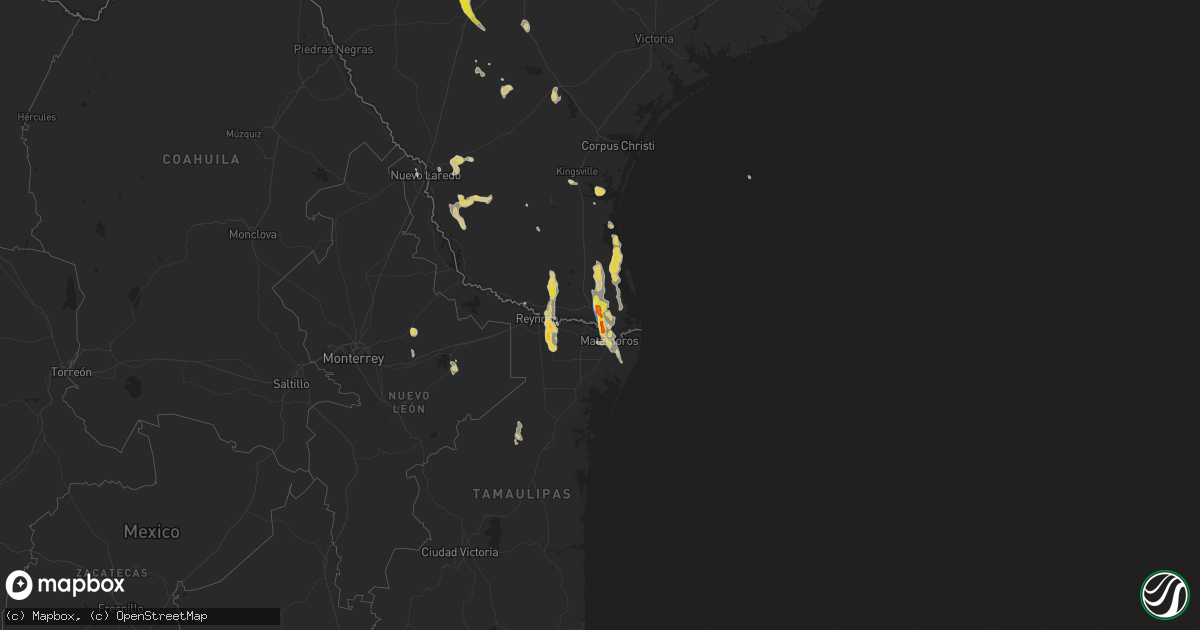
Hail Map on June 4, 2023
Get this storm
June 4 map
$229
one time, instant access
Download today. No call, no setup
Keep the $229
Bought the map and want the full workflow? Apply the entire $229 to a subscription within 7 days. None of it is wasted.
Every map, not just this one
This buys you this map. Subscription and you get every map we run, in the markets you choose from a few cities to whole states to nationwide. Plus real-time alerts the moment a storm fires.
Contact data
Name, contact info, occupancy, even credit band for addresses in the footprint. You go from where it hit to who to call.
Become the source they trust
Unlimited branding weather history reports on demand. You already have the documented answer ready for the property owner, and you are the one who showed up with it.
Property data and RoofTrace estimates
Pull up any address you have got, its value and the exact code rules for that jurisdiction, straight from One Click Code. Then RoofTrace estimates the squares, pitch, and roof value, priced the way you price.
States Impacted by Hail Map on June 4, 2023
Storm reports
West Virginia
| Date | Description |
|---|---|
| 06/04/20234:57 PM CDT | A local report indicates 1.00 inch wind near 2 ESE Princeton |
Virginia
| Date | Description |
|---|---|
| 06/04/20234:35 PM CDT | Several trees down along sr 623. |
| 06/04/20234:32 PM CDT | A local report indicates 1.00 inch wind near 1 ESE Burkes Garden |
North Carolina
| Date | Description |
|---|---|
| 06/04/20232:30 PM CDT | A few trees down. |
Montana
| Date | Description |
|---|---|
| 06/04/20236:18 PM CDT | Trained spotter in the town of savage estimated wind gusts of at least 60 mph. |
| 06/04/20235:19 PM CDT | A local report indicates 61 MPH wind near 1 WNW Ingomar |
Tennessee
| Date | Description |
|---|---|
| 06/04/20236:55 PM CDT | Hail size between 1 and 1.25 inches reported. |
| 06/04/20236:25 PM CDT | Dime to quarter size hail reported. |
| 06/04/20236:15 PM CDT | Several trees were blown down along stewarts ferry pike. One tree fell on a car and was blocking the road. No injuries were reported. |
| 06/04/20236:10 PM CDT | Facebook photos and reports show several trees blown down in the tinnell valley subdivision. |
| 06/04/20236:00 PM CDT | Corrects previous hail report from 7 w pulaski. Tennessee valley weather twitter photo showed estimated quarter to half dollar size hail in the westside community. |
| 06/04/20236:00 PM CDT | Tennessee valley weather twitter photo showed estimated quarter size hail in the westside community. |
| 06/04/20236:00 PM CDT | Tennessee valley weather twitter photo showed estimated quarter size hail in the westside community. |
| 06/04/20235:46 PM CDT | Report from mping: quarter |
| 06/04/20234:25 PM CDT | Twitter photo showed a tree blown down onto the driveway of a home in bellevue. |
| 06/04/20234:24 PM CDT | Social media photos and videos showed a microburst blew down a few small trees in the crossings shopping center. |
| 06/03/20237:50 PM CDT | Social media video of quarter to ping pong sized hail. |
Alabama
| Date | Description |
|---|---|
| 06/04/20236:52 PM CDT | Roof damage at the circle k gas station in brookwood. Picture relayed through social media. |
| 06/04/20236:51 PM CDT | A few tree branches were knocked down and lawn furniture was tossed around at a residence. Relayed by broadcast/social media. |
| 06/04/20236:10 PM CDT | Trees downed on powerlines. |
| 06/04/20236:00 PM CDT | Quarter size hail reported east of highway 231/431 near hazel green. |
North Dakota
| Date | Description |
|---|---|
| 06/04/20234:10 PM CDT | Ndawn site. |
Illinois
| Date | Description |
|---|---|
| 06/04/20234:33 PM CDT | Power line or cable line was down along a roadway in baldwin. |
| 06/04/20233:27 PM CDT | Three farmers reported quarter size hail southwest of terre haute. Crop damage was also reported from the hail. Time estimated by radar. |
| 06/04/20233:20 PM CDT | Pea to quarter sized hail covering the ground. Hail lasted 10-15 minutes. |
| 06/04/20233:20 PM CDT | Pea to quarter sized hail lasting 10 to 15 minutes covering the ground. Damage occurred to bean and corn crops. |
| 06/04/20233:18 PM CDT | Report via social media with picture. |
Kansas
| Date | Description |
|---|---|
| 06/04/20233:35 PM CDT | Awos station kcbk 2 n colby. |
Florida
| Date | Description |
|---|---|
| 06/04/20234:55 PM CDT | Quarter size hail reported northeast of new tampa. |
| 06/04/20234:50 PM CDT | Mesonet station 1672w fswn pasco wesley chapel south. |
| 06/04/20234:15 PM CDT | Power outage caused by fallen trees or limbs. |
| 06/04/20233:30 PM CDT | Fallen trees or limbs resulted in a power outage north of sopchoppy. |
| 06/04/20233:15 PM CDT | Multiple reports of trees down throughout wakulla county. |
| 06/03/202311:15 PM CDT | Picture received from nws employee of a small tree snapped in pembroke pines in the area of nw 136 ave and nw 11 street. Another smaller tree was downed in the same are |
Iowa
| Date | Description |
|---|---|
| 06/04/20234:01 PM CDT | Metal chimney blown off the roof of a house. Mailbox damaged. Multiple large branches down. |
| 06/04/20232:53 PM CDT | Large branches down and several shingles off home. |
| 06/04/20232:53 PM CDT | A local report indicates 60 MPH wind near 4 S Mount Union |
Missouri
| Date | Description |
|---|---|
| 06/04/20236:27 PM CDT | Several sheds blown over or destroyed near the junction of business loop 67 and state route 53. |
| 06/04/20233:40 PM CDT | Photo on facebook shows several hail stones next to a ruler... With the largest stone being an inch in diameter. Time estimated from radar. |
| 06/04/20233:38 PM CDT | Photo on twitter shows several hail stones of at least an inch in diameter... With some possibly slightly larger than an inch in diameter. Time estimated from radar. |
| 06/04/20233:07 PM CDT | Images on twitter show large portions of the roof and wall of a church damaged... As well as several trees and large tree branches snapped in the sherman park area. Tim |
Louisiana
| Date | Description |
|---|---|
| 06/04/20235:09 PM CDT | Tree down on james williams rd. Off of highway 558. |
| 06/04/20233:27 PM CDT | Emergency manager reported dime to quarter sized hail via photo/video. |
| 06/04/20233:20 PM CDT | Half dollar size hail also reported around houma this afternoon. |
| 06/03/202310:40 PM CDT | Port of nola administration building measured a wind gust of 64 mph. |
| 06/03/202310:35 PM CDT | Site kt0ja cwop mesonet measured a wind gust of 58 mph. |
| 06/03/20237:47 PM CDT | Tree down across road. |
| 06/03/20237:39 PM CDT | Tree reported down on highway 783. |
| 06/03/20237:30 PM CDT | Tree down across highway. |
| 06/03/20237:30 PM CDT | Tree |
Georgia
| Date | Description |
|---|---|
| 06/04/20236:20 PM CDT | Tree in roadway. |
| 06/04/20236:17 PM CDT | Tree in roadway. |
| 06/04/20236:14 PM CDT | Tree in roadway. |
| 06/04/20236:07 PM CDT | Tree in roadway. |
Nebraska
| Date | Description |
|---|---|
| 06/04/20232:31 PM CDT | Mostly dime size but some up to quarter size. |
| 06/04/20231:58 PM CDT | Tin roof peeled off of machine shed. |
| 06/04/20231:56 PM CDT | Tree damage in blair. Estimated 50-60 mph winds. Large limb across street and some in power lines. |
| 06/04/20231:52 PM CDT | Personal weather station reported 60 mph. |
Texas
| Date | Description |
|---|---|
| 06/03/20238:15 PM CDT | A member of the public reported golf ball sized hail in west brownsville at 8:15 pm through social media. |
| 06/03/20238:15 PM CDT | Trained spotter called to report half dollar sized hail at riverbend resort in brownsville... Tx. |
| 06/03/20238:13 PM CDT | Member of the public shared pictures of three hail stones all larger than a quarter. They were estimated to be about the size of a golf ball. Time estimated by radar. |
| 06/03/20238:12 PM CDT | A member of the public recorded a video showing quarter sized hail and gusty winds at a self car wash at the intersection of canton and raul longoria. |
| 06/03/20238:08 PM CDT | Member of the public shared a picture of hail with an estimated size of 2 inches from the corner of fm1421 and fm1732 in cameron county. Time estimated by radar. |
| 06/03/20238:07 PM CDT | A member of the public reported quarter sized hail at 8:07 pm in north brownsville through social media. |
| 06/03/20237:32 PM CDT | An nws employee sent in a picture of a power pole leaning on grimes rd east of the fire station. Time estimated by radar and the wind gust recorded at khrl during the e |
| 06/03/20237:31 PM CDT | Valley international airport gusted to 82 mph at 731 pm cdt. |
Cities Impacted by Hail Map on June 4, 2023
- Halifax, PA
- Harrisburg, PA
- Grantville, PA
- Lemoyne, PA
- New Cumberland, PA
- Camp Hill, PA
- Mechanicsburg, PA
- Dillsburg, PA
- Lewisberry, PA
- Dickson, TN
- Nunnelly, TN
- McEwen, TN
- Yarmouth, IA
- New London, IA
- Mount Union, IA
- Mount Pleasant, IA
- La Harpe, IL
- Houma, LA
- Land O'Lakes, FL
- Wesley Chapel, FL
- Lutz, FL
- Hondo, TX
- Yancey, TX
- Moore, TX
- Devine, TX
- Pearsall, TX
- Kingsport, TN
- Jonesborough, TN
- Johnson City, TN
- Pulaski, TN
- Goodspring, TN
- Saint Xavier, MT
- Newton, TX
- Burkeville, TX
- Sunset, LA
- Chesterfield, MO
- Martinsburg, MO
- Goldonna, LA
- Sylacauga, AL
- Alpine, AL
- Ava, IL
- Hobart, OK
- Leigh, NE
- Sparta, IL
- Saint Francisville, LA
- Cleveland, TN
- Bandera, TX
- Pipe Creek, TX
- Niota, IL
- Grand Bay, AL
- Choudrant, LA
- Colfax, LA
- Clutier, IA
- Monteagle, TN
- Dahlonega, GA
- Deridder, LA
- Leesville, LA
- Meadow, SD
- Wapello, IA
- Monticello, GA
- Ewing, VA
- Rose Hill, VA
- Tamms, IL
- McClure, IL
- Thebes, IL
- West Liberty, IA
- Nichols, IA
- Fremont, NE
- White Castle, LA
- Lockport, LA
- Brighton, IA
- Keota, IA
- Dodson, LA
- Winnfield, LA
- Wewahitchka, FL
- New Iberia, LA
- Oran, MO
- Tallahassee, FL
- Boonville, MO
- Erath, LA
- Clarinda, IA
- Shambaugh, IA
- Stronghurst, IL
- Princeton, WV
- Jonesville, VA
- Wright City, MO
- Only, TN
- Tazewell, VA
- Bastian, VA
- Rayville, LA
- Deville, LA
- Saint Louis, MO
- Happy, TX
- Reeves, LA
- Lomax, IL
- Homosassa, FL
- Brooksville, FL
- Hemphill, TX
- Pineland, TX
- Wellington, TX
- Marrero, LA
- Belle Chasse, LA
- Colon, NE
- Cedar Bluffs, NE
- Schriever, LA
- Gibson, LA
- La Center, KY
- Dallas City, IL
- Franklin, TN
- Tilden, TX
- Ruston, LA
- Chaffee, MO
- Murphysboro, IL
- Nashville, TN
- Amidon, ND
- Childersburg, AL
- Nauvoo, IL
- Cutler, IL
- Pinckneyville, IL
- Imperial, MO
- Cape Girardeau, MO
- Whitewater, MO
- Advance, MO
- Scott City, MO
- Raceland, LA
- Mathews, LA
- D Hanis, TX
- Walford, IA
- Amana, IA
- Fairfax, IA
- Norway, IA
- Mediapolis, IA
- Medina, TX
- Utopia, TX
- Tarpley, TX
- Mico, TX
- Crow Agency, MT
- Defiance, MO
- Junction City, AR
- Lillie, LA
- Baldwin, IL
- Marissa, IL
- Coulterville, IL
- Tilden, IL
- Boerne, TX
- White, GA
- Englewood, TN
- Carthage, IL
- Madison, FL
- Spring Hill, TN
- Thonotosassa, FL
- Tampa, FL
- Murphy, NC
- Farner, TN
- Huron, TN
- Ocala, FL
- Dunnellon, FL
- Whiteville, TN
- Dubach, LA
- Sabinal, TX
- Mangham, LA
- Andrews, NC
- Bluefield, VA
- Rocky Gap, VA
- Wayland, IA
- Woodville, MS
- Lenoir City, TN
- Blair, NE
- Talking Rock, GA
- Morrill, KS
- Hiawatha, KS
- New Boston, IL
- Ames, NE
- Spring Hill, FL
- Winfield, IA
- Gladstone, IL
- Opelousas, LA
- Moss Point, MS
- Estillfork, AL
- Broussard, LA
- American Falls, ID
- Cameron, LA
- Lafayette, LA
- Youngsville, LA
- Spearsville, LA
- Thompsons Station, TN
- Many, LA
- Talladega, AL
- New England, ND
- Ochopee, FL
- Chiefland, FL
- Madisonville, TN
- Mineral Bluff, GA
- Centreville, MS
- Dover, FL
- Plant City, FL
- Lee, FL
- Valmeyer, IL
- Barnhart, MO
- Zwolle, LA
- Hayesville, NC
- Sweetwater, TN
- Harvey, LA
- Sikeston, MO
- Evans, LA
- Blairstown, IA
- Clarendon, TX
- Lone Wolf, OK
- Morganton, GA
- Blairsville, GA
- Belle Rose, LA
- Pierre Part, LA
- Plaquemine, LA
- Macks Creek, MO
- Blue Ridge, GA
- Cumming, GA
- Gainesville, GA
- Harlan, KY
- Colmesneil, TX
- Sullivan, MO
- Florien, LA
- Parrish, FL
- Ellijay, GA
- Trout, LA
- Jena, LA
- Crystal River, FL
- Duke, OK
- Atlanta, LA
- Montgomery, LA
- Dry Creek, LA
- Telford, TN
- Harlingen, TX
- Rio Hondo, TX
- San Benito, TX
- Los Fresnos, TX
- Olmito, TX
- Brownsville, TX
- Edinburg, TX
- Labelle, FL
- Clewiston, FL
- Maryland Heights, MO
- Hazel Green, AL
- Alsen, ND
- Esmond, ND
- Allerton, IA
- Clio, IA
- Lineville, IA
- Plaza, ND
- Paloma, IL
- Moriarty, NM
- Center, ND
- Parshall, ND
- Carson, IA
- Oakland, IA
- Morgan City, LA
- Jeanerette, LA
- Edina, MO
- Chattanooga, TN
- George West, TX
- Novelty, MO
- Church Point, LA
- Forsyth, GA
- Barnesville, GA
- Jackson, GA
- Elmer, MO
- Scottsboro, AL
- Rossville, GA
- Flintstone, GA
- Wauchula, FL
- San Juan, TX
- Bowdon, ND
- Elizabethton, TN
- Unicoi, TN
- Hermitage, TN
- Mount Juliet, TN
- Neche, ND
- Pembina, ND
- Spencer, TN
- Lacombe, LA
- Ringgold, GA
- Hargill, TX
- Alamo, TX
- Port Barre, LA
- Le Mars, IA
- Hebbronville, TX
- Sandia, TX
- Greeneville, TN
- Fowlerton, TX
- Cotulla, TX
- Fall Branch, TN
- Brenham, TX
- Palmyra, MO
- Port Mansfield, TX
- Wildwood, GA
- Coushatta, LA
- Lumpkin, GA
- Mendon, IL
- Sainte Genevieve, MO
- Bunkie, LA
- Campti, LA
- Trenton, GA
- Linn, MO
- Leoma, TN
- New Market, AL
- Butler, TN
- Cornersville, TN
- Bartow, FL
- Crossville, TN
- Limestone, TN
- Faxon, OK
- Bigfoot, TX
- Frederick, OK
- Conchas Dam, NM
- Festus, MO
- Toney, AL
- Myakka City, FL
- Sebastian, TX
- Lyford, TX
- San Perlita, TX
- Raymondville, TX
- Armstrong, TX
- Tucumcari, NM
- Tahlequah, OK
- Park Hill, OK
- Homestead, FL
- Ellis, KS
- Harvest, AL
- Laredo, TX
- Ville Platte, LA
- Atlanta, GA
- Afton, TN
- Chuckey, TN
- Cuthbert, GA
- Morris, GA
- Duluth, GA
- Kirksville, MO
- Novinger, MO
- Cloutierville, LA
- Natchez, LA
- Marksville, LA
- Kingsville, TX
- Riviera, TX
- Carencro, LA
- Pineville, LA
- Eunice, LA
- Rock Spring, GA
- Uvalde, TX
- Salem, MO
- New Cambria, MO
- McDonald, TN
- Fort Meade, FL
- Loose Creek, MO
- Richland, GA
- Quincy, IL
- Marietta, GA
- Encino, TX
- Searsboro, IA
- New Sharon, IA
- Rugby, ND
- Crystal City, MO
- Crowley, LA
- Rayne, LA
- Taft, TN
- Hurdland, MO
- Keytesville, MO
- Brunswick, MO
- Treynor, IA
- Naples, FL
- Cohutta, GA
- Apison, TN
- Tunnel Hill, GA
- Oak Ridge, TN
- Zapata, TX
- New Orleans, LA
- Addison, AL
- Marathon, TX
- Roswell, NM
- Arley, AL
- Donna, TX
- Pharr, TX
- La Joya, TX
- Mission, TX
- Gainesville, TX
- San Ygnacio, TX
- Pleasanton, TX