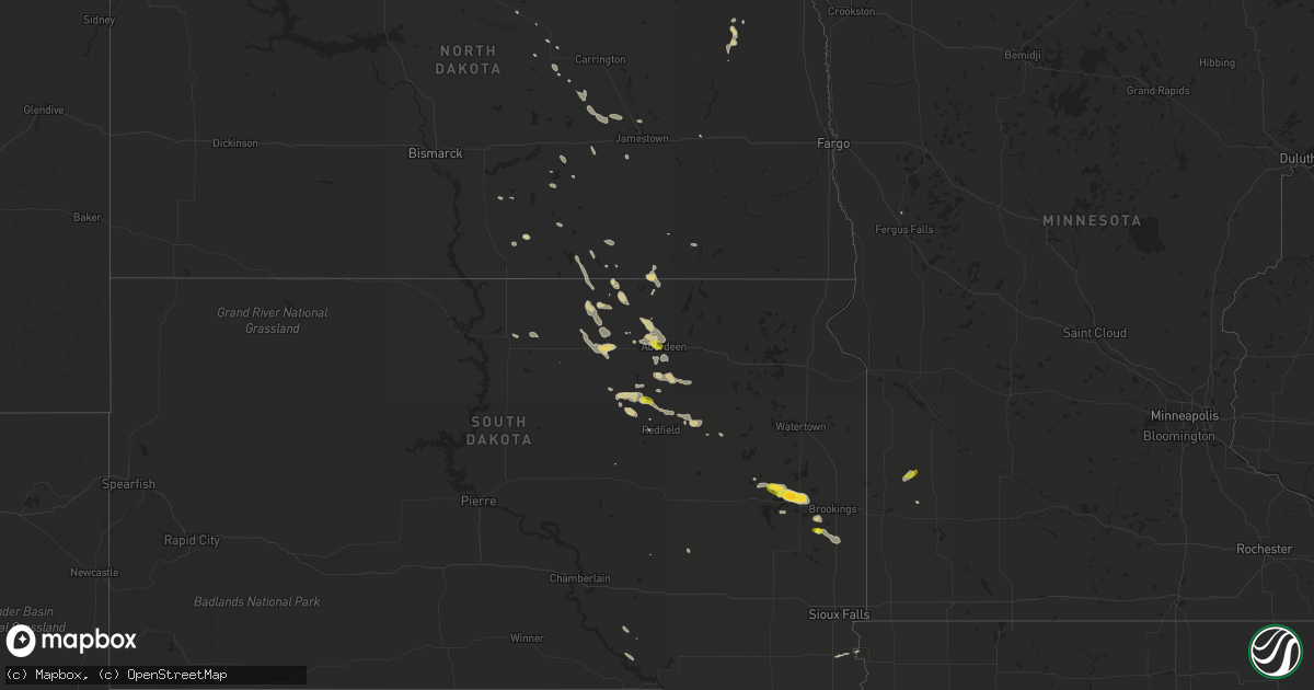
Hail Map on June 3, 2016
Get this storm
June 3 map
$229
one time, instant access
Download today. No call, no setup
Keep the $229
Bought the map and want the full workflow? Apply the entire $229 to a subscription within 7 days. None of it is wasted.
Every map, not just this one
This buys you this map. Subscription and you get every map we run, in the markets you choose from a few cities to whole states to nationwide. Plus real-time alerts the moment a storm fires.
Contact data
Name, contact info, occupancy, even credit band for addresses in the footprint. You go from where it hit to who to call.
Become the source they trust
Unlimited branding weather history reports on demand. You already have the documented answer ready for the property owner, and you are the one who showed up with it.
Property data and RoofTrace estimates
Pull up any address you have got, its value and the exact code rules for that jurisdiction, straight from One Click Code. Then RoofTrace estimates the squares, pitch, and roof value, priced the way you price.
States Impacted by Hail Map on June 3, 2016
Storm reports
Kansas
| Date | Description |
|---|---|
| 06/03/20166:48 PM CDT | Delayed report from friday evening. A few stones up to quarter size. Time estimated from radar. |
| 06/03/20166:30 PM CDT | Hail lasted about 5 minutes |
| 06/03/20165:56 PM CDT | Quarter size hail... Estimated 60 mph winds and 4-5 inch diameter limbs down. |
| 06/03/20165:30 PM CDT | Hail up to half dollar size. Hailed for roughly 5 minutes ending at 530 pm. |
| 06/03/20165:20 PM CDT | Up to quarter size hail along highway 36 |
South Carolina
| Date | Description |
|---|---|
| 06/03/20166:25 PM CDT | Sc highway patrol reported a tree down on wesley grove road between the round o road intersection and the song bird drive intersection. |
| 06/03/20165:40 PM CDT | Sc highway patrol reported a tree down and in the roadway on hw-303 near the intersection with ritter road. |
| 06/03/20165:05 PM CDT | Sc highway patrol reported a tree down and in the roadway near the intersection of bailey mills road and calf pen bay road. |
Nebraska
| Date | Description |
|---|---|
| 06/03/20166:50 PM CDT | Silo blown over and tree damage reported at this location north of valley |
| 06/03/20166:49 PM CDT | A local report indicates 59 MPH wind near 1 NW VALLEY |
| 06/03/20165:32 PM CDT | Correction to earlier report. Owner of home weather station confirmed peak gust. |
| 06/03/20165:31 PM CDT | Home weather station with online data |
| 06/03/20164:28 PM CDT | Roof partially blown off a metal outbuilding one mile south of highway 6. Preliminary info. Time estimated from radar. |
North Dakota
| Date | Description |
|---|---|
| 06/03/20163:40 PM CDT | Hail passed just south of the hansboro port of entry. |
South Dakota
| Date | Description |
|---|---|
| 06/03/20165:50 PM CDT | . |
| 06/03/20165:14 PM CDT | Marble to quarter size hail. |
| 06/03/20164:57 PM CDT | Large portion of tree blocking road. |
| 06/03/20164:35 PM CDT | Large hail covered the ground. |
| 06/03/20162:30 PM CDT | A lot of pea size hail and wind gusts up to 60 mph. |
| 06/03/20162:25 PM CDT | . |
| 06/03/20162:06 PM CDT | . |
| 06/03/20162:06 PM CDT | Delayed report: grain bin blown off cement base and tossed approximately 50 yards... Taking out a power pole in the process. Grain bin was empty and not properly anchor |
Wisconsin
| Date | Description |
|---|---|
| 06/03/20166:47 PM CDT | Trees down in the township of stettin. Report relayed via the marathon county sheriff office. Time estimated based on radar. |
| 06/03/20166:17 PM CDT | At least two trees and several branches down on shady road two miles north of highway 10. Time estimated based on radar. |
| 06/03/20166:15 PM CDT | Trees down in the township of day. Report relayed via the marathon county sheriff office. Time estimated based on radar. |
| 06/03/20165:33 PM CDT | Power line pole and tree down in neillsville. |
| 06/03/20164:45 PM CDT | Reports of trees down in northfield. Time estimated from radar. |
| 06/03/20164:10 PM CDT | Reports of multiple trees and a bank sign down in independence. |
Tennessee
| Date | Description |
|---|---|
| 06/03/20163:54 PM CDT | Power line pole down near truck stop along i-75 |
| 06/02/20169:05 PM CDT | Tree reported down across both lanes of 96e past trinity ln |
Minnesota
| Date | Description |
|---|---|
| 06/03/20166:00 PM CDT | . |
| 06/03/20165:56 PM CDT | . |
| 06/03/20165:35 PM CDT | . |
| 06/03/20165:35 PM CDT | Brief landspout. |
| 06/03/20165:25 PM CDT | Portion of turkey barn roof torn away. Large pine tree severed approximately 10 feet off the ground. Time estimated. |
| 06/03/20165:25 PM CDT | Portion of turkey barn roof torn away. Large pine tree severed approximately 10 feet off the ground. Time estimated. |
Iowa
| Date | Description |
|---|---|
| 06/02/201610:10 PM CDT | Machine shed destroyed just south of new providence. Time estimated from radar. |
| 06/02/20169:48 PM CDT | Measured on personal weather station. |
Alabama
| Date | Description |
|---|---|
| 06/03/20166:54 PM CDT | A few trees and powerlines down along highway 207 and county road 93 in anderson. Time estimated by radar. |
| 06/03/201612:25 PM CDT | Tree reported down along 11th street and 11th avenue in decatur. |
| 06/02/20167:12 PM CDT | A few trees and powerlines reported down near 2390 county road 14 north of waterloo. Time estimated by radar. |
| 06/02/20167:00 PM CDT | A couple of trees reported down along county road 14 in waterloo. |
Cities Impacted by Hail Map on June 3, 2016
- Wishek, ND
- Aberdeen, SD
- Doland, SD
- Smith Center, KS
- Inavale, NE
- Lebanon, KS
- Whitten, IA
- New Providence, IA
- Radcliffe, IA
- Hubbard, IA
- Union, IA
- Eldora, IA
- Conrad, IA
- Mansfield, SD
- Mellette, SD
- Warner, SD
- Cresbard, SD
- Faulkton, SD
- Rockham, SD
- Lyons, NE
- Leola, SD
- Roscoe, SD
- Ipswich, SD
- Paradise, KS
- Natoma, KS
- Scottsville, KY
- Scandinavia, WI
- Amherst Junction, WI
- Iola, WI
- Whitehall, WI
- Fremont, NE
- Lehr, ND
- Nunda, SD
- Rutland, SD
- Campbell, NE
- Bladen, NE
- Lake Preston, SD
- Geddes, SD
- Platte, SD
- Gobler, MO
- Steele, MO
- Lynd, MN
- Leoma, TN
- Franklin, TN
- Arrington, TN
- Nolensville, TN
- Red Cloud, NE
- Woodworth, ND
- Pingree, ND
- Albany, MO
- Arlington, SD
- Natchez, MS
- Phillipsburg, KS
- College Grove, TN
- Davey, NE
- Waverly, NE
- Lincoln, NE
- Volga, SD
- Hornersville, MO
- Kennett, MO
- Alton, KS
- Kirwin, KS
- Glade, KS
- Agra, KS
- Mondovi, WI
- Alma, WI
- Corpus Christi, TX
- Finley, ND
- Sharon, ND
- Fort Myers, FL
- Westport, SD
- Raymond, SD
- Taunton, MN
- Minneota, MN
- Ashley, ND
- Bennet, NE
- Craig, NE
- Hooper, NE
- Ashton, SD
- Junction City, WI
- Milladore, WI
- Hague, ND
- Franklin, KY
- Los Fresnos, TX
- San Benito, TX
- Rio Hondo, TX
- Valrico, FL
- Ceresco, NE
- Wahoo, NE
- Ithaca, NE
- Memphis, NE
- Ashland, NE
- Linden, TN
- Decaturville, TN
- Juniata, NE
- Hastings, NE
- Napoleon, ND
- Nickerson, NE
- Arlington, NE
- Winslow, NE
- Long Lake, SD
- Chapel Hill, NC
- Ocklawaha, FL
- Victoria, KS
- Russell, KS
- Osborne, KS
- Gorham, KS
- Old Town, FL
- Indian Mound, TN
- Big Rock, TN
- Oldham, SD
- Valley City, ND
- Ellendale, ND
- Frederick, SD
- Colon, NE
- Yutan, NE
- Mead, NE
- Grundy Center, IA
- Dunnellon, FL
- Fort Necessity, LA
- Canton, SD
- Valley, NE
- Frankfort, SD
- Northville, SD
- Brandon, FL
- Tekamah, NE
- Herman, NE
- Jamestown, ND
- Rolla, ND
- Floral City, FL
- Brooksville, FL
- Fort Bragg, NC
- Waterloo, AL
- Chiefland, FL
- McFall, MO
- Fredonia, ND
- Oakland, NE
- Uehling, NE
- Malcolm, NE
- Raymond, NE
- Fairchild, WI
- Augusta, WI
- Woonsocket, SD
- Iowa Falls, IA
- Steamboat Rock, IA
- Mosinee, WI
- Iuka, MS
- Garden City, IA
- Waverly, VA
- Spring Grove, VA
- Dendron, VA
- Bowdon, ND
- Cedar Bluffs, NE
- Morriston, FL
- Hosmer, SD
- Eureka, SD
- Dunseith, ND
- Crystal Springs, MS
- Marshfield, WI
- Calhoun, TN
- Cleveland, TN
- Charleston, TN
- Ames, NE
- Beresford, SD
- Worthing, SD
- Oberon, ND
- Naples, FL
- Dover, TN
- Breckenridge, MO
- Bowling Green, FL
- Woodlawn, TN
- Waterloo, NE
- Ridgeland, SC
- Lecanto, FL
- Redfield, SD
- Kulm, ND
- Homosassa, FL
- Raeford, NC
- Baxley, GA
- Surrency, GA
- Northwood, ND
- Waldo, KS
- Saint Stephens Church, VA
- Lenox, IA
- Shannon City, IA
- Diagonal, IA
- King William, VA
- Mechanicsville, VA
- New Kent, VA
- Independence, WI
- Georgetown, TN
- Birchwood, TN
- Cleveland, ND
- Pantego, NC
- Aylett, VA
- Java, SD
- Colman, SD
- Flandreau, SD
- Conde, SD
- Brentford, SD
- Custer, WI
- Bennington, NE
- Scribner, NE
- West Point, NE
- Saint Augustine, FL
- Saint Johns, FL
- Inverness, FL
- Buchanan, ND
- Perry, FL
- Fayetteville, NC
- Maddock, ND
- Esmond, ND
- Estero, FL
- Belcourt, ND
- De Smet, SD
- Erwin, SD
- Rolette, ND
- Franklinton, NC
- Wake Forest, NC
- Willow City, ND
- Inwood, IA
- Mercedes, TX
- Williston, FL
- Ocala, FL
- Reddick, FL
- Kintyre, ND
- Harlingen, TX
- Fessenden, ND
- Tappen, ND
- Oakes, ND
- Linton, ND
- North Port, FL
- Punta Gorda, FL
- Port Charlotte, FL
- Hayti, MO
- Caruthersville, MO
- Chili, WI
- Russellville, KY
- Adairville, KY
- Gallatin, MO
- Hamilton, MO
- New Concord, KY
- Ayden, NC
- Bonita Springs, FL
- Brownsville, TX