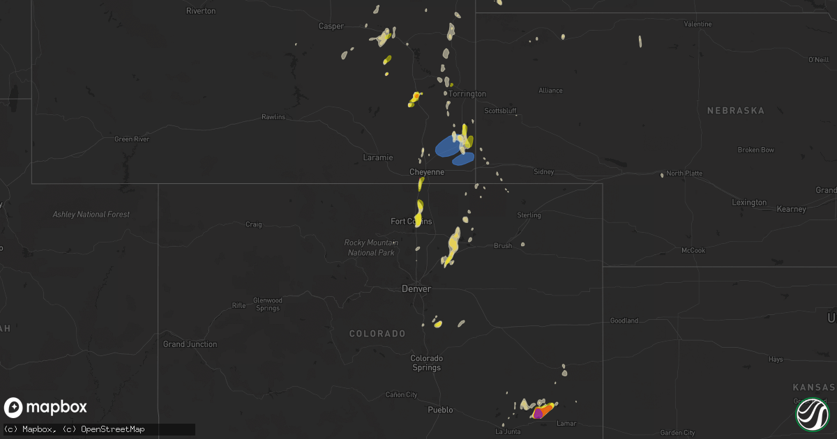
Hail Map on May 27, 2023
Get this storm
May 27 map
$229
one time, instant access
Download today. No call, no setup
Keep the $229
Bought the map and want the full workflow? Apply the entire $229 to a subscription within 7 days. None of it is wasted.
Every map, not just this one
This buys you this map. Subscription and you get every map we run, in the markets you choose from a few cities to whole states to nationwide. Plus real-time alerts the moment a storm fires.
Contact data
Name, contact info, occupancy, even credit band for addresses in the footprint. You go from where it hit to who to call.
Become the source they trust
Unlimited branding weather history reports on demand. You already have the documented answer ready for the property owner, and you are the one who showed up with it.
Property data and RoofTrace estimates
Pull up any address you have got, its value and the exact code rules for that jurisdiction, straight from One Click Code. Then RoofTrace estimates the squares, pitch, and roof value, priced the way you price.
States Impacted by Hail Map on May 27, 2023
Storm reports
North Dakota
| Date | Description |
|---|---|
| 05/27/20234:07 PM CDT | Relayed via social media with pictures. |
Nevada
| Date | Description |
|---|---|
| 05/27/20234:47 PM CDT | Mesonet station mjbn2 majuba. |
| 05/27/20233:50 PM CDT | Mesonet station up973 3.9 sw gerlach |
Nebraska
| Date | Description |
|---|---|
| 05/27/20236:56 PM CDT | Corrects report for 50 se la grange. |
| 05/27/20236:56 PM CDT | A local report indicates 60 MPH wind near 50 SE LA GRANGE |
| 05/26/20237:06 PM CDT | A local report indicates 1.00 inch wind near 3 S BUSHNELL |
| 05/26/20237:06 PM CDT | A local report indicates a tornado near 3 NW BUSHNELL |
| 05/26/20237:00 PM CDT | Portions of metal roof torn off from building. Reported by laramie county fd #3. |
Utah
| Date | Description |
|---|---|
| 05/26/20238:35 PM CDT | Large tree branch broke off a tree and took down power lines. |
New Mexico
| Date | Description |
|---|---|
| 05/27/20236:37 PM CDT | A local report indicates 1.75 inch wind near 5 N SUMNER LAKE STATE P |
| 05/27/20236:15 PM CDT | A local report indicates 1.00 inch wind near 5 N SUMNER LAKE STATE P |
| 05/27/20235:23 PM CDT | Us hwy 70 4mi e-ne elkins. |
| 05/26/202310:27 PM CDT | Quarter size hail lasted 2 to 3 minutes and completely covered the ground. |
| 05/26/20237:10 PM CDT | Tornado briefly touched down in an open field to the north of tatum... Nm. |
South Dakota
| Date | Description |
|---|---|
| 05/27/20235:10 PM CDT | A local report indicates 1.75 inch wind near 5 W BELLE FOURCHE |
| 05/27/20235:00 PM CDT | A local report indicates 1.25 inch wind near 10 WNW DWTN SPEARFISH |
| 05/26/20237:22 PM CDT | A local report indicates 62 MPH wind near 1 N BUFFALO |
Wyoming
| Date | Description |
|---|---|
| 05/27/20236:44 PM CDT | Corrects previous hail report from 4 nw lingle. |
| 05/27/20236:35 PM CDT | A local report indicates 61 MPH wind near 6 WNW NEWCASTLE |
| 05/27/20236:15 PM CDT | A local report indicates 1.00 inch wind near 5 SE FORT LARAMIE |
| 05/27/20236:06 PM CDT | A local report indicates 1.25 inch wind near LA GRANGE |
| 05/27/20236:00 PM CDT | A local report indicates 1.00 inch wind near 7 NW ALVA |
| 05/27/20235:32 PM CDT | A local report indicates 1.50 inch wind near 6 ENE PINE HAVEN |
| 05/27/20235:25 PM CDT | A local report indicates 1.25 inch wind near 8 N ALVA |
| 05/27/20235:20 PM CDT | A local report indicates 1.25 inch wind near 5 SE PINE HAVEN |
| 05/27/20235:05 PM CDT | Landspout tornado sighted southwest of cheyenne. |
| 05/27/20234:50 PM CDT | A local report indicates 1.00 inch wind near 6 W UPTON |
| 05/27/20234:38 PM CDT | Report from mping: quarter |
| 05/27/20234:30 PM CDT | A local report indicates 1.75 inch wind near 8 WSW UPTON |
| 05/27/20234:25 PM CDT | A local report indicates 1.25 inch wind near 7 WSW UPTON |
| 05/27/20234:22 PM CDT | Ping pong size hail. |
| 05/27/20234:19 PM CDT | Twitter post. |
| 05/27/20234:10 PM CDT | Mostly marble size covering the ground |
| 05/27/20234:00 PM CDT | A local report indicates 1.00 inch wind near 8 SW WHEATLAND |
| 05/27/20233:50 PM CDT | Facebook post. North 4th st in douglas. |
| 05/27/20233:25 PM CDT | Picture from twitter. |
| 05/27/20233:22 PM CDT | Confirmed tornado over laramie peak. |
| 05/26/20237:00 PM CDT | Portion of manufactured building roof torn off. Corrects report from 2.3 se bushnell. |
Colorado
| Date | Description |
|---|---|
| 05/27/20234:45 PM CDT | A local report indicates 1.00 inch wind near 1 NW TIMNATH |
| 05/27/20234:43 PM CDT | A local report indicates 1.25 inch wind near 2 NW NEW WINDSOR RESERV |
| 05/27/20234:37 PM CDT | A local report indicates 1.00 inch wind near TIMNATH |
| 05/27/20234:31 PM CDT | A local report indicates 1.25 inch wind near 2 NW NEW WINDSOR RESERV |
| 05/27/20234:25 PM CDT | A local report indicates 1.00 inch wind near 4 NNE TIMNATH |
| 05/26/20237:29 PM CDT | Brief ground circulation beneath funnel cloud. Has since dissipated. |
| 05/26/20237:11 PM CDT | A local report indicates 62 MPH wind near 5 S BURLINGTON |
Montana
| Date | Description |
|---|---|
| 05/27/20236:50 PM CDT | Heavy downpours along with hail up to the size of quarters. |
Texas
| Date | Description |
|---|---|
| 05/27/20234:08 PM CDT | Landspout.... Developed around 408 pm about 20 miles nw of marfa... Tx and was on the ground for approximately one minute. A second developed shortly after the first... |
| 05/26/202311:55 PM CDT | Awos station kdlf laughlin afb. |
| 05/26/20238:55 PM CDT | A local report indicates 1.00 inch wind near PLAINS |
| 05/26/20238:51 PM CDT | A local report indicates 1.00 inch wind near MORTON |
| 05/26/20238:26 PM CDT | Video on social media confirms ground circulation. |
| 05/26/20237:52 PM CDT | Wtm castolon 1nw. |
Cities Impacted by Hail Map on May 27, 2023
- Walls, MS
- Coldwater, MS
- Douglas, WY
- Wheatland, WY
- Newcastle, WY
- Upton, WY
- Beulah, WY
- Aladdin, WY
- Fort Collins, CO
- Timnath, CO
- Windsor, CO
- Belle Fourche, SD
- Spearfish, SD
- Hazen, ND
- Beulah, ND
- Wellington, CO
- Nunn, CO
- Carr, CO
- Roswell, NM
- Cheyenne, WY
- Moorcroft, WY
- Alva, WY
- Harrisburg, AR
- Marked Tree, AR
- Las Animas, CO
- Hulett, WY
- Santa Rosa, NM
- Lodge Grass, MT
- Saint Xavier, MT
- Crow Agency, MT
- Plevna, MT
- Baker, MT
- New Salem, ND
- Lagrange, WY
- Hawk Springs, WY
- Keenesburg, CO
- Carrollton, MS
- Ripley, MS
- Haswell, CO
- Eads, CO
- Sundance, WY
- Blue Mountain, MS
- Mead, CO
- Platteville, CO
- Longmont, CO
- Parkin, AR
- Wynne, AR
- New Albany, MS
- Glenrock, WY
- Earle, AR
- Rocky Ford, CO
- Boyes, MT
- Hammond, MT
- Stanton, ND
- Turrell, AR
- Tyronza, AR
- Blue Springs, MS
- Arlington, CO
- Cherry Valley, AR
- Dumas, MS
- Booneville, MS
- Grass Range, MT
- Jackson, TN
- Denmark, TN
- Bethel Springs, TN
- Hudson, CO
- Casper, WY
- Alzada, MT
- Baldwyn, MS
- Crawfordsville, AR
- Padroni, CO
- Kimball, NE
- La Junta, CO
- Fort Sumner, NM
- Tatum, NM
- Lingle, WY
- Meriden, WY
- Albin, WY
- Burns, WY
- Pine Bluffs, WY
- Osage, WY
- Lead, SD
- Wibaux, MT
- Crossroads, NM
- Plains, TX
- Hinsdale, MT
- Andrews, TX
- Stanton, TX
- Ingomar, MT
- Forsyth, MT
- Morton, TX
- Levelland, TX
- Littlefield, TX
- Franktown, CO
- Elizabeth, CO
- Raton, NM
- Volborg, MT
- Custer, SD
- Toone, TN
- Richey, MT
- Roundup, MT
- Dickinson, ND
- Edgemont, SD
- Wolf Point, MT
- Busby, MT
- Winnett, MT
- Dunn Center, ND
- Briggsdale, CO
- Savannah, TN
- Bushnell, NE
- Elida, NM
- Yoder, WY
- Ramah, CO
- Lance Creek, WY
- Buffalo, SD
- Camp Crook, SD
- Counce, TN
- Michie, TN
- Nettleton, MS
- Amory, MS
- Kersey, CO
- Selmer, TN
- Gardendale, TX
- Midland, TX
- Jay Em, WY
- Aberdeen, MS
- Joliet, MT
- Otter, MT
- Lusk, WY
- Roggen, CO
- Castle Rock, CO
- Enochs, TX
- Brusett, MT
- Okolona, MS
- Manning, ND
- Grover, CO
- Fort Laramie, WY
- Billings, MT
- Laurel, MT
- Weldona, CO
- Orchard, CO
- Wiggins, CO
- Sudan, TX
- Bridger, MT
- Edgar, MT
- Kit Carson, CO
- Killdeer, ND
- Fallon, MT
- Harrisburg, NE
- Bolivar, TN
- Syracuse, KS
- Rapid City, SD
- Chadron, NE
- Deadwood, SD
- Red Lodge, MT
- Three Forks, MT
- Grand Junction, TN
- Hickory Valley, TN
- Quemado, TX
- Del Rio, TX
- Brackettville, TX
- Laughlin Afb, TX
- Eagle Pass, TX
- Uvalde, TX
- Brockton, MT
- Minatare, NE
- Poplar, MT
- Homestead, MT
- Circle, MT
- Vida, MT
- Hay Springs, NE
- Platina, CA
- Cottonwood, CA
- Fairfield, ND
- Belfield, ND
- Terry, MT
- Akron, CO
- Antelope, MT
- Cody, NE
- Odessa, TX
- Hollandale, MS
- Sutherland, NE
- Big Wells, TX