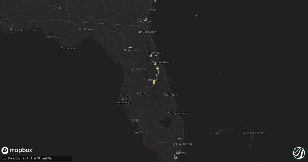
Hail Map on May 18, 2023
Get this storm
May 18 map
$229
one time, instant access
Download today. No call, no setup
Keep the $229
Bought the map and want the full workflow? Apply the entire $229 to a subscription within 7 days. None of it is wasted.
Every map, not just this one
This buys you this map. Subscription and you get every map we run, in the markets you choose from a few cities to whole states to nationwide. Plus real-time alerts the moment a storm fires.
Contact data
Name, contact info, occupancy, even credit band for addresses in the footprint. You go from where it hit to who to call.
Become the source they trust
Unlimited branding weather history reports on demand. You already have the documented answer ready for the property owner, and you are the one who showed up with it.
Property data and RoofTrace estimates
Pull up any address you have got, its value and the exact code rules for that jurisdiction, straight from One Click Code. Then RoofTrace estimates the squares, pitch, and roof value, priced the way you price.
States Impacted by Hail Map on May 18, 2023
Storm reports
Texas
| Date | Description |
|---|---|
| 05/18/20236:50 PM CDT | A local report indicates 2.50 inch wind near 14 N AMARILLO |
| 05/18/20236:33 PM CDT | Wind driven hail caused extensive damage to house and trees. All windows on north side of house were blown out. Trees were stripped |
| 05/18/20236:04 PM CDT | Reported by stratford pd. |
| 05/18/20234:53 PM CDT | Time estimated based on radar. |
| 05/18/20234:03 PM CDT | Social media report showing hail up to about quarter size in fluvanna. Time estimated by radar. |
| 05/18/20233:17 PM CDT | Received social media photo showing approximately ping pong ball size hail in big spring. Time estimated by radar. |
| 05/18/20233:10 PM CDT | Report from mping: quarter |
| 05/17/202311:00 PM CDT | Storm chaser measured with anemometer. |
| 05/17/202310:45 PM CDT | Corrects previous tstm wnd gst report from 4 wsw white deer. Storm chaser measured with anemometer. |
| 05/17/202310:17 PM CDT | A local report indicates 59 MPH wind near 1 E HAPPY |
| 05/17/20239:55 PM CDT | A local report indicates 1.00 inch wind near 9 N PANHANDLE |
| 05/17/20239:55 PM CDT | Storm chaser measured with his anemometer. |
| 05/17/20239:22 PM CDT | A local report indicates 58 MPH wind near 1 W CANYON |
| 05/17/20239:14 PM CDT | A local report indicates 2.00 inch wind near 4 NNW PANHANDLE |
| 05/17/20238:42 PM CDT | A local report indicates 2.00 inch wind near 2 WSW PANTEX |
| 05/17/20238:10 PM CDT | A local report indicates 1.00 inch wind near 4 WNW PANTEX |
| 05/17/20237:59 PM CDT | A local report indicates 1.75 inch wind near 7 NNW PANTEX |
| 05/17/20237:28 PM CDT | A metal roof was blown off one of the apartment buildings at the cactus jbs apartments. Time estimated based on radar. |
Florida
| Date | Description |
|---|---|
| 05/18/20235:45 PM CDT | Quarter sized hail reported at 4775 curry ford road. |
| 05/18/20234:43 PM CDT | Public report of quarter sized hail in lake helen... Relayed by spectrum news 13. |
| 05/18/20233:45 PM CDT | Tree fell into electric wires... Blocking roadway near 901 east lambert st. Time estimated by radar. |
Wyoming
| Date | Description |
|---|---|
| 05/18/20233:20 PM CDT | Trained storm spotter estimates 60mph wind gusts with pea sized hail... And heavy rainfall in the severe thunderstorm. |
Alabama
| Date | Description |
|---|---|
| 05/18/20236:55 PM CDT | Tree down on lake front road. Time estimated by radar. |
| 05/18/20236:47 PM CDT | Estimated quarter-sized hail on hwy 80 near county road 11. |
| 05/18/20236:36 PM CDT | Quarter-sized hail reported in corner... Al. |
| 05/18/20235:25 PM CDT | Golf ball sized hail reported. Time estimated. |
| 05/18/20235:25 PM CDT | Social media report of ping pong ball size hail on eastaboga rd near talladega municipal airport. |
| 05/18/20235:24 PM CDT | Hail up to quarter size hail reported on cr 49. Hail was mostly dime sized and covered the ground. |
| 05/18/20235:24 PM CDT | Hail up to quarter size reported on cr 49. Hail was mostly dime sized and covered the ground. |
| 05/18/20234:44 PM CDT | Several trees down off of lentzville road in limestone county. Time estimated based on radar. |
| 05/18/20234:37 PM CDT | Social media report of trees down and flooded roadway on valley brook dr. |
| 05/18/20234:30 PM CDT | Quarter-size hail on highway 21 south of jacksonville. |
| 05/18/20234:26 PM CDT | Time is estimated from radar. |
| 05/18/20233:44 PM CDT | Several trees reported down on cotaco-florette road in somerville... Al just north of hwy 67. Time estimated based on radar. |
| 05/18/20233:26 PM CDT | Several trees down around romulus... Mostly pines. |
| 05/18/20233:07 PM CDT | Quarter-size hail reported in harvest... Al. Report relayed via social media. |
| 05/18/20232:00 PM CDT | Report of quarter-size hail near cleveland. |
| 05/17/20237:52 PM CDT | Sporadic trees uprooted. Green leaves are covering the ground due to large hail. |
| 05/17/20237:52 PM CDT | Corrected wording. Large hail removed leaves from trees in the spear branch area... Near cty rd 56. Green leaves & vegetative debris is covering roadways. No measuremen |
| 05/17/20237:35 PM CDT | Trees down north of weogufka on cty rd 29. |
Tennessee
| Date | Description |
|---|---|
| 05/18/20235:58 PM CDT | Twitter photo showed hail slightly larger than quarter size near epps mill road at i-24 in christiana. |
| 05/18/20234:44 PM CDT | A tree was reported down at the intersection of highway 231 and petersburg chestnut ridge road. |
Cities Impacted by Hail Map on May 18, 2023
- Cleveland, AL
- Big Spring, TX
- Fluvanna, TX
- Jacksonville, AL
- Anniston, AL
- Lincoln, AL
- Eastaboga, AL
- Seymour, TX
- Vega, TX
- Bellevue, TX
- Bowie, TX
- Munford, AL
- Talladega, AL
- Amarillo, TX
- Dalhart, TX
- Stratford, TX
- Christiana, TN
- Murfreesboro, TN
- Haswell, CO
- Arlington, CO
- Auburn, AL
- Opelika, AL
- Millerville, AL
- Goodwater, AL
- Ashland, AL
- Dumas, TX
- Cactus, TX
- Hartley, TX
- Sylacauga, AL
- Weogufka, AL
- Sunray, TX
- Channing, TX
- Panhandle, TX
- Masterson, TX
- Canyon, TX
- Midway, AL
- La Pine, OR
- Bend, OR
- Groom, TX
- Clarendon, TX
- White Deer, TX
- Claude, TX
- Pampa, TX
- Mclean, TX
- Harvest, AL
- Moulton, AL
- Danville, AL
- Bremen, AL
- Empire, AL
- Hayden, AL
- Warrior, AL
- Dora, AL
- Hanceville, AL
- Lake Helen, FL
- Deland, FL
- Deltona, FL
- New Smyrna Beach, FL
- Orlando, FL
- Oneonta, AL
- Tahoka, TX
- Henrietta, TX
- Cle Elum, WA
- Eufaula, AL
- Sterling, CO
- Knott, TX
- Merino, CO
- Laramie, WY
- Laredo, TX
- Jacksboro, TX
- Ralph, AL
- Buhl, AL
- Marion, AL
- Westbrook, TX
- Greensboro, AL
- Moundville, AL
- Kingsland, GA
- Coahoma, TX
- Union Grove, AL
- Arab, AL
- Dryden, TX
- Ozona, TX
- Comstock, TX
- Sterling City, TX
- Camp Sherman, OR
- Hillsboro, AL
- Trinity, AL
- Goodwell, OK
- Faunsdale, AL
- Winter Springs, FL
- Oviedo, FL
- Linden, AL
- Union Springs, AL
- Hurtsboro, AL
- Woodrow, CO
- Daleville, AL
- Robert Lee, TX
- Readyville, TN
- Rockford, AL
- Miami, FL
- Stanton, TX
- Bosler, WY
- Pierson, FL
- Kingfisher, OK
- Happy, TX
- Berthoud, CO
- Longmont, CO
- Hilliard, FL
- Homestead, FL
- Bunnell, FL
- Titus, AL
- Thorp, WA
- Newcastle, TX
- Throckmorton, TX
- Fosters, AL
- Osteen, FL
- Fayetteville, TN
- Live Oak, FL
- Mayo, FL
- Pompano Beach, FL
- Sawyerville, AL
- Mulberry, TN
- Lynchburg, TN
- Loveland, CO
- Bellvue, CO
- Newbern, AL
- Taft, TN
- Mertzon, TX
- Olney, TX
- Loving, TX
- Windthorst, TX
- Palm Coast, FL
- Saint George, UT
- Liberty, TN
- Stoneham, CO
- Gainesville, FL
- Duncanville, AL
- Lucedale, MS
- Fort Stewart, GA
- Shelbyville, TN
- Wartrace, TN
- Alachua, FL
- Eva, AL
- Somerville, AL
- Jasper, AL
- Clayton, AL
- Randle, WA
- Petersburg, TN
- Montello, NV
- Fort Rucker, AL
- Prattville, AL
- Billingsley, AL
- Beechgrove, TN
- Bell Buckle, TN
- De Leon Springs, FL
- Wellington, AL
- Ohatchee, AL
- Gadsden, AL
- Alexandria, AL
- Weaver, AL
- Lisman, AL
- Lineville, AL
- Selma, AL
- Hartselle, AL
- Otis, CO
- Alexander City, AL
- Pine Bluffs, WY
- Big Lake, TX
- Blountsville, AL
- Sanford, FL
- Gladstone, NM
- Quitman, MS
- Shubuta, MS
- Pine Hill, AL
- Geneva, FL
- Yuma, CO
- Garden City, TX
- Marbury, AL
- Naches, WA