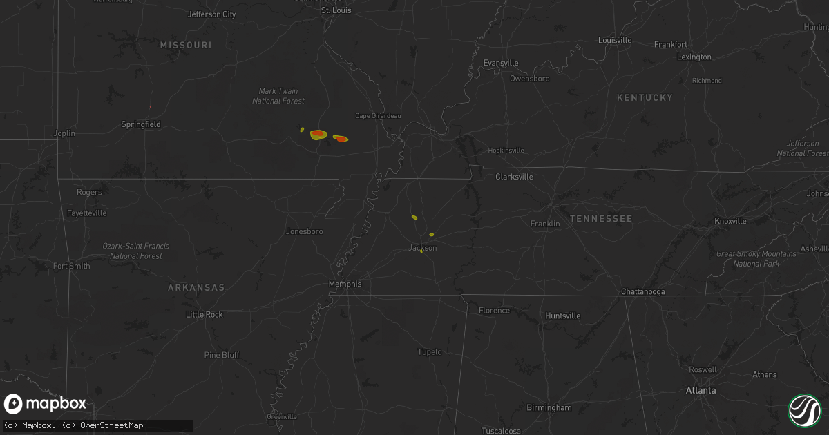
Hail Map on May 15, 2023
Get this storm
May 15 map
$229
one time, instant access
Download today. No call, no setup
Keep the $229
Bought the map and want the full workflow? Apply the entire $229 to a subscription within 7 days. None of it is wasted.
Every map, not just this one
This buys you this map. Subscription and you get every map we run, in the markets you choose from a few cities to whole states to nationwide. Plus real-time alerts the moment a storm fires.
Contact data
Name, contact info, occupancy, even credit band for addresses in the footprint. You go from where it hit to who to call.
Become the source they trust
Unlimited branding weather history reports on demand. You already have the documented answer ready for the property owner, and you are the one who showed up with it.
Property data and RoofTrace estimates
Pull up any address you have got, its value and the exact code rules for that jurisdiction, straight from One Click Code. Then RoofTrace estimates the squares, pitch, and roof value, priced the way you price.
States Impacted by Hail Map on May 15, 2023
Storm reports
Missouri
| Date | Description |
|---|---|
| 05/15/20235:30 PM CDT | Golf ball sized hail in the leora area of northern stoddard county. |
| 05/15/20235:06 PM CDT | Quarter sized hail in and around williamsville... Just south of greenville. |
| 05/15/20234:05 PM CDT | A local report indicates 1.00 inch wind near PIEDMONT |
| 05/15/20233:50 PM CDT | A local report indicates 61 MPH wind near 2 WSW OLIVE |
Louisiana
| Date | Description |
|---|---|
| 05/15/20233:40 PM CDT | Emergency manager reported one tree down and six utility poles down near the intersection of 3127 and highway 20. Time estimated by radar. |
Georgia
| Date | Description |
|---|---|
| 05/15/20235:20 PM CDT | A pine tree was blown down along with some roof damage and a broken flag pole in the hilton area. |
Florida
| Date | Description |
|---|---|
| 05/15/20234:26 PM CDT | A powerline and tree were down across the roadway on tennessee street in alford. |
| 05/15/20234:25 PM CDT | Social media report of golfball sized hail near alford. |
| 05/15/20233:27 PM CDT | Milton whiting field awos measures thunderstorm wind gust to 60kts or 69mph. |
| 05/15/20232:41 PM CDT | Tree down along tram road. |
| 05/15/20232:15 PM CDT | Tree down along centerville road. |
Mississippi
| Date | Description |
|---|---|
| 05/15/20232:20 PM CDT | Weather station recorded 72 mph wind and 7 trees were downed in the city. Pea size hail was also reported. |
Texas
| Date | Description |
|---|---|
| 05/15/20234:15 PM CDT | Wind gust of 58 mph measured at the hondo municipal airport. |
| 05/15/20232:57 PM CDT | Report from mping: quarter |
Montana
| Date | Description |
|---|---|
| 05/15/20231:00 AM CDT | A car hit a fallen tree that was blocking the westbound lane of us-2 near mile marker 6. |
| 05/15/202312:00 AM CDT | A large tree fell onto us-2 near mile marker 5. |
Tennessee
| Date | Description |
|---|---|
| 05/15/20236:48 PM CDT | Quarter sized hail reported in jackson... Tn. |
| 05/15/20236:37 PM CDT | Quarter sized hail reported. |
| 05/15/20236:30 PM CDT | Several trees uprooted or snapped in trenton. At least one home was damaged by a downed tree. |
Alabama
| Date | Description |
|---|---|
| 05/15/20235:40 PM CDT | A few single tree down reports in the vestavia hills/hoover area. Tree limbs down in mountain brook. Sub-severe winds probable. Also a few reports of small hail up to 0 |
| 05/15/20234:35 PM CDT | Viewer report of trees blown down and swings flipped over relayed to nws from broadcast media. Specific location and time of event were based on radar data. |
| 05/15/20234:02 PM CDT | A tree was blown down into a residence along cr 51 in lexington. Specific location was based on radar data. |
| 05/15/20233:43 PM CDT | Power poles were snapped and at least 12 were blown down from a possible microburst. Several trees were blown down in the same area. Damage report and location were rec |
| 05/15/20231:39 PM CDT | Trees down on allsboro road at liberty road. |
| 05/15/20231:23 PM CDT | Trees down at the intersection of allsboro road and redbud road. |
Cities Impacted by Hail Map on May 15, 2023
- Fair Grove, MO
- Cottondale, FL
- Alford, FL
- Marianna, FL
- Piedmont, MO
- Greenville, MO
- Mill Spring, MO
- McGee, MO
- Williamsville, MO
- Puxico, MO
- Wappapello, MO
- Bloomfield, MO
- Medina, TN
- Jackson, TN
- Trenton, TN
- Dyer, TN
- Grand View, ID
- Murphy, ID
- Oakfield, TN
- Holladay, TN
- Sugar Tree, TN
- Dallas, TX
- Somerville, AL
- Town Creek, AL
- Chipley, FL
- Lohn, TX
- New Iberia, LA
- Knippa, TX
- Sabinal, TX
- Brenham, TX
- Washington, TX
- Milano, TX
- Del Rio, TX
- Marble Hill, MO
- Zalma, MO
- Moore, TX
- Pearsall, TX
- Princeton, AL
- Hollytree, AL
- Obion, TN
- Madison, FL
- Bruneau, ID
- Rockland, ID
- Dudley, MO
- Altha, FL
- Bells, TN
- Ellington, MO
- Dexter, MO
- Sarcoxie, MO
- Golden City, MO
- Grapeland, TX
- Rocksprings, TX
- Gibson, LA
- Crockett, TX
- Advance, MO
- Bunker, MO
- Salem, MO
- Napoleonville, LA
- Courtland, AL
- Rochelle, TX
- Richland Springs, TX
- Richardson, TX
- Montello, NV
- Sturdivant, MO
- Nettleton, MS
- Anderson, TX
- Navasota, TX
- Iredell, TX
- Independence, LA
- Amite, LA
- Scottsboro, AL
- Estillfork, AL
- Hampshire, TN
- Mooreville, MS
- Tupelo, MS
- Redford, MO
- Plattenville, LA
- Belle Rose, LA
- White Castle, LA
- Pierre Part, LA
- Patterson, LA
- Gainesville, TX
- Collinsville, TX
- Wewahitchka, FL
- Greensburg, LA
- Saint Martinville, LA
- Breaux Bridge, LA
- Lowndes, MO
- Oil City, LA
- Van Buren, MO
- Devine, TX
- Berwick, LA
- London, TX
- Junction, TX
- Leopold, MO
- Copperas Cove, TX
- Longview, TX
- Gladewater, TX
- Maupin, OR
- Spring, TX
- Houston, TX
- Battle Ground, WA
- Reeds, MO
- Carthage, MO
- Avilla, MO
- Hamilton, TX
- Winters, TX
- Hornbeak, TN
- Dilley, TX
- Bonifay, FL
- Caryville, FL
- Kosse, TX
- Franklin, TX
- Union Grove, AL
- Laceys Spring, AL
- Arlington, TX
- Garland, TX
- Cameron, TX
- Lewisburg, TN
- Mansfield, TX
- Springfield, LA
- Hohenwald, TN
- Cypress Inn, TN
- Iron City, TN
- Medon, TN
- Winona, MO
- Morgan City, LA
- Troy, TN
- Centre, AL
- Brownsville, TN
- Tallahassee, FL
- Humboldt, TN
- Bernie, MO
- Riverside, OR
- Hodges, AL
- Vacherie, LA
- Tioga, TX
- Goldthwaite, TX
- Woodworth, LA
- Bascom, FL
- Vina, AL
- Bristol, FL
- Enterprise, LA
- Newville, AL
- Abbeville, AL
- Jefferson, TX
- Stanton, TN
- Whiteville, TN
- Smithville, TX
- Huntsville, AL
- Grand Prairie, TX
- Middleton, TN
- Bolivar, TN
- Loretto, TN
- Saint Joseph, TN
- Cairo, GA
- Lockwood, MO
- Essex, MO
- Plano, TX
- Sachse, TX
- Melvin, TX
- Oran, MO
- Eldorado, TX
- Ozona, TX
- Jackpot, NV
- Westpoint, TN
- Franklinton, LA
- Vivian, LA
- Smithdale, MS
- Liberty, MS
- Thomasville, GA
- Pottsville, TX
- Mullin, TX
- Birmingham, AL
- Glen Rose, TX
- Rutherford, TN
- Eastpoint, FL
- Alamo, TN
- Albany, LA
- Holden, LA
- Bell City, MO
- Ellsinore, MO
- Patterson, MO
- Lawrenceburg, TN
- Harrisonburg, LA
- Prospect, TN
- Ardmore, TN
- Brierfield, AL
- Gilmer, TX