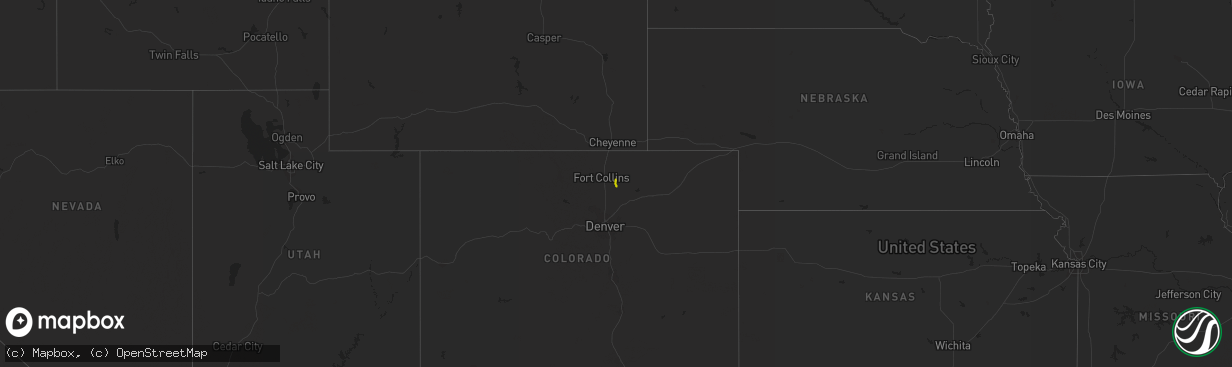
Hail Map on May 11, 2013
The weather event on May 11, 2013 includes Hail map. 2 states and 12 cities were impacted and suffered possible damage. The total estimated number of properties impacted is 21,507.
Want more than just the map?
Turn this storm into a full workflow.
- Owner + property data so you know who to knock
- OnDemand branded weather history reports to win the "did we even have hail?" argument
- RoofTrace estimate so reps stop guessing numbers at the door
Bought this map? Upgrade within 7 days and we'll credit the $230. (10-15 min setup call)
Hail
21,507
Estimated number of impacted properties by a 1.00" hail or larger1,492
Estimated number of impacted properties by a 1.75" hail or larger0
Estimated number of impacted properties by a 2.50" hail or largerStorm reports
Virginia
| Date | Description |
|---|---|
| 05/11/20136:45 PM CDT | Two trees downed with minor crop damage on 2100 block of ballahack rd |
| 05/11/20136:17 PM CDT | Few trees down on dickerson mill road. |
| 05/11/20135:35 PM CDT | Time is radar estimated. Tree downed along va-740...turkey egg rd. |
| 05/11/20134:36 PM CDT | Half dollar hail and possible funnel cloud |
| 05/11/20134:31 PM CDT | Tree down across e court house road |
| 05/11/20134:30 PM CDT | Several trees broken off at the ground downing powerlines. Dime size hail was also observed. |
| 05/11/20134:17 PM CDT | Quarter size hail and strong winds |
| 05/11/20134:15 PM CDT | Damaged shed...blew off 300 pound dog pen roof...nickel size hail |
| 05/11/20134:08 PM CDT | Tree down across road due to strong winds |
| 05/11/20133:45 PM CDT | 45 year old pine tree down across road...farm buildings damaged |
Maryland
| Date | Description |
|---|---|
| 05/11/20133:59 PM CDT | 10 plus trees down |
| 05/11/20133:57 PM CDT | Several dozen hardwood and softwood trees uprooted and snapped lying in same direction along a 200 yard path. |
| 05/11/20133:48 PM CDT | Large tree into house. |
| 05/11/20133:37 PM CDT | Trees down near intersection of carrs mill road and wildwood drive. |
North Carolina
| Date | Description |
|---|---|
| 05/11/20135:15 PM CDT | Branches from oak tree blown down. |
| 05/11/20135:15 PM CDT | Two pine trees blown down along with several large branches. |
| 05/11/20135:15 PM CDT | A local report indicates 1.00 inch wind near 3 N MORGANTON |
| 05/11/201312:55 PM CDT | A tree down across riverside campground road...a quarter mile s of ponzer |
Florida
| Date | Description |
|---|---|
| 05/11/20135:55 PM CDT | Nickel to quarter-sized hail |
| 05/11/20133:55 PM CDT | Reported damage to 2 mobile home car ports and 1 porch. |
| 05/11/20133:50 PM CDT | Usaf 54 ft wind tower number 9404 measured a 54 kt/62 mph wind gust |
| 05/10/20137:00 PM CDT | Large tents were turned over due to strong winds about 1 mile north of flagler county airport. |
New York
| Date | Description |
|---|---|
| 05/11/20133:04 PM CDT | Several trees down on south end avenue. |
New Jersey
| Date | Description |
|---|---|
| 05/11/20132:43 PM CDT | Trees down on edgewood avenue. |
| 05/11/20132:40 PM CDT | Wires and large tree branch down on washington place. Time estimated by radar. |
| 05/11/20132:40 PM CDT | Tree down on main street between oakwood and glenwood avenues. |
| 05/11/20132:36 PM CDT | Multiple trees reported down across south orange. Time estimated by radar. |
| 05/11/20132:20 PM CDT | Trees down. |
| 05/11/20132:15 PM CDT | Trees down. |
| 05/11/20132:10 PM CDT | Trees down. |
Colorado
| Date | Description |
|---|---|
| 05/11/20134:40 PM CDT | A local report indicates 1.25 inch wind near 3 W GREELEY |
| 05/11/20134:35 PM CDT | A local report indicates 1.00 inch wind near 2 ENE GREELEY |