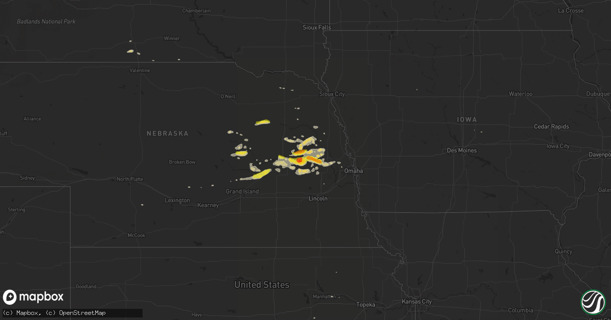
Hail Map on May 2, 2015
Get this storm
May 2 map
$229
one time, instant access
Download today. No call, no setup
Keep the $229
Bought the map and want the full workflow? Apply the entire $229 to a subscription within 7 days. None of it is wasted.
Every map, not just this one
This buys you this map. Subscription and you get every map we run, in the markets you choose from a few cities to whole states to nationwide. Plus real-time alerts the moment a storm fires.
Contact data
Name, contact info, occupancy, even credit band for addresses in the footprint. You go from where it hit to who to call.
Become the source they trust
Unlimited branding weather history reports on demand. You already have the documented answer ready for the property owner, and you are the one who showed up with it.
Property data and RoofTrace estimates
Pull up any address you have got, its value and the exact code rules for that jurisdiction, straight from One Click Code. Then RoofTrace estimates the squares, pitch, and roof value, priced the way you price.
States Impacted by Hail Map on May 2, 2015
Storm reports
North Dakota
| Date | Description |
|---|---|
| 05/02/20154:15 PM CDT | Peak wind reported at the grafton airport /kgaf/ at 2115 uct. |
| 05/02/20154:00 PM CDT | An 8 inch diameter cherry tree split approximately 4ft above base. Top portion felled and made contact with rear of automobile. Observed at 445 pm across from schroeder |
South Dakota
| Date | Description |
|---|---|
| 05/02/20155:57 PM CDT | A local report indicates 1.00 inch wind near 5 ESE ROSEBUD |
Minnesota
| Date | Description |
|---|---|
| 05/01/20159:46 PM CDT | 3 large jack pines were blown down across fencing. One fell onto roof of house. |
Arizona
| Date | Description |
|---|---|
| 05/01/20159:00 PM CDT | Power pole and power lines knocked down from winds estimated 50 mph from nearby mesonet weather station. |
Colorado
| Date | Description |
|---|---|
| 05/01/20158:17 PM CDT | Spotter network report. |
Nebraska
| Date | Description |
|---|---|
| 05/01/20159:04 PM CDT | A local report indicates 1.50 inch wind near 2 S MORSE BLUFF |
| 05/01/20159:00 PM CDT | A local report indicates 1.00 inch wind near 3 W TILDEN |
| 05/01/20158:45 PM CDT | Delayed report from saturday evening. Public reports dime to a few quarter size along highway 56. |
| 05/01/20158:34 PM CDT | A local report indicates 1.00 inch wind near CLARKS |
| 05/01/20158:12 PM CDT | A local report indicates 1.75 inch wind near N SCHUYLER |
| 05/01/20157:40 PM CDT | A local report indicates 1.50 inch wind near 8 NE SCHUYLER |
| 05/01/20157:00 PM CDT | A local report indicates 1.00 inch wind near 5 S PLATTE CENTER |
Iowa
| Date | Description |
|---|---|
| 05/02/20151:55 AM CDT | At the harlan iowa airport. |
Cities Impacted by Hail Map on May 2, 2015
- Palmer, NE
- Fullerton, NE
- Central City, NE
- Clarks, NE
- Karval, CO
- Schuyler, NE
- Malmo, NE
- Prague, NE
- Maxwell, NE
- Winside, NE
- Stanton, NE
- Genoa, NE
- Dannebrog, NE
- Kennard, NE
- Bennington, NE
- Archer, NE
- Silver Creek, NE
- Leigh, NE
- Clarkson, NE
- Greeley, NE
- Cedar Rapids, NE
- Wolbach, NE
- West Point, NE
- Howells, NE
- Dodge, NE
- Scribner, NE
- North Bend, NE
- Weston, NE
- Wahoo, NE
- Creston, NE
- Hooper, NE
- Ames, NE
- Fremont, NE
- Valley, NE
- Beemer, NE
- Hartington, NE
- Coleridge, NE
- Mission, SD
- Boone, CO
- Spalding, NE
- Rogers, NE
- Columbus, NE
- Carroll, NE
- Bartlett, NE
- Primrose, NE
- Wayne, NE
- Omaha, NE
- Morse Bluff, NE
- Cedar Bluffs, NE
- Pine Bluffs, WY
- Madison, NE
- Wamego, KS
- Saint George, KS
- Meadow Grove, NE
- Tilden, NE
- Oakdale, NE
- Linwood, NE
- David City, NE
- Bellwood, NE
- Trementina, NM
- Colon, NE
- Duncan, NE
- Monroe, NE
- Eads, CO
- Garita, NM
- Shelby, NE
- Rising City, NE
- Platte Center, NE
- Wausa, NE
- Brainard, NE
- Bruno, NE
- Saint Francis, SD
- Colome, SD
- Saint Libory, NE
- Saint Paul, NE
- Albion, NE
- Chapman, NE
- Ravenna, NE
- Parmelee, SD
- Snyder, NE
- Osceola, NE
- Elgin, NE
- Oakland, NE