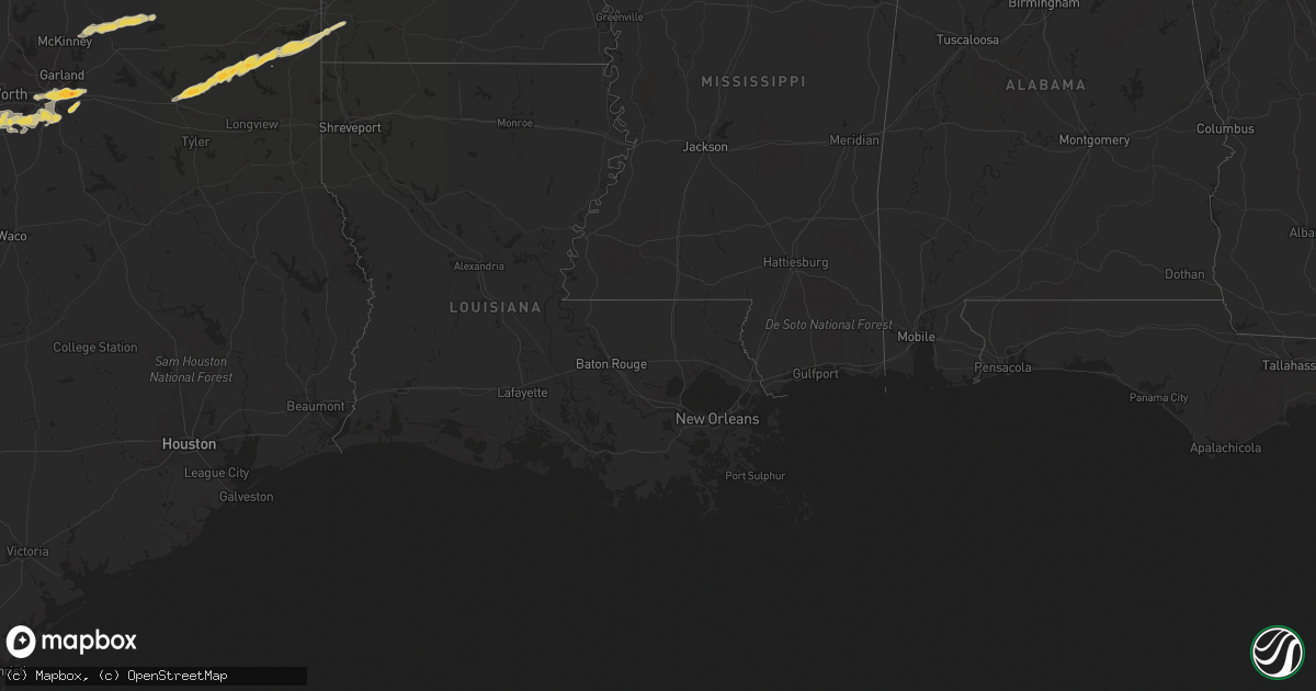
Hail Map on April 30, 2011
Get this storm
April 30 map
$229
one time, instant access
Download today. No call, no setup
Keep the $229
Bought the map and want the full workflow? Apply the entire $229 to a subscription within 7 days. None of it is wasted.
Every map, not just this one
This buys you this map. Subscription and you get every map we run, in the markets you choose from a few cities to whole states to nationwide. Plus real-time alerts the moment a storm fires.
Contact data
Name, contact info, occupancy, even credit band for addresses in the footprint. You go from where it hit to who to call.
Become the source they trust
Unlimited branding weather history reports on demand. You already have the documented answer ready for the property owner, and you are the one who showed up with it.
Property data and RoofTrace estimates
Pull up any address you have got, its value and the exact code rules for that jurisdiction, straight from One Click Code. Then RoofTrace estimates the squares, pitch, and roof value, priced the way you price.
States Impacted by Hail Map on April 30, 2011
Storm reports
Arkansas
| Date | Description |
|---|---|
| 04/29/20118:06 PM CDT | A local report indicates 1.00 inch wind near CLINTON |
Texas
| Date | Description |
|---|---|
| 04/30/20116:57 PM CDT | Golf ball sized hail just east of i635 along us80 |
| 04/30/20116:36 AM CDT | Strong winds tore sheet metal roof from house and blew out billboard |
| 04/30/20116:35 AM CDT | Nws survey found widespread significant wind damage in callahan county and the community of clyde and estimated winds causing this damage to be in the range of 90 to 10 |
| 04/30/20116:25 AM CDT | Steeple blown off of parkside baptist church |
| 04/30/20116:25 AM CDT | 65 mph wind gust measured in north denison |
| 04/30/20116:20 AM CDT | Roofs blown off of 2 buildings at north texas regional airport |
| 04/30/20116:18 AM CDT | 60 mph wind gust at the north texas regional airport near sherman |
| 04/30/20116:12 AM CDT | A local report indicates 60 MPH wind near 3 SW POTTSBORO |
| 04/30/20116:01 AM CDT | Quarter size hail 4 miles east of nocona |
| 04/30/20115:40 AM CDT | A local report indicates 1.00 inch wind near 3 S RINGGOLD |
| 04/30/20115:25 AM CDT | Tree down over highway 148. Report from clay county sherriff office relayed by emergency manager. |
| 04/30/20115:15 AM CDT | Reports of wind damage along hwy 281 in windthorst. |
| 04/30/20115:13 AM CDT | Winds estimated 60 mph at deer creek park near lake arrowhead. |
| 04/30/20114:56 AM CDT | Power line down along highway 79 about 1.5 miles south of archer city. Parts of the city are without power. |
| 04/30/20114:50 AM CDT | Quarter size hail in desoto |
| 04/30/20114:50 AM CDT | Large oak tree down. Cedar post driven into attic of house. Resident reports possible tornado. |
| 04/30/20114:45 AM CDT | Quarter size hail in ovilla |
| 04/30/20114:43 AM CDT | Half dollar size hail 8 miles west of alvord |
| 04/30/20114:43 AM CDT | 65 mph wind gust 8 miles west northwest of alvord |
| 04/30/20114:35 AM CDT | Reports of wind damage in the megargel area. |
| 04/30/20114:17 AM CDT | Kswo-tv viewer. |
| 04/30/20114:01 AM CDT | A local report indicates 1.00 inch wind near 1 SE CROWLEY |
| 04/30/20113:55 AM CDT | Quarter hail covering the ground |
| 04/30/20113:55 AM CDT | A local report indicates 65 MPH wind near BURLESON |
| 04/30/20113:50 AM CDT | A local report indicates 1.00 inch wind near 9 SSE ALEDO |
| 04/30/20113:30 AM CDT | Numerous large trees uprooted or snapped in olney |
| 04/30/20113:20 AM CDT | A local report indicates 60 MPH wind near 2 NE GRANBURY |
| 04/30/20113:02 AM CDT | A local report indicates 2.00 inch wind near 4 ENE LIPAN |
| 04/30/20113:01 AM CDT | Golf ball size or larger hail reported by public |
| 04/30/20113:01 AM CDT | Golf ball size or larger hail reported by public. Corrected location. |
| 04/30/20113:00 AM CDT | Golfball hail on south side of throckmorton |
| 04/30/20112:56 AM CDT | Ping pong to golfball hail in lipan. |
| 04/30/20112:39 AM CDT | A local report indicates 2.50 inch wind near 2.5 SE SANTO |
| 04/30/20112:32 AM CDT | 1 n gordon |
| 04/30/20112:20 AM CDT | Measured 68 mph wind gust 1.5 miles north of strawn |
| 04/30/20112:17 AM CDT | Pea to quarter size hail in community of haskell |
| 04/30/20112:15 AM CDT | A local report indicates 1.00 inch wind near HASKELL |
| 04/30/20112:01 AM CDT | 2 se la casa |
| 04/29/201110:30 PM CDT | Quarter sized hail reported at the intersection of county road 3544 and fm 96 |
| 04/29/201110:05 PM CDT | Quarter sized hail reported at county road 3214 and highway 77w |
| 04/29/201110:03 PM CDT | State trooper reported quarter sized hail |
| 04/29/20119:25 PM CDT | Tornado on ground moving ne at 25 mph. |
| 04/29/20119:24 PM CDT | An ef0 tornado touched down on the southwest side of hughes springs. Several trees were snapped near fm 250. Trees were downed onto powerlines and shingles removed from |
| 04/29/20119:10 PM CDT | Storm survey conducted in southern morris county determined that damage was consistent with severe thunderstorm wind gusts near 80 mph. Damage was very sporadic and a t |
| 04/29/20119:09 PM CDT | Trees and power lines down on the north side of lone star. Power outages reported in lone star. |
| 04/29/20118:29 PM CDT | Trees down at cr 2088 and coyote road |
| 04/29/20118:26 PM CDT | An ef0 tornado touched down east of the simpsonville community. The storm continued on an east northeast trajectory crossing wolverine road and lifted near fm 2454. Dam |
| 04/29/20118:14 PM CDT | Quarter sized hail near klondike |
| 04/29/20118:10 PM CDT | Metal carport was lifted off the ground and damaged |
| 04/29/20118:00 PM CDT | Half dollar hail in mesquite |
| 04/29/20117:46 PM CDT | Quarter sized hail in ladonia |
| 04/29/20117:38 PM CDT | Quarter sized hail covering the ground in wolfe city |
| 04/29/20117:20 PM CDT | Quarter hail reported by the public in forney. |
| 04/29/20117:12 PM CDT | Hail to the size quarters in the city of mesquite |
| 04/29/20117:06 PM CDT | An ef0 tornado touched down west of hainesville. Trees were snapped with a path width of 50-75 yards wide. The storm continued on an east northeast track crossing fm 49 |
Oklahoma
| Date | Description |
|---|---|
| 04/30/20116:50 AM CDT | A local report indicates 65 MPH wind near DURANT |
| 04/30/20116:40 AM CDT | Emergency management reports wind damage in achille and colbert in bryan county. The worst damage occurred at the intersection of river road and chickasaw road with dow |
Florida
| Date | Description |
|---|---|
| 04/30/20113:30 PM CDT | Hail was reported at the corner of tamiami trail and highway 951 to be about the size of quarters for a few minutes at walgreens. |
| 04/30/20112:50 PM CDT | Hail ranged from dime to quarter sized for 5 to 10 min at the port of the islands resort. |
Missouri
| Date | Description |
|---|---|
| 04/29/201111:40 PM CDT | A local report indicates 1.00 inch wind near DEXTER |
Kentucky
| Date | Description |
|---|---|
| 04/29/20118:40 PM CDT | A local report indicates 1.00 inch wind near SHARPE |
Cities Impacted by Hail Map on April 30, 2011
- Cabot, AR
- Sherwood, AR
- Jacksonville, AR
- North Little Rock, AR
- Throckmorton, TX
- Newcastle, TX
- Daingerfield, TX
- Hughes Springs, TX
- Lonsdale, AR
- Hot Springs Village, AR
- Maumelle, AR
- Roland, AR
- Mountain Pine, AR
- Paron, AR
- Mount Ida, AR
- Jessieville, AR
- Benton, AR
- Norman, AR
- Little Rock, AR
- Alexander, AR
- Story, AR
- Elizabethtown, IL
- Cave In Rock, IL
- Linden, TX
- Weatherford, TX
- Lipan, TX
- Granbury, TX
- Bellevue, TX
- Henrietta, TX
- Breckenridge, TX
- Cisco, TX
- Ranger, TX
- Eastland, TX
- Bradford, AR
- Pleasant Plains, AR
- Bells, TN
- Alamo, TN
- Friendship, TN
- Humboldt, TN
- Dallas, TX
- Sadler, TX
- Pittsburg, TX
- Chico, TX
- Jacksboro, TX
- Sunset, TX
- Bowie, TX
- Fouke, AR
- Quitman, TX
- Dickens, TX
- Windthorst, TX
- Seymour, TX
- Wichita Falls, TX
- Scotland, TX
- Ringgold, TX
- Holliday, TX
- Cleburne, TX
- Joshua, TX
- Godley, TX
- Cresson, TX
- Crowley, TX
- Burleson, TX
- Hardy, AR
- Ravenden, AR
- Williford, AR
- Santo, TX
- Ward, AR
- Paragould, AR
- Beech Grove, AR
- Bono, AR
- Walnut Ridge, AR
- Alicia, AR
- Lafe, AR
- Marmaduke, AR
- Drummonds, TN
- Tyronza, AR
- Saint Jo, TX
- Hoxie, AR
- Benton, KY
- Gilbertsville, KY
- Calvert City, KY
- Oden, AR
- Bokchito, OK
- Paducah, TX
- Halls, TN
- Westport, TN
- Holladay, TN
- Ledbetter, KY
- Red Oak, TX
- Alvarado, TX
- Venus, TX
- Desoto, TX
- Ferris, TX
- Wilmer, TX
- Fort Worth, TX
- Lancaster, TX
- Midlothian, TX
- Waxahachie, TX
- Mansfield, TX
- Lillian, TX
- Cedar Hill, TX
- Moran, TX
- Abilene, TX
- Baird, TX
- Strawn, TX
- Clyde, TX
- Albany, TX
- Dexter, MO
- Gainesville, TX
- Pottsboro, TX
- Denison, TX
- Cartwright, OK
- Seagoville, TX
- Forney, TX
- Tuckerman, AR
- Swifton, AR
- Whitesboro, TX
- Bernie, MO
- West Salem, IL
- Mount Erie, IL
- Providence, KY
- Nebo, KY
- Dixon, KY
- Clay, KY
- Slaughters, KY
- Manitou, KY
- Russellville, AR
- Atkins, AR
- Pottsville, AR
- Mineola, TX
- Pecan Gap, TX
- Ladonia, TX
- Wolfe City, TX
- Milan, TN
- Forestburg, TX
- Haskell, TX
- Balch Springs, TX
- Sunnyvale, TX
- Mesquite, TX
- Gordon, TX
- Mingus, TX
- Commerce, TX
- Goree, TX
- Palo Pinto, TX
- Millsap, TX
- Wilson, OK
- Archer City, TX
- Nocona, TX
- Elizabethtown, KY
- Hodgenville, KY
- Glendale, KY
- Sonora, KY
- Strawberry, AR
- Lynn, AR
- Saffell, AR
- Cord, AR
- Rector, AR
- Vienna, IL
- Simpson, IL
- Belknap, IL
- Crosbyton, TX
- Mcadoo, TX
- Atlanta, TX
- Queen City, TX
- Douglassville, TX
- Cottage Grove, TN
- Paris, TN
- Rosie, AR
- Oil Trough, AR
- Bell City, MO
- Oran, MO
- Advance, MO
- Farmersville, TX
- Blue Ridge, TX
- Leonard, TX
- Celeste, TX
- Cooper, TX
- Colbert, OK
- Calera, OK
- Mountain View, AR
- Leslie, AR
- Timbo, AR
- Shirley, AR
- Clinton, AR
- Fox, AR
- Ochopee, FL
- Ripley, TN
- Neelyville, MO
- Puxico, MO
- Scotland, AR
- Cleveland, AR
- Cave City, AR
- Muenster, TX
- Gilmer, TX
- Leesburg, TX
- Marietta, TX
- Winnsboro, TX
- Texarkana, AR
- Omaha, TX
- Hustonville, KY
- Kings Mountain, KY
- Black Rock, AR
- Powhatan, AR
- Hazen, AR
- Des Arc, AR
- Dudley, MO
- Beech Bluff, TN
- Bryson, TX
- McCrory, AR
- Gates, TN
- Brownsville, TN
- Mason, TN
- Jackson, TN
- Olney, TX
- Graham, TX
- Loving, TX
- Naples, FL
- Everglades City, FL
- Fancy Farm, KY
- Stanton, TN
- Covington, TN
- Grand Prairie, TX
- Aledo, TX
- Tolar, TX
- Kennedale, TX
- Hutchins, TX
- Arlington, TX
- Bluff Dale, TX
- Alvord, TX
- Island, KY
- Jermyn, TX
- Knox City, TX
- Benjamin, TX
- Old Glory, TX
- Collierville, TN
- Slaton, TX
- Etowah, AR
- Osceola, AR
- Center Ridge, AR
- Moro, AR
- Brinkley, AR
- Bells, TX
- Qulin, MO
- Quitman, AR
- Munday, TX
- Benton, MO
- Scott City, MO
- Heber Springs, AR
- Wilburn, AR
- Drasco, AR
- Pangburn, AR
- Rule, TX
- Frenchmans Bayou, AR
- Joiner, AR
- Paducah, KY
- Upton, KY
- Thackerville, OK
- Lindsay, TX
- Perryville, AR
- Plainview, AR
- Ola, AR
- Casa, AR
- Centertown, KY
- Griffithville, AR
- Cunningham, KY
- Bardwell, KY
- Trenton, TN
- Thida, AR
- Weinert, TX
- Caddo Gap, AR
- Parkin, AR
- Cherry Valley, AR
- Burlison, TN
- Munford, TN
- Memphis, TN
- Arlington, TN
- Brighton, TN
- Millington, TN
- Turrell, AR
- Atoka, TN
- Medina, TN
- Gadsden, TN
- Biscoe, AR
- Texarkana, TX
- Princeton, TX
- Essex, MO
- Bloomfield, MO
- Searcy, AR
- Kuttawa, KY
- McKenzie, TN
- Huntingdon, TN
- Henning, TN
- Chokoloskee, FL
- Marco Island, FL
- Poughkeepsie, AR
- Batesville, AR
- Smithville, AR
- Floral, AR
- Carlisle, AR
- Lonoke, AR
- Afton, TX
- Roaring Springs, TX
- Sanibel, FL
- McKee, KY
- Tyner, KY
- Ida, AR
- Pocahontas, AR
- Ravenden Springs, AR
- Charlotte, AR
- Grand Rivers, KY
- Marion, AR
- Central City, KY
- Piggott, AR
- Corning, AR
- Pollard, AR
- Knobel, AR
- Edgemont, AR
- Fairfield Bay, AR
- Trezevant, TN
- Eads, TN
- Bonnerdale, AR
- Marietta, OK
- Dongola, IL
- Vincent, KY
- Newport, AR
- Mena, AR
- Dover, TN
- Broseley, MO
- Fisk, MO
- Poplar Bluff, MO
- Durant, OK
- Cotton Plant, AR
- Doddridge, AR
- Naples, TX
- Bloomburg, TX
- Sikeston, MO
- Vanduser, MO
- Springville, TN
- Symsonia, KY
- Ivanhoe, TX
- Hot Springs National Park, AR
- Conway, AR
- Pencil Bluff, AR
- Bigelow, AR
- Little Rock Air Force Base, AR
- Austin, AR
- Umpire, AR
- Mayflower, AR
- Vilonia, AR
- Langley, AR
- Royal, AR
- Luxora, AR
- Hendrix, OK
- Hampton, KY
- Rosiclare, IL
- Golconda, IL
- Tamms, IL
- Dierks, AR
- Montague, TX
- East Prairie, MO
- Charleston, MO
- Dyersburg, TN
- O'Brien, TX
- Rochester, TX
- Gilmore, AR
- Crawfordsville, AR
- Earle, AR
- Telephone, TX
- Prim, AR
- Locust Grove, AR
- Concord, AR
- Campbell, MO
- Higden, AR
- Grandin, MO
- Harviell, MO
- Fairdealing, MO
- Arlington, KY
- Somerville, TN
- Williamsville, MO
- Atwood, TN
- Clinton, KY
- Columbus, KY
- Decatur, TX
- Rosston, TX
- Jayton, TX
- Girard, TX