Hail Map on April 22, 2016
Get this storm
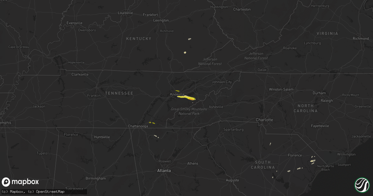
April 22 map
$229
one time, instant access
Download today. No call, no setup
Keep the $229
Bought the map and want the full workflow? Apply the entire $229 to a subscription within 7 days. None of it is wasted.
Every map, not just this one
This buys you this map. Subscription and you get every map we run, in the markets you choose from a few cities to whole states to nationwide. Plus real-time alerts the moment a storm fires.
Contact data
Name, contact info, occupancy, even credit band for addresses in the footprint. You go from where it hit to who to call.
Become the source they trust
Unlimited branding weather history reports on demand. You already have the documented answer ready for the property owner, and you are the one who showed up with it.
Property data and RoofTrace estimates
Pull up any address you have got, its value and the exact code rules for that jurisdiction, straight from One Click Code. Then RoofTrace estimates the squares, pitch, and roof value, priced the way you price.
States Impacted by Hail Map on April 22, 2016
Storm reports
Washington
| Date | Description |
|---|---|
| 04/21/20169:30 PM CDT | Hail covered highway 2 near newport. Visibility reduced to near zero in very heavy rain. |
Tennessee
| Date | Description |
|---|---|
| 04/22/20164:35 PM CDT | A local report indicates 1.00 inch wind near 2 E CLEVELAND |
| 04/22/20164:35 PM CDT | A local report indicates 1.00 inch wind near 2 E CLEAR WATER |
| 04/22/20163:31 PM CDT | A local report indicates 1.00 inch wind near SEVIERVILLE |
| 04/22/20163:30 PM CDT | Half dollar hail in downtown sevierville via twitter. |
| 04/22/20163:05 PM CDT | Tree down across old sevierville pike at newel station rd. Report via twitter |
Georgia
| Date | Description |
|---|---|
| 04/22/20166:30 PM CDT | 3 trees down near east ellijay. One on legion road...one on south main street...and one on progress road |
| 04/22/20164:35 PM CDT | One tree down on wye road. Time estimated by radar. |
| 04/22/20164:27 PM CDT | Shingles blown off of a home and several shallow rooted oak trees blown down. |
New Mexico
| Date | Description |
|---|---|
| 04/22/20164:55 PM CDT | Ke80 awos. |
| 04/21/20168:00 PM CDT | Kcao asos. |
California
| Date | Description |
|---|---|
| 04/22/20164:20 PM CDT | Downed tree near the intersection of blythe and clinton in fresno. Reported via social media. Winds estimated around 40 mph. |
| 04/22/20163:38 PM CDT | Trees down at courthouse park in madera. Reported via madera county sheriff. |
| 04/22/20163:38 PM CDT | Tree down at thomas jefferson middle school. Social media report. Winds estimated at 40 to 50 mph. |
| 04/22/20163:38 PM CDT | Trees down around the city of madera. Specifically sonora st and gateway. Winds estimated at 40 to 50 mph. |
Florida
| Date | Description |
|---|---|
| 04/22/20163:05 PM CDT | Emergency manager reports wires down blocking the roadway near the 7800 block of la trec drive. Time estimated by radar. |
| 04/22/20163:05 PM CDT | Emergency manager reports wires down on a house in the 2700 block of arapahoe ave. Time estimated by radar. |
| 04/22/20163:03 PM CDT | Emergency manager reports wires down near the intersection of algonquin ave and baltic street. Time estimated by radar. |
| 04/22/20163:00 PM CDT | Emergency manager reports various trees and wires down on seaboard ave and timuquana rd. Time estimated from radar. |
Cities Impacted by Hail Map on April 22, 2016
- Lake City, SC
- Hemingway, SC
- Johnsonville, SC
- Roma, TX
- Blanchester, OH
- Clarksville, OH
- Morrow, OH
- Cusick, WA
- Manchester, KY
- Sevierville, TN
- Cosby, TN
- Pigeon Forge, TN
- Seymour, TN
- Knoxville, TN
- Kershaw, SC
- Superior, MT
- Kingstree, SC
- New Zion, SC
- Townsend, GA
- Galivants Ferry, SC
- Aynor, SC
- Loris, SC
- Newport, WA
- Midway, GA
- Ellijay, GA
- Nichols, SC
- Blue Creek, OH
- Hardeeville, SC
- Pinewood, SC
- Elloree, SC
- Deming, NM
- Darien, GA
- Booneville, KY
- Jackson, KY
- Chatsworth, GA
- Elk, WA
- Big Creek, KY
- Cleveland, TN
- Old Fort, TN
- Ocoee, TN