Hail Map on April 20, 2019
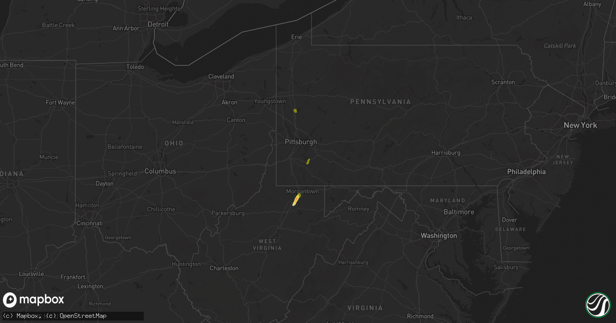
Get this storm
April 20 map
$229
one time, instant access
Download today. No call, no setup
Keep the $229
Bought the map and want the full workflow? Apply the entire $229 to a subscription within 7 days. None of it is wasted.
Every map, not just this one
This buys you this map. Subscription and you get every map we run, in the markets you choose from a few cities to whole states to nationwide. Plus real-time alerts the moment a storm fires.
Contact data
Name, contact info, occupancy, even credit band for addresses in the footprint. You go from where it hit to who to call.
Become the source they trust
Unlimited branding weather history reports on demand. You already have the documented answer ready for the property owner, and you are the one who showed up with it.
Property data and RoofTrace estimates
Pull up any address you have got, its value and the exact code rules for that jurisdiction, straight from One Click Code. Then RoofTrace estimates the squares, pitch, and roof value, priced the way you price.
States Impacted by Hail Map on April 20, 2019
Storm reports
Colorado
| Date | Description |
|---|---|
| 04/20/20194:03 AM CDT | At 902 PM MDT, a severe thunderstorm was located 8 miles southeast of Lamar, moving northeast at 30 mph. HAZARD...70 mph wind gusts. SOURCE...weather sensor at the Lamar airport. IMPACT...Expect considerable tree damage. Damage is likely to mobile homes, roofs, and outbuildings. Locations impacted include... Lamar, Holly, Granada, Hartman and Bristol. |
Pennsylvania
| Date | Description |
|---|---|
| 04/20/20196:04 PM CDT | A local report indicates 1.00 inch wind near 2 NE PORTERSVILLE |
| 04/20/20194:23 PM CDT | A local report indicates 1.00 inch wind near 1 SSW RANKINS CORNERS |
| 04/20/20191:38 AM CDT | At 638 PM EDT, a severe thunderstorm was located 8 miles south of Slippery Rock, or 12 miles east of New Castle, moving northwest at 10 mph. HAZARD...Quarter-size hail. SOURCE...Radar. IMPACT...Minor damage to vehicles is possible. Locations impacted include... Prospect... West Liberty... Portersville... Moraine State Park... McConnells Mill... Rose Point Park... Cooper's Lake Campground... This includes Interstate 79 in Pennsylvania between mile markers 95and 104. |
| 04/20/201912:09 AM CDT | At 508 PM EDT, a severe thunderstorm was located near Monessen, or 13 miles southeast of Gastonville, moving north at 15 mph. HAZARD...Quarter-size hail. SOURCE...Radar. IMPACT...Minor damage to vehicles is possible. Locations impacted include... Monessen... California... Donora... Monongahela... Charleroi... West Newton... New Eagle... North Belle Vernon... Wickerham Manor-Fisher... Baidland... North Charleroi... Speers...This includes Interstate 70 in Pennsylvania between mile markers 35and 49. |
North Carolina
| Date | Description |
|---|---|
| 04/19/201911:34 PM CDT | At 434 AM EDT, a severe thunderstorm was located over Frisco, moving north at 55 mph. HAZARD...60 mph wind gusts. SOURCE...Radar indicated. IMPACT...Expect damage to roofs, siding, and trees. Locations impacted include... Frisco, Buxton, Salvo, Avon, Waves, Nags Head, Rodanthe, Manteo, Whalebone, Jockeys Ridge State Park, Roanoke Island Festival Park, Hatteras Ferry Terminal, Nags Head Fishing Pier, Avon Pier, Cape Hatteras Lighthouse, Wanchese, Hatteras Island Fishing Pier, Bodie Island Lighthouse and Outer Banks Fishing Pier. |
West Virginia
| Date | Description |
|---|---|
| 04/20/20192:52 PM CDT | A local report indicates 1.00 inch wind near 1 ESE OPEKISKA |
| 04/20/20192:46 PM CDT | A local report indicates 1.75 inch wind near 5 N FAIRMONT |
| 04/20/20197:47 AM CDT | At 1247 AM EDT, a severe thunderstorm was located near Spurlockville, or 13 miles west of Madison, moving north at 50 mph. HAZARD...60 mph wind gusts. SOURCE...Radar indicated. IMPACT...Expect damage to roofs, siding, and trees. Locations impacted include... Spurlockville, Harts, Palermo, Griffithsville, Sweetland, Alkol, Mud, Yawkey and Myra. |
| 04/19/201910:26 PM CDT | At 326 PM EDT, a severe thunderstorm was located over Pleasant Valley, or over Fairmont, moving north at 30 mph. HAZARD...Quarter-size hail. SOURCE...Radar. IMPACT...Minor damage to vehicles is possible. Locations impacted include... Morgantown... Fairmont... Westover... Star City... Pleasant Valley... Winfield... Barrackville... Monongah... Granville... Cassville... Brookhaven... Rivesville...This includes the following highways... Interstate 68 in West Virginia between mile markers 1 and 9. Interstate 79 in West Virginia between mile markers 130 and 160. |