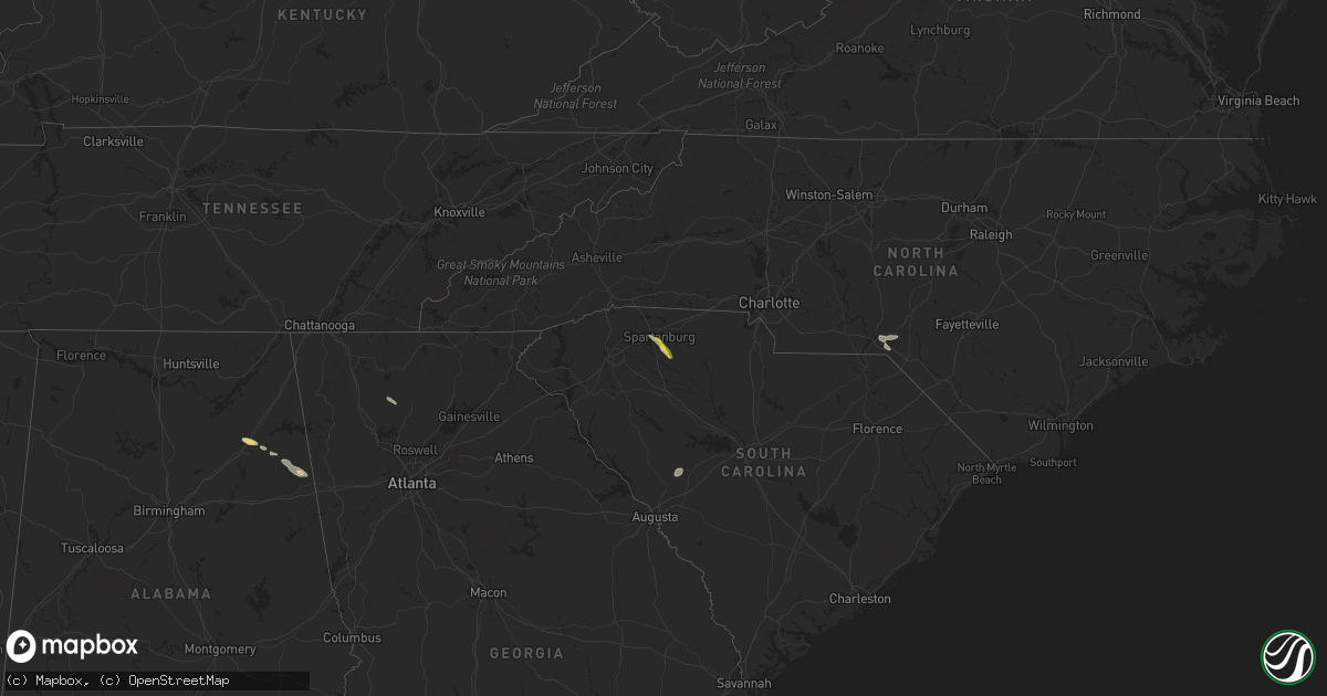
Hail Map on April 19, 2024
Get this storm
April 19 map
$229
one time, instant access
Download today. No call, no setup
Keep the $229
Bought the map and want the full workflow? Apply the entire $229 to a subscription within 7 days. None of it is wasted.
Every map, not just this one
This buys you this map. Subscription and you get every map we run, in the markets you choose from a few cities to whole states to nationwide. Plus real-time alerts the moment a storm fires.
Contact data
Name, contact info, occupancy, even credit band for addresses in the footprint. You go from where it hit to who to call.
Become the source they trust
Unlimited branding weather history reports on demand. You already have the documented answer ready for the property owner, and you are the one who showed up with it.
Property data and RoofTrace estimates
Pull up any address you have got, its value and the exact code rules for that jurisdiction, straight from One Click Code. Then RoofTrace estimates the squares, pitch, and roof value, priced the way you price.
States Impacted by Hail Map on April 19, 2024
Storm reports
South Carolina
| Date | Description |
|---|---|
| 04/19/20245:05 PM CDT | Two trees down in buffalo. Time estimated from radar. |
| 04/19/20244:26 PM CDT | Report of hail up to 1.25-inch diameter. |
| 04/19/20244:25 PM CDT | Report of a tree down and a power line down in the pauline area. Time estimated from radar. |
| 04/19/20248:55 AM CDT | Reported damaging winds broke a power pole bringing down lines along indian trail road near craven road. |
| 04/19/20248:55 AM CDT | Aiken county sheriffs office reports trees down near the intersection of huckleberry finn rd and holder road. Downed trees brought down power lines leading to power out |
North Carolina
| Date | Description |
|---|---|
| 04/19/20241:15 PM CDT | Two trees reported down on harrison road. |
Alabama
| Date | Description |
|---|---|
| 04/19/20247:25 AM CDT | Tree on a home on 18th ave. Other trees also reported down in the haleyville area. |
| 04/19/20247:20 AM CDT | Trees uprooted and powerlines down on newburg rd. |
Texas
| Date | Description |
|---|---|
| 04/19/20246:00 AM CDT | Delayed report... Report from mping: quarter |
| 04/19/20241:49 AM CDT | Cocorahs station tx-gd-8 reported ping pong size hail. Time estimated by radar. |
Illinois
| Date | Description |
|---|---|
| 04/19/20244:45 PM CDT | Delayed report. Hail larger than golfballs. |
Cities Impacted by Hail Map on April 19, 2024
- Johnston, SC
- Ridge Spring, SC
- Ward, SC
- Rockingham, NC
- Hamlet, NC
- Marston, NC
- Attalla, AL
- Roebuck, SC
- Spartanburg, SC
- Gadsden, AL
- Pauline, SC
- Piedmont, AL
- Fruithurst, AL
- Fairmount, GA
- Jasper, GA
- Ranger, GA
- Weinert, TX
- Haskell, TX
- Crowell, TX
- Goree, TX
- Seymour, TX
- Electra, TX
- Bryson, TX
- Jermyn, TX
- Loving, TX
- Jacksboro, TX
- Mineral Wells, TX
- Decatur, TX
- Sanger, TX
- Krum, TX
- Pilot Point, TX
- Aubrey, TX
- Valley View, TX
- Delhi, LA
- Tioga, TX
- Gunter, TX