Hail Map on April 18, 2022
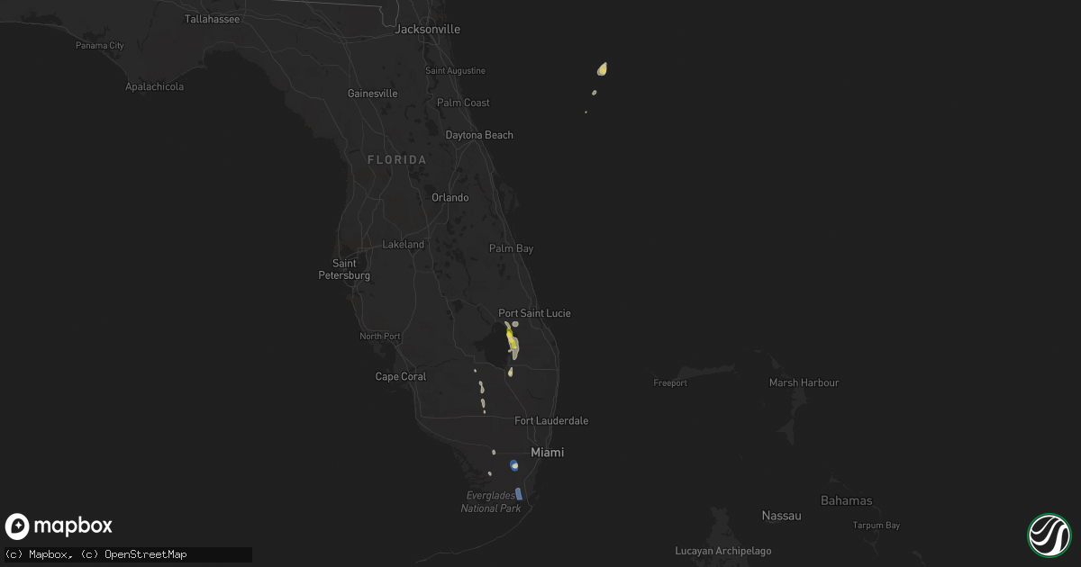
Get this storm
April 18 map
$229
one time, instant access
Download today. No call, no setup
Keep the $229
Bought the map and want the full workflow? Apply the entire $229 to a subscription within 7 days. None of it is wasted.
Every map, not just this one
This buys you this map. Subscription and you get every map we run, in the markets you choose from a few cities to whole states to nationwide. Plus real-time alerts the moment a storm fires.
Contact data
Name, contact info, occupancy, even credit band for addresses in the footprint. You go from where it hit to who to call.
Become the source they trust
Unlimited branding weather history reports on demand. You already have the documented answer ready for the property owner, and you are the one who showed up with it.
Property data and RoofTrace estimates
Pull up any address you have got, its value and the exact code rules for that jurisdiction, straight from One Click Code. Then RoofTrace estimates the squares, pitch, and roof value, priced the way you price.
States Impacted by Hail Map on April 18, 2022
Storm reports
Florida
| Date | Description |
|---|---|
| 04/18/20226:23 PM CDT | Mesonet station chkf1 chekika reported a wind gust of 58mph at 7:23pm as a severe thunderstorm moved through the area. Site elevation is listed as 4 feet. |
| 04/18/20225:34 PM CDT | Corrects previous tstm wnd gst report from 7 wnw inlikita. Mesonet station chkf1 chekika reported a wind gust of 58mph at 6:34 pm as a severe thunderstorm moved through |
| 04/18/20227:40 AM CDT | At 1239 AM CDT, severe thunderstorms were located along a line extending from 6 miles south of De Funiak Springs to 8 miles east of Santa Rosa Beach to 26 miles southeast of Destin, moving east at 45 mph. HAZARD...60 mph wind gusts. SOURCE...Radar indicated. IMPACT...Expect damage to roofs, siding, and trees. Locations impacted include... Panama City, Lynn Haven, Panama City Beach, Callaway, Vernon, De Funiak Springs, Bonifay, Chipley, Santa Rosa Beach, Springfield, Mexico Beach, Hiland Park, Tyndall Air Force Base, Eglin Air Force Base, Bradford, Union, Live Oak, Parker, Freeport and Ponce De Leon. |
| 04/18/20227:11 AM CDT | At 1210 AM CDT, severe thunderstorms were located along a line extending from near Crestview to near Niceville to 6 miles south of Destin, moving east at 45 mph. HAZARD...70 mph wind gusts and penny size hail. SOURCE...Radar indicated. IMPACT...Expect considerable tree damage. Damage is likely to mobile homes, roofs, and outbuildings. Locations impacted include... Santa Rosa Beach, De Funiak Springs, Eglin Air Force Base, Union, Liberty, Freeport, Ponce De Leon, Pond Creek, Oakwood Hills, Cluster Springs, Portland, Alpine Heights, Villa Tasso, Blue Mountain Beach, Arrant Settlement, De Funiak Spring Airport, Seaside, Rock Hill, Glendale and Pleasant Ridge. |
| 04/18/20221:41 AM CDT | At 641 PM EDT, severe thunderstorms were located along a line extending from 6 miles southeast of Shark Valley Obs Tower to near Country Walk, moving south at 5 to 10 mph. HAZARD...60 mph wind gusts and quarter size hail. SOURCE...Radar indicated. IMPACT...Hail damage to vehicles is expected. Expect wind damage to roofs, siding, and trees. Locations impacted include... Homestead, Homestead Miami Speedway, Homestead General Airport, The Redland and Florida City. |
| 04/18/20221:14 AM CDT | At 613 PM EDT, a severe thunderstorm was located near Canal Point, moving southeast at 20 mph. HAZARD...60 mph wind gusts and half dollar size hail. SOURCE...Radar indicated. IMPACT...Hail damage to vehicles is expected. Expect wind damage to roofs, siding, and trees. Locations impacted include... Belle Glade, Pahokee, Canal Point, Lion Country Safari Park and Fremd Village-Padgett Island. |
| 04/18/20221:10 AM CDT | At 609 PM EDT, a severe thunderstorm was located near Big Cypress Seminole Reservation, or 29 miles south of Montura, moving south at 20 to 25 mph. HAZARD...60 mph wind gusts and quarter size hail. SOURCE...Radar indicated. IMPACT...Hail damage to vehicles is expected. Expect wind damage to roofs, siding, and trees. Locations impacted include... Miccosukee Indian Reservation, Miccosukee Service Plaza and Big Cypress National Preserve, and I-75 Eastern Inland Collier and far Western Broward Counties. |
| 04/18/202212:43 AM CDT | At 543 PM EDT, a severe thunderstorm was located near J And S Fish Camp, moving southeast at 20 mph. HAZARD...60 mph wind gusts and quarter size hail. SOURCE...Radar indicated. IMPACT...Hail damage to vehicles is expected. Expect wind damage to roofs, siding, and trees. Locations impacted include... Pahokee, Canal Point and Fremd Village-Padgett Island. |
| 04/18/202212:27 AM CDT | At 527 PM EDT, a severe thunderstorm was located 8 miles northeast of J And S Fish Camp, moving southeast at 10 mph. HAZARD...60 mph wind gusts and quarter size hail. SOURCE...Radar indicated. IMPACT...Hail damage to vehicles is expected. Expect wind damage to roofs, siding, and trees. Locations impacted include... Indiantown, J And S Fish Camp, Tradition and Port Mayaca. |
| 04/17/20229:41 PM CDT | At 240 AM EDT/140 AM CDT/, severe thunderstorms were located along a line extending from 18 miles west of Blountstown to 9 miles northeast of Tyndall Air Force Base to 20 miles west of Mexico Beach, moving east at 45 mph. HAZARD...60 mph wind gusts and nickel size hail. SOURCE...Radar indicated. IMPACT...Expect damage to roofs, siding, and trees. Locations impacted include... Carrabelle, Eastpoint, Apalachicola, Blountstown, St George Island, Port St. Joe, Mexico Beach, Stonemill Creek, Tyndall Air Force Base, Orange, Franklin, Wewahitchka, Bristol, Honeyville, Jewel Fire Tower, Clarksville, Allanton, Vilas, Chipola Cutoff and St George Island St Pk. |