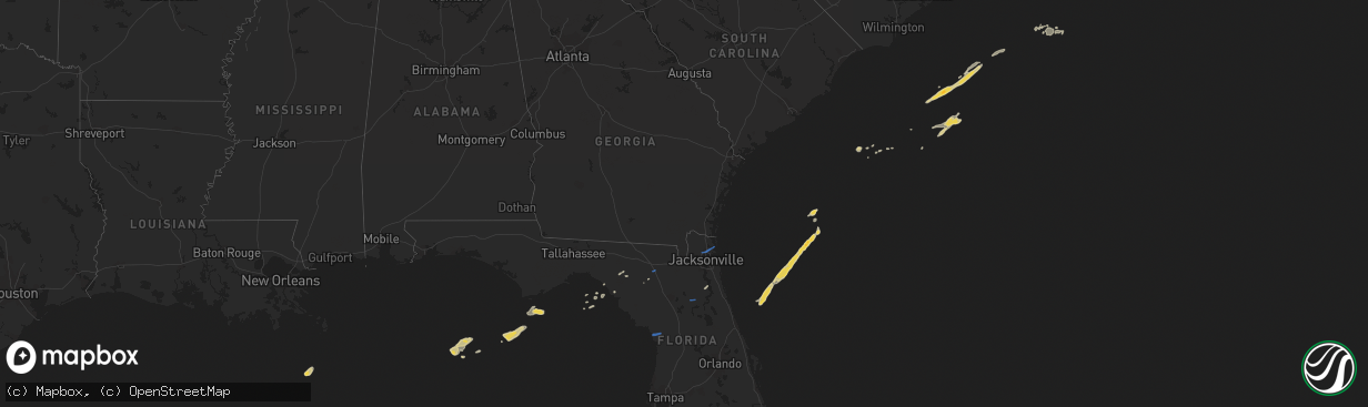
Hail Map on April 14, 2020
The weather event on April 14, 2020 includes Hail and Wind maps. 1 state and 12 cities were impacted and suffered possible damage. The total estimated number of properties impacted is 0.
Want more than just the map?
Turn this storm into a full workflow.
- Owner + property data so you know who to knock
- OnDemand branded weather history reports to win the "did we even have hail?" argument
- RoofTrace estimate so reps stop guessing numbers at the door
Bought this map? Upgrade within 7 days and we'll credit the $230. (10-15 min setup call)
Hail
Wind
0
Estimated number of impacted properties by a 1.00" hail or larger0
Estimated number of impacted properties by a 1.75" hail or larger0
Estimated number of impacted properties by a 2.50" hail or largerStates Impacted by Hail Map on April 14, 2020
Storm reports
Florida
| Date | Description |
|---|---|
| 04/14/202011:55 AM CDT | Tree down on power line near interlachen. |
| 04/14/20207:50 AM CDT | Suwannee county emergency management relayed photos of playground equipment and a metal shed damaged by sub-severe wind gusts. Time of damage based on radar data. |
| 04/14/20207:45 AM CDT | Suwannee county 911/dispatch reported trees and powerlines down along 144th street near luraville. Time of damage based on radar data. |
| 04/14/20207:37 AM CDT | At 1237 PM EDT, a severe thunderstorm was located over Melrose Landing, or near Interlachen, moving east at 20 mph. HAZARD...60 mph wind gusts. SOURCE...Radar indicated. IMPACT...Expect damage to roofs, siding, and trees. Locations impacted include... Interlachen, Melrose Landing, Bardin, Hollister, Carraway and Mannville. |
| 04/14/20206:38 AM CDT | Snapped tree fell on a truck and uprooted trees fell across boney road. Radar estimated time. |
| 04/14/20206:36 AM CDT | Uprooted trees and broken tree limbs on property near grover road and staratt road. Radar estimated time. |
| 04/14/20206:18 AM CDT | Snapped tree fell on house near sarasota lane. Radar estimated time. |
| 04/14/20204:02 AM CDT | At 902 AM EDT, a severe thunderstorm was located over Bostwick, or 10 miles north of Palatka, moving east at 35 mph. HAZARD...60 mph wind gusts and quarter size hail. SOURCE...Radar indicated. IMPACT...Hail damage to vehicles is expected. Expect wind damage to roofs, siding, and trees. Locations impacted include... Saint Augustine, World Golf Village, Saint Augustine Beach, Bostwick, South Ponte Vedra, Vilano Beach, Saint Augustine South, Picolata, Guana River State Park and Anastasia. |
| 04/14/20203:59 AM CDT | At 859 PM EDT, a severe thunderstorm was located 20 miles west of Steinhatchee, moving east at 35 mph. HAZARD...60 mph wind gusts and penny size hail. SOURCE...Radar indicated. IMPACT...Expect damage to roofs, siding, and trees. Locations impacted include... Cross City, Steinhatchee, Horseshoe Point, Suwannee, Horseshoe Beach, Tennille, Shamrock, Jug Island, Clara, Cross City Airport, Shired Island, Old Town, Jonesboro, Jack Lee Island, Hatch Bend, Cedar Island, Fish Creek, Howell Place, Guaranto Springs and Jena. |
| 04/14/20201:58 AM CDT | Snapped tree fell on mobile home and shed causing roofs to cave in. Radar estimated time. |
| 04/13/202010:58 PM CDT | At 357 PM EDT, a severe thunderstorm was located over Satsuma, or near Palatka, moving east at 25 mph. HAZARD...60 mph wind gusts. SOURCE...Radar indicated. IMPACT...Expect damage to roofs, siding, and trees. Locations impacted include... Palatka, East Palatka, San Mateo and Satsuma. |
| 04/13/20208:30 PM CDT | Part of a tree fell on a power line and resulted in a power outage south of perry. Likely due to outflow winds from storms just south of the area. |